Nationalpark Skjoldungernes Land
Ice Age hills, fjord horizons and saga‑laden burial mounds weave together in Skjoldungernes Land, Zealand’s first national park and a living tapestry of Danish nature and history.
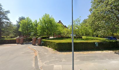
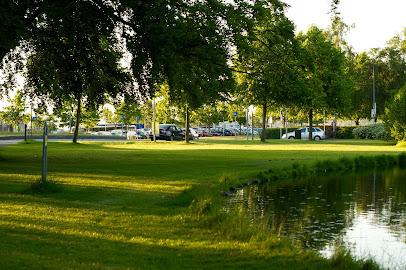
Nationalpark Skjoldungernes Land spreads across 170 square kilometres of fjord, forests and farmland around Roskilde in central Zealand, just 30 km from Copenhagen. Here Ice Age hills, salt meadows and coastal bluffs meet beech woods, lakes and ancient burial mounds, stone ships and manors. The park weaves nature with 7,000 years of history, from Stone Age settlements to Roskilde’s UNESCO-listed cathedral, offering calm trails, shelters, swimming lakes and rich birdlife, including white‑tailed eagles.
A brief summary to Nationalpark Skjoldungernes Land
- Roskilde, 4000, DK
- Duration: 2 to 8 hours
- Free
-
 Outdoor
- Mobile reception: 4 out of 5
- Monday 12 am-12 am
- Tuesday 12 am-12 am
- Wednesday 12 am-12 am
- Thursday 12 am-12 am
- Friday 12 am-12 am
- Saturday 12 am-12 am
- Sunday 12 am-12 am
Local tips
- Bring sturdy walking shoes or a bike: distances are large and the best experiences follow forest paths, shoreline trails and the long‑distance Skjoldungesti route.
- Pack layers and a windproof jacket, even in summer; the open fjord and hilltops can feel noticeably cooler and breezier than sheltered forest sections.
- Carry snacks and water, especially on longer hikes, as services and cafés are concentrated in Roskilde, Lejre and villages rather than in the middle of the park.
- For birdwatching and a chance to see white‑tailed eagles, bring binoculars and plan extra time around viewpoints and hides along Roskilde Fjord.
- If you plan to use shelters or designated camp sites, check local maps and any booking requirements in advance, especially during summer weekends and holidays.
For the on-the-go comforts that matter to you
- Restrooms
- Drinking Water
- Seating Areas
- Sheltered Areas
- Picnic Areas
- Trash Bins
- Information Boards
- Visitor Center
Getting There
-
Regional train and local bus from Copenhagen
From central Copenhagen, regional trains to Roskilde run roughly every 10–20 minutes and take about 25–30 minutes. A standard single ticket for this journey typically costs around 80–110 DKK in standard class, depending on fare type. From Roskilde Station, several local bus lines serve different parts of the national park within 10–30 minutes, with local tickets usually 24–30 DKK. Services run year‑round but are less frequent in evenings and on Sundays, so check timetables when planning early or late walks.
-
Drive from Copenhagen by car
Driving from Copenhagen to the Roskilde area of Skjoldungernes Land usually takes 30–40 minutes in normal traffic. There are various small parking areas near trailheads, viewpoints and fjord access points, many of which are free, though some sites close to attractions or museums may charge modest parking fees in the range of 10–20 DKK per hour. In peak summer weekends and on public holidays, spaces nearest popular beaches and viewpoints can fill quickly, so arriving earlier in the day offers more choice.
-
Cycling from Roskilde
From Roskilde town, it is realistic to reach many parts of the national park by bicycle in 15–45 minutes, using a mix of cycle paths, minor roads and signposted recreational routes such as sections of the Skjoldungesti. The terrain is mostly gentle with some rolling hills, making it manageable for riders with moderate fitness. If you do not have your own bike, expect to pay roughly 100–200 DKK per day for a standard city or trekking bike from local rental providers. Surfaces are a mix of asphalt and gravel, so wider tyres and lights are useful for comfort and safety.
-
Walking from Roskilde outskirts
If you are already staying on the edge of Roskilde, you can enter parts of the national park on foot within about 30–60 minutes along pavements, local roads and signposted paths leading towards forest and fjord. Once you cross into park landscapes, trail networks allow you to extend your walk for several hours. Surfaces vary from firm gravel to occasionally muddy forest tracks, so waterproof footwear is helpful in wet seasons. This option is free but demands enough time and basic fitness, especially if you plan to walk several additional kilometres inside the park.
Nationalpark Skjoldungernes Land location weather suitability
-
 Any Weather
-
 Clear Skies
-
 Windy Conditions
-
 Mild Temperatures
-
 Hot Weather
-
 Cold Weather
-
 Rain / Wet Weather
Discover more about Nationalpark Skjoldungernes Land
Ice Age landscapes around the Roskilde Fjord
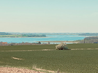
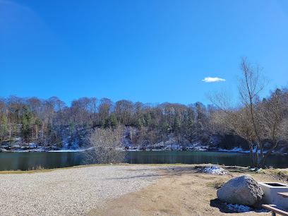
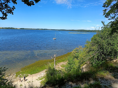
Skjoldungernes Land National Park unfolds along Roskilde Fjord in central Zealand, a broad patchwork of water, wetlands, fields and forest framed by softly rolling hills. Shaped by retreating Ice Age glaciers, the terrain is full of meltwater valleys, rounded ridges and low coastal bluffs that give gentle but ever‑changing views as you walk or cycle. The fjord itself is shallow and sheltered, dotted with small islands and islets that create a constantly shifting pattern of light on the water. The "blue" side of the park centres on Roskilde Fjord and its salt meadows, reed beds and mudflats. At low tide you see exposed shallows that teem with invertebrates, drawing in flocks of waders and ducks. In winter, rafts of waterfowl gather on the open water, while in summer the shorelines feel almost pastoral, with grazing animals helping to maintain the open coastal landscape.Deciduous forests, lakes and quiet clearings
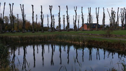
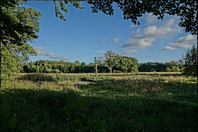
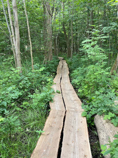
Inland, the "green" part of Skjoldungernes Land is dominated by large deciduous forests, classic for Zealand with tall beech and oak canopies that glow fresh green in spring and turn copper in autumn. Narrow paths weave between tree trunks and through clearings where sunlight reaches the forest floor. Some of these woods hide small forest lakes with clean bathing water, offering refreshing swimming on warm days. Between forest blocks you cross farmland, hedgerows and meadows, a reminder that this is a lived‑in cultural landscape as much as a wilderness. Streams meander through wet grassland, occasionally dammed by old water mills. The mix of managed woodland and more natural patches creates a variety of habitats, so you may spot deer at the forest edge, hares in the fields or a red fox slipping along a hedge.Traces of ancient peoples and legendary kings
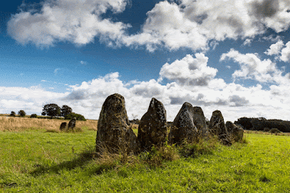
Humans have shaped this area since the Stone Age, and the national park is rich in visible traces of that long story. Burial mounds rise from ridgelines, sometimes grouped in clusters, while stone ship settings hint at ceremonies from the Bronze and Iron Ages. Around the hamlet of Gl. Lejre, archaeology and saga tradition connect the landscape to the Skjoldung family of legendary Danish kings, whose name the park bears. Later centuries added manor houses, farmsteads and small villages that still punctuate the countryside with avenues, barns and church towers. Roskilde, at the southern end of the fjord, became a medieval royal and ecclesiastical centre. Its brick cathedral, a UNESCO World Heritage Site, forms a cultural anchor to the south, linking the park’s open fields and fjord vistas with Denmark’s royal history inside its chapels.Birdlife and the return of the white‑tailed eagle
Roskilde Fjord is one of the park’s great wildlife strongholds. Shallow waters, fish and resting areas for migratory birds make it an important stopover and breeding ground. Throughout the year you can watch geese, swans and waders feeding on the mudflats or resting on islets, while marsh harriers quarter the reed beds in search of prey. A particular highlight is the white‑tailed eagle, Northern Europe’s largest bird of prey, which breeds and hunts in the national park. With a wingspan that can reach well over two metres, it is often visible soaring over the fjord, scanning for fish, waterfowl or carrion. Spotting one circling above the water adds a dramatic, almost primeval note to the otherwise tranquil scenery of flat farmland and low hills.Paths, shelters and life within the park
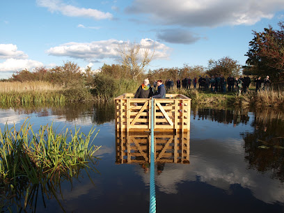
Skjoldungernes Land is designed to be experienced slowly, on foot or by bicycle. Waymarked routes like the Skjoldungesti wind for many kilometres through forests, along lakeshores and past historic sites, often linking small villages with viewpoints over the fjord. Simple campsites and shelters are scattered throughout, turning the park into a natural overnight destination for those who want to sleep under the trees or near the water. Because people live and work inside the park boundaries, you encounter working farms, local businesses and small cultural venues alongside the natural attractions. Fields may be busy with tractors, and livestock graze many of the meadows and coastal pastures. This close coexistence of daily rural life, protected habitats and deep history is part of what defines Skjoldungernes Land as a Danish national park.Protected nature with a community focus
Established in 2015 as Zealand’s first national park, Skjoldungernes Land was created to safeguard some of Denmark’s most characteristic landscapes while keeping them accessible. Large parts of the park are privately owned, and management relies on voluntary agreements and cooperation with local communities, municipalities and landowners. The overarching goal is to protect and enhance nature and cultural heritage while supporting outdoor recreation, education and sustainable tourism. For visitors, that means a network of trails, information points and modest facilities rather than heavy infrastructure. You move through a living countryside rather than a remote wilderness, but with the sense that the fjord, forests and ancient monuments are being actively cared for so their stories can continue into the future.Iconic landmarks you can’t miss
Sct Hans Have
4.3 km
Explore Aarhus’ signature waterfront, where innovative architecture, lively promenades, and maritime history create Denmark’s most vibrant urban shoreline.
Det Kongelige Palæ i Roskilde
6.1 km
Baroque palace where Danish royalty met democracy, now a vibrant hub for art and culture.
Skänk Beer & Wine bar
6.6 km
Experience Aarhus’ celestial heritage at the Ole Rømer Observatory, where history, culture, and astronomy converge for hands-on stargazing and exploration.
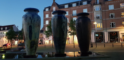
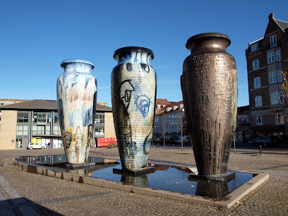
Roskildekrukkerne
6.6 km
Three colossal ceramic jars rising from a mirrored basin transform Roskilde’s station square into an open-air monument to a thousand years of city history.
Masterhøj udsigtspost
6.7 km
Bronze Age mound commanding 360-degree views of Roskilde, fjord, and medieval heritage.
Jægerspris Castle
20.0 km
Discover Danish history and royal romance at Jægerspris Castle, a beautifully preserved estate with a captivating museum and scenic parklands, offering a glimpse into the lives of King Frederik VII and Countess Danner.
Thomas on the Mountain, The 6 Forgotten Giants
21.3 km
A welcoming wooden giant inviting you to sit, relax, and share the view from atop an Albertslund hilltop.
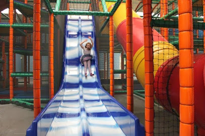
LegeJunglen
21.5 km
Discover LegeJunglen in Slangerup: An indoor playground paradise with slides, trampolines, and jungle-themed fun for kids of all ages, ensuring a memorable family day out, rain or shine.
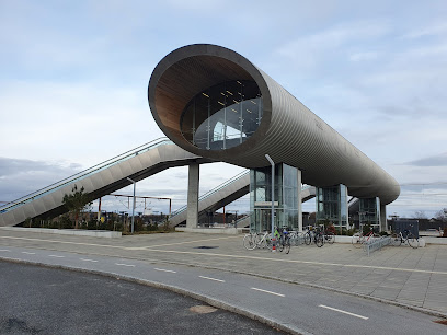
Køge Nord
22.4 km
A soaring timber‑lined footbridge and high‑speed rail hub turning everyday commuting into a slice of contemporary Danish architecture and panoramic landscape.
Køge Å
23.2 km
Explore Skagen’s maritime history with hands-on exhibits and live marine engines at Maskinrummet, an atmospheric museum in the heart of the harbour.
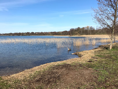
Søndersø
24.1 km
Escape to Søndersø: A serene lake in Værløse offering tranquil nature walks, birdwatching, and recreational activities amidst lush forests and historical landscapes.
Drive in Put and Take
24.6 km
Discover a serene fishing escape at Drive in Put and Take in Lynge, Denmark, boasting clear waters, family-friendly facilities, and a tranquil atmosphere just a short drive from Copenhagen.
Køge Ås
25.0 km
Striking lighthouse at Denmark’s northern edge, offering panoramic views, interactive birdwatching, café, exhibitions, and a window into Skagen’s wild coastal nature.
Pangea Park
25.0 km
Experience global wildlife up-close in Zealand’s countryside, with interactive exhibits, animal encounters, and a strong conservation focus at Pangea Park near Bjæverskov.
Nordskoven
25.4 km
Discover ancient oaks, tranquil trails, and royal history in Nordskoven, a captivating woodland escape near Jægerspris, Denmark, offering a serene nature experience.
Unmissable attractions to see
Boserup skov
1.4 km
Ancient beech forests, spring anemones, and fjord views in Denmark's most enchanting woodland sanctuary.

Kattinge Vig
1.5 km
A sheltered fjord cove near Roskilde where protected nature, birdlife and gentle Scandinavian coastal scenery create a quiet escape for walkers, anglers and paddlers.
National Park Skjoldungernes Land
1.6 km
Where Roskilde Fjord’s blue waters meet beech forests, manor landscapes and Viking legends in an accessible Danish national park near Copenhagen.
Kornerup Å Trækfærge
3.3 km
A hand-powered cable ferry in the Kornerup River Valley, turning a simple stream crossing into a playful pause amid open meadows, big skies and quiet Danish nature.
Rørmosen sti
3.7 km
A small, tranquil nature path with pond, reeds and everyday birdlife, tucked behind Roskilde’s Hørhusene homes for easy, close-to-town walks.
Vigen Strandpark
4.5 km
Calm fjord waters, a sandy strand and wide views to Roskilde’s skyline make Vigen Strandpark a relaxed, easy-going escape for swimming, paddling and picnics.

Koncertkapellet
5.1 km
Roskilde's intimate chapel-turned-concert hall for classical and acoustic music in a historic restored setting.
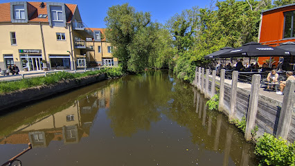
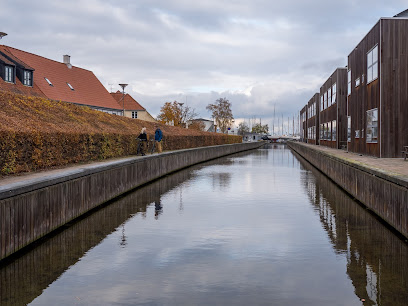
Roskilde Harbour
5.3 km
Historic fjordside harbour where Viking heritage, a modern marina and relaxed waterfront life meet beneath the towers of Roskilde Cathedral.
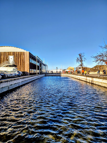
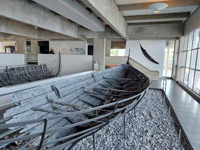
Viking Ship Museum
5.4 km
Original Viking ships, cutting-edge archaeology and a living boatyard unite on Roskilde Fjord to tell the story of how seafaring defined the Viking Age.
Puppe
5.4 km
A small but evocative public sculpture in Roskilde, “Puppe” offers a quiet moment of contemporary art amid everyday city life.
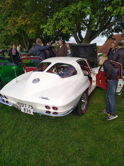
MC og Bil træf
5.5 km
Sommeraftener med motorbrøl, krom og uformel bilkultur på et åbent areal i Roskilde, hvor bil- og MC-entusiaster samles til hyggeligt torsdagstræf.
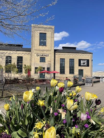
RoS Gallery
5.5 km
Contemporary art in a beautifully restored gasworks on Roskilde’s harbour, pairing industrial character with changing exhibitions and free, easy-going access.
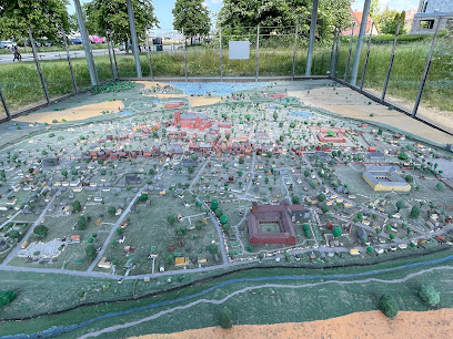
Roskilde Mini Town
5.6 km
Explore centuries of Danish architecture in miniature form at this charming, detail-rich attraction.
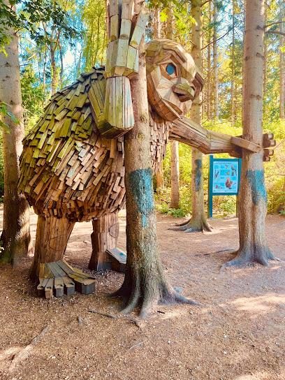
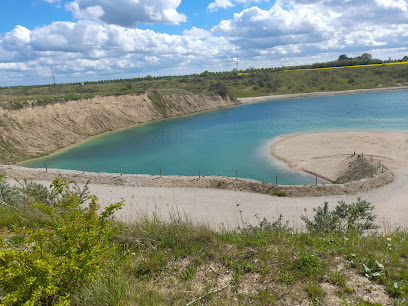
Lynghøjsøerne Runde Rie
5.6 km
Former gravel pits turned opal-blue lakes, winding trails and a wooden troll named Runde Rie make Lynghøjsøerne Roskilde’s playful pocket of wild nature.
Byparkens Legeplads
5.7 km
Shaded, child-friendly play space in the heart of Roskilde’s Byparken, surrounded by mature trees, gentle equipment and the calm of a classic Danish city park.
Essential places to dine
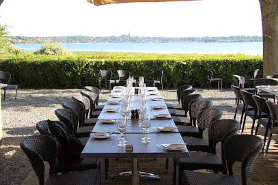
Restaurant Vigen
4.6 km
Waterfront Danish dining on Roskilde Fjord, where smørrebrød lunches and sunset dinners share the stage with sweeping views towards Roskilde’s historic skyline.
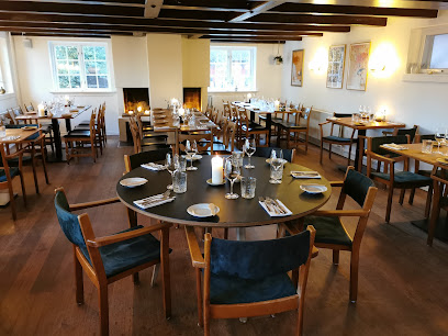
Svogerslev Kro
4.9 km
Historic countryside inn with Michelin-trained chef, seasonal Nordic cuisine, and overnight stays near Roskilde.
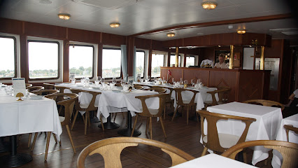
M/S Sagafjord - Restaurant Roskilde
5.3 km
Classic restaurant ship gliding across Roskilde Fjord, pairing seasonal local cuisine with slow, scenic cruises from the harbour’s edge.
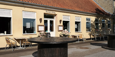
Restaurant Store Børs
5.3 km
Seasonal Danish gourmet dining overlooking Roskilde Fjord, where ingredient quality and informal elegance meet.
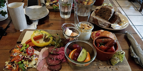
Café Fjordliv
5.4 km
Harbourfront Nordic–French café in Roskilde with its own sourdough bakery, organic coffee and seasonal small plates served beside the calm waters of the fjord.
Snekken Trattoria
5.4 km
Waterfront Italian-inspired dining on Roskilde Harbour, pairing fjord views and a large terrace with relaxed brasserie dishes, brunch and all‑day service.
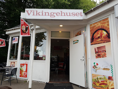
Viking Pizza Roskilde
5.6 km
Hearty pizzas and grill classics near Roskilde’s Viking harbour, serving no‑nonsense comfort food for families, locals and museum‑goers from late morning to evening.
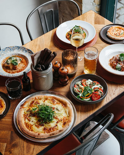
Disotto
5.8 km
Cozy southern Italian ristobar in central Roskilde, serving classic antipasti, Neapolitan-style pizza and Italian wines in an intimate, evening-only setting.
Pipers Hus
5.8 km
Classic Danish comfort food in a park pavilion with sweeping views over Roskilde Bypark, the harbour and fjord, blending city dining with a touch of nature.
An No
5.8 km
Authentic Vietnamese street food in Roskilde, serving fresh homemade dishes from scratch with genuine Saigon spirit.
Restaurant That's Amore
5.9 km
Cozy, candlelit Italian restaurant in central Roskilde, serving wood-fired pizzas, hearty pasta and Italian wines in a warm, romantic yet relaxed setting.
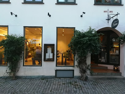
Restaurant Mumm I/S
6.0 km
Slow-food focused, seasonal small-plate dining in an intimate Roskilde townhouse with a leafy summer courtyard and a distinctly Nordic, wine-led evening atmosphere.
Café Korn - Roskilde
6.0 km
Cosy all‑day café and brasserie on Roskilde’s main pedestrian street, serving hearty brunches, burgers and salads in a warm, grocery‑style setting.
Marcella Pizza & Pasta - Restaurant Roskilde
6.0 km
Cozy Italian bistro in Roskilde’s main shopping street, serving Neapolitan-style pizzas, generous pasta dishes and easygoing, family-friendly comfort food.
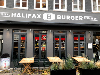
Halifax Burgers Roskilde
6.0 km
Casual build-your-own burger joint on Roskilde’s main street, pairing generous portions and craft drinks with a strong line-up of vegetarian and vegan options.
Markets, malls and hidden boutiques
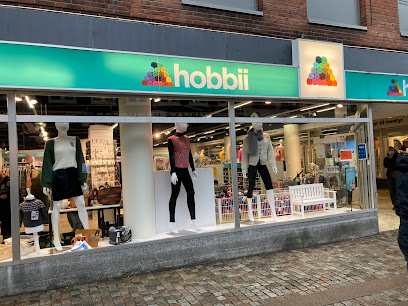
Hobbii
6.0 km
Denmark's premier yarn destination where creativity meets expert guidance and community.
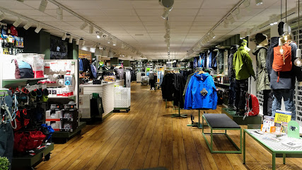
Friluftsland
6.0 km
Specialist outdoor shop in central Roskilde, equipping you with quality clothing, footwear and gear for Scandinavian weather, local escapes and longer adventures.
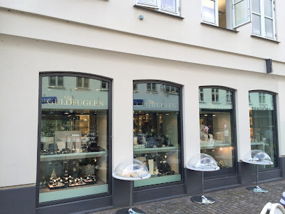
Guldfuglen A/S
6.0 km
Traditional Roskilde jeweller on lively Skomagergade, offering classic jewellery, watches and personal service in a calm, central setting.
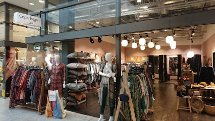
Copenhagen Luxe Roskilde
6.1 km
Curated Scandinavian fashion in natural materials on Roskilde's pedestrian shopping street.
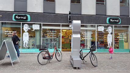
Normal
6.1 km
Brand-name products at unbeatable prices in central Roskilde's premier discount store.
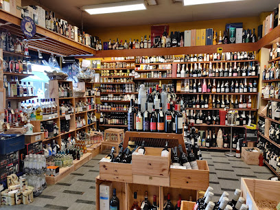
Den franske vinhandel
6.1 km
Historic Roskilde wine merchant with a cavernous cellar, freshly roasted coffee and gourmet treats, turning a simple shopping stop into a richly flavoured experience.
Red Cross Op Shop
6.1 km
Volunteer-run Red Cross thrift shop in central Roskilde, where affordable second-hand finds and everyday browsing quietly support humanitarian work.
Boutique Dedenroth v / Helle Dedenroth
6.1 km
Owner-run women’s fashion boutique on Roskilde’s central square, offering curated, timeless clothing and a relaxed, personal shopping experience.
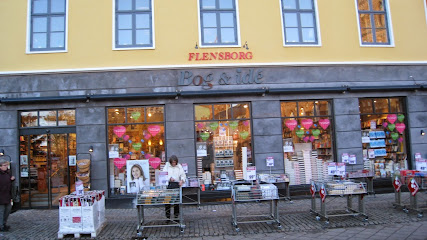
Bog & Idé
6.1 km
Central Roskilde’s cozy book and gift shop, where classic Danish bookselling meets games, stationery and everyday essentials on historic Stændertorvet.
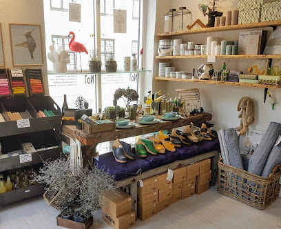
No 1 Butik
6.2 km
Intimate Roskilde lifestyle boutique blending Nordic design, playful gifts and gourmet treats into one cozy, carefully curated shopping stop.
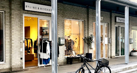
Byline Denmark (tidligere Byline & Bisgaard)
6.2 km
A cozy courtyard boutique in the heart of Roskilde, blending Scandinavian fashion, accessories, and gift ideas in a calm, well-curated setting.
Perssons Roskilde
6.2 km
Contemporary fashion in the heart of Roskilde's historic shopping district.

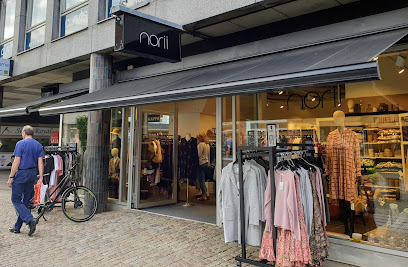
NORII Roskilde
6.2 km
A cozy Scandinavian womenswear boutique on Roskilde’s Algade, offering curated, timeless pieces and personal service in the heart of the historic city.
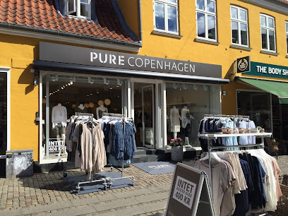
PURE Copenhagen
6.2 km
A cosy Roskilde boutique blending Scandinavian-inspired women’s fashion, personal styling, and a relaxed neighbourhood feel right on historic Algade.
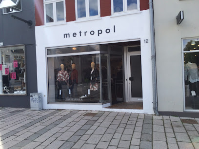
Metropol
6.2 km
Intimate Roskilde boutique in Djalma Lunds Gård, blending Scandinavian style, curated labels and a touch of vintage in a calm, welcoming shopping space.
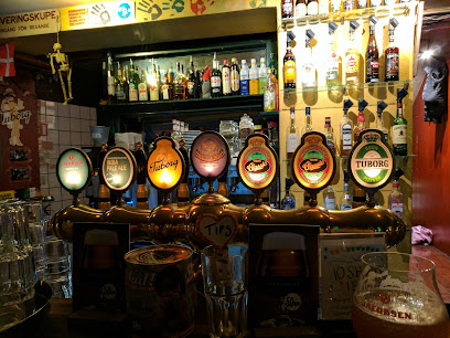
Essential bars & hidden hideouts
Teatercaféen
5.3 km
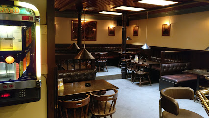
Unpretentious local beer hall in Roskilde where everyday life, cheap drinks and warm conversation matter more than design or trends.
PAUSE
5.9 km
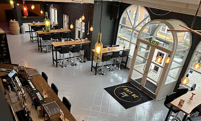
Intimate wine and beer bar in Roskilde's historic center, celebrating Nordic hospitality and craft beverages.
Ruder Konge Bodega
6.0 km
A timeworn Danish bodega in central Roskilde, offering cheap beer, pool tables and unpretentious pub life just off the city’s main pedestrian street.
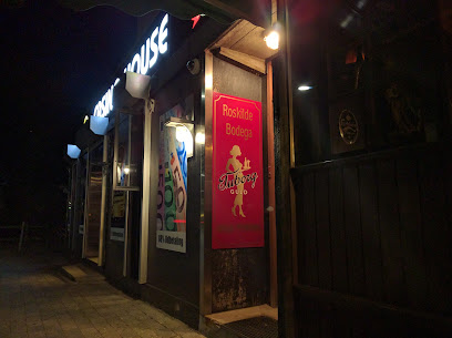
Roskilde Bodega
6.1 km
Classic Danish corner bar on Holbækvej with pool, darts, slot machines and a lively local crowd, offering an unpolished, authentic bodega atmosphere from day to late night.
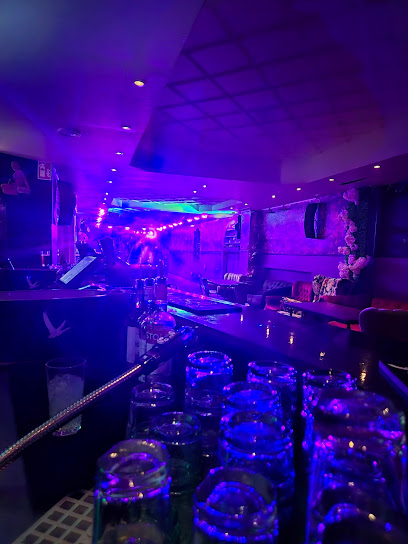
28 Live
6.1 km
A lively “youth club for adults” in central Roskilde, blending bar, games, live shows, sport and nightclub energy under one sociable roof.
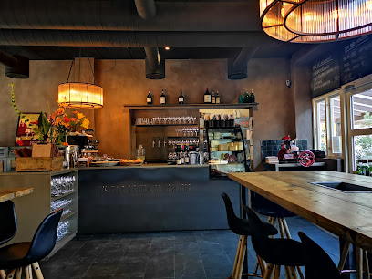
PROP Vin og Tapasbar
6.1 km
Intimate Roskilde wine bar pairing curated bottles with Mediterranean-inspired tapas in a candlelit room and sheltered courtyard, strictly for a relaxed 25+ crowd.
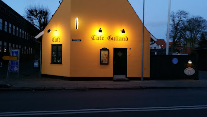
Gullanden
6.2 km
An unpretentious Roskilde pub with darts, DJ nights, cold beer and a loyal local crowd, where evenings stretch easily into the early hours.
Gustav Wieds - Byens Ølbar
6.5 km
Craft-focused neighbourhood beer bar in central Roskilde, combining eight rotating taps, a cosy wooden interior, jukebox tunes and billiards in a relaxed local atmosphere.
Klosterkælderen
6.5 km
Roskilde's premier craft beer cellar with 200+ beers and authentic Danish pub charm.
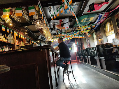
Mulligans Irish Pub
6.6 km
Authentic Irish pub in two storeys with live music, craft beers, and vibrant social atmosphere in central Roskilde.
Copé Lounge
6.6 km
Urban lounge bar by Roskilde’s main square, blending backyard summer vibes, easygoing cocktails and cosy Danish hygge late into the night.
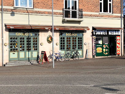
Georges Bodega
6.6 km
Old-school Danish bodega at Roskilde’s Hestetorvet, pouring cold beer from morning to late night with indoor smoking, local regulars and station-square views.
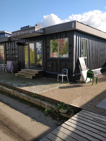
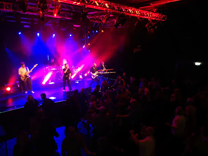
Musicon Mikrobryggeri
7.3 km
Local craft beer, stainless-steel tanks and live music energy in the heart of Roskilde’s creative Musicon district.
Vinbaren Muicon
7.4 km
An intimate wine bar in Roskilde’s Musicon district, pairing cozy Nordic warmth with a curated wine list and relaxed, conversation-friendly vibes.
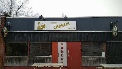
Charlie Chaplin
7.7 km
An unfussy neighbourhood bar in Roskilde, Charlie Chaplin pours cold beers and warm conversation in a relaxed local bodega setting far from the city’s tourist crowds.
Nightclubs & after hour spots
Danseriet
5.8 km
Frivilligdrevet danseklub i Roskilde med stort dansegulv, livebands og hyggelig stemning for danseglade gæster på tværs af aldre og niveauer.
Garbos Roskilde
6.5 km
Cozy neighborhood nightclub in central Roskilde, blending casual bar vibes with a compact dance floor and late-night weekend energy on Hersegade.
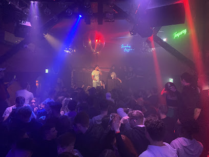
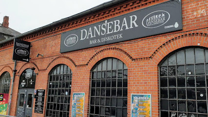
Dansebar Roskilde
6.6 km
Roskilde's premier multi-floor nightclub with dual dance spaces, three bars, and DJ-driven energy until dawn.
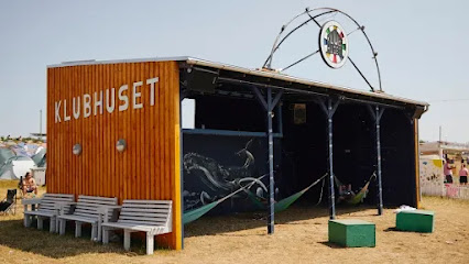
Klubhuset
8.1 km
Low-key local clubhouse turned disco-style nightspot, where a simple bar, small dance floor and regulars’ vibe create relaxed, unpretentious nights in Roskilde.
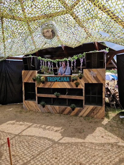
Tropicana DC
8.2 km
Compact Latin-flavoured nightclub on Roskilde’s industrial edge, delivering loud beats, simple drinks and a late-night dancefloor focused purely on partying.
Den Dansende Viking
15.2 km
High-energy suburban nightclub in Egedal Centret, serving packed dance floors, late-night DJ sets and budget-friendly drinks for party-focused weekends.
Club El Diablo
21.9 km
Adults-only entertainment venue offering a discreet, welcoming atmosphere for private social experiences.
The Flame
27.3 km
Compact, high-energy nightclub by Køge’s harbor, serving up youthful beats, live acts and weekend dance-floor vibes in an intimate, no-frills setting.

LUSIO
27.3 km
Compact harbor-side nightclub in Køge with late Friday hours, a tight dance floor, and an intimate, no‑frills setting for Danish weekend nights out.
Bloom Nightclub
27.3 km
Late-night harborfront beats and a compact dance floor bring big-night energy to small-city Køge every Friday and Saturday.
Falafelberg
32.7 km
Discover the pulsating nightlife of Frederiksberg at Falafelberg, a night club offering delicious falafel and electrifying music for an unforgettable experience.
Haven - Events
32.8 km
Discover the electrifying nightlife at Haven, Frederiksberg's top night club, where music, dance, and fun come together for an unforgettable experience.
Afrobeat Palace Nightclub
33.0 km
Discover the energetic Afrobeat Palace Nightclub in Copenhagen, where music, dance, and multicultural vibes unite for an unforgettable nightlife experience.
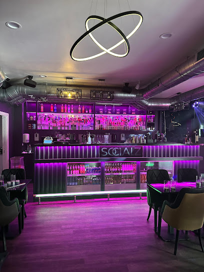
Socialz
33.6 km
Intimate cocktail bar and nightclub in the heart of Hillerød, blending shisha lounge vibes, late-night DJ sets and a compact dance floor on lively Slotsgade.
Temple Bar
34.4 km
Discover the energetic vibe of Temple Bar in Nørrebro, Copenhagen, where great drinks and lively entertainment meet.
For the vibe & atmosphere seeker
- Tranquil
- Zen
- Scenic
- Relaxing
- Adventurous
- Unique
- Casual
For the design and aesthetic lover
- Rustic Designs
For the architecture buff
- Parks & Gardens
- Heritage Neighborhoods
- Viewpoints
- Landmarks
For the view chaser and sunset hunter
- Iconic Views
- Panoramas
- Waterfront
- Sunset Spots
For the social media creator & influencer
- Photo Spots
- Selfie Spots
- Reel-Friendly
- Architectural Shots
- Instagrammable
For the eco-conscious traveler
- Sustainable
- Eco-Friendly
- Low Impact
- Protected Area
- Public-Transport Accessible
- Leave-No-Trace Critical
- Locally Managed
- Wildlife Habitat
- National Park
For the kind of experience you’re after
- Nature Escape
- Day Trip
- Roadtrip Stop
- Photowalk
- Adventure Photo Shoot
- Myth & Legends
- Cultural Heritage
- Mindfulness
- Meditation Spot
- Weekend Getaway
For how adventurous you want the journey to be
- Easy Access
- Requires Hike
Location Audience
- Family Friendly
- Senior Friendly
- Child Friendly
- Teen Friendly
- Solo Friendly
- Couple Friendly
- Solo Female Friendly
- Vegetarian Friendly
- Vegan Friendly
- LGBT Friendly


