

Free El Oro Region Travel Guide & Mobile App
Explore El Oro Region with free travel guides. Discover regional history, expert tips, proposed trips, and audio guides on web or mobile app.


Explore El Oro in Ecuador for banana country, historic Zaruma, Pacific islands, seafood, gold-mining heritage and cloud-forest wildlife.
Read more about El Oro Region
When is the best time to visit El Oro Region?
Best: January, July–August · 30°C| Month | High (°C) | Rainfall (mm) |
|---|---|---|
| January (best) | 30 | 30 |
| February | 30 | 35 |
| March | 31 | 40 |
| April | 31 | 45 |
| May | 30 | 40 |
| June | 30 | 35 |
| July (best) | 30 | 30 |
| August (best) | 30 | 35 |
| September | 30 | 40 |
| October | 30 | 45 |
| November | 31 | 40 |
| December | 31 | 35 |
Getting to and around El Oro Region
How to get there
Transportation
Best attractions in El Oro Region
El Oro’s attractions range from coastal wetlands and island beaches to historic mining towns and forested mountain reserves. Machala offers urban parks, museums and an introduction to the province’s banana economy, while nearby Puerto Bolívar provides a working maritime setting rather than a conventional resort waterfront. Boat excursions lead towards the Jambelí islands, where beaches, mangroves and shallow Gulf waters form the main appeal; Isla Santa Clara is noted for its protected coastal habitat and birdlife. Around Santa Rosa, the Laguna de La Tembladera offers wetland scenery and opportunities for observing aquatic environments. Inland, Zaruma and Portovelo combine historic streets with the industrial and geological story of gold mining. Piñas is a useful base for the greener southern uplands, and Buenaventura’s protected forest is important for birdwatching and guided nature walks. The Yacuviñay archaeological area adds a cultural dimension to the Atahualpa canton. Because several rural attractions are dispersed and public transport may be limited, they are best approached as planned excursions rather than as spontaneous stops between towns.
Best landmarks in El Oro Region
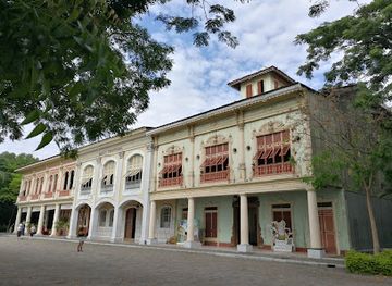
Zaruma’s historic centre is El Oro’s most recognisable architectural landmark, with steep streets, timber balconies, carved details and colourful façades shaped by the town’s mining prosperity and mountain setting. The Sanctuary of the Virgin of the Rosary, commonly known as Zaruma’s main church, is especially notable for its traditional interior woodwork and prominent position within the town. Portovelo’s mining landscape forms a contrasting industrial landmark, recalling the machinery, tunnels and company infrastructure associated with gold extraction in the district. On the coast, Puerto Bolívar’s port and waterfront represent the province’s modern commercial identity, linking agricultural production with maritime export. The Jambelí islands and Isla Santa Clara provide natural landmarks rather than monumental architecture: sand, mangroves, open Gulf horizons and protected bird habitats define their importance. Inland, the wooded slopes around Buenaventura and the wetland landscape of La Tembladera demonstrate how strongly El Oro’s visual character changes between the coastal plain and the southern Andes.
-
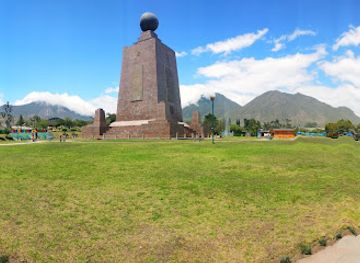
Monument
Middle of the World City
Visit the Middle of the World City in Ecuador – where the Northern and Southern Hemispheres meet, offering cultural experiences and stunning views.
-
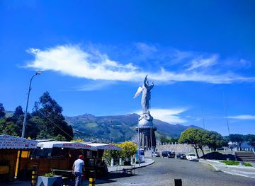
Tourist attraction
Virgin of the Panecillo
Explore the Virgin of the Panecillo, a grand monument in Quito offering stunning views and a rich blend of history and culture in the heart of Ecuador.
-
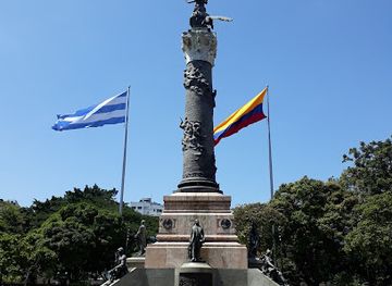
Park
Parque Centenario
Discover the rich history and serene landscapes of Parque Centenario, Guayaquil's treasured park and a perfect escape for tourists seeking culture and relaxation.
-
Tourist attraction
Guayaquil Historical Park
Discover the rich history and vibrant nature at Guayaquil Historical Park, a serene escape and cultural gem for tourists in Ecuador.
Explore El Oro Region on the map
Plan your trip on one map. See where the top cities, national parks and sights are, and book hotels and experiences in a few clicks.
Best hotels in El Oro Region
Best restaurants in El Oro Region
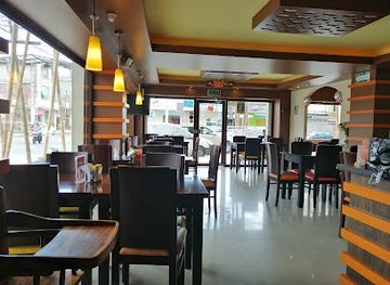
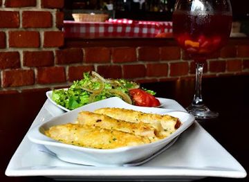
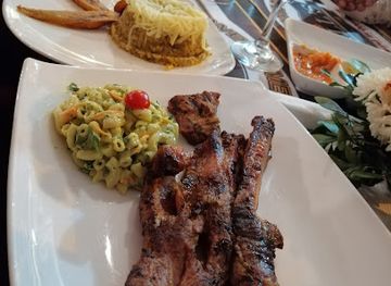
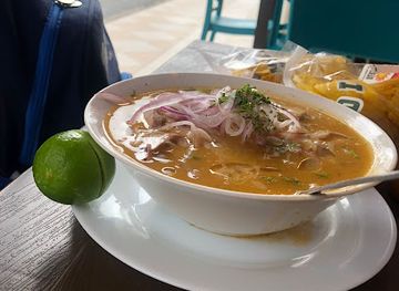
El Oro’s food reflects its position between productive lowlands, estuaries and the Pacific. Seafood is central along the coast, with ceviche, prawns, fish, crab and rice-based dishes appearing in restaurants around Machala, Puerto Bolívar, Santa Rosa and Puerto Jelí. Green plantain is a staple, served in preparations such as bolón de verde, while tigrillo combines cooked plantain with egg and other savoury ingredients and is especially suitable for breakfast. The province’s agricultural economy also supplies cacao, bananas and other tropical produce, and mountain areas contribute coffee and locally grown ingredients. Machala has the broadest choice, from everyday almuerzos and bakeries to contemporary restaurants, while smaller towns rely more on family-run eateries, traditional kitchens and roadside food. At seafood establishments, ask what is locally available and in season. Markets are useful for seeing the range of produce, but visitors should choose busy, well-maintained food stalls and drink treated or bottled water when the supply is uncertain.
-
Restaurant
La Olla Criolla
Experience authentic Ecuadorian cuisine at La Olla Criolla in Machala – where tradition meets flavor in every dish.
-
Italian
Rosso Pastas & Vinos
Experience authentic Italian cuisine at Rosso Pastas & Vinos in Machala – where every dish tells a story.
-
Restaurant
Grill's Especialistas En Costillas
Experience the rich flavors of Ecuador at Grill's Especialistas En Costillas in Machala – famous for its delectable ribs and inviting atmosphere.
-
Restaurant
La Delicia Cevichería
Experience authentic Ecuadorian ceviche at La Delicia Cevichería in Machala – where freshness meets flavor in every bite.
Best bars in El Oro Region
Evening life in El Oro is concentrated in Machala and the larger towns rather than spread evenly across the province. Machala has the widest selection of cafés, restaurants, casual bars, karaoke venues and late-night entertainment, with activity generally strongest around commercial and central areas. Santa Rosa and Pasaje offer a smaller local scene, while Zaruma and Piñas are better suited to relaxed evenings in traditional bars, restaurants and cafés than to a large club circuit. Coastal communities such as Puerto Jelí are particularly associated with seafood dining and informal drinks, although the atmosphere can be quieter outside busy periods. Live music and social gatherings are more significant than a dedicated nightlife district in many smaller communities. Opening arrangements and venue status can change, so check locally rather than relying on old listings, and arrange a safe return when travelling from rural or waterfront areas.
-
 Hotel
HotelHotel Oro Verde Machala
Discover unparalleled luxury and comfort at Hotel Oro Verde Machala, the premier hotel in Machala, Ecuador, offering exceptional amenities and service.
-
Bar
Skuisyto Cocteles
Discover the vibrant nightlife and exquisite cocktails at Skuisyto Cocteles, Machala's premier bar for a memorable evening.
-
Italian
Rosso Pastas & Vinos
Experience the authentic taste of Italian cuisine at Rosso Pastas & Vinos in Machala, a culinary gem where every dish is a masterpiece.
-
Restaurant
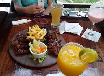
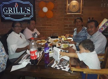
Grill's Especialistas En Costillas
Explore the rich flavors of Machala at Grill's Especialistas En Costillas, the ultimate destination for rib lovers and culinary enthusiasts.
Best nightclubs in El Oro Region
Evening life in El Oro is concentrated in Machala and the larger towns rather than spread evenly across the province. Machala has the widest selection of cafés, restaurants, casual bars, karaoke venues and late-night entertainment, with activity generally strongest around commercial and central areas. Santa Rosa and Pasaje offer a smaller local scene, while Zaruma and Piñas are better suited to relaxed evenings in traditional bars, restaurants and cafés than to a large club circuit. Coastal communities such as Puerto Jelí are particularly associated with seafood dining and informal drinks, although the atmosphere can be quieter outside busy periods. Live music and social gatherings are more significant than a dedicated nightlife district in many smaller communities. Opening arrangements and venue status can change, so check locally rather than relying on old listings, and arrange a safe return when travelling from rural or waterfront areas.
-
Bar
Skuisyto Cocteles
Discover the vibrant nightlife of Machala at Skuisyto Cocteles, where expertly crafted cocktails and a lively atmosphere await.
-
Bar
Fizz Lounge-Bar
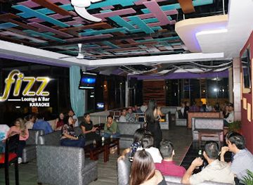
Experience the vibrant nightlife at Fizz Lounge-Bar in Machala, where great music, karaoke, and cocktails come together for an unforgettable evening.
-
Bar
Zona Rosa Machala
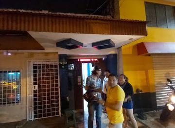
Discover the vibrant nightlife at Zona Rosa Machala, a lively bar that offers an unforgettable experience with great drinks and entertainment.
-
Night club
Night Club Extasis
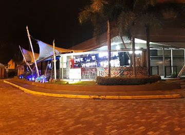
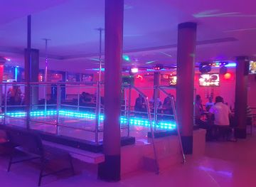
Discover the pulsating nightlife of Machala at Night Club Extasis, where vibrant music and energetic dance create unforgettable moments.
Best shops in El Oro Region
Shopping in El Oro is centred on Machala’s commercial streets, markets and supermarkets, where visitors can find tropical produce, everyday Ecuadorian goods, clothing and practical travel supplies. The city is also a useful place to look for bananas, cacao and other products associated with the provincial economy, although packaging and export quality vary between sellers. Santa Rosa and Pasaje have more local market-town atmospheres, with fresh food, small shops and household goods rather than extensive tourist retail. Zaruma’s independent shops and cafés provide opportunities to buy regional coffee, sweets, cacao products and small craft items, while Piñas is a practical stop for locally produced food and gifts. In coastal communities, seafood is generally a meal rather than a souvenir, and visitors should comply with regulations protecting marine life. Choose responsibly made crafts, avoid archaeological objects and wildlife products, and remember that rural markets may operate on particular days and may accept cash only.
-
Shopping mall
Mall Del Río
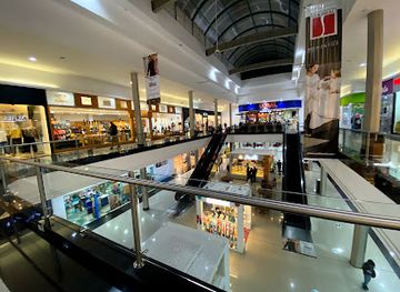
Explore the diverse shopping, dining, and entertainment options at Mall Del Río, the largest mall in Cuenca, Ecuador.
-
Shopping mall
"Andes" Shopping Mall
Discover the vibrant Andes Shopping Mall in Ambato, Ecuador, offering diverse shopping, dining, and entertainment options for every traveler.
-
Resort hotel
Hillary Nature Resort & Spa
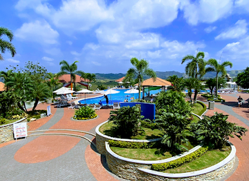
Discover tranquility at Hillary Nature Resort & Spa in Arenillas, Ecuador, where luxury meets nature and every moment is a chance for relaxation.
-
Park
El Algarrobo Central Park
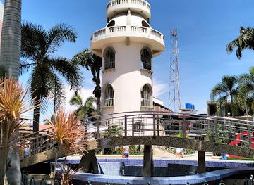
Experience the natural beauty and cultural vibrancy of El Algarrobo Central Park in Huaquillas, Ecuador, a perfect escape for relaxation and exploration.
Get your free copy of our complete guide to El Oro Region, delivered straight to you.
Everything on this page, from attractions and restaurants to essentials and local phrases, in one PDF you can read offline, print or share.
Already have an account? Sign in
Your El Oro Region guide is ready.
We'll send it to · Not you? Sign out

Getting your guide ready…
We are putting together a fresh copy of the El Oro Region guide. This can take up to a minute.
This can take a few moments. If your browser asks, choose Allow so the download can start. You'll find the guide in your Downloads folder.
Nothing happened? Download it again
Sorry, the guide is taking longer than usual. Please try again in a minute, or get it by email instead.
El Oro Region essentials
Currency and Payment
Safety
Emergency Situations
Do's and Don'ts
Local Tips
From Eve
Local phrases worth knowing
You don't need to get them perfect. A few words go a long way, and locals appreciate the effort.
Basics
| English | Local | Say it |
|---|---|---|
| Hello | Hola | [OH-lah] |
| Goodbye | Adiós | [ah-DYOS] |
| Yes | Sí | [SEE] |
| No | No | [NO] |
| Please/You're welcome | Por favor / De nada | [por fah-VOR / de NAH-dah] |
| Thank you | Gracias | [GRAH-syahs] |
| Excuse me/Sorry | Disculpe / Lo siento | [dees-KOOL-peh / lo SYEN-toh] |
| How are you? | ¿Cómo estás? | [KOH-moh es-TAS] |
| Fine. And you? | Bien. ¿Y tú? | [BYEN. ee TOO] |
| Do you speak English? | ¿Hablas inglés? | [AH-blahs een-GLES] |
| I don't understand | No entiendo | [NO en-TYEN-do] |
Eating & Drinking
| English | Local | Say it |
|---|---|---|
| I'd like to see the menu, please | Me gustaría ver el menú, por favor | [meh goos-tah-REE-ah BEHR el meh-NOO, por fah-VOR] |
| I don't eat meat | No como carne | [NO KOH-moh KAR-neh] |
| Cheers! | ¡Salud! | [sah-LOOD] |
| I would like to pay, please | Me gustaría pagar, por favor | [meh goos-tah-REE-ah pah-GAR, por fah-VOR] |
Emergencies
| English | Local | Say it |
|---|---|---|
| Help! | ¡Ayuda! | [ah-YOO-dah] |
| Go away! | ¡Vete! | [BEH-teh] |
| Call the Police! | ¡Llama a la policía! | [YAH-mah ah lah poh-lee-SEE-ah] |
| Call a doctor! | ¡Llama a un doctor! | [YAH-mah ah oon dok-TOR] |
| I'm lost | Estoy perdido | [es-TOY per-DEE-doh] |
| I'm ill | Estoy enfermo | [es-TOY en-FER-mo] |
Shopping
| English | Local | Say it |
|---|---|---|
| I'd like to buy... | Me gustaría comprar... | [meh goos-tah-REE-ah kom-PRAHR] |
| I'm just looking | Solo estoy mirando | [SOH-lo es-TOY mee-RAHN-do] |
| How much is it? | ¿Cuánto cuesta? | [KWAN-toh KWEH-stah] |
| That's too expensive | Eso es muy caro | [EH-so es MOO-ee KAH-ro] |
| Can you lower the price? | ¿Puedes bajar el precio? | [PWEH-des bah-HAR el PREH-syo] |
Time & Numbers
| English | Local | Say it |
|---|---|---|
| What time is it? | ¿Qué hora es? | [KEH OH-rah es] |
| It's one o'clock | Es la una | [es lah OO-nah] |
| Half past (10) | Y diez y media | [ee DYAS ee MEH-diah] |
| Morning | Mañana | [mah-NYAH-nah] |
| Afternoon | Tarde | [TAR-deh] |
| Evening | Noche | [NOH-cheh] |
| Yesterday | Ayer | [ah-YER] |
| Today | Hoy | [OY] |
| Tomorrow | Mañana | [mah-NYAH-nah] |
| 1 | Uno | [OO-no] |
| 2 | Dos | [DOS] |
| 3 | Tres | [TRES] |
| 4 | Cuatro | [KWAT-ro] |
| 5 | Cinco | [SEEN-ko] |
| 6 | Seis | [SAYS] |
| 7 | Siete | [SYEH-teh] |
| 8 | Ocho | [OH-cho] |
| 9 | Nueve | [NWEH-veh] |
| 10 | Diez | [DYAS] |
Transport & Directions
| English | Local | Say it |
|---|---|---|
| Where's a/the...? | ¿Dónde está un/ el ...? | [DON-deh es-TAH oon/ el ...] |
| What's the address? | ¿Cuál es la dirección? | [KWAL es lah dee-rek-SYON] |
| Can you show me (on the map)? | ¿Puedes mostrarme (en el mapa)? | [PWEH-des mos-TRAR-me (en el MAH-pah)] |
| When's the next (bus)? | ¿Cuándo es el próximo (bus)? | [KWAN-do es el PROK-si-mo (boos)] |
| A ticket (to ....) | Un boleto (a ....) | [oon bo-LEH-to (ah ....)] |
History of El Oro Region
Pre-Columbian coastal and highland societies
Before Spanish rule, the territory now called El Oro was occupied by diverse communities connected to both the Pacific lowlands and the southern Andean world. Coastal peoples relied on fishing, shellfish, farming and exchange through estuaries, while upland communities cultivated more varied terrain and maintained trading links across the mountain routes. Archaeological evidence in southern Ecuador points to long-standing movement of goods and ideas between coast and highlands. Sites such as Yacuviñay, in the Atahualpa canton, preserve part of this earlier landscape, although the archaeological record remains more complex than a single continuous regional culture.
Spanish conquest and colonial reorganisation
Spanish rule transformed existing systems of landholding, labour and administration across the region. Settlements, churches and roads were reorganised around colonial authority, while indigenous communities faced tribute demands, disease and social disruption. The coastal plain, river valleys and mountain routes acquired new importance as agriculture, livestock raising and mineral prospecting expanded. Many later towns in El Oro developed from this layered colonial geography, even where their present buildings date from the republican period or from later rebuilding.
Gold mining and the rise of Zaruma and Portovelo
Gold has been extracted in the Zaruma–Portovelo district for centuries, but industrial-scale development accelerated from the late nineteenth century. Foreign and Ecuadorian companies introduced new equipment, capital and labour systems, helping turn the mountain settlements into one of Ecuador’s best-known mining zones. The industry brought roads, commercial activity and population growth, while also leaving difficult environmental and social legacies. Zaruma’s timber architecture and Portovelo’s mining landscapes remain the clearest physical reminders of this period.
The creation of El Oro Province in 1884
El Oro became a separate Ecuadorian province in 1884, reflecting the growing political and economic importance of its mining districts, agricultural lowlands and maritime connections. Machala developed as the provincial capital and as an outlet for trade through Puerto Bolívar. The new administrative framework helped consolidate relationships between coastal settlements and the mining towns inland, although those areas continued to have markedly different economies and geographic identities.
Bananas, ports and twentieth-century transformation
During the twentieth century, banana cultivation became one of El Oro’s defining industries. Warm lowlands, irrigation, transport links and access to Puerto Bolívar supported the expansion of plantations and related commerce. Machala consequently grew from a regional town into a major agricultural and trading centre. The banana economy created employment and export wealth but also brought dependence on international markets, pressure on land and water, and continuing debates about labour and environmental conditions.
Aquaculture, conservation and the modern province
In recent decades, shrimp farming and other forms of aquaculture have become prominent around El Oro’s estuaries, alongside bananas, cacao and other agricultural products. These industries coexist with mangrove ecosystems, wetlands and island habitats that support fisheries and wildlife. Conservation areas such as Buenaventura and the protection of coastal islands and wetlands reflect a growing effort to safeguard the province’s ecological variety. Modern El Oro is therefore shaped by the negotiation between export agriculture, port development, mining legacies and nature-based tourism.
El Oro Region in Photos
Browse through our photo collection highlighting the charm and character of the destination.
Neighbouring regions of El Oro Region
The closest regions to El Oro Region, if you have time for more than one.
-

-

-

-

-


Swipe for more regions

