

Cerro Verde National Park Travel Guide - Free Web & App
Your ultimate guide to Cerro Verde National Park. Discover top landmarks, proposed trips, and local tips. Free on the web or via the Evendo companion app.


Cerro Verde National Park in El Salvador offers cloud forest walks, volcano views, Santa Ana hikes, Izalco scenery and Lake Coatepeque panoramas.
Volcanic Landscapes
Cerro Verde National Park occupies the cool, forested highlands of western El Salvador, within the volcanic landscape commonly known as Los Volcanes. Its central feature is Cerro Verde, a long-dormant volcanic cone rising to roughly 2,030 metres and cloaked in cloud forest vegetation. From the park's viewpoints, visitors can look across the broad crater of Santa Ana Volcano, the steep, symmetrical cone of Izalco Volcano and, on clear days, the blue waters of Lake Coatepeque. The scenery changes quickly with cloud, wind and sunlight, giving the highland park a markedly different atmosphere from El Salvador's warmer lowlands.Read more about Cerro Verde National Park
Forest, Wildlife and Conservation
Gateway to Western El Salvador
When is the best time to visit Cerro Verde National Park?
Best: July–September · 28°C| Month | High (°C) | Rainfall (mm) |
|---|---|---|
| January | 28 | 11 |
| February | 29 | 10 |
| March | 29 | 9 |
| April | 30 | 9 |
| May | 29 | 8 |
| June | 29 | 7 |
| July (best) | 28 | 8 |
| August (best) | 28 | 8 |
| September (best) | 28 | 9 |
| October | 29 | 9 |
| November | 29 | 10 |
| December | 29 | 11 |
Getting to and around Cerro Verde National Park
How to get there
Transportation
Best attractions in Cerro Verde National Park
Cerro Verde's principal attraction is its elevated viewpoint over the volcanic chain of western El Salvador. From the forested park, visitors can often see Santa Ana Volcano's broad crater and Izalco's sharply defined cone, while Lake Coatepeque spreads below in a collapsed volcanic basin. Walking routes through the cool vegetation reveal the park's highland character, with opportunities for birdwatching and observing orchids, bromeliads and other montane plants. More strenuous excursions lead towards the summits of Santa Ana and Izalco when authorised and accompanied according to local regulations. The park also works well as a base for exploring the surrounding volcanic landscape, including the shores and viewpoints of Lake Coatepeque, the coffee-growing highlands near the Ruta de las Flores and the historic city of Santa Ana, all outside the park's core protected area. Weather can change the experience significantly: cloud may conceal the cones, while clear periods open long views across the western landscape.
-
Tourist attraction
El Jardin de Los Volcanes
Experience the breathtaking beauty and tranquility of El Jardin de Los Volcanes, a natural paradise in Santa Ana, El Salvador, perfect for adventure and relaxation.
-
Tourist attraction
Volcan santa ana
Discover the awe-inspiring beauty and adventure at Volcan Santa Ana, El Salvador's premier hiking destination amidst stunning landscapes.
-
Tourist attraction
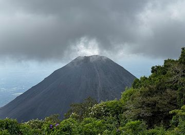
Volcán de Izalco
Explore the breathtaking Volcán de Izalco, a stunning natural wonder and hiking paradise in El Salvador, offering panoramic views and rich biodiversity.
-
National park
Complejo Los Volcanes
Discover the stunning landscapes and rich biodiversity of Complejo Los Volcanes National Park in Santa Ana, a paradise for nature lovers and adventurers.


Best landmarks in Cerro Verde National Park
The defining landmarks of Cerro Verde National Park are the volcanic forms visible from its forested slopes: Santa Ana Volcano, El Salvador's highest volcano, with its distinctive crater lake, and Izalco, the steep cone shaped by historic eruptions. Cerro Verde itself is a landmark of the highland skyline and provides the park's principal viewpoints. Below the volcanoes, Lake Coatepeque occupies a large caldera and forms one of western El Salvador's most recognisable natural features, although its shoreline lies outside the national park. The surrounding coffee landscapes, cloud-affected forests and rugged volcanic ridges express the relationship between geology, agriculture and settlement. In the wider region, Santa Ana's historic urban heritage provides a contrasting man-made landmark environment, but the protected area's identity rests primarily on volcanoes, crater landscapes and montane vegetation rather than monuments or grand architecture.
-
National park
Parque Nacional Cerro Verde
Discover El Salvador's volcanic heart: Hike through cloud forests, witness stunning vistas, and explore the beauty of Cerro Verde National Park.

Explore Cerro Verde National Park on the map
Plan your trip on one map. See where the top attractions, landmarks, restaurants and hotels are, and book hotels and experiences in a few clicks.
Best hotels in Cerro Verde National Park
Best restaurants in Cerro Verde National Park
Dining inside Cerro Verde National Park is limited compared with the surrounding towns, so visitors should not expect a restaurant district within the protected area. Refreshments may be available around the visitor area or through small local vendors, but provisions and opening arrangements can vary. Santa Ana offers the broadest choice of restaurants for travellers using the city as a base, while Juayúa and other Ruta de las Flores settlements provide cafés, eateries and food-focused local tourism in the surrounding highlands. Regional cooking commonly draws on maize, beans, rice, plantains, dairy products and seasonal produce, with coffee from the volcanic slopes an important part of the local agricultural identity. Pupusas are widely associated with Salvadoran cuisine and are found throughout the country, while rural markets and small eateries offer a more direct connection to everyday regional food than the park itself.
-
 Hotel
Casa 1800 Cerro Verde
Experience the beauty of El Salvador at Casa 1800 Cerro Verde—where stunning volcanic views meet authentic Salvadoran cuisine.
-
Restaurant
Los Volcanes Bistro Café
Discover Los Volcanes Bistro Café: A charming spot offering delicious local cuisine amidst the stunning landscapes of El Congo.
-
Restaurant
Está Carbón
Experience authentic Salvadoran flavors at Está Carbón in Santa Ana – where tradition meets culinary innovation amidst breathtaking landscapes.
-
Restaurant
Great pupusas
Discover authentic Salvadoran cuisine at Great Pupusas in El Congo—home to deliciously stuffed pupusas bursting with flavor.


Best bars in Cerro Verde National Park
Cerro Verde is a daytime nature destination rather than a nightlife centre, and evening options within the park are very limited. Visitors staying nearby generally spend the night in quiet rural accommodation or return to Santa Ana, where the larger population supports a wider selection of cafés, restaurants and informal evening venues. Juayúa and other towns along the Ruta de las Flores can offer a relaxed social atmosphere, particularly when local cultural or food events are taking place, but schedules and availability vary. Traditional cafés and village establishments are more characteristic of the area than dedicated nightclubs. Anyone returning from the volcanoes after dark should plan transport in advance, since mountain roads, limited lighting and reduced rural services make spontaneous late-night travel impractical.
-
Restaurant
Los Volcanes Bistro Café
Discover the flavors of El Salvador at Los Volcanes Bistro Café, where traditional cuisine meets modern coffee culture.
-
Restaurant
Hostal y Restaurante Las Lomas
Discover the flavors of El Salvador at Hostal y Restaurante Las Lomas, where authentic cuisine meets breathtaking views in Cerro Verde.
-
Restaurant
Bosko Cerro Verde
Discover the flavors of El Salvador at Bosko Cerro Verde, where stunning views meet culinary excellence in a warm, inviting atmosphere.
-
Bar
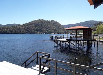
Lago Coatepeque
Explore the stunning Lago Coatepeque, a volcanic lake in El Salvador, offering breathtaking views, water sports, and local culture.



Best nightclubs in Cerro Verde National Park
Cerro Verde is a daytime nature destination rather than a nightlife centre, and evening options within the park are very limited. Visitors staying nearby generally spend the night in quiet rural accommodation or return to Santa Ana, where the larger population supports a wider selection of cafés, restaurants and informal evening venues. Juayúa and other towns along the Ruta de las Flores can offer a relaxed social atmosphere, particularly when local cultural or food events are taking place, but schedules and availability vary. Traditional cafés and village establishments are more characteristic of the area than dedicated nightclubs. Anyone returning from the volcanoes after dark should plan transport in advance, since mountain roads, limited lighting and reduced rural services make spontaneous late-night travel impractical.
-
Restaurant
Los Volcanes Bistro Café
Experience the blend of local culture and exquisite flavors at Los Volcanes Bistro Café, a culinary gem in El Congo, El Salvador.
-
Night club
Club Coatepeque
Immerse yourself in the vibrant nightlife of El Porvenir at Club Coatepeque, where music, dance, and fun come together in a thrilling atmosphere.
-
Bar
D’COATELAKEICE
D’COATELAKEICE: A lively bar in El Congo, Santa Ana, perfect for cocktails, music, and immersing in local nightlife.
-
Lounge
Tapachula
Experience the vibrant lounge culture of Tapachula, where relaxation meets lively entertainment in a picturesque Salvadoran setting.

Best shops in Cerro Verde National Park
Shopping within Cerro Verde National Park is modest and generally limited to refreshments, practical visitor items or small locally made goods when vendors are present. More substantial purchases are easier in Santa Ana, where shops and markets serve the surrounding population, or in towns along the Ruta de las Flores, where visitors may find regional food products, coffee and locally produced crafts. The volcanic highlands are strongly associated with coffee cultivation, making locally grown coffee a meaningful regional purchase when bought from reputable producers. Small-scale artisan goods, foodstuffs and market products can vary by settlement and season, so they are best viewed as expressions of the wider western highlands rather than as a fixed park shopping offer. Carry essential hiking supplies before arrival, since retail choices at the protected area itself are limited.
-
National park
Parque Nacional Cerro Verde
Discover the stunning landscapes and rich biodiversity of Parque Nacional Cerro Verde, a must-visit national park in El Salvador for nature lovers and adventurers.
-
Hotel
Casa 1800 Cerro Verde
Discover the beauty of El Salvador at Casa 1800 Cerro Verde, a peaceful hotel in the stunning Cerro Verde National Park offering authentic cuisine and nature experiences.
-
Mountain cabin
Glass House Mountain Park
Discover the natural beauty and tranquility of Glass House Mountain Park, a perfect getaway for nature lovers and adventure seekers alike.
-
Restaurant
Los Volcanes Bistro Café
Discover Los Volcanes Bistro Café, where local flavors meet stunning views in El Congo, perfect for coffee lovers and food enthusiasts.


Get your free copy of our complete guide to Cerro Verde National Park, delivered straight to you.
Everything on this page, from attractions and restaurants to essentials and local phrases, in one PDF you can read offline, print or share.
Already have an account? Sign in
Your Cerro Verde National Park guide is ready.
We'll send it to · Not you? Sign out

Getting your guide ready…
We are putting together a fresh copy of the Cerro Verde National Park guide. This can take up to a minute.
This can take a few moments. If your browser asks, choose Allow so the download can start. You'll find the guide in your Downloads folder.
Nothing happened? Download it again
Sorry, the guide is taking longer than usual. Please try again in a minute, or get it by email instead.
Cerro Verde National Park essentials
Currency and Payment
Safety
Emergency Situations
Do's and Don'ts
Local Tips
From Eve
Local phrases worth knowing
You don't need to get them perfect. A few words go a long way, and locals appreciate the effort.
Basics
| English | Local | Say it |
|---|---|---|
| Hello | Hola | [oh-la] |
| Goodbye | Adiós | [ah-dee-ohs] |
| Yes | Sí | [see] |
| No | No | [noh] |
| Please/You're welcome | Por favor/De nada | [por fah-vor/de nah-dah] |
| Thank you | Gracias | [grah-see-ahs] |
| Excuse me/Sorry | Perdón/Lo siento | [pair-dohn/loh see-en-toh] |
| How are you? | ¿Cómo estás? | [koh-moh ehs-tahs] |
| Fine. And you? | Bien. ¿Y tú? | [byen. ee too] |
| Do you speak English? | ¿Hablas inglés? | [ah-blahs een-glays] |
| I don't understand | No entiendo | [noh ehn-tee-ehn-doh] |
Eating & Drinking
| English | Local | Say it |
|---|---|---|
| I'd like to see the menu, please | Me gustaría ver el menú, por favor | [may goos-tah-ree-ah vehr ehl meh-noo, por fah-vor] |
| I don't eat meat | No como carne | [noh koh-moh kahr-neh] |
| Cheers! | ¡Salud! | [sah-lood] |
| I would like to pay, please | Me gustaría pagar, por favor | [may goos-tah-ree-ah pah-gar, por fah-vor] |
Emergencies
| English | Local | Say it |
|---|---|---|
| Help! | ¡Ayuda! | [ah-yoo-dah] |
| Go away! | ¡Vete! | [veh-teh] |
| Call the Police! | ¡Llama a la policía! | [yah-mah ah lah poh-lee-see-ah] |
| Call a doctor! | ¡Llama a un médico! | [yah-mah ah oon meh-dee-koh] |
| I'm lost | Estoy perdido | [ehs-toy pair-dee-doh] |
| I'm ill | Estoy enfermo | [ehs-toy ehn-fehr-moh] |
Shopping
| English | Local | Say it |
|---|---|---|
| I'd like to buy... | Me gustaría comprar... | [may goos-tah-ree-ah kohm-prar] |
| I'm just looking | Solo estoy mirando | [soh-loh ehs-toy mee-rahn-doh] |
| How much is it? | ¿Cuánto cuesta? | [kwan-toh kwehs-tah] |
| That's too expensive | Eso es demasiado caro | [eh-soh ehs de-mah-see-ah-doh kah-roh] |
| Can you lower the price? | ¿Puedes rebajar el precio? | [pweh-dehs reh-bah-har ehl pree-syoh] |
Time & Numbers
| English | Local | Say it |
|---|---|---|
| What time is it? | ¿Qué hora es? | [keh oh-rah ehs] |
| It's one o'clock | Es la una | [ehs lah oo-nah] |
| Half past (10) | Las diez y media | [lahs d'yehs ee meh-dee-ah] |
| Morning | Mañana | [mah-nyah-nah] |
| Afternoon | Tarde | [tahr-deh] |
| Evening | Noche | [noh-cheh] |
| Yesterday | Ayer | [ah-yehr] |
| Today | Hoy | [oy] |
| Tomorrow | Mañana | [mah-nyah-nah] |
| 1 | Uno | [oo-noh] |
| 2 | Dos | [dohs] |
| 3 | Tres | [trehs] |
| 4 | Cuatro | [kwah-troh] |
| 5 | Cinco | [seen-koh] |
| 6 | Seis | [say-ees] |
| 7 | Siete | [syeh-teh] |
| 8 | Ocho | [oh-choh] |
| 9 | Nueve | [nweh-veh] |
| 10 | Diez | [d'yehs] |
Transport & Directions
| English | Local | Say it |
|---|---|---|
| Where's a/the...? | ¿Dónde está...? | [dohn-deh ehs-tah] |
| What's the address? | ¿Cuál es la dirección? | [kwal ehs lah dee-rehk-syohn] |
| Can you show me (on the map)? | ¿Puedes enseñarme (en el mapa)? | [pweh-dehs ehn-seh-nyar-meh (ehn ehl mah-pah)] |
| When's the next (bus)? | ¿Cuándo es el próximo (autobús)? | [kwan-doh ehs ehl prohk-see-moh (ow-toh-boos)] |
| A ticket (to ....) | Un boleto (a ....) | [oon boh-leh-toh (ah)] |
History of Cerro Verde National Park
Volcanic Formation and Highland Ecology
Cerro Verde is part of the volcanic chain that defines western El Salvador, where tectonic activity and repeated eruptions have shaped cones, craters, lava fields and highland lakes. The park's forested summit is a dormant volcanic edifice rather than a conventional mountain, and its cool, humid climate supports vegetation markedly different from that of the Pacific lowlands. Santa Ana Volcano and Izalco, the two more prominent neighbouring volcanoes, remain central to understanding the area's geology and visual identity.
Indigenous Highland Landscapes
Before the modern park existed, the surrounding western highlands formed part of the territory inhabited and cultivated by Indigenous communities, including Pipil-speaking peoples. Villages and agricultural areas developed around the volcanoes, while fertile volcanic soils later supported coffee and other crops. The wider region retains Indigenous and colonial place names, although the protected forest around Cerro Verde is best understood as one part of a much broader cultural landscape rather than an isolated wilderness.
Izalco, the Lighthouse of the Pacific
Izalco Volcano became one of the region's defining historical features after a long eruptive period began in 1770. Its frequent activity and visible lava glow made it a prominent landmark for ships navigating the Pacific coast, contributing to the nickname 'Lighthouse of the Pacific'. Eruptions continued intermittently until the twentieth century, and the sharply formed cone remains one of the most recognisable sights from Cerro Verde, even though it is now quiet.
A Changing Volcanic Region
Santa Ana Volcano, also known as Ilamatepec, has also influenced the area's history and contemporary visitor culture. Its 2005 eruption demonstrated that the western volcanic chain remains geologically active, despite the dormancy of Cerro Verde itself. The volcanoes have shaped settlement, agriculture, travel routes and local livelihoods, while their slopes have also created conditions favourable to coffee cultivation. Today, volcanic tourism exists alongside farming and rural communities rather than replacing them.
Protected Area and Biosphere Reserve
Cerro Verde became a protected recreation and conservation landscape during the twentieth century as interest grew in safeguarding the highland forests and making the volcanoes accessible to visitors. It is now associated with Los Volcanes National Park and forms part of the Apaneca-Ilamatepec Biosphere Reserve, designated by UNESCO in 2007. Conservation in the area involves balancing habitat protection, volcanic-risk awareness, local livelihoods and carefully managed access to trails and viewpoints.
Cerro Verde National Park in Photos
Browse through our photo collection highlighting the charm and character of the destination.
Neighbouring destination travel guides
The closest destinations to Cerro Verde National Park, if you have time for more than one.
-

-
-
-

-


Swipe for more destinations
Explore more
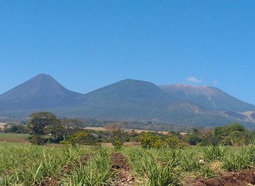
Explore more of Western Region
Discover the beauty and history of the Western Region of El Salvador, from the majestic Santa Ana Volcano to ancient ruins and picturesque coffee plantations.
Explore Western Region
Explore more of El Salvador
Discover the hidden gem of Central America with El Salvador's stunning landscapes, rich culture, and world-class surfing. A paradise for adventurers and culture lovers alike.
Explore El Salvador