

Free Quetzaltenango Travel Guide & Mobile App
Plan your Quetzaltenango trip with Evendo. Get free guides to top attractions, restaurants, hotels, and bars. Web access or download the mobile app.


Quetzaltenango, Guatemala, blends K’iche’ Maya culture, neoclassical architecture, highland markets, volcano views and memorable local experiences year-round.
Highland Character and K’iche’ Heritage
At around 2,300 metres above sea level, Quetzaltenango occupies a broad mountain basin in Guatemala’s western highlands, where cool air, volcanic horizons and a strong K’iche’ Maya presence shape everyday life. Often known by its Indigenous name, Xelajú, the city is a regional centre for education, commerce and culture, with a more measured pace than Guatemala City and a distinctly highland identity. Indigenous dress, market traditions and the K’iche’ language remain visible throughout the city and its surrounding communities.Read more about Quetzaltenango
Architecture and Urban Life
Markets, Mountains and Neighbouring Towns
When is the best time to visit Quetzaltenango?
Best: October–December · 24°C| Month | High (°C) | Rainfall (mm) |
|---|---|---|
| January | 23 | 5 |
| February | 23 | 5 |
| March | 23 | 5 |
| April | 23 | 5 |
| May | 24 | 5 |
| June | 24 | 6 |
| July | 24 | 6 |
| August | 24 | 6 |
| September | 24 | 6 |
| October (best) | 24 | 6 |
| November (best) | 24 | 6 |
| December (best) | 24 | 6 |
Getting to and around Quetzaltenango
How to get there
Transportation
Best attractions in Quetzaltenango
Quetzaltenango’s principal sightseeing area spreads around Parque Centro América, a formal urban square from which visitors can explore the Cathedral of the Holy Spirit, the Municipalidad, Pasaje Enríquez and the Municipal Theatre. The Museo del Ferrocarril de Los Altos preserves the story of the railway that once linked the highlands with the coast, while Casa No’j hosts cultural exhibitions and activities in a historic central setting. Mercado La Democracia offers a more immediate encounter with daily commerce, from produce and clothing to regional foods. For open-air views, Cerro El Baúl rises above the city and provides a perspective across the basin and towards the volcanic landscape. The city is also a base for visits to nearby communities such as Salcajá and Zunil, as well as the Fuentes Georginas hot springs; these lie outside Quetzaltenango itself but reveal the agricultural, Indigenous and volcanic setting that gives the city its character.
-
Tourist attraction
Parque Municipal Cerro El Baúl
Escape to Parque Municipal Cerro El Baúl for breathtaking views, nature trails, and family fun in Quetzaltenango's green oasis.
6 min drive · 2.1 km from city centre
-
Tourist attraction
Minerva Temple
Discover the Minerva Temple in Quetzaltenango, a neo-classical landmark amidst the vibrant Mercado El Terminal, reflecting Guatemala's cultural heritage.
6 min drive · 2.0 km from city centre
-
Tourist attraction
Catedral del Espíritu Santo
Discover Quetzaltenango's historic Catedral del Espíritu Santo, a blend of colonial heritage and spiritual significance.
2 min walk · 0.1 km from city centre
-
Tourist attraction
Zoológico Minerva
Discover diverse wildlife at Zoológico Minerva in Quetzaltenango, a family-friendly zoo committed to conservation and education.
7 min drive · 2.2 km from city centre


Best landmarks in Quetzaltenango
The Cathedral of the Holy Spirit, beside Parque Centro América, is one of Quetzaltenango’s defining religious landmarks, combining a surviving colonial façade with a later church building shaped by earthquake damage and reconstruction. The Municipalidad represents the city’s civic ambitions, while the Municipal Theatre reflects the cultural confidence that accompanied nineteenth-century commercial prosperity. Pasaje Enríquez, an arcaded commercial building on the central square, contributes an especially recognisable neoclassical presence to the historic streetscape. The Iglesia de San Nicolás and the Iglesia del Calvario extend the historic centre’s religious architecture beyond the main plaza. Cerro El Baúl is a natural landmark as well as a viewpoint, linking the urban landscape to the volcanic basin. Together, these places express Quetzaltenango’s development from colonial settlement to prosperous liberal-era regional capital and modern highland city.
-
Park
Parque a Centro América
Discover the lush landscapes and cultural richness of Parque a Centro América in Quetzaltenango, a serene retreat for tourists and locals alike.
1 min walk · 0.1 km from city centre
-
Tourist attraction
Fuentes Georginas
Experience the enchanting natural hot springs of Fuentes Georginas, a tranquil oasis in the heart of Zunil, Guatemala.
30 min drive · 10 km from city centre
-
Performing arts theater
Municipal Theatre
Discover the vibrant cultural heritage of Quetzaltenango at the Municipal Theatre, a hub for performing arts and local community engagement.
4 min walk · 0.3 km from city centre
-
Hotel
Latam Hotel Plaza Pradera Quetzaltenango
Discover luxury and comfort at Latam Hotel Plaza Pradera Quetzaltenango, your gateway to exploring the rich culture and beauty of Guatemala.
7 min drive · 2.5 km from city centre


Explore Quetzaltenango on the map
Plan your Quetzaltenango trip on one map. See where the top attractions, landmarks, restaurants, bars and hotels are, find what's near where you're staying, and book hotels and experiences in a few clicks.
Best hotels in Quetzaltenango
Best restaurants in Quetzaltenango
Quetzaltenango’s food culture combines K’iche’ highland traditions, Guatemalan home cooking and the habits of a substantial student population. Local menus may include pepián, a richly seasoned meat and vegetable stew; jocón, prepared with a green sauce; tamales and chuchitos; and paches, potato-based parcels particularly associated with the western highlands. Shecas, a slightly sweet regional bread, are a characteristic purchase from bakeries and market stalls. Around the centre, cafés, modest comedor eateries and contemporary restaurants serve both Guatemalan dishes and international food, while Mercado La Democracia and other markets provide inexpensive breakfasts, snacks, fruit and prepared meals. Quetzaltenango’s cool climate and surrounding farms support a strong market culture, with vegetables arriving from nearby agricultural communities such as Almolonga. Dining is generally informal, and the most revealing meals often come from ordinary local establishments rather than polished tourist venues.
-
Restaurant
Restaurante Tertulianos
Experience exquisite European cuisine at Restaurante Tertulianos in Quetzaltenango—where fondue dreams come true.
15 min walk · 1.2 km from city centre
-
French
Brule Gourmet
Experience authentic French cuisine in Quetzaltenango at Brule Gourmet - where every meal is a delightful journey through France's culinary traditions.
5 min drive · 1.6 km from city centre
-
Restaurant
Restaurante Don Carlos - Quetzaltenango.
Savor authentic Guatemalan flavors at Restaurante Don Carlos - A must-visit culinary gem in Quetzaltenango.
6 min drive · 1.9 km from city centre
-
Restaurant
Tony's Steakhouse
Experience the best grilled meats and authentic Guatemalan flavors at Tony's Steakhouse in Quetzaltenango.
14 min walk · 1.1 km from city centre


Best bars in Quetzaltenango
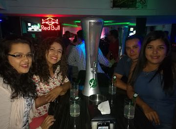
Quetzaltenango’s evening life is shaped more by cafés, student gatherings, small bars and cultural events than by a large club scene. The streets around the historic centre, including the area near Parque Centro América and Pasaje Enríquez, offer places for a relaxed drink or conversation, while some venues present live music, DJ nights or occasional cultural performances. Spanish-language schools contribute an international social atmosphere, but nightlife remains relatively compact and can vary with the academic calendar. The city also has theatres and performance spaces where music, dance and public cultural programmes provide alternatives to drinking. After dark, visitors should remain in well-used areas and arrange trusted transport, particularly when returning to accommodation outside the central neighbourhoods.
-
Grill
Charlie's Restaurant & Bar
Discover the vibrant culinary scene of Quetzaltenango at Charlie's Restaurant & Bar, where delicious grill specialties await every visitor.
1 min walk · 0.1 km from city centre
-
Bar
El Shamrock
Experience the vibrant nightlife of Quetzaltenango at El Shamrock, where local culture meets refreshing drinks in a lively atmosphere.
4 min walk · 0.3 km from city centre
-
Pub
Calixto Güin Pub
Discover the lively Calixto Güin Pub in Quetzaltenango, where local culture meets a vibrant nightlife atmosphere, perfect for unwinding after a day of exploration.
10 min drive · 3.3 km from city centre
-
Sports bar
Coyote Sport Bar
Coyote Sport Bar in Quetzaltenango: Where sports, cocktails, and delicious food come together for an unforgettable night out.
8 min drive · 2.7 km from city centre


Best nightclubs in Quetzaltenango
Quetzaltenango’s evening life is shaped more by cafés, student gatherings, small bars and cultural events than by a large club scene. The streets around the historic centre, including the area near Parque Centro América and Pasaje Enríquez, offer places for a relaxed drink or conversation, while some venues present live music, DJ nights or occasional cultural performances. Spanish-language schools contribute an international social atmosphere, but nightlife remains relatively compact and can vary with the academic calendar. The city also has theatres and performance spaces where music, dance and public cultural programmes provide alternatives to drinking. After dark, visitors should remain in well-used areas and arrange trusted transport, particularly when returning to accommodation outside the central neighbourhoods.
-
Disco club
El Duende Disco Bar Xela
Discover the lively atmosphere of El Duende Disco Bar Xela, a must-visit destination for an unforgettable nightlife experience in Quetzaltenango.
3 min walk · 0.3 km from city centre
-
Bar
Maderos Nigth Club
Discover the heart of Quetzaltenango's nightlife at Maderos Night Club, a vibrant bar for music, dance, and unforgettable moments.
5 min drive · 1.5 km from city centre
-
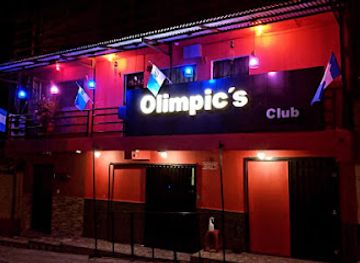
Night club
Olimpics Club Xela
Experience the vibrant nightlife of Quetzaltenango at Olimpics Club Xela, where music, dance, and unforgettable moments await every visitor.
11 min walk · 0.9 km from city centre
-
Disco club
Sahara Disco Xela
Experience the vibrant nightlife at Sahara Disco Xela, the premier disco club in Quetzaltenango, where unforgettable memories and electrifying energy await.
4 min walk · 0.3 km from city centre


Best shops in Quetzaltenango
Shopping in Quetzaltenango is closely tied to everyday regional commerce rather than a concentrated luxury retail scene. Mercado La Democracia is one of the city’s busiest shopping areas, with stalls selling produce, clothing, household goods and prepared food, while Mercado Minerva and other neighbourhood markets reveal the scale of trade serving the surrounding highlands. The streets near the historic centre contain small clothing shops, bookshops, cafés and independent retailers, and Pasaje Enríquez adds an architectural setting to central browsing. Visitors may find woven goods, embroidered textiles, leatherwork, carved items, coffee and regional foods, although the origin and quality of crafts vary. Surrounding towns are often more closely associated with particular textile and agricultural traditions, so shopkeepers or cultural organisations can help explain where products were made. Polite negotiation is customary in some informal markets but not in every shop.
-
Shopping mall
Centro Comercial Interplaza Xela
Explore Centro Comercial Interplaza Xela, the ultimate shopping destination in Quetzaltenango, blending modern amenities with local charm.
13 min drive · 4.5 km from city centre
-
Game store
Rubiks Xela
Discover Rubiks Xela in Quetzaltenango, a vibrant game store offering a diverse selection of board games, card games, and engaging activities for all ages.
13 min walk · 1.1 km from city centre
-
Men's clothing store
Emporium Pradera Xela
Discover the trendy Emporium Pradera Xela, the premier men's clothing store in Quetzaltenango, featuring stylish fashion and a vibrant shopping experience.
7 min drive · 2.4 km from city centre
-
CD store
Kpopers Xela
Explore Kpopers Xela in Quetzaltenango for a vibrant selection of K-pop music and a welcoming community of fans and enthusiasts.
14 min walk · 1.1 km from city centre


Get your free copy of our complete guide to Quetzaltenango, delivered straight to you.
Everything on this page, from attractions and restaurants to essentials and local phrases, in one PDF you can read offline, print or share.
Already have an account? Sign in
Your Quetzaltenango guide is ready.
We'll send it to · Not you? Sign out

Getting your guide ready…
We are putting together a fresh copy of the Quetzaltenango guide. This can take up to a minute.
This can take a few moments. If your browser asks, choose Allow so the download can start. You'll find the guide in your Downloads folder.
Nothing happened? Download it again
Sorry, the guide is taking longer than usual. Please try again in a minute, or get it by email instead.
Quetzaltenango essentials
Currency and Payment
Safety
Emergency Situations
Do's and Don'ts
Local Tips
From Eve
Local phrases worth knowing
You don't need to get them perfect. A few words go a long way, and locals appreciate the effort.
Basics
| English | Local | Say it |
|---|---|---|
| Hello | K'ulaj | [koo-lahkh] |
| Goodbye | Chawe | [chah-weh] |
| Yes | E' | [eh] |
| No | Ma' | [mah] |
| Please/You're welcome | Taj | [tahkh] |
| Thank you | Matyox | [mah-chohsh] |
| Excuse me/Sorry | Patzun | [pahtz-oon] |
| How are you? | B'ane'ech | [bah-neh-ehch] |
| Fine. And you? | Laj k'awoq. Oj | [lahkh kah-wohk. ohkh] |
| Do you speak English? | At k'utaj ri Inglés? | [aht koo-tahkh ree een-glehs] |
| I don't understand | Ma xk'utij | [mah shkoo-teekh] |
Eating & Drinking
| English | Local | Say it |
|---|---|---|
| I'd like to see the menu, please | Aj k'utz ri menú, taj | [ahkh kootz ree meh-noo, tahkh] |
| I don't eat meat | Ma k'uj ri b'iil | [mah koo-h ree bee-eel] |
| Cheers! | Tzijó! | [tsee-hoh] |
| I would like to pay, please | Aj k'utz ri pa ri tjaj | [ahkh kootz ree pah ree tah-khah] |
Emergencies
| English | Local | Say it |
|---|---|---|
| Help! | Xk'aslemal! | [shkahs-leh-mahl] |
| Go away! | Xk'otzil! | [shkoh-tseel] |
| Call the Police! | Ri Polisiawi ri'! | [ree poh-lee-see-ah-wee ree] |
| Call a doctor! | Ri' k'aslemal ri'! | [ree shkahs-leh-mahl ree] |
| I'm lost | Ma k'ajol | [mah kah-hohl] |
| I'm ill | Ma k'ab'anoj | [mah kahb-ah-nohkh] |
Shopping
| English | Local | Say it |
|---|---|---|
| I'd like to buy... | Aj k'utz ri... | [ahkh kootz ree] |
| I'm just looking | Xu'ma'aj | [shoo-mah-ahkh] |
| How much is it? | Xq'ij ri? | [shkee-kh ree] |
| That's too expensive | Xq'ij ri k'astiyan | [shkee-kh ree kahs-tee-yahn] |
| Can you lower the price? | K'ori k'utaj ri xq'ij? | [koh-ree koo-tahkh ree shkee-kh] |
Time & Numbers
| English | Local | Say it |
|---|---|---|
| What time is it? | Xq'ij k'otzij? | [shkee-kh koh-tsee] |
| It's one o'clock | Wanb'eyel | [wahn-beh-yel] |
| Half past (10) | Ri mitamb'an | [ree mee-tahm-bahn] |
| Morning | Ri' k'icheje'el | [ree kee-cheh-heh-ehl] |
| Afternoon | Ri' k'ijunuje'el | [ree kee-hoon-hoo-heh-ehl] |
| Evening | Ri' k'ijb'ox | [ree kee-hbohsh] |
| Yesterday | Ri' k'ak'oj | [ree kah-kohkh] |
| Today | Ri' k'aj | [ree kahkh] |
| Tomorrow | Ri' k'ajb'ey | [ree kahkh-beh-eh] |
| 1 | Jun | [hoon] |
| 2 | K'ab'ey | [kahb-eh-eh] |
| 3 | Oxlahun | [ohsh-lah-hoon] |
| 4 | K'a'aj | [kah-ahkh] |
| 5 | Wuqub'ey | [woo-koo-beh-eh] |
| 6 | Junb'ey | [hoon-beh-eh] |
| 7 | Jun k'oxb'ey | [hoon kohsh-beh-eh] |
| 8 | Jun k'a'ajb'ey | [hoon kah-ahkh-beh-eh] |
| 9 | B'alamk'ajb'ey | [bah-lahm-kahkh-beh-eh] |
| 10 | Lajun | [lah-hoon] |
Transport & Directions
| English | Local | Say it |
|---|---|---|
| Where's a/the...? | Achi ri... | [ah-chee ree] |
| What's the address? | Achi ri' ri nima' | [ah-chee ree ree nee-mah] |
| Can you show me (on the map)? | K'ori k'utaj ri' (en mapan)? | [koh-ree koo-tahkh ree (ehn mah-pahn)] |
| When's the next (bus)? | Ri k'otzij (bus) k'o? | [ree koh-tsee (boos) koh] |
| A ticket (to ....) | Ri tziket (k'o ....) | [ree tsee-keht (koh ....)] |
History of Quetzaltenango
Xelajú Before Spanish Rule
The area now occupied by Quetzaltenango formed part of the K’iche’ Maya world before the arrival of the Spanish. Indigenous traditions refer to the settlement as Xelajú or Xelajú Noj, names that remain important to the city’s identity. The surrounding highlands supported farming communities connected through trade, political alliances and conflict, while the basin’s fertile soils and strategic position helped make it a significant regional centre. Spanish accounts describe contact with the K’iche’ kingdom during Pedro de Alvarado’s campaign in 1524, including the defeat of K’iche’ forces associated with the nearby region. The precolonial name survived alongside the Spanish designation Quetzaltenango, preserving a visible link between the modern city and its Indigenous foundations.
Colonial Quetzaltenango Emerges
Following the Spanish conquest, colonial authorities established settlements and institutions in the valley, gradually reorganising landholding, labour and religious life. Quetzaltenango developed as a centre for agriculture and regional exchange, connected to surrounding Indigenous communities that supplied food, textiles and labour. Catholic churches and civic buildings became prominent features of the urban landscape, while Spanish administrative structures were laid over older patterns of settlement. The city’s population remained culturally mixed, and K’iche’ communities continued to shape its economy and social life. Although colonial Quetzaltenango never rivalled Guatemala City in political power, its position in the western highlands gave it enduring commercial importance.
Independence and Los Altos
After Central American independence from Spain in 1821, Quetzaltenango became the leading city of the western highlands and the capital of the short-lived State of Los Altos. The state was created in 1838 within the Federal Republic of Central America and brought together western territories with interests distinct from those of Guatemala City. Its government was suppressed by Rafael Carrera in 1840, and Los Altos was reincorporated into Guatemala. The episode left a lasting regional memory, reflecting tensions over political authority, taxation and the relationship between the highland provinces and the capital. Quetzaltenango nevertheless retained its influence as a centre of trade, education and civic ambition.
Coffee, Liberalism and Civic Ambition
During the nineteenth century, liberal reforms and the expansion of coffee production transformed Quetzaltenango’s economy. Commercial agriculture connected the city more closely with coastal plantations and international markets, while merchants and prosperous families financed schools, theatres and imposing civic buildings. The city became associated with liberal politics and regional autonomy, and its educated middle class supported newspapers, cultural societies and public institutions. This prosperity helped create the formal urban character visible around Parque Centro América, where municipal, religious and commercial architecture expressed confidence in Quetzaltenango’s growing importance. It also rested on unequal land and labour systems that affected Indigenous communities throughout the western highlands.
Revolt and the Santa María Disaster
Quetzaltenango’s political prominence brought confrontation as well as prosperity. In 1897, opposition to President José María Reina Barrios and resistance to his government’s policies contributed to the Quetzaltenango uprising, which was suppressed by national forces. A few years later, the eruption of Santa María volcano in October 1902, followed by severe seismic activity, caused widespread destruction across the region and badly damaged the city. The disaster killed many people, disrupted agriculture and commerce, and destroyed or weakened buildings. Quetzaltenango’s subsequent rebuilding altered parts of its streetscape while preserving its role as the principal urban centre of western Guatemala.
Reconstruction and Modern Highland Identity
The twentieth century brought reconstruction, new transport links, expanding schools and stronger connections with Guatemala’s national economy. Quetzaltenango’s historic centre acquired much of its present mixture of neoclassical, eclectic and later modern buildings during the period of recovery from earlier earthquakes and urban change. The city continued to attract students, professionals and traders from across the western highlands, while Indigenous political and cultural movements asserted the importance of K’iche’ identity in public life. Today, Quetzaltenango combines a historic civic core with busy markets, universities, Spanish-language schools and neighbourhoods shaped by migration from surrounding towns, making its past an active part of contemporary urban life.
Quetzaltenango in Photos
Browse through our photo collection highlighting the charm and character of the destination.
Cities near Quetzaltenango
The closest cities to Quetzaltenango, if you have time for more than one stop.
-

-

-

-

-


Swipe for more cities
Explore more
Explore more of Guatemala
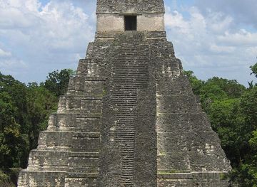
Discover Guatemala: A land of ancient Mayan wonders, breathtaking natural beauty, and vibrant cultural experiences. Perfect for history buffs, nature lovers, and adventure seekers.
Explore Guatemala