

Los Chorros de la Calera Travel Guide - Free Web & App
Your ultimate guide to Los Chorros de la Calera. Discover top landmarks, proposed trips, and local tips. Free on the web or via the Evendo companion app.


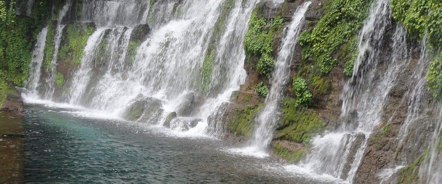


Los Chorros de la Calera in El Salvador offers waterfalls, forest walks and natural pools near Juayúa on the scenic Ruta de las Flores.
Water, Forest and Volcanic Landscapes
Los Chorros de la Calera is a group of waterfalls and natural pools in western El Salvador, close to the highland town of Juayúa in Sonsonate Department. The falls lie within the landscape of the Ruta de las Flores, where volcanic uplands, coffee plantations, shaded ravines and small rural communities create a markedly cooler setting than the Pacific lowlands. Water runs through a narrow, green-sided valley, forming cascades and pools that have become one of the area's best-known outdoor attractions.Read more about Los Chorros de la Calera
A Rural Gateway in the Ruta de las Flores
Experiencing the Falls Responsibly
When is the best time to visit Los Chorros de la Calera?
Best: January–March · 27–28°C| Month | High (°C) | Rainfall (mm) |
|---|---|---|
| January (best) | 28 | 5 |
| February (best) | 27 | 5 |
| March (best) | 27 | 5 |
| April | 28 | 5 |
| May | 29 | 5 |
| June | 29 | 5 |
| July | 29 | 5 |
| August | 29 | 5 |
| September | 28 | 5 |
| October | 28 | 5 |
| November | 28 | 5 |
| December | 28 | 5 |
Getting to and around Los Chorros de la Calera
How to get there
Transportation
Best attractions in Los Chorros de la Calera
The central attraction is the chain of cascades and pools known as Los Chorros de la Calera, reached from Juayúa through a rural, wooded setting in the western highlands. The route brings visitors close to running water, shaded ravine vegetation and volcanic terrain, with opportunities for walking, photography and bathing only where conditions and local guidance allow. Juayúa itself adds a cultural dimension through its town square, church and celebrated weekend food tradition, while the surrounding countryside introduces coffee plantations and views across the Ruta de las Flores. Visitors with more time can use Juayúa as a base for exploring other towns and natural sites along the route, including Salcoatitán, Concepción de Ataco and Apaneca, although these are separate destinations rather than attractions within Los Chorros de la Calera. The appeal of the waterfall area lies in its modest, natural character: there is no extensive visitor complex, and the experience depends on the stream, ravine and changing weather.

Explore Los Chorros de la Calera on the map
Plan your trip on one map. See where the top attractions, landmarks, restaurants and hotels are, and book hotels and experiences in a few clicks.
Best hotels in Los Chorros de la Calera
Best shops in Los Chorros de la Calera
Shopping at Los Chorros de la Calera itself is minimal, so visitors should look to Juayúa and the other towns of the Ruta de las Flores for local products. Juayúa's food stalls and small businesses are useful places to sample or purchase Salvadoran snacks, coffee and regional produce, while nearby highland communities are known for craft and artisan traditions that vary from town to town. Coffee is the most directly characteristic purchase associated with the surrounding landscape, reflecting the cool upland climate and plantation economy. Small shops may also sell practical provisions for the walk, but visitors should not expect a large retail district, specialist outdoor store or permanent market at the waterfalls. Ask sellers about provenance and support genuine local businesses rather than removing natural materials or buying items made from protected plants or wildlife.
Get your free copy of our complete guide to Los Chorros de la Calera, delivered straight to you.
Everything on this page, from attractions and restaurants to essentials and local phrases, in one PDF you can read offline, print or share.
Already have an account? Sign in
Your Los Chorros de la Calera guide is ready.
We'll send it to · Not you? Sign out

Getting your guide ready…
We are putting together a fresh copy of the Los Chorros de la Calera guide. This can take up to a minute.
This can take a few moments. If your browser asks, choose Allow so the download can start. You'll find the guide in your Downloads folder.
Nothing happened? Download it again
Sorry, the guide is taking longer than usual. Please try again in a minute, or get it by email instead.
Los Chorros de la Calera essentials
Currency and Payment
Safety
Emergency Situations
Do's and Don'ts
Local Tips
From Eve
Local phrases worth knowing
You don't need to get them perfect. A few words go a long way, and locals appreciate the effort.
Basics
| English | Local | Say it |
|---|---|---|
| Hello | Hola | [oh-lah] |
| Goodbye | Adiós | [ah-dyohs] |
| Yes | Sí | [see] |
| No | No | [noh] |
| Please/You're welcome | Por favor | [pohr fah-vohr] |
| Thank you | Gracias | [grah-syahs] |
| Excuse me/Sorry | Perdón | [pehr-dohn] |
| How are you? | ¿Cómo estás? | [koh-moh ehs-tahs] |
| Fine. And you? | Bien. ¿Y tú? | [byehn. ee too] |
| Do you speak English? | ¿Hablas inglés? | [ahb-lahs een-glehs] |
| I don't understand | No entiendo | [noh ehn-tyen-doh] |
Eating & Drinking
| English | Local | Say it |
|---|---|---|
| I'd like to see the menu, please | Me gustaría ver el menú, por favor | [meh goos-tah-reeah behr ehl meh-noo, pohr fah-vohr] |
| I don't eat meat | No como carne | [noh koh-moh kahr-neh] |
| Cheers! | ¡Salud! | [sah-lood] |
| I would like to pay, please | Me gustaría pagar, por favor | [meh goos-tah-reeah pah-gahr, pohr fah-vohr] |
Emergencies
| English | Local | Say it |
|---|---|---|
| Help! | ¡Ayuda! | [ah-yoo-dah] |
| Go away! | ¡Vete! | [veh-teh] |
| Call the Police! | ¡Llama a la Policía! | [yah-mah ah lah poh-lee-see-ah] |
| Call a doctor! | ¡Llama a un doctor! | [yah-mah ah oon dohk-tohr] |
| I'm lost | Estoy perdido | [ehs-toy pehr-dee-doh] |
| I'm ill | Estoy enfermo | [ehs-toy ehn-fehr-moh] |
Shopping
| English | Local | Say it |
|---|---|---|
| I'd like to buy... | Me gustaría comprar... | [meh goos-tah-reeah kohm-prahr] |
| I'm just looking | Sólo estoy mirando | [soh-loh ehs-toy meer-ahn-doh] |
| How much is it? | ¿Cuánto cuesta? | [kwan-toh kwes-tah] |
| That's too expensive | Esto es demasiado caro | [ehs-toh ehs deh-mah-syah-doh kah-roh] |
| Can you lower the price? | ¿Puedes bajar el precio? | [pweh-dehs bah-hahr ehl pree-syoh] |
Time & Numbers
| English | Local | Say it |
|---|---|---|
| What time is it? | ¿Qué hora es? | [keh oh-rah ehs] |
| It's one o'clock | Es la una en punto | [ehs lah oo-nah ehn poon-toh] |
| Half past (10) | Media (10) | [meh-dyah (deh-eez)] |
| Morning | Mañana | [mah-nyah-nah] |
| Afternoon | Tarde | [tahr-deh] |
| Evening | Noche | [noh-cheh] |
| Yesterday | Ayer | [ah-yehr] |
| Today | Hoy | [oy] |
| Tomorrow | Mañana | [mah-nyah-nah] |
| 1 | Uno | [oo-noh] |
| 2 | Dos | [dohs] |
| 3 | Tres | [trehs] |
| 4 | Cuatro | [kwah-troh] |
| 5 | Cinco | [seen-koh] |
| 6 | Seis | [seys] |
| 7 | Siete | [syeh-teh] |
| 8 | Ocho | [oh-choh] |
| 9 | Nueve | [nweh-veh] |
| 10 | Diez | [dyehs] |
Transport & Directions
| English | Local | Say it |
|---|---|---|
| Where's a/the...? | ¿Dónde está un/el...? | [dohn-deh ehs-tah oon/ehl] |
| What's the address? | ¿Cuál es la dirección? | [kwal ehs lah dee-rehk-syohn] |
| Can you show me (on the map)? | ¿Puedes mostrarme (en el mapa)? | [pweh-dehs mohs-trahr-meh (ehn ehl mah-pah)] |
| When's the next (bus)? | ¿Cuándo es el próximo (autobús)? | [kwan-doh ehs ehl prohk-see-moh (ow-toh-boos)] |
| A ticket (to ....) | Un boleto (a ....) | [oon boh-leh-toh (ah)] |
History of Los Chorros de la Calera
Volcanic Uplands and Flowing Water
Los Chorros de la Calera belongs to the volcanic highlands of western El Salvador, a region shaped by successive volcanic processes, erosion and the movement of water through steep terrain. The waterfalls are not a monument created at a particular historical date but a natural expression of this landscape: streams descend through rock and vegetation before continuing towards the wider drainage systems around Juayúa. Their modern identity is therefore closely connected with the broader geology and humid climate of the Apaneca-Ilamatepec highlands, where elevated terrain produces cooler conditions and supports dense vegetation and agriculture.
Indigenous Roots of Juayúa
The wider Juayúa area has deep Indigenous roots associated with the Pipil-speaking communities of western El Salvador. Before Spanish rule, settlements in this part of the country were connected through agriculture, local exchange and cultural traditions adapted to the volcanic uplands. The waterfalls themselves are a natural site rather than a documented archaeological centre, but their position within a long-inhabited landscape places them in a region where rivers, springs, cultivated land and forest have historically shaped daily life. Indigenous heritage remains an important part of the cultural context of western El Salvador.
Colonial Settlement and Changing Land Use
Spanish colonial influence altered settlement patterns, land ownership and religious life across the Sonsonate highlands. Juayúa developed as a settled community within this changing regional landscape, and its church and town traditions reflect the continuing presence of colonial-era institutions alongside older local identities. Over subsequent centuries, upland land was increasingly used for cultivation, with roads and settlements linking communities across the hills. The ravines and streams around Juayúa remained part of the rural environment, supplying water and shaping routes through terrain that was difficult to develop intensively.
Coffee, Tourism and Local Access
Coffee became central to the economy and visual character of El Salvador's western highlands, including the countryside around Juayúa. Plantations, shade trees and rural roads now form part of the setting through which visitors approach Los Chorros de la Calera. In the late twentieth and early twenty-first centuries, Juayúa and neighbouring communities became associated with the Ruta de las Flores, a tourism corridor linking highland towns, crafts, food and outdoor attractions. The waterfalls gained prominence within this visitor economy, while access continues to depend on local knowledge, weather and responsible use of a natural site rather than extensive formal infrastructure.
Los Chorros de la Calera in Photos
Browse through our photo collection highlighting the charm and character of the destination.
Neighbouring destination travel guides
The closest destinations to Los Chorros de la Calera, if you have time for more than one.
-

-

-

-

-


Swipe for more destinations
Explore more
Explore more of Western Region
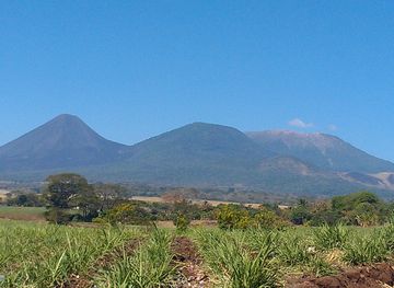
Discover the beauty and history of the Western Region of El Salvador, from the majestic Santa Ana Volcano to ancient ruins and picturesque coffee plantations.
Explore Western Region
Explore more of El Salvador
Discover the hidden gem of Central America with El Salvador's stunning landscapes, rich culture, and world-class surfing. A paradise for adventurers and culture lovers alike.
Explore El Salvador