

Mont Boron (Nice) Travel Guide - Free
Explore Mont Boron in Nice with Evendo's free guide. Find the best shops, historic streets, restaurants, and gems on web or mobile.


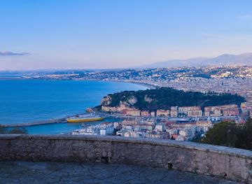
Mont Boron in Nice combines pine-scented hill walks, Riviera villas, the Fort du Mont Alban and sweeping views over the Baie des Anges and Villefranche, French Riviera
A Hillside Between City and Coast
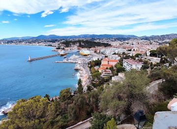
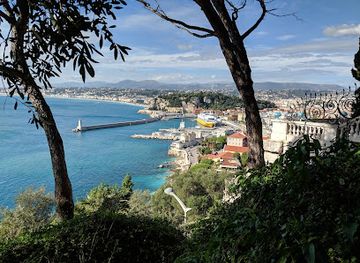
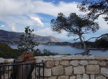
Mont Boron rises east of central Nice between the Mediterranean and the harbour district, a predominantly residential hillside where wooded paths, elegant villas and quiet roads replace the density of the city centre. Its slopes look across the Baie des Anges to the west and towards Villefranche-sur-Mer and Cap Ferrat to the east, giving the neighbourhood an unusually open geographical setting. The hill is best understood as a landscape as much as an urban district: roads wind through maritime pine woodland, while villas and apartment buildings appear among gardens and rocky outcrops.Read more about Mont Boron
Woodland, Fortifications and Coastal Paths
Villas and Everyday Mont Boron
Best attractions in Mont Boron
Mont Boron's attractions are primarily landscape-based and reward unhurried exploration. Parc du Mont Boron brings together pine woodland, rocky paths and clearings with wide views over Nice, the Baie des Anges and the eastern Riviera. The Fort du Mont Alban, on the adjoining height, is the area's major historic attraction: its sixteenth-century walls and strategic position place the neighbourhood within Nice's defensive story, although opening arrangements should be checked before visiting. Below, Coco Beach and the rocky shore around Cap de Nice provide a contrasting coastal setting, while the Sentier du Littoral can offer a demanding walk towards Villefranche-sur-Mer when the route is accessible. Boulevard du Mont-Boron and the surrounding residential roads add interest through villas, gardens and changing viewpoints. There is no dense museum quarter here; the principal experience is the combination of woodland, fortifications, architecture and sea-facing paths.
-
Tourist attraction
Parc du Mont Boron
Explore the serene beauty and stunning views of Parc du Mont Boron, a top tourist attraction in Nice, France, perfect for nature lovers and adventurers.
12 min walk · 1.0 km from neighbourhood centre
-
Observation deck
Belvédère du Mont Boron
Experience the stunning panoramic views of Nice and the French Riviera at the breathtaking Belvédère du Mont Boron, a must-visit observation deck.
7 min walk · 0.5 km from neighbourhood centre
-
Tourist attraction
Villa Beau Site
Discover the enchanting Villa Beau Site in Nice, a historical landmark that beautifully blends architecture with the stunning views of the French Riviera.
7 min walk · 0.5 km from neighbourhood centre
-
Park
Belvédère de la Petite batterie
Discover the tranquil beauty of Belvédère de la Petite Batterie in Nice, offering stunning views and a serene escape from the city.
3 min walk · 0.3 km from neighbourhood centre

Best landmarks in Mont Boron
Mont Boron's defining landmark is the Fort du Mont Alban, a substantial sixteenth-century fortress positioned on the neighbouring height between Nice and Villefranche-sur-Mer. Built under Savoyard rule between 1557 and 1560, it represents the military importance of the eastern approaches and remains the clearest physical link between the neighbourhood's scenery and Nice's defensive history. The Parc du Mont Boron is another landmark in the broader local sense: its preserved woodland gives the hill a recognisable green silhouette above the coast. Boulevard du Mont-Boron and the roads running towards Cap de Nice reveal a succession of Riviera villas, garden walls and later apartment buildings rather than a single monumental street. The rocky coastal edge around Coco Beach and Cap de Nice also forms part of Mont Boron's visual identity, linking the residential hill to the sea and to views of Villefranche's bay.
-
Park
Parc du Mont Boron
Discover the serene beauty of Parc du Mont Boron, a stunning park in Nice offering breathtaking views, lush landscapes, and a rich historical backdrop.
12 min walk · 1.0 km from neighbourhood centre
-
Observation deck
Panorama du Mont-Boron
Discover unparalleled views of Nice and the Mediterranean at Panorama du Mont-Boron, a serene observation deck in the heart of the French Riviera.
10 min walk · 0.8 km from neighbourhood centre
-
Observation deck
Belvédère du Mont Boron
Discover the breathtaking views of Nice and the French Riviera from the stunning Belvédère du Mont Boron, a serene observation deck perfect for every traveler.
7 min walk · 0.5 km from neighbourhood centre
-
Castle
Batterie du Mont Boron
Explore the historic Batterie du Mont Boron, where stunning views and rich history meet on the hills of Nice.
2 min walk · 0.1 km from neighbourhood centre


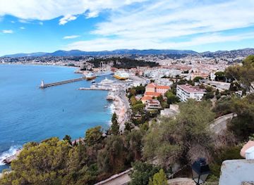
Explore Mont Boron on the map
A handpicked selection of must-see spots in Mont Boron, mapped for you.
Best hotels in Mont Boron
Best restaurants in Mont Boron
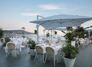
Mont Boron has a modest dining scene rather than a concentrated restaurant quarter, with options more apparent on the lower slopes, along Boulevard Carnot and around the approaches to the port than in the upper residential roads. Visitors will find the everyday mix associated with Nice and the Côte d'Azur: cafés, casual Mediterranean cooking, seafood-oriented menus and places suited to a simple meal before or after a walk. The neighbourhood's hillside geography means that restaurants are not evenly distributed, so carrying water and a picnic for the park can be practical, provided food is eaten responsibly and all rubbish is removed. For a broader choice, the port and central Nice are nearby, but they should be understood as neighbouring areas rather than part of Mont Boron's own culinary identity. Local markets elsewhere in Nice can also supply produce for a self-catered stay, while the hill itself is better known for views than for food tourism.
-
French
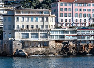
La Réserve de Nice
Experience exquisite French and Mediterranean cuisine at La Réserve de Nice with breathtaking views of the Mediterranean coastline.
11 min walk · 0.9 km from neighbourhood centre
-
Pizza
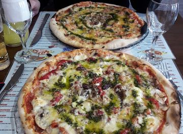
PIZZA MONT BORON
Discover Pizza Mont Boron in Nice: where authentic Italian pizza meets breathtaking views and warm hospitality.
7 min walk · 0.6 km from neighbourhood centre
-
Restaurant
La Stoa
Experience exquisite French cuisine at La Stoa with stunning views over Villefranche-sur-Mer's beautiful Mediterranean coast.
15 min walk · 1.2 km from neighbourhood centre
-
Restaurant
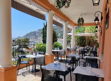
La Terrasse du Versailles
Experience exquisite Mediterranean dining at La Terrasse du Versailles in Villefranche-sur-Mer with stunning sea views.
15 min walk · 1.2 km from neighbourhood centre
Best bars in Mont Boron
Mont Boron is quiet after dark and does not function as one of Nice's principal nightlife districts. Evening activity is concentrated around relaxed cafés and restaurants on the lower approaches, particularly towards Boulevard Carnot and the port, while the upper slopes are predominantly residential. There are no broad entertainment streets or dense club scene within the hill's wooded interior, and many visitors come for sunset views rather than late-night venues. Those seeking a larger choice of bars, live music or nightclubs will find it in central Nice or around the port, reached from Mont Boron by descending roads or arranging transport. At night, the park and coastal paths should not be treated as illuminated promenades; use public roads, remain aware of traffic and respect the quiet of villa-lined streets.
-
Bar
Le Plongeoir
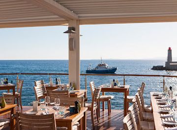
Experience the stunning Mediterranean views and exquisite cuisine at Le Plongeoir, a must-visit culinary destination in Nice.
12 min walk · 1.0 km from neighbourhood centre
-
Bar tabac
Le San Lucas
Discover the charm of Nice at Le San Lucas, a cozy bar tabac offering delightful drinks and a taste of local culture.
7 min walk · 0.5 km from neighbourhood centre
Mont Boron essentials
Getting There
Getting Around
Safety
Emergency Situations
Do's and Don'ts
Local Tips

From Eve
Local phrases worth knowing
You don't need to get them perfect. A few words go a long way, and locals appreciate the effort.
Basics
| English | Local | Say it |
|---|---|---|
| Hello | Bonjour | [bon-zhoor] |
| Goodbye | Au revoir | [oh re-vwar] |
| Yes | Oui | [wee] |
| No | Non | [noh] |
| Please/You're welcome | S'il vous plaît/De rien | [see voo pleh/duh ryen] |
| Thank you | Merci | [mehr-see] |
| Excuse me/Sorry | Excusez-moi/Désolé | [ex-coo-zay mwah/deh-zoh-lay] |
| How are you? | Comment ça va? | [koh-mon sah vah] |
| Fine. And you? | Bien. Et vous? | [byen. ay voo] |
| Do you speak English? | Parlez-vous anglais? | [par-lay voo ahn-glai] |
| I don't understand | Je ne comprends pas | [zhuh nuh kohm-prahnd pah] |
Eating & Drinking
| English | Local | Say it |
|---|---|---|
| I'd like to see the menu, please | Je voudrais voir le menu, s'il vous plaît | [zhuh voo-dray vwar luh meh-nyoo, see voo pleh] |
| I don't eat meat | Je ne mange pas de viande | [zhuh nuh mahnzh pah duh vyand] |
| Cheers! | Santé! | [san-tay] |
| I would like to pay, please | Je voudrais payer, s'il vous plaît | [zhuh voo-dray pay-ay, see voo pleh] |
Emergencies
| English | Local | Say it |
|---|---|---|
| Help! | À l'aide! | [ah layd] |
| Go away! | Allez-vous en! | [al-ay vooz ahn] |
| Call the Police! | Appelez la police! | [ah-peh-lay lah poh-lees] |
| Call a doctor! | Appelez un médecin! | [ah-peh-lay ahn may-deh-sahn] |
| I'm lost | Je suis perdu | [zhuh swee pair-doo] |
| I'm ill | Je suis malade | [zhuh swee mah-lahd] |
Shopping
| English | Local | Say it |
|---|---|---|
| I'd like to buy... | Je voudrais acheter... | [zhuh voo-dray zah-shey...] |
| I'm just looking | Je regarde juste | [zhuh ruh-gard zhust] |
| How much is it? | Combien ça coûte? | [kohm-byen sah koot] |
| That's too expensive | C'est trop cher | [say troh shair] |
| Can you lower the price? | Pouvez-vous baisser le prix? | [poo-vay voo bay-say luh pree] |
Time & Numbers
| English | Local | Say it |
|---|---|---|
| What time is it? | Quelle heure est-il? | [kel ur ay teel] |
| It's one o'clock | Il est une heure | [eel ay tun ur] |
| Half past (10) | Dix heures et demie | [dees ur ay duh-mee] |
| Morning | Matin | [mah-tan] |
| Afternoon | Après-midi | [ah-pray meh-dee] |
| Evening | Soir | [swar] |
| Yesterday | Hier | [yair] |
| Today | Aujourd'hui | [oh-zhoor dwee] |
| Tomorrow | Demain | [duh-man] |
| 1 | Un | [uhn] |
| 2 | Deux | [duh] |
| 3 | Trois | [twah] |
| 4 | Quatre | [kat-ruh] |
| 5 | Cinq | [sank] |
| 6 | Six | [sees] |
| 7 | Sept | [set] |
| 8 | Huit | [weet] |
| 9 | Neuf | [nuhf] |
| 10 | Dix | [dees] |
Transport & Directions
| English | Local | Say it |
|---|---|---|
| Where's a/the...? | Où est le/la...? | [oo ay luh/lah] |
| What's the address? | Quelle est l'adresse? | [kel ay lad-res] |
| Can you show me (on the map)? | Pouvez-vous me montrer (sur la carte)? | [poo-vay voo muh mohn-tray (sir lah kart)] |
| When's the next (bus)? | Quand est le prochain (bus)? | [kahn ay luh proh-shahn (bus)] |
| A ticket (to ....) | Un billet (pour ....) | [uhn bee-yay (poor)] |
History of Mont Boron
A Strategic Eastern Height
Mont Boron formed part of the chain of heights protecting Nice from the east, although its history is closely connected with the neighbouring Mont Alban rather than with a separate medieval town. The elevated ground offered surveillance over the coast, the harbour approaches and the route towards Villefranche. The name Mont Boron is old, but its precise etymology is not securely established enough to support a single definitive explanation. For centuries the slopes remained largely rural and wooded, standing outside the dense urban core below.
The Fort du Mont Alban
The most important historic development on the heights came in the sixteenth century, when the rulers of Savoy strengthened the eastern defences of Nice. Fort du Mont Alban was built between 1557 and 1560 under Emmanuel Philibert, Duke of Savoy, as part of a defensive system facing both landward approaches and the Mediterranean. Its position between Nice and Villefranche gave it strategic reach across the coastline. Although usually associated with Mont Alban rather than Mont Boron proper, the fort is an essential part of the historical landscape experienced from the neighbourhood.
From Rural Slopes to Riviera Suburb
Nice's annexation to France in 1860 accelerated the transformation of the eastern hills from peripheral countryside into an attractive residential landscape. The expansion of roads, promenades and villa development during the later nineteenth century brought the wider Mont Boron area into the orbit of the growing Riviera resort. Houses were built for affluent residents and seasonal visitors, often set within gardens and positioned to capture sea views. The resulting pattern of winding streets, detached villas and wooded plots still distinguishes the hillside from the more regular urban fabric below.
A Protected Urban Landscape
During the twentieth century, Mont Boron became increasingly residential while retaining substantial woodland and its defensive heritage. The Parc du Mont Boron preserved a broad natural setting amid Nice's expansion, and the fort and surrounding coastal landscape remained important markers of the city's eastern history. Later development added apartment buildings and improved road access without eliminating the hill's villas, pine forests and panoramic viewpoints. Today the neighbourhood is valued less for a concentrated commercial centre than for the way its built environment, public woodland and coastal paths preserve a distinctive edge between Nice and the open sea.
Mont Boron in Photos
Browse through our photo collection highlighting the charm and character of the destination.
Neighbourhoods near Mont Boron
The closest neighbourhoods to Mont Boron, if you have time for more than one stop.
-

-

-

-


Swipe for more neighbourhoods
Explore more

Explore more of Nice
Nice, France blends Mediterranean promenades, Belle Époque architecture, Provençal cuisine and celebrated museums with the Côte d’Azur’s bright coastal spirit today.
Explore Nice