Harzer Rotes Höhenvieh Infotafel: A Glimpse into Harz's Agricultural Heritage
Discover the story of Harzer Rotes Höhenvieh at this informative panel in Osterode am Harz, offering insights into the breed's history, characteristics, and ecological importance within the Harz region.
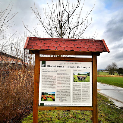
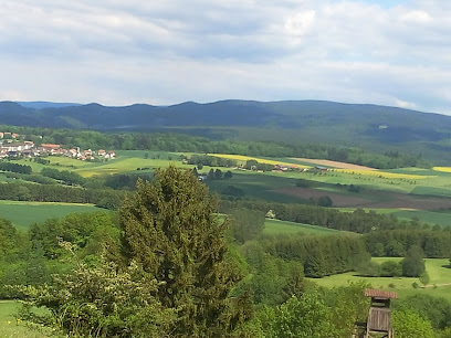
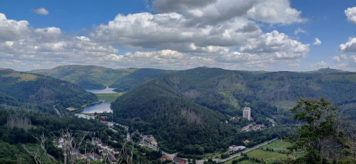
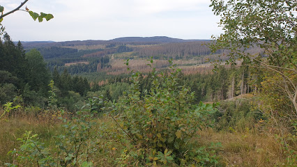
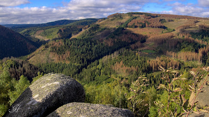
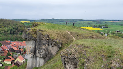
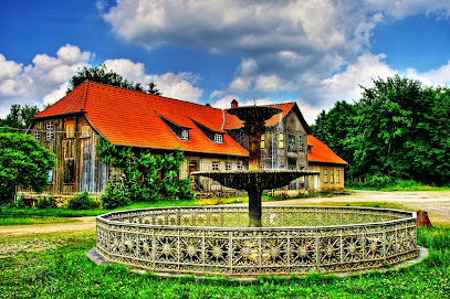
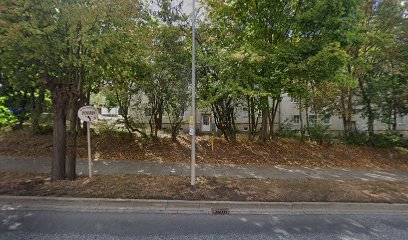
The Harzer Rotes Höhenvieh Infotafel, located in Osterode am Harz, offers a window into the unique agricultural heritage of the Harz region. This informative panel highlights the Harzer Rotes Höhenvieh, a breed of red cattle that played a crucial role in shaping the cultural landscape of the Harz Mountains. Once near extinction, these robust animals are now making a comeback, largely due to their suitability for grazing on the region's steep slopes and their contribution to maintaining biodiversity. The Infotafel serves as an educational landmark, providing insights into the breed's history, characteristics, and importance to the local ecosystem. A visit offers a connection to the region's past and an appreciation for the ongoing efforts to preserve its agricultural traditions.
A brief summary to Harzer Rotes Höhenvieh • Infotafel
- Osterode am Harz, Düna, 37520, DE
Local tips
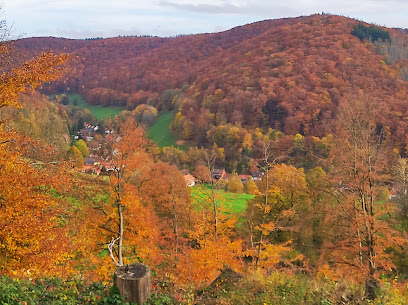
- Combine your visit with a hike in the surrounding Harz Mountains to fully appreciate the landscape that the Harzer Rotes Höhenvieh helps to maintain.
- Look for local farms or restaurants that serve Harzer Rotes Höhenvieh beef or dairy products for a taste of the region's agricultural heritage.
- Visit the Tourist Information in Osterode am Harz for more information on local attractions and events related to the Harzer Rotes Höhenvieh.
Getting There
-
Walking
From the center of Düna, where local bus services may drop you off, the Infotafel is a short walk. Head north, following local signs for hiking trails in the area. The Infotafel is located along a well-maintained path, easily accessible on foot. The walk is generally flat and should take no more than 10-15 minutes from most points in Düna.
-
Driving
If driving, approach Düna via the main roads (e.g., B243). Once in Düna, follow signs towards hiking areas or agricultural landmarks. Limited free parking is available near the Infotafel. Be mindful of local traffic and pedestrian areas. Parking is free.
Discover more about Harzer Rotes Höhenvieh • Infotafel
Iconic landmarks you can’t miss
Harzer Rotes Höhenvieh • Infotafel
0.0 km
Discover the story of Harzer Rotes Höhenvieh at this informative panel in Osterode am Harz, offering insights into the breed's history, characteristics, and ecological importance within the Harz region.
Auerhuhngehege Lonau
4.5 km
Discover the elusive capercaillie in its natural habitat at Auerhuhngehege Lonau, nestled in the scenic Harz National Park, offering a unique wildlife experience and tranquil escape.
Lonauer Wasserfall
5.1 km
Discover the enchanting Lonauer Wasserfall near Herzberg am Harz, a natural spectacle in the Harz Mountains offering scenic hiking trails and a tranquil escape.
Gipskarstlandschaft bei Ührde
6.4 km
Discover a unique landscape sculpted by gypsum karst formations in the Gipskarstlandschaft bei Ührde, a haven for nature lovers and hikers near Osterode am Harz.
Steinberg
8.6 km
Discover the serene beauty of Steinberg Nature Preserve near Herzberg am Harz: Hike scenic trails, explore diverse landscapes, and immerse yourself in the tranquility of the Harz Mountains.
Hanskühnenburg
9.6 km
Experience panoramic views and hearty German cuisine at the Hanskühnenburg, a historic mountain hut nestled in the heart of the Harz National Park, perfect for hikers and nature lovers.
Scharzfels Castle
10.6 km
Explore the atmospheric ruins of Scharzfels Castle in the Harz Mountains, a medieval fortress with a turbulent past and panoramic views, offering a unique blend of history and nature.
Harz Nature Park
12.7 km
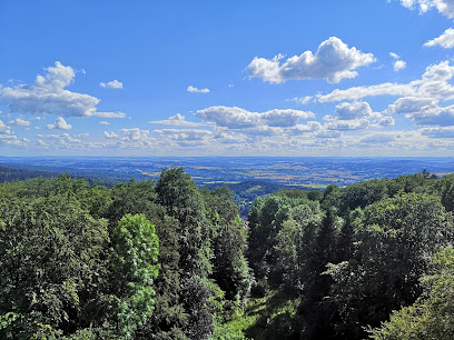
Discover the untamed beauty of the Harz Nature Park: Hike through ancient forests, explore historic mining sites, and witness breathtaking views from the legendary Brocken peak.
Wolfswarte
19.2 km
Discover panoramic views and a rich history at the Wolfswarte, a captivating quartzite rock formation in the heart of the Harz Mountains, perfect for hikers and nature enthusiasts.
Nationalpark-Besucherzentrum TorfHaus
21.9 km
Discover the Harz National Park: Explore interactive exhibits, hike scenic trails, and immerse yourself in the wilderness from the TorfHaus Visitor Center, your gateway to adventure.
Oberer Bodewasserfall
22.9 km
Explore the breathtaking Oberer Bodewasserfall in Braunlage, a stunning natural waterfall that captivates with its serene beauty and outdoor adventures.
Wurmberg-Steinbruch (Vogelschutzgebiet)
23.7 km
Discover the serene beauty of Wurmberg-Steinbruch near Braunlage, a reclaimed quarry turned bird sanctuary, offering a tranquil escape into nature in the Harz.
Feigenbaumklippe
24.1 km
Discover panoramic views and geological wonders at the Feigenbaumklippe in Bad Harzburg, a captivating granite rock formation in the heart of the Harz Mountains.
Verlobungsinsel in der Oker HWN 116
24.2 km
Discover the enchanting Verlobungsinsel in the Oker Valley, a romantic island escape surrounded by stunning natural beauty, perfect for hikers, nature lovers, and those seeking tranquility.
Rammelsberg
24.4 km
Discover the breathtaking beauty and rich history of Rammelsberg Mountain Peak near Goslar, a UNESCO World Heritage site perfect for adventure and exploration.
Unmissable attractions to see
Steinkirche
8.6 km
Discover Steinkirche in Herzberg am Harz: A Historical Landmark Surrounded by Breathtaking Nature and Scenic Hiking Trails.
Aussichtsturm Kuckholzklippe
9.3 km
Discover breathtaking views and serene beauty at Aussichtsturm Kuckholzklippe, a captivating observation deck in the heart of the Harz Mountains.
Unicorn Cave
9.8 km
Explore the enchanting Unicorn Cave, a historical landmark in the Harz Mountains, offering breathtaking natural formations and rich geological history.
BURGSEILBAHN BAD LAUTERBERG | SEILBAHN HARZ
13.9 km
Discover breathtaking mountain views and thrilling hikes at Burgseilbahn Bad Lauterberg, a must-see tourist attraction in the Harz region.
Königshütte
14.1 km
Explore Königshütte, a historical foundry in Bad Lauterberg, showcasing the region's industrial heritage amidst stunning Harz mountain scenery.
Caves experience center Isenberg limestone cave
14.9 km
Explore the breathtaking Isenberg Limestone Cave in Bad Grund, a hidden gem of natural beauty and geological wonder in the heart of Germany.
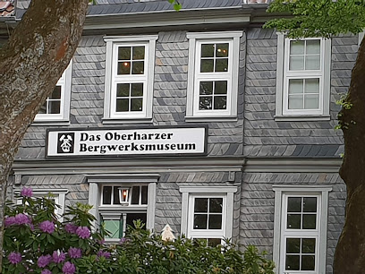
Upper Harz Mining Museum
15.2 km
Explore the fascinating history of mining at the Upper Harz Mining Museum, a cultural gem in the heart of the Harz Mountains.
Weltwald Bad Grund
15.4 km
Explore the stunning natural beauty of Weltwald Bad Grund, a serene park in the Harz Mountains, perfect for nature lovers and families seeking tranquility.
Zufahrt Dammkrone Odertalsperre
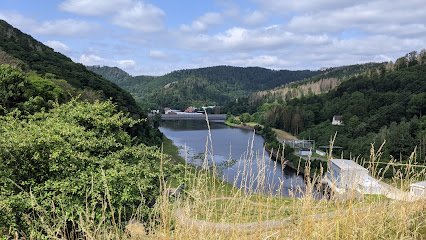
15.8 km
Discover the Odertalsperre Dam: A stunning blend of natural beauty and engineering marvel in the Harz Mountains, perfect for hiking and scenic views.
Fledermausquartier
16.2 km
Experience the natural beauty and conservation efforts at Fledermausquartier in Sankt Andreasberg, a must-visit destination for nature lovers.
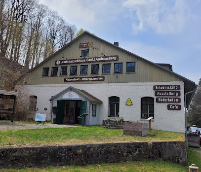
Sankt Andreasberg National Park Center
16.3 km
Explore the beauty and biodiversity of the Harz Mountains at Sankt Andreasberg National Park Center, a perfect blend of education and nature.
Samson Pit
16.3 km
Uncover the rich mining heritage of the Harz region at Samson Pit, a historical museum showcasing the life and work of miners in Sankt Andreasberg.
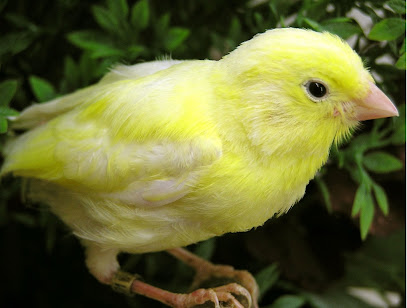
Harzer Roller-Kanarien-Museum
16.3 km
Explore the enchanting world of canaries at the Harzer Roller-Kanarien-Museum in Sankt Andreasberg, a unique attraction for bird lovers and tourists alike.
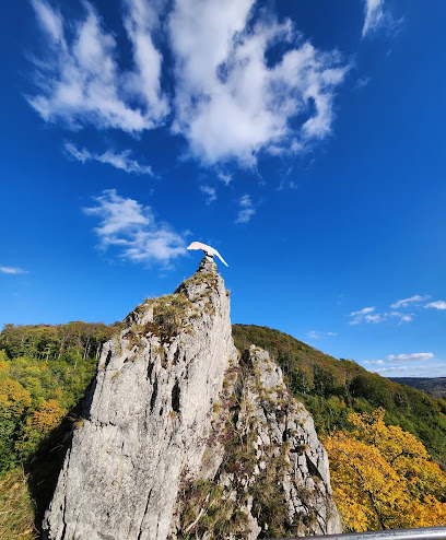
Dreibrodestein HWN 154
16.6 km
Explore Dreibrodestein in Sankt Andreasberg, a stunning natural attraction offering breathtaking views and rich history amidst the Harz mountains.
Harzer Gesteine
17.0 km
Discover the stunning geological formations and breathtaking views at Harzer Gesteine in Sankt Andreasberg, a must-visit tourist attraction in the Harz Mountains.
Essential places to dine
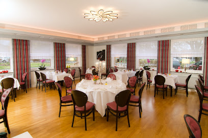
Ben - das Restaurant
5.5 km
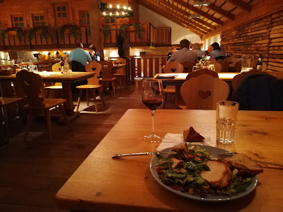
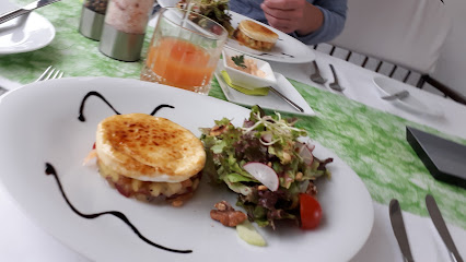
Experience culinary excellence at Ben - das Restaurant in Herzberg am Harz with seasonal dishes and exceptional service.
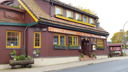
Erlebnisgastronomie im Restaurant Zur alten Harzstraße
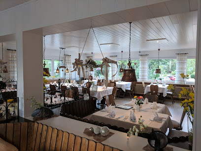
6.7 km
Experience exceptional local cuisine and renowned steaks at Restaurant Zur alten Harzstraße in Osterode am Harz.
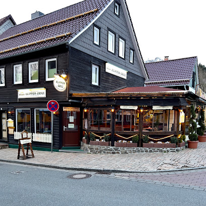
Klippen - Grill Inh. Matthias Biesel
17.2 km
Discover Klippen - Grill in Altenau for an unforgettable steakhouse experience amidst breathtaking Harz landscapes.
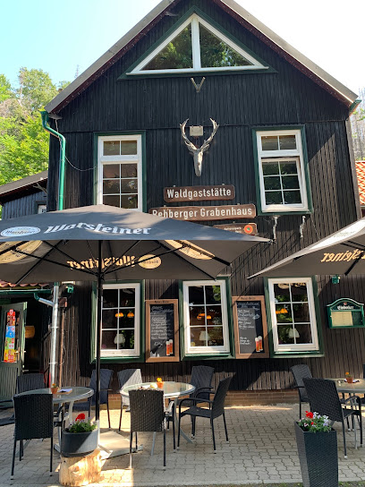
Nationalparkgaststätte Rehberger Grabenhaus
18.3 km
Experience authentic German cuisine surrounded by breathtaking landscapes at Nationalparkgaststätte Rehberger Grabenhaus in the Harz Mountains.
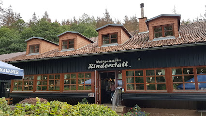
Waldgaststätte Rinderstall im Nationalpark Harz
19.6 km
Experience authentic German cuisine at Waldgaststätte Rinderstall, nestled in scenic Harz National Park – a perfect blend of nature and gastronomy.
Bavaria Alm Torfhaus
21.9 km
Discover authentic Bavarian cuisine with stunning views at Bavaria Alm Torfhaus in Germany's beautiful Harz region.
Hotel Zur Erholung
22.9 km
Experience comfort and adventure at Hotel Zur Erholung in Braunlage – your gateway to exploring Germany's enchanting Harz mountains.
Kleine Auszeit
22.9 km
Discover exquisite German cuisine at Kleine Auszeit in Braunlage – where every meal is a delightful journey through local flavors.
JASPER Grill Bar & Lounge / Club
22.9 km
Discover culinary delights and vibrant nightlife at JASPER Grill Bar & Lounge in Braunlage – where every meal is an experience!
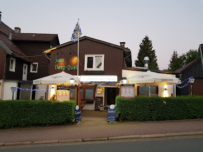
Restaurant "Zum Berg - Quell Stübchen"
23.0 km
Experience authentic German cuisine at Zum Berg - Quell Stübchen in Braunlage – a must-visit destination for food lovers exploring the Harz region.
Karthi‘s
23.0 km
Discover Karthi's in Braunlage: where delicious grilled flavors meet warm hospitality in a charming setting.
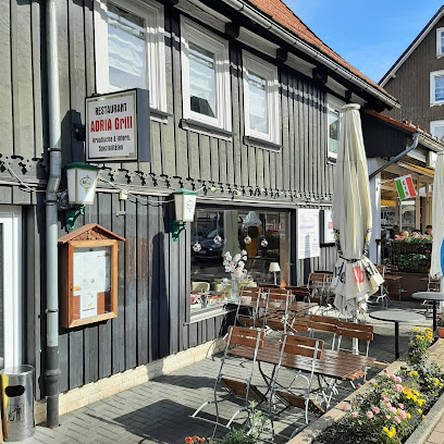
ADRIA Grill
23.0 km
Discover authentic Croatian flavors at ADRIA Grill in Braunlage - a culinary journey filled with delicious grilled specialties.
51° Nord - Steakhouse & Bar
23.0 km
Experience the best steaks at 51° Nord - Steakhouse & Bar in Braunlage, where quality meets exceptional service in a cozy atmosphere.
Tenne Schwof & Schmaus Am Blueberry Hill
23.1 km
Discover the flavors of Braunlage at Tenne Schwof & Schmaus Am Blueberry Hill—where culinary tradition meets modern dining in a stunning setting.
Harz-Heimat
23.1 km
Experience authentic local cuisine at Harz-Heimat Bistro in Braunlage – where comfort meets tradition amidst stunning mountain views.
Markets, malls and hidden boutiques
Harzkind – Der Shop
5.9 km
Explore Harzkind – Der Shop for authentic handcrafted goods and local delights that capture the spirit of Osterode am Harz.
HARZKIND GmbH
5.9 km
Explore HARZKIND GmbH in Osterode am Harz, where creativity meets digital innovation and marketing excellence.
Lauter Lieblingsstücke
14.3 km
Explore the enchanting Lauter Lieblingsstücke, a unique gift shop in Bad Lauterberg offering handmade treasures, local delicacies, and more.
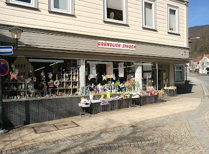
Gründlich Sparen
14.4 km
Explore Gründlich Sparen in Bad Grund for unique gifts, clothing, and home goods reflecting local charm and creativity.
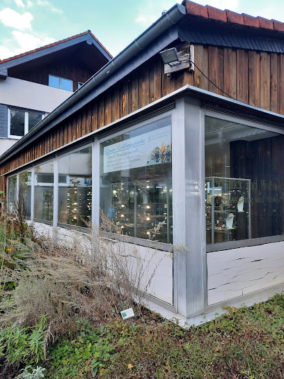
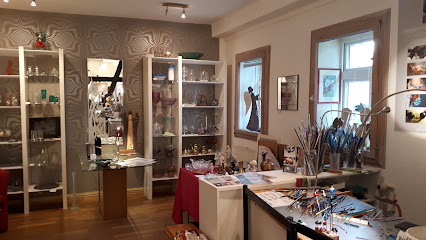
Glasspielerei-Harz
15.2 km
Explore the captivating world of handcrafted glass at Glasspielerei-Harz in Clausthal-Zellerfeld, where tradition meets artistry in every piece.
Waldschwimmbad Okerteich
17.7 km
Experience the serene beauty of Waldschwimmbad Okerteich, an outdoor swimming pool surrounded by breathtaking nature, perfect for relaxation and family fun.
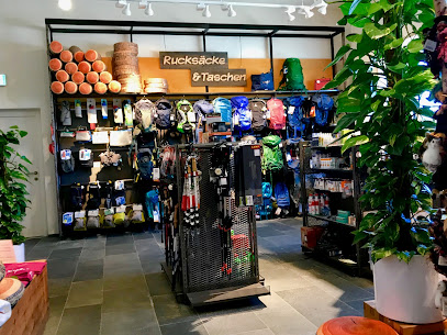
Globetrotter Equipment GmbH
21.8 km
Discover outdoor adventures at Globetrotter Equipment GmbH in Altenau - your one-stop shop for camping, skiing, and climbing gear.
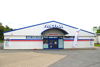
TRIGEMA
21.8 km
Discover the vibrant world of fashion at TRIGEMA, your go-to clothing store in Bad Sachsa for stylish apparel and accessories for the whole family.
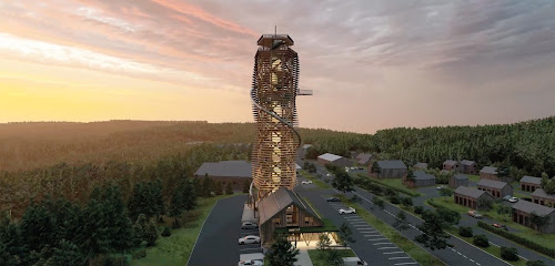
Harzturm GmbH
21.9 km
Experience breathtaking views and family-friendly fun at Harzturm GmbH, your destination in the heart of the Harz Mountains.
Gamaswelt Braunlage
22.9 km
Discover unique souvenirs and local crafts at Gamaswelt Braunlage, a charming gift shop in the heart of the picturesque town of Braunlage.
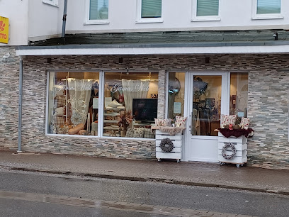
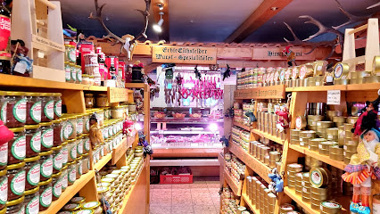
Sühl´s Harzspezialitäten
23.0 km
Discover the authentic flavors of the Harz region at Sühl´s Harzspezialitäten, the premier butcher shop in Braunlage, Germany.
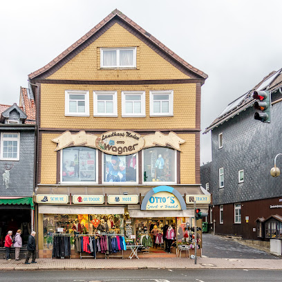
Ottos Sport & Tracht
23.0 km
Discover the charm of German traditions at Ottos Sport & Tracht, your go-to destination for authentic costumes and outdoor sports gear in Braunlage.
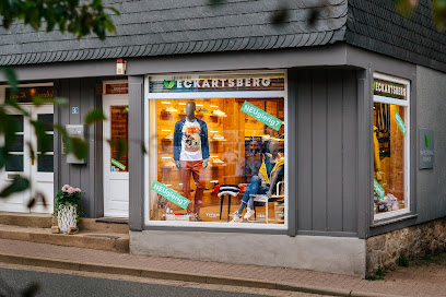
Eckartsberg Fair & Organic Fashion
23.1 km
Shop sustainably at Eckartsberg Fair & Organic Fashion, where style meets eco-consciousness in the heart of Braunlage.
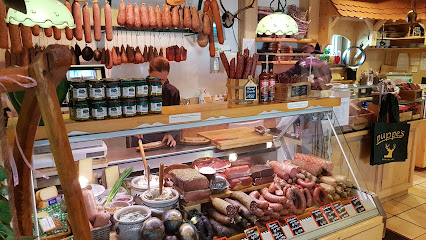
Harzer Spezialitäten & Brotzeitstube puppe‘s
23.1 km
Experience the authentic taste of the Harz region at Puppe’s, a delightful deli and bistro in Braunlage offering local specialties and souvenirs.
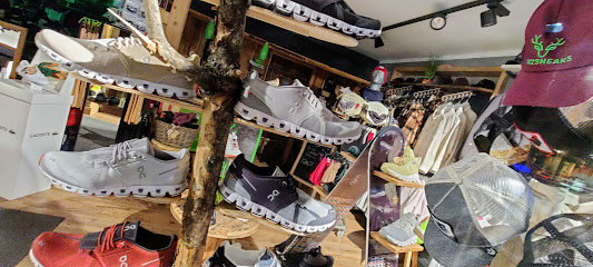
Harzsneaks
23.1 km
Discover unique styles and local flair at Harzsneaks, the premier clothing store in Braunlage, perfect for fashion-savvy tourists.
Essential bars & hidden hideouts
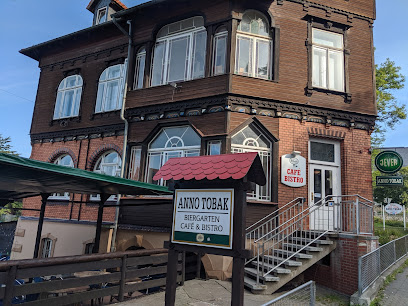
Anno Tobak
13.7 km
Discover Anno Tobak in Clausthal-Zellerfeld: a cozy pub and bistro offering delicious local cuisine and a warm atmosphere for all visitors.
Kellerclub im StuZ e.V.
13.7 km
Discover the cultural heartbeat of Clausthal-Zellerfeld at Kellerclub im StuZ e.V., a lively pub and cocktail bar with a local flair.
5th Rock Avenue
14.1 km
Experience the vibrant nightlife at 5th Rock Avenue, where locals and tourists come together to enjoy craft cocktails and a lively atmosphere in Bad Lauterberg.
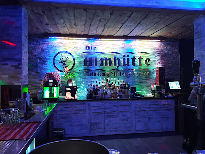
Almhütte
14.2 km
Discover the charm of Almhütte, a cozy bar in Bad Lauterberg, perfect for unwinding with drinks in the scenic Harz region.
Weinbar Steigerbucht
15.3 km
Discover the warmth and elegance of Weinbar Steigerbucht, a top destination for wine lovers in Clausthal-Zellerfeld.
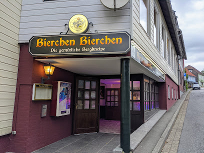
Bierchen Bierchen - die gemütliche Bergkneipe
16.4 km
Discover the cozy embrace of Bierchen Bierchen, the mountain pub in Sankt Andreasberg, where local charm meets refreshing brews and hearty food.
Altes Backhaus
17.2 km
Discover the authentic German pub experience at Altes Backhaus, a beloved local gem in Altenau, known for its cozy atmosphere and variety of drinks.
Waldgaststätte zur Kamelfichte
21.3 km
Experience authentic German cuisine and a charming beer garden in the heart of Braunlage's stunning natural landscape.
John's Bar
22.7 km
Discover the cozy atmosphere of John's Bar in Braunlage, a perfect retreat after enjoying the breathtaking Harz mountains.
BegebaR
23.0 km
Discover the inviting atmosphere of BegebaR, a must-visit bar in Braunlage offering local brews, cozy vibes, and vibrant community interactions.

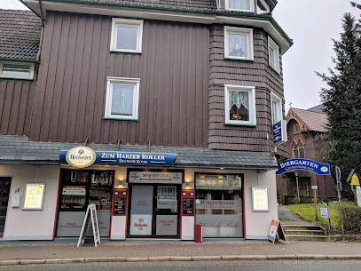
Zum Harzer Roller
23.0 km
Experience authentic German cuisine in the heart of Braunlage at Zum Harzer Roller, where local flavors and a cozy atmosphere await.
Hotel Wagner - Die Kleine Zauberwelt
23.0 km
Experience the perfect blend of comfort and fine dining at Hotel Wagner - Die Kleine Zauberwelt in Braunlage, a hidden gem in the Harz mountains.
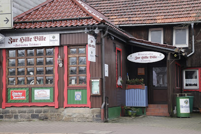
Hille-Bille „betreutes Trinken“
23.1 km
Discover the charm of Hille-Bille, a cozy gastropub in Braunlage, where delightful drinks and a warm atmosphere await tourists and locals alike.
Bar Milano im San Siro
23.1 km
Discover Bar Milano in Braunlage, where Italian hospitality meets vibrant nightlife with cocktails and tapas to delight every traveler.
The VALHALLA Bar
23.1 km
Discover the vibrant nightlife at The VALHALLA Bar in Braunlage, where every evening is filled with fun, great drinks, and unforgettable moments.
Nightclubs & after hour spots
Palithi Discotheque
8.7 km
Discover the energy and excitement of Palithi Discotheque, a top night club in Herzberg am Harz for music lovers and party enthusiasts.
MIP
8.9 km
Discover the lively nightlife at MIP, a premier night club in Osterode am Harz, where unforgettable moments and vibrant music await.
Harz-Mountains Ranch
14.7 km
Discover the vibrant live music scene at Harz-Mountains Ranch, nestled in the stunning Harz Mountains, perfect for unforgettable nights out.
Harz Club
14.8 km
Experience vibrant nightlife at Harz Club in Clausthal-Zellerfeld, where music, dance, and fun come together for an unforgettable evening.
Discothek Beat Club
28.3 km
Discover the vibrant nightlife of Langelsheim at Discothek Beat Club, the ultimate destination for music lovers and party enthusiasts.
Nachtschicht
28.9 km
Immerse yourself in the electric atmosphere of Nachtschicht, Goslar's top disco club, where unforgettable nights await with music and dance.
Klima Club Lounge
34.5 km
Discover the vibrant nightlife of Ilsenburg at Klima Club Lounge, where disco meets lounge in an unforgettable atmosphere.
Elmo Klub Wernigerode
37.8 km
Experience Wernigerode's nightlife at Elmo Klub, where vibrant music and a lively atmosphere await every visitor seeking a memorable night out.
MLK Area Blankenburg
46.7 km
Dive into the lively nightlife at MLK Area Blankenburg, where great music, drinks, and a vibrant atmosphere await.
HarzMATCH.de
48.3 km
Discover the lively nightlife at HarzMATCH.de in Blankenburg (Harz), where music, dancing, and social connections await every visitor.
Check Point
49.5 km
Discover the electrifying nightlife at Check Point in Duingen, a disco club blending culture, cuisine, and vibrant entertainment.
Klubraum deluxe
50.7 km
Discover the cozy warmth of Klubraum Deluxe, a charming bar in Timmenrode perfect for unwinding and enjoying local drinks.
Party San Open Air
51.6 km
Experience electrifying nightlife at Party San Open Air in Nottertal-Heilinger Heights, a must-visit destination for music lovers and party enthusiasts.
Bergtheater Thale
51.8 km
Discover the enchanting Bergtheater Thale, where captivating performances meet breathtaking views in the heart of the Harz Mountains.
NITE CLUB
57.8 km
Experience the pulse of the local music scene at Nite Club, where live performances and vibrant energy create unforgettable nights.