

Free Hunsrück Travel Guide & Mobile App
Explore Hunsrück with free travel guides. Discover regional history, expert tips, proposed trips, and audio guides on web or mobile app.


Explore Hunsrück’s forested ridges, Celtic and Roman heritage, national park trails, castles and rural villages in western Germany.
Read more about Hunsrück
When is the best time to visit Hunsrück?
Best: June–August · 22–24°C| Month | High (°C) | Rainfall (mm) |
|---|---|---|
| January | 4 | 50 |
| February | 4 | 45 |
| March | 9 | 50 |
| April | 13 | 55 |
| May | 18 | 65 |
| June (best) | 22 | 70 |
| July (best) | 24 | 75 |
| August (best) | 23 | 70 |
| September | 19 | 65 |
| October | 14 | 60 |
| November | 8 | 55 |
| December | 4 | 60 |
Getting to and around Hunsrück
How to get there
Transportation
Top city travel guides in Hunsrück
The cities of Hunsrück, and the easiest places to base yourself.

Swipe for more cities
Destinations in Hunsrück
Resorts, valleys and scenic spots worth a trip of their own.

Swipe for more destinations
Best attractions in Hunsrück
The Hunsrück’s attractions are spread across a broad rural landscape rather than concentrated in one urban centre. The Hunsrück-Hochwald National Park is the region’s principal natural draw, offering marked paths through beech woods, wetlands, heath and highland terrain, while the Erbeskopf provides the upland’s highest viewpoints and outdoor recreation. Around Mörsdorf, the Geierlay suspension bridge forms part of a walking landscape of wooded ravines and village paths. History is represented by the Belginum Archaeological Park near Morbach, the castle ruins at Kastellaun and the Schmidtburg near Schneppenbach, as well as local museums interpreting forestry, mining and rural life. Idar-Oberstein, on the southern edge of the Hunsrück, adds gemstone heritage and a distinctive rock-face setting. Cycling, birdwatching, wildlife observation and long-distance walking are central to the region’s appeal, while the Moselle, Rhine and Nahe margins bring river viewpoints, historic towns and access to vineyards. Many sites are seasonal or have limited facilities, so the interior is best explored with advance route planning rather than an expectation of continuous tourist infrastructure.
-
Tourist attraction
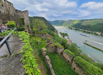
Rheinfels Castle
Discover the enchanting Rheinfels Castle, a historical landmark offering breathtaking views and a glimpse into Germany's medieval past.
-
Rheinstein Castle
Explore the historic charm and breathtaking views at Rheinstein Castle, a stunning landmark overlooking the Rhine River, with a hotel and restaurant on site.
-
Tourist attraction
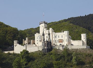
Stolzenfels Castle
Explore Stolzenfels Castle, a stunning 19th-century landmark on the Rhine River, rich in history and breathtaking views.
-
Tourist attraction
Thurant Castle
Explore the enchanting Thurant Castle, a historical gem in the Moselle Valley, offering breathtaking views, rich history, and unforgettable experiences.


Best landmarks in Hunsrück
The Erbeskopf is the Hunsrück’s defining natural landmark, rising above the surrounding forest and marking the highest point in Rhineland-Palatinate. In the western uplands, the Hunsrück-Hochwald National Park protects an extensive landscape whose significance lies in its connected woodland, heath and wetland habitats rather than in one monumental structure. The Geierlay suspension bridge near Mörsdorf has become a prominent contemporary landmark, spanning the narrow Mörsdorfer Bachtal and linking a carefully managed walking area. Among historic sites, the ruins of Kastellaun Castle occupy a visible position above the town, while the Schmidtburg’s remains near Schneppenbach recall the power of medieval local lords. The Belginum Archaeological Park provides a landmark of a different kind: an interpreted Celtic and Roman settlement on a major ancient route. On the southern edge, Idar-Oberstein’s Felsenkirche, built into a steep rock face above the town, is one of the area’s most recognisable architectural sights.
-
Monument
Deutsches Eck
Witness the confluence of the Rhine and Moselle at Deutsches Eck, a historic landmark symbolizing German unity with its monumental statue and stunning river views in Koblenz.
-
Castle
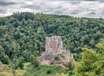
Eltz Castle
Discover the magic of Eltz Castle, a fairytale fortress nestled in the German forest, offering a journey through 850 years of history and stunning medieval architecture.
-
Castle
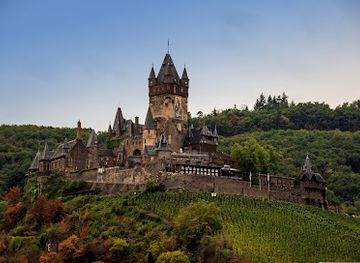
Cochem Castle
Discover the majestic Cochem Castle, a Neo-Gothic masterpiece perched high above the Moselle River, offering breathtaking views and a glimpse into Germany's rich history and architectural splendor.
-
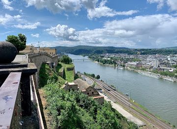
Fortress
Ehrenbreitstein Fortress
Explore the mighty Ehrenbreitstein Fortress in Koblenz: a historic landmark with panoramic views, fascinating museums, and a vibrant cultural center in the heart of the Rhine Valley.

Explore Hunsrück on the map
Plan your trip on one map. See where the top cities, national parks and sights are, and book hotels and experiences in a few clicks.
Best hotels in Hunsrück
Best restaurants in Hunsrück
Hunsrück dining is rooted in the practical, seasonal cooking of western Germany, with hearty dishes commonly appearing in village inns, rural guesthouses and small-town restaurants. Potatoes, pork, sausages, game, cabbage and locally available mushrooms feature in traditional menus, while nearby Moselle and Nahe wine areas influence the drinks and produce offered along the region’s margins. The upland itself is not defined by one exclusive signature dish, but local food culture is closely tied to farm shops, bakeries, seasonal menus and ingredients from woodland and pasture. Expect straightforward German cooking alongside contemporary interpretations in hotels and country restaurants. In places such as Morbach, Simmern, Kastellaun and Idar-Oberstein, visitors will find the broadest choice of cafés and restaurants; smaller villages may have only a few establishments and limited evening service. Regional wine is particularly easy to explore on excursions towards the Moselle or Nahe, while local beer is a natural accompaniment to traditional pub food.
-
 Restaurant
Burghotel Auf Schönburg Oberwesel
Discover history and stunning views at Burghotel Auf Schönburg – where culinary excellence meets enchanting landscapes in Germany's Rhine Valley.
-
German
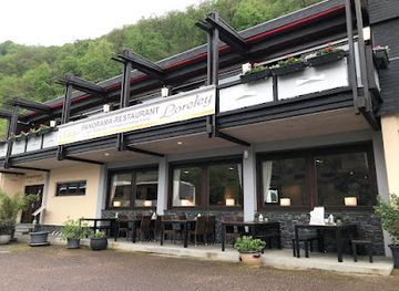
Loreley
Discover the enchanting Loreley: a blend of stunning landscapes, rich German culture, and unforgettable legends along the Rhine River.
-
Restaurant
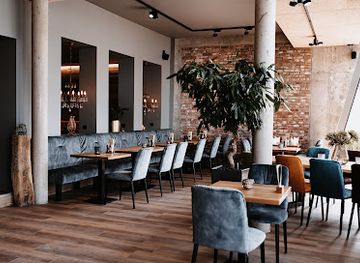
Esszimmer by MyPlace
Discover the taste of Lautzenhausen at Esszimmer by MyPlace, where culinary excellence meets warm hospitality.
-
Restaurant
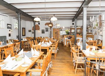
Landgasthof "Altes Stadttor" Kastellaun
Discover authentic German cuisine at Landgasthof 'Altes Stadttor' in Kastellaun – where tradition meets hospitality.
Best bars in Hunsrück
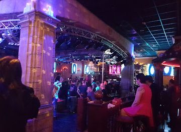
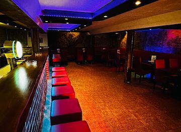
Evenings in the Hunsrück are generally quiet and sociable rather than centred on a large club scene. Traditional pubs, village inns and hotel bars provide places for local beer, wine from the neighbouring river valleys and uncomplicated food, with the liveliest choice found in larger centres such as Simmern, Kastellaun, Morbach and Idar-Oberstein. Some towns offer occasional live music, cultural performances or seasonal events, but programmes and opening arrangements change, so current local listings are useful. The region’s rural character means that many visitors spend evenings at their accommodation, especially after walking, cycling or touring the national park. For theatre, larger concerts or a broader late-night choice, visitors generally travel beyond the upland to cities such as Koblenz, Trier or Saarbrücken, rather than expecting a major nightlife district within the Hunsrück itself.
-
Irish pub
Irish Pub Koblenz
Experience authentic Irish culture and hospitality at Irish Pub Koblenz, a lively spot for food, drinks, and entertainment in the heart of the city.
-
Restaurant
Loreleyblick Maria Ruh
Experience exquisite dining at Loreleyblick Maria Ruh, where stunning Rhine views meet delightful German cuisine in a charming beer garden.
-
Bar
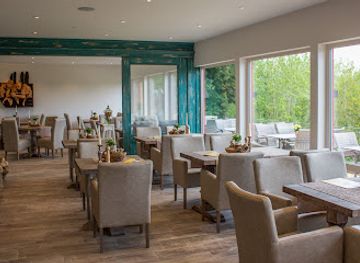
MyPlace - hotel.bar.restaurant
Experience the perfect blend of comfort, dining, and nightlife at MyPlace - your ultimate destination in Lautzenhausen.
-
Bar
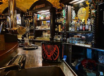
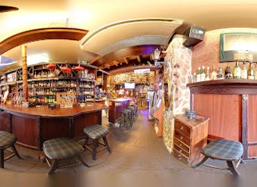
The Dudelsack Scottish Pub & Whisky-Bar
Discover a taste of Scotland in Rüdesheim am Rhein at The Dudelsack Scottish Pub & Whisky-Bar, offering a wide selection of whiskies and traditional Scottish cuisine.
Best nightclubs in Hunsrück
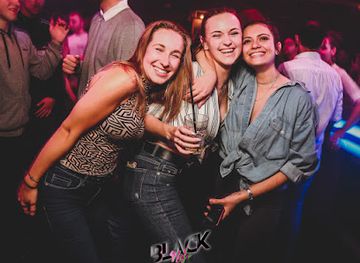
Evenings in the Hunsrück are generally quiet and sociable rather than centred on a large club scene. Traditional pubs, village inns and hotel bars provide places for local beer, wine from the neighbouring river valleys and uncomplicated food, with the liveliest choice found in larger centres such as Simmern, Kastellaun, Morbach and Idar-Oberstein. Some towns offer occasional live music, cultural performances or seasonal events, but programmes and opening arrangements change, so current local listings are useful. The region’s rural character means that many visitors spend evenings at their accommodation, especially after walking, cycling or touring the national park. For theatre, larger concerts or a broader late-night choice, visitors generally travel beyond the upland to cities such as Koblenz, Trier or Saarbrücken, rather than expecting a major nightlife district within the Hunsrück itself.
-
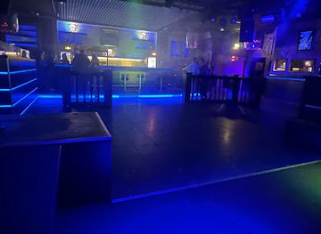
Disco club
Nachtarena Koblenz
Experience the electrifying nightlife of Koblenz at Nachtarena, where music, dance, and fun come together in a vibrant disco club setting.
-
Disco club
Musikpark A1 Trier
Discover the electrifying vibe of Musikpark A1 Trier, where music, dancing, and unforgettable nightlife come together in one of Germany's oldest cities.
-
Night club
Zenit Club Koblenz
Experience the vibrant nightlife at Zenit Club Koblenz, where electrifying music and a lively atmosphere create unforgettable evenings.
-
Disco club
Zum Schinderhannes Inh.Andreas Herlitz
Dive into the lively atmosphere of Zum Schinderhannes, the top disco club in Cochem, and dance the night away surrounded by vibrant music and culture.
Best shops in Hunsrück
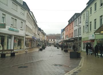
Shopping in the Hunsrück is concentrated in market towns rather than large retail districts. Simmern, Kastellaun, Morbach and Idar-Oberstein offer everyday shops, independent businesses, bakeries and cafés, while smaller settlements may have only a limited selection. Farm shops and local producers are useful places to look for regional honey, preserves, sausages, bread, spirits and seasonal produce. The area around Idar-Oberstein is especially associated with gemstones and jewellery, reflecting a long-established cutting and trading tradition; reputable specialist shops can explain the origin and treatment of stones more clearly than generic souvenir outlets. Craft shops and galleries appear in some tourist centres, often featuring woodwork, ceramics, textiles or locally themed goods. Weekly markets vary by town and date, so confirm arrangements locally. Visitors staying near the Moselle or Nahe can also browse wine merchants and vineyard shops for bottles from the neighbouring valleys, although these wines are regional rather than exclusively Hunsrück products.
-
Shopping mall
Zweibrücken Fashion Outlet
Discover unbeatable deals and top designer brands at Zweibrücken Fashion Outlet, your ultimate shopping destination in Germany.
-
Outlet mall
Outlet Montabaur
Discover unbeatable deals at Outlet Montabaur, where fashion meets savings in a charming German town.
-
Furniture store
Möbel Preiss GmbH & Co. KG
Explore Möbel Preiss in Kastellaun for exquisite furniture and kitchen supplies that redefine your living space with style and functionality.
-
Home goods store
Kaefer Sohren
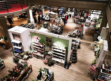
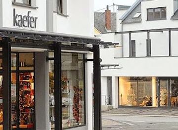
Explore Kaefer Sohren, a charming haven for chinaware and unique home goods in Sohren, Germany, perfect for souvenirs and gifts.

Get your free copy of our complete guide to Hunsrück, delivered straight to you.
Everything on this page, from attractions and restaurants to essentials and local phrases, in one PDF you can read offline, print or share.
Already have an account? Sign in
Your Hunsrück guide is ready.
We'll send it to · Not you? Sign out

Getting your guide ready…
We are putting together a fresh copy of the Hunsrück guide. This can take up to a minute.
This can take a few moments. If your browser asks, choose Allow so the download can start. You'll find the guide in your Downloads folder.
Nothing happened? Download it again
Sorry, the guide is taking longer than usual. Please try again in a minute, or get it by email instead.
Hunsrück essentials
Currency and Payment
Safety
Emergency Situations
Do's and Don'ts
Local Tips
From Eve
Local phrases worth knowing
You don't need to get them perfect. A few words go a long way, and locals appreciate the effort.
Basics
| English | Local | Say it |
|---|---|---|
| Hello | Hallo | [Hah-loh] |
| Goodbye | Auf Wiedersehen | [Owf Veed-er-zay-en] |
| Yes | Ja | [Yah] |
| No | Nein | [Nyn] |
| Please/You're welcome | Bitte | [Bitt-eh] |
| Thank you | Danke | [Dahn-keh] |
| Excuse me/Sorry | Entschuldigung | [Ent-shool-dee-goong] |
| How are you? | Wie geht's? | [Vee gates?] |
| Fine. And you? | Gut. Und dir? | [Goot. Oond deer?] |
| Do you speak English? | Sprechen Sie Englisch? | [Shpre-khen Zee Eng-lish?] |
| I don't understand | Ich verstehe nicht | [Ish fer-shtay-eh nikht] |
Eating & Drinking
| English | Local | Say it |
|---|---|---|
| I'd like to see the menu, please | Ich hätte gerne die Speisekarte, bitte | [Ish het-teh gair-neh dee Shpyze-kahr-teh, bitt-eh] |
| I don't eat meat | Ich esse kein Fleisch | [Ish ess-eh kine Flysh] |
| Cheers! | Prost! | [Prohst!] |
| I would like to pay, please | Ich möchte bezahlen, bitte | [Ish merkh-teh beh-tsah-len, bitt-eh] |
Emergencies
| English | Local | Say it |
|---|---|---|
| Help! | Hilfe! | [Hil-feh!] |
| Go away! | Geh weg! | [Geh vek!] |
| Call the Police! | Rufen Sie die Polizei! | [Roo-fen Zee dee Poh-lee-tsai!] |
| Call a doctor! | Rufen Sie einen Arzt! | [Roo-fen Zee eye-nen Artzt!] |
| I'm lost | Ich habe mich verlaufen | [Ish hah-beh mikh fer-lau-fen] |
| I'm ill | Ich bin krank | [Ish bin krank] |
Shopping
| English | Local | Say it |
|---|---|---|
| I'd like to buy... | Ich möchte ... kaufen | [Ish merkh-teh ... kauf-en] |
| I'm just looking | Ich schaue nur | [Ish shou-eh noor] |
| How much is it? | Wie viel kostet es? | [Vee feel kost-et es?] |
| That's too expensive | Das ist zu teuer | [Das ist tsoy-er] |
| Can you lower the price? | Könnten Sie den Preis senken? | [Kern-ten Zee den Pryce senk-en?] |
Time & Numbers
| English | Local | Say it |
|---|---|---|
| What time is it? | Wie spät ist es? | [Vee shpaet ist es?] |
| It's one o'clock | Es ist ein Uhr | [Es ist ayn Oor] |
| Half past (10) | Halb (10) | [Halb (10)] |
| Morning | Morgen | [Mor-gen] |
| Afternoon | Nachmittag | [Nahkh-mit-tahg] |
| Evening | Abend | [Ah-bent] |
| Yesterday | Gestern | [Gehs-tairn] |
| Today | Heute | [Hoy-tah] |
| Tomorrow | Morgen | [Mor-gen] |
| 1 | Eins | [Ayns] |
| 2 | Zwei | [Tsvy] |
| 3 | Drei | [Dry] |
| 4 | Vier | [Fear] |
| 5 | Fünf | [Foonf] |
| 6 | Sechs | [Zex] |
| 7 | Sieben | [Zee-ben] |
| 8 | Acht | [Akh-t] |
| 9 | Neun | [Noyn] |
| 10 | Zehn | [Tsayn] |
Transport & Directions
| English | Local | Say it |
|---|---|---|
| Where's a/the...? | Wo ist ein/das ...? | [Voh ist ayn/dahs ...?] |
| What's the address? | Wie lautet die Adresse? | [Vee low-tet dee Ah-dre-sseh?] |
| Can you show me (on the map)? | Könnten Sie mir (auf der Karte) zeigen? | [Kern-ten Zee meer (owf der Kar-teh) tsai-gen?] |
| When's the next (bus)? | Wann kommt der nächste (Bus)? | [Vahn komt der nay-sh-teh (Boos)?] |
| A ticket (to ....) | Ein Ticket (nach ....) | [Ayn Ti-ket (nahkh ....)] |
History of Hunsrück
Celtic Settlement and the Belginum Route
People lived and traded across the Hunsrück long before the Roman period, and Celtic communities established settlements near routes crossing the upland. The Belginum Archaeological Park near Morbach preserves and interprets one of the most important examples. Excavations have revealed evidence of settlement, burial practices, craft activity and exchange, showing that the Hunsrück was not an isolated wilderness but part of wider networks linking the Moselle, Rhine and Nahe regions. The archaeological landscape remains one of the clearest ways to understand the region before and during Roman rule.
Roman Roads and Provincial Life
Roman administration brought roads, settlements and new political structures to the Hunsrück. The upland lay between the important Roman centres of Trier and the Rhine frontier, and routes crossed it to connect river valleys and trading communities. At Belginum, Roman influence can be seen alongside earlier Celtic traditions rather than as a complete replacement of them. Roads helped goods, officials and armies move through the region, while rural settlements supported agriculture and transport. The surviving route patterns and archaeological remains establish the Hunsrück as part of the Roman province of Gallia Belgica and its frontier economy.
Medieval Lords, Castles and Market Towns
During the Middle Ages, the Hunsrück was divided among ecclesiastical institutions, counts and lesser nobles whose territories were marked by castles, fortified houses and market settlements. Kastellaun became an important local centre, while the Schmidtburg near Schneppenbach represents the power of the Schmidtburg lords in the southern Hunsrück. Simmern later developed as the residence of a branch of the Wittelsbach dynasty and a regional administrative centre. Many fortifications are now ruins, but their positions on ridges and above valleys still reveal how authority, trade and defence were organised across the upland.
Slate, Forestry and Rural Industry
For centuries, the Hunsrück economy combined small-scale farming with forestry, quarrying, handicrafts and seasonal labour. Slate extraction was particularly important in parts of the region, producing roofing material suited to the wet western German climate and giving many villages their characteristic dark roofs. Timber remained another central resource, while local roads and market towns connected producers with the Moselle, Rhine and Nahe valleys. Industrialisation affected the Hunsrück less dramatically than the nearby Rhine and Saar areas, but it encouraged migration, altered rural employment and left a legacy visible in former mines, workshops and transport routes.
French Rule and the Napoleonic Reorganisation
French revolutionary and Napoleonic forces occupied the west bank of the Rhine and reorganised the Hunsrück at the end of the eighteenth and beginning of the nineteenth century. Traditional lordships and ecclesiastical territories were dissolved, administrative boundaries were redrawn and legal reforms introduced elements of the Napoleonic system. French rule was followed by the incorporation of most of the Hunsrück into the Kingdom of Prussia after 1815. The period brought upheaval but also helped end the patchwork of small territories that had shaped local government for centuries.
Flight, Military Infrastructure and Postwar Change
The Hunsrück’s upland geography made it suitable for military and aviation infrastructure in the twentieth century. Hahn airfield began as a United States Air Force installation after the Second World War and later became a civilian airport, although its commercial role and services have changed over time. Wider military land use affected roads, employment and local communities, particularly during the Cold War. Since the late twentieth century, parts of the region have placed greater emphasis on protected landscapes, hiking, cultural heritage and rural tourism, with the Hunsrück-Hochwald National Park symbolising this shift towards conservation.
Hunsrück in Photos
Browse through our photo collection highlighting the charm and character of the destination.
Neighbouring regions of Hunsrück
The closest regions to Hunsrück, if you have time for more than one.
-

-

-

-

-


Swipe for more regions

