

Free Pago Bay Travel Guide & Mobile App
Explore Pago Bay with free travel guides. Discover regional history, expert tips, proposed trips, and audio guides on web or mobile app.


Explore Pago Bay on Guam’s green eastern coast for Pacific views, quiet landscapes and a slower alternative to the island’s resort districts.
Read more about Pago Bay
When is the best time to visit Pago Bay?
Best: January–March · 29°C| Month | High (°C) | Rainfall (mm) |
|---|---|---|
| January (best) | 29 | 120 |
| February (best) | 29 | 110 |
| March (best) | 29 | 120 |
| April | 30 | 122 |
| May | 31 | 175 |
| June | 31 | 240 |
| July | 31 | 272 |
| August | 31 | 285 |
| September | 31 | 312 |
| October | 30 | 272 |
| November | 30 | 210 |
| December | 29 | 150 |
Getting to and around Pago Bay
How to get there
Transportation
Best attractions in Pago Bay
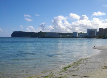
Pago Bay’s attractions are primarily environmental and scenic rather than a collection of formal visitor sites. The bay itself offers an eastern-coast perspective on Guam, with open Pacific horizons, green slopes and the meeting of coastal and tropical landscapes. Visitors interested in geography can observe how the island’s wetter, more exposed east differs from the developed western shore. Short walks or roadside viewpoints may provide opportunities for landscape photography, but access conditions vary and some land is private or managed for residential or commercial purposes. The wider Yona area can be incorporated into a drive through eastern Guam, while the island’s principal museums, war memorials and cultural institutions lie elsewhere and should be treated as separate destinations. Outdoor plans should remain flexible because heavy rain, heat, rough seas and typhoon-related weather can quickly alter conditions. Pago Bay is therefore best suited to travellers who appreciate quiet scenery, coastal observation and independent touring rather than those seeking organised water sports, family attractions or a full programme of visitor facilities.
-
Tourist attraction
Pago Bay Overlook
Experience breathtaking panoramic views of Pago Bay from this easily accessible overlook in Yona, Guam. A must-see for nature lovers!
-
Historical landmark
Pago Bay Bridge
Discover the historic Pago Bay Bridge in Guam, offering scenic views and a connection to the island's rich cultural heritage.


Best landmarks in Pago Bay
The defining landmark of the area is Pago Bay itself, a broad indentation on Guam’s eastern coastline whose open Pacific setting distinguishes it from the island’s busier western waterfront. Its visual importance comes from the relationship between sea, forested slopes and exposed coastal terrain rather than from monumental architecture. The nearby mouth and lower course of the Pago River contribute to the area’s geography, linking inland drainage with the bay, although visitors should not assume that every riverside or coastal section is publicly accessible. The surrounding hills provide a sense of Guam’s eastern topography and help explain why this side of the island has retained a less urban appearance. Unlike Hagåtña’s churches, government buildings and war memorials, Pago Bay’s landmarks are primarily natural and spatial: the curve of the inlet, the ocean horizon and the densely vegetated land behind it. Their significance is best appreciated through careful observation rather than through a formal sightseeing circuit.
-
Tourist attraction
Pago Bay Overlook
Experience breathtaking panoramic views of Pago Bay's turquoise waters and lush landscapes from this tranquil Guam overlook.
-
Historical landmark
Pago Bay Bridge
Explore the historic Pago Bay Bridge in Guam, offering stunning views and a glimpse into the island's rich cultural heritage and natural beauty.


Explore Pago Bay on the map
Plan your trip on one map. See where the top cities, national parks and sights are, and book hotels and experiences in a few clicks.
Best hotels in Pago Bay
Best restaurants in Pago Bay
Pago Bay itself has no concentrated restaurant quarter, so visitors should arrange meals and provisions in Guam’s established commercial areas before travelling to the eastern coast. Dining around the wider island reflects both CHamoru food traditions and Guam’s Pacific connections, with dishes and ingredients commonly including rice, seafood, barbecue, coconut, taro and spicy finadene sauce. Chamorro-style barbecue, kelaguen and red rice are among the local foods visitors may encounter, although recipes and availability vary between establishments. In the main towns and resort districts, the choice extends from cafés and casual family restaurants to international dining, while rural roads may have fewer dependable options. Markets and local food outlets can be useful for fruit, snacks and prepared food, but opening arrangements change. Treat Pago Bay as a scenic stop rather than a place to arrive without supplies in search of a broad dining selection.
-
Grill
Jeff's Pirates Cove
Savor delicious grilled delights at Jeff's Pirates Cove while enjoying breathtaking ocean views in beautiful Guam.
-
American
King's Restaurant
Discover the perfect blend of American and Guamanian flavors at King's Restaurant in Tamuning - a must-visit dining destination.
-
Restaurant
Proa Restaurant
Experience authentic Chamorro flavors at Proa Restaurant in Tumon, Guam – where local cuisine meets unforgettable dining.
-
Restaurant
Pika's Cafe
Experience the charm of Pika's Cafe in Guam - where every meal is a celebration of local flavors and warm hospitality.


Best bars in Pago Bay
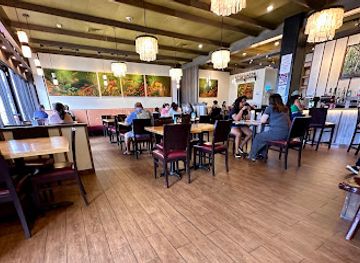
Pago Bay has no established nightlife district and its evening character is quiet, residential and landscape-oriented. Visitors staying nearby are more likely to spend the evening at their accommodation or travel to restaurants and bars in Guam’s larger commercial and resort centres. Across the island, nightlife ranges from casual bars and hotel venues to live entertainment and late-opening establishments, with the greatest concentration around Tumon and other developed western areas outside Pago Bay. Traditional social drinking is not necessary to appreciate the bay, and there is little reason to expect late-night services on the eastern shore. Anyone returning after dark should plan transport in advance, drive cautiously on unfamiliar roads and avoid isolated coastal areas, particularly when weather or surf conditions are unsettled.
-
Grill
The Beach Restaurant & Bar Guam
Discover the flavors of Guam with stunning ocean views at The Beach Restaurant & Bar, an unforgettable dining experience by the shore.
-
Bar
Porky's
Experience the vibrant nightlife of Tumon at Porky's, where live music and delicious cocktails create unforgettable memories.
-
Tiki bar
Green Lizzard Tiki Bar
Discover the lively atmosphere and tropical cocktails at Green Lizzard Tiki Bar in Tumon, Guam – the ultimate nightlife destination for tourists.
-
Pub
Shamrocks Sports Pub
Discover Shamrocks Sports Pub in Tumon, Guam - a lively spot for drinks, food, and fun entertainment in a vibrant atmosphere.


Best nightclubs in Pago Bay
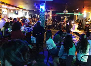
Pago Bay has no established nightlife district and its evening character is quiet, residential and landscape-oriented. Visitors staying nearby are more likely to spend the evening at their accommodation or travel to restaurants and bars in Guam’s larger commercial and resort centres. Across the island, nightlife ranges from casual bars and hotel venues to live entertainment and late-opening establishments, with the greatest concentration around Tumon and other developed western areas outside Pago Bay. Traditional social drinking is not necessary to appreciate the bay, and there is little reason to expect late-night services on the eastern shore. Anyone returning after dark should plan transport in advance, drive cautiously on unfamiliar roads and avoid isolated coastal areas, particularly when weather or surf conditions are unsettled.
-
Lounge
Gudtaym Lounge
Discover the lively ambiance of Gudtaym Lounge in Guam, where karaoke and live music meet for an unforgettable night out.
-
Karaoke bar
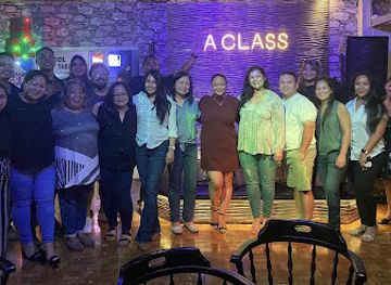
A Class Lounge
Experience the vibrant karaoke scene at A Class Lounge in Guam, the perfect place for music lovers to sing and celebrate.
-
Lounge
Regency Club
Discover the serene ambiance of Regency Club, a premier lounge in Tumon, Guam, perfect for relaxation and socializing amidst stunning views.
-
Adult entertainment club
CLUB U.S.A.
Discover the vibrant nightlife at CLUB U.S.A. in Tumon, Guam, featuring electrifying performances and an unforgettable atmosphere for adults.


Best shops in Pago Bay
Shopping in Pago Bay is extremely limited, with no substantial retail centre or established market district within the bay itself. Visitors should purchase fuel, food, drinking water, medicines and outdoor supplies in Guam’s larger towns and commercial areas before heading east. Across the island, useful locally associated purchases include CHamoru foods, packaged coconut products, handicrafts, woven items, artwork and souvenirs that reflect Guam’s Pacific and Indigenous identity. More extensive retail, department-store shopping and tourist-oriented merchandise are concentrated outside Pago Bay, particularly in the main western commercial and resort districts. When buying crafts or cultural products, choose reputable sellers and ask about materials and local provenance rather than assuming every item is locally made. Pago Bay is better regarded as a landscape destination than as a shopping stop.
-
Outlet mall
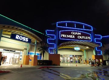
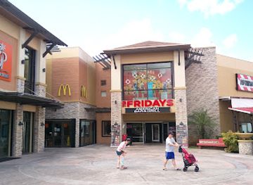
Guam Premier Outlets
Discover unbeatable deals and a vibrant shopping atmosphere at Guam Premier Outlets - your ultimate shopping destination in paradise.
-
Shopping mall
JP Superstore
Discover a unique shopping experience at JP Superstore in Tumon, Guam, offering local products and international brands under one roof.
-
Supermarket
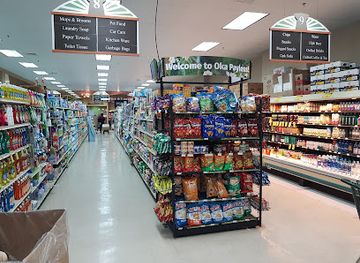
Pay-Less Supermarkets
Experience the vibrant culture of Guam at Pay-Less Supermarkets, where local flavors meet everyday essentials in a welcoming atmosphere.
-
General store
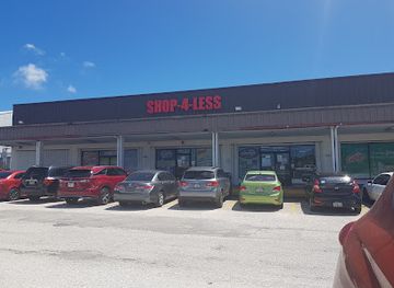
Shop 4 Less
Discover unique crafts, office supplies, and party essentials at Shop 4 Less in Guam, your go-to general store for all your needs.
Get your free copy of our complete guide to Pago Bay, delivered straight to you.
Everything on this page, from attractions and restaurants to essentials and local phrases, in one PDF you can read offline, print or share.
Already have an account? Sign in
Your Pago Bay guide is ready.
We'll send it to · Not you? Sign out

Getting your guide ready…
We are putting together a fresh copy of the Pago Bay guide. This can take up to a minute.
This can take a few moments. If your browser asks, choose Allow so the download can start. You'll find the guide in your Downloads folder.
Nothing happened? Download it again
Sorry, the guide is taking longer than usual. Please try again in a minute, or get it by email instead.
Pago Bay essentials
Currency and Payment
Safety
Emergency Situations
Do's and Don'ts
Local Tips
From Eve
Local phrases worth knowing
You don't need to get them perfect. A few words go a long way, and locals appreciate the effort.
Basics
| English | Local | Say it |
|---|---|---|
| Hello | Hafa Adai | [Hah-fah Ah-dai] |
| Goodbye | Adios | [Ah-dee-ohs] |
| Yes | Hunggan | [Hoong-gahn] |
| No | Ahe | [Ah-heh] |
| Please/You're welcome | Si Yu'os Ma'ase | [See Yoo-os Mah-ah-seh] |
| Thank you | Si Yu'os Ma'ase | [See Yoo-os Mah-ah-seh] |
| Excuse me/Sorry | Dispensa | [Dees-pen-sah] |
| How are you? | Kumusta? | [Koo-moos-tah] |
| Fine. And you? | Maolek. Si Yu'os? | [Mah-oh-lek. See Yoo-os?] |
| Do you speak English? | Sige, ta' na'ån English? | [See-geh, tah nah-ahn English?] |
| I don't understand | Ti hu na'ån | [Tee hoo nah-ahn] |
Eating & Drinking
| English | Local | Say it |
|---|---|---|
| I'd like to see the menu, please | Hu guaiya un menu, si yu'os | [Hoo gwah-ee-yah oon meh-noo, see yoo-os] |
| I don't eat meat | Ti hu unta' carne | [Tee hoo oon-tah kahr-neh] |
| Cheers! | Prost! | [Prohst] |
| I would like to pay, please | Hu guaiya un paga, si yu'os | [Hoo gwah-ee-yah oon pah-gah, see yoo-os] |
Emergencies
| English | Local | Say it |
|---|---|---|
| Help! | Help! | [Help!] |
| Go away! | Sige, taya! | [See-geh, tah-yah!] |
| Call the Police! | Tao i Polisi! | [Tao ee Poh-lee-see!] |
| Call a doctor! | Tao un doktor! | [Tao oon dok-tor!] |
| I'm lost | Hu na'ån ma'ayuyong | [Hoo nah-ahn mah-ah-yoo-yong] |
| I'm ill | Hu na'ån malå'la' | [Hoo nah-ahn mah-lah-lah] |
Shopping
| English | Local | Say it |
|---|---|---|
| I'd like to buy... | Hu guaiya un na'na... | [Hoo gwah-ee-yah oon nah-nah] |
| I'm just looking | Hu na'ån siha | [Hoo nah-ahn see-hah] |
| How much is it? | Maguaiya i na'na? | [Mah-gwah-ee-yah ee nah-nah?] |
| That's too expensive | Sos na'ån muy expensivu | [Sohs nah-ahn moo-ee eks-pen-see-voo] |
| Can you lower the price? | Kaya yu' ta' na'ån i precio? | [Kah-yah yoo tah nah-ahn ee preh-see-oh?] |
Time & Numbers
| English | Local | Say it |
|---|---|---|
| What time is it? | Håfa tiempo i? | [Hah-fah tee-em-poh ee?] |
| It's one o'clock | Uno i tiempo | [Oo-no ee tee-em-poh] |
| Half past (10) | Medio pasado (10) | [Meh-dee-oh pah-sah-doh (10)] |
| Morning | Månnge | [Mah-nn-geh] |
| Afternoon | Månnge na'ån | [Mah-nn-geh nah-ahn] |
| Evening | Sangailan | [Sahn-guy-lahn] |
| Yesterday | Ater | [Ah-ter] |
| Today | Åsoge | [Ah-soh-geh] |
| Tomorrow | Bai | [Bye] |
| 1 | Usu | [Oo-soo] |
| 2 | Dos | [Dohs] |
| 3 | Tres | [Tress] |
| 4 | Kåtu | [Kah-too] |
| 5 | Singko | [Sing-koh] |
| 6 | Sais | [Sah-ees] |
| 7 | Siete | [See-eh-teh] |
| 8 | Ocho | [Oh-choh] |
| 9 | Nueve | [Nweh-veh] |
| 10 | Diyes | [Dee-yes] |
Transport & Directions
| English | Local | Say it |
|---|---|---|
| Where's a/the...? | Håfa i...? | [Hah-fah ee...?] |
| What's the address? | Håfa i address? | [Hah-fah ee ah-dress?] |
| Can you show me (on the map)? | Kaya yu' ta' show i mapa? | [Kah-yah yoo tah show ee mah-pah?] |
| When's the next (bus)? | Kåti i mas håfa (bus)? | [Kah-tee ee mahs hah-fah (bus)?] |
| A ticket (to ....) | Un tiket (para ....) | [Oon tee-ket (pah-rah ....)] |
History of Pago Bay
Ancient CHamoru Seafaring and Settlement
The CHamoru people settled the Mariana Islands long before European arrival, developing sophisticated ocean-going traditions and communities adapted to Guam’s reefs, forests and limestone landscapes. Pago Bay forms part of the eastern coastal environment associated with this wider history, although the visible bay today is not presented as a single preserved archaeological settlement. Ancient life on Guam depended on fishing, agriculture, exchange and movement by canoe between coastal and inland places. The continuing importance of the ocean to CHamoru identity is central to understanding the cultural setting of Pago Bay.
Spanish Rule and Catholic Transformation, 1668–1898
Spanish colonial rule began in the seventeenth century, bringing Catholic missions, new administrative structures and profound changes to CHamoru society. Guam became the principal Spanish base in the Marianas, linking the island to the Manila galleon route across the Pacific. Missionisation and colonial settlement reshaped patterns of authority, land use and population, while disease and conflict caused severe disruption. Pago Bay’s historical context is therefore connected to the wider transformation of Guam’s villages and coastal networks, even though the bay itself is not a surviving Spanish colonial townscape.
The American Naval Period, 1898–1941
After the Spanish-American War, Guam was ceded to the United States in 1898 and administered by the US Navy for much of the first half of the twentieth century. Roads, communications, public administration and commercial links developed under a system that treated the island principally as a strategic Pacific possession. The eastern coast, including the broader Pago Bay area, remained less urbanised than the western harbour and administrative centres. This period established many of the political and infrastructural conditions that shaped Guam’s later relationship with the United States.
Japanese Occupation and Liberation, 1941–1944
Japanese forces captured Guam shortly after the United States entered the Second World War in 1941. The occupation brought military control, forced labour, hardship and displacement for the island’s population. US forces returned in 1944 in a major campaign that caused extensive destruction before Guam was retaken. Although the heaviest fighting and best-known wartime sites lie elsewhere on the island, the war altered Guam’s communities, landscape and strategic importance. The modern roads and military presence encountered by visitors are partly products of this decisive period.
Post-war Reconstruction and Guam’s Political Status
Following liberation, Guam underwent rapid reconstruction and became increasingly integrated into the American military and economic system. The Organic Act of 1950 granted US citizenship and established Guam as an unincorporated territory with an elected civilian government. New roads, utilities and communications connected rural areas more closely to Hagåtña and the growing commercial districts. Pago Bay’s contemporary setting, with residential development alongside undeveloped slopes and coastline, reflects this post-war pattern of gradual expansion rather than the dense urban form found around Guam’s principal western visitor areas.
Tourism, Development and the Eastern Coast
From the late twentieth century, tourism became one of Guam’s major economic sectors, concentrated particularly along the western and northern developed coast. Eastern locations such as Pago Bay experienced a different balance between residential use, open landscape and proposed or existing private development. This contrast is historically significant: it shows how Guam’s tourism economy has not transformed every coastline in the same way. Today, Pago Bay is best understood as part of the island’s evolving eastern landscape, where development, environmental considerations and access to coastal land continue to shape the visitor experience.
Pago Bay in Photos
Browse through our photo collection highlighting the charm and character of the destination.
Neighbouring regions of Pago Bay
The closest regions to Pago Bay, if you have time for more than one.
-

-
-

-

-


Swipe for more regions
Explore more
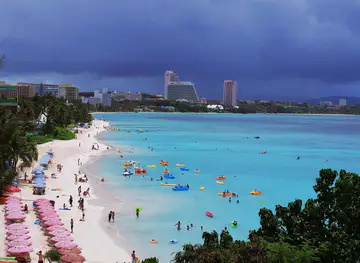
Explore more of Guam
Discover Guam: A tropical paradise offering pristine beaches, rich Chamorro culture, and diverse marine life, perfect for adventure seekers and relaxation enthusiasts alike.
Explore Guam