

Free Southern Guam Travel Guide & Mobile App
Explore Southern Guam with free travel guides. Discover regional history, expert tips, proposed trips, and audio guides on web or mobile app.


Explore Southern Guam for Chamorro heritage, forested hills, historic bays, reef pools, coastal drives and views towards Cocos Island.
Read more about Southern Guam
When is the best time to visit Southern Guam?
Best: January–March · 30–31°C| Month | High (°C) | Rainfall (mm) |
|---|---|---|
| January (best) | 30 | 150 |
| February (best) | 30 | 140 |
| March (best) | 31 | 130 |
| April | 31 | 140 |
| May | 32 | 160 |
| June | 32 | 200 |
| July | 32 | 230 |
| August | 32 | 250 |
| September | 32 | 230 |
| October | 31 | 200 |
| November | 31 | 180 |
| December | 31 | 160 |
Getting to and around Southern Guam
How to get there
Transportation
Top city travel guides in Southern Guam
The cities of Southern Guam, and the easiest places to base yourself.
-
-
-

-

-

-


Swipe for more cities
Destinations in Southern Guam
Resorts, valleys and scenic spots worth a trip of their own.
-

-

-

-

-
-


Swipe for more destinations
Best attractions in Southern Guam
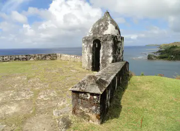
Southern Guam’s attractions combine coastal scenery, village history and outdoor activity rather than a single concentrated resort district. Umatac is the main historical focus, with Fort Nuestra Señora de la Soledad overlooking the bay and other reminders of Spanish-era settlement nearby. Around Inalåhan, the Inarajan Natural Pool offers a distinctive reef-fringed bathing site when conditions are suitable, while Gef Pa'go Cultural Village presents Chamorro crafts, architecture and food traditions through cultural programming. Cetti Bay Overlook is a memorable roadside viewpoint across the island’s rugged southern coast. Talofofo’s river valley and falls provide a greener inland contrast, and Merizo is associated with boat excursions towards Cocos Island and its surrounding waters. Route 4 itself is part of the experience, linking villages, forested slopes, churches, farms and ocean viewpoints. Visitors can add short walks, birdwatching, swimming, snorkelling or photography, but should check weather, tide and access conditions before committing to water-based activities. Some military and archaeological areas are restricted, and not every attractive coastal path is a formal public facility.
-
Tourist attraction
Inarajan Natural Pool
Discover Inarajan Natural Pool: Swim, snorkel, and explore Guam's stunning coastal paradise and immerse yourself in Chamorro culture.
-
Grill
Jeff's Pirates Cove
Discover Guam's pirate history, beachfront dining, and seaside museum at Jeff's Pirates Cove in Talofofo.
-
Tourist attraction
Merizo Pier Park
Discover a serene coastal escape at Merizo Pier Park in Guam, offering stunning views, recreational activities, and a taste of local culture.
-
Scenic spot
Talo'fo'fo' Falls
Discover the beauty and history of Talo'fo'fo' Falls, a must-see Guam attraction with stunning waterfalls and cultural insights.


Best landmarks in Southern Guam
Mount Lamlam forms one of Southern Guam’s most striking natural landmarks, rising above the island’s southwestern interior and embodying the steep volcanic and limestone relief that distinguishes the area. Cetti Bay Overlook is a recognised viewpoint rather than a built monument, but its broad view of folded green hills descending to the Philippine Sea makes it a defining southern image. In Umatac, Fort Nuestra Señora de la Soledad stands on a hillside above the bay as a surviving reminder of Spanish military and maritime history. The nearby Spanish Bridge is a modest but important remnant of colonial road building. Merizo’s Catholic church and bell tower contribute to the village’s historic coastal profile, while Inalåhan’s older buildings and streets preserve an atmosphere of pre-war and early modern village Guam. Along the coast, the Inarajan Natural Pool is a geographical landmark shaped by reef and rock rather than formal architecture. Cocos Island, offshore from Merizo, is another prominent visual feature, although access is dependent on boat arrangements and sea conditions and it should not be treated as a freely accessible beach stop.
-
Tourist attraction
Inarajan Natural Pool
Discover the beauty and tranquility of Guam's Inarajan Natural Pool, a perfect blend of nature, culture, and relaxation.
-
Grill
Jeff's Pirates Cove
Discover Guam's hidden gem: Jeff's Pirates Cove, where history, culture, and beachfront fun collide. Enjoy BBQ, ocean views, and pirate adventures!
-
Park
Merizo Pier Park
Experience the serene beauty and cultural richness of Merizo Pier Park in Malesso', Guam, your perfect getaway for relaxation and adventure.
-
Scenic spot
Talo'fo'fo' Falls
Talo'fo'fo' Falls: A breathtaking natural wonder in Guam, where cascading waters meet lush landscapes, perfect for adventure and relaxation.


Explore Southern Guam on the map
Plan your trip on one map. See where the top cities, national parks and sights are, and book hotels and experiences in a few clicks.
Best hotels in Southern Guam
Best restaurants in Southern Guam
Southern Guam’s dining is more dispersed and informal than the restaurant scene around Tumon and Hagåtña. Village eateries, takeaways, roadside stands and community gatherings may offer Chamorro favourites such as kelaguen, finely chopped meat or seafood seasoned with citrus and coconut, red rice, barbecue and titiyas, a flatbread traditionally made from corn or flour. Fresh seafood appears in coastal communities, although availability varies with weather and fishing conditions. Inalåhan, Merizo, Agat and the larger southern settlements provide the best chance of finding local food without returning north, but opening arrangements can be limited and changeable. Look also for tropical fruit, coconut-based preparations and Filipino influences that reflect Guam’s wider Pacific and Asian connections. Casual American-style meals, cafés and family restaurants are available in parts of the region, while visitors seeking a broad choice of international cuisine will find more options in central Guam. Community fiestas and cultural events can be particularly good opportunities to encounter home-style cooking, but they should be approached as local occasions rather than commercial food festivals.
-
Restaurant
Lone Star Steakhouse
Savor the authentic taste of America at Lone Star Steakhouse in Apotgan, Guam – where every meal is an unforgettable experience.
-
Grill
Jeff's Pirates Cove
Experience authentic island cuisine at Jeff's Pirates Cove – where every meal comes with breathtaking ocean views in Guam.
-
American
King's Restaurant
Discover King's Restaurant in Guam for an unforgettable dining experience featuring American classics blended with local flavors.
-
Restaurant
Proa Restaurant
Experience the unique fusion of Chamorro flavors at Proa Restaurant in Tumon - a must-visit culinary destination in Guam.


Best bars in Southern Guam
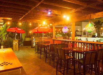
Southern Guam does not have a major nightclub district; evening life is centred on village gatherings, family restaurants, small bars and informal social occasions rather than late-night entertainment. Agat, Santa Rita, Merizo and the larger communities may have local places for a drink or a meal, while central Guam remains the practical choice for clubs, extensive cocktail menus and organised live entertainment. Traditional and contemporary music can feature at fiestas, cultural events and community celebrations, whose dates and programmes vary. Visitors should not expect every southern village to have businesses open late, so plan food and transport before travelling far from the main road. A sunset drive, dinner featuring Chamorro food or a quiet evening near the coast is often more representative of the region than a nightclub-focused itinerary. Drink responsibly, arrange a sober driver when hiring a car and respect the quieter character of residential villages.
-
Grill
Jeff's Pirates Cove
Discover the unique flavors and stunning ocean views at Jeff's Pirates Cove, a must-visit grill in Guam for an unforgettable dining experience.
-
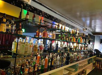
Bar
Porky's
Experience the vibrant nightlife of Tumon at Porky's, where live music meets a fun atmosphere and delicious drinks await you.
-
Tiki bar
Green Lizzard Tiki Bar
Discover the vibrant atmosphere of Green Lizzard Tiki Bar in Tumon, Guam, where tropical cocktails and island vibes create unforgettable memories.
-
Pub
Shamrocks Sports Pub
Experience the vibrant nightlife at Shamrocks Sports Pub in Tumon, Guam, where fun, drinks, and entertainment come together.



Best nightclubs in Southern Guam
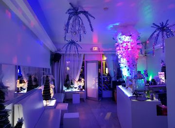
Southern Guam does not have a major nightclub district; evening life is centred on village gatherings, family restaurants, small bars and informal social occasions rather than late-night entertainment. Agat, Santa Rita, Merizo and the larger communities may have local places for a drink or a meal, while central Guam remains the practical choice for clubs, extensive cocktail menus and organised live entertainment. Traditional and contemporary music can feature at fiestas, cultural events and community celebrations, whose dates and programmes vary. Visitors should not expect every southern village to have businesses open late, so plan food and transport before travelling far from the main road. A sunset drive, dinner featuring Chamorro food or a quiet evening near the coast is often more representative of the region than a nightclub-focused itinerary. Drink responsibly, arrange a sober driver when hiring a car and respect the quieter character of residential villages.
-
Outdoor activity organiser
Bikini Island Club
Explore the natural beauty of Guam at Bikini Island Club, where outdoor adventures and exquisite dining come together in a tropical paradise.
-
Lounge
Drop
Discover Guam's nightlife at Drop Lounge, a stylish venue offering unique cocktails and a vibrant atmosphere in Tumon.
-
Bar
Bernie's Bar
Discover the lively atmosphere and refreshing drinks at Bernie's Bar in Apotgan, Guam - a must-visit for an unforgettable night out.
-
Lounge
Gudtaym Lounge
Discover the vibrant Gudtaym Lounge in Guam, where live music and karaoke create unforgettable nightlife experiences.


Best shops in Southern Guam
Shopping in Southern Guam is primarily local and practical rather than centred on large retail complexes. Small village stores serve everyday needs, while roadside stands and community events may offer fruit, prepared food and locally made items when available. The strongest cultural purchases include Chamorro handicrafts, woven pieces, carved objects, locally produced artwork and packaged foods, but visitors should ask about materials and provenance rather than assuming every souvenir is traditionally made. Gef Pa'go Cultural Village and other cultural venues may provide opportunities to see or purchase craftwork when programmes are operating. Merizo, Inalåhan, Agat and the Talofofo area can be useful stops for regional produce and informal shopping, though opening days and stock vary. For a larger selection of jewellery, fashion, electronics and international brands, central Guam’s commercial districts are more suitable and lie outside the southern region. Buy responsibly, avoid collecting coral, shells or archaeological material, and remember that many small businesses may accept cash more readily than cards.
-
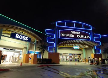
Outlet mall
Guam Premier Outlets
Shop till you drop at Guam Premier Outlets, the ultimate destination for discounts, dining, and delightful experiences in Guam.
-
Shopping mall
JP Superstore
Explore the vibrant shopping experience at JP Superstore in Guam, where local culture meets international flair.
-
Shopping mall
Compadres Mall
Experience the best of shopping and dining at Compadres Mall, Guam's premier retail destination, blending local culture with global brands.
-
Clothing store
Opake Guam
Explore Opake Guam for unique clothing that captures the island's spirit, offering a blend of local culture and contemporary fashion.


Get your free copy of our complete guide to Southern Guam, delivered straight to you.
Everything on this page, from attractions and restaurants to essentials and local phrases, in one PDF you can read offline, print or share.
Already have an account? Sign in
Your Southern Guam guide is ready.
We'll send it to · Not you? Sign out

Getting your guide ready…
We are putting together a fresh copy of the Southern Guam guide. This can take up to a minute.
This can take a few moments. If your browser asks, choose Allow so the download can start. You'll find the guide in your Downloads folder.
Nothing happened? Download it again
Sorry, the guide is taking longer than usual. Please try again in a minute, or get it by email instead.
Southern Guam essentials
Currency and Payment
Safety
Emergency Situations
Do's and Don'ts
Local Tips
From Eve
Local phrases worth knowing
You don't need to get them perfect. A few words go a long way, and locals appreciate the effort.
Basics
| English | Local | Say it |
|---|---|---|
| Hello | Håfa Adai | [ha-fah ah-dye] |
| Goodbye | Adios | [ah-dee-ohs] |
| Yes | Åhe | [ah-heh] |
| No | Ti | [tee] |
| Please/You're welcome | Por favor | [por fah-vor] |
| Thank you | Si Yu'os Ma'åse' | [see yoo-os mah-ah-seh] |
| Excuse me/Sorry | Dispensa | [dis-pen-sah] |
| How are you? | Kao manåo? | [kao mah-nah-o] |
| Fine. And you? | Måolek. Hao manåo? | [mah-oh-lek. hao mah-nah-o] |
| Do you speak English? | Kei yu' på'go English? | [kay yoo pah-go en-glish] |
| I don't understand | Ti un tungo' | [tee oon toon-go] |
Eating & Drinking
| English | Local | Say it |
|---|---|---|
| I'd like to see the menu, please | Håfå na'ån i menù, por favor | [ha-fah nah-ahn ee meh-noo, por fah-vor] |
| I don't eat meat | Ti un chule' i karne | [tee oon choo-leh ee kar-neh] |
| Cheers! | Biba! | [bee-bah] |
| I would like to pay, please | Håfå na'ån i bill, por favor | [ha-fah nah-ahn ee bill, por fah-vor] |
Emergencies
| English | Local | Say it |
|---|---|---|
| Help! | Tao! | [tow] |
| Go away! | Mågo! | [mah-go] |
| Call the Police! | Tåyi i Polisia! | [tah-ee ee poh-lis-ee-ah] |
| Call a doctor! | Tåyi i doktu! | [tah-ee ee dok-too] |
| I'm lost | Un na'ån | [oon nah-ahn] |
| I'm ill | Un ma'åse' | [oon mah-ah-seh] |
Shopping
| English | Local | Say it |
|---|---|---|
| I'd like to buy... | Håfå na'ån u ma'åse'... | [ha-fah nah-ahn oo mah-ah-seh] |
| I'm just looking | Bai hu chumo'cho' | [bye hoo choo-mo-cho] |
| How much is it? | Håfa i pris? | [ha-fah ee prees] |
| That's too expensive | Kao mas chumo'cho' | [kao mahs choo-mo-cho] |
| Can you lower the price? | Kei yu' ma'chu' i pris? | [kay yoo mah-choo ee prees] |
Time & Numbers
| English | Local | Say it |
|---|---|---|
| What time is it? | Håfa tiempo? | [ha-fah tee-em-poh] |
| It's one o'clock | Un ora | [oon oh-rah] |
| Half past (10) | Tåtu na'ån (10) | [tah-too nah-ahn (ten)] |
| Morning | Mañana | [mah-nyah-nah] |
| Afternoon | Popble | [poh-bleh] |
| Evening | Sangra | [sang-rah] |
| Yesterday | Inañå | [ee-nah-nyah] |
| Today | Håfa | [ha-fah] |
| Tomorrow | Put i mañåna | [poot ee mah-nyah-nah] |
| 1 | Håo | [how] |
| 2 | Dos | [dos] |
| 3 | Tres | [tres] |
| 4 | Kuåtro | [koo-ah-tro] |
| 5 | Sinko | [sin-koh] |
| 6 | Sais | [sah-ees] |
| 7 | Siete | [see-eh-teh] |
| 8 | Ocho | [oh-cho] |
| 9 | Nueve | [nweh-veh] |
| 10 | Dís | [deez] |
Transport & Directions
| English | Local | Say it |
|---|---|---|
| Where's a/the...? | Kao' i ...? | [kao ee ...?] |
| What's the address? | Håfa i adres? | [ha-fah ee ah-dres] |
| Can you show me (on the map)? | Kei yu' ma' åmko' (i mapa)? | [kay yoo mah ahm-koh ee mah-pah] |
| When's the next (bus)? | Kao' i mas (bus)? | [kao ee mahs bus] |
| A ticket (to ....) | Un tiket (para ....) | [oon tee-ket para] |
History of Southern Guam
Ancient Chamorro Settlement
The Mariana Islands were settled by Austronesian seafarers many centuries before European contact, and Guam became the largest and most populous island in the archipelago. Ancient Chamorro communities lived along coasts, river valleys and fertile terraces, using fishing, reef resources and cultivated land. Latte stones, the distinctive paired stone pillars associated with Chamorro architecture, survive in archaeological contexts across Guam, including the southern villages. Their presence represents the organisation and continuity of indigenous society rather than merely a decorative architectural style. Southern Guam’s bays, springs and agricultural slopes formed part of this long-established cultural landscape.
Spanish Contact and Colonial Rule
Ferdinand Magellan’s expedition reached the Mariana Islands in 1521, and Spanish colonial rule developed later through missionary activity, military control and the Manila galleon network. Umatac became an important harbour and ceremonial point during the Spanish period, while churches, roads and defensive works reshaped village life. The southern coast retains reminders of that era in Umatac’s fortifications, the Spanish Bridge and historic village sites. Spanish rule also brought epidemics, forced population movements and profound disruption to Chamorro society, alongside the spread of Catholicism and new political institutions.
The Galleon Era and Southern Ports
From the sixteenth to the nineteenth centuries, Guam served as a way station for Spanish ships travelling between Mexico and the Philippines. Southern bays, particularly around Umatac, were important points of anchorage, provisioning and interaction with colonial authorities. The galleon trade connected Guam to wider Pacific and Asian networks, but it did not make the island an equal commercial partner; its communities supplied labour, food and logistical support within a colonial system. The coastal geography of southern Guam, including sheltered bays and navigable approaches, explains the concentration of historic sites in this area.
Transfer to the United States, 1898
Spain ceded Guam to the United States after the Spanish-American War in 1898, while the rest of the Mariana Islands followed different political paths. Guam was administered by the US Navy for much of the first half of the twentieth century, and its institutions, economy and infrastructure increasingly reflected American influence. The island remained a strategically important Pacific possession, with military facilities and new administrative arrangements affecting communities throughout Guam, including the south. This period established the constitutional and political framework by which Guam remains a US unincorporated territory rather than a US state.
Japanese Occupation and the Liberation of Guam
Japanese forces occupied Guam from December 1941 until American forces recaptured the island in 1944. Chamorro civilians endured displacement, forced labour, food shortages and violence during the occupation, while the later fighting brought bombardment and military destruction. Southern Guam was closely affected by the liberation campaign because its beaches, roads and hills were important to American operations. War memorials, earthworks and surviving structures form part of the region’s historical landscape, although many military sites are on private, restricted or hazardous land and should not be entered without permission.
Postwar Reconstruction and Military Expansion
After 1944, Guam was rebuilt with American financial and military support, and its economy became increasingly linked to defence, construction and public administration. Santa Rita lies beside Naval Base Guam, a major installation whose presence has shaped local employment, land use and transport patterns. At the same time, southern villages retained agricultural, fishing and church-centred identities, while roads and improved services made the coast more accessible to residents and visitors. Postwar development therefore produced both modern infrastructure and continuing debates about land, access, environmental protection and the balance between military and civilian needs.
Chamorro Cultural Revitalisation
Contemporary southern Guam reflects sustained efforts to maintain and strengthen Chamorro language, foodways, crafts, music and knowledge of the land. Cultural institutions and village events provide settings for traditional cooking, weaving, carving and storytelling, while places such as Gef Pa'go Cultural Village have helped present aspects of village life to visitors. Cultural revitalisation is not simply a performance for tourism: it is connected to questions of identity, land rights, historical memory and the status of Chamorro heritage in a modern American territory. Visitors benefit from approaching these traditions with attention and respect.
Southern Guam in Photos
Browse through our photo collection highlighting the charm and character of the destination.
Neighbouring regions of Southern Guam
The closest regions to Southern Guam, if you have time for more than one.
-

-

-
-

-


Swipe for more regions
Explore more
Explore more of Guam
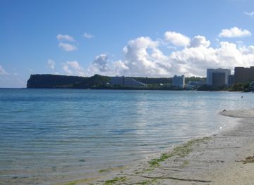
Discover Guam: A tropical paradise offering pristine beaches, rich Chamorro culture, and diverse marine life, perfect for adventure seekers and relaxation enthusiasts alike.
Explore Guam