

Pacaya Volcano Travel Guide - Free Web & App
Your ultimate guide to Pacaya Volcano. Discover top landmarks, proposed trips, and local tips. Free on the web or via the Evendo companion app.


Pacaya Volcano in Guatemala offers guided volcanic walks, lava landscapes, highland views and a close encounter with one of Central America’s active peaks.
A Volcano Close to Guatemala’s Urban Heart
Pacaya Volcano rises in southern Guatemala, between Guatemala City and Antigua Guatemala, and forms part of the volcanic chain that crosses the country’s Pacific side. Its accessible slopes lie within the Pacaya Volcano and Laguna de Calderas National Park, whose principal visitor entrance is near San Francisco de Sales in the municipality of San Vicente Pacaya. From the capital or Antigua, the journey is relatively straightforward, but the volcano itself is a rural, exposed landscape rather than a developed resort.Read more about Pacaya Volcano
Lava Fields and Highland Views
Walking, Geology and Local Life
When is the best time to visit Pacaya Volcano?
Best: November–January · 20°C| Month | High (°C) | Rainfall (mm) |
|---|---|---|
| January (best) | 20 | 10 |
| February | 20 | 15 |
| March | 21 | 20 |
| April | 21 | 25 |
| May | 21 | 30 |
| June | 21 | 35 |
| July | 21 | 40 |
| August | 21 | 40 |
| September | 21 | 35 |
| October | 21 | 25 |
| November (best) | 20 | 15 |
| December (best) | 20 | 10 |
Getting to and around Pacaya Volcano
How to get there
Transportation
Best attractions in Pacaya Volcano
The central attraction is the volcanic landscape itself: a guided walk from the San Francisco de Sales area reaches open slopes of black ash, solidified lava and sparse vegetation, with changing views across Guatemala’s southern highlands. Routes and stopping points vary according to current volcanic conditions, and visitors should follow the path and limits set by park authorities. The upper terrain provides viewpoints towards Agua, Fuego and Acatenango when visibility is good, while Lake Amatitlán and the surrounding valleys can be seen from suitable elevations. Lower parts of the protected area include woodland and the Laguna de Calderas area, a small lake basin associated with the national park rather than with the summit route. San Vicente Pacaya and the surrounding rural communities add a local dimension through guiding, agriculture and small-scale visitor services. Pacaya is best understood as a landscape for guided interpretation and walking, not as a conventional attraction complex with numerous buildings or indoor exhibits.
-
Tourist attraction
Parque Natural Calderas
Discover Guatemala's hidden gem: Hike, explore wildlife, and soak in breathtaking volcanic views at Parque Natural Calderas.
-
Hiking area
Cerro Chino
Hike Cerro Chino for stunning views of Volcán Pacaya, Guatemala's active volcano, and experience a unique volcanic landscape.
-
Tourist attraction
Laguna Escondida Calderas
Discover the serene beauty of Laguna Escondida Calderas, a hidden lagoon near Volcán de Pacaya, Guatemala, perfect for nature and tranquility.
-
Tourist attraction
Mirador 1 faldas Pacaya
Experience breathtaking views of Pacaya Volcano from Mirador 1 Faldas, a must-see Guatemalan landmark for nature and adventure enthusiasts.


Best landmarks in Pacaya Volcano
Pacaya’s defining landmark is its active volcanic cone and the dark lava terrain spreading across the upper slopes, physical features that record repeated eruptions far more clearly than any built monument. The approximately 2,552-metre summit area belongs to a complex volcanic system shaped by overlapping cones, ash deposits and lava flows, while the accessible route provides changing views towards Agua, Fuego and Acatenango. Laguna de Calderas is another important natural feature within the protected landscape, occupying a volcanic basin among the surrounding highlands. The national park itself is a significant conservation landmark because it brings the active volcano, forested lower slopes and lake environment under a shared protected-area framework. San Francisco de Sales is the principal cultural reference point for visitors, linking the mountain experience with the communities that provide access and guiding.
-
National park
Centro de visitantes, Volcan Pacaya
Explore the breathtaking landscapes and active volcanic features of Volcan Pacaya National Park in Guatemala, a paradise for adventure seekers and nature lovers.
-
National park
Entrada: Parque Nacional Volcan De Pacaya
Discover the breathtaking landscapes and thrilling adventures at Parque Nacional Volcan De Pacaya, Guatemala's iconic active volcano.
-
National park
Volcán Pacaya
Explore the breathtaking Volcán Pacaya, an active volcano in Guatemala offering thrilling hikes and stunning views, perfect for nature lovers and adventure seekers.
-
Volcano
Pacaya
Discover the captivating beauty of Pacaya Volcano, Guatemala's accessible active volcano, perfect for adventurous travelers seeking unique experiences in nature.


Explore Pacaya Volcano on the map
Plan your trip on one map. See where the top attractions, landmarks, restaurants and hotels are, and book hotels and experiences in a few clicks.
Best hotels in Pacaya Volcano
Best restaurants in Pacaya Volcano
Pacaya itself has limited dining infrastructure, with simple refreshments and small local food businesses concentrated around access communities rather than distributed across the volcanic slopes. Visitors commonly eat before or after the walk in San Francisco de Sales, San Vicente Pacaya or along the approach road, although the range and opening of individual establishments can vary. More extensive choices are available in Antigua Guatemala and Guatemala City, both outside the destination, where Guatemalan staples such as pepián, tamales, chuchitos, tortillas, beans and grilled meats are easier to find alongside cafés and international restaurants. Regional produce from the surrounding highlands and agricultural valleys shapes everyday cooking, while packed food is useful for a full day outdoors. Do not leave food waste on the mountain, and confirm in advance whether an organised excursion includes meals or only transport and guiding.
-
Restaurant
Pacaya Bistro
Experience the authentic flavors of Guatemala at Pacaya Bistro in San Vicente Pacaya - where every meal tells a story.
-
Meal delivery
El Jardín del Cabro BBQ Guatemala
Discover the taste of authentic American barbecue at El Jardín del Cabro BBQ in Pacaya, Guatemala - where flavor meets hospitality!
-
Restaurant
Restaurante El Volcan
Experience authentic Guatemalan flavors at Restaurante El Volcan in San Vicente Pacaya amidst stunning volcanic views.
-
Pizza
Pizza Pacaya
Discover authentic flavors at Pizza Pacaya - where every slice tells a story and every meal is an adventure.


Best bars in Pacaya Volcano
Pacaya is not a nightlife destination, and the national park and its access communities do not have a concentrated scene of bars or nightclubs. Evenings are generally quiet in rural San Francisco de Sales and San Vicente Pacaya, with social life centred on local restaurants, small shops and community venues rather than late-night entertainment. Visitors staying in Antigua Guatemala can find a broader selection of established bars, traditional drinking places and evening restaurants, while Guatemala City offers the country’s largest range of nightlife outside the destination. These are nearby urban bases, not facilities within the volcano park. Because many Pacaya excursions begin early and road journeys can be dark or tiring, visitors usually return to their accommodation after the walk rather than planning an evening around the mountain.
-
Restaurant
Pacaya Bistro
Experience the rich flavors of Guatemala at Pacaya Bistro, a culinary gem in San Vicente Pacaya offering local dishes in a cozy atmosphere.
-
Restaurant
Restaurante El Volcan
Experience the authentic flavors of Guatemalan cuisine at Restaurante El Volcan, a culinary haven in San Vicente Pacaya.
-
Pizza
Pizza Pacaya
Discover the authentic taste of Italy in San Vicente Pacaya with handcrafted pizzas made from fresh, local ingredients.
-
Restaurant
Retro Restaurant, Food, Drinks & Music
Dive into a unique culinary experience at Retro Restaurant in San Vicente Pacaya, where food, drinks, and live music come together for an unforgettable night.


Best nightclubs in Pacaya Volcano
Pacaya is not a nightlife destination, and the national park and its access communities do not have a concentrated scene of bars or nightclubs. Evenings are generally quiet in rural San Francisco de Sales and San Vicente Pacaya, with social life centred on local restaurants, small shops and community venues rather than late-night entertainment. Visitors staying in Antigua Guatemala can find a broader selection of established bars, traditional drinking places and evening restaurants, while Guatemala City offers the country’s largest range of nightlife outside the destination. These are nearby urban bases, not facilities within the volcano park. Because many Pacaya excursions begin early and road journeys can be dark or tiring, visitors usually return to their accommodation after the walk rather than planning an evening around the mountain.
-
National park
Entrada: Parque Nacional Volcan De Pacaya
Discover the breathtaking beauty of Volcan De Pacaya National Park, featuring an active volcano and stunning landscapes in Guatemala.
-
Bar
DonD'vinny
Discover the vibrant nightlife at DonD'vinny in San Vicente Pacaya, where great drinks, live music, and local culture converge.


Best shops in Pacaya Volcano
Shopping at Pacaya is modest and concentrated around the access communities rather than organised into a substantial retail district. Visitors may find snacks, drinks and practical walking supplies near the approach, together with locally offered services connected with guiding and the mountain visit. San Vicente Pacaya provides a more conventional local town setting, while Antigua Guatemala and Guatemala City, both outside the destination, offer far greater choice for Guatemalan textiles, woven goods, ceramics, coffee, chocolate, handicrafts and contemporary art. Purchases from local vendors should be made respectfully and with realistic expectations about availability, since rural displays and small businesses are not equivalent to permanent markets. Avoid removing volcanic material from the park, and consider carrying reusable containers to reduce waste in an area with limited visitor infrastructure.
-
Clothing store
Volcan de pacaya
Experience the stunning landscapes and thrilling hikes at Volcan de Pacaya, one of Guatemala's most active and beautiful volcanoes.
-
Grocery store
Restaurante humito en tus ojos
Discover the authentic flavors of Guatemala at Restaurante Humito en Tus Ojos, a charming grocery store and culinary hotspot in San Vicente Pacaya.
-
Home goods store
TIENDA LOS ÁNGELES
Explore Tienda Los Ángeles for unique home goods and authentic Guatemalan crafts in San Vicente Pacaya.
-
Store
Lava store
Explore the unique Lava Store in San Vicente Pacaya for volcanic-inspired crafts, authentic Guatemalan souvenirs, and a taste of local culture.


Get your free copy of our complete guide to Pacaya Volcano, delivered straight to you.
Everything on this page, from attractions and restaurants to essentials and local phrases, in one PDF you can read offline, print or share.
Already have an account? Sign in
Your Pacaya Volcano guide is ready.
We'll send it to · Not you? Sign out

Getting your guide ready…
We are putting together a fresh copy of the Pacaya Volcano guide. This can take up to a minute.
This can take a few moments. If your browser asks, choose Allow so the download can start. You'll find the guide in your Downloads folder.
Nothing happened? Download it again
Sorry, the guide is taking longer than usual. Please try again in a minute, or get it by email instead.
Pacaya Volcano essentials
Currency and Payment
Safety
Emergency Situations
Do's and Don'ts
Local Tips
From Eve
Local phrases worth knowing
You don't need to get them perfect. A few words go a long way, and locals appreciate the effort.
Basics
| English | Local | Say it |
|---|---|---|
| Hello | Hola | [oh-lah] |
| Goodbye | Adiós | [ah-dee-ohs] |
| Yes | Sí | [see] |
| No | No | [noh] |
| Please/You're welcome | Por favor/De nada | [por fah-vor/deh nah-dah] |
| Thank you | Gracias | [grah-see-as] |
| Excuse me/Sorry | Perdón/Lo siento | [pair-dohn/loh see-en-toh] |
| How are you? | ¿Cómo estás? | [koh-moh ehs-tahs] |
| Fine. And you? | Bien. ¿Y tú? | [bee-en. ee too] |
| Do you speak English? | ¿Hablas inglés? | [ah-blahs een-glays] |
| I don't understand | No entiendo | [noh ehn-tee-en-doh] |
Eating & Drinking
| English | Local | Say it |
|---|---|---|
| I'd like to see the menu, please | Me gustaría ver el menú, por favor | [may goo-stah-ree-ah vehr ehl meh-noo, poor fah-vor] |
| I don't eat meat | No como carne | [noh koh-moh kahr-neh] |
| Cheers! | ¡Salud! | [sah-lood] |
| I would like to pay, please | Me gustaría pagar, por favor | [may goo-stah-ree-ah pah-gar, poor fah-vor] |
Emergencies
| English | Local | Say it |
|---|---|---|
| Help! | ¡Ayuda! | [ah-yoo-dah] |
| Go away! | ¡Vete! | [veh-teh] |
| Call the Police! | ¡Llama a la Policía! | [yah-mah ah lah poh-lee-see-ah] |
| Call a doctor! | ¡Llama a un médico! | [yah-mah ah oon meh-dee-koh] |
| I'm lost | Estoy perdido/a | [ehs-toy pair-dee-doh/dah] |
| I'm ill | Estoy enfermo/a | [ehs-toy ehn-fehr-moh/dah] |
Shopping
| English | Local | Say it |
|---|---|---|
| I'd like to buy... | Me gustaría comprar... | [may goo-stah-ree-ah kohm-prar...] |
| I'm just looking | Solo estoy mirando | [soh-loh ehs-toy meer-ahn-doh] |
| How much is it? | ¿Cuánto cuesta? | [kwan-toh kwehs-tah] |
| That's too expensive | Esto es demasiado caro | [ehs-toh ehs deh-mah-syah-doh kah-roh] |
| Can you lower the price? | ¿Puede rebajar el precio? | [pweh-deh reh-bah-har ehl preh-see-oh] |
Time & Numbers
| English | Local | Say it |
|---|---|---|
| What time is it? | ¿Qué hora es? | [keh oh-rah ehs] |
| It's one o'clock | Es la una en punto | [ehs lah oo-nah ehn poon-toh] |
| Half past (10) | Siete y media | [see-eh-teh ee meh-dee-ah] |
| Morning | Mañana | [mah-nyah-nah] |
| Afternoon | Tarde | [tahr-deh] |
| Evening | Noche | [noh-che] |
| Yesterday | Ayer | [ah-yehr] |
| Today | Hoy | [oy] |
| Tomorrow | Mañana | [mah-nyah-nah] |
| 1 | Uno | [oo-noh] |
| 2 | Dos | [dohs] |
| 3 | Tres | [trehs] |
| 4 | Cuatro | [kwah-troh] |
| 5 | Cinco | [seen-koh] |
| 6 | Seis | [says] |
| 7 | Siete | [see-eh-teh] |
| 8 | Ocho | [oh-choh] |
| 9 | Nueve | [nweh-veh] |
| 10 | Diez | [dyehs] |
Transport & Directions
| English | Local | Say it |
|---|---|---|
| Where's a/the...? | ¿Dónde está...? | [dohn-deh ehs-tah] |
| What's the address? | ¿Cuál es la dirección? | [kwal ehs lah dee-rehk-syon] |
| Can you show me (on the map)? | ¿Puede mostrarme (en el mapa)? | [pweh-deh mohs-trar-meh (ehn ehl mah-pah)] |
| When's the next (bus)? | ¿Cuándo es el próximo (autobús)? | [kwan-doh ehs ehl proh-ssee-moh (ow-toh-boos)] |
| A ticket (to ....) | Un boleto (a ...) | [oon boh-leh-toh (ah ...)] |
History of Pacaya Volcano
A Young Volcanic Landscape
Pacaya forms part of Guatemala’s volcanic arc, created by the subduction of the Cocos Plate beneath the Caribbean Plate. The present volcano is a complex built from overlapping volcanic features and successive lava deposits rather than a single simple cone. Its relatively young basaltic rocks and ongoing eruptive history explain the dark, open terrain encountered on the upper slopes. These geological processes remain visible in lava flows, ash deposits and unstable ground, making Pacaya a particularly accessible place to understand how Guatemala’s volcanic landscape continues to develop.
Recorded Eruptions and Colonial Observation
Pacaya’s eruptions entered the written historical record during the Spanish colonial period, with a commonly cited eruption in 1565. Later accounts documented further activity, although observations from earlier centuries were uneven and often made from surrounding settlements rather than from the summit. The volcano’s proximity to the densely populated central highlands meant that ash, fire and changes in the mountain were part of the historical experience of nearby communities. Its name became firmly established in colonial geographical descriptions of the region.
The Modern Eruptive Era
A major modern phase began in 1961, followed by renewed and persistent activity from 1965 onwards. During the following decades Pacaya produced lava flows, ash emissions and episodes of stronger eruption, repeatedly altering access and affecting communities around the mountain. Activity was especially prominent in the early twenty-first century, including significant eruptions in 2010 and 2021. Because Pacaya remains an active volcano, its visible landscape and visitor arrangements are subject to monitoring and operational decisions rather than being permanently fixed.
Protected Landscape and Visitor Access
The Pacaya Volcano and Laguna de Calderas National Park was established to protect the volcanic environment, surrounding forests and the lake basin while supporting controlled public access. The park’s management has developed around local entrances and community-based guiding, particularly near San Francisco de Sales. Guides are an important part of the visitor system because they help direct people along current routes and away from hazardous or restricted areas. The protected-area framework also reflects the need to balance tourism with conservation, public safety and the interests of communities living around the volcano.
A Contemporary Rural Destination
Pacaya’s tourism identity has grown through day trips from Antigua Guatemala and Guatemala City, where its relative accessibility contrasts with the more remote character of many highland volcanoes. Visitors now come primarily for guided walking, volcanic interpretation and views across southern Guatemala rather than for a permanent resort infrastructure. Local residents provide guiding and small-scale services at the access communities, while accommodation and more extensive dining remain concentrated outside the park. This pattern keeps Pacaya closely connected to regional towns and to the practical realities of an active volcanic environment.
Pacaya Volcano in Photos
Browse through our photo collection highlighting the charm and character of the destination.
Neighbouring destination travel guides
The closest destinations to Pacaya Volcano, if you have time for more than one.
-

-

-
-

-


Swipe for more destinations
Explore more
Explore more of Pacific Lowlands
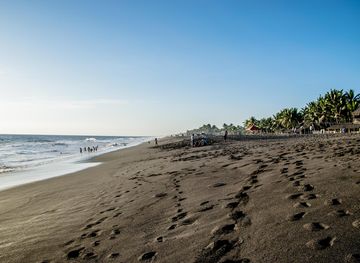
Discover the Pacific Lowlands of Guatemala: A blend of stunning beaches, rich history, vibrant wildlife, and delectable cuisine, perfect for nature and adventure lovers.
Explore Pacific Lowlands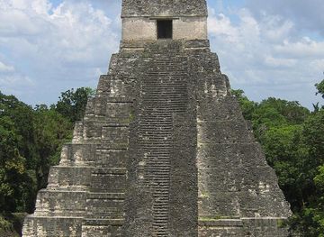
Explore more of Guatemala
Discover Guatemala: A land of ancient Mayan wonders, breathtaking natural beauty, and vibrant cultural experiences. Perfect for history buffs, nature lovers, and adventure seekers.
Explore Guatemala