

Free Rupununi Travel Guide & Mobile App
Explore Rupununi with free travel guides. Discover regional history, expert tips, proposed trips, and audio guides on web or mobile app.


Explore Guyana’s Rupununi through vast savannas, Indigenous communities, river wildlife, Kanuku Mountains and adventurous overland journeys.
Read more about Rupununi
When is the best time to visit Rupununi?
Best: January–March · 30–31°C| Month | High (°C) | Rainfall (mm) |
|---|---|---|
| January (best) | 30 | 50 |
| February (best) | 31 | 60 |
| March (best) | 31 | 70 |
| April | 32 | 80 |
| May | 32 | 90 |
| June | 33 | 100 |
| July | 33 | 110 |
| August | 34 | 120 |
| September | 33 | 110 |
| October | 33 | 100 |
| November | 32 | 90 |
| December | 32 | 80 |
Getting to and around Rupununi
How to get there
Transportation
Top city travel guides in Rupununi
The cities of Rupununi, and the easiest places to base yourself.

Swipe for more cities
Best attractions in Rupununi
The Rupununi’s attractions are predominantly landscape-based and community-led rather than concentrated in formal visitor complexes. Around Lethem, the open savanna, Takutu River and approaches to the Kanuku Mountains provide opportunities for birdwatching, photography, short walks and guided drives. The North Rupununi offers river excursions, wetlands, forest trails and community tourism in places such as Yupukari and Rewa, where visitors may learn about fishing, wildlife monitoring, canoe travel and local livelihoods. The South Rupununi has a more remote character, with broad grasslands, ranch country, Indigenous communities and access towards the Marudi Mountains. Dadanawa Ranch is associated with the region’s cattle history, although visits should be arranged in advance. Wildlife is an important attraction throughout the area, with possibilities including giant river otters, black caimans, capybaras, monkeys and a wide variety of birds, depending on season and habitat. The best experiences usually involve locally organised guiding, because tracks, waterways and community protocols are not always apparent to independent visitors. The Rupununi is not a destination for guaranteed sightings or tightly timed sightseeing; its appeal lies in extended journeys through changing savanna, forest and river environments.
-
Tourist attraction
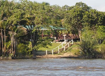
Iwokrama River Lodge
Explore the breathtaking beauty and rich biodiversity of Iwokrama River Lodge, a premier eco-destination in Guyana's rainforest.
-
 Nature preserve
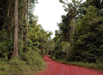
Iwokrama Forest
Discover the stunning Iwokrama Forest, a biodiversity hotspot in Guyana, perfect for eco-tourism and wildlife adventures.
-
National forest
Iwokrama Forest Reserve
Experience the breathtaking landscape and rich biodiversity of Iwokrama Forest Reserve, a hidden gem in Guyana's lush rainforest.
-
Tourist attraction
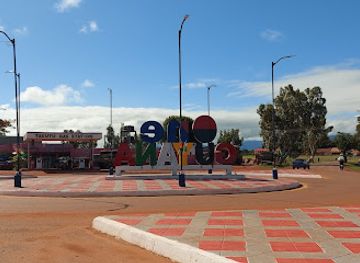
One Guyana Monument
Explore the One Guyana Monument, a stunning tribute to unity and diversity in Lethem, Guyana, where culture and history come alive.
Best landmarks in Rupununi
The Kanuku Mountains are the Rupununi’s most commanding natural landmark, rising as forested ranges above the surrounding savanna and forming an important habitat corridor. Their scale and isolation make them a defining feature of views around Lethem and the wider southern interior, although access to mountain areas should be arranged with local guides. The Takutu River and the Takutu River Bridge mark the region’s international gateway, linking Lethem with Bonfim in Brazil and illustrating the Rupununi’s long-standing borderland connections. The Rupununi River is another central geographical landmark, winding through wetlands, forest and Indigenous territories before joining the Essequibo system. Farther south, the Marudi Mountains stand above the South Rupununi grasslands, where their geological and cultural importance is best understood through local guidance. Dadanawa Ranch represents the historic landscape of large-scale cattle ranching and the long-distance movement that once connected isolated savanna estates. Within Lethem and neighbouring communities, churches, civic buildings, river crossings and village spaces are less monumental but reveal the region’s blend of Indigenous, Guyanese and Brazilian-border influences.
-
Monument
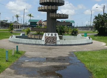
The 1763 Monument
Explore Georgetown's 1763 Monument: A historic landmark symbolizing freedom and resilience, surrounded by lush greenery and rich culture.
-
Tourist attraction
I Love Guyana Sign
Immerse yourself in the vibrant culture of Georgetown at the iconic 'I Love Guyana' sign, a must-visit for every tourist.
-
Cultural center
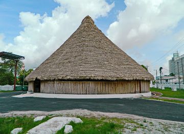
Umana Yana
Discover the cultural essence of Guyana at Umana Yana, a unique center celebrating Indigenous heritage and vibrant local traditions.
-
Nature preserve
Iwokrama Forest
Discover the breathtaking beauty and biodiversity of Iwokrama Forest, a lush nature preserve in the heart of Guyana's tropical rainforest.

Explore Rupununi on the map
Plan your trip on one map. See where the top cities, national parks and sights are, and book hotels and experiences in a few clicks.
Best hotels in Rupununi
Best restaurants in Rupununi
Dining in the Rupununi is practical, locally sourced and closely tied to the supplies available in a remote interior region. Lethem has the widest choice of cafés, simple restaurants and takeaway food, with Guyanese staples such as rice, dhal, roti, curries, chicken, plantain and cassava commonly appearing alongside Brazilian-influenced flavours near the border. In villages and lodges, meals may include freshwater fish, locally raised meat, cassava bread, farine, vegetables and seasonal fruit, although menus vary according to community and supply conditions. Food served at ecolodges and community stays is often arranged as part of the accommodation rather than selected from a large à la carte menu. Visitors should communicate dietary requirements before travelling, particularly when heading to remote areas. Markets and small shops in Lethem are useful for snacks and provisions, but options become limited outside town. Eating with a host community can offer a more meaningful introduction to local foodways than seeking formal dining, provided arrangements and expectations are agreed in advance.
-
Grill
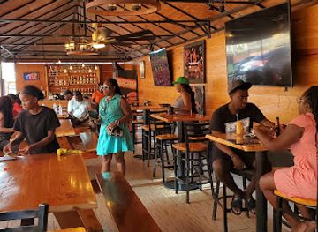
Fireside Grill and Chill
Discover delightful grilled dishes at Fireside Grill and Chill in Georgetown – where taste meets warmth in every bite.
-
American
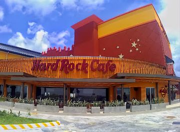
Hard Rock Cafe Guyana
Experience vibrant American dining at Hard Rock Cafe Guyana – where rock music meets culinary delight!
-
Indian
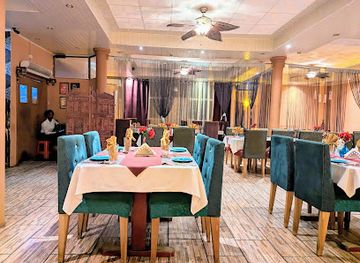
Aagman Indian Restaurant
Experience authentic Indian flavors at Aagman Indian Restaurant in Georgetown - where every dish tells a story.
-
Indian
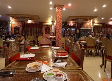
Maharaja Palace Restaurant
Discover the rich flavors of India at Maharaja Palace Restaurant in Georgetown, where culinary excellence meets cultural charm.
Best bars in Rupununi
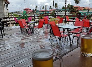
Nightlife in the Rupununi is modest and concentrated in Lethem, where small bars, restaurants and social venues provide evening activity for residents and travellers. Near the Brazilian border, musical and culinary influences may be more noticeable, but the scene remains informal rather than comparable with Guyana’s coastal cities. In villages, ranches and ecolodges, evenings usually centre on conversation, shared meals, storytelling, bird or wildlife discussions and the quiet sounds of the surrounding landscape. Some lodges may offer limited drinks, but supplies and licensing arrangements vary, so visitors should not assume that a full bar is available. Live music and community events occur occasionally, while larger celebrations depend on local calendars and should not be treated as permanent attractions. Respect household and village quiet hours, avoid excessive drinking before river or outdoor activities, and arrange transport after dark rather than walking unfamiliar roads or savanna tracks alone.
-
Night club
Palm Court
Discover Georgetown's nightlife at Palm Court, a vibrant night club with great drinks, music, and a lively atmosphere.
-
Grill
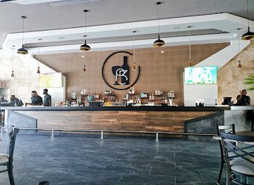
Rs53RestoBar & Lounge
Discover the culinary charm of Rs53RestoBar & Lounge in Providence, Georgetown, offering delicious grills and a lively dining atmosphere.
-
Bar
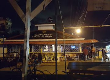
Plaisance Guinness Bar
Discover the lively atmosphere and local charm of Plaisance Guinness Bar, your go-to destination for a refreshing drink and authentic Guyanese experience.
-
Restaurant
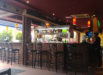
Pyramid Restaurant & Pub
Experience the vibrant flavors of Pyramid Restaurant & Pub in Windsor Forest, where great food meets a welcoming atmosphere.
Best nightclubs in Rupununi
Nightlife in the Rupununi is modest and concentrated in Lethem, where small bars, restaurants and social venues provide evening activity for residents and travellers. Near the Brazilian border, musical and culinary influences may be more noticeable, but the scene remains informal rather than comparable with Guyana’s coastal cities. In villages, ranches and ecolodges, evenings usually centre on conversation, shared meals, storytelling, bird or wildlife discussions and the quiet sounds of the surrounding landscape. Some lodges may offer limited drinks, but supplies and licensing arrangements vary, so visitors should not assume that a full bar is available. Live music and community events occur occasionally, while larger celebrations depend on local calendars and should not be treated as permanent attractions. Respect household and village quiet hours, avoid excessive drinking before river or outdoor activities, and arrange transport after dark rather than walking unfamiliar roads or savanna tracks alone.
-
River
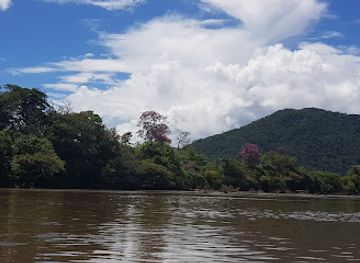
Rupununi River
Discover the natural beauty of Rupununi River, a tranquil escape into the heart of Guyana's pristine wilderness, perfect for adventure and relaxation.
Best shops in Rupununi
Shopping in the Rupununi is centred on practical supplies, locally made crafts and regional food products rather than large retail districts. Lethem has the broadest selection, with small shops and market stalls selling provisions, clothing, household goods and goods influenced by trade with Brazil. Handicrafts may include woven baskets, mats, beadwork, woodwork and other items made by Indigenous artisans, though availability and designs vary between communities. Buying directly through recognised community organisations or from the makers themselves helps keep income within the region and provides a clearer understanding of the item’s materials and meaning. Cassava products, farine, cassava bread and locally produced foods may be available when supplies permit, but transport and storage conditions make availability seasonal. Beyond Lethem, shopping opportunities are limited and usually connected to village visits, lodges or community craft initiatives. Carry cash in small denominations, ask before photographing or handling craftwork, and do not purchase archaeological objects, wildlife products or items made from protected species.
-
Clothing store
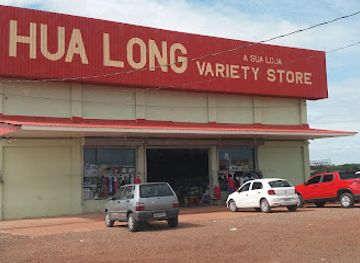
Hua Long - Variety Store
Discover unique clothing and accessories at Hua Long - Variety Store in Lethem, where local culture meets vibrant fashion.
-
Shopping mall
Giftland Mall
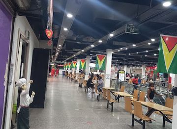
Explore Giftland Mall, Georgetown's premier shopping destination, offering a vibrant mix of local and international brands, dining, and entertainment.
-
Shopping mall
Linus Shopping Plaza
Experience the charm of Linus Shopping Plaza in Lethem, a shopping destination blending local culture with modern retail offerings for unforgettable moments.
-
Shopping mall
Amazonia Mall
Discover the vibrant shopping and dining experience at Amazonia Mall in Georgetown, where local culture meets modern retail.
Get your free copy of our complete guide to Rupununi, delivered straight to you.
Everything on this page, from attractions and restaurants to essentials and local phrases, in one PDF you can read offline, print or share.
Already have an account? Sign in
Your Rupununi guide is ready.
We'll send it to · Not you? Sign out

Getting your guide ready…
We are putting together a fresh copy of the Rupununi guide. This can take up to a minute.
This can take a few moments. If your browser asks, choose Allow so the download can start. You'll find the guide in your Downloads folder.
Nothing happened? Download it again
Sorry, the guide is taking longer than usual. Please try again in a minute, or get it by email instead.
Rupununi essentials
Currency and Payment
Safety
Emergency Situations
Do's and Don'ts
Local Tips
From Eve
Local phrases worth knowing
You don't need to get them perfect. A few words go a long way, and locals appreciate the effort.
Basics
| English | Local | Say it |
|---|---|---|
| Hello | Naimaka | [Nai-ma-ka] |
| Goodbye | Nekul | [Ne-kul] |
| Yes | Ayo | [A-yo] |
| No | Noh | [Noh] |
| Please/You're welcome | Tengki | [Ten-gi] |
| Thank you | Tenk yu | [Ten-k yu] |
| Excuse me/Sorry | Sori | [So-ri] |
| How are you? | Ow yuh doin? | [Ow yuh do-in?] |
| Fine. And you? | Fain. An yuh? | [Fain. An yuh?] |
| Do you speak English? | Yuh speak English? | [Yuh speak In-glish?] |
| I don't understand | Mi no undastand | [Mi no un-da-stand] |
Eating & Drinking
| English | Local | Say it |
|---|---|---|
| I'd like to see the menu, please | Mi wan si di menu, tengki | [Mi wan si di men-u, ten-gi] |
| I don't eat meat | Mi no eat meat | [Mi no eat meat] |
| Cheers! | Skal! | [Skal] |
| I would like to pay, please | Mi wan pay, tengki | [Mi wan pay, ten-gi] |
Emergencies
| English | Local | Say it |
|---|---|---|
| Help! | Help! | [Help!] |
| Go away! | Guh way! | [Guh way!] |
| Call the Police! | Call di Police! | [Call di Po-lice!] |
| Call a doctor! | Call a doctor! | [Call a doc-tor!] |
| I'm lost | Mi lost | [Mi lost] |
| I'm ill | Mi sick | [Mi sick] |
Shopping
| English | Local | Say it |
|---|---|---|
| I'd like to buy... | Mi wan buy... | [Mi wan buy...] |
| I'm just looking | Mi jus de look | [Mi jus de look] |
| How much is it? | Ow much it cost? | [Ow much it cost?] |
| That's too expensive | Dat too high | [Dat too high] |
| Can you lower the price? | Yuh can drop di price? | [Yuh can drop di price?] |
Time & Numbers
| English | Local | Say it |
|---|---|---|
| What time is it? | Ow di time? | [Ow di time?] |
| It's one o'clock | It one o'clock | [It one o-clock] |
| Half past (10) | Half past ten | [Half past ten] |
| Morning | Mornin | [Morn-in] |
| Afternoon | Afternoon | [Af-ter-noon] |
| Evening | Evenin | [Ev-en-in] |
| Yesterday | Yesterday | [Yes-ter-day] |
| Today | Today | [To-day] |
| Tomorrow | Tomorrow | [To-mor-row] |
| 1 | Wan | [Wan] |
| 2 | Tu | [Tu] |
| 3 | Tri | [Tri] |
| 4 | Foh | [Foh] |
| 5 | Fai | [Fai] |
| 6 | Siks | [Siks] |
| 7 | Sev | [Sev] |
| 8 | Eit | [Eit] |
| 9 | Nain | [Nain] |
| 10 | Ten | [Ten] |
Transport & Directions
| English | Local | Say it |
|---|---|---|
| Where's a/the...? | Wheh di...? | [Wheh di...?] |
| What's the address? | Ow di address? | [Ow di ad-dress?] |
| Can you show me (on the map)? | Yuh can show mi (pon di map)? | [Yuh can show mi (pon di map)?] |
| When's the next (bus)? | When di next (bus)? | [When di next (bus)?] |
| A ticket (to ....) | A ticket (to ...) | [A tick-et (to ...)] |
History of Rupununi
Ancient Settlement and Indigenous Landscapes
The Rupununi has been inhabited and travelled by Indigenous peoples for centuries, including Macushi and Wapishana communities whose territories extend across present-day Guyana and Brazil. Archaeological and oral histories point to long-established patterns of fishing, hunting, cultivation, seasonal movement and exchange. The savanna was not an empty wilderness: trails, gardens, rivers and named places formed a cultural landscape managed through detailed environmental knowledge. Contemporary communities retain strong connections with these territories, even though colonial boundaries and later administrative systems divided older networks of movement.
Colonial Expansion and the Southern Interior
European colonial authority was concentrated for much of Guyana’s history on the Atlantic coast and along major rivers, while the Rupununi remained comparatively remote. Missionaries, traders, surveyors and administrators gradually extended outside influence into the southern interior, but Indigenous communities continued to shape local life. The region’s distance from the coast, difficult overland access and connections with northern Brazil gave it a distinctive borderland character. Portuguese-speaking Brazil was often more accessible than coastal British Guiana, influencing trade, travel and cultural exchange around the Takutu and neighbouring savannas.
Ranching and the Rupununi Cattle Economy
Cattle ranching became a major economic presence on the Rupununi savannas during the late colonial period. Large ranches used the open grasslands for extensive grazing, and cattle were moved across long distances in a landscape where roads were limited. Dadanawa Ranch became particularly associated with this history, reflecting the scale and isolation of southern Guyana’s pastoral economy. Ranching changed land-use patterns and connected the region to wider markets, while Indigenous communities continued to rely on mixed livelihoods involving cultivation, fishing, hunting, craft production and wage work.
The Rupununi Uprising of 1969
In January 1969, an armed rebellion known as the Rupununi uprising took place in the southern interior shortly after Guyana became independent. It was associated with ranchers and other opponents of the new national government, and received support from elements across the Brazilian border before being suppressed by Guyanese forces. The episode exposed tensions involving regional autonomy, ethnicity, land, national identity and the relationship between the coastal state and the interior. Its memory remains part of the Rupununi’s political history, although accounts differ and the subject should be approached with historical care.
Independence, Border Roads and Regional Integration
After independence in 1966, the Guyanese state sought to strengthen connections between the coast and the interior. Roads, air links, administrative services and later telecommunications gradually tied the Rupununi more closely to Georgetown and other parts of Guyana. The Linden–Lethem road, despite difficult conditions and continuing upgrades, became the principal overland corridor across the interior. The Takutu River Bridge, opened in 2009 near Lethem, created a direct road connection with Brazil and reinforced the town’s role as a commercial and transport gateway.
Indigenous Rights and Community-Based Conservation
Late twentieth- and early twenty-first-century developments brought greater recognition of Indigenous land rights, local governance and community involvement in conservation. In the Rupununi, village organisations and Indigenous initiatives have helped develop tourism, wildlife monitoring, sustainable fishing and protection of important habitats. The North Rupununi has become associated with locally managed conservation and research partnerships, while communities across the region continue to negotiate how development, roads, ranching, mining and environmental protection should proceed. This history is ongoing and varies between villages and subregions.
Rupununi in Photos
Browse through our photo collection highlighting the charm and character of the destination.
Neighbouring regions of Rupununi
The closest regions to Rupununi, if you have time for more than one.
-

-

-

-

-


Swipe for more regions
Explore more

Explore more of Guyana
Discover Guyana, where the Amazon Rainforest meets Caribbean charm, offering everything from stunning waterfalls to vibrant cities and rich cultural experiences.
Explore Guyana