

Free Pakaraima Mountains Travel Guide & Mobile App
Explore Pakaraima Mountains with free travel guides. Discover regional history, expert tips, proposed trips, and audio guides on web or mobile app.


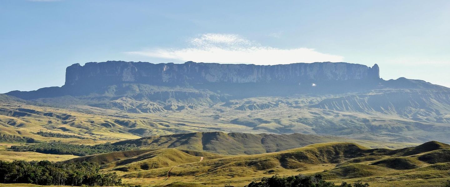


Explore Guyana’s Pakaraima Mountains for tepuis, Kaieteur Falls, Indigenous culture, river journeys and remote highland landscapes.
Read more about Pakaraima Mountains
When is the best time to visit Pakaraima Mountains?
Best: January, September–October · 28°C| Month | High (°C) | Rainfall (mm) |
|---|---|---|
| January (best) | 28 | 100 |
| February | 29 | 100 |
| March | 29 | 100 |
| April | 30 | 100 |
| May | 30 | 100 |
| June | 30 | 100 |
| July | 29 | 100 |
| August | 29 | 100 |
| September (best) | 28 | 100 |
| October (best) | 28 | 100 |
| November | 28 | 100 |
| December | 28 | 100 |
Getting to and around Pakaraima Mountains
How to get there
Transportation
Top city travel guides in Pakaraima Mountains
The cities of Pakaraima Mountains, and the easiest places to base yourself.
-
-


Swipe for more cities
Best attractions in Pakaraima Mountains
The Pakaraima Mountains offer a concentrated selection of highland, river and rainforest attractions rather than a conventional circuit of towns and museums. Kaieteur Falls is the region’s major draw, with the Potaro River making one of the world’s great single-drop waterfalls as it leaves the plateau. The surrounding national park combines rainforest, river scenery, sandstone formations and specialised plants, and can be reached by air or through longer guided journeys. Beyond Kaieteur, visitors may arrange river travel and community-based excursions in the Upper Mazaruni, where forest trails, fishing, village life and upland views provide a more extended encounter with the interior. Mount Ayanganna, one of Guyana’s highest mountains, appeals to experienced trekkers with suitable permissions, guides and logistical support. The wider tepui landscape around Mount Roraima is geologically compelling, but the established summit route is approached from Venezuela, not Guyana. Outdoor activities are weather-dependent and may include hiking, birdwatching, landscape photography, canoeing and cultural interpretation. Facilities are deliberately limited, so attractions are best experienced through responsible operators who understand local access, environmental conditions and community protocols.
-
Museum
Guyana National Museum
Discover the cultural history of Guyana at the National Museum, showcasing artifacts from indigenous peoples to natural history in the heart of Georgetown.
-
Park
Promenade Gardens Guyana
Explore the lush landscapes and serene beauty of Promenade Gardens in Georgetown, Guyana, a perfect escape for nature lovers and tranquility seekers.
-
Monument
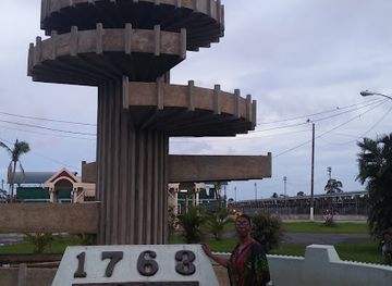
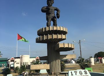
The 1763 Monument
Discover the powerful history behind The 1763 Monument in Georgetown, a tribute to the struggle for freedom and resilience of enslaved Africans in Guyana.
-
 Nature preserve
Iwokrama Forest
Explore the incredible biodiversity and untamed beauty of Iwokrama Forest, a nature preserve in Guyana that invites adventure and discovery in the Amazon rainforest.

Best landmarks in Pakaraima Mountains
Kaieteur Falls is the defining landmark of the Pakaraima region, where the Potaro River drops over a sandstone ledge into the rainforest and creates a powerful visual expression of the Guiana Shield landscape. The falls are important not only for their scale but also for their place in Patamona cultural tradition and Guyana’s national identity. Mount Ayanganna forms another major Guyanese landmark: its broad, elevated summit and surrounding escarpments dominate sections of the western interior and carry strong cultural significance for Indigenous communities. The flat-topped tepuis around the wider Pakaraima system are geological landmarks rather than isolated monuments, their sheer cliffs and unusual vegetation revealing the long history of the ancient plateau. Mount Roraima is visible as part of this regional setting, but its summit lies at the junction of Guyana, Venezuela and Brazil and the established climbing route is accessed from Venezuela. Upper Mazaruni rivers, rapids and sandstone outcrops complete a landmark landscape defined as much by water and elevation as by built structures.
-
Tourist attraction
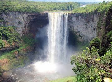
Kaieteur Falls - Guyana
Experience the breathtaking beauty and power of Kaieteur Falls, a natural wonder nestled in the heart of Guyana's lush rainforest.
-
Monument
The 1763 Monument
Discover the 1763 Monument in Georgetown, a historic landmark that celebrates Guyana's rich heritage and the spirit of resilience.
-
Tourist attraction
Iwokrama River Lodge
Discover the enchanting Iwokrama River Lodge, where nature meets adventure in the heart of the Guyanese rainforest.
-
Cultural center
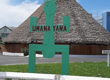
Umana Yana
Discover the cultural heart of Georgetown at Umana Yana, a striking center celebrating Guyana's rich heritage and traditions in a serene riverside setting.
Explore Pakaraima Mountains on the map
Plan your trip on one map. See where the top cities, national parks and sights are, and book hotels and experiences in a few clicks.
Best hotels in Pakaraima Mountains
Best restaurants in Pakaraima Mountains
Dining in the Pakaraima Mountains is centred on lodges, guesthouses, expedition camps and community kitchens rather than a restaurant scene. Meals commonly draw on Guyanese staples such as rice, provisions, vegetables, fish and chicken, with local hosts adapting menus to available supplies and transport conditions. In river communities, freshly caught fish may feature, while cassava, plantain and other starchy foods are important parts of interior cooking. Visitors may encounter pepperpot, metemgee or other dishes associated with Guyana, although recipes and ingredients vary between households and communities. Packaged provisions are often carried in by air or boat, so travellers should tell operators about dietary requirements well before arrival. Eating with a community host can be an important cultural exchange when arranged appropriately; ask before photographing food preparation or entering kitchen areas. There are few opportunities for spontaneous dining, and remote stays should be booked on a full-board or pre-arranged meal basis.
-
American
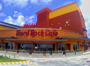
Hard Rock Cafe Guyana
Indulge in classic American flavors at Hard Rock Cafe Guyana while soaking up rock 'n' roll vibes in Georgetown's lively Movie Towne.
-
Indian
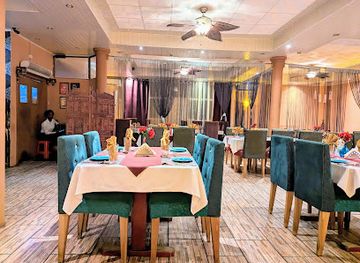
Aagman Indian Restaurant
Discover authentic Indian flavors at Aagman Indian Restaurant in Georgetown - where every meal is a journey through India's rich culinary heritage.
-
Indian
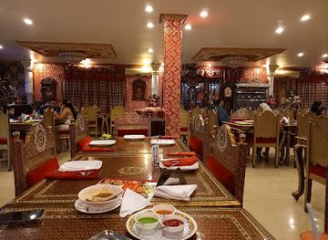
Maharaja Palace Restaurant
Discover the rich flavors of India at Maharaja Palace Restaurant in Georgetown - where tradition meets modern culinary artistry.
-
Asian
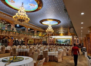
The New Thriving Restaurant
Discover authentic Asian flavors at The New Thriving Restaurant in Georgetown – where every dish tells a story.
Best bars in Pakaraima Mountains
The Pakaraima Mountains do not have a commercial nightlife scene or established nightclub districts. Evening life generally takes place at a lodge, guesthouse, expedition camp or village gathering, with conversation, music and storytelling replacing late-night entertainment. Some accommodation may offer beer, rum or soft drinks, but supplies are limited and alcohol should never be taken on guided river or mountain activities. In Indigenous communities, social occasions follow local arrangements and should not be treated as performances created for visitors. The most memorable evenings are often shaped by the setting: forest sounds, a clear highland sky or discussions with guides about local history and routes. Travellers should keep noise low, respect household routines and confirm whether photography or recording is appropriate. Anyone seeking bars or clubs will find the nearest substantial choices in larger Guyanese towns outside the Pakaraimas, not within the remote mountain settlements.
-
Bar
Rewind Bar and Lounge
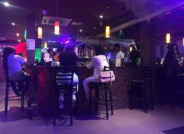
Experience the vibrant nightlife at Rewind Bar and Lounge, a local gem in Vreed En Hoop with excellent drinks and a lively atmosphere.
Best nightclubs in Pakaraima Mountains
The Pakaraima Mountains do not have a commercial nightlife scene or established nightclub districts. Evening life generally takes place at a lodge, guesthouse, expedition camp or village gathering, with conversation, music and storytelling replacing late-night entertainment. Some accommodation may offer beer, rum or soft drinks, but supplies are limited and alcohol should never be taken on guided river or mountain activities. In Indigenous communities, social occasions follow local arrangements and should not be treated as performances created for visitors. The most memorable evenings are often shaped by the setting: forest sounds, a clear highland sky or discussions with guides about local history and routes. Travellers should keep noise low, respect household routines and confirm whether photography or recording is appropriate. Anyone seeking bars or clubs will find the nearest substantial choices in larger Guyanese towns outside the Pakaraimas, not within the remote mountain settlements.
-
Night club
Palm Court
Experience Georgetown's vibrant nightlife at Palm Court, the ultimate night club for dancing, drinks, and entertainment.
-
Club
Montra Restaurant & Lounge
Experience the vibrant nightlife at Montra Restaurant & Lounge in Georgetown, where delicious cuisine and energizing music come together for an unforgettable evening.
-
Night club
Club Red Dragon
Experience the vibrant nightlife at Club Red Dragon, Georgetown's premier night club for music, dancing, and unforgettable memories.
-
Night club
Club Martini Inc
Discover the electrifying nightlife of Georgetown at Club Martini Inc, where dance, music, and good company await every night.


Best shops in Pakaraima Mountains
Shopping in the Pakaraima Mountains is limited and should be viewed as a way to support local communities rather than as a retail activity. Village markets and small shops stock practical necessities, drinks and basic provisions, while lodges may offer locally made crafts or small souvenirs. Depending on the community and season, visitors may find woven items, beadwork, baskets, carvings or products made from locally available fibres, but selection and availability are not guaranteed. Buy directly and respectfully, ask about the maker and materials, and avoid purchasing anything that appears to come from wildlife, archaeological sites or protected plants. Packaged Guyanese food products and practical supplies are easier to obtain in Georgetown or other larger towns before travelling inland. Carry enough cash in Guyanese dollars because card payments are usually unavailable, and remember that limited air baggage allowances can make transporting bulky purchases impractical.
-
Electronics company
Unique Innovations
Discover cutting-edge electronics and innovative appliances at Unique Innovations in Georgetown's Amazonia Mall.

Get your free copy of our complete guide to Pakaraima Mountains, delivered straight to you.
Everything on this page, from attractions and restaurants to essentials and local phrases, in one PDF you can read offline, print or share.
Already have an account? Sign in
Your Pakaraima Mountains guide is ready.
We'll send it to · Not you? Sign out

Getting your guide ready…
We are putting together a fresh copy of the Pakaraima Mountains guide. This can take up to a minute.
This can take a few moments. If your browser asks, choose Allow so the download can start. You'll find the guide in your Downloads folder.
Nothing happened? Download it again
Sorry, the guide is taking longer than usual. Please try again in a minute, or get it by email instead.
Pakaraima Mountains essentials
Currency and Payment
Safety
Emergency Situations
Do's and Don'ts
Local Tips
From Eve
Local phrases worth knowing
You don't need to get them perfect. A few words go a long way, and locals appreciate the effort.
Basics
| English | Local | Say it |
|---|---|---|
| Hello | Bai | [Bye] |
| Goodbye | Sikur | [See-kur] |
| Yes | Ehe | [Eh-he] |
| No | No | [No] |
| Please/You're welcome | Dukuh | [Doo-koh] |
| Thank you | Tenki | [Ten-kee] |
| Excuse me/Sorry | Mek way | [Mek way] |
| How are you? | Ow yu deh? | [Oh you deh?] |
| Fine. And you? | Mi deh good. Ow 'bout yu? | [Me deh good. Oh 'bout you?] |
| Do you speak English? | Yu sabi English? | [You sa-bee English?] |
| I don't understand | Mi no sabi | [Me no sa-bee] |
Eating & Drinking
| English | Local | Say it |
|---|---|---|
| I'd like to see the menu, please | Mi wan see di menu, dukuh | [Me wan see dee menu, doo-koh] |
| I don't eat meat | Mi no eat meat | [Me no eat meat] |
| Cheers! | Cheers! | [Cheers!] |
| I would like to pay, please | Mi wan pay, dukuh | [Me wan pay, doo-koh] |
Emergencies
| English | Local | Say it |
|---|---|---|
| Help! | Help! | [Help!] |
| Go away! | Guh way! | [Guh way!] |
| Call the Police! | Call di Police! | [Call dee Police!] |
| Call a doctor! | Call a doctor! | [Call a doctor!] |
| I'm lost | Mi lost | [Me lost] |
| I'm ill | Mi sick | [Me sick] |
Shopping
| English | Local | Say it |
|---|---|---|
| I'd like to buy... | Mi wan buy... | [Me wan buy...] |
| I'm just looking | Mi jus' a look | [Me jus' a look] |
| How much is it? | Ow much it cost? | [Oh much it cost?] |
| That's too expensive | Dat too much | [Dat too much] |
| Can you lower the price? | Yu can drop di price? | [You can drop dee price?] |
Time & Numbers
| English | Local | Say it |
|---|---|---|
| What time is it? | Ow much time it deh? | [Oh much time it deh?] |
| It's one o'clock | It one o'clock | [It one o'clock] |
| Half past (10) | Half past ten | [Half past ten] |
| Morning | Mornin' | [Mornin'] |
| Afternoon | Afternoon | [Afternoon] |
| Evening | Evenin' | [Evenin'] |
| Yesterday | Yestiday | [Yes-ti-day] |
| Today | Today | [Today] |
| Tomorrow | Tomorrow | [Tomorrow] |
| 1 | Wan | [Wan] |
| 2 | Tu | [Tu] |
| 3 | Tree | [Tree] |
| 4 | Foh | [Foh] |
| 5 | Fai | [Fai] |
| 6 | Sik | [Sik] |
| 7 | Sev'n | [Sev'n] |
| 8 | Eit | [Eit] |
| 9 | Nain | [Nain] |
| 10 | Ten | [Ten] |
Transport & Directions
| English | Local | Say it |
|---|---|---|
| Where's a/the...? | Wheh deh ...? | [Wheh deh ...?] |
| What's the address? | Ow much di address? | [Oh much dee address?] |
| Can you show me (on the map)? | Yu can show me (pon di map)? | [You can show me (pon dee map)?] |
| When's the next (bus)? | Wen di next (bus) deh? | [Wen dee next (bus) deh?] |
| A ticket (to ....) | A ticket (to ...) | [A ticket (to ...)] |
History of Pakaraima Mountains
Ancient Tepui Landscapes and Indigenous Settlement
The Pakaraimas are part of the ancient Guiana Shield, whose sandstone formations date back hundreds of millions of years. Erosion produced the isolated table mountains known as tepuis, while rivers cut deep valleys through the surrounding plateau and forest. Indigenous peoples have inhabited and travelled through this landscape for generations, using detailed knowledge of waterways, plants, hunting grounds and seasonal routes. Akawaio, Patamona and neighbouring communities retain cultural and historical connections with the highlands that long predate European mapping or colonial administration.
European Exploration and the Guiana Interior
European colonisation developed first along Guyana’s coastal rivers, while the interior remained difficult for outsiders to reach. From the eighteenth and nineteenth centuries, missionaries, traders, surveyors and colonial officials increasingly travelled into the highlands along river corridors such as the Essequibo and Potaro. Their maps and reports introduced European audiences to the region’s plateaux, waterfalls and Indigenous communities, although these accounts often misunderstood or overlooked established Indigenous geography and authority.
Kaieteur and the Making of a National Symbol
Kaieteur Falls became internationally known through nineteenth-century exploration and surveying, while Indigenous Patamona traditions associated the falls with Chief Kai and a story of sacrifice. The waterfall’s setting on the Potaro River, where water plunges from the Guiana Shield plateau into rainforest, helped make it a defining symbol of Guyana’s natural heritage. The surrounding area was later protected as Kaieteur National Park, reinforcing the falls’ importance for conservation, national identity and carefully managed tourism.
Colonial Boundaries and the Western Highlands
The western highlands were affected by the long-running boundary dispute between British Guiana and Venezuela. The 1899 arbitral decision placed most of the territory administered by British Guiana, including the Guyanese side of the Pakaraima country, within the colony, but Venezuela continued to contest the settlement. Guyana’s present western boundary is therefore part of a wider political history that visitors should understand when viewing the tri-border landscape around Mount Roraima.
Mission Stations, Airstrips and Interior Administration
During the twentieth century, missions, government stations, trading posts and later airstrips became important links between coastal Guyana and communities in the interior. In the Upper Mazaruni, settlements such as Kamarang, Jawalla, Kako and Waramadong developed as centres for education, administration, commerce and regional travel. Aircraft transformed access to places that could otherwise require lengthy river journeys, while rivers and footpaths remained essential for connecting villages beyond the limited road network.
Indigenous Rights and Community-led Development
Modern history in the Pakaraimas has been shaped by growing recognition of Indigenous land rights, local governance and the need to balance development with environmental protection. Guyana’s Amerindian land rights framework and village councils have influenced how communities manage resources, receive visitors and participate in tourism. Contemporary travel is consequently best understood not simply as wilderness exploration, but as movement through inhabited cultural landscapes where local consent, benefit-sharing and respect for community decisions are important.
Conservation and Contemporary Tourism
The highlands have become increasingly important to Guyana’s conservation strategy and its nature-based tourism economy. Kaieteur National Park protects a major section of the Potaro landscape, while community-based initiatives provide access to river journeys, forest experiences and cultural interpretation elsewhere. Tourism remains selective because of distance, limited infrastructure and weather dependence. This relative remoteness helps preserve the region’s character, but also places responsibility on visitors and operators to minimise waste, respect local rules and avoid treating fragile upland environments as recreational commodities.
Pakaraima Mountains in Photos
Browse through our photo collection highlighting the charm and character of the destination.
Neighbouring regions of Pakaraima Mountains
The closest regions to Pakaraima Mountains, if you have time for more than one.
-

-

-

-

-


Swipe for more regions
Explore more

Explore more of Guyana
Discover Guyana, where the Amazon Rainforest meets Caribbean charm, offering everything from stunning waterfalls to vibrant cities and rich cultural experiences.
Explore Guyana