

Free Missouri River Valley Travel Guide & Mobile App
Explore Missouri River Valley with free travel guides. Discover regional history, expert tips, proposed trips, and audio guides on web or mobile app.


Explore Iowa’s Missouri River Valley for Loess Hills trails, river history, wildlife, scenic drives and welcoming western Iowa communities.
Read more about Missouri River Valley
When is the best time to visit Missouri River Valley?
Best: May, August–September · 24–30°C| Month | High (°C) | Rainfall (mm) |
|---|---|---|
| January | 2 | 25 |
| February | 4 | 28 |
| March | 11 | 46 |
| April | 18 | 70 |
| May (best) | 24 | 105 |
| June | 29 | 110 |
| July | 31 | 95 |
| August (best) | 30 | 90 |
| September (best) | 25 | 80 |
| October | 17 | 60 |
| November | 10 | 45 |
| December | 4 | 30 |
Getting to and around Missouri River Valley
How to get there
Transportation
Top city travel guides in Missouri River Valley
The cities of Missouri River Valley, and the easiest places to base yourself.

Swipe for more cities
Destinations in Missouri River Valley
Resorts, valleys and scenic spots worth a trip of their own.
Swipe for more destinations
Best attractions in Missouri River Valley
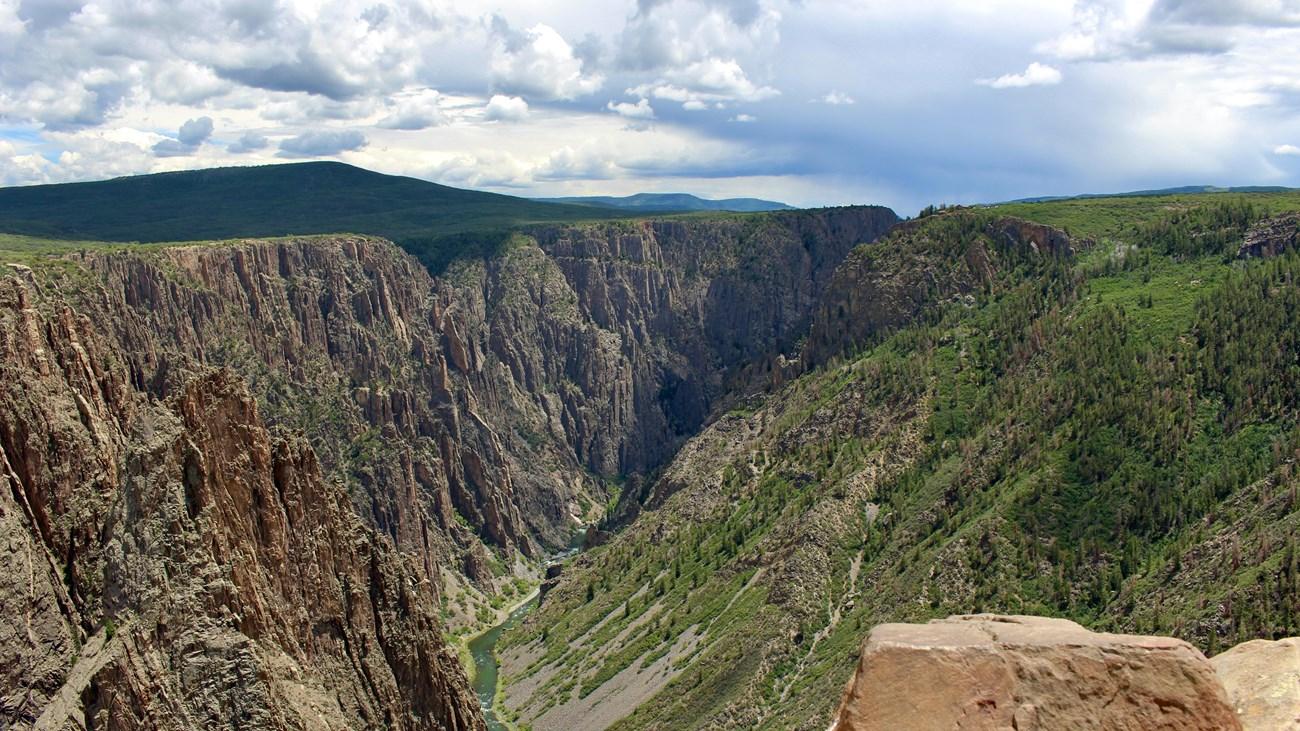
The Missouri River Valley’s attractions combine landscape, history and small-city culture. Around Council Bluffs, the Lewis and Clark Monument Scenic Overlook provides broad views towards the river and Nebraska, while the Union Pacific Railroad Museum explains the railway forces that shaped the city. The Loess Hills begin nearby, with hiking and nature interpretation at Hitchcock Nature Center and in Loess Hills State Forest. Farther north, rural communities and river-bottom roads lead towards the wetlands, prairies and woodland habitats associated with the Missouri corridor. Sioux City provides the region’s strongest concentration of museums and public interpretation, including the Sioux City Public Museum and the Sergeant Floyd River Museum and Welcome Center. Outdoor visitors can walk, cycle, watch birds and explore changing floodplain habitats, while history enthusiasts can follow themes of Indigenous life, exploration, migration, railways and agriculture. The most rewarding itinerary alternates between elevated Loess Hills viewpoints and the broad, engineered river landscape below.
-
Brewery
Thunderhead Brewing Taproom
Experience the best of Omaha's craft beer scene at Thunderhead Brewing Taproom, where quality brews meet a vibrant atmosphere.
-
Night club
Parliament Pub
Discover the vibrant nightlife at Parliament Pub in West Omaha, a perfect spot for refreshing drinks, live music, and a lively social atmosphere.
-
Tourist attraction
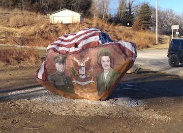
Missouri Valley Freedom Rock
Experience the Missouri Valley Freedom Rock, a vibrant tribute to veterans showcasing stunning murals and heartfelt stories of heroism.


Best landmarks in Missouri River Valley
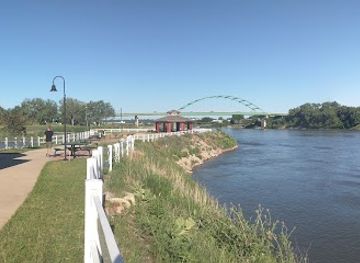
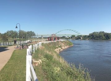
The Missouri River itself is the region’s defining geographical landmark, forming Iowa’s western boundary and explaining the location of its towns, transport routes and flood-control works. In Council Bluffs, the Lewis and Clark Monument Scenic Overlook occupies a prominent position above the valley and links the modern landscape with the 1804 expedition. The city’s Union Pacific Railroad Museum is a landmark of interpretation rather than monumental architecture, documenting the railway connection that helped make Council Bluffs a western gateway. Near Sioux City, the Sergeant Floyd Monument rises above the river and commemorates Sergeant Charles Floyd, the only member of the Lewis and Clark Expedition to die during the journey. The Loess Hills are the valley’s most distinctive natural landmark: narrow, steep ridges formed from windblown silt and found in an especially prominent belt along western Iowa. Together, river, bluffs, monuments and railway heritage give the region a recognisable visual and historical identity.
-
Monument
Sergeant Floyd Monument
Explore the historic Sergeant Floyd Monument, a tribute to the Lewis and Clark expedition with stunning river views in Sioux City, Iowa.
-
Historical landmark
Missouri River Trail Marker
Explore the Missouri River Trail Marker, a captivating historical landmark in Sioux City, Iowa, showcasing the region's rich heritage and scenic beauty.
-
Historical landmark
Town of Dumfries Historical Marker
Explore the Town of Dumfries Historical Marker in Council Bluffs, Iowa - a place where history and heritage come alive in a tranquil setting.


Explore Missouri River Valley on the map
Plan your trip on one map. See where the top cities, national parks and sights are, and book hotels and experiences in a few clicks.
Best hotels in Missouri River Valley
Best restaurants in Missouri River Valley
Dining in Iowa’s Missouri River Valley is rooted in the practical food culture of the Midwest, with family restaurants, diners, cafés, bakeries, pubs and locally oriented contemporary eateries concentrated in Council Bluffs and Sioux City. Menus commonly draw on beef, pork, burgers, sandwiches, fried foods, seasonal vegetables and baked goods, reflecting the surrounding agricultural economy rather than a narrowly defined regional cuisine. Farmers’ markets and farm shops can provide seasonal produce, while breweries and casual restaurants offer a more modern interpretation of western Iowa dining. Council Bluffs benefits from its links with the larger Omaha area, although Omaha restaurants are across the state line and should not be presented as Iowa destinations. In smaller communities, opening days and evening service can be limited, so planning ahead is sensible. Tipping for table service follows United States practice, and sales tax is normally added to displayed prices.
-
New American
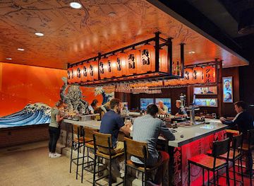
CRAVE American Kitchen & Sushi Bar (Hilton Garden Inn - Sioux City)
Experience exquisite New American cuisine and sushi at CRAVE American Kitchen & Sushi Bar with stunning river views in Sioux City.
-
Sushi
Blue Sushi Sake Grill
Experience the best of sushi culture at Blue Sushi Sake Grill in Downtown Des Moines - where tradition meets innovation.
Best bars in Missouri River Valley
Evening life is centred on traditional pubs, bars, breweries, restaurants and live entertainment rather than a large, region-wide nightclub scene. Council Bluffs has the broadest access to casual bars and evening venues because of its proximity to the Omaha metropolitan area, while Sioux City provides a substantial local choice of pubs, music-oriented venues and restaurants. Smaller Missouri River Valley communities generally become quiet earlier, with social life focused on local taverns, community events and dining rather than late-night clubs. Visitors should distinguish Iowa venues from those across the river in Nebraska, particularly when planning taxis or accommodation. Craft beer and relaxed evening meals are more representative of the region than an intensive party circuit, and current opening arrangements can vary by day and season.
-
New American
CRAVE American Kitchen & Sushi Bar (Hilton Garden Inn - Sioux City)
Experience a delightful fusion of New American cuisine and sushi at CRAVE American Kitchen & Sushi Bar in Sioux City, where ambiance meets exquisite flavors.
-
Restaurant
Applebee's Grill + Bar
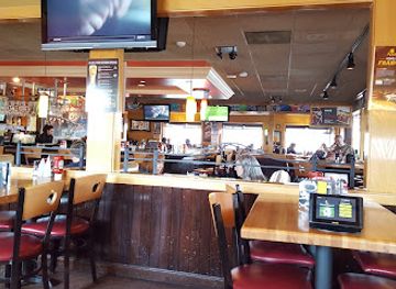
Experience the flavors of America at Applebee's Grill + Bar, your go-to spot for family dining in Waterloo, Iowa.
-
Grill
The River Tap
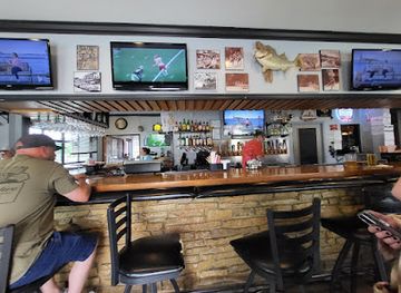
Discover the charm of The River Tap, where delicious grilled cuisine meets the serene beauty of Iowa Falls, perfect for families and friends.
Best nightclubs in Missouri River Valley
-
Bar
Andrew's Lounge
Experience the vibrant atmosphere and friendly service at Andrew's Lounge, the go-to bar in Council Bluffs for locals and tourists alike.
-
Bar
Hard Luck Saloon
Discover the lively atmosphere of Hard Luck Saloon, a top bar in Council Bluffs, Iowa, known for live music, great drinks, and unforgettable experiences.
-
Bar
Street Side Lounge
Discover the vibrant nightlife at Street Side Lounge in Council Bluffs, offering a welcoming atmosphere, extensive drink menu, and friendly locals.
-
Lounge
DUSTY'S LOUNGE
Experience the vibrant nightlife at Dusty's Lounge in Council Bluffs, where great drinks and a welcoming atmosphere await.


Best shops in Missouri River Valley
-
Department store
Walmart Supercenter
Discover Walmart Supercenter in Council Bluffs for all your shopping needs—from groceries to electronics, at unbeatable prices.
-
Shopping mall
Metro Crossing Shopping Center
Explore the diverse retail and dining options at Metro Crossing Shopping Center, Council Bluffs' premier shopping destination for tourists and locals.
-
Sporting goods store
Bass Pro Shops
Discover the ultimate outdoor experience at Bass Pro Shops in Council Bluffs, your gateway to fishing, hunting, camping, and adventure gear.
-
Candy store
Hollywood Candy
Experience the sweetness of Hollywood Candy in Omaha, NE, where nostalgia meets deliciousness in a vibrant candy wonderland.


Get your free copy of our complete guide to Missouri River Valley, delivered straight to you.
Everything on this page, from attractions and restaurants to essentials and local phrases, in one PDF you can read offline, print or share.
Already have an account? Sign in
Your Missouri River Valley guide is ready.
We'll send it to · Not you? Sign out

Getting your guide ready…
We are putting together a fresh copy of the Missouri River Valley guide. This can take up to a minute.
This can take a few moments. If your browser asks, choose Allow so the download can start. You'll find the guide in your Downloads folder.
Nothing happened? Download it again
Sorry, the guide is taking longer than usual. Please try again in a minute, or get it by email instead.
Missouri River Valley essentials
Currency and Payment
Safety
Emergency Situations
Do's and Don'ts
Local Tips
From Eve
Local phrases worth knowing
You don't need to get them perfect. A few words go a long way, and locals appreciate the effort.
Basics
| English | Local | Say it |
|---|---|---|
| Hello | Howdy | [Ha-dee] |
| Goodbye | See you later | [See ya lay-ter] |
| Yes | Yep | [Yep] |
| No | Nope | [Nope] |
| Please/You're welcome | Please/No problem | [Pleez/No prob-lem] |
| Thank you | Thanks a lot | [Thanks uh lot] |
| Excuse me/Sorry | Excuse me/Sorry 'bout that | [Ex-cuse me/Sor-ree 'bout that] |
| How are you? | How ya doin'? | [How ya doin'?] |
| Fine. And you? | Good. You? | [Good. You?] |
| Do you speak English? | Do ya speak English? | [Do ya speak English?] |
| I don't understand | I ain't followin' | [I ain't follow-in'] |
Eating & Drinking
| English | Local | Say it |
|---|---|---|
| I'd like to see the menu, please | Could I see the menu, please? | [Could I see the men-yoo, pleez?] |
| I don't eat meat | I ain't eatin' meat | [I ain't eatin' meat] |
| Cheers! | Cheers! | [Cheers!] |
| I would like to pay, please | I'd like to settle up, please | [I'd like to set-tle up, pleez] |
Emergencies
| English | Local | Say it |
|---|---|---|
| Help! | Help! | [Help!] |
| Go away! | Leave me alone! | [Leave me a-lone!] |
| Call the Police! | Call the cops! | [Call the cops!] |
| Call a doctor! | Get a doctor over here! | [Get a doc-tor over here!] |
| I'm lost | I’m lost | [I’m lost] |
| I'm ill | I ain't feelin' well | [I ain't feelin' well] |
Shopping
| English | Local | Say it |
|---|---|---|
| I'd like to buy... | I wanna buy... | [I wanna buy...] |
| I'm just looking | Just browsin' | [Just browsin'] |
| How much is it? | How much's this? | [How much's this?] |
| That's too expensive | That's a bit pricey | [That's a bit pry-see] |
| Can you lower the price? | Can ya bring the price down? | [Can ya bring the pryce down?] |
Time & Numbers
| English | Local | Say it |
|---|---|---|
| What time is it? | What time's it? | [What time's it?] |
| It's one o'clock | It's one o'clock | [It's one o'clock] |
| Half past (10) | Half past ten | [Half past ten] |
| Morning | Mornin' | [Mornin'] |
| Afternoon | Afternoon | [Af-ter-noon] |
| Evening | Evenin' | [E-ve-ning] |
| Yesterday | Yesterday | [Yes-ter-day] |
| Today | Today | [To-day] |
| Tomorrow | Tomorrow | [To-morrow] |
| 1 | One | [One] |
| 2 | Two | [Two] |
| 3 | Three | [Three] |
| 4 | Four | [Four] |
| 5 | Five | [Five] |
| 6 | Six | [Six] |
| 7 | Seven | [Seven] |
| 8 | Eight | [Eight] |
| 9 | Nine | [Nine] |
| 10 | Ten | [Ten] |
Transport & Directions
| English | Local | Say it |
|---|---|---|
| Where's a/the...? | Where's the...? | [Where's the...?] |
| What's the address? | What's the address? | [What's the ad-dress?] |
| Can you show me (on the map)? | Can ya point it out for me? | [Can ya point it out for me?] |
| When's the next (bus)? | When’s the next bus? | [When’s the next bus?] |
| A ticket (to ....) | A ticket to... | [A ticket to...] |
History of Missouri River Valley
Indigenous Missouri River Cultures
The Missouri River valley has been used and inhabited by Indigenous peoples for many centuries. Its water, floodplain, wildlife and defensible bluffs supported travel, trade and seasonal settlement, while the surrounding prairies provided access to game and plant resources. The Omaha, Ponca, Otoe-Missouria and other peoples have important historical connections with the wider Missouri basin. European-American settlement later transformed the valley, but Indigenous histories remain essential to understanding the landscape and should not be reduced to a prelude to later exploration.
Lewis and Clark Expedition, 1804
The Corps of Discovery travelled up the Missouri River in 1804 after leaving the St Louis area, passing through the western Iowa landscape on its way towards the northern Plains. The expedition’s journals recorded geography, wildlife and encounters with Native nations, although the journey took place within an already occupied and politically complex Indigenous world. Interpretive sites around Council Bluffs and the southern valley commemorate this episode, while the river corridor itself remains the principal geographical key to understanding the expedition’s route.
Trails, Steamboats and Early Settlement
During the nineteenth century, the river became a major route for migration, commerce and communication. Council Bluffs developed as an important crossing and outfitting point for travellers heading west, while ferries and steamboats connected settlements along the valley. The surrounding prairie was progressively surveyed, farmed and incorporated into the expanding American state. Towns such as Council Bluffs and Sioux City grew where river access, overland routes and later rail connections met.
Railways and the Transcontinental Connection
Railway development transformed the Missouri River crossing and strengthened western Iowa’s role as a transportation corridor. Council Bluffs became closely associated with the Union Pacific’s eastern connection for the first transcontinental railway, while Sioux City developed as a significant rail and commercial centre farther north. Railways brought migrants, manufactured goods and agricultural markets, accelerating urban growth and reshaping the relationship between river towns and the surrounding countryside.
Agriculture and Industrial River Towns
From the late nineteenth century into the twentieth, the valley’s economy combined farming, grain handling, livestock activity, food processing, rail transport and river commerce. Floodplain soils supported intensive agriculture, while the bluffs influenced settlement, roads and land use. Sioux City became particularly important for meatpacking and regional trade, and Council Bluffs grew as part of the wider Omaha economic area. Industrial change has altered employment patterns, but agriculture and logistics remain visible forces in the region.
Flood Control and River Restoration
The Missouri River has always been both a transport route and a source of flood risk. Major floods, especially those of the twentieth and early twenty-first centuries, prompted extensive levee construction, channel alteration and floodplain management. These interventions protected communities and farmland but also changed wetlands and wildlife habitat. Contemporary conservation work in the valley increasingly combines flood protection with restoration of wooded river margins, prairies and wetlands, creating new opportunities for birdwatching and environmental education.
Missouri River Valley in Photos
Browse through our photo collection highlighting the charm and character of the destination.
Neighbouring regions of Missouri River Valley
The closest regions to Missouri River Valley, if you have time for more than one.
-
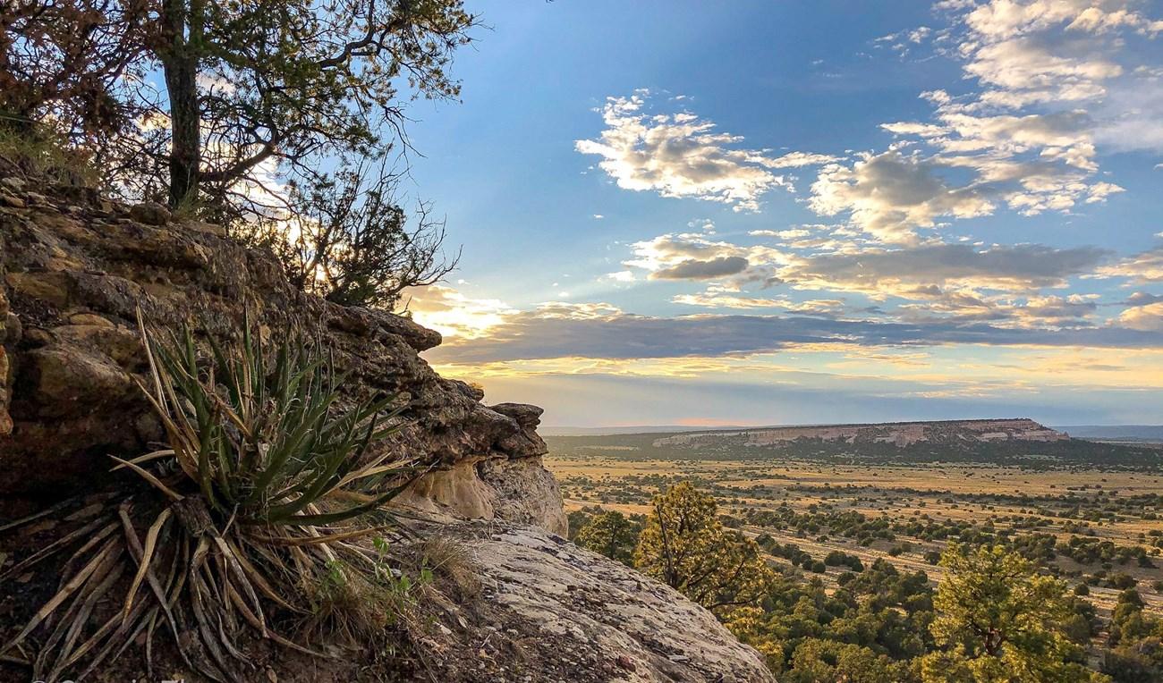 Loess Hills
Discover the rare and enchanting Loess Hills of Iowa, a natural wonder offering breathtaking landscapes, diverse wildlife, and rich cultural history.
-

-

-
-


Swipe for more regions
Explore more

Explore more of Iowa
Explore Iowa: The American Heartland with its blend of rural charm, vibrant cities, rich cultural experiences, and natural beauty, perfect for nature lovers and cultural enthusiasts.
Explore Iowa