

Ring of Kerry Travel Guide - Free Web & App
Your ultimate guide to Ring of Kerry. Discover top landmarks, proposed trips, and local tips. Free on the web or via the Evendo companion app.


Ring of Kerry, Ireland, combines scenic coastal roads, Killarney landscapes, Atlantic villages, hiking, island heritage and unforgettable views.
Coastal Roads and Mountain Landscapes
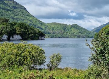
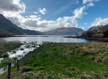
The Ring of Kerry is the popular touring route around the Iveragh Peninsula in south-west Ireland, combining Atlantic coastline, mountain passes, glacial lakes, wooded valleys and traditional settlements. Most visitors begin in Killarney, where the route connects with Killarney National Park before continuing west through towns and villages including Killorglin, Glenbeigh, Cahersiveen, Waterville, Sneem and Kenmare. The route is not a single attraction but a broad landscape of linked experiences, and its character changes markedly between the wooded shores of the Lakes of Killarney, the open uplands around Moll's Gap and the exposed coast facing the Atlantic.Read more about Ring of Kerry
Heritage on the Iveragh Peninsula
Exploring the Route
When is the best time to visit Ring of Kerry?
Best: June–August · 20–22°C| Month | High (°C) | Rainfall (mm) |
|---|---|---|
| January | 11 | 100 |
| February | 10 | 90 |
| March | 12 | 80 |
| April | 14 | 70 |
| May | 16 | 60 |
| June (best) | 20 | 50 |
| July (best) | 22 | 50 |
| August (best) | 21 | 60 |
| September | 19 | 70 |
| October | 15 | 80 |
| November | 13 | 90 |
| December | 11 | 100 |
Getting to and around Ring of Kerry
How to get there
Transportation
Best attractions in Ring of Kerry
The Ring of Kerry's attractions are spread across the Iveragh Peninsula rather than concentrated in one centre. Killarney National Park introduces visitors to the Lakes of Killarney, Muckross House, Torc Waterfall and wooded routes beneath the MacGillycuddy's Reeks. Westwards, Killorglin and Glenbeigh lead towards Rossbeigh Strand and the mountain scenery of the Killarney-to-Kenmare road, while Cahersiveen provides access to Cahergall Stone Fort, Leacanabuaile and the coast. Waterville is associated with the Atlantic shore and views towards the Skellig Islands, and nearby Valentia Island combines coastal scenery with heritage attractions. The Skellig Ring adds dramatic roads and viewpoints around Portmagee, Ballinskelligs and St Finan's Bay. Kenmare, at the peninsula's south-eastern gateway, offers an attractive base for exploring the coast, uplands and nearby Beara landscapes without being part of the Ring's central circuit.
-
 Tourist attraction
Bantry House
Experience the elegance of Bantry House, a historical landmark in Co. Cork, surrounded by stunning gardens and breathtaking views of Bantry Bay.
-
Racecourse
Killarney Racecourse & Ross Golf Course
Discover the excitement of horse racing and the beauty of golf at Killarney Racecourse & Ross Golf Course, a premier destination in County Kerry.
-
Tourist attraction
Falconry Kerry (in Killarney)
Discover the art of falconry amidst Killarney's stunning landscapes at Falconry Kerry, a unique heritage experience in Ireland.
-
Tourist attraction
Sneem Sculpture Trail
Explore the Sneem Sculpture Trail, where art meets nature in the heart of Co. Kerry, offering breathtaking views and inspiring sculptures.


Best landmarks in Ring of Kerry
The natural landmarks of the Ring of Kerry are defined by the Iveragh Peninsula's Atlantic edge and mountainous interior. The Lakes of Killarney, surrounded by wooded slopes and peaks, form the scenic core of the eastern section, while Moll's Gap and the road towards Kenmare reveal the upland character of the route. On the west coast, Valentia Island, Bray Head and the Skellig Islands give the landscape a distinctly maritime identity; Skellig Michael is also an important early Christian monument and UNESCO World Heritage property, reached by boat rather than road. Cahergall Stone Fort and Leacanabuaile preserve evidence of earlier settlement near Cahersiveen, while Ballycarbery Castle stands as a weathered reminder of the peninsula's Gaelic and medieval past. Rossbeigh Strand, Ballinskelligs Bay and the cliffs and headlands around the Skellig Ring complete the landmark landscape.
-
National park
Killarney National Park
Discover Killarney National Park, a stunning natural wonder in County Kerry, brimming with breathtaking landscapes, rich wildlife, and historic charm.
-
Museum
Muckross House
Explore Muckross House, a historic Victorian mansion surrounded by stunning gardens in Killarney National Park, Ireland's natural gem.
-
Castle
Ross Castle
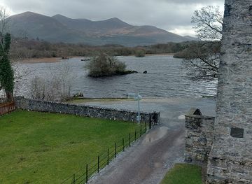
Explore Ross Castle, a stunning 15th-century fortress in Killarney National Park, where history and breathtaking scenery merge seamlessly.
-
Tourist attraction
Torc Waterfall
Explore the enchanting Torc Waterfall in Killarney National Park, a breathtaking natural wonder surrounded by lush landscapes and serene trails.

Explore Ring of Kerry on the map
Plan your trip on one map. See where the top attractions, landmarks, restaurants and hotels are, and book hotels and experiences in a few clicks.
Best hotels in Ring of Kerry
Best restaurants in Ring of Kerry
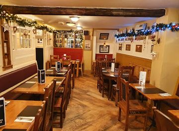
Dining around the Ring of Kerry is concentrated in gateway towns and villages rather than at every viewpoint or rural hamlet. Killarney, Kenmare, Cahersiveen, Waterville, Killorglin and Sneem provide the broadest choice of restaurants, cafés, bakeries, hotel dining rooms and traditional pubs, while smaller communities may have limited options outside the main season. Menus commonly reflect Ireland's west-coast setting through local fish and shellfish, Irish beef and lamb, farmhouse cheeses, breads and seasonal produce, although the exact offer varies by establishment. Seafood is particularly associated with coastal settlements, while cafés and village shops are useful for provisions before a long drive or walk. Farm shops, delis and food producers can provide regional goods, but visitors should check opening arrangements rather than assume that every rural stop operates daily.
-
Gastropub
Porterhouse Restaurant
Experience the best of Irish cuisine at The Porterhouse Restaurant in Killarney - where local flavors meet a warm gastropub atmosphere.
-
Restaurant
Cronins Restaurant
Discover the authentic flavors of Ireland at Cronins Restaurant in Killarney - where local ingredients meet warm hospitality.
-
Restaurant
The Lobster Bar & Restaurant
Experience fresh and flavorful seafood at The Lobster Bar & Restaurant in scenic Waterville, Co. Kerry – a true taste of Ireland's coastal cuisine.
-
Restaurant
O'Carroll's Cove Restaurant & Bar
Experience exceptional dining at O'Carroll's Cove Restaurant & Bar on the breathtaking Ring of Kerry – where culinary delights meet stunning coastal views.


Best bars in Ring of Kerry
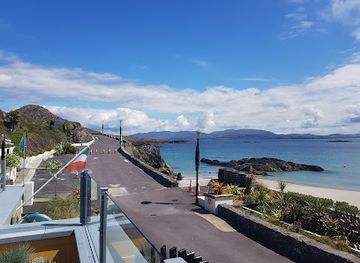
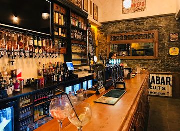
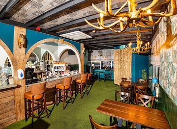
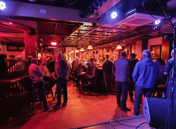
The Ring of Kerry is known for quiet evenings and traditional hospitality rather than a concentrated club scene. Killarney has the widest choice of pubs and evening venues, including establishments associated with Irish music, while Kenmare, Killorglin, Cahersiveen, Waterville and Sneem offer smaller selections of pubs and hotel bars where local residents and visitors gather. Live music may form part of the atmosphere in some traditional pubs, but performances and opening arrangements are not uniform. In remote coastal and mountain areas, evening entertainment is more likely to mean a meal, conversation, a sunset walk where conditions permit or a quiet drink near an accommodation base. Visitors travelling the full circuit should plan ahead, as villages are separated by rural roads and late transport options are limited.
-
Pub
J.M. Reidy's
Discover J.M. Reidy's in Killarney: A must-visit pub blending traditional Irish charm with a vibrant dining experience.
-
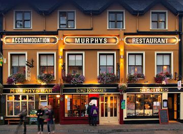
Bar
Murphys Bar, Restaurant & Townhouse Killarney
Discover the heart of Killarney at Murphys Bar, a charming spot for authentic Irish food, drinks, and unforgettable experiences.
-
Breakfast
The Shire Bar & Cafe
Experience the perfect blend of breakfast delights and vibrant nightlife at The Shire Bar & Cafe in Killarney, where every meal is a celebration.
-
Irish pub
Danny Mann Pub
Danny Mann Pub in Killarney offers an authentic Irish experience with delicious food, refreshing drinks, and live music in a charming atmosphere.

Best nightclubs in Ring of Kerry
The Ring of Kerry is known for quiet evenings and traditional hospitality rather than a concentrated club scene. Killarney has the widest choice of pubs and evening venues, including establishments associated with Irish music, while Kenmare, Killorglin, Cahersiveen, Waterville and Sneem offer smaller selections of pubs and hotel bars where local residents and visitors gather. Live music may form part of the atmosphere in some traditional pubs, but performances and opening arrangements are not uniform. In remote coastal and mountain areas, evening entertainment is more likely to mean a meal, conversation, a sunset walk where conditions permit or a quiet drink near an accommodation base. Visitors travelling the full circuit should plan ahead, as villages are separated by rural roads and late transport options are limited.
-
Breakfast
The Shire Bar & Cafe
Explore The Shire Bar & Cafe in Killarney for a delightful fusion of breakfast, lunch, and live entertainment in a cozy atmosphere.
-
Pub
The Killarney Grand
Experience the vibrant heart of Killarney nightlife at The Killarney Grand, a lively pub offering great food, drinks, and entertainment.
-
Bar
Courtney's Bar
Discover the lively spirit of Killarney at Courtney's Bar, where great drinks, live music, and friendly faces await you.
-
Irish pub
Speakeasy Bar
Discover Killarney's vibrant nightlife at Speakeasy Bar, where authentic Irish charm meets contemporary culture.



Best shops in Ring of Kerry
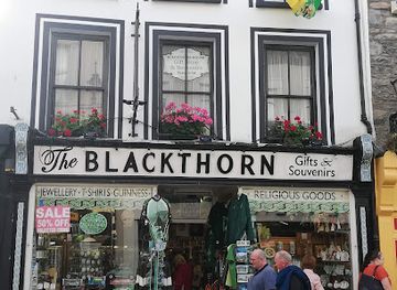
Shopping on the Ring of Kerry is modest and locally focused, with the greatest concentration in Killarney, Kenmare, Cahersiveen and other larger villages. Visitors can find Irish knitwear, woollen goods, pottery, paintings, books, jewellery and craft products, although the range and provenance of items vary between businesses. Food shops, bakeries, delis, farm shops and village stores are useful for picnic supplies, local cheeses, breads and other regional produce before travelling into the more sparsely settled parts of the peninsula. Kenmare and Killarney have the broadest general retail choices, while smaller villages provide practical provisions rather than extensive shopping districts. Markets and craft events may be seasonal or occasional, so they should be treated as local happenings rather than permanent features of the route.
-
Gift shop
Ladies' View Gift Store Cafe Bar & Roof Terrace
Experience the best of shopping and dining at Ladies' View Gift Store Café Bar & Roof Terrace, where stunning views meet local charm in Killarney.
-
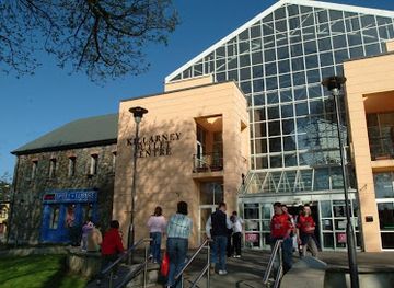
Shopping mall
Killarney Outlet Centre
Explore the Killarney Outlet Centre for a unique shopping experience with diverse brands and delightful cafes in the heart of Killarney.
-
Gift shop
Avoca Molls Gap Shop & Café
Experience the perfect blend of shopping and dining at Avoca Molls Gap Shop & Café, a must-visit in the scenic Ring of Kerry.
-
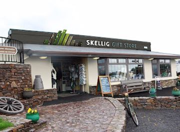
Gift shop
Skellig Gift Store
Discover authentic Irish crafts and unique souvenirs at Skellig Gift Store, your gateway to the essence of Co. Kerry's rich heritage.

Get your free copy of our complete guide to Ring of Kerry, delivered straight to you.
Everything on this page, from attractions and restaurants to essentials and local phrases, in one PDF you can read offline, print or share.
Already have an account? Sign in
Your Ring of Kerry guide is ready.
We'll send it to · Not you? Sign out

Getting your guide ready…
We are putting together a fresh copy of the Ring of Kerry guide. This can take up to a minute.
This can take a few moments. If your browser asks, choose Allow so the download can start. You'll find the guide in your Downloads folder.
Nothing happened? Download it again
Sorry, the guide is taking longer than usual. Please try again in a minute, or get it by email instead.
Ring of Kerry essentials
Currency and Payment
Safety
Emergency Situations
Do's and Don'ts
Local Tips
From Eve
Local phrases worth knowing
You don't need to get them perfect. A few words go a long way, and locals appreciate the effort.
Basics
| English | Local | Say it |
|---|---|---|
| Hello | Dia duit | [dee-uh gwitch] |
| Goodbye | Slán | [slawn] |
| Yes | Tá | [taw] |
| No | Níl | [neel] |
| Please/You're welcome | Le do thoil | [leh duh hull] |
| Thank you | Go raibh maith agat | [guh rev mah agut] |
| Excuse me/Sorry | Tá brón orm | [taw broan orum] |
| How are you? | Conas atá tú? | [kun-us ah-taw too] |
| Fine. And you? | Tá mé go maith. Agus tú? | [taw may goh mah. ah-gus too] |
| Do you speak English? | An labhraíonn tú Béarla? | [ahn low-reen too bayr-la] |
| I don't understand | Ní thuigim | [nee hoo-ig-im] |
Eating & Drinking
| English | Local | Say it |
|---|---|---|
| I'd like to see the menu, please | Ba mhaith liom an billeog a fheiceáil, le do thoil | [bah wah lum on bill-ohg ah eck-ayl, leh duh hull] |
| I don't eat meat | Ní ithim feoil | [nee ih-him foh-il] |
| Cheers! | Sláinte! | [slawn-cheh] |
| I would like to pay, please | Ba mhaith liom íoc, le do thoil | [bah wah lum eek, leh duh hull] |
Emergencies
| English | Local | Say it |
|---|---|---|
| Help! | Cabhair! | [cah-ver] |
| Go away! | Imigh uaim! | [im-ee oom] |
| Call the Police! | Glan na Gardaí! | [glahn nah gar-dee] |
| Call a doctor! | Glan dochtúir! | [glahn dohk-too-ir] |
| I'm lost | Tá mé caillte | [taw may kyle-teh] |
| I'm ill | Tá mé tinn | [taw may chin] |
Shopping
| English | Local | Say it |
|---|---|---|
| I'd like to buy... | Ba mhaith liom ceannach... | [bah wah lum kay-nukh] |
| I'm just looking | Táim ag féachaint amach | [tawm egg fay-ah-kint ah-mock] |
| How much is it? | Cé mhéad atá air? | [kay vayd ah-taw air] |
| That's too expensive | Tá sé sin ró-dhaor | [taw shay shin row-yuhr] |
| Can you lower the price? | An féidir leat an praghas a laghdú? | [ahn fay-dur lat on prah-guhs ah lay-goo] |
Time & Numbers
| English | Local | Say it |
|---|---|---|
| What time is it? | Cén t-am é? | [kayn tahm ay] |
| It's one o'clock | Tá sé a haon a chlog | [taw shay ah hayn ah khlog] |
| Half past (10) | Leathuair tar éis a deich | [lah-hoo-ir tar es ah deh] |
| Morning | Madraí | [muh-dree] |
| Afternoon | Tráthnóna | [traw-noh-nuh] |
| Evening | Tráthnóna | [traw-noh-nuh] |
| Yesterday | Inné | [in-yay] |
| Today | Inniu | [in-yoo] |
| Tomorrow | Amárach | [ah-maw-rukh] |
| 1 | A haon | [ah hayn] |
| 2 | Dó | [doh] |
| 3 | Trí | [tree] |
| 4 | Ceathair | [cah-her] |
| 5 | Cúig | [koo-ig] |
| 6 | Sé | [shay] |
| 7 | Seacht | [shockt] |
| 8 | Ocht | [ukht] |
| 9 | Naoi | [nee] |
| 10 | Deich | [deh] |
Transport & Directions
| English | Local | Say it |
|---|---|---|
| Where's a/the...? | Cá bhfuil an...? | [kah wil on] |
| What's the address? | Cad é an seoladh? | [kahd ay on shoh-luh] |
| Can you show me (on the map)? | An féidir leat é a thaispeáint (ar an léarscáil)? | [ahn fay-dur lat ay ah hash-paynt (er ahn layr-skawl)] |
| When's the next (bus)? | Cén uair an chéad (bus) eile? | [kayn oo-ir on khayd (bus) el-eh] |
| A ticket (to ....) | Ticéad (go dtí ....) | [tick-ayd (guh dee)] |
History of Ring of Kerry
A Peninsula Shaped by Ice and Sea
The mountains, valleys and loughs of the Iveragh Peninsula were strongly influenced by geological processes and later glaciation. Ice carved many of the rounded valleys and lake basins associated with Killarney, while the Atlantic continued to work on the peninsula's exposed headlands, coves and islands. The resulting relief shaped settlement, farming and transport: communities developed in more sheltered valleys and coastal lowlands, while upland areas remained sparsely populated and were used largely for grazing. This geological and climatic setting still explains the sharp contrast between the wooded interior, high mountain passes and open Atlantic shore encountered along the Ring of Kerry.
Early Settlement and Sacred Sites
Human activity on the peninsula reaches back into prehistory, represented by stone circles, standing stones, burial monuments and ring forts scattered through the landscape. Early Christian communities later established important religious sites, including the monastery on Skellig Michael, whose monks lived on the remote rock from the early medieval period. Stone forts such as Cahergall and Leacanabuaile near Cahersiveen reveal the defensive and domestic character of earlier settlement, although the precise history of individual sites varies. These remains demonstrate that Iveragh was not an empty wilderness but a settled cultural landscape shaped by farming, belief and maritime connections.
Lordships, Castles and Gaelic Society
During the medieval period, the Iveragh Peninsula formed part of the Gaelic political world of south-west Munster. The MacCarthy and O'Sullivan families were among the regional powers, and fortified sites such as Ballycarbery Castle reflect the contested nature of land and authority. The peninsula's geography encouraged strong local identities, while its coastline connected communities to wider maritime networks. English administration and plantation policies gradually altered these political structures from the sixteenth century onwards. Many later ruins and estate landscapes around Kerry therefore sit within a long transition from Gaelic lordship to English-controlled landholding rather than representing a single historical moment.
Famine, Emigration and Rural Change
The Great Famine of the 1840s brought severe hardship to Kerry, where many rural families depended on smallholdings and the potato crop. Hunger, disease, eviction and emigration changed the population and economy of the peninsula for generations. Later improvements in roads, mail services and steamship connections made remote communities more accessible, while fishing, livestock farming and small-scale trade remained important. The villages encountered on the Ring of Kerry developed as practical service centres rather than as a continuous urban area. Their churches, piers, bridges, market spaces and cottages preserve aspects of the social and economic landscape that followed the famine years.
Tourism and Conservation
Travel through Kerry expanded during the nineteenth century as improved transport brought visitors to Killarney's lakes, mountains and estate landscapes. The area became one of Ireland's best-known scenic destinations, and touring around the Iveragh Peninsula developed alongside the growth of motor travel in the twentieth century. Killarney National Park, established in 1932, provided a formal framework for conserving important lakes, woodlands and mountain habitats. In the wider region, protection of archaeological sites, coastal environments and the Skellig Islands has increasingly shaped visitor management. Tourism remains economically significant, but weather, fragile habitats, narrow roads and the preservation of historic sites all influence how the route is experienced.
Ring of Kerry in Photos
Browse through our photo collection highlighting the charm and character of the destination.
Cities in Ring of Kerry
The towns and cities of Ring of Kerry, and the easiest places to base yourself.
-

-

-


Swipe for more cities
Neighbouring destination travel guides
The closest destinations to Ring of Kerry, if you have time for more than one.
-

-

-

-

-


Swipe for more destinations
Explore more

Explore more of County Kerry
Explore the breathtaking landscapes, rich history, and vibrant culture of County Kerry, Ireland's jewel of natural beauty and charm.
Explore County Kerry
Explore more of Ireland
Discover Ireland: A land of enchanting landscapes, rich history, and vibrant culture, where every corner tells a story and every visit feels like coming home.
Explore Ireland