

Slieve League Travel Guide - Free Web & App
Your ultimate guide to Slieve League. Discover top landmarks, proposed trips, and local tips. Free on the web or via the Evendo companion app.


Slieve League, Ireland: explore Atlantic cliffs, Donegal walking routes, Teelin heritage, sea views and wild coastal landscapes near Killybegs.
Cliffs Above the Atlantic
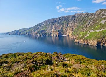
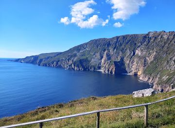
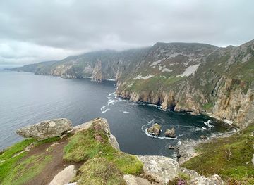
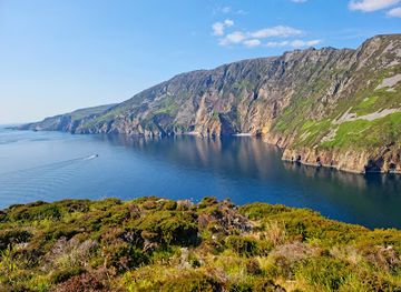
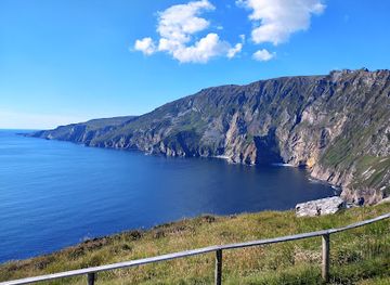
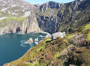
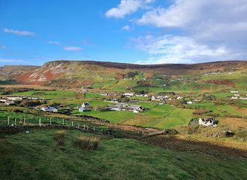
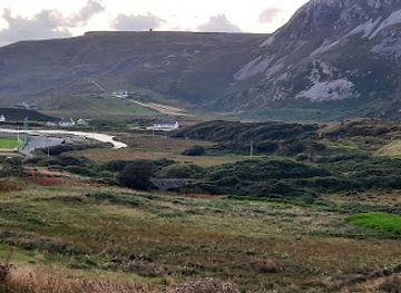
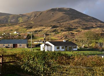
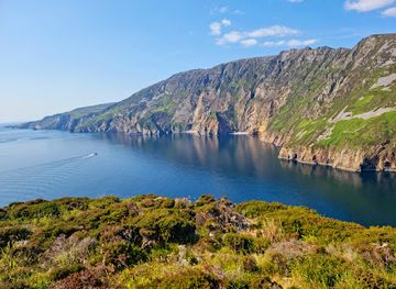
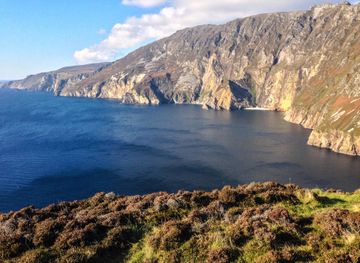
Slieve League, or Sliabh Liag, rises from the Atlantic coast of south-west County Donegal, where pale quartzite cliffs form a dramatic wall above Donegal Bay. The destination is best understood as a rugged coastal landscape rather than a conventional resort: its principal viewpoints and walking routes lie amid exposed upland, while the small settlements of Carrick and Teelin provide the closest local services. From the Bunglas viewpoint, the cliffs descend towards the sea in long, weather-beaten ridges, with views extending across Donegal Bay towards the coast and islands when visibility is clear.Read more about Slieve League
Landscape, Culture and Access
When is the best time to visit Slieve League?
Best: June–August · 15–16°C| Month | High (°C) | Rainfall (mm) |
|---|---|---|
| January | 11 | 150 |
| February | 10 | 140 |
| March | 11 | 130 |
| April | 12 | 120 |
| May | 13 | 110 |
| June (best) | 15 | 100 |
| July (best) | 16 | 100 |
| August (best) | 16 | 110 |
| September | 15 | 120 |
| October | 14 | 130 |
| November | 12 | 140 |
| December | 11 | 150 |
Getting to and around Slieve League
How to get there
Transportation
Best attractions in Slieve League
The principal attraction is the Slieve League cliff landscape, best seen from the Bunglas viewpoint where the Atlantic-facing escarpment drops towards Donegal Bay. Short walks around the viewpoint lead to changing perspectives across the ridges, while more demanding routes follow exposed ground towards the upper cliffs and the narrow One Man’s Pass. The Pilgrim’s Path offers a more historic dimension, linking the mountain scenery with local Christian tradition, although it is a serious walk rather than a casual promenade. Teelin and Carrick provide insight into the area’s rural and maritime character, and the coast around Teelin can be explored from the water on locally operated boat excursions when conditions permit. Further afield, visitors can connect a Slieve League visit with the beaches, valleys and cultural heritage of south-west Donegal, including the Glencolmcille area, but these lie in the wider region rather than at the cliffs themselves.
-
Scenic spot
Sliabh Liag Viewing Platform
Experience the breathtaking beauty of the Sliabh Liag Viewing Platform, where dramatic cliffs meet the Atlantic and nature unfolds in stunning vistas.
-
Tourist attraction
Glencolumbkille Folk Village
Explore Glencolumbkille Folk Village, a beautiful cultural heritage site in Donegal showcasing traditional Irish life through restored thatched cottages and engaging exhibits.
-
Visitor center
Sliabh Liag Cliff Experience & Visitor Centre
Explore the breathtaking Sliabh Liag Cliffs and immerse yourself in the local culture at the Visitor Centre in County Donegal.
-
Scenic spot
Bunglass Point
Discover the stunning cliffs and breathtaking vistas of Bunglass Point in Co. Donegal, a must-visit scenic spot for every traveler.
Best landmarks in Slieve League
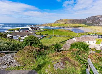
Slieve League’s defining landmark is the high quartzite cliff line above Donegal Bay, a natural feature whose long ridges and abrupt Atlantic faces dominate the surrounding coast. Bunglas is the best-known viewing area, offering a close perspective on the cliffs without requiring a full ridge walk. One Man’s Pass is a narrow high-level feature on the mountain route, while the Pilgrim’s Path represents the cultural significance of movement through this remote landscape. Teelin Harbour is an important nearby maritime landmark, reflecting the community’s continuing relationship with fishing and the sea. The villages of Teelin and Carrick, together with the wider Donegal coastal landscape, provide the human context for the cliffs; they are small rural settlements rather than monumental architectural sites.
-
Scenic spot
Sliabh Liag Viewing Platform
Experience the breathtaking views of Ireland's rugged coastline at the Sliabh Liag Viewing Platform in County Donegal, a must-visit scenic spot.
-
Museum
Glencolumbkille Folk Village
Discover the enchanting Glencolumbkille Folk Village in County Donegal, where Irish heritage meets breathtaking landscapes in a unique open-air museum experience.
-
Visitor center
Sliabh Liag Cliff Experience & Visitor Centre
Explore the breathtaking cliffs of Sliabh Liag, Ireland's highest sea cliffs, at the Visitor Centre in Donegal, where adventure meets stunning natural beauty.
-
Parking lot
Slieve League Car Park
Experience the unrivaled beauty of Slieve League Car Park, your gateway to Ireland's breathtaking cliffs and stunning coastal views.
Explore Slieve League on the map
Plan your trip on one map. See where the top attractions, landmarks, restaurants and hotels are, and book hotels and experiences in a few clicks.
Best hotels in Slieve League
Best restaurants in Slieve League
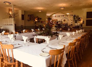
Dining around Slieve League is concentrated in the nearby villages and gateway towns rather than at the cliff viewpoint. Teelin and Carrick provide the closest opportunities for a meal or refreshment, while Killybegs has the broadest choice in the immediate region, including cafés, pubs and restaurants shaped by its long fishing-port tradition. Menus in south-west Donegal commonly draw on Irish home cooking, locally landed seafood where available, meat, baking and hearty dishes suited to a cool Atlantic climate. Visitors staying in guesthouses, cottages or rural accommodation may also encounter breakfast and home-prepared food, but arrangements vary. Because services are dispersed, it is sensible to plan meals around driving routes and opening arrangements, particularly outside the main season, rather than expecting a cluster of restaurants beside the cliffs.
-
Restaurant
An Chistin @ Cook's Pantry
Discover An Chistin @ Cook's Pantry in Glencolumbkille - where local flavors meet stunning Irish landscapes.
-
Restaurant
Kelly's Kitchen (at Slieve League Lodge)
Experience authentic Irish cuisine at Kelly's Kitchen in Carrick Upper, where local flavors meet warm hospitality amidst stunning Donegal scenery.
-
Chinese Takeout
K-wok Carrick Chinese
Discover authentic Chinese flavors at K-wok Carrick Chinese in Co. Donegal - where delicious takeout meets affordable prices.
-
Family-friendly
Cafe Blasta
Experience family-friendly dining at Café Blasta in Cashel – where delicious food meets warm hospitality.
Best bars in Slieve League
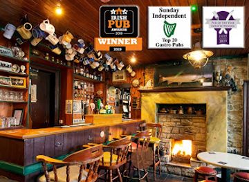
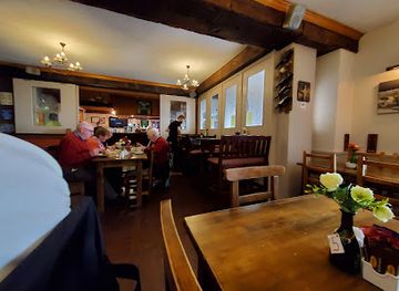
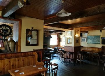
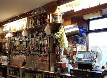
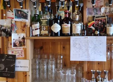
Slieve League has no concentrated nightlife scene, and evenings are generally quiet once visitors leave the viewpoints and walking routes. Traditional pubs in Teelin, Carrick and nearby villages provide the most characteristic evening setting, with conversation, local hospitality and, at times, informal music or community activity rather than a guaranteed programme of entertainment. Killybegs offers a larger selection of pubs and places to spend an evening, although it remains a working coastal town rather than a late-night club destination. Seasonal festivals and cultural events may add occasional activity across south-west Donegal, but dates and performances vary. The area’s evening appeal lies chiefly in rural pubs, dark skies, coastal sounds and the slower rhythm of a small Donegal community.
-
Bar
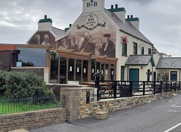
The Rusty Mackerel
Experience authentic Irish hospitality at The Rusty Mackerel, a charming pub in Carrick, Donegal, known for its cozy atmosphere and delicious local fare.
-
Restaurant
Kelly's Kitchen (at Slieve League Lodge)
Experience the charm of Kelly's Kitchen at Slieve League Lodge, where local flavors meet breathtaking views in the heart of Donegal.
-
Bar
Roartys Bar & Accomodation
Experience the warmth and charm of Roartys Bar & Accommodation in Glencolumbkille, your ideal spot for local brews and hearty meals.
-
Bar
Evelyn's Central Bar
Discover the warm hospitality and vibrant atmosphere of Evelyn's Central Bar in County Donegal, the perfect spot for a cozy drink and local charm.
Best nightclubs in Slieve League
Slieve League has no concentrated nightlife scene, and evenings are generally quiet once visitors leave the viewpoints and walking routes. Traditional pubs in Teelin, Carrick and nearby villages provide the most characteristic evening setting, with conversation, local hospitality and, at times, informal music or community activity rather than a guaranteed programme of entertainment. Killybegs offers a larger selection of pubs and places to spend an evening, although it remains a working coastal town rather than a late-night club destination. Seasonal festivals and cultural events may add occasional activity across south-west Donegal, but dates and performances vary. The area’s evening appeal lies chiefly in rural pubs, dark skies, coastal sounds and the slower rhythm of a small Donegal community.
-
Bar
The Rusty Mackerel
Discover the heart of Irish culture at The Rusty Mackerel, a charming bar and pub in scenic County Donegal, perfect for tourists seeking local hospitality.
-
 Mountain peak
Slieve League
Experience the breathtaking beauty of Slieve League, home to Europe's highest sea cliffs, where adventure meets stunning coastal views.
-
Bar
Evelyn's Central Bar
Experience the heart of Irish culture at Evelyn's Central Bar in Carrick Upper, Donegal - where community and hospitality meet over a pint.
-
Bar
Slieve League Bar
Discover the inviting atmosphere of Slieve League Bar in Co. Donegal, where local culture meets stunning scenery for an unforgettable experience.
Best shops in Slieve League
Shopping at Slieve League itself is limited, with no extensive retail area around the cliffs. The nearest useful places for provisions and everyday purchases are Teelin and Carrick, while Killybegs provides a broader range of shops and services. Visitors may find locally produced food, Donegal crafts, artwork, knitwear and other regional goods in independent businesses, galleries, farm shops or visitor-oriented outlets across south-west Donegal, although selection and opening arrangements vary. The wider county is associated with textiles, handmade products and food traditions that reflect its rural and Atlantic setting. Those walking or touring the coast should stock up before heading into the more remote areas, as the cliffs are a place for landscape and walking rather than commercial browsing.
-
Scenic spot
Sliabh Liag Viewing Platform
Experience breathtaking views and rich history at Sliabh Liag Viewing Platform, one of Ireland's most stunning scenic spots.
-
Visitor center
Sliabh Liag Cliff Experience & Visitor Centre
Explore the breathtaking Sliabh Liag cliffs and immerse yourself in the natural beauty and rich culture of Donegal at our Visitor Centre.
-
Cafe
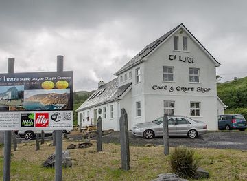
Tí Linn Cafe
Discover Tí Linn Cafe in County Donegal, where stunning views meet delicious food and local craftsmanship.
-
Coffee store
Brew In Thru (Barista Coffee Vintage Van)
Discover Brew In Thru, a vintage coffee van nestled in the stunning Slieve League, offering exquisite brews amidst breathtaking Donegal landscapes.
Get your free copy of our complete guide to Slieve League, delivered straight to you.
Everything on this page, from attractions and restaurants to essentials and local phrases, in one PDF you can read offline, print or share.
Already have an account? Sign in
Your Slieve League guide is ready.
We'll send it to · Not you? Sign out

Getting your guide ready…
We are putting together a fresh copy of the Slieve League guide. This can take up to a minute.
This can take a few moments. If your browser asks, choose Allow so the download can start. You'll find the guide in your Downloads folder.
Nothing happened? Download it again
Sorry, the guide is taking longer than usual. Please try again in a minute, or get it by email instead.
Slieve League essentials
Currency and Payment
Safety
Emergency Situations
Do's and Don'ts
Local Tips
From Eve
Local phrases worth knowing
You don't need to get them perfect. A few words go a long way, and locals appreciate the effort.
Basics
| English | Local | Say it |
|---|---|---|
| Hello | Dia dhuit | [dee-ah gwitch] |
| Goodbye | Slán | [slawn] |
| Yes | Tá | [taw] |
| No | Níl | [neel] |
| Please/You're welcome | Le do thoil | [leh duh hull] |
| Thank you | Go raibh maith agat | [guh rev mah a-gut] |
| Excuse me/Sorry | Tá brón orm | [taw brohn urm] |
| How are you? | Conas atá tú? | [kun-us ah-taw too] |
| Fine. And you? | Tá mé go maith. Agus tú? | [taw may go my-uh. ah-gus too] |
| Do you speak English? | An labhraíonn tú Béarla? | [ahn law-vreen too bayr-lah] |
| I don't understand | Ní thuigim | [nee hug-im] |
Eating & Drinking
| English | Local | Say it |
|---|---|---|
| I'd like to see the menu, please | Ba mhaith liom an mianu a fheiceáil, le do thoil | [bah wah lyum on mee-uh-noo ah eck-awl, leh duh hull] |
| I don't eat meat | Ní ithim feoil | [nee ih-him foh-il] |
| Cheers! | Sláinte! | [slawn-cheh] |
| I would like to pay, please | Ba mhaith liom íoc, le do thoil | [bah wah lyum ee-uk, leh duh hull] |
Emergencies
| English | Local | Say it |
|---|---|---|
| Help! | Cabhraigh! | [kuhv-ree] |
| Go away! | Imigh uaim! | [im-ee uhm] |
| Call the Police! | Glan an Garda! | [glan on gahr-dah] |
| Call a doctor! | Glan dochtúir! | [glan duhk-too-ir] |
| I'm lost | Táim caillte | [taw-im kahl-cheh] |
| I'm ill | Táim tinn | [taw-im chin] |
Shopping
| English | Local | Say it |
|---|---|---|
| I'd like to buy... | Ba mhaith liom ceannach... | [bah wah lyum can-ukh] |
| I'm just looking | Níl mé ach ag féachaint | [neel may uck egg fay-ukh-int] |
| How much is it? | Cé mhéad atá air? | [kay vayd ah-taw air] |
| That's too expensive | Tá sé ró-dháiríre | [taw shay roh-gaw-reh] |
| Can you lower the price? | An féidir leat an praghas a laghdú? | [ahn fay-dur lat on prah-gus ah lah-goo] |
Time & Numbers
| English | Local | Say it |
|---|---|---|
| What time is it? | Cén t-am é? | [kayn tahm ay] |
| It's one o'clock | Tá sé a haon | [taw shay ah hayn] |
| Half past (10) | Leathuair tar éis a deich | [lah-hoo-ur tahr aysh ah deh] |
| Morning | Maidin | [mah-din] |
| Afternoon | Tráthnóna | [traw-noh-nah] |
| Evening | Tráthnóna | [traw-noh-nah] |
| Yesterday | Inné | [in-ay] |
| Today | Inniu | [in-you] |
| Tomorrow | Amárach | [ah-maw-rahk] |
| 1 | a haon | [ah hayn] |
| 2 | a dó | [ah doh] |
| 3 | a trí | [ah tree] |
| 4 | a ceathair | [ah kah-hir] |
| 5 | a cúig | [ah koo-ig] |
| 6 | a sé | [ah shay] |
| 7 | a seacht | [ah shakht] |
| 8 | a hocht | [ah hukht] |
| 9 | a naoi | [ah knee] |
| 10 | a deich | [ah deh] |
Transport & Directions
| English | Local | Say it |
|---|---|---|
| Where's a/the...? | Cá bhfuil an...? | [kaw will on] |
| What's the address? | Cén seoladh atá air? | [kayn shoh-lah ah-taw air] |
| Can you show me (on the map)? | An féidir leat léarscáil a thaispeáint dom? | [ahn fay-dur lat lay-ahr-skawl ah hash-paynt dum] |
| When's the next (bus)? | Cathain a bheidh an chéad (bus)? | [kah-heen ah veh ahn khayd] |
| A ticket (to ....) | Ticéad (go dtí ....) | [tick-ayd guh dee] |
History of Slieve League
Ancient Rock and Atlantic Formation
The cliffs are formed largely from quartzite and related metamorphic rocks belonging to the ancient geological foundations of the north-west of Ireland. Their present shape reflects prolonged erosion, weathering and the action of the Atlantic, which has cut into the elevated coastal margin and exposed steep faces above the sea. Geological structure helps explain the cliffs’ long ridgelines, pale rock surfaces and abrupt transitions between mountain slopes and ocean. This geological history predates human settlement by immense periods and provides the physical setting for the cultural landscape around Slieve League.
Early Settlement and Gaelic Tradition
The surrounding uplands and coastal valleys have been inhabited for centuries, with communities traditionally combining small-scale farming, fishing and the use of common mountain land. The area lies within a part of Donegal where the Irish language and Gaelic cultural traditions have retained a visible presence. Settlements such as Teelin and Carrick developed as local communities rather than as large urban centres, and the landscape’s remoteness helped preserve patterns of life closely tied to weather, sea routes and seasonal land use. Religious, oral and place-name traditions remain important to the identity of south-west Donegal.
Pilgrimage and Mountain Paths
Paths around Slieve League include routes associated with historic movement through the mountain landscape and with Christian pilgrimage traditions. The Pilgrim’s Path is linked in local interpretation with passage towards an early Christian site associated with the cliffs, although walking conditions and route character are those of exposed mountain terrain rather than a formal paved pilgrimage way. One Man’s Pass forms a narrow and demanding section on the high ridge. These routes illustrate how the cliffs are not only a scenic attraction but also part of a landscape shaped by devotion, local travel and long familiarity with difficult ground.
Maritime Communities and Coastal Change
For generations, the communities around Slieve League depended on the Atlantic for fishing, transport and access to neighbouring coastal settlements. Teelin’s harbour and the wider coast reflect this maritime history, while nearby Carrick developed as a small service settlement for the surrounding rural area. Improved roads and the growth of scenic tourism gradually made the cliffs more accessible to visitors from beyond Donegal, but the area never developed into a dense resort. Its present character still depends on the relationship between upland farming, coastal weather, local settlement and the sea.
Tourism and Landscape Stewardship
Slieve League’s reputation grew through the popularity of Donegal’s coastal touring routes, walking holidays and landscape photography. Visitor interest has brought improved access and viewpoint facilities, while the cliffs remain an exposed natural environment rather than a fully engineered attraction. Pressure from traffic, footfall and roadside parking makes responsible behaviour important, particularly around fragile ground and cliff edges. Modern visits therefore take place within a continuing balance between public enjoyment, the needs of local communities and the protection of a landscape whose remoteness is one of its defining historical characteristics.
Slieve League in Photos
Browse through our photo collection highlighting the charm and character of the destination.
Neighbouring destination travel guides
The closest destinations to Slieve League, if you have time for more than one.
-

-

-
-

-


Swipe for more destinations
Explore more
Explore more of County Donegal
Experience the wild and unspoiled beauty of County Donegal, Ireland's hidden gem, where rugged landscapes, rich history, and vibrant culture await.
Explore County Donegal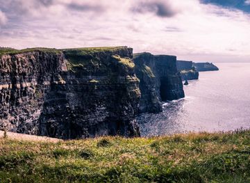
Explore more of Ireland
Discover Ireland: A land of enchanting landscapes, rich history, and vibrant culture, where every corner tells a story and every visit feels like coming home.
Explore Ireland