

Connemara National Park Travel Guide - Free Web & App
Your ultimate guide to Connemara National Park. Discover top landmarks, proposed trips, and local tips. Free on the web or via the Evendo companion app.


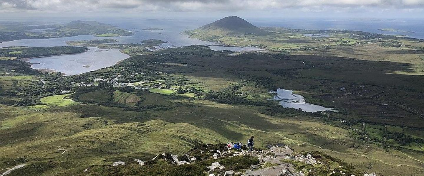


Connemara National Park in Ireland offers wild mountains, bogs and coastal landscapes near Letterfrack with hiking, wildlife and nearby Kylemore Abbey.
Landscape and Natural Character
Connemara National Park occupies almost 3,000 hectares in the north-west of County Galway, where the Twelve Bens rise above broad valleys, Atlantic bogs, lakes and rough green mountains. The park lies beside the village of Letterfrack and is crossed by the Renvyle Peninsula and the western edge of the Connemara landscape. Its mountains are largely formed from ancient metamorphic rocks, while glacial movement has shaped the valleys, corries and scattered lakes that give the area its distinctive character. Wet heath, blanket bog, grassland and woodland support red deer, Connemara ponies, birds of prey and a rich variety of bogland plants.Read more about Connemara National Park
Walking and Visiting
Heritage and Surrounding Places
When is the best time to visit Connemara National Park?
Best: June–August · 18–19°C| Month | High (°C) | Rainfall (mm) |
|---|---|---|
| January | 10 | 110 |
| February | 11 | 90 |
| March | 11 | 95 |
| April | 13 | 78 |
| May | 15 | 76 |
| June (best) | 18 | 91 |
| July (best) | 19 | 85 |
| August (best) | 19 | 93 |
| September | 17 | 98 |
| October | 15 | 120 |
| November | 12 | 132 |
| December | 11 | 120 |
Getting to and around Connemara National Park
How to get there
Transportation
Best attractions in Connemara National Park
The National Park Visitor Centre near Letterfrack introduces the area's habitats, history and conservation work, while its surrounding paths provide an accessible first encounter with woodland, bog and mountain scenery. Diamond Hill is the park's signature walking destination, with marked routes climbing from lower ground to a broad summit ridge overlooking the Twelve Bens, Kylemore valley, lakes and the Atlantic coast. Lower-level walks offer a less strenuous alternative through varied vegetation and open landscapes. Within and around the park, the changing views towards Bencullagh, Benbrack and the other Twelve Bens reveal the scale of north-west Connemara, although the summits themselves are not all inside the national park. Nearby Kylemore Abbey and its Victorian walled garden lie outside the park boundary and form a separate heritage visit. Letterfrack provides the closest village setting, while the Renvyle Peninsula, Killary Harbour and Clifden extend the experience into the wider Connemara region rather than belonging to the park itself.
-
Park
Walled Victorian Garden
Discover Dublin's hidden gem: A beautifully restored Victorian garden offering a tranquil escape in the heart of Phoenix Park.
-
Hiking area
Diamond Hill
Hike Diamond Hill in Connemara National Park for stunning views of Kylemore Abbey, the Twelve Bens, and the wild Atlantic coast.
-
Tourist attraction
DK Connemara Oysters
Discover the taste of the Wild Atlantic Way at DK Connemara Oysters, a sustainable oyster farm offering tours, tastings, and breathtaking coastal views.
-
Tourist attraction
Maladrolaun Lake
Discover the tranquil beauty of Maladrolaun Lake in County Galway, a perfect escape into Ireland's serene natural landscape.


Best landmarks in Connemara National Park
Diamond Hill is Connemara National Park's defining accessible landmark, its layered summit and broad views making the relationship between mountain, bog, lake and coast unusually clear. The Twelve Bens form the wider mountainous backdrop, a group of rugged peaks whose exposed rock and glacially shaped valleys define central Connemara even though only parts of the range fall within the park. Blanket bog is another landmark of the landscape rather than a single monument, storing water across open ground and supporting specialised plants. Kylemore Abbey, visible from parts of the surrounding area, is a major historic landmark just outside the national park; its castle, church and Victorian garden belong to a separate managed attraction. Letterfrack's village buildings and former institutional sites provide a human context, while the park's lakes, woodland and mountain paths express the region's geological and ecological identity.
-
Visitor center
Connemara National Park Visitor Centre
Explore Connemara National Park: Discover trails, wildlife, and breathtaking scenery at the gateway to Ireland's natural beauty.
-
Hiking area
Diamond Hill
Hike Diamond Hill in Connemara National Park for breathtaking panoramic views of Ireland's rugged coastline and iconic landmarks.
-
 Indoor lodging
Connemara National Park lodge
Explore the wild beauty of Connemara National Park from this welcoming Letterfrack lodge, offering comfort and convenience for your Irish adventure.
-
Scenic spot
Connemara National Park Viewpoint
Experience breathtaking panoramic views of Connemara National Park's mountains, valleys, and lakes from this must-see scenic viewpoint in County Galway.


Explore Connemara National Park on the map
Plan your trip on one map. See where the top attractions, landmarks, restaurants and hotels are, and book hotels and experiences in a few clicks.
Best hotels in Connemara National Park
Best restaurants in Connemara National Park
Connemara National Park has limited dining provision within its boundaries, so visitors generally eat in Letterfrack, Clifden or other nearby villages rather than expecting cafés beside every walking route. Rural pubs, cafés, guesthouses and small restaurants across the region reflect the west of Ireland's food culture, with menus commonly shaped by local dairy products, meat, vegetables, baking and Atlantic seafood where available. Galway's wider culinary tradition also has strong links with oysters, mussels and other shellfish from the coast, while brown bread, scones and hearty soups suit a day in changeable mountain weather. Farm shops and local producers can provide cheese, preserves, baked goods and other supplies for picnics, although exact availability varies. Visitors should carry food and water for longer walks and check eating arrangements in advance when travelling beyond Letterfrack or Clifden.
-
Restaurant
Veldons Seafarer Bar & Restaurant
Experience authentic Irish hospitality at Veldons Seafarer Bar & Restaurant in Letterfrack—where local flavors meet breathtaking landscapes.
-
Restaurant
Connemara Woodfire
Discover Connemara Woodfire: A Culinary Haven Offering Exquisite Wood-Fired Dishes Surrounded by Breathtaking Irish Scenery.
-
Restaurant
The Hungry Hiker Cafe
Experience delightful local cuisine at The Hungry Hiker Cafe in Connemara National Park—where flavor meets nature's beauty.


Best bars in Connemara National Park
Evening entertainment around Connemara National Park is rural and subdued rather than club-oriented. Letterfrack and nearby villages have traditional pubs where visitors may find a convivial local atmosphere, conversation and, depending on the evening, Irish music or other informal entertainment, but performances and opening arrangements should not be assumed. Clifden offers the broadest concentration of pubs and evening venues close to the park, with a seasonal atmosphere influenced by visitors and the surrounding Gaeltacht communities. In smaller settlements, a pub may function as a social meeting place as much as a drinking venue, and choices can be separated by considerable distances on winding roads. The national park itself has no nightlife infrastructure, so evenings there are better suited to quiet walks near a base, stargazing where conditions permit, or local cultural events when genuinely scheduled.
-
Restaurant
Veldons Seafarer Bar & Restaurant
Discover the charm of Veldons Seafarer Bar & Restaurant in Letterfrack, where local flavors and warm hospitality come together for an unforgettable dining experience.
-
Bar
Molly's Bar
Experience the warmth of Irish hospitality at Molly's Bar in Letterfrack, where every visit is a celebration of local culture and community.


Best nightclubs in Connemara National Park
Evening entertainment around Connemara National Park is rural and subdued rather than club-oriented. Letterfrack and nearby villages have traditional pubs where visitors may find a convivial local atmosphere, conversation and, depending on the evening, Irish music or other informal entertainment, but performances and opening arrangements should not be assumed. Clifden offers the broadest concentration of pubs and evening venues close to the park, with a seasonal atmosphere influenced by visitors and the surrounding Gaeltacht communities. In smaller settlements, a pub may function as a social meeting place as much as a drinking venue, and choices can be separated by considerable distances on winding roads. The national park itself has no nightlife infrastructure, so evenings there are better suited to quiet walks near a base, stargazing where conditions permit, or local cultural events when genuinely scheduled.
-
Bar
Molly's Bar
Discover the heart of Irish hospitality at Molly's Bar, a cozy spot in Letterfrack with a welcoming atmosphere and a great selection of drinks.

Best shops in Connemara National Park
Shopping inside Connemara National Park is minimal and concentrated around visitor services rather than a retail district. Letterfrack provides the closest everyday facilities, while Clifden has a wider selection of shops, galleries, craft outlets and food businesses serving the surrounding region. Visitors may find locally made textiles, woollen goods, pottery, paintings, jewellery and other crafts associated with western Ireland, alongside regional foods such as preserves, baking and farmhouse products. Galway city offers the broadest range of specialist shopping before or after a visit, although its retail scene should not be confused with facilities within the national park. Small village shops and rural businesses can be useful for provisions, but opening arrangements and stock vary. Buying directly from established local makers and producers can provide a more meaningful connection with Connemara's materials, landscape and cultural traditions than treating the area as a conventional shopping destination.
-
Supermarket
Letterfrack Country Shop
Explore fresh local produce and unique Irish crafts at Letterfrack Country Shop, your essential stop in County Galway.

Get your free copy of our complete guide to Connemara National Park, delivered straight to you.
Everything on this page, from attractions and restaurants to essentials and local phrases, in one PDF you can read offline, print or share.
Already have an account? Sign in
Your Connemara National Park guide is ready.
We'll send it to · Not you? Sign out

Getting your guide ready…
We are putting together a fresh copy of the Connemara National Park guide. This can take up to a minute.
This can take a few moments. If your browser asks, choose Allow so the download can start. You'll find the guide in your Downloads folder.
Nothing happened? Download it again
Sorry, the guide is taking longer than usual. Please try again in a minute, or get it by email instead.
Connemara National Park essentials
Currency and Payment
Safety
Emergency Situations
Do's and Don'ts
Local Tips
From Eve
Local phrases worth knowing
You don't need to get them perfect. A few words go a long way, and locals appreciate the effort.
Basics
| English | Local | Say it |
|---|---|---|
| Hello | Dia dhuit | [Dee-ah gwitch] |
| Goodbye | Slán | [Slawn] |
| Yes | Tá | [Taw] |
| No | Níl | [Neel] |
| Please/You're welcome | Le do thoil | [Leh duh hull] |
| Thank you | Go raibh maith agat | [Guh rev mah agut] |
| Excuse me/Sorry | Maith thú | [Mah hoo] |
| How are you? | Conas atá tú? | [Kun-us ah-taw too] |
| Fine. And you? | Tá mé go maith. Agus tú? | [Taw may guh mah. Ah-gus too?] |
| Do you speak English? | An bhfuil Béarla agat? | [On will bayr-lah ah-gut] |
| I don't understand | Ní thuigim | [Neel hug-im] |
Eating & Drinking
| English | Local | Say it |
|---|---|---|
| I'd like to see the menu, please | Ba mhaith liom an miasnú, le do thoil | [Bah why luhm on mee-ass-noo, leh duh hull] |
| I don't eat meat | Ní ithim feoil | [Neel ih-him foh-il] |
| Cheers! | Sláinte! | [Slawn-cheh] |
| I would like to pay, please | Ba mhaith liom íoc, le do thoil | [Bah why luhm ee-uck, leh duh hull] |
Emergencies
| English | Local | Say it |
|---|---|---|
| Help! | Cabhair! | [Caw-er] |
| Go away! | Imigh uaim! | [Im-ee oo-um] |
| Call the Police! | Glan an Gharda! | [Glawn on gar-da] |
| Call a doctor! | Glan dochtúir! | [Glawn duck-too-ir] |
| I'm lost | Tá mé caillte | [Taw may kyle-tuh] |
| I'm ill | Tá mé tinn | [Taw may chin] |
Shopping
| English | Local | Say it |
|---|---|---|
| I'd like to buy... | Ba mhaith liom ceannach... | [Bah why luhm kyann-uck] |
| I'm just looking | Níl mé ach ag féachaint | [Neel may ahk egg fay-ah-khent] |
| How much is it? | Cé mhéad atá air? | [Kay vayd ah-taw air] |
| That's too expensive | Tá sé ródhaor | [Taw shay row-dear] |
| Can you lower the price? | An féidir leat an praghas a ísliú? | [On fay-djir lat on prah-guss ah eesh-loo] |
Time & Numbers
| English | Local | Say it |
|---|---|---|
| What time is it? | Cén t-am é? | [Kayn tahm ay] |
| It's one o'clock | Tá sé a haon a chlog | [Taw shay ah hayn ah khlog] |
| Half past (10) | Leathuair tar éis a deich | [Lah-hoo-ir tar aysh ah deh] |
| Morning | Maidin | [Mah-din] |
| Afternoon | Tráthnóna | [Traw-no-na] |
| Evening | Tráthnóna | [Traw-no-na] |
| Yesterday | Inné | [In-ay] |
| Today | Inniu | [In-yoo] |
| Tomorrow | Amárach | [Ah-mar-ahkh] |
| 1 | Aon | [Ayn] |
| 2 | Dó | [Doh] |
| 3 | Trí | [Tree] |
| 4 | Ceathair | [Kyah-hir] |
| 5 | Cúig | [Koo-ig] |
| 6 | Sé | [Shay] |
| 7 | Seacht | [Shakht] |
| 8 | Ocht | [Ukht] |
| 9 | Naoi | [Nee] |
| 10 | Deich | [Deh] |
Transport & Directions
| English | Local | Say it |
|---|---|---|
| Where's a/the...? | Cá bhfuil an...? | [Kah will on] |
| What's the address? | Cén seoladh atá air? | [Kayn shohl-ah ah-taw air] |
| Can you show me (on the map)? | An féidir leat liom a thaispeáint (ar an léarscáil)? | [On fay-djir lat luhm ah hash-pay-nt (ahr on layr-skawl)] |
| When's the next (bus)? | Cén uair atá an chéad bhus? | [Kayn oo-ir ah-taw on khayd vuss] |
| A ticket (to ....) | Ticéad (go dtí ....) | [Tick-aid (goh jee)] |
History of Connemara National Park
Ancient Rocks and Glacial Landforms
The physical foundation of Connemara National Park is far older than human settlement. Its mountains are composed mainly of ancient metamorphic rocks, including schist and gneiss, created and altered through deep geological processes. Much of the present relief was then sharpened by glaciation: moving ice carved valleys, hollowed mountain basins and left lakes and deposits across the landscape. The rounded summits, exposed rock, bog-filled hollows and U-shaped valleys seen around Diamond Hill and the Twelve Bens are therefore products of geological time rather than a single historical event. This combination of resistant uplands and waterlogged low ground has helped create the park's distinctive mosaic of mountain, heath and blanket bog.
Early Settlement and Gaelic Connemara
People have lived, farmed and travelled through Connemara for many centuries, adapting to a difficult landscape of thin soils, wet ground and exposed Atlantic weather. Early settlement is represented across the wider region by field systems, stone structures and ecclesiastical remains, while the cultural history of Connemara is closely associated with the Irish language and Gaelic traditions. The park itself is not an open-air archaeological complex with a single historic town at its centre; its significance lies in the surviving relationship between rural communities, small farms, mountain grazing and the surrounding landscape. Nearby areas of Connemara remain important parts of the Gaeltacht, where Irish continues to shape local identity.
Estates, Farming and Woodland
Before becoming a national park, much of the land was managed through large estates as well as small-scale farming. The Kylemore estate, associated with Kylemore Castle and its grounds just beyond the park's principal visitor area, is an important part of the local historical setting. Estate management introduced or expanded woodland in places, while surrounding communities depended on grazing, peat cutting and cultivation suited to the region's poor soils. The resulting landscape was neither wholly wild nor intensively farmed: bog, mountain pasture, woodland and small fields developed together. Traces of these contrasting land uses help explain why Connemara appears both natural and clearly shaped by people.
Letterfrack and Changing Social History
Letterfrack developed as a settled community and an important local centre, with its history intertwined with estate activity, education and rural life. The village is also associated with the former industrial school established there in the nineteenth century, a reminder of the complex and often painful social history of institutional education in Ireland. That history belongs to the settlement and wider locality rather than to the mountains alone. For visitors, Letterfrack provides the practical gateway to the national park while also offering context for understanding how education, landownership, religion and community life influenced Connemara during the nineteenth and twentieth centuries.
National Park and Conservation
Connemara National Park was formally established in 1980, bringing a substantial area of mountain, heath, woodland, lakes and blanket bog into a protected landscape managed for conservation and public enjoyment. Its creation reflected growing recognition of the ecological value of upland habitats and the need to manage recreation alongside protection of sensitive bogland and wildlife. The park now combines scientific monitoring, habitat management, interpretation and public access. Walking routes, including those on Diamond Hill, allow visitors to experience the landscape without treating fragile ground as an unrestricted playground. Conservation remains an active process, particularly as weather, grazing, drainage and visitor pressure continue to influence the park.
Connemara National Park in Photos
Browse through our photo collection highlighting the charm and character of the destination.
Neighbouring destination travel guides
The closest destinations to Connemara National Park, if you have time for more than one.
-

-
-

-

-


Swipe for more destinations
Explore more
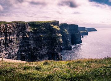
Explore more of County Galway
Discover County Galway: A blend of stunning landscapes, vibrant culture, and rich history on Ireland's breathtaking west coast.
Explore County Galway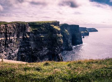
Explore more of Ireland
Discover Ireland: A land of enchanting landscapes, rich history, and vibrant culture, where every corner tells a story and every visit feels like coming home.
Explore Ireland