

Alta Via 1 Travel Guide - Free Web & App
Your ultimate guide to Alta Via 1. Discover top landmarks, proposed trips, and local tips. Free on the web or via the Evendo companion app.


Alta Via 1 in Italy crosses the Dolomites from Lago di Braies to Belluno, linking mountain huts, limestone peaks, war history and alpine trails.
A Mountain Traverse Through the Dolomites
Alta Via 1 is one of Italy’s best-known long-distance mountain routes, crossing the eastern Dolomites from Lago di Braies in South Tyrol to the outskirts of Belluno in Veneto. The route covers roughly 120 kilometres, although the exact distance varies with stage choices and access arrangements, and passes through a succession of limestone towers, high plateaux, narrow valleys and open alpine pastures. It is a linear journey rather than a single attraction, with most walkers completing it over around ten to twelve days.Read more about Alta Via 1
Rock Towers, Passes and Mountain Refuges
Landscape, Heritage and Seasonal Access
When is the best time to visit Alta Via 1?
Best: July–September · 21–25°C| Month | High (°C) | Rainfall (mm) |
|---|---|---|
| January | 1 | 54 |
| February | 2 | 59 |
| March | 5 | 65 |
| April | 9 | 80 |
| May | 16 | 100 |
| June | 21 | 120 |
| July (best) | 25 | 130 |
| August (best) | 25 | 120 |
| September (best) | 21 | 100 |
| October | 15 | 80 |
| November | 8 | 62 |
| December | 3 | 56 |
Getting to and around Alta Via 1
How to get there
Transportation
Best attractions in Alta Via 1
The principal attraction of Alta Via 1 is the changing sequence of Dolomite landscapes rather than one isolated sight. Lago di Braies provides the celebrated northern setting, followed by the high valleys and pale rock formations of the Fanes and Lagazuoi groups. Around Lagazuoi and the Cinque Torri, walkers encounter dramatic military landscapes alongside renowned climbing scenery, while the Tofane and Pelmo areas add some of the route’s most recognisable mountain silhouettes. Farther south, the traverse reaches the Civetta massif and the quieter terrain above Zoldo and Belluno, where wooded valleys contrast with high limestone walls. Mountain refuges are attractions in their own right, offering historic walking culture, alpine food and access to viewpoints that are impractical from the valley. The route also passes near communities such as Cortina d’Ampezzo and Alleghe, but these are gateways and service centres rather than a continuous part of the high trail.
-
Tourist attraction
Parco Naturale Tre Cime
Discover the breathtaking landscapes and rich biodiversity of Tre Cime Natural Park in South Tyrol, a must-visit for nature lovers and adventure seekers alike.
-
Tourist attraction
Fanes-Sennes-Braies Natural Park
Explore the natural beauty of Fanes-Sennes-Braies Natural Park, where stunning landscapes and outdoor adventures await in the heart of the Dolomites.
-
Tourist attraction
Lake Braies
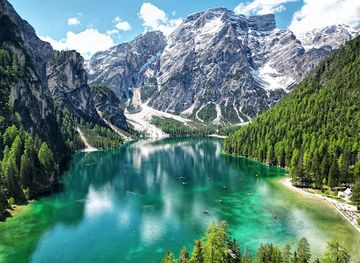
Discover the stunning beauty of Lake Braies, a breathtaking alpine lake nestled in the Dolomites, perfect for nature lovers and outdoor enthusiasts.
-
Catholic cathedral
Brixner Dom
Discover the Brixner Dom, a stunning Baroque cathedral in Bressanone, showcasing rich history, breathtaking architecture, and serene beauty in South Tyrol.

Best landmarks in Alta Via 1
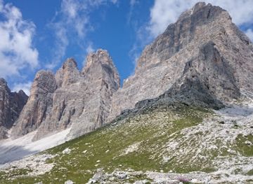
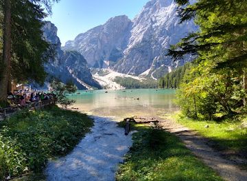
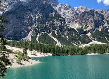
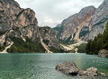
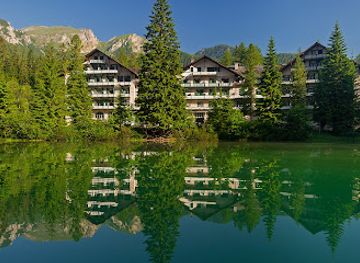
Alta Via 1 is defined by natural landmarks of exceptional geological character, including the cliffs and pinnacles around the Fanes, Lagazuoi, Tofane, Pelmo and Civetta groups. Lago di Braies marks the northern approach with a deep, green mountain lake framed by forest and pale rock, while the Cinque Torri form one of the route’s most recognisable clusters of weathered limestone towers. Lagazuoi and the neighbouring high passes are also historic landmarks, preserving tunnels, trenches and other traces of the First World War in an alpine setting. The pale dolomite rock itself is significant: uplift, fracturing and erosion produced the vertical walls, towers and scree slopes that distinguish the eastern Dolomites from many other European mountain landscapes. Individual refuges, passes and valley churches may carry local importance, but the route’s landmark identity rests chiefly on the relationship between dramatic geology, historic mountain use and high-altitude travel.
-
Lake
Pragser Wildsee
Explore the stunning beauty of Pragser Wildsee, a breathtaking alpine lake in the Dolomites, perfect for outdoor adventures and serene escapes.
-
Tourist attraction
Lake Braies
Experience the stunning beauty of Lake Braies, a breathtaking alpine lake in the Dolomites, ideal for nature lovers and adventure seekers.
-
Mountain cabin
Rifugio Lagazuoi
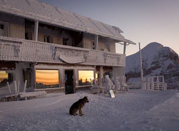
Discover the enchanting Rifugio Lagazuoi, a mountain cabin retreat offering stunning Dolomite views and traditional Italian cuisine amidst nature's beauty.
-
Restaurant
Rifugio Averau
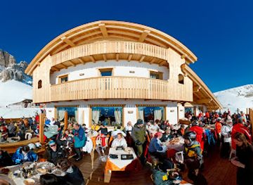
Discover exquisite Italian cuisine at Rifugio Averau, nestled in the breathtaking Dolomites, offering stunning views and authentic flavors.
Explore Alta Via 1 on the map
Plan your trip on one map. See where the top attractions, landmarks, restaurants and hotels are, and book hotels and experiences in a few clicks.
Best hotels in Alta Via 1
Best restaurants in Alta Via 1
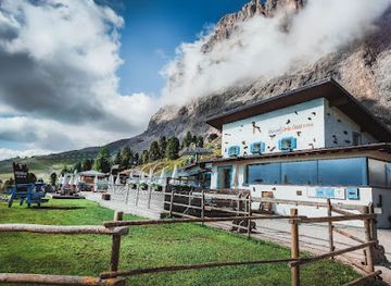
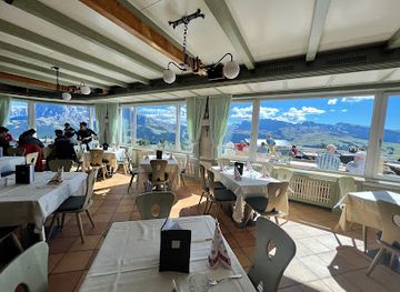
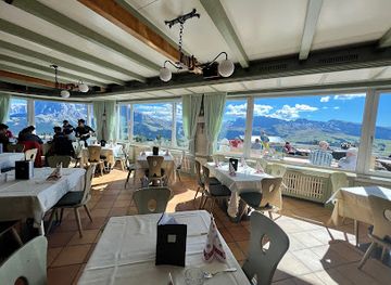
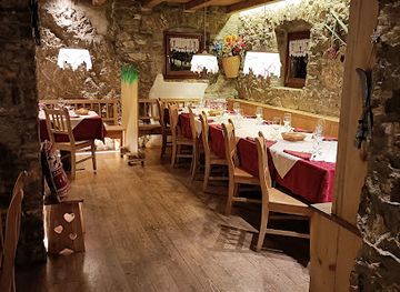
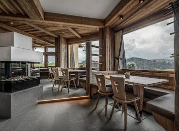
Dining on Alta Via 1 is shaped by the mountain-refuge network rather than by a continuous restaurant scene. Rifugi commonly provide set meals, packed lunches or simple alpine dishes for registered guests and walkers, with menus reflecting the mixed culinary traditions of South Tyrol, Ladin valleys and Veneto. Expect mountain staples such as soups, pasta, polenta, dumplings and hearty meat or cheese dishes, alongside regional breads and cakes; exact offerings vary by hut and season. More extensive choice is available in gateway towns and valleys including Dobbiaco, Cortina d’Ampezzo, Alleghe, Selva di Cadore and Belluno, where restaurants, cafés, bars and food shops serve South Tyrolean and Veneto traditions. Carry snacks for stretches between huts, and confirm meal arrangements when booking, since remote refuges have limited supplies and are not comparable with full-service town restaurants.
-
Restaurant
Emilio-Comici-Hütte
Discover Emilio-Comici-Hütte: A culinary gem nestled in the Dolomites offering traditional dishes with breathtaking views.
-
Restaurant
Hotel Lago di Braies
Experience breathtaking views and nature’s beauty at Hotel Lago di Braies - your perfect getaway in South Tyrol.
-
Restaurant
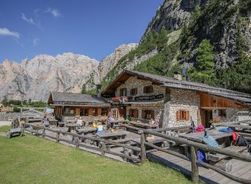
Scotoni Hütte
Discover Scotoni Hütte: where authentic Italian cuisine meets breathtaking alpine views in the heart of South Tyrol's Dolomites.
-
Restaurant
Almgasthof Mont Seuc
Discover exquisite South Tyrolean cuisine amidst breathtaking mountain views at Almgasthof Mont Seuc.
Best bars in Alta Via 1
Evenings on Alta Via 1 are generally quiet and organised around the rhythms of the mountains. The principal social settings are staffed rifugi, where walkers eat together, discuss the next stage and enjoy local beer, wine or non-alcoholic drinks before an early night. There is no continuous nightlife infrastructure along the route, and remote huts are not substitutes for bars or clubs. A broader choice of après-hike venues, traditional inns and hotel bars can be found in gateway resorts such as Cortina d’Ampezzo and in larger valley settlements, while Belluno offers the most conventional town evening atmosphere near the southern end. In smaller communities, local festivals and seasonal events may provide entertainment, but programmes and opening arrangements change, so they should not be assumed to coincide with a trek.
-
Restaurant
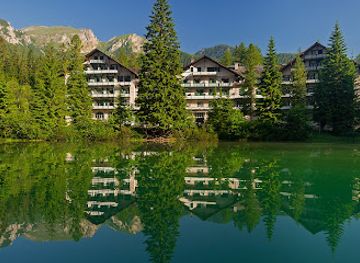
Hotel Lago di Braies
Discover the flavors of South Tyrol at Hotel Lago di Braies, where culinary excellence meets breathtaking natural beauty.
-
Restaurant
Almgasthof Mont Seuc
Experience the flavors of South Tyrol at Almgasthof Mont Seuc, a delightful restaurant in the heart of the Dolomites, perfect for every food lover.
-
Restaurant
Ristorante Malga Peniola
Discover the flavors of Trentino at Ristorante Malga Peniola, where authentic Italian cuisine meets breathtaking mountain views.
-
Bar
Alpine Restaurant Piz Arlara
Experience the flavors of the Alps at Alpine Restaurant Piz Arlara, where breathtaking mountain views meet exquisite local cuisine.
Best nightclubs in Alta Via 1
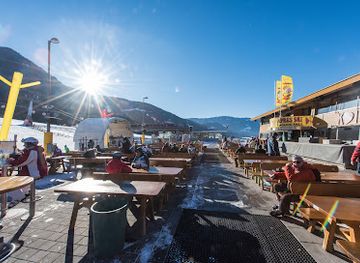
Evenings on Alta Via 1 are generally quiet and organised around the rhythms of the mountains. The principal social settings are staffed rifugi, where walkers eat together, discuss the next stage and enjoy local beer, wine or non-alcoholic drinks before an early night. There is no continuous nightlife infrastructure along the route, and remote huts are not substitutes for bars or clubs. A broader choice of après-hike venues, traditional inns and hotel bars can be found in gateway resorts such as Cortina d’Ampezzo and in larger valley settlements, while Belluno offers the most conventional town evening atmosphere near the southern end. In smaller communities, local festivals and seasonal events may provide entertainment, but programmes and opening arrangements change, so they should not be assumed to coincide with a trek.
-
Restaurant
K1 Après Ski/Restaurant/Pizzeria
Experience the vibrant atmosphere of K1 Après Ski, where delicious food meets lively entertainment in the heart of South Tyrol’s stunning landscapes.
-
Lounge
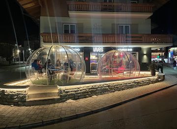
Vives Pizza Loungebar
Experience the best of Italian cuisine at Vives Pizza Loungebar in San Vigilio di Marebbe, where delicious pizzas meet refreshing cocktails in a stunning setting.
-
Bar
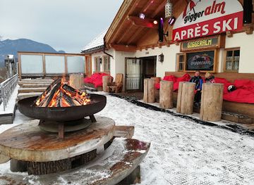
Apres Ski Giggeralm
Experience the exhilarating nightlife at Apres Ski Giggeralm, the ultimate bar and disco club for après-ski fun in South Tyrol, Italy.
-
Disco club
Belvedere Cortina d'Ampezzo
Dance the night away at Belvedere Cortina d'Ampezzo, where the stunning Dolomites meet electrifying nightlife in a vibrant disco club atmosphere.
Best shops in Alta Via 1
Shopping opportunities are limited on the high route and are concentrated in the towns and villages used for approach, resupply or transport. Cortina d’Ampezzo has the broadest retail offer among the major resort gateways, while Dobbiaco, Alleghe, Selva di Cadore and Belluno provide food shops, outdoor equipment and everyday supplies at different points around the wider itinerary. Traditional products associated with the region include South Tyrolean and Ladin foods, mountain cheeses, cured meats, baked goods, honey, woollen items, woodwork and locally made crafts, although availability varies between settlements and seasons. Rifugi may sell a small selection of regional products or souvenirs, but they are not shopping centres and have limited storage. Buy specialist equipment and substantial provisions before entering remote stages, rather than relying on villages or huts to provide every item.
-
Mountain cabin
Rifugio Lagazuoi
Discover the enchanting Rifugio Lagazuoi, a mountain cabin in the Dolomites offering stunning views, cozy accommodations, and delicious local cuisine.
-
Mountain cabin
Rifugio Nuvolau
Explore the breathtaking vistas and savor local delicacies at Rifugio Nuvolau, a must-visit mountain cabin in the heart of the Dolomites.
-
 Wellness hotel
BAD MOOS – Aqua Spa Resort
Discover the perfect blend of wellness, luxury, and adventure at BAD MOOS – Aqua Spa Resort in the stunning Dolomites.
-
Mountain cabin
Rifugio Adolfo Sonino al Coldai
Experience the charm of Rifugio Adolfo Sonino al Coldai, a mountain hut offering breathtaking views and authentic alpine cuisine in the Dolomites.
Get your free copy of our complete guide to Alta Via 1, delivered straight to you.
Everything on this page, from attractions and restaurants to essentials and local phrases, in one PDF you can read offline, print or share.
Already have an account? Sign in
Your Alta Via 1 guide is ready.
We'll send it to · Not you? Sign out

Getting your guide ready…
We are putting together a fresh copy of the Alta Via 1 guide. This can take up to a minute.
This can take a few moments. If your browser asks, choose Allow so the download can start. You'll find the guide in your Downloads folder.
Nothing happened? Download it again
Sorry, the guide is taking longer than usual. Please try again in a minute, or get it by email instead.
Alta Via 1 essentials
Currency and Payment
Safety
Emergency Situations
Do's and Don'ts
Local Tips
From Eve
Local phrases worth knowing
You don't need to get them perfect. A few words go a long way, and locals appreciate the effort.
Basics
| English | Local | Say it |
|---|---|---|
| Hello | Ciao | [chow] |
| Goodbye | Arrivederci | [ah-ree-veh-dehr-chee] |
| Yes | Sì | [see] |
| No | No | [noh] |
| Please/You're welcome | Per favore/Prego | [pehr fah-voh-reh/preh-goh] |
| Thank you | Grazie | [grah-tsee-eh] |
| Excuse me/Sorry | Mi scusi/Scusa | [mee skoo-zee/skoo-sah] |
| How are you? | Come stai? | [koh-meh stai] |
| Fine. And you? | Bene. E tu? | [beh-neh. eh too] |
| Do you speak English? | Parli inglese? | [pahr-lee een-gleh-zeh] |
| I don't understand | Non capisco | [nohn kah-pee-skoh] |
Eating & Drinking
| English | Local | Say it |
|---|---|---|
| I'd like to see the menu, please | Vorrei vedere il menu, per favore | [vohr-ray veh-deh-reh eel meh-noo, pehr fah-voh-reh] |
| I don't eat meat | Non mangio carne | [nohn mahn-joh kahr-neh] |
| Cheers! | Salute! | [sah-loo-teh] |
| I would like to pay, please | Vorrei pagare, per favore | [vohr-ray pah-gah-reh, pehr fah-voh-reh] |
Emergencies
| English | Local | Say it |
|---|---|---|
| Help! | Aiuto! | [ah-yoo-toh] |
| Go away! | Vai via! | [vah-ee vee-ah] |
| Call the Police! | Chiama la Polizia! | [kyah-mah lah poh-lee-tsee-ah] |
| Call a doctor! | Chiama un dottore! | [kyah-mah oon doh-toh-reh] |
| I'm lost | Mi sono perso | [mee soh-no pehr-soh] |
| I'm ill | Mi sento male | [mee sehn-toh mah-leh] |
Shopping
| English | Local | Say it |
|---|---|---|
| I'd like to buy... | Vorrei comprare... | [vohr-ray kohm-prah-reh] |
| I'm just looking | Sto solo guardando | [stoh soh-loh gwar-dahn-doh] |
| How much is it? | Quanto costa? | [kwahn-toh koh-stah] |
| That's too expensive | È troppo caro | [eh troh-poh kah-roh] |
| Can you lower the price? | Puoi abbassare il prezzo? | [pwah-ee ahb-bahs-sah-reh eel preh-tsoh] |
Time & Numbers
| English | Local | Say it |
|---|---|---|
| What time is it? | Che ora è? | [keh oh-rah eh] |
| It's one o'clock | È l'una | [eh loo-nah] |
| Half past (10) | Le dieci e mezza | [leh dee-eh-chee eh meh-tzah] |
| Morning | Mattina | [mah-tee-nah] |
| Afternoon | Pomeriggio | [poh-meh-ree-joh] |
| Evening | Sera | [seh-rah] |
| Yesterday | Ieri | [yeh-ree] |
| Today | Oggi | [oh-jee] |
| Tomorrow | Domani | [doh-mah-nee] |
| 1 | Uno | [oo-noh] |
| 2 | Due | [doo-eh] |
| 3 | Tre | [treh] |
| 4 | Quattro | [kwah-troh] |
| 5 | Cinque | [cheen-kweh] |
| 6 | Sei | [seh-ee] |
| 7 | Sette | [seht-teh] |
| 8 | Otto | [oh-toh] |
| 9 | Nove | [noh-veh] |
| 10 | Dieci | [dee-eh-chee] |
Transport & Directions
| English | Local | Say it |
|---|---|---|
| Where's a/the...? | Dov'è un/il... | [doh-veh oon/eel] |
| What's the address? | Qual è l'indirizzo? | [kwahl eh leen-dee-reetz-soh] |
| Can you show me (on the map)? | Puoi mostrarmi (nella mappa)? | [pwah-ee mohs-treh-ar-mee (neh-lah mahp-pah)] |
| When's the next (bus)? | Quando è il prossimo (autobus)? | [kwahn-doh eh eel prohs-shee-moh (ow-toh-boos)] |
| A ticket (to ....) | Un biglietto (per ....) | [oon bee-lyet-toh (pehr)] |
History of Alta Via 1
Limestone Seas and Alpine Uplift
The Dolomites began as marine carbonate platforms and reefs that accumulated in the ancient Tethys region before tectonic forces uplifted and fractured them. Erosion, glacial action and weathering later shaped the pale cliffs, pinnacles, scree slopes and high basins encountered along Alta Via 1. The route’s dramatic scenery is therefore the result of geological processes operating over immense timescales rather than a single mountain-building event. The distinctive dolomite rock, named for its magnesium-rich carbonate composition, gives many of the surrounding massifs their light colour and sharply sculpted forms.
Pastoral Communities and Mountain Culture
Long before modern hiking routes, people used the valleys and uplands around the eastern Dolomites for farming, forestry, seasonal grazing and movement between settlements. Much of the northern route lies within or near areas shaped by Ladin culture, while German-speaking South Tyrol and Italian-speaking Veneto meet across the wider mountain region. Transhumance, haymaking and summer pasture helped create the open meadows that contrast with the rocky summits. Historic villages, farm buildings, place names and local food traditions continue to express the relationship between mountain communities and a demanding alpine environment.
War in the High Mountains
During the First World War, the Dolomite front ran through the mountains crossed by the Alta Via 1 and its neighbouring paths. Italian and Austro-Hungarian forces occupied ridges, passes and summits around Lagazuoi, the Cinque Torri and the Fanes area. Soldiers constructed tunnels, roads, galleries and defensive positions in terrain made hazardous by altitude, winter and rockfall. Several remains are now interpreted as open-air historic sites, although visitors should treat tunnels, ruins and steep military paths with caution. The conflict permanently connected these landscapes with the military history of the alpine frontier.
The Rise of Alpine Tourism
Organised mountaineering and early alpine tourism expanded in the Dolomites during the nineteenth and early twentieth centuries, supported by growing interest in climbing, surveying and scenic travel. Mountain refuges gradually developed from practical shelters into the hut network used by contemporary trekkers. The Alta Via 1 was established in the post-war period as a marked long-distance itinerary linking existing paths and refuges across the eastern Dolomites. Its creation helped transform a network of local mountain routes into a coherent multi-day journey without turning the high country into a continuous urbanised resort.
Conservation and World Heritage
Modern management of the route takes place within a patchwork of protected landscapes, provincial responsibilities and local mountain authorities rather than a single enclosure surrounding the entire itinerary. The Dolomites were inscribed on the UNESCO World Heritage List in 2009 for their geological and scenic values. Conservation now has to balance path maintenance, refuge tourism, grazing, climbing, weather-related erosion and heavy seasonal foot traffic. The Alta Via remains a working mountain landscape, and its future depends on visitors respecting marked routes, local restrictions, refuge practices and the vulnerability of alpine habitats.
Alta Via 1 in Photos
Browse through our photo collection highlighting the charm and character of the destination.
Neighbouring destination travel guides
The closest destinations to Alta Via 1, if you have time for more than one.
-

-

-

-

-


Swipe for more destinations
Explore more
Explore more of Alto Adige
Discover Alto Adige, Italy’s alpine gem, where breathtaking Dolomites, rich cultural heritage, and exquisite cuisine await in a perfect blend of Italian and Austrian traditions.
Explore Alto Adige
Explore more of Italy
Discover Italy: A land of ancient history, artistic marvels, and culinary delights; where every corner reveals a new story and every meal is a celebration.
Explore Italy