

Free Pamir-Alai Mountains Travel Guide & Mobile App
Explore Pamir-Alai Mountains with free travel guides. Discover regional history, expert tips, proposed trips, and audio guides on web or mobile app.


Explore Kyrgyzstan's Pamir-Alai through the Alay Valley, high lakes, remote villages, horse treks and views towards Lenin Peak.
Read more about Pamir-Alai Mountains
When is the best time to visit Pamir-Alai Mountains?
Best: June–August · 20–22°C| Month | High (°C) | Rainfall (mm) |
|---|---|---|
| January | 0 | 20 |
| February | 1 | 25 |
| March | 5 | 30 |
| April | 10 | 35 |
| May | 15 | 40 |
| June (best) | 20 | 45 |
| July (best) | 22 | 40 |
| August (best) | 20 | 35 |
| September | 17 | 30 |
| October | 12 | 25 |
| November | 5 | 20 |
| December | 1 | 15 |
Getting to and around Pamir-Alai Mountains
How to get there
Transportation
Best landmarks in Pamir-Alai Mountains
The most recognisable landmark of the Kyrgyz Pamir-Alai is the Trans-Alay skyline above the Alay Valley, whose snow and ice define views from Sary-Mogul, Sary-Tash and the surrounding roads. Lenin Peak, rising on the Kyrgyz-Tajik frontier, is the region's best-known mountaineering symbol, although the summit and its higher approaches belong to a serious expedition environment rather than an ordinary sightseeing itinerary. Tulpar-Kul is a significant natural landmark in its own right: a group of high lakes set against broad alpine slopes and the route towards the peak's base-camp area. The Taldyk Pass is another memorable feature of the approach from Osh, marking the transition into the high Alay landscape and offering expansive views when weather permits. In the valley settlements, traditional yurts, pasture camps and the open road corridors are less monumental but highly characteristic elements of the region's visual identity. These landmarks matter because they express the relationship between geology, altitude, travel and pastoral life, rather than representing a dense collection of built monuments. The landscape itself is the principal enduring marker of place.
-
Mountain range
Alai Range
Discover the stunning Alai Range in Kyrgyzstan, a paradise for trekkers and nature lovers, showcasing breathtaking landscapes and rich biodiversity.

Explore Pamir-Alai Mountains on the map
Plan your trip on one map. See where the top cities, national parks and sights are, and book hotels and experiences in a few clicks.
Best hotels in Pamir-Alai Mountains
Best restaurants in Pamir-Alai Mountains
Dining in the Pamir-Alai is modest, local and closely connected to household hospitality rather than a restaurant industry. Homestays and guesthouses commonly serve filling Kyrgyz and Central Asian dishes such as lagman, plov, manti, soups, bread and noodles, with menus shaped by what can be stored or produced in a remote mountain settlement. Dairy products, including fermented drinks and clotted or dried preparations, reflect pastoral life, while meat, potatoes and grains are practical staples in the high valleys. Tea is central to social hospitality and is often offered throughout the day. In Sary-Mogul and Sary-Tash, a small number of cafés or roadside eateries may provide simple meals for travellers, but choice and opening arrangements can be limited. Visitors joining a yurt stay may be offered fresh bread, dairy foods or meals prepared by the hosting family. Food supplies become less predictable away from settlements, so trekkers should carry snacks and confirm arrangements for multi-day routes rather than relying on finding shops or cafés along the way.
-
Mountain range
Alai Range
Explore the breathtaking beauty of Alai Range in Kyrgyzstan - an adventure lover's paradise with stunning views and rich culture.

Best bars in Pamir-Alai Mountains
The Pamir-Alai has no substantial nightclub scene, and evening life centres on homestays, guesthouses, roadside cafés and family yurts rather than commercial entertainment. Travellers usually spend nights sharing tea and meals, discussing routes with hosts, or preparing for an early departure into the mountains. Sary-Mogul and Sary-Tash may have simple cafés or places where drivers and residents meet, but opening arrangements are informal and seasonal. Alcohol is not necessary for socialising and may be absent from family-run accommodation; visitors should follow the household's preferences. In trekking areas, evenings are shaped by cold temperatures, limited electricity and the need to rest at altitude. Occasional music or communal gatherings may occur during local celebrations, but these should not be treated as scheduled tourist nightlife. Bring a torch and power bank, and do not expect late-night transport or a choice of bars outside the larger towns beyond the mountain region.
-
Bar
SomeWhere Bistro
Discover the enchanting atmosphere of SomeWhere Bistro in Bishkek, where exquisite food meets live music and artistic expression.

Best nightclubs in Pamir-Alai Mountains
The Pamir-Alai has no substantial nightclub scene, and evening life centres on homestays, guesthouses, roadside cafés and family yurts rather than commercial entertainment. Travellers usually spend nights sharing tea and meals, discussing routes with hosts, or preparing for an early departure into the mountains. Sary-Mogul and Sary-Tash may have simple cafés or places where drivers and residents meet, but opening arrangements are informal and seasonal. Alcohol is not necessary for socialising and may be absent from family-run accommodation; visitors should follow the household's preferences. In trekking areas, evenings are shaped by cold temperatures, limited electricity and the need to rest at altitude. Occasional music or communal gatherings may occur during local celebrations, but these should not be treated as scheduled tourist nightlife. Bring a torch and power bank, and do not expect late-night transport or a choice of bars outside the larger towns beyond the mountain region.
-
Mountain range
Alai Range
Uncover the breathtaking beauty of the Alai Range, a mountain paradise in Kyrgyzstan perfect for adventure and nature lovers.

Best shops in Pamir-Alai Mountains
Shopping in the Pamir-Alai is limited and practical, with the best opportunities found in Osh before entering the high valleys. Sary-Mogul and Sary-Tash have small shops and informal points of sale for basic food, drinks and travel supplies, but they are not established retail destinations. Homestays and local guides may help visitors find handmade felt items, woven goods, wool products or small souvenirs connected with Kyrgyz pastoral culture, although availability varies and purchases should be made directly and respectfully. Regional food products such as dried dairy foods, honey or preserves may also be available from households, subject to season and local arrangements. Travellers should not assume that craft goods are mass-produced for tourism, and it is sensible to ask about prices before accepting items or services. For books, specialist equipment, medicines and a wider selection of gifts, use larger towns outside the mountain region, particularly Osh. Shopping here is best understood as supporting local households and buying useful, genuinely local products rather than browsing a formal market district.
-
Shopping mall
Asia Mall
Discover the vibrant shopping scene at Asia Mall in Bishkek, where local culture meets international brands and diverse dining experiences await.
-
Bazar
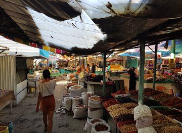
Jayma Bazaar
Experience the vibrant essence of Kyrgyz culture at Jayma Bazaar, where traditional crafts, local delicacies, and a bustling atmosphere await.
-
Souvenir store
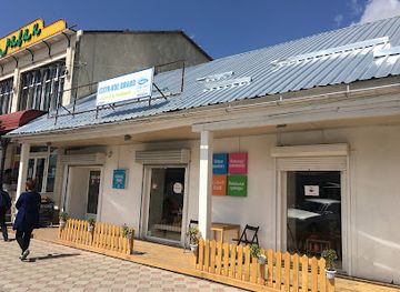
Issyk-Kul Brand Shop
Explore authentic Kyrgyz culture at Issyk-Kul Brand Shop, featuring unique souvenirs, natural goods, and local delicacies in Karakol.
-
Outdoor activity organiser
Visit Alay - Tajikistan Tours
Discover Tajikistan's breathtaking landscapes and rich culture with Visit Alay, your trusted outdoor adventure organizer.


Get your free copy of our complete guide to Pamir-Alai Mountains, delivered straight to you.
Everything on this page, from attractions and restaurants to essentials and local phrases, in one PDF you can read offline, print or share.
Already have an account? Sign in
Your Pamir-Alai Mountains guide is ready.
We'll send it to · Not you? Sign out

Getting your guide ready…
We are putting together a fresh copy of the Pamir-Alai Mountains guide. This can take up to a minute.
This can take a few moments. If your browser asks, choose Allow so the download can start. You'll find the guide in your Downloads folder.
Nothing happened? Download it again
Sorry, the guide is taking longer than usual. Please try again in a minute, or get it by email instead.
Pamir-Alai Mountains essentials
Currency and Payment
Safety
Emergency Situations
Do's and Don'ts
Local Tips
From Eve
Local phrases worth knowing
You don't need to get them perfect. A few words go a long way, and locals appreciate the effort.
Basics
| English | Local | Say it |
|---|---|---|
| Hello | Салам | [Salam] |
| Goodbye | Сау бол | [Sau bol] |
| Yes | Ооба | [Ooba] |
| No | Жок | [Jok] |
| Please/You’re welcome | Суранамын | [Surana myn] |
| Thank you | Рахмат | [Rahmat] |
| Excuse me/Sorry | Кечиресиз | [Kechiresiz] |
| How are you? | Сиз кандайсыз? | [Siz kandaysyz?] |
| Fine. And you? | Жакшы. Ал сиз? | [Jakshy. Al siz?] |
| Do you speak English? | Сиз англисче сүйлөйсүзбү? | [Siz anglische süylöy süz bü?] |
| I don’t understand | Мен түшүнбөйм | [Men tüshünböy m] |
Eating & Drinking
| English | Local | Say it |
|---|---|---|
| I’d like to see the menu, please | Мени менюну көрсөтүңүз, суранамын | [Meni menyunu körsötüñüz, surana myn] |
| I don’t eat meat | Мен эт жомок эмесмин | [Men et jomok emesmin] |
| Cheers! | Кошук! | [Koshuk!] |
| I would like to pay, please | Мен төлөмдү каалайм, суранамын | [Men tölömdü kaalaym, surana myn] |
Emergencies
| English | Local | Say it |
|---|---|---|
| Help! | Жардам бериңиз! | [Jardam beriñiz!] |
| Go away! | Кет! | [Ket!] |
| Call the Police! | Полицияны чакырыңыз! | [Politsiyany chakyryñız!] |
| Call a doctor! | Доктурду чакырыңыз! | [Dokturdü chakyryñız!] |
| I’m lost | Мен жоголуп кеттим | [Men jogolup kettim] |
| I’m ill | Мен ооруйм | [Men ooruym] |
Shopping
| English | Local | Say it |
|---|---|---|
| I’d like to buy... | Мен сатып алгым келет... | [Men satıp algım kelet...] |
| I’m just looking | Мен жөн гана карап жатам | [Men jön gana karap jatam] |
| How much is it? | Бул канча турат? | [Bul kancha turat?] |
| That’s too expensive | Бул өтө кымбат | [Bul ö Tö kymbat] |
| Can you lower the price? | Баасын төмөндөтсөңүз болот беле? | [Baasını tömön dötsöñüz bolot bele?] |
Time & Numbers
| English | Local | Say it |
|---|---|---|
| What time is it? | Саат канча? | [Saat kancha?] |
| It’s one o’clock | Бир саат | [Bir saat] |
| Half past (10) | Ондон жарым | [Ondon zharım] |
| Morning | Таң | [Tang] |
| Afternoon | Түш | [Tüsh] |
| Evening | Кечинде | [Kechinde] |
| Yesterday | Кечээ | [Kechée] |
| Today | Бүгүн | [Bügün] |
| Tomorrow | Эртең | [Erteñ] |
| 1 | Бир | [Bir] |
| 2 | Эки | [Eki] |
| 3 | Үч | [Üch] |
| 4 | Төрт | [Tört] |
| 5 | Беш | [Besh] |
| 6 | Алты | [Alty] |
| 7 | Жети | [Zheti] |
| 8 | Сегиз | [Segiz] |
| 9 | Тогуз | [Toguz] |
| 10 | Он | [On] |
Transport & Directions
| English | Local | Say it |
|---|---|---|
| Where's a/the...? | Кайда ...? | [Kayda ...?] |
| What's the address? | Адреси канча? | [Adresi kancha?] |
| Can you show me (on the map)? | Маған көрсөңүз (картадан)? | [Mağan körsöñüz (kartadan)?] |
| When's the next (bus)? | Кийинки (автобус) качан? | [Kiyinki (avtobus) kachan?] |
| A ticket (to ....) | Билет (.... жери) | [Bilet (.... jer)] |
History of Pamir-Alai Mountains
Early mountain routes and pastoral life
The Alay and adjoining Pamir-Alai valleys have long functioned as routes between the lowlands of the Ferghana region and the high passes leading towards the Pamirs and eastern Central Asia. Archaeological evidence in the wider southern Kyrgyzstan area points to successive pastoral and settled communities, while seasonal movement between valley settlements and high pastures became a defining feature of Kyrgyz economic life. The mountains were not an empty barrier: passes, river valleys and grazing grounds connected communities, although travel was always closely governed by altitude, weather and access to water.
Silk Roads and transmontane exchange
The mountain corridors south of Osh formed part of a wider network of routes linking Central Asian market centres with territories beyond the Pamirs. Goods, animals, travellers and ideas moved through the region in stages rather than along one single road. The Alay Valley's importance lay in its position between the Ferghana basin and highland routes towards China and the Pamirs. Although the most substantial cities and caravan centres lay outside the modern mountain region, the paths and settlement patterns of the valleys reflect this long history of exchange.
Kokand rule and frontier politics
From the eighteenth century into the nineteenth, much of southern Kyrgyzstan came under the influence or authority of the Kokand Khanate. Forts, taxation and military pressure affected communities in the Ferghana-facing valleys, while highland groups retained considerable local autonomy. The Alay was also shaped by political competition between Central Asian rulers and expanding Russian power. These changes gradually turned mountain passes and pasturelands into strategically important frontier spaces, a role that intensified as imperial boundaries advanced towards the Pamirs.
Russian expansion and the Alay campaigns
Russian imperial forces extended control into southern Kyrgyzstan during the nineteenth century, following the defeat of the Kokand Khanate and the consolidation of Russian administration in the Ferghana region. The Alay became associated with resistance, negotiation and the incorporation of nomadic territories into a new imperial frontier. The campaigns and administrative changes affected pasture use, taxation and political authority. Later Soviet boundary-making further formalised borders across the Pamir-Alai, leaving a region whose cultural connections extend beyond the present-day Kyrgyz frontier.
Soviet roads, borders and modernisation
During the Soviet period, roads, collective farms, schools and administrative settlements transformed the practical geography of the Alay. Mountain communities were incorporated into planned agricultural systems, while transport routes linked remote valleys to regional centres and border infrastructure. The modern road network through southern Kyrgyzstan reflects this period as well as later investment. Soviet cartography and the division of Central Asia into republics also gave contemporary borders greater administrative force, even though pastoral, linguistic and trading relationships continued across them.
Mountaineering and the opening of high-altitude travel
The high peaks of the Trans-Alay, particularly Lenin Peak on the Kyrgyz-Tajik frontier, became established objectives for Soviet and later international mountaineering. Expeditions brought specialised camps, route knowledge and seasonal employment to the Kyrgyz side of the range. Since independence, the Alay has also gained recognition among trekkers, horse riders and overland travellers seeking high valleys and remote roads. This newer tourism exists alongside pastoral life rather than replacing it, making careful local coordination and respect for seasonal land use important.
Pamir-Alai Mountains in Photos
Browse through our photo collection highlighting the charm and character of the destination.
Neighbouring regions of Pamir-Alai Mountains
The closest regions to Pamir-Alai Mountains, if you have time for more than one.
-

-

-

-

-


Swipe for more regions
Explore more
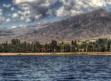
Explore more of Kyrgyzstan
Discover Kyrgyzstan: A land of majestic mountains, nomadic traditions, and rich history in the heart of Central Asia.
Explore Kyrgyzstan