

Free Katahdin Region Travel Guide & Mobile App
Explore Katahdin Region with free travel guides. Discover regional history, expert tips, proposed trips, and audio guides on web or mobile app.


Explore Maine’s Katahdin Region for mountain trails, deep forests, working-woods heritage, remote rivers and four-season outdoor adventure.
Read more about Katahdin Region
Getting to and around Katahdin Region
How to get there
Transportation
Best attractions in Katahdin Region
The Katahdin Region’s attractions are primarily outdoor and landscape-based. Baxter State Park provides the signature experience, with demanding trails on Katahdin, quieter routes around ponds and valleys, and a carefully protected wilderness setting. Hiking ranges from short woodland walks to serious mountain days, while camping, wildlife watching, fishing and paddling are important parts of the wider offering. Katahdin Woods and Waters National Monument adds river corridors, waterfalls, forest roads and viewpoints towards the mountain, although visitors should expect limited infrastructure and plan independently. Around Millinocket, the West Branch of the Penobscot supports canoeing, kayaking, fishing and rafting, with local outfitters and guides helping visitors choose suitable trips. Snowmobiling and cross-country skiing become major seasonal activities in winter. The region also offers opportunities to understand Maine’s logging and paper-making history through local interpretation, former industrial landscapes and the continuing presence of working forests. Rather than a concentration of conventional museums or amusement attractions, the area’s appeal lies in the scale of its woodland, the variety of water environments and the contrast between a small service town and genuinely remote country.
-
State park
Quoddy Head State Park
Explore the stunning coastal beauty and diverse wildlife of Quoddy Head State Park, a must-visit destination in Maine for nature lovers and adventure seekers.
-
State park
Baxter State Park
Explore the stunning beauty of Baxter State Park in Maine, where adventure meets tranquility in a pristine natural setting.
-
State park
Lily Bay State Park
Experience the natural beauty and outdoor adventures at Lily Bay State Park, a serene oasis on Moosehead Lake in Maine.
-
Historical landmark
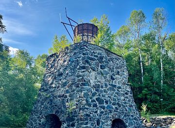
Katahdin Iron Works State Historic Site
Explore the historic Katahdin Iron Works State Historic Site in Maine, where industrial heritage meets stunning natural beauty.

Explore Katahdin Region on the map
Plan your trip on one map. See where the top cities, national parks and sights are, and book hotels and experiences in a few clicks.
Best hotels in Katahdin Region
Best restaurants in Katahdin Region
Dining in the Katahdin Region is shaped by its outdoor culture and small, dispersed communities. Millinocket offers the broadest choice, including diners, cafés, pubs and casual restaurants where hearty breakfasts, soups, burgers, sandwiches and other practical meals suit hikers, paddlers and snowmobilers. In smaller settlements and rural areas, food is more likely to be found at an inn, general store or seasonal service rather than in a dense restaurant district. Maine staples such as seafood, blueberries, potatoes, baked goods and maple products appear alongside familiar northern New England cooking, while packed lunches are useful for remote excursions. Local craft beer and coffee are common complements to casual dining, but opening arrangements can vary by season and day of the week. Visitors heading into Baxter State Park or the monument should buy provisions in advance, as dependable food services are limited once they leave the main communities.
-
State park
Baxter State Park
Explore Baxter State Park: A Majestic Wilderness Retreat in Maine with Stunning Views and Outdoor Adventures Awaiting You.
-
Resort hotel
New England Outdoor Center
Discover adventure and relaxation at New England Outdoor Center – your gateway to Maine's stunning landscapes and thrilling outdoor activities.
-
American
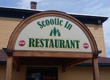
Scootic In Restaurant
Experience culinary delight at Scootic In Restaurant in Millinocket – where American comfort meets Italian tradition and fresh seafood.
-
General store
Katahdin General Store, LLC
Discover the heart of Millinocket at Katahdin General Store - where local flavors meet unique finds.



Best bars in Katahdin Region
Nightlife in the Katahdin Region is low-key and community-based rather than club-oriented. Millinocket has the greatest concentration of pubs, taverns, restaurant bars and informal evening gathering places, with activity often reflecting the season and the flow of hikers, snowmobilers and local residents. In smaller communities, evenings centre on traditional bars, cafés, lodges and occasional live music rather than dedicated nightclubs. Après-outdoor conversation, local beer and simple meals are more typical than late-night entertainment, and rural distances make responsible transport planning important. Some accommodation providers and outdoor businesses create a social atmosphere for visitors, but hours and seasonal availability can change. The absence of a major club scene is part of the region’s character: after dark, many visitors are more likely to be stargazing, resting after a mountain day or enjoying the quiet of a lakeside camp.
-
Mountain peak
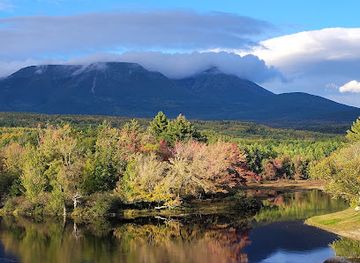
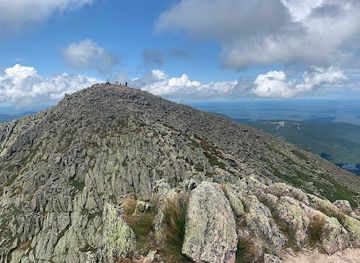
Mt Katahdin
Explore the breathtaking beauty of Mt Katahdin, Maine's highest peak, a must-visit destination for hikers and nature lovers.
Best nightclubs in Katahdin Region
Nightlife in the Katahdin Region is low-key and community-based rather than club-oriented. Millinocket has the greatest concentration of pubs, taverns, restaurant bars and informal evening gathering places, with activity often reflecting the season and the flow of hikers, snowmobilers and local residents. In smaller communities, evenings centre on traditional bars, cafés, lodges and occasional live music rather than dedicated nightclubs. Après-outdoor conversation, local beer and simple meals are more typical than late-night entertainment, and rural distances make responsible transport planning important. Some accommodation providers and outdoor businesses create a social atmosphere for visitors, but hours and seasonal availability can change. The absence of a major club scene is part of the region’s character: after dark, many visitors are more likely to be stargazing, resting after a mountain day or enjoying the quiet of a lakeside camp.
-
Park
Appalachian Mountain Club 100 Mile Wilderness Conservation Area
Explore the rugged landscapes and pristine wilderness of the Appalachian Mountain Club's 100 Mile Wilderness Conservation Area in Maine.
-
Night club
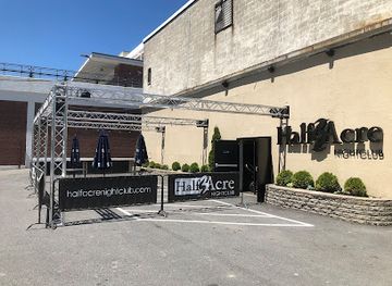
Half Acre Nightclub
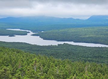
Half Acre Nightclub: Discover Bangor's energetic nightlife with music, dancing, and a vibrant bar scene.
Best shops in Katahdin Region
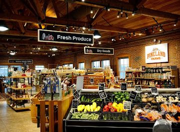
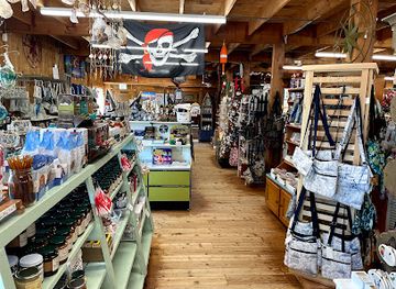
Shopping in the Katahdin Region is practical and locally focused. Millinocket is the main place to obtain groceries, fuel, outdoor supplies, clothing, maps and last-minute provisions before travelling into Baxter State Park or the more remote conservation lands. Independent shops, cafés, galleries and seasonal vendors may offer Maine-made food, artwork, books, clothing and outdoor-related goods, while local farm stands and small markets provide opportunities to buy blueberries, maple products, baked goods and other regional produce when available. The surrounding communities have modest high streets rather than extensive retail centres, and opening days can be seasonal, so visitors should not postpone essential purchases until they reach a small settlement. Souvenirs connected with Katahdin, the Appalachian Trail, the North Woods and local conservation areas are common, but the most meaningful regional purchases are often practical: locally produced food, handcrafted items or maps and books that reflect the landscape and its working-forest history.
-
Outlet mall
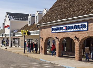
Kittery Premium Outlets
Explore Kittery Premium Outlets for unbeatable deals on your favorite brands in a beautiful coastal setting.
-
Farm
Pineland Farms
Discover the beauty of Pineland Farms, where agriculture meets adventure in the heart of Maine's countryside.
-
Gift shop
Land's End Gift Shop
Explore Land's End Gift Shop in Bailey Island for unique artisan gifts and treasures that embody the spirit of Maine's coastal charm.
-
General store
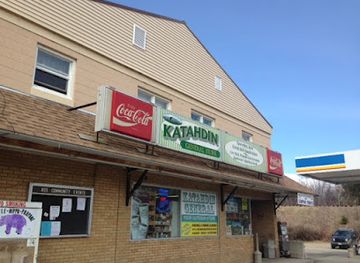
Katahdin General Store, LLC
Discover the charm of Katahdin General Store, your go-to spot for Maine-themed treasures and adventure essentials in Millinocket.
Get your free copy of our complete guide to Katahdin Region, delivered straight to you.
Everything on this page, from attractions and restaurants to essentials and local phrases, in one PDF you can read offline, print or share.
Already have an account? Sign in
Your Katahdin Region guide is ready.
We'll send it to · Not you? Sign out

Getting your guide ready…
We are putting together a fresh copy of the Katahdin Region guide. This can take up to a minute.
This can take a few moments. If your browser asks, choose Allow so the download can start. You'll find the guide in your Downloads folder.
Nothing happened? Download it again
Sorry, the guide is taking longer than usual. Please try again in a minute, or get it by email instead.
Katahdin Region essentials
Currency and Payment
Safety
Emergency Situations
Do's and Don'ts
Local Tips
From Eve
Local phrases worth knowing
You don't need to get them perfect. A few words go a long way, and locals appreciate the effort.
Basics
| English | Local | Say it |
|---|---|---|
| Hello | Howdy | [haʊdi] |
| Goodbye | See ya | [si jə] |
| Yes | Yup | [jʌp] |
| No | Nope | [noʊp] |
| Please/You're welcome | You bet | [ju bɛt] |
| Thank you | Thanks a lot | [θæŋks ə lɑt] |
| Excuse me/Sorry | Pardon me | [ˈpɑrdən mi] |
| How are you? | How's it going? | [haʊz ɪt ˈgoʊɪŋ] |
| Fine. And you? | Good. And you? | [ɡʊd. ənd ju] |
| Do you speak English? | Do ya know English? | [du jə noʊ ˈɪŋɡlɪʃ] |
| I don't understand | I ain't gettin' it | [aɪ eɪnt ˈɡɛtɪn ɪt] |
Eating & Drinking
| English | Local | Say it |
|---|---|---|
| I'd like to see the menu, please | Can I see the menu, please? | [kæn aɪ si ðə ˈmɛnju pliz] |
| I don't eat meat | I ain't eatin' meat | [aɪ eɪnt ˈiːtɪn mit] |
| Cheers! | Cheers! | [ʧɪrz] |
| I would like to pay, please | Can I pay, please? | [kæn aɪ peɪ pliz] |
Emergencies
| English | Local | Say it |
|---|---|---|
| Help! | Help! | [hɛlp] |
| Go away! | Get lost! | [ɡɛt lɔst] |
| Call the Police! | Call the cops! | [kɔl ðə kɑps] |
| Call a doctor! | Get a doctor! | [ɡɛt ə ˈdɑktər] |
| I'm lost | I’m all turned around | [aɪm ɔl tɜrnd əˈraʊnd] |
| I'm ill | I ain't feelin' well | [aɪ eɪnt ˈfiːlɪn wɛl] |
Shopping
| English | Local | Say it |
|---|---|---|
| I'd like to buy... | I wanna buy... | [aɪ ˈwɑnə baɪ] |
| I'm just looking | Just browsin' | [dʒʌst ˈbraʊzɪn] |
| How much is it? | What's the price? | [wʌts ðə praɪs] |
| That's too expensive | That's a bit steep | [ðæts ə bɪt stip] |
| Can you lower the price? | Can ya drop the price? | [kæn jə drɑp ðə praɪs] |
Time & Numbers
| English | Local | Say it |
|---|---|---|
| What time is it? | What time ya got? | [wʌt taɪm jə ɡɑt] |
| It's one o'clock | It's one | [ɪts wʌn] |
| Half past (10) | Half past ten | [hæf pæst tɛn] |
| Morning | Mornin' | [ˈmɔrnɪn] |
| Afternoon | Afternoon | [ˌæftərˈnun] |
| Evening | Evenin' | [ˈivnɪn] |
| Yesterday | Yesterday | [ˈjɛstərdeɪ] |
| Today | Today | [təˈdeɪ] |
| Tomorrow | Tomorrow | [təˈmɔroʊ] |
| 1 | One | [wʌn] |
| 2 | Two | [tu] |
| 3 | Three | [θri] |
| 4 | Four | [fɔr] |
| 5 | Five | [faɪv] |
| 6 | Six | [sɪks] |
| 7 | Seven | [ˈsɛvən] |
| 8 | Eight | [eɪt] |
| 9 | Nine | [naɪn] |
| 10 | Ten | [tɛn] |
Transport & Directions
| English | Local | Say it |
|---|---|---|
| Where's a/the...? | Where's the...? | [wɛrz ðə] |
| What's the address? | What's the address? | [wʌts ði əˈdrɛs] |
| Can you show me (on the map)? | Can ya show me (on the map)? | [kæn jə ʃoʊ mi (ɑn ðə mæp)] |
| When's the next (bus)? | When's the next bus? | [wɛn z ðə nɛkst bʌs] |
| A ticket (to ....) | One ticket (to ...) | [wʌn ˈtɪkɪt (tu ...)] |
History of Katahdin Region
Penobscot Homeland and River Travel
The Katahdin Region lies within the wider homeland of the Penobscot Nation, whose culture and history are closely connected with the Penobscot River, its tributaries and the surrounding forests. Rivers provided routes for travel, fishing and seasonal movement, while knowledge of woodland ecology supported hunting and gathering. Mount Katahdin and the surrounding landscape hold enduring significance in Wabanaki cultural geography. Visitors should understand that the region’s history did not begin with logging or European settlement, and that Indigenous communities remain part of Maine’s present as well as its past.
European Settlement and the North Woods
European-American settlement expanded slowly into the Katahdin country because the terrain was distant from Maine’s coastal towns and difficult to farm. River corridors and lakes supported limited settlement, guiding later roads, camps and timber operations. The area remained overwhelmingly forested, and its development was shaped less by dense agriculture than by seasonal resource use, hunting, guiding and the movement of timber. The resulting pattern of small communities separated by extensive woodland still defines the region’s geography.
Logging and River Drives in the Nineteenth Century
During the nineteenth century, commercial logging transformed the North Woods. Crews cut spruce and other timber, then used streams and rivers to move logs towards sawmills and downstream markets. The West Branch and East Branch systems were essential transport routes, while camps, tote roads and logging railways extended deeper into the forest. This work was physically demanding and seasonal, creating a distinctive working-woods culture that remains visible in local stories, roads, buildings and the continuing importance of forestry.
Millinocket and the Great Northern Paper Company
Millinocket grew rapidly after the Great Northern Paper Company established a major pulp and paper mill there in the late nineteenth century. Hydroelectric power from the West Branch of the Penobscot helped make large-scale manufacturing possible, and the mill became the economic centre of the community for generations. Papermaking supported employment, schools, shops and transport links, while also tying the town’s fortunes to global changes in the paper industry. The mill’s eventual closure marked a major economic and social transition for the region.
Baxter State Park and the Conservation of Katahdin
Former Maine governor Percival P. Baxter began acquiring land around Katahdin in the 1930s and donated it to the people of Maine, creating the foundation of Baxter State Park. Further gifts and acquisitions expanded the park over subsequent decades. Baxter’s vision favoured a protected mountain wilderness rather than intensive development, and the park continues to operate under distinctive rules intended to conserve its forests, ponds, wildlife and high country. Its approach explains the limited infrastructure and careful access arrangements encountered by visitors today.
The Appalachian Trail Reaches Katahdin
Katahdin became the northern terminus of the Appalachian National Scenic Trail, which runs through fourteen eastern states from Georgia. The trail’s northern approach helped give the mountain an important place in American long-distance hiking culture, although the summit lies within a demanding wilderness environment rather than an urban trail system. Northbound hikers finish on Baxter Peak, while others visit the mountain as part of a shorter Maine expedition. The Appalachian Trail has strengthened the region’s international profile without changing its remote physical character.
From Paper Industry to Conservation and Outdoor Recreation
The decline of papermaking forced Millinocket and neighbouring communities to reconsider their economic future. Tourism, guiding, hospitality, renewable energy and outdoor recreation have become more prominent alongside forestry and other traditional activities. In 2016, Katahdin Woods and Waters National Monument was established along the East Branch of the Penobscot, adding a nationally recognised conservation landscape to the region. Debate over land use continues, reflecting the area’s long-standing balance between public access, environmental protection and the working forest.
Katahdin Region in Photos
Browse through our photo collection highlighting the charm and character of the destination.
Neighbouring regions of Katahdin Region
The closest regions to Katahdin Region, if you have time for more than one.
-

-

-

-

-
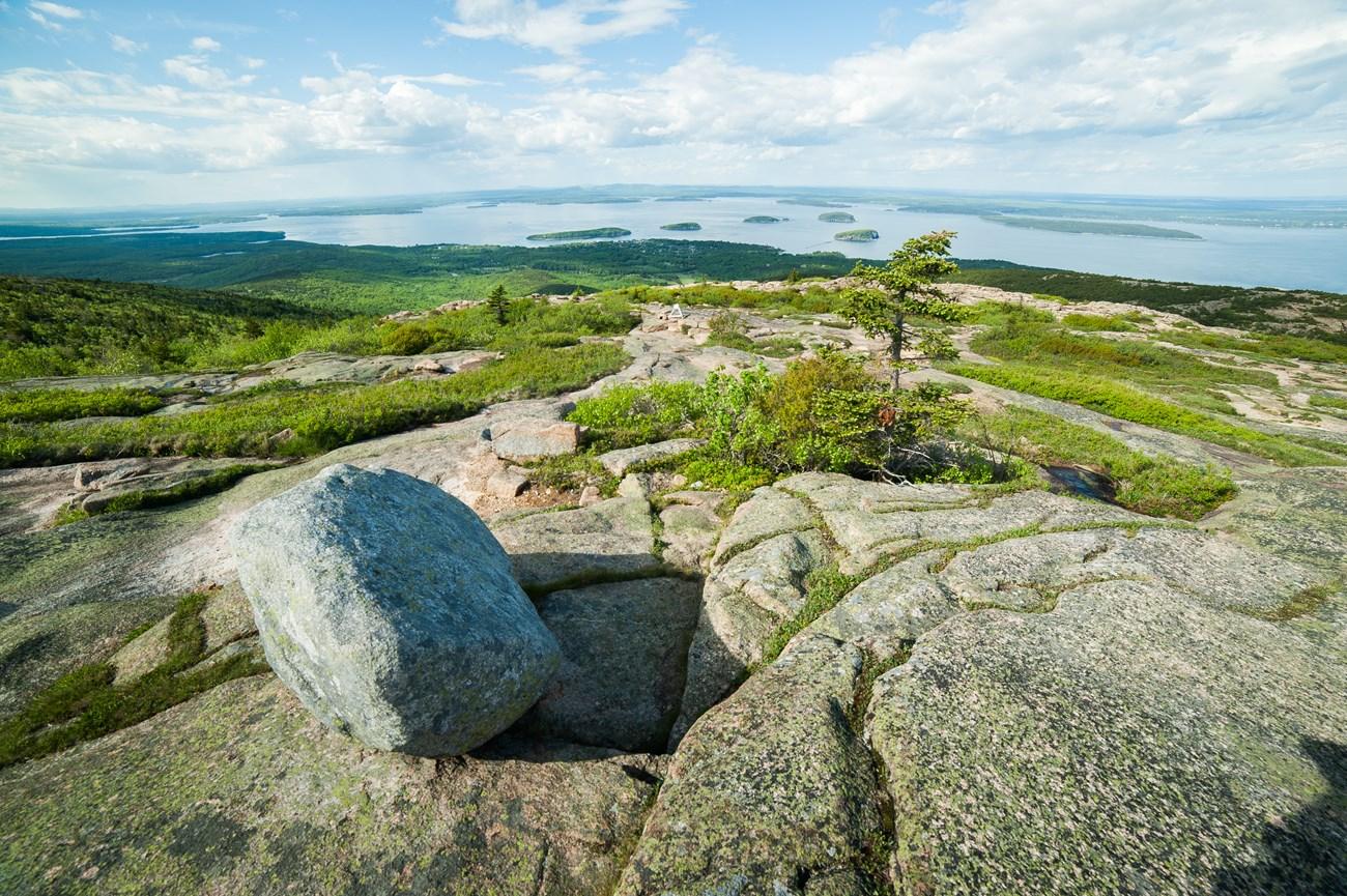 Downeast
Explore Downeast Maine for Acadia landscapes, working harbours, wild blueberry country, tidal shores and quiet coastal roads.


Swipe for more regions
Explore more

Explore more of Maine
Discover Maine's breathtaking landscapes, charming coastal towns, and rich cultural heritage. From Acadia's cliffs to fresh lobster feasts, Maine promises an unforgettable adventure.
Explore Maine