

Free Aroostook County Travel Guide & Mobile App
Explore Aroostook County with free travel guides. Discover regional history, expert tips, proposed trips, and audio guides on web or mobile app.


Explore Aroostook County’s potato country, St John Valley heritage, northern forests, winter trails and wide-open Maine landscapes.
Read more about Aroostook County
When is the best time to visit Aroostook County?
Best: June–August · 23–26°C| Month | High (°C) | Rainfall (mm) |
|---|---|---|
| January | -7 | 60 |
| February | -4 | 55 |
| March | 4 | 65 |
| April | 12 | 75 |
| May | 18 | 90 |
| June (best) | 23 | 100 |
| July (best) | 26 | 105 |
| August (best) | 25 | 100 |
| September | 19 | 90 |
| October | 12 | 80 |
| November | 4 | 70 |
| December | -3 | 65 |
Getting to and around Aroostook County
How to get there
Transportation
Destinations in Aroostook County
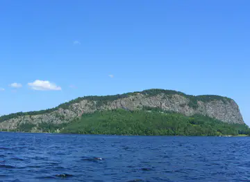
Resorts, valleys and scenic spots worth a trip of their own.
-

-

-


Swipe for more destinations
Best attractions in Aroostook County
Aroostook County’s attractions are spread across a large rural landscape rather than concentrated in one visitor district. Presque Isle combines the Northern Maine Museum of Science with the Nordic Heritage Outdoor Center, whose trails and facilities support cross-country skiing, biathlon and year-round recreation. Nearby Aroostook State Park offers hiking, swimming and paddling around Echo Lake in a more compact setting. At Mars Hill, Bigrock Mountain provides downhill skiing and broad views over the agricultural county. The St John Valley adds a strong cultural dimension through the Acadian Village in Van Buren, the Musée culturel du Mont-Carmel in Madawaska and Fort Kent’s historic blockhouse. Houlton, Caribou and Presque Isle contain further local museums, civic history and seasonal events. Outdoor visitors can fish, canoe, cycle, hike and snowmobile, but should allow for long distances and variable access. The former Loring Air Force Base near Limestone provides a different perspective on regional military history, while the Maine Solar System Model along the Route 1 corridor turns a long road journey between communities into an educational landscape experience.
-
Historical landmark
America's First Mile - U.S. Route 1
Experience the historic charm of America's First Mile on U.S. Route 1 in Fort Kent, Maine, where adventure and history meet in stunning landscapes.
-
State park
Allagash Wilderness Waterway
Explore the Allagash Wilderness Waterway, a stunning state park in Maine offering pristine lakes, serene rivers, and abundant opportunities for outdoor adventure.


Best landmarks in Aroostook County
Fort Kent Blockhouse is Aroostook’s most recognisable historic structure, a preserved nineteenth-century defensive building associated with the boundary tensions that preceded the Aroostook War. In the St John Valley, the churches, older houses and river communities of Madawaska, Van Buren and Fort Kent express the area’s Acadian and Franco-American history, while the Musée culturel du Mont-Carmel occupies a former religious complex with a prominent position overlooking the valley. Presque Isle’s civic buildings and agricultural surroundings represent the county’s development as a service and potato-farming centre. The former Loring Air Force Base near Limestone forms a very different landmark landscape of runways, military infrastructure and Cold War memory. For natural reference points, Mars Hill rises above the surrounding farm country, and the wooded shores and hills of Aroostook State Park provide a compact example of the county’s northern terrain. The St John River itself is both a geographical feature and a cultural landmark, marking a border that has never fully separated the communities along its banks.
-
State park
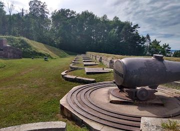
Fort Knox and Penobscot Narrows Observatory
Explore Maine's historic Fort Knox and enjoy breathtaking views from the Penobscot Narrows Observatory, a blend of history and natural beauty.
-
Historical place
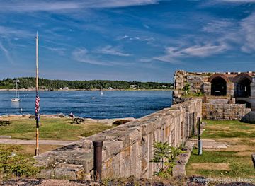
Fort Popham State Historic Site
Explore Fort Popham State Historic Site – a captivating blend of history, architecture, and stunning coastal views in Phippsburg, Maine.
-
Historical landmark
America's First Mile - U.S. Route 1
Experience the historical significance and natural beauty of America's First Mile - U.S. Route 1 in Fort Kent, Maine, a unique travel destination for every explorer.
-
State park
Aroostook State Park
Discover the natural beauty of Aroostook State Park in Maine, perfect for outdoor activities, wildlife watching, and serene escapes into nature.


Explore Aroostook County on the map
Plan your trip on one map. See where the top cities, national parks and sights are, and book hotels and experiences in a few clicks.
Best hotels in Aroostook County
Best restaurants in Aroostook County
Dining in Aroostook County reflects its farming economy, northern climate and St John Valley heritage. Potato-based dishes, baked goods, preserves and locally raised produce appear in family restaurants, cafés, diners and seasonal farm outlets, while the county’s working landscape supports straightforward meals built around filling portions and regional ingredients. In Madawaska, Van Buren and Fort Kent, French-Canadian and Acadian influences can be found in home-style cooking, meat pies, breads and other locally familiar preparations, though recipes vary between families and establishments. Presque Isle, Caribou and Houlton offer the broadest choice of restaurants, from casual American dining and pizza to contemporary menus and cafés. Rural inns and traditional pubs are useful for an evening meal outside the main towns. Farmers’ markets and roadside stands are particularly worthwhile in the growing season, when potatoes, berries, vegetables and preserves provide a more direct connection with Aroostook’s agricultural identity.
-
American
Governor's Restaurant & Bakery
Experience delightful American cuisine at Governor's Restaurant & Bakery in Presque Isle - perfect for breakfast, lunch, or dessert.
-
American
Grammy's Country Inn
Experience authentic American comfort food at Grammy's Country Inn in Houlton, Maine - where every meal feels like home.
-
Seafood
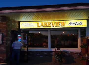
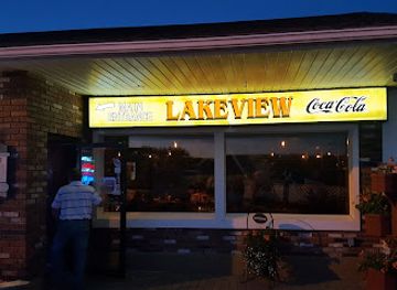
Lakeview Restaurant
Experience fresh seafood and American classics at Lakeview Restaurant while enjoying stunning lakeside views in St. Agatha.
-
American
Swamp Buck Restaurant & Lounge
Experience the heart of American cuisine at Swamp Buck Restaurant & Lounge in Fort Kent, where flavors meet hospitality.



Best bars in Aroostook County
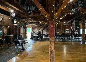
Evenings in Aroostook County are generally low-key, with traditional pubs, taverns, restaurant bars and cafés providing more of the social life than large nightclubs. Presque Isle has the broadest concentration of evening options, including places associated with live music, college life and local events, while Houlton, Caribou and the St John Valley offer smaller-scale venues and community-centred nightlife. Fort Kent’s hospitality scene is influenced by its outdoor-sports calendar, and busy periods can coincide with skiing, snowmobiling and local celebrations. Craft beer and spirits may appear on regional menus, but the county is not primarily a destination for late-night entertainment. In rural districts, evening plans often centre on an early meal, a pub gathering or a seasonal performance, and visitors should check current opening arrangements rather than expect city-style hours.
-
Seafood
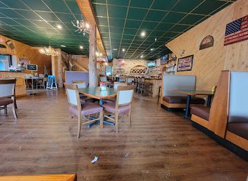
Lakeview Restaurant
Discover the charm of Lakeview Restaurant, where fresh seafood meets stunning lakeside views in St. Agatha, Maine.
-
American
Swamp Buck Restaurant & Lounge
Experience the heart of Fort Kent with delightful American cuisine and a cozy atmosphere at Swamp Buck Restaurant & Lounge.
-
American
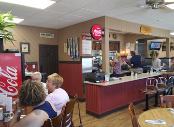
Riverside Inn Restaurant
Experience delicious American breakfast and casual dining at Riverside Inn Restaurant in Presque Isle, Maine, a local favorite for tourists and residents.
-
Grill
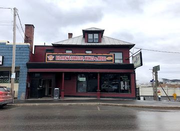
Big Ricks Burgers & Wings
Experience mouthwatering burgers and wings in a vibrant atmosphere at Big Ricks Burgers & Wings, the heart of Madawaska's culinary scene.
Best nightclubs in Aroostook County
-
Bar
Woody's Bar
Discover the heart of Greenville Junction nightlife at Woody's Bar, where delicious food and vibrant atmosphere come together for an unforgettable experience.
Best shops in Aroostook County
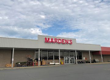
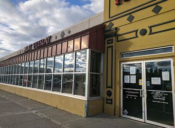
Shopping in Aroostook County is centred on practical town services, independent retailers, farm produce and locally made goods rather than large-scale luxury retail. Presque Isle and Houlton have the widest selection of shops, while Caribou and the St John Valley provide smaller high streets and specialist businesses. Farmers’ markets and seasonal farm stands are good places to look for potatoes, preserves, baked goods, maple products and other Maine produce, with availability changing through the year. Craft galleries, antique shops and independent gift stores may stock pottery, textiles, woodwork, artwork and products connected with Acadian or northern Maine culture. Museum shops can provide more considered regional souvenirs than generic roadside stores. Visitors should not expect a dense shopping district in the rural parts of the county, where distances between communities are considerable; combining shopping with a town visit, market morning or cultural stop is usually the most efficient approach.
-
Discount store
Marden's
Explore Marden's in Presque Isle, Maine, where incredible deals and unique surplus finds await every savvy shopper.
-
Shopping mall
Aroostook Centre Mall
Explore the Aroostook Centre Mall in Presque Isle, Maine – where shopping, dining, and entertainment come together for an unforgettable experience.
-
Department store
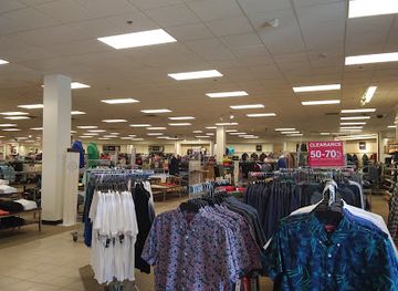
JCPenney
Discover fashion, home decor, and accessories at JCPenney in Presque Isle – your one-stop destination for shopping delights.
-
Grocery store
Shop 'n Save
Discover fresh local produce and a diverse selection of groceries at Shop 'n Save in Caribou, Maine, the ultimate shopping destination for tourists.

Get your free copy of our complete guide to Aroostook County, delivered straight to you.
Everything on this page, from attractions and restaurants to essentials and local phrases, in one PDF you can read offline, print or share.
Already have an account? Sign in
Your Aroostook County guide is ready.
We'll send it to · Not you? Sign out

Getting your guide ready…
We are putting together a fresh copy of the Aroostook County guide. This can take up to a minute.
This can take a few moments. If your browser asks, choose Allow so the download can start. You'll find the guide in your Downloads folder.
Nothing happened? Download it again
Sorry, the guide is taking longer than usual. Please try again in a minute, or get it by email instead.
Aroostook County essentials
Currency and Payment
Safety
Emergency Situations
Do's and Don'ts
Local Tips
From Eve
Local phrases worth knowing
You don't need to get them perfect. A few words go a long way, and locals appreciate the effort.
Basics
| English | Local | Say it |
|---|---|---|
| Hello | Howdy | [Ha-dee] |
| Goodbye | See ya later | [See ya lay-ter] |
| Yes | Yup | [Yup] |
| No | Nah | [Nah] |
| Please/You're welcome | No problem | [No prob-lem] |
| Thank you | Thanks a lot | [Thanks a lot] |
| Excuse me/Sorry | Pardon me | [Par-don me] |
| How are you? | How's it goin'? | [How's it goin'?] |
| Fine. And you? | Good, and you? | [Good, and you?] |
| Do you speak English? | Do ya speak English? | [Do ya speak English?] |
| I don't understand | I ain't gettin' it | [I ain't gettin' it] |
Eating & Drinking
| English | Local | Say it |
|---|---|---|
| I'd like to see the menu, please | Can I see the menu? | [Can I see the menu?] |
| I don't eat meat | I don't eat meat | [I don't eat meat] |
| Cheers! | Cheers! | [Cheers!] |
| I would like to pay, please | Can I get the bill? | [Can I get the bill?] |
Emergencies
| English | Local | Say it |
|---|---|---|
| Help! | Help! | [Help!] |
| Go away! | Get lost! | [Get lost!] |
| Call the Police! | Call the cops! | [Call the cops!] |
| Call a doctor! | Get a doctor! | [Get a doctor!] |
| I'm lost | I'm turned around | [I'm turned around] |
| I'm ill | I'm feelin' sick | [I'm feelin' sick] |
Shopping
| English | Local | Say it |
|---|---|---|
| I'd like to buy... | I wanna buy... | [I wanna buy...] |
| I'm just looking | I'm just browsin' | [I'm just browsin'] |
| How much is it? | What’s the price? | [What’s the price?] |
| That's too expensive | That’s a bit rich | [That’s a bit rich] |
| Can you lower the price? | Can ya knock off a bit? | [Can ya knock off a bit?] |
Time & Numbers
| English | Local | Say it |
|---|---|---|
| What time is it? | What time ya got? | [What time ya got?] |
| It's one o'clock | It's one | [It's one] |
| Half past (10) | Half past ten | [Half past ten] |
| Morning | Mornin' | [Mornin'] |
| Afternoon | Afternoon | [Afternoon] |
| Evening | Evenin' | [Evenin'] |
| Yesterday | Yesterday | [Yesterday] |
| Today | Today | [Today] |
| Tomorrow | Tomorrow | [Tomorrow] |
| 1 | One | [One] |
| 2 | Two | [Two] |
| 3 | Three | [Three] |
| 4 | Four | [Four] |
| 5 | Five | [Five] |
| 6 | Six | [Six] |
| 7 | Seven | [Seven] |
| 8 | Eight | [Eight] |
| 9 | Nine | [Nine] |
| 10 | Ten | [Ten] |
Transport & Directions
| English | Local | Say it |
|---|---|---|
| Where's a/the...? | Where's the...? | [Where's the...?] |
| What's the address? | What's the address? | [What's the address?] |
| Can you show me (on the map)? | Can ya point it out? | [Can ya point it out?] |
| When's the next (bus)? | When's the next bus? | [When's the next bus?] |
| A ticket (to ....) | A ticket to... | [A ticket to...] |
History of Aroostook County
Wabanaki Homeland and Early Indigenous Presence
Before European settlement, the forests, rivers and wetlands of northern Maine formed part of the homeland and travelling landscape of Wabanaki peoples, including the Maliseet, known as Wolastoqiyik in their own language. The St John River was an important natural corridor, linking communities and resources across what is now the Maine–New Brunswick border. European mapping and settlement later imposed different political boundaries, but Indigenous history remains fundamental to understanding the region’s geography and its long tradition of movement along rivers and through the forest.
French Settlement in the St John Valley
French-speaking settlement expanded along the upper St John River during the late eighteenth and nineteenth centuries, creating communities that developed enduring Acadian and Québécois connections. Madawaska, Van Buren and neighbouring towns on both sides of the river retain elements of this culture in family names, religious buildings, foodways and historical collections. The border did not erase these relationships, although it gradually placed closely connected communities under different national administrations. The St John Valley’s French heritage is one of Aroostook County’s clearest regional distinctions.
The Aroostook War and the Maine–Canada Boundary
Disputed claims over the boundary between Maine and British North America produced the Aroostook War in the late 1830s and early 1840s. The confrontation involved competing land surveys, timber interests and the movement of officials and militia into the upper St John and Aroostook valleys. Although no major battle took place, the crisis carried real political and economic consequences. The Webster–Ashburton Treaty of 1842 settled the boundary and established the international line that still shapes travel, trade and family connections in the region.
Agricultural Expansion and the Potato Economy
During the nineteenth and twentieth centuries, cleared land in central and southern Aroostook became increasingly associated with potato cultivation. Farms, seasonal labour, railways, storage facilities and processing businesses helped create a specialised agricultural economy centred on towns such as Presque Isle, Caribou and Houlton. Potatoes remain an important part of the county’s identity, although modern agriculture is more varied and mechanised than the traditional image suggests. The broad cultivated fields around the central county are a direct historical consequence of this transformation.
Railways, Forestry and Industrial Development
Railways connected Aroostook’s farms and timber resources with wider markets, encouraging the growth of towns and making large-scale extraction more practical. Forestry, sawmilling and pulp-related activity shaped employment and settlement across the northern woods, while rail connections supported the movement of agricultural goods. The county’s industrial history was never concentrated in one large urban centre; instead, it developed through a network of farms, mills, depots and service towns. Roads and trucking later replaced much of the railway’s former regional role.
Military Aroostook and Loring Air Force Base
The Second World War and the Cold War brought a major military presence to northern Aroostook. Loring Air Force Base, established near Limestone during the Second World War and later used by the United States Air Force, became one of the county’s largest installations. Its closure in the 1990s had a substantial economic impact, but the former base remains part of the landscape and local memory. The site also illustrates how Aroostook’s proximity to the Canadian border and northern air approaches gave the county strategic importance.
Modern Franco-American and Outdoor Culture
The twentieth and twenty-first centuries have seen Aroostook maintain its agricultural and forest economy while placing greater emphasis on heritage tourism, outdoor recreation and cultural interpretation. Institutions in the St John Valley preserve Acadian and Franco-American traditions, while Presque Isle’s Nordic facilities reflect the county’s strong winter-sports culture. Snowmobiling, cross-country skiing, fishing and hunting are not simply visitor activities but part of the region’s contemporary seasonal economy. These developments have added new forms of tourism without displacing the county’s older rural identity.
Aroostook County in Photos
Browse through our photo collection highlighting the charm and character of the destination.
Neighbouring regions of Aroostook County
The closest regions to Aroostook County, if you have time for more than one.
-

-

-

-

-


Swipe for more regions
Explore more

Explore more of Maine
Discover Maine's breathtaking landscapes, charming coastal towns, and rich cultural heritage. From Acadia's cliffs to fresh lobster feasts, Maine promises an unforgettable adventure.
Explore Maine