

Free Inner Niger Delta Travel Guide & Mobile App
Explore Inner Niger Delta with free travel guides. Discover regional history, expert tips, proposed trips, and audio guides on web or mobile app.


Explore Mali’s Inner Niger Delta for seasonal wetlands, ancient Djenné, river culture and remarkable landscapes, subject to strict security advice.
Read more about Inner Niger Delta
When is the best time to visit Inner Niger Delta?
Best: December–February · 26–29°C| Month | High (°C) | Rainfall (mm) |
|---|---|---|
| January (best) | 26 | 2 |
| February (best) | 29 | 2 |
| March | 35 | 3 |
| April | 38 | 8 |
| May | 41 | 15 |
| June | 41 | 30 |
| July | 37 | 80 |
| August | 35 | 100 |
| September | 35 | 50 |
| October | 34 | 20 |
| November | 30 | 5 |
| December (best) | 26 | 2 |
Getting to and around Inner Niger Delta
How to get there
Transportation
Destinations in Inner Niger Delta
Resorts, valleys and scenic spots worth a trip of their own.
-

-


Swipe for more destinations
Best attractions in Inner Niger Delta
The Inner Niger Delta’s principal attraction is its changing wetland environment rather than a conventional collection of developed visitor sites. From an authorised base near Mopti, the Niger–Bani confluence and river port illustrate how boats, fishing, grain and livestock have connected the floodplain for centuries. Djenné offers monumental earthen architecture and access to the archaeological landscape of Jenne-jeno, although visits require careful advance planning and current security assessment. Farther into the wetland, Lake Débo and Lake Walado-Débo are associated with broad open water, reed beds, fishing communities and important bird habitats, but they are remote and not suitable for casual independent excursions. Archaeological remains at Dia and the ruins of Hamdallahi provide insight into earlier urban and Islamic political traditions. Wetland observation, seasonal rice landscapes, pirogue travel, market activity and community-based cultural interpretation can all be meaningful, provided they are arranged responsibly and permitted locally. At present, severe insecurity may make many of these experiences inaccessible.
-
Tourist attraction
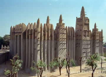
Grand Mosque of Mopti
Discover the Grand Mosque of Mopti, a stunning architectural landmark that reflects Mali's cultural heritage and spiritual essence.
-
Scenic spot
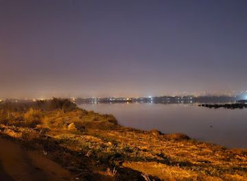
Fleuve Niger de Bamako
Experience the breathtaking beauty and cultural richness of the Fleuve Niger de Bamako, a picturesque river that embodies the heart of Mali.
-
 Garden
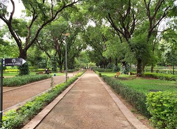
Lougal
Explore Lougal, a tranquil garden in Korientzé, offering lush greenery, vibrant flowers, and serene pathways for a peaceful escape into nature.
-
Tourist attraction
هندوhandaw
Explore the historical wonders of Timbuktu at Hindouhandaw, a key attraction that embodies the rich heritage of this ancient city.
Best landmarks in Inner Niger Delta
The Great Mosque of Djenné is the Inner Niger Delta’s best-known landmark, its monumental banco walls and regularly renewed earthen surface expressing the architectural traditions of the wider Sahel. The mosque stands within Djenné’s historic urban setting, where narrow streets and earthen houses reflect the town’s relationship with floodwaters and long-distance commerce. Mopti’s Komoguel Mosque provides another important example of Sudanese-Sahelian earthen architecture, while the town’s port is a functional landmark shaped by river transport rather than monumental design. The archaeological mound of Jenne-jeno represents a much older urban landscape beneath and around the modern floodplain, connecting present-day Djenné with early regional craft and trading networks. The ruins of Hamdallahi, the former capital of the Massina state, are historically significant for understanding nineteenth-century Islamic government in the delta. Lake Débo and Lake Walado-Débo are natural landmarks whose extent and appearance alter with the flood cycle, although their remoteness and current security conditions make access highly restricted.
-
National park
Mali National Park.
Escape the city bustle in Bamako's green heart: trails, gardens, and nature await at Mali National Park.
-
Mosque
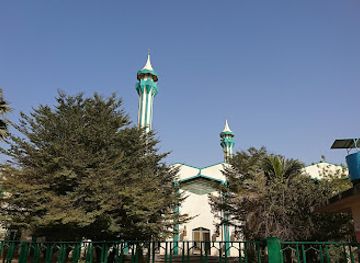
Grande Mosquée de Bamako
Discover Bamako's iconic mosque, a blend of Arabian architecture and Malian Islamic heritage, located near the city's central market and cathedral.
-
River
Niger
Explore the Niger River: West Africa's vital waterway, a cradle of civilization, offering scenic beauty and rich cultural experiences.
-
Zoo
ZOO NATIONAL DU MALI
Discover Mali's wildlife at ZOO NATIONAL DU MALI in Bamako, a destination for animal lovers and families seeking education and recreation.
Explore Inner Niger Delta on the map
Plan your trip on one map. See where the top cities, national parks and sights are, and book hotels and experiences in a few clicks.
Best hotels in Inner Niger Delta
Best restaurants in Inner Niger Delta
Dining in the Inner Niger Delta reflects the floodplain’s dependence on rice, millet, fish, livestock and seasonal produce. In Mopti and Djenné, visitors may encounter simple restaurants, market stalls and family kitchens serving rice with fish or meat, millet-based dishes, sauces and grilled or fried river fish where supplies and security allow. Tea is an important social drink, while sweetened drinks and basic coffee are common in urban settings. Food availability changes with transport, harvests and local conditions, and rural communities should not be treated as restaurant destinations. Visitors staying with a local host or using an established operator may be introduced to regional dishes, but should follow advice on water, food hygiene and safe eating. The delta’s culinary identity is best understood through its relationship with fishing, rice cultivation, pastoralism and trade rather than through a fixed list of branded specialities.
-
Restaurant
Amandine by Sel & Miel
Experience exquisite French pastries and local flavors at Amandine by Sel & Miel in Bamako—a must-visit culinary gem!
-
Restaurant
Relax
Experience authentic Lebanese cuisine at Relax Restaurant in Bamako - where every dish tells a story of flavor and tradition.
-
Restaurant
Bamako Kitchen
Experience authentic Malian cuisine at Bamako Kitchen - where traditional flavors meet vibrant culture in every dish.
-
Restaurant
Au bord de l'eau
Discover culinary delights at Au bord de l'eau in Bamako, where local flavors meet serene waterside dining.
Best bars in Inner Niger Delta
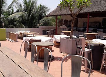
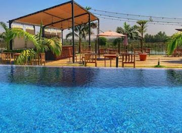
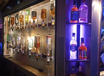
Nightlife in the Inner Niger Delta is limited and security conditions currently outweigh entertainment considerations. In Mopti and larger settlements, evening life has traditionally centred on tea, cafés, restaurants, conversation, music and occasional performances rather than a substantial nightclub circuit. Djenné’s evenings are generally quiet, and smaller floodplain communities have social life organised around households, markets, mosques and local gatherings rather than purpose-built venues. Alcohol is not central to public life in many communities, and visitors should respect local religious and social conventions. Night movement is particularly unwise in the present security environment; remain within accommodation or an authorised compound after dark unless local security arrangements explicitly permit travel. Any venue information should be checked locally because businesses, public events and operating patterns can change quickly.
-
Bar
Bla Bla Bar
Experience the vibrant nightlife of Bamako at Bla Bla Bar, where great drinks and local culture collide in a lively atmosphere.
-
Resort hotel
Ambedjele Resort hotel restaurant
Discover the charm of Ambedjele Resort Hotel Restaurant in Mopti, where culinary delights meet vibrant local culture in a stunning setting.
-
Restaurant
Izba bar
Discover the lively spirit of Bamako at Izba Bar, where delicious Malian cuisine meets a vibrant nightlife experience.
-
Bar
Le Pub Bar
Discover the lively spirit of Bamako at Le Pub Bar, where great drinks and vibrant nightlife await you.
Best nightclubs in Inner Niger Delta
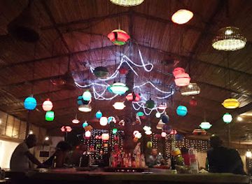
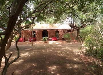
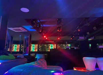
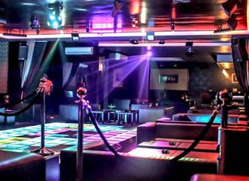
Nightlife in the Inner Niger Delta is limited and security conditions currently outweigh entertainment considerations. In Mopti and larger settlements, evening life has traditionally centred on tea, cafés, restaurants, conversation, music and occasional performances rather than a substantial nightclub circuit. Djenné’s evenings are generally quiet, and smaller floodplain communities have social life organised around households, markets, mosques and local gatherings rather than purpose-built venues. Alcohol is not central to public life in many communities, and visitors should respect local religious and social conventions. Night movement is particularly unwise in the present security environment; remain within accommodation or an authorised compound after dark unless local security arrangements explicitly permit travel. Any venue information should be checked locally because businesses, public events and operating patterns can change quickly.
-
Disco club
Le Byblos
Experience the vibrant nightlife at Le Byblos, a premier disco club in Bamako offering bowling, hookah, and authentic Lebanese cuisine.
-
Night club
IBIZA CLUB
Unleash your nightlife experience at Ibiza Club, Bamako's premier dance destination with electrifying music and vibrant atmosphere.
-
Night club
Éclipse
Experience the vibrant nightlife at Éclipse, Bamako's ultimate night club, where music, dance, and culture come together in an electrifying atmosphere.
-
Night club
LEVEL CLUB & LOUNGE
Experience the dynamic nightlife of Niamey at LEVEL CLUB & LOUNGE, where music, dance, and vibrant energy come together for an unforgettable night.


Best shops in Inner Niger Delta
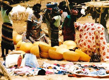
Shopping in the Inner Niger Delta is concentrated in markets and river-linked trading towns rather than formal retail districts. Mopti has traditionally been a place to encounter fish, grain, livestock products, household goods, textiles and practical items moving through the inland port, while Djenné’s market culture is closely connected to its surrounding agricultural communities. Visitors may find woven mats, baskets, leatherwork, textiles, carved objects and earthen architectural details represented in local craft traditions, but purchases should be made through reputable sellers and with respect for cultural property. Food products such as dried fish, rice and grain reflect the delta’s economy, although transport and customs rules should be considered before taking them abroad. Do not buy archaeological objects, old manuscripts or religious artefacts without clear provenance and legal documentation. Market days, stock and opening arrangements can change, and current security conditions may prevent access altogether.
-
Market
Sakarowel Market
Explore Sakarowel Market in Mopti for an authentic taste of Malian culture and a vibrant shopping experience filled with local goods and flavors.
-
Shopping mall
Mall of Africa
Explore the Mall of Africa in Bamako – a vibrant shopping destination with diverse retail, dining, and entertainment options.
-
Natural goods store
Shop MOTHER MARIE
Explore the essence of Mali at Shop MOTHER MARIE, your destination for authentic natural goods and local delicacies in Sevare.
-
Shopping mall
Boutique Halimatou Bello et fils
Discover unique Malian craftsmanship at Boutique Halimatou Bello et fils, a vibrant shopping destination in the heart of Mopti.

Get your free copy of our complete guide to Inner Niger Delta, delivered straight to you.
Everything on this page, from attractions and restaurants to essentials and local phrases, in one PDF you can read offline, print or share.
Already have an account? Sign in
Your Inner Niger Delta guide is ready.
We'll send it to · Not you? Sign out

Getting your guide ready…
We are putting together a fresh copy of the Inner Niger Delta guide. This can take up to a minute.
This can take a few moments. If your browser asks, choose Allow so the download can start. You'll find the guide in your Downloads folder.
Nothing happened? Download it again
Sorry, the guide is taking longer than usual. Please try again in a minute, or get it by email instead.
Inner Niger Delta essentials
Currency and Payment
Safety
Emergency Situations
Do's and Don'ts
Local Tips
From Eve
Local phrases worth knowing
You don't need to get them perfect. A few words go a long way, and locals appreciate the effort.
Basics
| English | Local | Say it |
|---|---|---|
| Hello | N'ka b'a | [N'ka bah] |
| Goodbye | N'ka k'a | [N'ka kah] |
| Yes | Iye | [Ee-yeh] |
| No | Ayi | [Ah-yee] |
| Please/You're welcome | Bara | [Bah-rah] |
| Thank you | M'be | [M-beh] |
| Excuse me/Sorry | Foli | [Foh-lee] |
| How are you? | I ni ce? | [Ee nee che?] |
| Fine. And you? | Ne y'a, i ni ce? | [Neh yah, ee nee che?] |
| Do you speak English? | I ka fo English? | [Ee kah fo English?] |
| I don't understand | N'ka fere | [N'kah feh-reh] |
Eating & Drinking
| English | Local | Say it |
|---|---|---|
| I'd like to see the menu, please | N'ba fo menu, bara | [N'bah fo meh-noo, bah-rah] |
| I don't eat meat | N'ka fere k'ogoni | [N'kah feh-reh kah-goh-nee] |
| Cheers! | Ala ka soro! | [Ah-lah kah soh-roh!] |
| I would like to pay, please | N'ba fo soro, bara | [N'bah fo soh-roh, bah-rah] |
Emergencies
| English | Local | Say it |
|---|---|---|
| Help! | Fô! | [Foh!] |
| Go away! | T'aw soro! | [Tah-oh soh-roh!] |
| Call the Police! | Foli don Police! | [Foh-lee don Poh-lees!] |
| Call a doctor! | Foli don dotor! | [Foh-lee don doh-tor!] |
| I'm lost | N'ka fere | [N'kah feh-reh] |
| I'm ill | N'ka k'i b'a | [N'kah kee bah] |
Shopping
| English | Local | Say it |
|---|---|---|
| I'd like to buy... | N'ba fo t'i... | [N'bah fo tee...] |
| I'm just looking | N'ka t'a kan | [N'kah tah kahn] |
| How much is it? | I t'a lon? | [Ee tah lon?] |
| That's too expensive | A t'a fô ko | [Ah tah foh koh] |
| Can you lower the price? | I ka t'a fô ko? | [Ee kah tah foh koh?] |
Time & Numbers
| English | Local | Say it |
|---|---|---|
| What time is it? | I t'a juma? | [Ee tah joo-mah?] |
| It's one o'clock | I t'a kelen | [Ee tah keh-len] |
| Half past (10) | Kelen juma (10) | [Keh-len joo-ma (10)] |
| Morning | Fôli | [Foh-lee] |
| Afternoon | Fôli k'ɛnɛ | [Foh-lee keh-neh] |
| Evening | Fôli k'ɛlɛ | [Foh-lee keh-leh] |
| Yesterday | N'ka fô juma | [N'kah foh joo-mah] |
| Today | N'ka fô | [N'kah foh] |
| Tomorrow | N'ka fô ni | [N'kah foh nee] |
| 1 | Kelen | [Keh-len] |
| 2 | Duo | [Doo-oh] |
| 3 | Tati | [Tah-tee] |
| 4 | N'na | [N'nah] |
| 5 | N'ka | [N'kah] |
| 6 | N'na k'ɛnɛ | [N'nah keh-neh] |
| 7 | N'na k'i | [N'nah kee] |
| 8 | N'na k'ɔ | [N'nah koh] |
| 9 | N'na k'ɔ fô | [N'nah koh foh] |
| 10 | N'na k'ɔ fô tati | [N'nah koh foh tah-tee] |
Transport & Directions
| English | Local | Say it |
|---|---|---|
| Where's a/the...? | N'ka fô ...? | [N'kah foh ...?] |
| What's the address? | I t'a n'ka fô? | [Ee tah n'kah foh?] |
| Can you show me (on the map)? | I ka fô m'be (k'ɛnɛ)? | [Ee kah foh m-beh (keh-neh)?] |
| When's the next (bus)? | N'ka t'a fô k'i ...? | [N'kah tah foh kee ...?] |
| A ticket (to ....) | N'ba fô ticket (k'i ...) | [N'bah foh tee-ket (kee ...)] |
History of Inner Niger Delta
Early Settlement and Jenne-jeno
The floodplain supported settled communities long before the rise of Mali’s great medieval empires. Jenne-jeno, near modern Djenné, developed from the first millennium BCE into an important urban centre associated with craft production, farming, fishing and regional exchange. Its excavated compounds, terracotta objects and evidence of ironworking demonstrate that complex urban life emerged in the inland delta without depending on a single centralised palace city. The site is among the clearest archaeological reminders that the Niger floodplain was an active economic landscape in antiquity.
Ghana, Mali and Trans-Saharan Exchange
From the medieval period, the delta lay within commercial networks connecting the western savannah, the Niger corridor and trans-Saharan routes. Djenné became a major entrepôt for goods moving between the riverine south and markets farther north, while the broader region was influenced successively by the Ghanaian, Mali and Songhai imperial spheres. Gold, salt, grain, cloth and other commodities circulated through towns and landing places. Islam became increasingly influential among merchants, rulers and scholars, while older social, economic and religious practices continued within delta communities.
Songhai Ascendancy and the Niger Corridor
During the fifteenth and sixteenth centuries, the Songhai Empire controlled much of the middle Niger and benefited from the river’s transport and agricultural potential. The delta’s channels connected commercial centres, farming zones and pastoral territories, although control was never simply a matter of occupying every wetland settlement. Islamic scholarship, long-distance trade and river commerce expanded, and the region’s strategic importance grew because it linked the western Sahel with cities such as Timbuktu and Gao.
The Massina State, Nineteenth Century
In the early nineteenth century, Seku Amadu established the Massina state, a Fulani-led Islamic polity centred on the inland delta. Its capital was Hamdallahi, located in the floodplain south-east of Mopti. The state sought to regulate pastoral movement, agriculture, fishing and religious life through a system of laws and officials, and it made the delta a major centre of Islamic learning and political organisation. The ruins of Hamdallahi and the continuing historical memory of Massina reflect the importance of nineteenth-century state formation in the region.
Toucouleur Expansion and Colonial Conquest
Massina was absorbed into the expanding Toucouleur Empire of El Hadj Umar Tall in the mid-nineteenth century, before French forces conquered the region near the end of the century. Colonial rule reorganised taxation, administration and transport, while the Niger became increasingly important for military and commercial movement. French authorities also classified and managed communities according to administrative categories that did not always correspond to the delta’s fluid social and environmental relationships. The period laid foundations for later state institutions but also introduced new pressures on local authority and resources.
Mali Independence and Modern Wetland Livelihoods
After Mali gained independence in 1960, the Inner Niger Delta remained central to national food production and inland commerce. Seasonal flooding supports flood-recession agriculture, especially rice cultivation, while fishing and livestock herding depend on the timing and extent of inundation. Droughts, changing rainfall patterns, population growth, water-management projects and competition over land and pasture have placed pressure on these linked livelihoods. Modern roads and motorised boats have altered movement, but the flood cycle remains the basic force organising much of regional life.
Conflict and Conservation in the Twenty-First Century
Since the 2010s, insecurity in central and northern Mali has affected travel, trade, public administration and humanitarian access across areas connected to the delta. Armed-group activity and local conflict have made many routes and settlements highly sensitive, while displacement has added pressure to host communities and natural resources. At the same time, the delta’s wetlands remain internationally significant for migratory and resident birds, fish and floodplain biodiversity. Conservation efforts must therefore balance ecological protection with the rights and livelihoods of communities that have long managed the seasonal landscape.
Inner Niger Delta in Photos
Browse through our photo collection highlighting the charm and character of the destination.
Neighbouring regions of Inner Niger Delta
The closest regions to Inner Niger Delta, if you have time for more than one.
-

-

-

-

-


Swipe for more regions
Explore more

Explore more of Mali
Discover Mali: A blend of ancient history, vibrant cultures, and breathtaking landscapes awaits you in this West African gem.
Explore Mali