

Free Victoria Lines Travel Guide & Mobile App
Explore Victoria Lines with free travel guides. Discover regional history, expert tips, proposed trips, and audio guides on web or mobile app.


Explore Malta’s Victoria Lines for military history, limestone countryside, escarpment walks and wide views across the island.
Read more about Victoria Lines
When is the best time to visit Victoria Lines?
Best: May–July · 22–29°C| Month | High (°C) | Rainfall (mm) |
|---|---|---|
| January | 15 | 80 |
| February | 16 | 60 |
| March | 17 | 45 |
| April | 19 | 25 |
| May (best) | 22 | 15 |
| June (best) | 26 | 5 |
| July (best) | 29 | 1 |
| August | 30 | 10 |
| September | 27 | 30 |
| October | 24 | 70 |
| November | 20 | 95 |
| December | 17 | 100 |
Getting to and around Victoria Lines
How to get there
Transportation
Best attractions in Victoria Lines
The chief attraction of the Victoria Lines is the defensive landscape itself: walls, ditches, redoubts, observation positions and stretches of escarpment that show how nineteenth-century engineers used Malta’s terrain. Different sections offer contrasting experiences, from elevated rural walks near the central plateau to rougher ground around Binġemma and the western approaches. The surrounding countryside adds dry-stone fields, limestone terraces, seasonal vegetation and views across valleys and cultivated land. The line is best explored selectively, since access and preservation vary and the whole route is not consistently presented as a formal visitor trail. Nearby settlements such as Għargħur, Naxxar, Rabat and Mġarr broaden the day with parish architecture, cafés and local history, although their principal monuments are separate from the fortifications. The area also suits visitors interested in geology, landscape photography, birdwatching and gentle rural walking, provided they remain alert to exposed edges, traffic and private land. Malta’s better-known archaeological and urban attractions lie beyond the immediate corridor, so the Victoria Lines work particularly well as a focused heritage excursion rather than a complete substitute for the island’s museums and historic cities.
-
Catholic church
Mosta Rotunda
Explore the Mosta Rotunda, a stunning neoclassical church in Malta, known for its magnificent dome and rich history.
-
Wedding venue
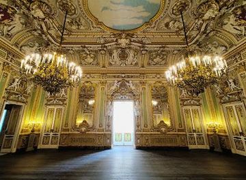
Palazzo Parisio
Experience the grandeur and charm of Palazzo Parisio, an exquisite palace in Malta with stunning gardens and exceptional dining options.
-
Scenic spot
Miġra l-Ferħa
Experience the breathtaking views and serene landscapes of Miġra l-Ferħa, a must-visit scenic spot in Rabat, Malta.
-
Catholic church
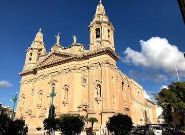
Knisja Parrokkjali tan-Naxxar - Natività tal-Madonna
Explore the exquisite Knisja Parrokkjali tan-Naxxar, a stunning Baroque church that embodies Malta's rich cultural and religious heritage.


Best landmarks in Victoria Lines
The Victoria Lines themselves form the defining landmark: a defensive boundary laid across Malta’s limestone highlands and shaped by the natural escarpment. Their importance is architectural as well as strategic, since the walls demonstrate how local stone and existing landforms were combined into a large military system. Fort Binġemma and the associated western defensive landscape are among the most recognisable features of the corridor, although access to individual structures can vary and some should be viewed from public paths rather than entered. In the eastern direction, the line approaches the Madliena heights, where military history is closely tied to Malta’s coastal geography. Ditches, bastions, observation points and surviving masonry give the route a different character from the concentrated fortresses of Valletta and the Grand Harbour. The strongest visual landmark is not one isolated tower but the long, irregular line of stone following the plateau edge, with fields and valleys opening beyond it. Nearby village churches and historic centres provide useful architectural companions, but they remain separate landmarks outside the fortification system itself.
-
Catholic church
Mosta Rotunda
Discover Malta's iconic landmark: a neoclassical masterpiece with a miraculous WWII story and breathtaking dome views.
-
Historical landmark
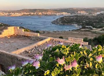
Fort Campbell
Discover the rich history and stunning views at Fort Campbell, a historical landmark in Mellieħa, Malta, perfect for history lovers and photographers alike.
-
Historical landmark
Dwejra Lines
Explore the Dwejra Lines, a historical landmark in Rabat, Malta, and immerse yourself in stunning views and rich heritage.
-
Christian church
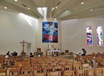
Santwarju Gesu Hniena Divina
Explore the Santwarju Gesu Hniena Divina in Naxxar, Malta - a serene haven of spirituality and rich cultural heritage.


Explore Victoria Lines on the map
Plan your trip on one map. See where the top cities, national parks and sights are, and book hotels and experiences in a few clicks.
Best hotels in Victoria Lines
Best restaurants in Victoria Lines
There is no continuous restaurant scene along the Victoria Lines, and walkers should eat before setting out or plan a stop in a nearby village. Around Naxxar, Għargħur, Rabat and Mġarr, dining ranges from cafés and bakeries to village restaurants, family-run establishments and traditional pubs. Menus commonly draw on Malta’s wider culinary traditions, including imqarrun il-forn, pastizzi, ftira, rabbit dishes and seasonal vegetable preparations, while local produce and bread remain important everyday foods. Mġarr is particularly associated with a rural food culture and countryside dining, though individual businesses and opening arrangements change. Nearby Rabat provides a broader choice because of its larger visitor economy. Expect Mediterranean ingredients, fish in suitable establishments, local cheeses and Maltese wines alongside international cooking. The most distinctive food experience is often a simple snack or meal before or after a walk, rather than dining beside the walls themselves.
-
Maltese
Ta' Kris
Experience authentic Maltese cuisine at Ta' Kris Bistro in Sliema - where tradition meets flavor.
-
Restaurant
Nine Lives Malta
Experience exquisite Mediterranean dining at Nine Lives Malta, where stunning views meet delicious local flavors in St. Paul's Bay.
-
Restaurant
NAAR Restobar
Discover the culinary magic at NAAR Restobar in St. Julian's - where local flavors meet global cuisine in an inviting atmosphere.
-
Maltese
Il-Barri Restaurant
Savor authentic Maltese cuisine at Il-Barri Restaurant in Mġarr - where tradition meets flavor in every dish.


Best bars in Victoria Lines
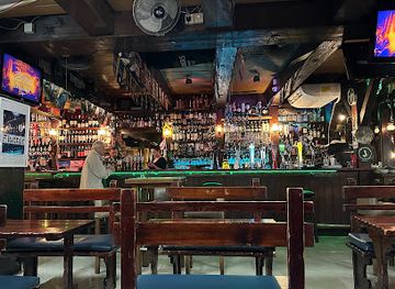
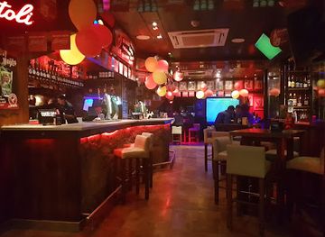
Evening life around the Victoria Lines is mainly village-based and relatively quiet. Traditional bars, cafés, restaurants and parish-centre establishments provide places for a drink or meal in settlements such as Naxxar, Għargħur, Rabat and Mġarr, while the fortification corridor itself has no nightlife infrastructure. Rabat offers the broadest nearby choice and a more established evening visitor scene, although it is still very different from the club-oriented districts of Malta’s main resort areas. Local evenings may include conversation, televised sport, seasonal village celebrations or occasional live music rather than late-night dancing. Craft beer, Maltese wine and the island’s familiar soft drinks can be found in suitable bars, but availability varies. Visitors should arrange a return journey in advance when staying outside a larger settlement, as rural public transport becomes less convenient at night.
-
Live music bar
Black Gold Saloon
Discover the lively Black Gold Saloon in Sliema, Malta, where live music meets delicious dining for an unforgettable night out.
-
Gastropub
Fat Harry's Pub
Discover culinary delights at Fat Harry's Pub, a lively gastropub in St. Paul's Bay, Malta, blending local flavors and vibrant atmosphere.
-
Restaurant
Hugo's Terrace & Rooftop
Experience exquisite dining at Hugo's Terrace & Rooftop, where stunning views and delightful cuisine await in St Julian's, Malta.
-
Bar
Bar Native
Experience the vibrant nightlife of St Julian's at Bar Native, where creative cocktails and a lively atmosphere await you.


Best nightclubs in Victoria Lines
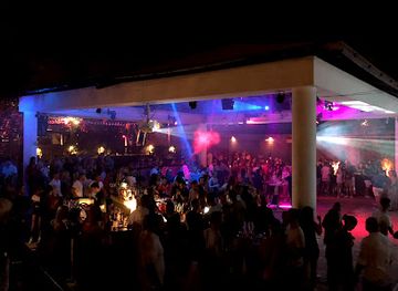
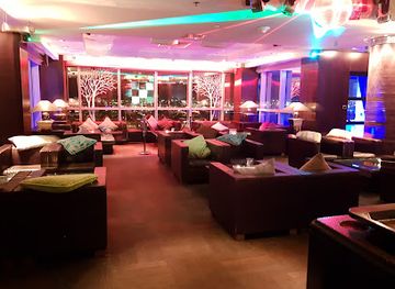
Evening life around the Victoria Lines is mainly village-based and relatively quiet. Traditional bars, cafés, restaurants and parish-centre establishments provide places for a drink or meal in settlements such as Naxxar, Għargħur, Rabat and Mġarr, while the fortification corridor itself has no nightlife infrastructure. Rabat offers the broadest nearby choice and a more established evening visitor scene, although it is still very different from the club-oriented districts of Malta’s main resort areas. Local evenings may include conversation, televised sport, seasonal village celebrations or occasional live music rather than late-night dancing. Craft beer, Maltese wine and the island’s familiar soft drinks can be found in suitable bars, but availability varies. Visitors should arrange a return journey in advance when staying outside a larger settlement, as rural public transport becomes less convenient at night.
-
Night club
Havana Club Malta
Dance the night away at Havana Club Malta, where vibrant beats and an electrifying atmosphere create unforgettable nightlife experiences.
-
Night club
Footloose
Discover the vibrant nightlife of St. Julian's at Footloose, a night club where great music and an electric atmosphere come together for an unforgettable experience.
-
Night club
UNO Malta
Dive into the electrifying nightlife of UNO Malta, where vibrant music and festive celebrations create unforgettable memories.
-
Night club
TwentyTwo
Discover the vibrant nightlife at TwentyTwo, a premier night club and cocktail bar in St. Julian's, where unforgettable memories await.


Best shops in Victoria Lines
Shopping along the Victoria Lines is limited and chiefly practical, with no single retail district attached to the fortifications. Visitors can buy water, snacks and everyday supplies in nearby villages, while Naxxar, Rabat and other surrounding centres offer a wider selection of cafés, convenience shops and small independent businesses. Malta-themed purchases are more naturally found in established town shops and visitor areas than beside rural wall sections. Look for local food products such as honey, preserves, olive oil, wine, sweets and packaged pastizzi-inspired goods, as well as ceramics, glass, jewellery, lace and other Maltese crafts where available. Rabat provides the most useful nearby choice for combining heritage sightseeing with food shopping, while village shops give a more ordinary local perspective. Markets and commercial offerings change by season and location, so confirm the day’s arrangements before making a special journey. Do not remove stones or archaeological material from the countryside as souvenirs.
-
Shopping mall
The Point Shopping Mall
Discover The Point Shopping Mall, Malta's premier shopping destination in Sliema, featuring diverse shops, dining, and stunning sea views.
-
Shopping mall
PAMA Shopping Mall
Explore the bustling PAMA Shopping Mall in Mosta, Malta - a retail paradise offering diverse shops, delightful dining, and vibrant atmosphere.
-
Shopping mall
Bay Street Shopping Complex
Experience the best of shopping, dining, and entertainment at Bay Street Shopping Complex in St. Julian's, Malta.
-
Shopping mall
Arkadia Commercial Centre
Discover shopping, dining, and local culture at the Arkadia Commercial Centre in Victoria, Gozo - a premier destination for tourists.


Get your free copy of our complete guide to Victoria Lines, delivered straight to you.
Everything on this page, from attractions and restaurants to essentials and local phrases, in one PDF you can read offline, print or share.
Already have an account? Sign in
Your Victoria Lines guide is ready.
We'll send it to · Not you? Sign out

Getting your guide ready…
We are putting together a fresh copy of the Victoria Lines guide. This can take up to a minute.
This can take a few moments. If your browser asks, choose Allow so the download can start. You'll find the guide in your Downloads folder.
Nothing happened? Download it again
Sorry, the guide is taking longer than usual. Please try again in a minute, or get it by email instead.
Victoria Lines essentials
Currency and Payment
Safety
Emergency Situations
Do's and Don'ts
Local Tips
From Eve
Local phrases worth knowing
You don't need to get them perfect. A few words go a long way, and locals appreciate the effort.
Basics
| English | Local | Say it |
|---|---|---|
| Hello | Bongu | [bong-goo] |
| Goodbye | Sahha | [sah-ha] |
| Yes | Iva | [ee-vah] |
| No | Le | [leh] |
| Please/You're welcome | Jekk jogħġbok | [yek jog-bok] |
| Thank you | Grazzi | [grah-tsee] |
| Excuse me/Sorry | Skużani | [skoo-zah-nee] |
| How are you? | Kif inti? | [keef in-tee] |
| Fine. And you? | Tajjeb. U int? | [tie-yeb. oo int?] |
| Do you speak English? | Titkellem bl-Ingliż? | [tit-kel-lem bl-ing-liz] |
| I don't understand | Ma nifhimx | [ma nif-hemx] |
Eating & Drinking
| English | Local | Say it |
|---|---|---|
| I'd like to see the menu, please | Nixtieq naraw il-menu, jekk jogħġbok | [nee-stee-ehk nah-row il-men-oo, yek jog-bok] |
| I don't eat meat | Ma niekolx laħam | [ma nee-eh-kolx lah-ham] |
| Cheers! | Salute! | [sah-loo-teh] |
| I would like to pay, please | Nixtieq inħallas, jekk jogħġbok | [nee-stee-ehk in-hah-las, yek jog-bok] |
Emergencies
| English | Local | Say it |
|---|---|---|
| Help! | Għajnuna! | [ah-yee-noo-nah] |
| Go away! | Mur 'il bogħod! | [moor il bog-hood] |
| Call the Police! | Ikkuntattja lill-Pulizija! | [ee-kun-tat-tee-uh lil-l pul-lee-zee-ah] |
| Call a doctor! | Ikkuntattja d-doċċa! | [ee-kun-tat-tee-uh do-chah] |
| I'm lost | Jien mitluf | [yeen mit-loof] |
| I'm ill | Jien morda | [yeen mor-dah] |
Shopping
| English | Local | Say it |
|---|---|---|
| I'd like to buy... | Nixtieq nixtri... | [nee-stee-ehk nik-tree] |
| I'm just looking | Qed nara biss | [ked nah-rah biss] |
| How much is it? | Kemm hi? | [kemm hee?] |
| That's too expensive | Dak hu wisq għali | [dak hoo wisq ah-lee] |
| Can you lower the price? | Tista' tnaqqas il-prezz? | [tee-stah tnah-kas il-prets] |
Time & Numbers
| English | Local | Say it |
|---|---|---|
| What time is it? | X'ħin hi? | [kshin hee?] |
| It's one o'clock | Hija l-ewwel siegħa | [hee-yah el-ewel see-ah] |
| Half past (10) | Nofs wara (10) | [nofs wah-rah (10)] |
| Morning | Filgħodu | [feel-oh-doo] |
| Afternoon | Wara nofsinhar | [wah-rah nof-seen-har] |
| Evening | Filgħaxija | [feel-ah-khee-yah] |
| Yesterday | Ilbieraħ | [il-beer-ah] |
| Today | Illum | [il-loom] |
| Tomorrow | Għada | [ah-dah] |
| 1 | 1 | [1] |
| 2 | 2 | [2] |
| 3 | 3 | [3] |
| 4 | 4 | [4] |
| 5 | 5 | [5] |
| 6 | 6 | [6] |
| 7 | 7 | [7] |
| 8 | 8 | [8] |
| 9 | 9 | [9] |
| 10 | 10 | [10] |
Transport & Directions
| English | Local | Say it |
|---|---|---|
| Where's a/the...? | Fejn hemm ...? | [fein hem] |
| What's the address? | X'hi l-indirizz? | [kshin hee l-in-deer-itz] |
| Can you show me (on the map)? | Tista' turi lili (fuq il-mappa)? | [tee-stah too-ree lee-lee fooq il-map-pah] |
| When's the next (bus)? | Meta ġej l-(bus) li jmiss? | [meh-tah jeh-ee l-bus lee im-miss] |
| A ticket (to ....) | Billett (għal ...) | [bee-let (ah-l)] |
History of Victoria Lines
Prehistoric Malta and the Escarpment Landscape
The high ground crossed by the Victoria Lines belongs to a landscape shaped long before the modern fortifications. Malta’s limestone plateaux, valleys and natural terraces supported prehistoric communities whose temples, tombs and agricultural traces survive elsewhere across the island. The Victoria Lines themselves were not prehistoric structures, but their route reflects the enduring military value of Malta’s elevated terrain. The escarpment offered visibility over approaches from the north while the valleys and cliffs created natural obstacles. Understanding this geology helps explain why later engineers followed the edge of the land rather than constructing an entirely artificial boundary.
The Knights and Malta’s Defensive Tradition
From the sixteenth century, the Order of St John developed Malta into a heavily fortified base in the central Mediterranean. The order concentrated major works around the Grand Harbour and important coastal positions, while watchtowers, entrenchments and rural defences extended the island’s warning and protection system. The Victoria Lines were built much later, but they continued this strategic tradition: Malta’s small size, exposed position and commanding limestone heights made control of movement across the island a central military concern. Earlier defensive practices also influenced the way later authorities assessed roads, ridges and natural barriers.
British Rule and the Construction of the Lines
Britain took control of Malta in the early nineteenth century, and the island became an important naval and military station. In the late nineteenth century, British planners developed a defensive line across the northern highlands to protect the more valuable southern settlements and harbour areas from an attack advancing overland. Construction began in the 1870s, using local limestone and the natural escarpment. The works included walls, ditches, redoubts and associated defensive positions. They were named the Victoria Lines in 1897 to mark Queen Victoria’s Diamond Jubilee.
The Fortifications as a Military System
The Victoria Lines were never simply a single wall. Their effectiveness depended on the relationship between the main barrier, observation points, access routes and supporting positions. Sections around the eastern heights and the Binġemma area reveal different responses to the terrain, with the engineers adapting the line to cliffs, ravines and open countryside. As military technology developed, fixed nineteenth-century defences became less decisive than artillery, communications and naval power. Even so, the line remained a visible expression of Britain’s effort to organise Malta’s landscape for strategic defence.
Malta in the Second World War
During the Second World War, Malta became a crucial Allied base in the Mediterranean and experienced intense aerial bombardment and military activity. The Victoria Lines were not the island’s principal wartime story, which centred more strongly on the harbours, airfields and coastal defences, but the wider system of roads, observation points and military installations contributed to the strategic landscape. The war also accelerated changes in Malta’s infrastructure and settlement patterns. Visitors should therefore distinguish the late nineteenth-century Victoria Lines from the many later wartime structures found elsewhere on the island.
Independence, Conservation and Rural Heritage
Malta became independent from Britain in 1964, and the Victoria Lines gradually shifted from active military infrastructure to historic and landscape heritage. Parts of the system remain integrated into working countryside, roads and later development, while other sections have suffered from weather, vegetation and neglect. Conservation has been uneven, making the line valuable as an open-air historical landscape but also vulnerable. Today its significance lies in the combined story of British military planning, Maltese limestone construction, agricultural land use and the continuing challenge of caring for dispersed heritage outside Malta’s principal urban monuments.
Victoria Lines in Photos
Browse through our photo collection highlighting the charm and character of the destination.
Neighbouring regions of Victoria Lines
The closest regions to Victoria Lines, if you have time for more than one.
-

-

-
-

-


Swipe for more regions
Explore more
Explore more of Malta
Discover Malta's crystal-clear waters, rich history, and vibrant culture. From ancient temples to modern nightlife, this Mediterranean gem offers something for everyone.
Explore Malta