

Free The Bitterroot Valley Travel Guide & Mobile App
Explore The Bitterroot Valley with free travel guides. Discover regional history, expert tips, proposed trips, and audio guides on web or mobile app.


Explore Montana’s Bitterroot Valley for mountain scenery, river walks, historic towns, ranch country, orchards and outdoor adventures near Hamilton.
Read more about The Bitterroot Valley
Getting to and around The Bitterroot Valley
How to get there
Transportation
Top city travel guides in The Bitterroot Valley
The cities of The Bitterroot Valley, and the easiest places to base yourself.

Swipe for more cities
Destinations in The Bitterroot Valley
Resorts, valleys and scenic spots worth a trip of their own.

Swipe for more destinations
Best attractions in The Bitterroot Valley
The Bitterroot Valley’s attractions combine working landscapes, local history and access to public mountain country. Stevensville is the principal heritage stop, with St Mary’s Mission offering insight into the valley’s nineteenth-century missionary period and the long-established presence of the Bitterroot Salish. Hamilton’s Daly Mansion presents the domestic and commercial world associated with Marcus Daly, while local museums and historic town buildings add context rather than functioning as isolated sights. South of Hamilton, Darby provides a base for exploring the West Fork and nearby Bitterroot National Forest. Blodgett Canyon is a major destination for walkers, climbers and scenic drives, although trail conditions and abilities vary. Painted Rocks State Park, in the southern part of the valley region, provides reservoir recreation, camping and access to forested surroundings. The Bitterroot River and its tributaries support fishing, wildlife observation and quiet riverside outings where access is permitted. Orchards, farm roads and seasonal produce stands contribute to the valley’s agricultural character, while hiking, camping, horseback riding, hunting and winter recreation extend into the surrounding mountains.
-
Haunted house
Field of Screams MT
Experience the thrill of fear at Field of Screams MT, a premier haunted house attraction in Victor, Montana, perfect for adventure seekers and families.
-
Museum
Daly Mansion
Explore the opulent Daly Mansion in Hamilton, MT, a historical gem showcasing the grandeur of early 20th-century living amidst stunning landscapes.
-
Nature preserve
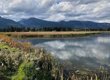
Lee Metcalf National Wildlife Refuge
Explore Lee Metcalf National Wildlife Refuge, a serene nature preserve in Montana, perfect for wildlife watching and enjoying diverse ecosystems.
-
State park
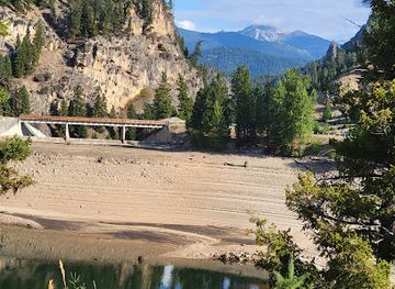
Painted Rocks State Park
Explore the stunning rock formations and vibrant landscapes of Painted Rocks State Park, a must-visit natural wonder in Montana.


Best landmarks in The Bitterroot Valley
-
Record store
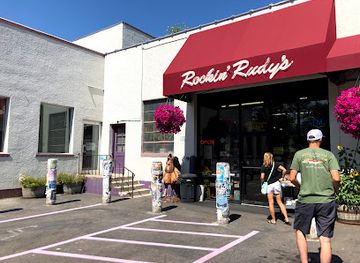
Rockin Rudy's
Discover a musical paradise at Rockin Rudy's in Missoula, where vinyl records, unique gifts, and local charm create an unforgettable shopping experience.
-
Park
Caras Park
Discover the beauty and community spirit of Caras Park, a scenic urban oasis in Missoula, Montana, perfect for relaxation and local events.
-
Restaurant
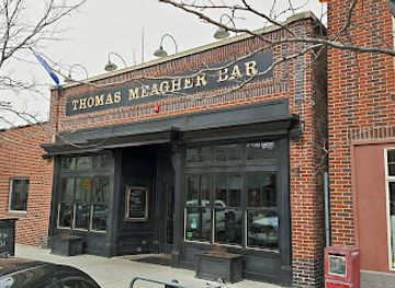
Thomas Meagher Bar
Discover the essence of Irish culture at Thomas Meagher Bar, a lively pub in Missoula offering traditional dishes, local brews, and unforgettable experiences.
-
Live Music
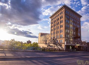
The Wilma
Experience the best of live music at The Wilma, a historic concert hall in Missoula that showcases top artists in an intimate setting.
Explore The Bitterroot Valley on the map
Plan your trip on one map. See where the top cities, national parks and sights are, and book hotels and experiences in a few clicks.
Best hotels in The Bitterroot Valley
Best restaurants in The Bitterroot Valley
Dining in the Bitterroot Valley reflects its rural setting and agricultural base rather than a concentrated restaurant district. Hamilton has the broadest choice of cafés, bakeries, diners, family restaurants and independently run establishments, with Stevensville, Corvallis and Darby offering smaller selections. Menus commonly draw on familiar Montana ingredients such as beef, trout, game and locally grown produce, alongside American comfort food, burgers, pizza and baked goods. Seasonal fruit and vegetables appear through farm stands, community markets and some local kitchens, while ranch country supports a strong interest in meat and hearty meals. Coffee shops and breakfast cafés are useful gathering places in the towns, and rural inns or lodge-style properties may provide meals near outdoor areas. Visitors should not expect extensive late-night dining or a large concentration of formal restaurants outside the main communities. For self-catering, supermarkets and small grocers are found in the larger towns, but supplies become less convenient once routes enter the national forest.
-
Hamburger
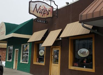
Nap's Grill
Experience mouthwatering hamburgers and diverse American cuisine at Nap's Grill in Hamilton - where great taste meets warm hospitality.
-
Cafe
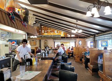
Coffee Cup Cafe
Experience the charm of Coffee Cup Cafe in Hamilton - a perfect blend of cozy ambiance and delicious breakfast delights.
-
Grill
The Edge Restaurant & Sports Bar
Discover culinary excellence at The Edge Restaurant & Sports Bar in Hamilton - where great food meets vibrant sports entertainment.
-
Restaurant
406 Saloon/ Big Cat Cafe
Experience delicious cuisine and lively entertainment at 406 Saloon/ Big Cat Cafe in Darby, Montana—a must-visit for every traveler.

Best bars in The Bitterroot Valley
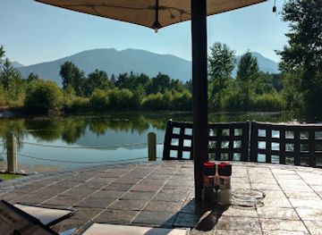
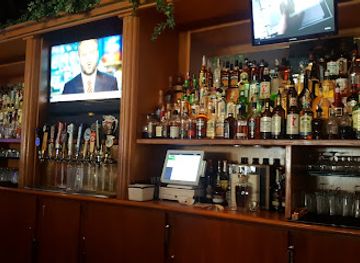
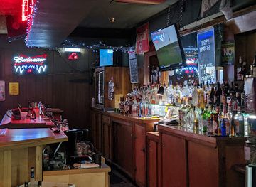
Evening life in the Bitterroot Valley is centred on traditional bars, pubs, restaurants and community venues rather than a major nightclub circuit. Hamilton has the widest selection, including places where residents meet for food, conversation, televised sport or occasional live music, while Stevensville, Corvallis and Darby have a smaller-town evening rhythm. Breweries and taprooms may feature Montana-made beer, but availability and opening arrangements can change, so checking locally is sensible. In rural areas, lodge restaurants and quiet bars are more common than late-night entertainment. Seasonal concerts, fairs and community events can add activity, particularly in warmer months, but they should not be assumed to run on fixed annual schedules. Visitors should arrange transport before drinking, as distances are substantial and taxis or ride services are limited outside the towns.
-
Bar
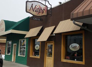
Nap's Grill
Discover Nap's Grill in Hamilton, where American comfort food meets a lively bar atmosphere, perfect for food lovers and social gatherings.
-
Grill
The Edge Restaurant & Sports Bar
Experience the perfect blend of delicious grill cuisine and thrilling sports action at The Edge Restaurant & Sports Bar in Hamilton, MT.
-
Grill
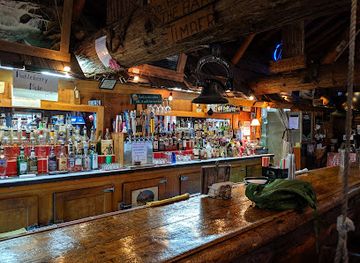
The Jack Saloon
Discover the rustic charm of The Jack Saloon in Lolo, Montana - a perfect retreat for grill lovers and nature enthusiasts alike.
-
Grill
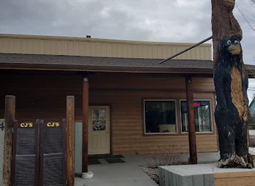
CJ's Den
Discover the flavors of America at CJ's Den, a beloved grill in Stevensville, Montana, offering a warm atmosphere and delicious local cuisine.
Best nightclubs in The Bitterroot Valley
Evening life in the Bitterroot Valley is centred on traditional bars, pubs, restaurants and community venues rather than a major nightclub circuit. Hamilton has the widest selection, including places where residents meet for food, conversation, televised sport or occasional live music, while Stevensville, Corvallis and Darby have a smaller-town evening rhythm. Breweries and taprooms may feature Montana-made beer, but availability and opening arrangements can change, so checking locally is sensible. In rural areas, lodge restaurants and quiet bars are more common than late-night entertainment. Seasonal concerts, fairs and community events can add activity, particularly in warmer months, but they should not be assumed to run on fixed annual schedules. Visitors should arrange transport before drinking, as distances are substantial and taxis or ride services are limited outside the towns.
-
Bowling alley
Ravalli Fun Center
Experience the thrill of bowling, gaming, and dining at Ravalli Fun Center, Hamilton's ultimate entertainment destination.
-
Restaurant
Brewski’s - Grill, Sports Bar, & Casino
Experience the ultimate blend of delicious food, electrifying sports, and thrilling casino games at Brewski’s in Hamilton, Montana.
-
Bar
High Country Club
Experience the vibrant atmosphere and local charm at High Country Club, a top bar in Stevensville, Montana, perfect for relaxation and entertainment.
Best shops in The Bitterroot Valley
Shopping in the Bitterroot Valley is concentrated in the small town centres rather than in large retail complexes. Hamilton has the broadest range of practical shops, independent businesses, galleries, antiques, books, outdoor equipment and locally oriented gifts, while Stevensville, Corvallis and Darby offer smaller collections of shops with distinct historic-town character. Seasonal farm stands and community markets are good places to look for fruit, vegetables, preserves, baked goods and other locally produced food, although availability follows the agricultural calendar. Art galleries and craft outlets may feature Montana landscapes, woodwork, pottery, jewellery and fibre work, but individual businesses and market schedules change. Outdoor equipment is particularly useful for visitors planning walks or camping in the Bitterroot National Forest. Regional food products, locally made crafts and books on Montana history or Indigenous culture make more meaningful purchases than generic souvenirs; ask sellers about provenance and support businesses that represent local makers accurately.
-
Clothing store
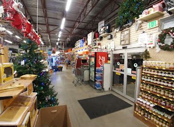
Murdoch's Ranch & Home Supply
Explore Murdoch's Ranch & Home Supply for a taste of Western culture, quality apparel, and essential home goods in Hamilton, Montana.
-
Gift shop
Old West Antiques & Candy Store
Explore the Old West Antiques & Candy Store in Darby, MT – a delightful mix of nostalgia, unique antiques, and sweet treats for all ages.
-
Department store
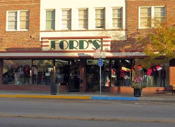
Fords Department Store
Explore Fords Department Store in Hamilton, Montana, a vintage shopping haven with unique local goods and a charming atmosphere.
-
Gift shop
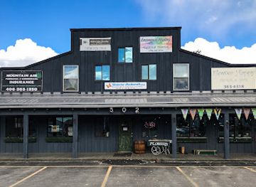
Flower Happy Floral & Gifts
Explore the enchanting Flower Happy Floral & Gifts in Hamilton, Montana – where stunning floral arrangements and unique gifts await to delight every visitor.

Get your free copy of our complete guide to The Bitterroot Valley, delivered straight to you.
Everything on this page, from attractions and restaurants to essentials and local phrases, in one PDF you can read offline, print or share.
Already have an account? Sign in
Your The Bitterroot Valley guide is ready.
We'll send it to · Not you? Sign out

Getting your guide ready…
We are putting together a fresh copy of the The Bitterroot Valley guide. This can take up to a minute.
This can take a few moments. If your browser asks, choose Allow so the download can start. You'll find the guide in your Downloads folder.
Nothing happened? Download it again
Sorry, the guide is taking longer than usual. Please try again in a minute, or get it by email instead.
The Bitterroot Valley essentials
Currency and Payment
Safety
Emergency Situations
Do's and Don'ts
Local Tips
From Eve
Local phrases worth knowing
You don't need to get them perfect. A few words go a long way, and locals appreciate the effort.
Basics
| English | Local | Say it |
|---|---|---|
| Hello | Howdy | [How-dee] |
| Goodbye | See ya | [See ya] |
| Yes | Yep | [Yep] |
| No | Nope | [Nope] |
| Please/You're welcome | Sure thing | [Shur thing] |
| Thank you | Thanks a lot | [Thangs a lot] |
| Excuse me/Sorry | Pardon me | [Pardon me] |
| How are you? | How's it going? | [How's it goin'?] |
| Fine. And you? | Good, you? | [Good, you?] |
| Do you speak English? | You speak English? | [You speak English?] |
| I don't understand | I ain't got it | [I ain't got it] |
Eating & Drinking
| English | Local | Say it |
|---|---|---|
| I'd like to see the menu, please | Can I see the menu? | [Can I see the menu?] |
| I don't eat meat | I don't do meat | [I don't do meat] |
| Cheers! | Cheers! | [Cheers!] |
| I would like to pay, please | Can I get the check? | [Can I get the check?] |
Emergencies
| English | Local | Say it |
|---|---|---|
| Help! | Help! | [Help!] |
| Go away! | Leave me alone! | [Leave me alone!] |
| Call the Police! | Call the cops! | [Call the cops!] |
| Call a doctor! | Get a doc! | [Get a doc!] |
| I'm lost | I’m turned around | [I’m turned around] |
| I'm ill | I ain't feelin' well | [I ain't feelin' well] |
Shopping
| English | Local | Say it |
|---|---|---|
| I'd like to buy... | I want to buy... | [I want to buy...] |
| I'm just looking | Just browsing | [Just browsing] |
| How much is it? | What’s the price? | [What’s the price?] |
| That's too expensive | That's way too high | [That's way too high] |
| Can you lower the price? | Can you give me a deal? | [Can you give me a deal?] |
Time & Numbers
| English | Local | Say it |
|---|---|---|
| What time is it? | What’s the time? | [What’s the time?] |
| It's one o'clock | It’s one | [It’s one] |
| Half past (10) | Ten-thirty | [Ten-thirty] |
| Morning | Mornin' | [Mornin'] |
| Afternoon | Afternoon | [Afternoon] |
| Evening | Evenin' | [Evenin'] |
| Yesterday | Yesterday | [Yesterday] |
| Today | Today | [Today] |
| Tomorrow | Tomorrow | [Tomorrow] |
| 1 | One | [One] |
| 2 | Two | [Two] |
| 3 | Three | [Three] |
| 4 | Four | [Four] |
| 5 | Five | [Five] |
| 6 | Six | [Six] |
| 7 | Seven | [Seven] |
| 8 | Eight | [Eight] |
| 9 | Nine | [Nine] |
| 10 | Ten | [Ten] |
Transport & Directions
| English | Local | Say it |
|---|---|---|
| Where's a/the...? | Where’s the...? | [Where’s the...?] |
| What's the address? | What’s the address? | [What’s the address?] |
| Can you show me (on the map)? | Can you point it out? | [Can you point it out?] |
| When's the next (bus)? | When’s the next bus? | [When’s the next bus?] |
| A ticket (to ....) | A ticket to... | [A ticket to...] |
History of The Bitterroot Valley
Bitterroot Salish Homeland
The Bitterroot Valley lies within the traditional homeland of the Bitterroot Salish, whose communities travelled, hunted, gathered and maintained cultural connections across the valley, river systems and surrounding mountains long before United States settlement. The Salish name for the valley and its plants reflects a relationship with the landscape that is deeper than the later agricultural and town-based geography. Any account of local history therefore begins with Indigenous presence and knowledge, not with the arrival of missionaries or homesteaders. The Confederated Salish and Kootenai Tribes remain an important part of Montana’s wider cultural and political life.
St Mary’s Mission and the 1840s
St Mary’s Mission was established near present-day Stevensville in the 1840s by Jesuit missionaries working among the Bitterroot Salish. It is commonly regarded as Montana’s first permanent non-Indigenous settlement, although the mission operated within an already inhabited Indigenous landscape and its history includes the complications of religious conversion, cultural change and United States expansion. The surviving mission buildings and associated interpretation provide a tangible starting point for understanding the valley’s early colonial period. Stevensville subsequently developed as a farming and trading community.
Lewis and Clark-era Exploration
The Lewis and Clark Expedition travelled through the broader Bitterroot region in 1805 and 1806, crossing the mountains to the west and returning through the area on its journey east. The expedition’s route is commemorated at places outside the valley itself, including Travelers’ Rest near present-day Lolo, but its passage illustrates the valley’s position between the mountain corridors of western Montana and the interior Northwest. It should not be confused with a permanent settlement or with the much later development of the valley’s towns.
Farming, Irrigation and Settlement
During the late nineteenth and early twentieth centuries, Euro-American settlers transformed parts of the valley floor through homesteading, irrigation and agriculture. The Bitterroot River and its tributaries supported hay meadows, grain, livestock and orchards, while rail connections and local roads helped move crops and timber. The open agricultural landscape visible around Stevensville, Corvallis and Hamilton is partly a product of this period. Irrigation also changed river management and land use, creating the productive but carefully engineered valley floor that contrasts with the largely forested mountain slopes.
Marcus Daly and the Hamilton Area
Industrialist Marcus Daly, one of Butte’s major mining entrepreneurs, became a powerful influence in the Bitterroot during the late nineteenth century. He developed timber and agricultural interests near Hamilton, promoted irrigation and brought rail and commercial investment to the valley. The Daly Mansion, built in Hamilton in the early twentieth century, represents the wealth and social ambitions associated with this period. Daly’s legacy is visible not only in the mansion but also in the valley’s changing economy, where mining-linked capital helped shape ranching, forestry and town development.
Timber, Railways and the Forest Economy
Forestry became one of the valley’s significant industries as railways, sawmills and improved roads connected mountain timber to regional markets. Logging supported communities and supplied material for wider industrial development, while also altering mountain landscapes and transport patterns. The Bitterroot National Forest, established in 1908, later provided a framework for managing extensive public lands in the surrounding mountains. Today, forestry remains part of the region’s history and economy, although recreation, conservation, construction and service industries have broadened the valley’s modern identity.
Conservation and Outdoor Recreation
The twentieth century brought growing recognition of the Bitterroot Mountains and adjacent public lands as places for conservation and recreation. The Bitterroot National Forest now encompasses large areas of forest, wilderness and mountain habitat west and south of the valley, including access corridors near Hamilton, Darby and the West Fork. Hiking, fishing, hunting, camping and scenic driving have become important aspects of regional life. Conservation has also brought continuing discussions about wildfire, forest management, wildlife habitat, river health and the pressures created by population growth.
The Bitterroot Valley in Photos
Browse through our photo collection highlighting the charm and character of the destination.
Neighbouring regions of The Bitterroot Valley
The closest regions to The Bitterroot Valley, if you have time for more than one.
-

-

-

-

-


Swipe for more regions
Explore more
Explore more of Montana
Discover Montana: A Treasure State of majestic landscapes, outdoor adventures, and rich cultural heritage. Explore Glacier and Yellowstone, charming towns, and historic sites.
Explore Montana