

Bitterroot National Forest Travel Guide - Free Web & App
Your ultimate guide to Bitterroot National Forest. Discover top landmarks, proposed trips, and local tips. Free on the web or via the Evendo companion app.


Bitterroot National Forest in Montana offers alpine lakes, granite canyons, wild rivers, hiking, camping and wildlife across the Bitterroot Range.
A Forest of Contrasting Landscapes
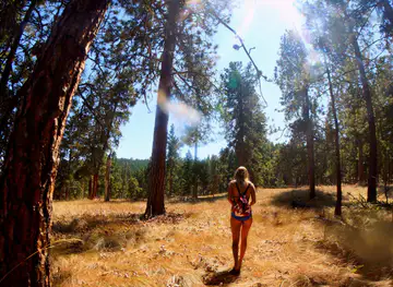
Bitterroot National Forest occupies a broad mountain landscape in south-western Montana, stretching along the Bitterroot Valley and rising west towards the Idaho border. Its terrain moves from ponderosa pine foothills and dry valley slopes to dense conifer forests, high alpine basins and rugged summits in the Bitterroot Range. The forest is extensive rather than compact, with access points and recreation areas spread across several valleys and long, winding roads.Read more about Bitterroot National Forest
Canyons, Lakes and Wilderness
Gateway Communities and Local Character
Exploring Responsibly
When is the best time to visit Bitterroot National Forest?
Best: June–August · 21–24°C| Month | High (°C) | Rainfall (mm) |
|---|---|---|
| January | 2 | 32 |
| February | 3 | 27 |
| March | 8 | 29 |
| April | 12 | 33 |
| May | 16 | 46 |
| June (best) | 21 | 38 |
| July (best) | 24 | 23 |
| August (best) | 24 | 23 |
| September | 18 | 31 |
| October | 12 | 31 |
| November | 4 | 33 |
| December | 2 | 36 |
Getting to and around Bitterroot National Forest
How to get there
Transportation
Best attractions in Bitterroot National Forest
Bitterroot National Forest's attractions are spread across a long mountain corridor rather than concentrated in one visitor centre. Blodgett Canyon, west of Hamilton, is a defining landscape of sheer granite walls, forested approaches and hiking routes leading into the Bitterroot Range. Kootenai Creek and Bass Creek offer further access to wooded valleys and mountain trails, while Lake Como near Darby combines a reservoir setting with walking and summer recreation. The West Fork Bitterroot River leads towards remote country and approaches to the Selway-Bitterroot Wilderness, where routes become more demanding and facilities diminish. Trapper Peak and other high summits provide the visual drama of the range, though ascents require appropriate preparation and conditions can be serious. The forest also contains quieter streams, meadows, campgrounds and wildlife habitat, with the character of each area changing markedly between the open Bitterroot Valley foothills and the high, roadless interior.
-
Tourist attraction
Lee Metcalf National Wildlife Refuge
Explore Lee Metcalf National Wildlife Refuge, a breathtaking nature preserve in Montana, teeming with wildlife and stunning landscapes.
-
Tourist attraction
Daly Mansion
Explore the historical charm of Daly Mansion in Hamilton, MT, where stunning architecture meets breathtaking landscapes, showcasing Montana's rich heritage.
-
Tourist attraction
River Park
Explore River Park in Hamilton, Montana - a tranquil retreat with scenic trails, lush landscapes, and stunning mountain views perfect for relaxation and recreation.
-
Tourist attraction
Kiwanis Park
Experience the natural beauty and recreational charm of Kiwanis Park in Hamilton, Montana, a perfect spot for relaxation and family fun.


Best landmarks in Bitterroot National Forest
The Bitterroot Range is the forest's defining natural landmark, forming a rugged mountain wall along the western side of the Bitterroot Valley and rising towards the Montana–Idaho divide. Blodgett Canyon is particularly notable for its dramatic granite geology and steeply enclosed valley, while Trapper Peak is one of the most recognisable summits in the southern Bitterroot landscape. Lake Como provides a contrasting water landmark near Darby, set below forested slopes and used for recreation. The Selway-Bitterroot Wilderness represents the region's most significant protected backcountry, where natural processes, roadless terrain and long-distance mountain travel shape the experience. Rivers and creeks including the Bitterroot, West Fork Bitterroot and Kootenai Creek are equally important landmarks, linking high-country watersheds with the settled valley below and supporting the forest's ecological character.
-
Museum
Daly Mansion
Explore the rich history and breathtaking beauty of Daly Mansion, a stunning museum and tourist attraction in the heart of Montana's Bitterroot Valley.
-
National forest
Selway-Bitterroot Wilderness
Discover the breathtaking landscapes, diverse wildlife, and endless outdoor adventures in the Selway-Bitterroot Wilderness, a true gem of Idaho's national forests.
-
State park
Painted Rocks State Park
Experience the vibrant landscapes and outdoor adventures at Painted Rocks State Park, a must-visit natural wonder in Montana.
-
Historical place museum
Historic St. Mary's Mission
Explore the captivating history and serene beauty of Historic St. Mary's Mission in Stevensville, Montana, where past and present meet.


Explore Bitterroot National Forest on the map
Plan your trip on one map. See where the top attractions, landmarks, restaurants and hotels are, and book hotels and experiences in a few clicks.
Best hotels in Bitterroot National Forest
Best restaurants in Bitterroot National Forest
Dining options are concentrated in the Bitterroot Valley communities rather than deep inside the national forest. Hamilton has the broadest selection of restaurants, cafés, bakeries and informal eateries, with additional choices in Stevensville, Victor, Corvallis and Darby; Sula serves as a smaller southern base where services are more limited. Regional menus commonly draw on Montana's ranching and agricultural identity, with beef, locally sourced produce, game where legally and commercially available, and familiar American café and pub cooking. Visitors staying in cabins or campgrounds often shop for provisions in the valley and prepare meals themselves, while farm shops and small grocers can be useful for picnic supplies. Food availability becomes increasingly limited on forest roads, so meals, water and cooking essentials should be organised before heading towards remote trailheads or wilderness approaches.
-
Hamburger
Nap's Grill
Discover Nap's Grill: A culinary delight in Hamilton offering gourmet burgers and American classics in a warm and inviting atmosphere.
-
Cafe
Coffee Cup Cafe
Experience delightful breakfasts and warm hospitality at Coffee Cup Cafe in Hamilton, Montana – your perfect stop for comfort food.
-
Mexican
Fiesta En Jalisco
Experience authentic Mexican cuisine at Fiesta En Jalisco in Hamilton - where every meal is a festive celebration!
-
Fast Food
Taco Bell
Experience affordable Tex-Mex flavors at Taco Bell in Hamilton - perfect for travelers seeking quick and delicious meals.


Best bars in Bitterroot National Forest
Bitterroot National Forest is not a nightlife destination, and there are no developed entertainment districts within the forest itself. Evening life is centred on the small communities of the Bitterroot Valley, particularly Hamilton, with local pubs, bars and restaurants providing informal places to meet after a day outdoors. Darby, Stevensville, Victor and Corvallis offer a quieter rural atmosphere, and seasonal community activities may add music or cultural entertainment without following a predictable nightlife schedule. In forest campgrounds and cabins, evenings are generally devoted to conversation, stargazing and listening to the surrounding landscape, subject to fire regulations and quiet-hour rules. Visitors seeking a wider choice of performances, late-opening venues or organised cultural events are more likely to find them in Missoula, outside the immediate destination.
-
Bar
Nap's Grill
Experience the heart of American cuisine at Nap's Grill in Hamilton, where delicious burgers and steaks meet a warm, inviting atmosphere.
-
Grill
The Edge Restaurant & Sports Bar
Experience the best of Montana's culinary scene at The Edge Restaurant & Sports Bar in Hamilton, offering mouthwatering grilled dishes and a lively sports atmosphere.
-
Grill
The Jack Saloon
Experience the charm of The Jack Saloon in Lolo, Montana - where delicious grill food meets the beauty of nature's playground.
-
Grill
CJ's Den
Discover CJ's Den in Stevensville, MT - a cozy grill serving delicious American cuisine with locally sourced ingredients in a welcoming atmosphere.


Best nightclubs in Bitterroot National Forest
Bitterroot National Forest is not a nightlife destination, and there are no developed entertainment districts within the forest itself. Evening life is centred on the small communities of the Bitterroot Valley, particularly Hamilton, with local pubs, bars and restaurants providing informal places to meet after a day outdoors. Darby, Stevensville, Victor and Corvallis offer a quieter rural atmosphere, and seasonal community activities may add music or cultural entertainment without following a predictable nightlife schedule. In forest campgrounds and cabins, evenings are generally devoted to conversation, stargazing and listening to the surrounding landscape, subject to fire regulations and quiet-hour rules. Visitors seeking a wider choice of performances, late-opening venues or organised cultural events are more likely to find them in Missoula, outside the immediate destination.
-
Bar
Backroad Cider
Explore the vibrant flavors of Montana at Backroad Cider, where artisanal ciders and a welcoming atmosphere come together in Hamilton.
-
Resort hotel
The Bitterroot Mile Club (TBMC)
Discover the serene escape of The Bitterroot Mile Club in Montana's breathtaking Bitterroot Valley, where luxury meets nature.


Best shops in Bitterroot National Forest
Shopping within Bitterroot National Forest is limited to practical supplies and small-scale purchases in surrounding communities. Hamilton is the main retail centre, with food shops, outdoor equipment, local services and independent businesses serving residents and visitors, while Darby, Stevensville, Victor, Corvallis and Sula provide more modest selections. Regional products may include Montana-made foods, ranch goods, artwork, pottery, woodwork and locally produced crafts, although stock and availability vary between businesses and seasons. Farm shops and small grocers in the valley can be useful for picnic provisions before travelling into the forest. There is no continuous shopping district inside the protected landscape, and remote campgrounds and trailheads should be approached with all necessary food, fuel, maps and equipment already obtained.
-
Gift shop
Old West Antiques & Candy Store
Explore the charm of the Old West with unique antiques and delightful candies at Old West Antiques & Candy Store in Darby, Montana.
-
Metaphysical supply store
Between the Worlds
Explore the enchanting 'Between the Worlds' in Hamilton, MT, your go-to metaphysical supply store for crystals, tarot cards, and spiritual artifacts.
-
Gift shop
The Closet Boutique and Gifts
Explore The Closet Boutique and Gifts for unique women's clothing and local treasures in the heart of Hamilton, Montana.
-
Antique store
Bitterroot Antique Mall
Uncover unique antiques and vintage treasures at Bitterroot Antique Mall in Hamilton, Montana, a must-visit destination for collectors and history lovers.


Get your free copy of our complete guide to Bitterroot National Forest, delivered straight to you.
Everything on this page, from attractions and restaurants to essentials and local phrases, in one PDF you can read offline, print or share.
Already have an account? Sign in
Your Bitterroot National Forest guide is ready.
We'll send it to · Not you? Sign out

Getting your guide ready…
We are putting together a fresh copy of the Bitterroot National Forest guide. This can take up to a minute.
This can take a few moments. If your browser asks, choose Allow so the download can start. You'll find the guide in your Downloads folder.
Nothing happened? Download it again
Sorry, the guide is taking longer than usual. Please try again in a minute, or get it by email instead.
Bitterroot National Forest essentials
Currency and Payment
Safety
Emergency Situations
Do's and Don'ts
Local Tips
From Eve
Local phrases worth knowing
You don't need to get them perfect. A few words go a long way, and locals appreciate the effort.
Basics
| English | Local | Say it |
|---|---|---|
| Hello | Howdy | [haw-dee] |
| Goodbye | See ya | [see yah] |
| Yes | Yup | [yuhp] |
| No | Nope | [nohp] |
| Please/You're welcome | Please/Welcome | [pleez/wel-kum] |
| Thank you | Thanks | [thaynks] |
| Excuse me/Sorry | Pardon | [par-dn] |
| How are you? | Howdy | [haw-dee] |
| Fine. And you? | Fine. And you? | [fahyn. and yuh?] |
| Do you speak English? | Ya speak English? | [yah speek ing-glish?] |
| I don't understand | Don't git it | [dont git it] |
Eating & Drinking
| English | Local | Say it |
|---|---|---|
| I'd like to see the menu, please | I wanna see the menu, please | [ah wahn-uh see thuh men-yoo, pleez] |
| I don't eat meat | I don't eat meat | [ah dont eet meet] |
| Cheers! | Cheers! | [cheers] |
| I would like to pay, please | I wanna pay, please | [ah wahn-uh pay, pleez] |
Emergencies
| English | Local | Say it |
|---|---|---|
| Help! | Help! | [help] |
| Go away! | Git outta here! | [git out-uh here] |
| Call the Police! | Call the Sheriff! | [call thuh sher-iff] |
| Call a doctor! | Get a doc! | [get uh doc] |
| I'm lost | I'm lost | [ahm lost] |
| I'm ill | I'm sick | [ahm sik] |
Shopping
| English | Local | Say it |
|---|---|---|
| I'd like to buy... | I wanna buy... | [ah wahn-uh buy] |
| I'm just looking | Just lookin' | [just look-in] |
| How much is it? | How much fer that? | [how much fur that] |
| That's too expensive | That's too spendy | [thats too spend-ee] |
| Can you lower the price? | Can ya drop the price? | [can yuh drop thuh price] |
Time & Numbers
| English | Local | Say it |
|---|---|---|
| What time is it? | What time is it? | [whut tahym iz it] |
| It's one o'clock | It's one o'clock | [its wun oh-klok] |
| Half past (10) | Half past (10) | [haff past (ten)] |
| Morning | Mornin' | [morn-in] |
| Afternoon | Afternoon | [af-ter-noon] |
| Evening | Evenin' | [eev-nin] |
| Yesterday | Yest'day | [yest-day] |
| Today | Today | [tuh-day] |
| Tomorrow | Tomorrah | [tom-or-uh] |
| 1 | One | [wun] |
| 2 | Two | [too] |
| 3 | Three | [three] |
| 4 | Four | [fawr] |
| 5 | Five | [fahyv] |
| 6 | Six | [siks] |
| 7 | Seven | [sev-uhn] |
| 8 | Eight | [eyt] |
| 9 | Nine | [nine] |
| 10 | Ten | [ten] |
Transport & Directions
| English | Local | Say it |
|---|---|---|
| Where's a/the...? | Where's the...? | [wheres thuh] |
| What's the address? | What's the address? | [whuts thuh ad-dress] |
| Can you show me (on the map)? | Show me (on the map) | [show me (on thuh map)] |
| When's the next (bus)? | When's the next (bus)? | [whens thuh nekst (bus)] |
| A ticket (to ....) | A ticket (to ....) | [uh tik-it (to)] |
History of Bitterroot National Forest
A Landscape Shaped by Ice and Rivers
The Bitterroot National Forest combines folded and faulted mountain terrain with valleys shaped by erosion, rivers and periods of glaciation. The Bitterroot Range forms a major mountainous divide near the Montana–Idaho border, while streams descending from its slopes have cut prominent canyons and nourished the Bitterroot Valley. These geological processes created the steep ridges, alpine basins and river corridors that later guided travel, settlement, forestry and recreation. The landscape remains dynamic: snowmelt, wildfire, landslides and changing vegetation continue to influence the appearance and ecology of the forest.
Indigenous Homelands and Travel Routes
The forest and the Bitterroot Valley lie within the traditional homelands and travel networks of Indigenous peoples, including the Bitterroot Salish, also known as the Séliš, and the Nimiipuu or Nez Perce, among other connected communities. These landscapes supported seasonal travel, hunting, fishing and the gathering of plants long before the arrival of American government institutions. The 1805–06 Lewis and Clark Expedition travelled through the broader Bitterroot region with assistance from Indigenous people, although its route did not follow every part of the modern national forest. Indigenous history remains essential to understanding the area's place names, landscapes and continuing cultural identity.
Settlement in the Bitterroot Valley
Euro-American settlement expanded in the nineteenth century alongside agriculture, transportation and the development of towns such as Stevensville and Hamilton. The valley's relatively mild agricultural conditions contrasted with the more difficult terrain of the surrounding mountains, where timber, minerals and seasonal grazing became important resources. The Bitterroot Salish were forcibly removed from their ancestral valley to the Flathead Reservation in 1891, a major rupture in the region's history. Ranching and farming subsequently shaped much of the open valley floor, while mountain forests remained comparatively less settled.
Federal Forest Management
The Bitter Root National Forest was established in 1908 during the expansion of the United States national forest system, which brought federal management to extensive mountain timberlands and watersheds. Forest administration developed around fire control, road building, timber production, grazing regulation and watershed protection. During the twentieth century, improved roads made remote valleys more accessible, while communities around the forest grew as service and logging centres. The Civilian Conservation Corps also contributed to public works in many American forests during the 1930s, although individual structures and surviving sites should be identified locally rather than assumed.
Wilderness and Conservation
The modern forest is defined not only by resource management but also by the protection of large roadless landscapes. The Wilderness Act of 1964 established a national framework for safeguarding areas where natural processes and limited development remain central, and the Selway-Bitterroot Wilderness became one of the important protected wilderness areas associated with this region. Wilderness designation changed how roads, motorised access and development are managed in the high country. Today the forest balances recreation, habitat protection, wildfire management, timber interests and the needs of nearby communities while preserving the character of its mountain ecosystems.
Bitterroot National Forest in Photos
Browse through our photo collection highlighting the charm and character of the destination.
Cities in Bitterroot National Forest
The towns and cities of Bitterroot National Forest, and the easiest places to base yourself.

Swipe for more cities
Neighbouring destination travel guides
The closest destinations to Bitterroot National Forest, if you have time for more than one.
-
-

-

-

-


Swipe for more destinations
Explore more

Explore more of The Bitterroot Valley
Explore Montana’s Bitterroot Valley for mountain scenery, river walks, historic towns, ranch country, orchards and outdoor adventures near Hamilton.
Explore The Bitterroot Valley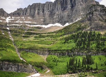
Explore more of Montana
Discover Montana: A Treasure State of majestic landscapes, outdoor adventures, and rich cultural heritage. Explore Glacier and Yellowstone, charming towns, and historic sites.
Explore Montana