

Free The Tobacco Root Mountains Travel Guide & Mobile App
Explore The Tobacco Root Mountains with free travel guides. Discover regional history, expert tips, proposed trips, and audio guides on web or mobile app.


Explore Montana’s Tobacco Root Mountains for alpine hiking, granite peaks, clear lakes, wildlife and quiet access from the Madison and Ruby valleys.
Read more about The Tobacco Root Mountains
Getting to and around The Tobacco Root Mountains
How to get there
Transportation
Top city travel guides in The Tobacco Root Mountains
The cities of The Tobacco Root Mountains, and the easiest places to base yourself.

Swipe for more cities
Destinations in The Tobacco Root Mountains
Resorts, valleys and scenic spots worth a trip of their own.
-

-


Swipe for more destinations
Best attractions in The Tobacco Root Mountains
The Tobacco Root Mountains are primarily an outdoor destination, with attractions spread across forest roads, alpine basins and high ridges rather than concentrated in a visitor centre or resort. Hiking is the central activity, ranging from lower-elevation walks along wooded drainages to strenuous routes towards Hollowtop Mountain and other summits. Granite Lake and nearby high-country terrain provide opportunities for lakeside walking, fishing and photography, while the range’s streams and open slopes support wildlife viewing and seasonal camping. Experienced mountaineers and scramblers can find demanding terrain, but routes should never be judged solely by distance or appearance. The surrounding valleys add a contrasting layer of interest: ranch landscapes, irrigation meadows, historic mining associations and small communities reached from the Ennis, Sheridan and Twin Bridges approaches. These gateway towns are outside the range, but they are useful for supplies and regional context. Scenic drives on suitable Forest Service roads reveal changing views from sagebrush foothills to subalpine forest, although road conditions and access can be seasonal. The appeal lies in the combination of public mountain land, quiet trailheads and a visible relationship between alpine wilderness and working agricultural country.
-
Tourist attraction
Lewis & Clark Caverns State Park
Explore the breathtaking beauty of Lewis & Clark Caverns State Park, home to stunning limestone formations and diverse outdoor adventures in Montana.

Best landmarks in The Tobacco Root Mountains
The most recognisable landmarks of the Tobacco Root Mountains are natural rather than architectural. Hollowtop Mountain forms the range’s highest summit and is a major reference point for the eastern skyline, while long ridges and granite formations give the range its strongly alpine profile. Granite Lake and the surrounding high basin are notable landscape features, combining clear water, bare rock and subalpine terrain in a setting reached by a demanding mountain journey rather than a roadside viewpoint. Forested drainages and high passes create a succession of smaller landmarks whose appearance changes markedly with season and weather. Historic traces are less monumental but still significant: prospecting roads, mining remnants and altered foothill sites record the nineteenth-century search for minerals. These should be treated as fragile and potentially hazardous, not explored as climbing structures. The broad views towards the Madison and Ruby valleys are themselves important geographical landmarks, showing how sharply the range rises above irrigated ranchland and sagebrush foothills. Nearby towns and historic sites may provide stronger built heritage, but they lie outside the mountain range and should be visited as regional gateways rather than described as Tobacco Root landmarks.
-
 Ski resort
Big Sky Resort
Discover the ultimate adventure at Big Sky Resort, where skiing, hiking, and breathtaking landscapes unite for an unforgettable experience in Montana.
Explore The Tobacco Root Mountains on the map
Plan your trip on one map. See where the top cities, national parks and sights are, and book hotels and experiences in a few clicks.
Best hotels in The Tobacco Root Mountains
Best restaurants in The Tobacco Root Mountains
Dining within the Tobacco Root Mountains is limited because the range has no substantial settlement or restaurant district. Visitors normally eat in gateway communities outside the range, including Ennis, Sheridan and Twin Bridges, where cafés, diners, public houses and locally oriented restaurants serve the travelling and ranching population. Meals are likely to reflect broader Montana cooking: beef, burgers, trout where available, hearty breakfasts, soups, sandwiches and baked goods, alongside contemporary dishes using regional produce. Grocery shops and basic provisions in the valleys are important for self-catering, particularly for camping trips. Farmers’ markets and seasonal farm stands may offer vegetables, fruit, preserves or baked products, but availability varies by town and season. In the mountains themselves, plan to carry food and cooking equipment; do not expect a café, water station or reliable resupply at a trailhead. Responsible anglers should follow Montana regulations rather than assuming that caught fish can be kept or cooked anywhere.
-
American
Sparky's Garage Dillon
Experience delightful American cuisine and vibrant bar culture at Sparky's Garage Dillon—your go-to dining spot in Montana.
-
Fine Dining
Horn and Cantle
Discover exquisite American cuisine at Horn and Cantle in Big Sky, Montana—where culinary innovation meets breathtaking mountain views.
-
Steak
Lahood Park
Discover Lahood Park Steakhouse: Where Flavor Meets Hospitality in Beautiful Cardwell, Montana.
-
Grill
Chick's Bar
Experience delightful dining at Chick's Bar in Alder, Montana - where hearty grill dishes meet friendly vibes in a cozy atmosphere.


Best bars in The Tobacco Root Mountains
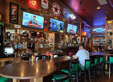
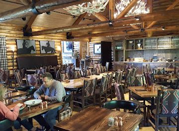
Evening life associated with the Tobacco Root Mountains is centred on the small towns and valley communities outside the range rather than on mountain venues. Ennis, Sheridan and Twin Bridges offer the kind of evening culture common to rural Montana: public houses, casual restaurants, community events and occasional live music rather than a concentrated nightclub scene. Historic mining communities in the wider area add a strong western architectural and social context, but visitors should check current arrangements rather than expect late opening or frequent entertainment. After dark in the mountains, the experience is more likely to be a campfire where permitted, quiet stargazing or listening to wildlife than organised nightlife. Alcohol should never be combined with remote driving, boating, hunting or demanding mountain travel, and fire restrictions can prohibit campfires during dry periods.
-
Bar
Montana Ale Works
Discover the vibrant flavors of Montana at Montana Ale Works, Bozeman's premier brewpub offering local beers and delicious American cuisine.
-
Grill
Copper | Whiskey Bar and Grill Bozeman
Experience the best of American Grill cuisine and an extensive whiskey selection at Copper | Whiskey Bar and Grill in Bozeman, Montana.
-
Grill
The Club Tavern and Grill
Experience the vibrant atmosphere of The Club Tavern and Grill in Bozeman, where great food meets a lively sports bar ambiance.
-
Grill
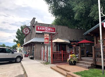
Gravel Bar
Discover delightful flavors at Gravel Bar in Ennis, Montana, where local ingredients and a cozy atmosphere create a memorable dining experience.

Best nightclubs in The Tobacco Root Mountains
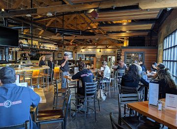
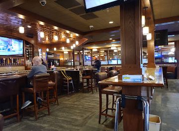
Evening life associated with the Tobacco Root Mountains is centred on the small towns and valley communities outside the range rather than on mountain venues. Ennis, Sheridan and Twin Bridges offer the kind of evening culture common to rural Montana: public houses, casual restaurants, community events and occasional live music rather than a concentrated nightclub scene. Historic mining communities in the wider area add a strong western architectural and social context, but visitors should check current arrangements rather than expect late opening or frequent entertainment. After dark in the mountains, the experience is more likely to be a campfire where permitted, quiet stargazing or listening to wildlife than organised nightlife. Alcohol should never be combined with remote driving, boating, hunting or demanding mountain travel, and fire restrictions can prohibit campfires during dry periods.
-
Adult entertainment club
Teasers
Experience the vibrant nightlife at Teasers, a premier adult entertainment club in Three Forks, Montana, offering delicious food, drinks, and lively performances.
-
Ski resort
Yellowstone Club
Discover the luxury of Yellowstone Club, a premier ski resort and golf course in Montana's breathtaking mountains, ideal for adventure and relaxation.


Best shops in The Tobacco Root Mountains
Shopping in the Tobacco Root Mountains is limited to practical supplies, outdoor equipment and locally produced goods found in gateway communities outside the range. Ennis, Sheridan and Twin Bridges have small-town commercial areas where visitors may find groceries, fuel, basic camping provisions, locally made crafts, artwork, books and western-style goods, though choice and opening arrangements vary. Seasonal farmers’ markets and roadside stands can offer produce, preserves, baked items and other products from the surrounding valleys. The most appropriate souvenirs are durable, locally made items or food products that reflect southwestern Montana’s ranching, mining and outdoor culture rather than objects removed from public land. Do not collect rocks, archaeological material or mining remnants from the mountains. Visitors heading into remote country should complete their shopping before leaving the valleys, since trailheads and Forest Service roads do not provide regular shops, vending facilities or dependable supplies.
-
Shopping mall
Gallatin Valley Mall
Explore the vibrant Gallatin Valley Mall in Bozeman, Montana, for a unique shopping and dining experience surrounded by stunning mountain views.
-
Record store
Cactus Records & Gifts
Explore the eclectic charm of Cactus Records & Gifts in Bozeman, Montana, where music, unique gifts, and local culture come together in harmony.
-
Gift shop
Heyday
Explore Heyday in Bozeman, your go-to gift shop for unique finds and local artisanal treasures that capture the essence of Montana.
-
Antique store
Montana Antique Mall
Explore the Montana Antique Mall in Missoula for an eclectic mix of vintage treasures and unique finds that capture the essence of the past.



Get your free copy of our complete guide to The Tobacco Root Mountains, delivered straight to you.
Everything on this page, from attractions and restaurants to essentials and local phrases, in one PDF you can read offline, print or share.
Already have an account? Sign in
Your The Tobacco Root Mountains guide is ready.
We'll send it to · Not you? Sign out

Getting your guide ready…
We are putting together a fresh copy of the The Tobacco Root Mountains guide. This can take up to a minute.
This can take a few moments. If your browser asks, choose Allow so the download can start. You'll find the guide in your Downloads folder.
Nothing happened? Download it again
Sorry, the guide is taking longer than usual. Please try again in a minute, or get it by email instead.
The Tobacco Root Mountains essentials
Currency and Payment
Safety
Emergency Situations
Do's and Don'ts
Local Tips
From Eve
Local phrases worth knowing
You don't need to get them perfect. A few words go a long way, and locals appreciate the effort.
Basics
| English | Local | Say it |
|---|---|---|
| Hello | Howdy | [Hau-dee] |
| Goodbye | See ya | [See yah] |
| Yes | Yup | [Yup] |
| No | Nah | [Nah] |
| Please/You’re welcome | Sure thing | [Shoor thing] |
| Thank you | Thanks a lot | [Thangs a lot] |
| Excuse me/Sorry | Pardon me | [Par-dun mee] |
| How are you? | How's it going? | [Hows it goin?] |
| Fine. And you? | Good, you? | [Good, you?] |
| Do you speak English? | You speakin' English? | [You speekin' Ing-lish?] |
| I don't understand | I ain't got it | [I ain't got it] |
Eating & Drinking
| English | Local | Say it |
|---|---|---|
| I’d like to see the menu, please | Can I see the menu? | [Can I see the men-yoo?] |
| I don't eat meat | I don't do meat | [I don't do meet] |
| Cheers! | Cheers! | [Cheers!] |
| I would like to pay, please | Can I get the bill? | [Can I get the bill?] |
Emergencies
| English | Local | Say it |
|---|---|---|
| Help! | Help! | [Help!] |
| Go away! | Get lost! | [Get lost!] |
| Call the Police! | Call the cops! | [Call the cops!] |
| Call a doctor! | Get a doctor! | [Get a doctor!] |
| I’m lost | I’m turned around | [I’m turned around] |
| I’m ill | I ain't feelin' good | [I ain't feelin' good] |
Shopping
| English | Local | Say it |
|---|---|---|
| I’d like to buy... | I wanna buy... | [I wanna buy...] |
| I’m just looking | Just browsin' | [Just browsin'] |
| How much is it? | What’s the price? | [What’s the price?] |
| That’s too expensive | That costs too much | [That costs too much] |
| Can you lower the price? | Can ya drop the price? | [Can ya drop the price?] |
Time & Numbers
| English | Local | Say it |
|---|---|---|
| What time is it? | What time ya got? | [What time ya got?] |
| It’s one o'clock | It's one | [It's one] |
| Half past (10) | Half past ten | [Half past ten] |
| Morning | Mornin' | [Mornin'] |
| Afternoon | Afternoon | [Afternoon] |
| Evening | Evenin' | [Evenin'] |
| Yesterday | Yestiddy | [Yestiddy] |
| Today | Today | [Today] |
| Tomorrow | Tomorra | [Tomorra] |
| 1 | One | [One] |
| 2 | Two | [Two] |
| 3 | Three | [Three] |
| 4 | Four | [Four] |
| 5 | Five | [Five] |
| 6 | Six | [Six] |
| 7 | Seven | [Seven] |
| 8 | Eight | [Eight] |
| 9 | Nine | [Nine] |
| 10 | Ten | [Ten] |
Transport & Directions
| English | Local | Say it |
|---|---|---|
| Where's a/the...? | Where's the nearest...? | [Where's the nearest...?] |
| What’s the address? | What’s the address? | [What’s the address?] |
| Can you show me (on the map)? | Can ya show me on the map? | [Can ya show me on the map?] |
| When's the next (bus)? | When's the next bus? | [When's the next bus?] |
| A ticket (to ....) | A ticket to... | [A ticket to...] |
History of The Tobacco Root Mountains
Indigenous Use of the Mountain Country
The Tobacco Root Mountains form part of the wider landscape long used by Indigenous peoples, including communities associated with the Northwestern Shoshone, Bannock and other peoples of the northern Rocky Mountains. Seasonal travel, hunting, plant gathering and knowledge of passes and watercourses connected the high country with the surrounding valleys. These relationships predate written records and continued through the period of Euro-American exploration and settlement. Visitors should understand that the mountains are not an untouched wilderness in the historical sense, but a cultural landscape with Indigenous connections that extend across southwestern Montana.
Exploration and the Fur Trade Era
During the early nineteenth century, fur trappers and traders moved through southwestern Montana’s river valleys and mountain corridors. Their journeys were part of a larger contest involving Indigenous nations, independent trappers and trading companies rather than a simple linear process of discovery. The Tobacco Roots were not transformed into a major colonial settlement during this period, but their surrounding valleys became better known to outsiders through travel along the Madison, Jefferson and Ruby river systems. Later maps and reports helped open the region to prospectors, ranchers and government surveyors.
Mining and Prospecting in the Nineteenth Century
Gold and other mineral discoveries changed the valleys around the Tobacco Root Mountains during Montana’s nineteenth-century mining era. Prospectors worked gulches and mountain drainages, while settlements and supply routes developed in nearby districts. Alder Gulch and Virginia City, outside the range, became especially important regional centres, and mining also affected communities and foothills associated with the Tobacco Roots. Evidence of this history survives in old workings, altered slopes, abandoned roads and historic settlement patterns. Mining brought investment and infrastructure, but also environmental disturbance and conflict over land and resources.
Ranching and Valley Settlement
As large-scale placer mining declined, ranching became a durable foundation of the valleys surrounding the range. Irrigated hay meadows, cattle operations and small agricultural communities developed in the Madison and Ruby valleys, using mountain snowmelt and streams. Towns such as Ennis, Sheridan and Twin Bridges are outside the Tobacco Root Mountains, but their histories are closely tied to the range through water, grazing, transport and seasonal labour. This relationship remains visible today in the contrast between open private ranchland below and public forest and alpine terrain above.
Federal Forest Management
The creation of national forest reserves in the early twentieth century introduced more systematic federal management of mountain timber, watersheds, grazing and access. Much of the Tobacco Root country is now managed through public-land systems associated with the Beaverhead-Deerlodge National Forest, although boundaries and regulations vary by location. Roads, fire policy, trail maintenance, grazing permits and wilderness values have all shaped the modern experience of the range. The result is a landscape where recreation takes place alongside forestry, wildlife management, ranching interests and conservation responsibilities.
Modern Outdoor Recreation
In the twentieth and twenty-first centuries the Tobacco Roots became increasingly valued for hiking, fishing, hunting, camping, climbing and landscape photography rather than for intensive development. Their relatively dispersed trailheads and absence of a large resort centre have preserved a quieter character, while also placing more responsibility on visitors. Seasonal access, wildfire, erosion, livestock, wildlife and private-land boundaries remain practical concerns. Contemporary travel to the range is therefore shaped by the continuing balance between public recreation, rural livelihoods and the protection of high-elevation ecosystems.
The Tobacco Root Mountains in Photos
Browse through our photo collection highlighting the charm and character of the destination.
Neighbouring regions of The Tobacco Root Mountains
The closest regions to The Tobacco Root Mountains, if you have time for more than one.
-

-

-

-

-


Swipe for more regions
Explore more
Explore more of Montana
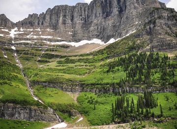
Discover Montana: A Treasure State of majestic landscapes, outdoor adventures, and rich cultural heritage. Explore Glacier and Yellowstone, charming towns, and historic sites.
Explore Montana