

Gallatin Canyon Travel Guide - Free Web & App
Your ultimate guide to Gallatin Canyon. Discover top landmarks, proposed trips, and local tips. Free on the web or via the Evendo companion app.


Gallatin Canyon, Montana, pairs the Gallatin River with rock walls, forests, wildlife, scenic drives, fly fishing and access to Big Sky and Yellowstone.
A River Through the Mountains
Gallatin Canyon follows the Gallatin River through south-western Montana, linking the open Gallatin Valley near Bozeman with the higher country approaching Big Sky and West Yellowstone. Much of the journey is made along US 191, a scenic route framed by steep, wooded slopes, exposed rock faces and the broad, fast-moving river. The canyon itself is less a single settlement than a linear landscape of public forest, ranch land, trailheads, fishing access sites and scattered accommodation.Read more about Gallatin Canyon
Outdoor Landscapes
Gateways and Regional Connections
When is the best time to visit Gallatin Canyon?
Best: June–August · 21–24°C| Month | High (°C) | Rainfall (mm) |
|---|---|---|
| January | -1 | 22 |
| February | 2 | 20 |
| March | 6 | 23 |
| April | 11 | 30 |
| May | 17 | 40 |
| June (best) | 21 | 48 |
| July (best) | 24 | 36 |
| August (best) | 23 | 34 |
| September | 18 | 32 |
| October | 11 | 27 |
| November | 4 | 24 |
| December | 0 | 22 |
Getting to and around Gallatin Canyon
How to get there
Transportation
Best attractions in Gallatin Canyon
The Gallatin River is Gallatin Canyon’s central attraction, winding between forested mountains and offering established opportunities for fly fishing, rafting and riverside observation where local conditions and regulations allow. US 191 itself provides a scenic journey through the corridor, with designated pull-offs and access points revealing changing views of the water and steep canyon walls. The Lava Lake Trail, reached from the Gallatin Canyon road, leads through forest towards an alpine lake beneath the Madison Range and is one of the area’s best-known hikes. Farther south, the road provides access towards Big Sky and the high country of the Lee Metcalf Wilderness, while routes into the Spanish Peaks open a more remote mountain landscape. Wildlife watching may bring sightings of elk, deer, mountain goats or bears, but the forest and river environment should be explored quietly and without expecting guaranteed encounters.
-
Tourist attraction
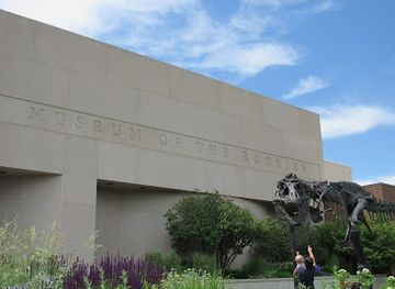
Museum of the Rockies
Explore the Museum of the Rockies in Bozeman, Montana, a family-friendly attraction featuring fascinating dinosaur exhibits, a planetarium, and rich cultural history.
-
Tourist attraction
Ousel Falls Park & Trailhead
Explore Ousel Falls Park & Trailhead in Gallatin Gateway, Montana - a picturesque hiking area with stunning waterfall views and rich natural beauty.
-
Brewery
Mountains Walking Brewery
Discover the perfect blend of craft beer, delicious pizza, and stunning mountain views at Mountains Walking Brewery in Bozeman, Montana.
-
Raft trip outfitter
Montana Whitewater Rafting & Zipline - Gallatin
Explore the thrills of rafting and ziplining at Montana Whitewater Rafting & Zipline, where adventure meets breathtaking landscapes.


Best landmarks in Gallatin Canyon
The Gallatin River is the defining natural landmark, its clear mountain water and trout habitat shaping both the scenery and the recreational identity of the corridor. The enclosing canyon walls reveal a sharp transition from a narrow river passage to forested slopes and high ridges leading towards the Gallatin and Madison ranges. Lava Lake, set beneath the dramatic Spanish Peaks area, is a prominent alpine destination reached by trail rather than road. The Lee Metcalf Wilderness and the Spanish Peaks represent the more remote mountain character beyond the developed corridor, while Big Sky is the principal built landmark of the southern approach, a resort community rather than a historic town. There are few major monuments or historic structures within the canyon itself; its significance lies chiefly in the river, mountain geography, public lands and long-established travel route linking Bozeman with the Yellowstone region.
-
Hiking area
Bozeman Trail Historic Marker
Discover the Bozeman Trail Historic Marker in Montana, where history meets stunning natural beauty on this iconic hiking trail.

Explore Gallatin Canyon on the map
Plan your trip on one map. See where the top attractions, landmarks, restaurants and hotels are, and book hotels and experiences in a few clicks.
Best hotels in Gallatin Canyon
Best restaurants in Gallatin Canyon
Dining in Gallatin Canyon is limited and dispersed rather than concentrated in a conventional restaurant district. Visitors commonly plan meals around Bozeman at the northern approach, Big Sky in the central-southern part of the corridor, or West Yellowstone farther south, with the choice of restaurants, cafés, bars and provisions varying between these settlements. Big Sky has the region’s most developed resort dining infrastructure, while smaller businesses and accommodation properties along the canyon may provide more limited food service, particularly outside the main season. The wider Montana food culture draws on beef, game, trout, grain, huckleberries and other locally associated produce, although menus and sourcing differ by establishment. Those heading to trailheads or river access should not rely on finding food en route: buy provisions in a gateway town and observe any restrictions on storing or carrying food in bear country.
-
American
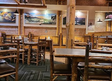
Ted's Montana Grill
Savor the rich flavors of traditional American cuisine at Ted's Montana Grill in Bozeman - where every meal tells a story.
-
Pizza
Old Chicago Pizza + Taproom
Discover Old Chicago Pizza + Taproom in Bozeman: where delicious pizza meets an impressive selection of craft beers in a family-friendly atmosphere.
-
American
MacKenzie River Pizza Co.
Discover delicious pizzas made with fresh ingredients at MacKenzie River Pizza Co., Bozeman's favorite spot for American cuisine.
-
Steak
Outback Steakhouse
Discover the rich flavors of Australian-inspired cuisine at Outback Steakhouse in Bozeman – where every meal is an adventure.


Best bars in Gallatin Canyon
Gallatin Canyon is not a nightlife destination in the urban sense. Evening options are generally found in accommodation properties, restaurants and established pubs in Big Sky, with a quieter selection in gateway communities such as West Yellowstone and the settlements near Bozeman. The atmosphere is oriented towards après-ski gatherings, informal drinks, live entertainment on some evenings and early starts for fishing, hiking or driving rather than late-night clubs. Along the more remote stretches of the canyon there may be no dependable evening venue, and darkness, wildlife and changing road conditions make unplanned driving less suitable after outdoor activities. Seasonal events and performances can occur in Big Sky or surrounding towns, but schedules vary and should be checked locally rather than assumed.
-
Bar
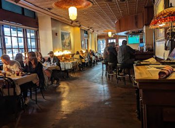
Montana Ale Works
Savor local craft beers and delicious American cuisine in the heart of Bozeman at Montana Ale Works, a must-visit brewpub for tourists.
-
Grill
Sidewinders American Grill
Discover the vibrant flavors of American cuisine at Sidewinders American Grill in Bozeman, MT, where delicious dishes meet a welcoming atmosphere.
-
Grill
Copper | Whiskey Bar and Grill Bozeman
Experience the best of Bozeman at Copper | Whiskey Bar and Grill, where delicious food meets an impressive whiskey selection in a vibrant atmosphere.
-
Barbecue
Riverhouse BBQ & Events
Experience authentic barbecue and stunning riverside views at Riverhouse BBQ & Events in Gallatin Gateway, Montana, the perfect spot for food lovers and event celebrations.


Best nightclubs in Gallatin Canyon
Gallatin Canyon is not a nightlife destination in the urban sense. Evening options are generally found in accommodation properties, restaurants and established pubs in Big Sky, with a quieter selection in gateway communities such as West Yellowstone and the settlements near Bozeman. The atmosphere is oriented towards après-ski gatherings, informal drinks, live entertainment on some evenings and early starts for fishing, hiking or driving rather than late-night clubs. Along the more remote stretches of the canyon there may be no dependable evening venue, and darkness, wildlife and changing road conditions make unplanned driving less suitable after outdoor activities. Seasonal events and performances can occur in Big Sky or surrounding towns, but schedules vary and should be checked locally rather than assumed.
-
Bar
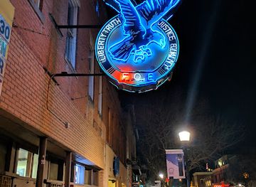
Fraternal Order of the Eagles, Bozeman Aerie #326
Discover the heart of Bozeman's nightlife at the Fraternal Order of the Eagles, where community spirit and fun come together in a welcoming bar atmosphere.
-
Bar
The Zebra
Experience the vibrant nightlife at The Zebra, Bozeman's premier bar with cocktails, live music, and casino excitement.

Best shops in Gallatin Canyon
Shopping within Gallatin Canyon is modest and practical, with opportunities concentrated in Big Sky and in the gateway towns rather than along the remote river corridor. Big Sky provides visitor-oriented retail, outdoor equipment, groceries, galleries and locally themed goods, while Bozeman offers the broadest selection of clothing, equipment, food producers, arts and crafts near the northern approach. West Yellowstone is useful for supplies and Yellowstone-related souvenirs when travelling from the south. Regional purchases may include Montana-made food products, outdoor clothing, artwork, leather goods and locally inspired crafts, although the provenance and availability of items vary by shop. There are few reasons to expect a continuous parade of independent stores between settlements, so visitors heading into the canyon should obtain fuel, provisions and specialist equipment before leaving the main commercial areas.
-
Gift shop
Gallatin Valley Mall
Explore the Gallatin Valley Mall in Bozeman, Montana, for a vibrant shopping experience with diverse stores and dining options in a picturesque setting.
-
Gift shop
Cactus Records & Gifts
Explore Cactus Records & Gifts in Bozeman, Montana - your one-stop shop for vinyl records, unique gifts, and live music in a vibrant atmosphere.
-
Gift shop
Heyday
Explore Heyday, Bozeman's charming gift shop, featuring unique local treasures, handmade crafts, and beautiful cards to delight every shopper.
-
Gift shop
Montana Gift Corral - Downtown Bozeman
Discover unique gifts and local treasures at Montana Gift Corral, your go-to destination in downtown Bozeman for memorable souvenirs and home goods.


Get your free copy of our complete guide to Gallatin Canyon, delivered straight to you.
Everything on this page, from attractions and restaurants to essentials and local phrases, in one PDF you can read offline, print or share.
Already have an account? Sign in
Your Gallatin Canyon guide is ready.
We'll send it to · Not you? Sign out

Getting your guide ready…
We are putting together a fresh copy of the Gallatin Canyon guide. This can take up to a minute.
This can take a few moments. If your browser asks, choose Allow so the download can start. You'll find the guide in your Downloads folder.
Nothing happened? Download it again
Sorry, the guide is taking longer than usual. Please try again in a minute, or get it by email instead.
Gallatin Canyon essentials
Currency and Payment
Safety
Emergency Situations
Do's and Don'ts
Local Tips
From Eve
Local phrases worth knowing
You don't need to get them perfect. A few words go a long way, and locals appreciate the effort.
Basics
| English | Local | Say it |
|---|---|---|
| Hello | Howdy | [haʊ-di] |
| Goodbye | See ya | [si jə] |
| Yes | Yup | [jʌp] |
| No | Nah | [nɑ] |
| Please/You're welcome | Please | [pliːz] |
| Thank you | Thanks | [θæŋks] |
| Excuse me/Sorry | Pardon | [pɑːrdn] |
| How are you? | Howdy | [haʊ-di] |
| Fine. And you? | Fine. And you? | [faɪn. ənd juː] |
| Do you speak English? | Ya speak English? | [jə spiːk ɪŋɡlɪʃ] |
| I don't understand | I don't get it | [aɪ doʊnt ɡɛt ɪt] |
Eating & Drinking
| English | Local | Say it |
|---|---|---|
| I'd like to see the menu, please | Can I see the menu, please | [kæn aɪ siː ðə ˈmɛnjuː pliːz] |
| I don't eat meat | I don't eat meat | [aɪ doʊnt it mit] |
| Cheers! | Cheers! | [ʧɪrz] |
| I would like to pay, please | Can I pay, please | [kæn aɪ peɪ pliːz] |
Emergencies
| English | Local | Say it |
|---|---|---|
| Help! | Help! | [hɛlp] |
| Go away! | Get out! | [ɡɛt aʊt] |
| Call the Police! | Call the Sheriff! | [kɔl ðə ʃɛrɪf] |
| Call a doctor! | Call a doc! | [kɔl ə dɑk] |
| I'm lost | I'm lost | [aɪm lɔst] |
| I'm ill | I'm sick | [aɪm sɪk] |
Shopping
| English | Local | Say it |
|---|---|---|
| I'd like to buy... | I'm looking to buy... | [aɪm ˈlʊkɪŋ tuː baɪ] |
| I'm just looking | I'm just looking | [aɪm ˈdʒʌst ˈlʊkɪŋ] |
| How much is it? | How much does it cost? | [haʊ mʌʧ dʌz ɪt kɑst] |
| That's too expensive | That's too much | [ðæts tuː mʌʧ] |
| Can you lower the price? | Can you do it cheaper? | [kæn juː duː ɪt ˈʧiːpər] |
Time & Numbers
| English | Local | Say it |
|---|---|---|
| What time is it? | What's the time? | [wɑːts ðə taɪm] |
| It's one o'clock | It's one | [ɪts wʌn] |
| Half past (10) | Half past (10) | [hæf pæst (10)] |
| Morning | Morning | [ˈmɔrnɪŋ] |
| Afternoon | Afternoon | [ˌæftərˈnun] |
| Evening | Evening | [ˈivnɪŋ] |
| Yesterday | Yesterday | [ˈjɛstərˌdeɪ] |
| Today | Today | [təˈdeɪ] |
| Tomorrow | Tomorrow | [təˈmɑˌroʊ] |
| 1 | One | [wʌn] |
| 2 | Two | [tuː] |
| 3 | Three | [θriː] |
| 4 | Four | [fɔr] |
| 5 | Five | [faɪv] |
| 6 | Six | [sɪks] |
| 7 | Seven | [ˈsɛvən] |
| 8 | Eight | [eɪt] |
| 9 | Nine | [naɪn] |
| 10 | Ten | [tɛn] |
Transport & Directions
| English | Local | Say it |
|---|---|---|
| Where's a/the...? | Where's the...? | [wɛrz ðə] |
| What's the address? | What's the address? | [wɑːts ðə əˈdrɛs] |
| Can you show me (on the map)? | Can you show me (on the map)? | [kæn juː ʃoʊ miː (ɒn ðə mæp)] |
| When's the next (bus)? | When's the next (bus)? | [wɛnz ðə nɛkst (bʌs)] |
| A ticket (to ....) | A ticket (to ....) | [ə ˈtɪkɪt (tu)] |
History of Gallatin Canyon
Geology of the Canyon
Gallatin Canyon occupies a mountain corridor shaped by the uplift and erosion of the northern Rocky Mountains. The Gallatin River has cut through resistant rock and transported sediment from the surrounding ranges, producing a narrow valley bordered by steep slopes and wider sections of river plain. Glacial processes during the Ice Age influenced the neighbouring valleys and left a landscape of alpine basins, forested ridges and high mountain passes. The geology is most evident where road cuts, cliffs and exposed ranges reveal the contrast between the river corridor and the surrounding Madison and Gallatin mountains.
Indigenous Lands and Early Travel
The wider Gallatin, Madison and Yellowstone country has long been connected with Indigenous peoples, including the Crow, whose traditional homeland extended across substantial parts of present-day Montana, as well as neighbouring Northern Plains and Rocky Mountain communities. Travel, hunting and seasonal movement followed river valleys and mountain routes long before the arrival of Euro-American settlement. The canyon’s modern name comes from Albert Gallatin, the American statesman commemorated in the names of the river, valley and surrounding national forest; that naming reflects the later political period rather than the region’s older Indigenous history.
Settlement and the Road South
Euro-American settlement expanded around the Gallatin Valley during the nineteenth century, with agriculture, ranching and transportation developing near Bozeman and along routes into the mountain country. The difficult canyon was primarily a passage between the valley and the Yellowstone region rather than a densely settled district. Roads and later highway improvements gradually made the corridor more accessible, linking local communities with recreational areas and the park gateway at West Yellowstone. Ranching remains part of the surrounding landscape, while public forest and wilderness lands limit the extent of permanent development.
Forestry, Recreation and Conservation
The mountains around Gallatin Canyon became part of the federal forest estate as the United States developed systems for managing public timber, watersheds and recreation. Today the corridor lies within the broad Custer Gallatin National Forest landscape, with nearby wilderness areas protecting high mountain country from intensive development. Fishing, hiking, boating and scenic travel grew in importance during the twentieth century, alongside the expansion of Big Sky and the increasing popularity of Yellowstone. Contemporary management balances public access with wildlife habitat, river health, wildfire awareness and the protection of fragile mountain environments.
Gallatin Canyon in Photos
Browse through our photo collection highlighting the charm and character of the destination.
Cities in Gallatin Canyon
The towns and cities of Gallatin Canyon, and the easiest places to base yourself.
-

-


Swipe for more cities
Neighbouring destination travel guides
The closest destinations to Gallatin Canyon, if you have time for more than one.
-

-

-

-

-


Swipe for more destinations
Explore more

Explore more of The Gallatin Valley
Explore the Gallatin Valley around Bozeman for mountain landscapes, dinosaur history, university culture, outdoor recreation and Montana ranch country.
Explore The Gallatin Valley
Explore more of Montana
Discover Montana: A Treasure State of majestic landscapes, outdoor adventures, and rich cultural heritage. Explore Glacier and Yellowstone, charming towns, and historic sites.
Explore Montana