

Free Southwest Nebraska Travel Guide & Mobile App
Explore Southwest Nebraska with free travel guides. Discover regional history, expert tips, proposed trips, and audio guides on web or mobile app.


Explore Southwest Nebraska for open prairie, historic trails, rail heritage, reservoir recreation and welcoming towns beneath immense Great Plains skies.
Read more about Southwest Nebraska
Getting to and around Southwest Nebraska
How to get there
Transportation
Top city travel guides in Southwest Nebraska
The cities of Southwest Nebraska, and the easiest places to base yourself.
-

-


Swipe for more cities
Destinations in Southwest Nebraska
Resorts, valleys and scenic spots worth a trip of their own.
-

-

-


Swipe for more destinations
Best attractions in Southwest Nebraska
Southwest Nebraska's attractions are dispersed across a landscape shaped by rivers, railways and open prairie. North Platte offers the strongest concentration of heritage experiences, including Buffalo Bill Ranch State Historical Park, the Golden Spike Tower and Visitor Center, Cody Park and interpretation of the North Platte Canteen. Around Ogallala, Boot Hill Cemetery and Front Street explore the cattle-shipping era, while nearby Lake McConaughy provides boating, fishing, swimming, camping and birdwatching on a broad reservoir shoreline. Ash Hollow State Historical Park, north of the North Platte River, combines geological scenery with trail history, pioneer graves and visible wagon ruts. McCook's Senator George Norris State Historic Site presents the home and public life of a nationally influential Nebraska politician, while the Museum of the High Plains places local settlement and agriculture in context. The region also suits anglers, wildlife watchers, stargazers and travellers interested in quiet drives through irrigated farmland, ranch country and river valleys. Attractions are rarely clustered, so the best itineraries link heritage sites with outdoor stops rather than treating them as a compact sightseeing circuit.
-
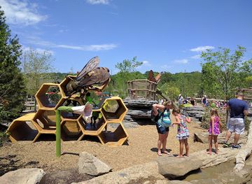
Zoo
Omaha's Henry Doorly Zoo and Aquarium
Explore the extraordinary wildlife and immersive exhibits at Omaha's Henry Doorly Zoo and Aquarium, a crown jewel of Nebraska's attractions.
-
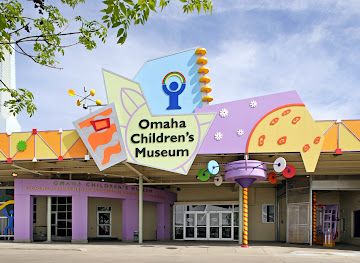
Children's museum
Omaha Children's Museum
Discover endless fun and learning at Omaha Children's Museum, where creativity and adventure await for children and families alike.
-
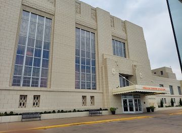
Museum
The Durham Museum
Discover the rich history and culture of Omaha at The Durham Museum, a must-visit destination for tourists seeking to explore the past.
-
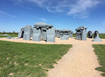
Tourist attraction
Carhenge
Explore Carhenge, a unique monument in Nebraska that creatively transforms vintage cars into a whimsical replica of Stonehenge.
Best landmarks in Southwest Nebraska
The most recognisable landmarks of southwest Nebraska reflect movement across the Great Plains. In North Platte, the Golden Spike Tower rises above the Union Pacific rail yard and symbolises the continuing importance of freight to the city, while Buffalo Bill Ranch State Historical Park preserves the home and grounds associated with William F. Cody. Ogallala's Boot Hill Cemetery is a tangible reminder of the cattle-shipping era, and the restored buildings of Front Street evoke the town's nineteenth-century commercial past without reproducing its frontier mythology uncritically. Ash Hollow State Historical Park is both a natural and historical landmark: its steep valley, springs and exposed trail route mark a place used by Indigenous travellers, emigrants and later settlers. Lake McConaughy's long shoreline and massive expanse of water form the region's most prominent modern landscape landmark, standing in contrast to the surrounding dry prairie. In McCook, the Senator George Norris State Historic Site represents the civic and political history of an influential Nebraskan whose career extended well beyond the region.
-
Museum
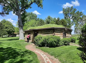
Buffalo Bill Ranch State Historical Park Museum
Discover the history and beauty of the American West at Buffalo Bill Ranch State Historical Park Museum in North Platte, Nebraska.
-
Antique store
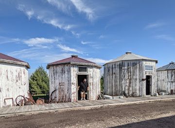
Grain Bin Antique Town
Explore the charm of Grain Bin Antique Town in North Platte, Nebraska, where every corner reveals unique vintage treasures and nostalgic finds.
-
Winery
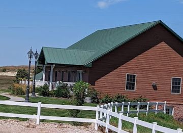
Feather River Vineyards
Experience the beauty and taste of Nebraska at Feather River Vineyards, a scenic winery offering exquisite wines and breathtaking landscapes.
-
Train yard
Union Pacific Bailey Yard
Explore the Union Pacific Bailey Yard, one of the world's largest train yards in North Platte, Nebraska, where railroading history comes to life.
Explore Southwest Nebraska on the map
Plan your trip on one map. See where the top cities, national parks and sights are, and book hotels and experiences in a few clicks.
Best hotels in Southwest Nebraska
Best restaurants in Southwest Nebraska
Dining in southwest Nebraska is practical, hearty and closely connected to the region's agricultural economy. North Platte, Ogallala and McCook have the broadest choice, from independent cafés and bakeries to steakhouses, family restaurants and familiar American diners. Beef is prominent in a ranching region, while local menus may also feature pork, chicken, freshwater fish and seasonal produce from irrigated farms and gardens. Along the Platte and Republican valleys, sweet corn, melons and other produce appear at farm stands or seasonal markets when available. Small-town cafés remain useful places for breakfast and lunch, and traditional bars often serve substantial meals as well as drinks. Reservoir communities add casual lakeside fare during the warmer months, though options may be limited outside the main settlements. Visitors should distinguish genuinely local produce from general Nebraska or Midwestern food: the strongest regional character lies in beef, farm produce, homemade baking and the informal community dining culture rather than in one single signature dish.
-
Steak
Round the Bend Steakhouse
Experience top-notch steaks and warm hospitality at Round the Bend Steakhouse in Ashland, Nebraska – where every meal is a celebration of flavor.
-
Steak
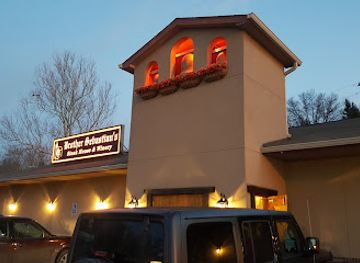
Brother Sebastian's Steakhouse
Experience the finest steak dining at Brother Sebastian's Steakhouse in Omaha - where quality meets tradition in every bite.
-
American
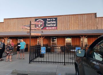
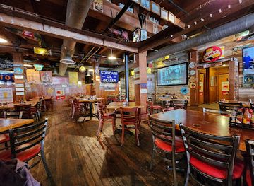
Buzzard Billy's
Experience the vibrant flavors of American and Creole cuisine at Buzzard Billy's in downtown Lincoln – where good food meets great ambiance.
-
Steak
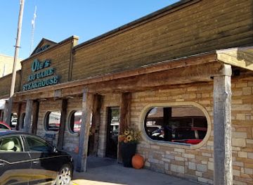
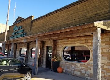
Ole's Big Game Steakhouse & Lounge
Experience exceptional steaks in a uniquely themed setting at Ole's Big Game Steakhouse & Lounge in Paxton, Nebraska.
Best bars in Southwest Nebraska
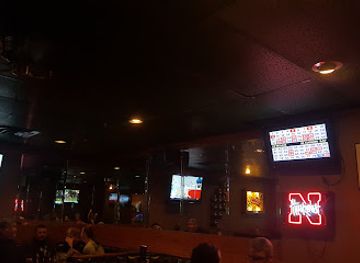
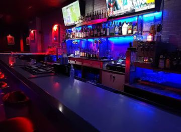
Evenings in southwest Nebraska usually centre on traditional bars, grills, brewpub-style spaces, restaurants and occasional live music rather than a large nightclub scene. North Platte has the widest choice of places for a drink, supper or community entertainment, while Ogallala and McCook provide smaller local scenes shaped by residents, rail and highway travellers, agricultural communities and seasonal visitors. Historic associations with cattle towns do not mean that nightlife is uniformly rowdy; much of it is relaxed and social, with conversations, televised sport and live or recorded music. Around Lake McConaughy, evening activity is more seasonal and often follows a day on the water or at a campsite. Opening arrangements and entertainment vary, especially outside the larger towns, so check locally rather than relying on assumptions about late-night service. Designated drivers and taxis should be arranged in advance in rural areas.
-
Steak
Ole's Big Game Steakhouse & Lounge
Savor the unique taste of game meats and classic steak dishes at Ole's Big Game Steakhouse & Lounge in Paxton, Nebraska.
-
Cocktail bar
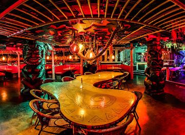
Laka Lono Rum Club
Experience the tropical vibes and exceptional cocktails at Laka Lono Rum Club, Omaha's premier cocktail bar and lounge.
-
Bar
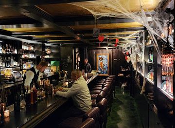
Wicked Rabbit
Experience the unique charm and vibrant atmosphere of Wicked Rabbit, Omaha's top bar for craft cocktails and nightlife.
-
Bar
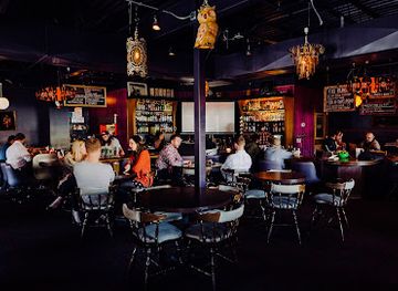
Nite Owl
Discover Nite Owl in Omaha – a trendy bar with crafted cocktails and an inviting atmosphere, perfect for nightlife enthusiasts.
Best nightclubs in Southwest Nebraska
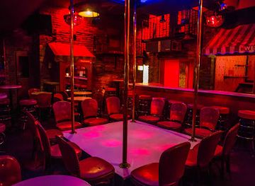
Evenings in southwest Nebraska usually centre on traditional bars, grills, brewpub-style spaces, restaurants and occasional live music rather than a large nightclub scene. North Platte has the widest choice of places for a drink, supper or community entertainment, while Ogallala and McCook provide smaller local scenes shaped by residents, rail and highway travellers, agricultural communities and seasonal visitors. Historic associations with cattle towns do not mean that nightlife is uniformly rowdy; much of it is relaxed and social, with conversations, televised sport and live or recorded music. Around Lake McConaughy, evening activity is more seasonal and often follows a day on the water or at a campsite. Opening arrangements and entertainment vary, especially outside the larger towns, so check locally rather than relying on assumptions about late-night service. Designated drivers and taxis should be arranged in advance in rural areas.
-
Adult entertainment club
Club Omaha Gentlemen’s Club
Discover the allure of Omaha's nightlife at Club Omaha Gentlemen’s Club, where entertainment and ambiance create unforgettable memories.
-
Lounge
Penthouse Lounge
Experience the vibrant nightlife at Penthouse Lounge, Omaha's top spot for cocktails, live music, and unforgettable karaoke nights.
-
Adult entertainment club
The Night Before Lounge
Discover the electrifying atmosphere of The Night Before Lounge in Lincoln, Nebraska, where captivating performances and great drinks await.
-
Night club
Rhythmz Lounge
Experience the vibrant nightlife at Rhythmz Lounge in Omaha, where music, dancing, and great drinks collide for an unforgettable evening.

Best shops in Southwest Nebraska
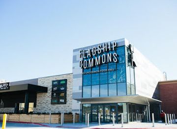
Shopping in southwest Nebraska is concentrated in the main streets and commercial areas of North Platte, Ogallala and McCook rather than in large metropolitan-style districts. Independent shops offer clothing, books, gifts, antiques, homewares and locally themed souvenirs, while supermarkets and specialist food shops are useful for provisions before travelling to reservoirs or rural sites. Farmers' markets and seasonal produce stalls, where operating, are good places to look for fruit, vegetables, baked goods and other products from the irrigated river valleys. Western wear, prairie-themed craftwork and ranch-style goods reflect the regional economy, although quality and provenance vary, so ask whether an item was made locally. Historic-site gift shops provide books and educational material about railways, trails, Buffalo Bill and Nebraska history. Highway businesses near major interchanges are convenient for essentials, but the older town centres generally offer more distinctive independent shopping and a better sense of local commercial life.
-
Shopping mall
Westroads Mall
Explore Westroads Mall: Omaha's ultimate shopping and dining destination offering a diverse range of retail and entertainment options.
-
Shopping mall
Nebraska Crossing
Explore Nebraska Crossing, the ultimate shopping destination with outlet stores, dining, and family-friendly entertainment in Gretna, Nebraska.
-
Shopping mall
Village Pointe
Discover Village Pointe, Omaha's vibrant shopping mall with diverse stores, delightful dining, and entertainment for a memorable experience.
-
Shopping mall
Shadow Lake Towne Center
Experience shopping, dining, and fun at Shadow Lake Towne Center in Papillion, Nebraska, a perfect destination for family and friends.
Get your free copy of our complete guide to Southwest Nebraska, delivered straight to you.
Everything on this page, from attractions and restaurants to essentials and local phrases, in one PDF you can read offline, print or share.
Already have an account? Sign in
Your Southwest Nebraska guide is ready.
We'll send it to · Not you? Sign out

Getting your guide ready…
We are putting together a fresh copy of the Southwest Nebraska guide. This can take up to a minute.
This can take a few moments. If your browser asks, choose Allow so the download can start. You'll find the guide in your Downloads folder.
Nothing happened? Download it again
Sorry, the guide is taking longer than usual. Please try again in a minute, or get it by email instead.
Southwest Nebraska essentials
Currency and Payment
Safety
Emergency Situations
Do's and Don'ts
Local Tips
From Eve
Local phrases worth knowing
You don't need to get them perfect. A few words go a long way, and locals appreciate the effort.
Basics
| English | Local | Say it |
|---|---|---|
| Hello | Howdy | [haʊdi] |
| Goodbye | See ya | [si jə] |
| Yes | Yep | [jɛp] |
| No | Nope | [noʊp] |
| Please/You're welcome | Please / No problem | [pliz / noʊ ˈprɒbləm] |
| Thank you | Thanks | [θæŋks] |
| Excuse me/Sorry | Excuse me / Sorry | [ɪkˈskjuz mi / ˈsɔri] |
| How are you? | How ya doin'? | [haʊ jə ˈduɪn] |
| Fine. And you? | Good. And you? | [ɡʊd. ənd ju] |
| Do you speak English? | Do ya speak English? | [du jə spiːk ˈɪŋɡlɪʃ] |
| I don't understand | I don’t get it | [aɪ doʊnt ɡɛt ɪt] |
Eating & Drinking
| English | Local | Say it |
|---|---|---|
| I'd like to see the menu, please | Can I see the menu, please? | [kæn aɪ si ðə ˈmɛnjuː pliz] |
| I don't eat meat | I don’t eat meat | [aɪ doʊnt it miːt] |
| Cheers! | Cheers! | [ʧɪrz] |
| I would like to pay, please | I’d like to settle up, please | [aɪd laɪk tu ˈsɛtəl ʌp pliz] |
Emergencies
| English | Local | Say it |
|---|---|---|
| Help! | Help! | [hɛlp] |
| Go away! | Get outta here! | [ɡɛt ˈɑːtə hɪr] |
| Call the Police! | Call the cops! | [kɔl ðə kɑps] |
| Call a doctor! | Get a doctor! | [ɡɛt ə ˈdɑktər] |
| I'm lost | I’m lost | [aɪm lɔst] |
| I'm ill | I’m not feelin' well | [aɪm nɑt ˈfiːlɪn wɛl] |
Shopping
| English | Local | Say it |
|---|---|---|
| I'd like to buy... | I’d like to get... | [aɪd laɪk tu ɡɛt] |
| I'm just looking | Just browsing | [dʒʌst ˈbraʊzɪŋ] |
| How much is it? | What’s the price? | [wʌts ðə praɪs] |
| That's too expensive | That costs too much | [ðæt kɔsts tu mʌʧ] |
| Can you lower the price? | Can ya bring that price down? | [kæn jə brɪŋ ðæt praɪs daʊn] |
Time & Numbers
| English | Local | Say it |
|---|---|---|
| What time is it? | What time ya got? | [wʌt taɪm jə ɡɑt] |
| It's one o'clock | It's one | [ɪts wʌn] |
| Half past (10) | Half past ten | [hæf pæst tɛn] |
| Morning | Mornin' | [ˈmɔrnɪn] |
| Afternoon | Afternoon | [ˌæftərˈnun] |
| Evening | Evenin' | [ˈivnɪn] |
| Yesterday | Yesterday | [ˈjɛstərdeɪ] |
| Today | Today | [təˈdeɪ] |
| Tomorrow | Tomorrow | [təˈmɔroʊ] |
| 1 | One | [wʌn] |
| 2 | Two | [tu] |
| 3 | Three | [θri] |
| 4 | Four | [fɔr] |
| 5 | Five | [faɪv] |
| 6 | Six | [sɪks] |
| 7 | Seven | [ˈsɛvən] |
| 8 | Eight | [eɪt] |
| 9 | Nine | [naɪn] |
| 10 | Ten | [tɛn] |
Transport & Directions
| English | Local | Say it |
|---|---|---|
| Where's a/the...? | Where's the...? | [wɛrz ðə] |
| What's the address? | What’s the address? | [wʌts ði əˈdrɛs] |
| Can you show me (on the map)? | Can ya show me on the map? | [kæn jə ʃoʊ mi ɑn ðə mæp] |
| When's the next (bus)? | When’s the next bus? | [wɛnʤ ðə nɛkst bʌs] |
| A ticket (to ....) | A ticket to... | [ə ˈtɪkɪt tu] |
History of Southwest Nebraska
Indigenous Plains Heritage
Long before United States settlement, the valleys and prairies of southwest Nebraska were used by Indigenous peoples for hunting, travel and trade. Pawnee communities had deep connections with the Platte and Republican river systems, while other Plains peoples moved through the wider region over time. The landscape cannot be understood solely through later wagon trails or railroad history: its rivers, grasslands and wildlife supported established cultural networks and seasonal lifeways. Many place names and archaeological traces preserve only part of this older history, and visitors should treat the region's Indigenous past as a continuing history rather than a vanished prelude.
Trails Across the Platte Valley
During the nineteenth century, the Platte River valley became one of the principal overland corridors across the Great Plains. Travellers on the Oregon, California and Mormon trails followed the river's broad valley, relying on its water and relatively navigable terrain while facing disease, exhaustion and exposure. Ash Hollow, in the western part of the region, was an important landmark and descent on these routes; its historic trail ruts and cemetery help convey the scale of migration. The trails connected the central United States with western territories, but they also intensified pressure on Indigenous communities and wildlife.
The Railroad and the Growth of Towns
The Union Pacific Railroad transformed southwest Nebraska from a corridor of movement into a network of permanent settlements. Tracks, depots and rail yards encouraged the growth of North Platte, Ogallala and numerous smaller communities, linking farms and ranches with national markets. North Platte became particularly important because of its location on the transcontinental route. Rail transport brought people, supplies and investment, while also accelerating the displacement of Indigenous peoples and the commercial development of the plains. Much of the region's contemporary geography, including its town spacing and freight economy, still reflects this nineteenth-century infrastructure.
Cattle Towns and Buffalo Bill
Ogallala became associated with the cattle-shipping era, when Texas cattle were driven north to railheads and then transported to eastern markets. Its reputation as a rowdy frontier town was shaped by saloons, temporary workers and the often romanticised violence of the cattle trade. North Platte was linked to another western legend through William F. Cody, known as Buffalo Bill, whose ranch and theatrical enterprises were based near the city. These stories remain visible in local museums and historic sites, although the region's development also depended on farmers, railroad workers, Indigenous communities and immigrant settlers whose contributions receive less attention in popular frontier narratives.
Irrigation, Farming and Settlement
Agriculture became more dependable as settlers developed irrigation along the Platte and Republican river systems and adopted methods suited to the semi-arid Great Plains. Water management enabled production of crops such as maize, wheat, alfalfa and sugar beet in suitable districts, while cattle ranching remained central in drier areas. Irrigation also altered river landscapes and tied local prosperity to infrastructure, groundwater and national agricultural markets. The contrast between irrigated green fields and surrounding dry prairie is one of southwest Nebraska's defining visual characteristics.
The North Platte Canteen During the Second World War
Between 1941 and 1946, volunteers in North Platte operated a canteen for servicemen whose trains stopped briefly in the city. Local residents supplied food, drinks and small comforts to millions of American military personnel passing through the rail station, creating one of Nebraska's best-known home-front stories. The effort depended on donations and volunteer labour from communities across the surrounding area. Its legacy is commemorated through local interpretation and is significant not because it changed the course of the war, but because it illustrates how a railway town mobilised community resources on an extraordinary scale.
Modern Rural Transformation
After the Second World War, mechanisation, improved highways, changing farm economics and population movement reshaped southwest Nebraska. Some small settlements declined as services and employment concentrated in regional centres such as North Platte, Ogallala and McCook, while agriculture became more productive and capital-intensive. Interstate 80 reinforced the region's role as a national transport corridor, and reservoirs added recreation to an economy still based heavily on farming, ranching, rail freight and logistics. Contemporary southwest Nebraska therefore combines older river and rail landscapes with modern highways, irrigation systems and communities adapting to rural change.
Southwest Nebraska in Photos
Browse through our photo collection highlighting the charm and character of the destination.
Neighbouring regions of Southwest Nebraska
The closest regions to Southwest Nebraska, if you have time for more than one.
-

-

-

-

-


Swipe for more regions
Explore more

Explore more of Nebraska
Discover Nebraska: A blend of rich history, diverse landscapes, and unique attractions in the heartland of America.
Explore Nebraska