

Free Loess Hills Travel Guide & Mobile App
Explore Loess Hills with free travel guides. Discover regional history, expert tips, proposed trips, and audio guides on web or mobile app.


Explore Nebraska’s loess bluffs through wooded trails, Missouri River views, historic towns, orchards and accessible countryside near Omaha.
Read more about Loess Hills
Getting to and around Loess Hills
How to get there
Transportation
Top city travel guides in Loess Hills
The cities of Loess Hills, and the easiest places to base yourself.
-

-
-


Swipe for more cities
Destinations in Loess Hills
Resorts, valleys and scenic spots worth a trip of their own.

Swipe for more destinations
Best attractions in Loess Hills
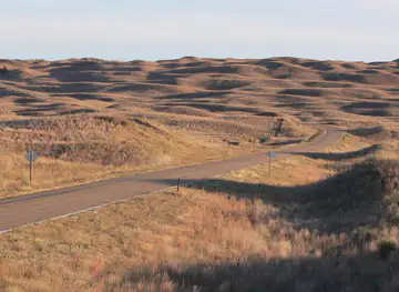
Nebraska’s loess-bluff landscape offers a mixture of protected woodland, river scenery, historic towns and accessible countryside rather than a concentrated chain of major attractions. Around Bellevue, Fontenelle Forest provides marked trails through steep ravines and mature forest, with interpretive opportunities and views shaped by the Missouri Valley. North of Omaha, the Ponca Hills area is suited to rural driving and observing the transition between city, farmland and wooded uplands. Southward, Nebraska City adds orchards, gardens, Arbor Day heritage and the state historic setting of Arbor Lodge. Brownville contributes museums, historic buildings and river-town character, while nearby conservation areas provide birdwatching and quieter walking. The wider Missouri corridor also includes floodplain habitats and seasonal wildlife, although river levels can affect access. Travellers should distinguish these Nebraska sites from the Loess Hills Scenic Byway and major preserves across the Missouri River in Iowa, which are nearby but outside the state. The attraction landscape is strongest for visitors who combine short walks, scenic roads, local history and changing views of the bluffs rather than trying to cover everything in one excursion.
-
Museum
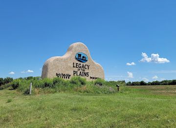
Legacy of the Plains Museum
Discover the rich agricultural and cultural history of the Great Plains at the Legacy of the Plains Museum in Gering, Nebraska.
-
Wildlife refuge
Loess Bluffs NWR Welcome Center
Explore the breathtaking landscapes and diverse wildlife of Loess Bluffs National Wildlife Refuge, a serene haven for nature lovers in Missouri.
-
Farm
Loess Hills Lavender Farm
Discover the tranquil beauty of Loess Hills Lavender Farm, where aromatic lavender fields and serene landscapes await your visit.
-
State park
Preparation Canyon State Park
Experience the beauty of nature at Preparation Canyon State Park, Iowa's serene escape for outdoor adventures and family fun.


Best landmarks in Loess Hills
-
Historical place
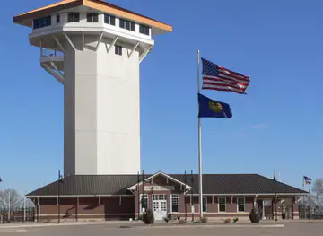
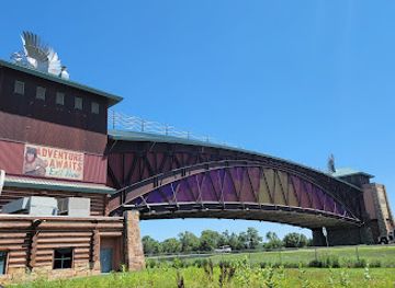
Great Platte River Road Archway Monument
Experience the rich history of American westward expansion at the Great Platte River Road Archway Monument, a remarkable tribute to explorers and pioneers.
-
Shopping mall
Conestoga Mall
Explore Conestoga Mall in Grand Island, Nebraska – a premier shopping destination with diverse retail options, dining, and entertainment for everyone.
-
Convention center
Fonner Park
Discover the thrill of horse racing, live concerts, and vibrant community events at Fonner Park in Grand Island, Nebraska.
-
Tourist attraction
Golden Spike Tower
Discover breathtaking views and rich railroad history at the Golden Spike Tower in North Platte, Nebraska, a must-visit for all train enthusiasts.


Explore Loess Hills on the map
Plan your trip on one map. See where the top cities, national parks and sights are, and book hotels and experiences in a few clicks.
Best hotels in Loess Hills
Best restaurants in Loess Hills
Dining in Nebraska’s Missouri River bluff country reflects the broader food traditions of the Great Plains, with farm produce, beef, pork, seasonal fruit and straightforward Midwestern cooking. Omaha provides the region’s broadest choice of restaurants, from contemporary dining and international cuisines to cafés, breweries and long-established neighbourhood establishments. Bellevue and smaller river communities offer diners, family restaurants, pubs and locally run cafés rather than a large concentration of destination restaurants. Around Nebraska City, orchard produce and apples are an important part of the local identity, particularly in season, while farmers’ markets and roadside stands may feature fruit, vegetables, preserves and baked goods. Brownville is better suited to a relaxed meal or refreshment combined with historic sightseeing. Regional specialities are generally part of Nebraska’s wider culinary culture rather than exclusive to the loess bluffs, so visitors should look for local sourcing, seasonal menus and independent producers instead of expecting a single defining dish.
-
Steak
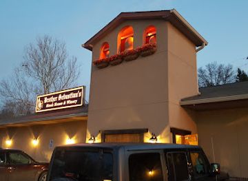
Brother Sebastian's Steakhouse
Experience the finest steaks at Brother Sebastian's Steakhouse in Omaha – where culinary excellence meets inviting ambiance.
-
Sandwich
Block 16
Discover Block 16 in Omaha – where innovative sandwiches meet vibrant dining experiences for food lovers of all kinds.
-
Grill
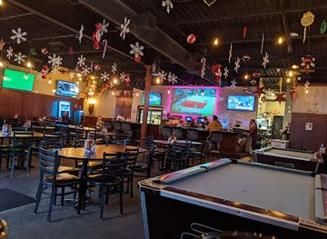
The Salty Dog Bar & Grill
Discover flavorful dishes and a lively atmosphere at The Salty Dog Bar & Grill in Council Bluffs - your go-to spot for great food and fun!
-
Restaurant
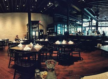
M's Pub
Experience the vibrant flavors at M's Pub in Downtown Omaha – where culinary creativity meets a lively atmosphere.

Best bars in Loess Hills
Nightlife varies sharply across the region. Omaha is the main evening centre, with cocktail bars, breweries, live-music venues, restaurants and late-opening entertainment in its urban districts. Bellevue has a more local, suburban pattern of pubs, casual bars and restaurants, while Nebraska City and Brownville offer quieter evenings centred on cafés, taverns, historic inns and seasonal community events. Rural areas do not have a continuous nightlife district, and distances between communities make driving after drinking especially important to plan. The region’s evening character is better suited to conversation, local food, small-scale live music and sunset views over the Missouri Valley than to a major nightclub scene. Brewery and taproom culture is more visible in the Omaha area, while smaller towns tend to close earlier and may have limited options outside weekends or special events.
-
Steak
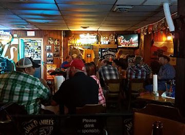
Ole's Big Game Steakhouse & Lounge
Experience a unique dining adventure at Ole's Big Game Steakhouse & Lounge, where delicious steaks and a friendly atmosphere await you.
-
Grill
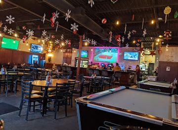
The Salty Dog Bar & Grill
Discover the best of American grill cuisine at The Salty Dog Bar & Grill, where flavor meets a vibrant atmosphere in Council Bluffs.
-
Grill
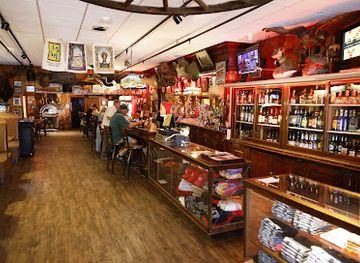
Buck's Bar and Grill
Discover Buck's Bar and Grill in Waterloo, Nebraska - where delicious grilled dishes meet live music in a friendly atmosphere.
-
Cocktail bar
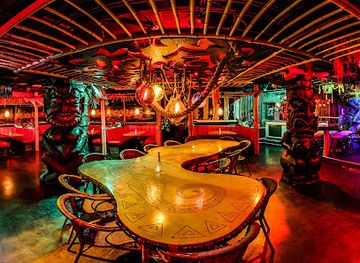
Laka Lono Rum Club
Experience tropical bliss at Laka Lono Rum Club, Omaha's premier cocktail bar with an extensive rum selection and vibrant ambiance.
Best nightclubs in Loess Hills
Nightlife varies sharply across the region. Omaha is the main evening centre, with cocktail bars, breweries, live-music venues, restaurants and late-opening entertainment in its urban districts. Bellevue has a more local, suburban pattern of pubs, casual bars and restaurants, while Nebraska City and Brownville offer quieter evenings centred on cafés, taverns, historic inns and seasonal community events. Rural areas do not have a continuous nightlife district, and distances between communities make driving after drinking especially important to plan. The region’s evening character is better suited to conversation, local food, small-scale live music and sunset views over the Missouri Valley than to a major nightclub scene. Brewery and taproom culture is more visible in the Omaha area, while smaller towns tend to close earlier and may have limited options outside weekends or special events.
-
Dance hall
Bushwackers Saloon & Dance Hall
Experience the vibrant nightlife at Bushwackers Saloon & Dance Hall in Ralston, Nebraska - the ultimate destination for dancing, dining, and live music.
-
Cocktail bar
The Berry & Rye
Experience the art of mixology at The Berry & Rye, Omaha's premier cocktail bar offering innovative drinks and a chic ambiance for all occasions.
-
Cocktail bar
Interlude Lounge
Experience the best of Omaha's nightlife at Interlude Lounge, a cozy cocktail bar with a welcoming atmosphere and creative drink offerings.
-
Bar
Bar 415
Experience Omaha's vibrant nightlife at Bar 415, a hub for underground dance music and delightful drinks.


Best shops in Loess Hills
Shopping is concentrated in Omaha and Bellevue, where visitors will find mainstream retail, independent businesses, galleries, books, clothing and food shops. The smaller communities offer a more local experience through antique stores, historic-town boutiques, craft outlets and seasonal produce sellers. Nebraska City is the strongest stop for orchard products, tree-related gifts, preserves and locally made food, particularly during the growing season, while farmers’ markets and roadside stands may provide fruit, vegetables, baked goods and honey. Brownville’s historic setting supports small-scale craft and antique shopping rather than extensive retail. In rural areas, opening days and hours can be limited, so it is sensible not to rely on a single shop being open. Good regional purchases include Nebraska food products, orchard goods, locally made crafts, books on the Missouri Valley and practical outdoor items rather than generic souvenirs.
-
Thrift store
New Life Thrift Store
Explore the hidden gems of Bellevue at New Life Thrift Store, where sustainable shopping meets unique treasures at unbeatable prices.
-
Flower designer
Loess Hills Floral
Experience the artistry of floral design at Loess Hills Floral, where unique arrangements and expert service create unforgettable moments.
-
Flea market
Flippin’ Vintage Boutiques & Thrift
Explore the charm of Flippin’ Vintage Boutiques & Thrift in Sergeant Bluff, Iowa, where unique vintage finds and local crafts await every visitor.
-
Cabinet maker
Loess Hills Woodworks
Explore exceptional craftsmanship at Loess Hills Woodworks, where artistry meets functionality in stunning wood creations.


Get your free copy of our complete guide to Loess Hills, delivered straight to you.
Everything on this page, from attractions and restaurants to essentials and local phrases, in one PDF you can read offline, print or share.
Already have an account? Sign in
Your Loess Hills guide is ready.
We'll send it to · Not you? Sign out

Getting your guide ready…
We are putting together a fresh copy of the Loess Hills guide. This can take up to a minute.
This can take a few moments. If your browser asks, choose Allow so the download can start. You'll find the guide in your Downloads folder.
Nothing happened? Download it again
Sorry, the guide is taking longer than usual. Please try again in a minute, or get it by email instead.
Loess Hills essentials
Currency and Payment
Safety
Emergency Situations
Do's and Don'ts
Local Tips
From Eve
Local phrases worth knowing
You don't need to get them perfect. A few words go a long way, and locals appreciate the effort.
Basics
| English | Local | Say it |
|---|---|---|
| Hello | Howdy | [Haw-dee] |
| Goodbye | See ya later | [See ya lay-ter] |
| Yes | Yep | [Yep] |
| No | Nope | [Nope] |
| Please/You're welcome | Please/No problem | [Pleez/No prob-lum] |
| Thank you | Thanks a lot | [Thanks uh lot] |
| Excuse me/Sorry | Excuse me/Sorry about that | [Ex-cuse me/Sor-ry uh-bout that] |
| How are you? | How ya doin'? | [How ya doin'?] |
| Fine. And you? | Good. And you? | [Good. And you?] |
| Do you speak English? | Do ya speak English? | [Do ya speak English?] |
| I don't understand | I ain't gettin' it | [I ain't gettin' it] |
Eating & Drinking
| English | Local | Say it |
|---|---|---|
| I'd like to see the menu, please | Can I see the menu, please? | [Can I see the men-yoo, pleez?] |
| I don't eat meat | I don’t eat meat | [I don’t eat meat] |
| Cheers! | Cheers! | [Cheers!] |
| I would like to pay, please | I'd like to settle up, please | [I'd like to set-l up, pleez] |
Emergencies
| English | Local | Say it |
|---|---|---|
| Help! | Help! | [Help!] |
| Go away! | Get lost! | [Get lost!] |
| Call the Police! | Call the cops! | [Call the cops!] |
| Call a doctor! | Get a doctor! | [Get a doc-tor!] |
| I'm lost | I'm lost | [I'm lost] |
| I'm ill | I'm not feelin' well | [I'm not feelin' wel] |
Shopping
| English | Local | Say it |
|---|---|---|
| I'd like to buy... | I wanna buy... | [I wanna buy...] |
| I'm just looking | Just lookin' around | [Just lookin' around] |
| How much is it? | How much is this? | [How much is this?] |
| That's too expensive | That's a bit pricey | [That's a bit pry-see] |
| Can you lower the price? | Can ya drop the price? | [Can ya drop the pryce?] |
Time & Numbers
| English | Local | Say it |
|---|---|---|
| What time is it? | What time is it? | [What time is it?] |
| It's one o'clock | It's one o'clock | [It's one o'clock] |
| Half past (10) | Half past ten | [Half past ten] |
| Morning | Morning | [Morning] |
| Afternoon | Afternoon | [Afternoon] |
| Evening | Evening | [Evening] |
| Yesterday | Yesterday | [Yesterday] |
| Today | Today | [Today] |
| Tomorrow | Tomorrow | [Tomorrow] |
| 1 | One | [One] |
| 2 | Two | [Two] |
| 3 | Three | [Three] |
| 4 | Four | [Four] |
| 5 | Five | [Five] |
| 6 | Six | [Six] |
| 7 | Seven | [Seven] |
| 8 | Eight | [Eight] |
| 9 | Nine | [Nine] |
| 10 | Ten | [Ten] |
Transport & Directions
| English | Local | Say it |
|---|---|---|
| Where's a/the...? | Where's a...? | [Where's a...?] |
| What's the address? | What's the address? | [What's the address?] |
| Can you show me (on the map)? | Can ya point it out? | [Can ya point it out?] |
| When's the next (bus)? | When's the next bus? | [When's the next bus?] |
| A ticket (to ....) | A ticket to ... | [A ticket to ...] |
History of Loess Hills
Ice-Age Loess and Missouri River Formation
The region’s defining landform began with deposits of windblown silt associated with the Ice Age. As glaciers expanded and retreated farther north, meltwater and changing winds supplied fine sediment that accumulated across the Missouri River Valley and its margins. Later erosion cut gullies and ravines into the soft material, while the river shifted across its floodplain. The resulting bluffs and rolling uplands are geological evidence of a much colder and drier past. Their steep, easily eroded slopes also continue to influence farming, woodland growth, trail design and conservation across eastern Nebraska.
Indigenous Homelands and River Networks
Long before European-American settlement, the Missouri River corridor supported Indigenous communities whose lives were connected to its forests, prairies, wetlands and tributaries. The area has longstanding associations with peoples including the Omaha, Ponca, Otoe-Missouria and Pawnee, although their histories extend well beyond the modern borders of Nebraska. The river served as a route for movement, exchange and seasonal subsistence. Archaeological sites, place names and continuing tribal presence provide important reminders that the region’s history did not begin with nineteenth-century towns or American expansion.
Exploration and the Missouri River Frontier
The Missouri River became a major corridor for exploration and expanding United States influence in the early nineteenth century. The Lewis and Clark expedition travelled along the river in 1804, documenting a landscape already inhabited and managed by Indigenous peoples. Later expeditions, military ventures and commercial traffic used the same waterway to move between the lower Missouri and the expanding interior. The river’s changing channel, sandbars and seasonal floods shaped settlement patterns, while the bluffs offered prominent viewpoints and, in some places, defensible high ground.
River Towns, Steamboats and Settlement
During the nineteenth century, communities such as Nebraska City and Brownville developed through their relationship with the Missouri River. Steamboats carried passengers, agricultural goods and manufactured supplies, while ferries and river landings connected Nebraska with neighbouring states. Brownville became an early centre of commerce, government and culture in the Nebraska Territory, and Nebraska City grew as a transport and supply point. Railways later reduced the river’s dominance, but historic streets, houses, civic buildings and museums preserve the period when the Missouri was the region’s principal commercial highway.
Agriculture, Orchards and Tree Culture
The loess uplands and fertile river terraces encouraged farming, although the steepest slopes required care to limit erosion. Orchards, field crops, livestock and timber all became part of the local economy. Nebraska City gained national significance through the work of J. Sterling Morton, a nineteenth-century editor, politician and advocate of tree planting who founded Arbor Day. Arbor Lodge and the continuing celebration of Arbor Day reflect a broader regional relationship with orchards, shelterbelts and cultivated landscapes. Tree planting helped shape both the appearance and the economic identity of southeastern Nebraska.
Conservation of Forests and River Bluffs
Twentieth-century conservation efforts protected important examples of the region’s woodland, prairie and river environments. Fontenelle Forest, established as a nature reserve in Bellevue, became one of the best-known protected natural areas in the Missouri Valley, preserving steep ravines and mature forest close to a major city. Other state and local conservation areas protect floodplain habitats, upland vegetation and wildlife corridors. These reserves demonstrate that the bluffs are not merely scenic formations: they are living environments shaped by fire, water, grazing, cultivation and changing land-management practices.
Modern Omaha and the Metropolitan River Valley
Omaha’s growth transformed the northern part of Nebraska’s Missouri River corridor from a frontier transport zone into a major metropolitan area. Industry, railways, bridges and suburban development altered the valley, while the bluffs remained a visible natural edge to the city. Bellevue, Papillion and other nearby communities now combine residential growth with access to forests, parks and rural roads. Contemporary travel in the Nebraska Loess Hills landscape therefore depends on this contrast between urban infrastructure and protected or agricultural uplands, with conservation areas providing close access to geological and ecological heritage.
Loess Hills in Photos
Browse through our photo collection highlighting the charm and character of the destination.
Neighbouring regions of Loess Hills
The closest regions to Loess Hills, if you have time for more than one.
-

-

-
-

-


Swipe for more regions
Explore more

Explore more of Nebraska
Discover Nebraska: A blend of rich history, diverse landscapes, and unique attractions in the heartland of America.
Explore Nebraska