

Free Coos County Travel Guide & Mobile App
Explore Coos County with free travel guides. Discover regional history, expert tips, proposed trips, and audio guides on web or mobile app.


Explore Coos County, New Hampshire, for Mount Washington, northern forests, lakes, scenic drives, hiking, wildlife and historic mill towns.
Read more about Coos County
When is the best time to visit Coos County?
Best: June–August · 20–23°C| Month | High (°C) | Rainfall (mm) |
|---|---|---|
| January | -5 | 80 |
| February | -4 | 70 |
| March | 2 | 80 |
| April | 8 | 90 |
| May | 15 | 100 |
| June (best) | 20 | 110 |
| July (best) | 23 | 110 |
| August (best) | 22 | 110 |
| September | 17 | 100 |
| October | 11 | 90 |
| November | 6 | 90 |
| December | -1 | 80 |
Getting to and around Coos County
How to get there
Transportation
Destinations in Coos County
Resorts, valleys and scenic spots worth a trip of their own.
-

-

-

-

-


Swipe for more destinations
Best attractions in Coos County
Coos County’s attractions are defined by the meeting of high mountains, deep forest and working communities. In the south, Gorham provides access to the Presidential Range, the White Mountain National Forest and routes towards Mount Washington, with hiking, scenic driving, wildlife viewing and winter recreation available in different seasons. Mount Washington itself is the county’s principal outdoor draw, but the surrounding valleys and lower-elevation trails offer alternatives when summit weather is unsuitable. The Androscoggin River corridor adds opportunities for paddling, fishing and exploring the industrial heritage of Berlin. Farther north, Pittsburg and the Connecticut Lakes region appeal to visitors seeking boating, fishing, hunting traditions, snowmobiling, wildlife observation and quiet forest roads. Lancaster’s historic civic centre and cultural institutions provide a useful contrast to the county’s wilder landscapes, while Weeks State Park offers views and an insight into the region’s early twentieth-century elite and political history. Families may also visit Santa’s Village in Jefferson, a seasonal amusement park with a long association with the northern New Hampshire tourism economy. Across the county, attractions are often separated by substantial distances, so a route organised around one valley or town is more practical than attempting to cover every district in a single day.
-
National forest
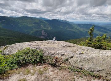
White Mountain National Forest
Explore the stunning landscapes, diverse wildlife, and outdoor activities in the picturesque White Mountain National Forest, a must-visit for nature enthusiasts.
-
Tourist attraction
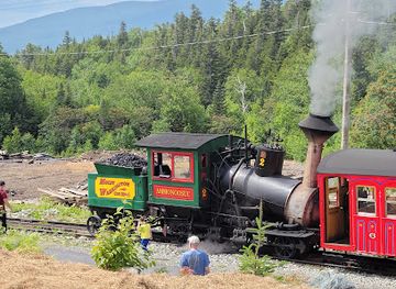
The Mount Washington Cog Railway
Discover the breathtaking ride of The Mount Washington Cog Railway, a historic journey to New Hampshire's iconic peak with stunning views and rich heritage.
-
Amusement park
Story Land
Experience the enchantment of Story Land, a family-friendly amusement park in Glen, New Hampshire, filled with rides, shows, and magical moments.
-
Tourist attraction
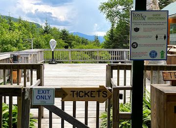
Lost River Gorge & Boulder Caves
Discover the breathtaking beauty of Lost River Gorge & Boulder Caves, a natural wonder in New Hampshire's White Mountains perfect for adventure and relaxation.

Best landmarks in Coos County
-
National forest
White Mountain National Forest
Experience the majestic landscapes and diverse outdoor activities at White Mountain National Forest, a must-visit destination in New Hampshire for nature lovers.
-
State park
Franconia Notch State Park
Experience the breathtaking beauty of Franconia Notch State Park, an outdoor paradise in New Hampshire's White Mountains, perfect for hiking and exploring.
-
Park
Flume Gorge
Experience the breathtaking beauty of Flume Gorge in New Hampshire, a stunning park filled with towering granite walls and cascading waterfalls.
-
Tourist attraction
The Mount Washington Cog Railway
Discover breathtaking views and rich history aboard the Mount Washington Cog Railway, the world's first mountain-climbing cog railway.


Explore Coos County on the map
Plan your trip on one map. See where the top cities, national parks and sights are, and book hotels and experiences in a few clicks.
Best hotels in Coos County
Best restaurants in Coos County
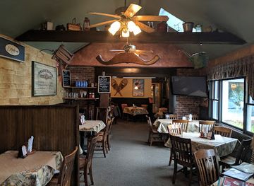
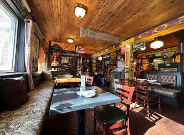
Dining in Coos County reflects northern New England’s rural and working landscapes rather than a highly formal restaurant scene. Restaurants, diners, cafés, pubs and inns in towns such as Gorham, Lancaster, Berlin, Colebrook and Pittsburg provide practical bases for meals before or after outdoor activities. Menus commonly draw on familiar New England cooking, including soups, chowders, roast meats, trout, burgers, baked goods and seasonal produce. Maple syrup and maple confectionery are important regional products, while locally sourced game may appear in some establishments without being available everywhere. Farm stands and independent shops are useful for provisions, especially when travelling towards the Connecticut Lakes, although opening arrangements can be seasonal. Craft beer and other New Hampshire drinks may accompany meals, but visitors should expect the widest choice in the larger towns and mountain gateways. Dining times and options can be more limited in remote areas, so planning ahead is sensible, particularly outside the summer season or during busy foliage weekends.
-
American
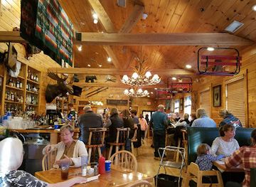
Muddy Moose Restaurant & Pub
Discover delicious American cuisine and a lively pub atmosphere at Muddy Moose Restaurant & Pub in North Conway.
-
Grill
Delaney's Hole In the Wall
Experience authentic American grilling at Delaney's Hole In The Wall in North Conway—where every meal feels like home.
-
Grill
The Common Man Lincoln
Discover the flavors of New Hampshire at The Common Man Lincoln - where American cuisine meets local charm.
-
Irish
May Kelly's Cottage
Discover the warmth and flavor of Ireland at May Kelly's Cottage in North Conway – where every meal is a celebration.

Best bars in Coos County
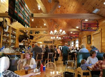
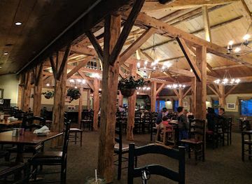
Evening life in Coos County is centred on pubs, taverns, restaurants, hotel bars and community venues rather than a substantial nightclub circuit. Gorham has the most concentrated choice for visitors staying near the Presidential Range, with places where hikers and seasonal travellers gather for food and drinks. Lancaster, Berlin and Colebrook offer additional local bars, live music and social venues, while Pittsburg’s evening activity is closely tied to accommodation, outdoor clubs and seasonal visitors. Traditional New England pubs and casual restaurants are more representative of the county than late-night dance venues. Some establishments serve local or regional beer, but availability and hours vary considerably by town and season. In rural districts, distances between venues make a designated driver or accommodation within walking distance particularly important. Cultural events, small concerts and community gatherings may provide more meaningful evening entertainment than nightlife marketed specifically to tourists.
-
American
Muddy Moose Restaurant & Pub
Experience the vibrant flavors of American cuisine at Muddy Moose Restaurant & Pub in North Conway, a perfect spot for families and friends.
-
Grill
Red Fox Bar and Grille
Discover the flavors of New Hampshire at Red Fox Bar and Grille, where delicious American cuisine meets a cozy atmosphere in Jackson.
-
Brewpub
Moat Mountain Smokehouse & Brewing Co.
Experience the best of craft brewing and delicious smokehouse flavors at Moat Mountain Smokehouse & Brewing Co. in North Conway, NH.
-
Brewpub
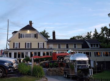
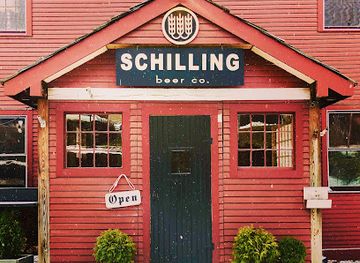
Schilling Beer Co.
Discover the vibrant flavors of craft beer in a welcoming atmosphere at Schilling Beer Co. in Littleton, New Hampshire.
Best nightclubs in Coos County
-
 Resort hotel
Omni Mount Washington Resort
Discover the enchanting Omni Mount Washington Resort, a historic haven for luxury, adventure, and relaxation amidst New Hampshire's stunning landscapes.
-
Recreation center
AMC Highland Center at Crawford Notch
Discover the AMC Highland Center at Crawford Notch - Your gateway to the stunning White Mountain National Forest and unforgettable outdoor adventures.
-
Lounge
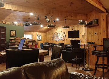
Cigar Shenanigans Cigar & Cocktail Lounge
Experience the ultimate cigar and cocktail lounge in North Conway, where relaxation meets sophistication in a cozy setting.
-
Live music bar
The Big House
Discover Laconia's vibrant music scene at The Big House, where live performances and a lively atmosphere create unforgettable nights.


Best shops in Coos County
Shopping in Coos County is concentrated in the high streets and independent businesses of Lancaster, Gorham, Berlin, Colebrook and Pittsburg, with the emphasis on practical supplies, outdoor equipment, gifts and locally made products rather than large shopping centres. Visitors may find maple syrup, maple sweets, smoked foods, preserves, local crafts, artwork, books, clothing and New Hampshire-themed souvenirs in small shops, farm stands and seasonal outlets. Outdoor retailers are particularly useful for hikers, anglers, snowmobilers and visitors travelling into remote parts of the county. Lancaster offers the strongest civic and independent-town shopping character, while Gorham’s businesses are closely linked to mountain travel and seasonal tourism. Pittsburg’s retail options are more dispersed and oriented towards outdoor recreation. Markets and farm shops vary with the season, so do not assume that a rural roadside business will be open every day. Buying regional food products is often a more characteristic souvenir than seeking luxury retail, especially in the northern lake and forest districts.
-
Gift shop
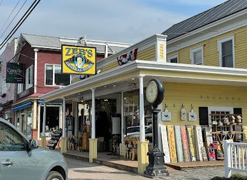
Zeb's General Store
Discover unique gifts and local flavors at Zeb's General Store in North Conway, the perfect stop for all your souvenir needs.
-
Outlet mall
Settlers Green Outlet Village
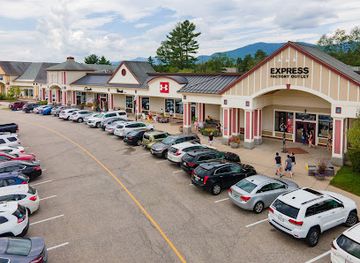
Discover unbeatable deals at Settlers Green Outlet Village in North Conway, where shopping meets stunning mountain views.
-
Gift shop
The Old Country Store and Museum
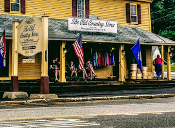
Explore the delightful fusion of history, gourmet foods, and unique souvenirs at The Old Country Store and Museum in Moultonborough, NH.
-
Gift shop
Chutters
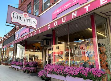
Experience the sweetest gift shop in Littleton, NH, with its extensive candy selection and unique gift offerings.
Get your free copy of our complete guide to Coos County, delivered straight to you.
Everything on this page, from attractions and restaurants to essentials and local phrases, in one PDF you can read offline, print or share.
Already have an account? Sign in
Your Coos County guide is ready.
We'll send it to · Not you? Sign out

Getting your guide ready…
We are putting together a fresh copy of the Coos County guide. This can take up to a minute.
This can take a few moments. If your browser asks, choose Allow so the download can start. You'll find the guide in your Downloads folder.
Nothing happened? Download it again
Sorry, the guide is taking longer than usual. Please try again in a minute, or get it by email instead.
Coos County essentials
Currency and Payment
Safety
Emergency Situations
Do's and Don'ts
Local Tips
From Eve
Local phrases worth knowing
You don't need to get them perfect. A few words go a long way, and locals appreciate the effort.
Basics
| English | Local | Say it |
|---|---|---|
| Hello | Howdy | [haʊdi] |
| Goodbye | See ya | [si jə] |
| Yes | Yup | [jʌp] |
| No | Nope | [noʊp] |
| Please/You’re welcome | No problem | [noʊ ˈprɒbləm] |
| Thank you | Thanks | [θæŋks] |
| Excuse me/Sorry | Sorry 'bout that | [ˈsɔri baʊt ðæt] |
| How are you? | How ya doin'? | [haʊ jə ˈduɪn] |
| Fine. And you? | Good, you? | [ɡʊd, ju?] |
| Do you speak English? | Can ya talk English? | [kæn jə tɔk ˈɪŋɡlɪʃ] |
| I don't understand | I don't get it | [aɪ doʊnt ɡɛt ɪt] |
Eating & Drinking
| English | Local | Say it |
|---|---|---|
| I’d like to see the menu, please | Can I see the menu? | [kæn aɪ si ðə ˈmɛnju] |
| I don’t eat meat | I’m a vegetarian | [aɪm ə ˌvɛdʒəˈtɛriən] |
| Cheers! | Cheers! | [ʧɪrz] |
| I would like to pay, please | Can I get the bill? | [kæn aɪ ɡɛt ðə bɪl] |
Emergencies
| English | Local | Say it |
|---|---|---|
| Help! | Help! | [hɛlp] |
| Go away! | Get lost! | [ɡɛt lɔst] |
| Call the Police! | Call the cops! | [kɔl ðə kɑps] |
| Call a doctor! | Get a doctor! | [ɡɛt ə ˈdɑktər] |
| I’m lost | I'm lost | [aɪm lɔst] |
| I’m ill | I ain't feelin' well | [aɪ eɪnt ˈfilɪn wɛl] |
Shopping
| English | Local | Say it |
|---|---|---|
| I’d like to buy... | I wanna buy... | [aɪ ˈwɑnə baɪ] |
| I’m just looking | Just browsing | [dʒʌst ˈbraʊzɪŋ] |
| How much is it? | What’s the price? | [wʌts ðə praɪs] |
| That’s too expensive | That’s a bit pricey | [ðæts ə bɪt ˈpraɪsi] |
| Can you lower the price? | Can ya bring down the price? | [kæn jə brɪŋ daʊn ðə praɪs] |
Time & Numbers
| English | Local | Say it |
|---|---|---|
| What time is it? | What time is it? | [wʌt taɪm ɪz ɪt] |
| It’s one o’clock | It’s one | [ɪts wʌn] |
| Half past (10) | Half past ten | [hæf pæst tɛn] |
| Morning | Mornin' | [ˈmɔrnɪn] |
| Afternoon | Afternoon | [ˌæftərˈnun] |
| Evening | Evenin' | [ˈivnɪn] |
| Yesterday | Yesterday | [ˈjɛstərdeɪ] |
| Today | Today | [təˈdeɪ] |
| Tomorrow | Tomorrow | [təˈmɑroʊ] |
| 1 | One | [wʌn] |
| 2 | Two | [tu] |
| 3 | Three | [θri] |
| 4 | Four | [fɔr] |
| 5 | Five | [faɪv] |
| 6 | Six | [sɪks] |
| 7 | Seven | [ˈsɛvən] |
| 8 | Eight | [eɪt] |
| 9 | Nine | [naɪn] |
| 10 | Ten | [tɛn] |
Transport & Directions
| English | Local | Say it |
|---|---|---|
| Where's a/the...? | Where's the...? | [wɛrz ðə] |
| What’s the address? | What’s the address? | [wʌts ði əˈdrɛs] |
| Can you show me (on the map)? | Can ya show me on the map? | [kæn jə ʃoʊ mi ɑn ðə mæp] |
| When’s the next (bus)? | When's the next bus? | [wɛnʔs ðə nɛkst bʌs] |
| A ticket (to ....) | One ticket to... | [wʌn ˈtɪkɪt tə] |
History of Coos County
Indigenous Homelands and River Travel
Before European settlement, the region was used by Abenaki peoples, whose seasonal movements followed the Connecticut, Androscoggin and upper river systems and the abundant game of the northern forests. Lakes and waterways served as routes for travel, fishing and hunting, while mountain passes connected different parts of northern New England. European maps and later colonial claims did not erase these earlier relationships with the land. Present-day visitors encounter a landscape shaped by those long-established patterns of movement, although much of the county’s documented built heritage dates from later settlement.
Frontier Settlement and the Northern Towns
European-American settlement expanded gradually in the eighteenth and nineteenth centuries, with farms, trading posts and small communities developing along river corridors and transport routes. Lancaster became an important civic and commercial centre in the upper Connecticut Valley, while settlements such as Colebrook and Pittsburg grew in connection with agriculture, forestry and cross-border movement. The difficult terrain and harsh winters limited population growth, but the same remoteness later helped preserve large tracts of woodland and encouraged the development of outdoor recreation.
Timber, River Power and Berlin’s Industrial Growth
The Androscoggin River gave Berlin the power and transport advantages that supported a major timber and paper industry. From the nineteenth century, logging camps, river drives, mills, railways and associated businesses transformed the settlement into one of northern New Hampshire’s principal industrial towns. Work drew residents from different backgrounds and created a distinctive company-town landscape. Although the scale of manufacturing has changed, Berlin’s streets, industrial sites and local institutions continue to reflect the economic importance of forests, water power and paper production.
Railways and the Opening of the Mountains
Railways greatly altered access to Coos County during the nineteenth century. Lines following the Androscoggin and Connecticut valleys connected northern communities with markets and brought visitors towards the White Mountains. Rail travel supported the timber economy while also helping establish the region as a destination for mountain scenery, hunting and fishing. The railway legacy remains visible in former alignments, stations and museum collections, even though visitors now generally arrive by road. The county’s long distances and valley settlements still reflect the routes first strengthened by rail.
Mount Washington and the Rise of Mountain Tourism
Mount Washington’s reputation grew during the nineteenth century as improved roads, rail connections and organised tourism made the Presidential Range more accessible. Guides, inns, scientific observers and early recreational parties all contributed to the mountain’s national profile. The summit’s severe weather also became part of its identity, and the area developed a tradition of careful preparation and mountain expertise. Today, hiking routes and the Mount Washington Auto Road connect visitors with a landscape whose significance lies not only in its elevation but also in its demanding climate and cultural history.
Conservation and the White Mountain National Forest
Extensive logging and fires in the late nineteenth and early twentieth centuries prompted growing concern about watershed damage and forest depletion across the White Mountains. Federal acquisition and conservation programmes helped create the White Mountain National Forest, within which much of southern Coos County’s mountain landscape is managed for public recreation, wildlife and forest protection. This history explains the balance visitors see today between maintained trails, working forests, protected watersheds and developed gateways such as Gorham. Conservation remains central to how the county’s outdoor landscapes are used.
Changing Industry and the Modern Outdoor Economy
During the twentieth century, changes in manufacturing, forestry and transport reduced the dominance of traditional mill employment, although timber and forest-related work remain important. Communities adapted by developing tourism, outdoor recreation, heritage interpretation and small-scale enterprise. Gorham’s position near the Presidential Range and Pittsburg’s lakes, rivers and snowmobile routes became especially important to the visitor economy, while Berlin continued to confront the legacy and reinvention of its industrial landscape. Coos County today combines working communities with a regional economy strongly influenced by mountains, forests, water and seasonal travel.
Coos County in Photos
Browse through our photo collection highlighting the charm and character of the destination.
Neighbouring regions of Coos County
The closest regions to Coos County, if you have time for more than one.
-

-

-
-

-


Swipe for more regions
Explore more

Explore more of New Hampshire
Discover New Hampshire: Explore the majestic White Mountains, serene lakes, and historic towns in the heart of New England's enchanting landscapes.
Explore New Hampshire