

Free Delaware Bayshore Travel Guide & Mobile App
Explore Delaware Bayshore with free travel guides. Discover regional history, expert tips, proposed trips, and audio guides on web or mobile app.





Explore New Jersey’s Delaware Bayshore for tidal wetlands, migrating shorebirds, oyster country, historic lighthouses and quiet waterfront communities.
Read more about Delaware Bayshore
Getting to and around Delaware Bayshore
How to get there
Transportation
Top city travel guides in Delaware Bayshore
The cities of Delaware Bayshore, and the easiest places to base yourself.
-

-

-


Swipe for more cities
Destinations in Delaware Bayshore
Resorts, valleys and scenic spots worth a trip of their own.
-

-


Swipe for more destinations
Best attractions in Delaware Bayshore
The Delaware Bayshore’s attractions are built around nature, maritime work and small-scale heritage rather than large resort complexes. In the north, Finns Point National Cemetery and nearby Fort Mott State Park explain the military history of the Delaware River landscape, while Salem’s historic buildings provide a compact introduction to colonial and early American New Jersey. The marshes around Pennsville and Salem are important for birdwatching and seasonal wildlife observation. In Cumberland County, the Bayshore Center at Bivalve interprets oyster harvesting, shellfish boats and the communities of the Maurice River, making it one of the most distinctive cultural attractions in the region. Wildlife management areas near Heislerville and the Maurice River offer birding, fishing and photography, subject to access restrictions and seasonal conditions. Cape May Point brings together Cape May Point State Park, the Cape May Lighthouse and coastal migration watching, with beaches, dunes and trails overlooking the bay. Kayaking, boating and fishing are available in suitable locations, but the tidal environment demands preparation. Across the region, the appeal lies in moving between working waterfronts, open marshes, historic settlements and migration sites rather than following a conventional sightseeing circuit.
-
Theme park
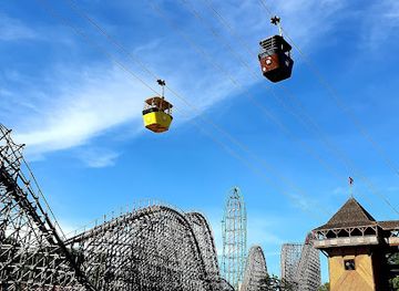
Six Flags Great Adventure
Experience the thrill of a lifetime at Six Flags Great Adventure, where rides, entertainment, and wildlife come together for unforgettable family fun.
-
Aquarium
Adventure Aquarium
Explore the wonders of marine life at Adventure Aquarium, a top-rated aquarium and amusement park in Camden, NJ, perfect for families and ocean enthusiasts.
-
Aquarium
Jenkinson's Aquarium
Discover the marine wonders at Jenkinson's Aquarium in Point Pleasant Beach, where education meets adventure in a family-friendly setting.
-
State park
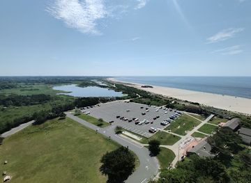
Cape May Point State Park
Explore the enchanting Cape May Point State Park, a perfect blend of nature, history, and breathtaking coastal views.


Best landmarks in Delaware Bayshore
-
Hotel
Caesars Atlantic City
Discover the luxury of Caesars Atlantic City: a premier hotel and buffet restaurant offering exquisite accommodations and dining along the iconic boardwalk.
-
Historical landmark
Atlantic City Boardwalk
Discover the historic Atlantic City Boardwalk, a stunning seaside promenade filled with entertainment, dining, and unforgettable experiences.
-
Amusement park
Morey's Piers & Beachfront Water Parks
Experience the ultimate family fun at Morey's Piers & Beachfront Water Parks in Wildwood, NJ, with thrilling rides, water attractions, and delicious dining options.
-
Shopping mall
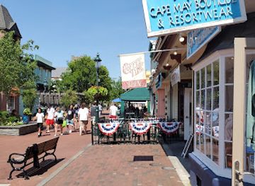
Washington Street Mall
Explore Washington Street Mall: A shopper's paradise in Cape May, NJ, offering unique boutiques, delicious eateries, and vibrant local culture.


Explore Delaware Bayshore on the map
Plan your trip on one map. See where the top cities, national parks and sights are, and book hotels and experiences in a few clicks.
Best hotels in Delaware Bayshore
Best restaurants in Delaware Bayshore
Dining along the Delaware Bayshore reflects its estuarine setting and rural communities. Oysters and other shellfish are central to the food identity of Cumberland County, especially around the Maurice River towns of Bivalve and Port Norris, although menus and availability vary with season, regulation and supply. Fish, crab and other seafood appear in waterfront restaurants and casual eateries, while Cape May Point and nearby Cape May offer a broader choice of cafés, bakeries, seafood restaurants and contemporary dining. In Salem and the northern bayshore, visitors will find family-run restaurants, diners, pubs and farm-oriented cooking rather than a concentrated restaurant district. Farmers’ markets and roadside sellers can provide local produce when operating, and regional wineries and breweries contribute to the wider South Jersey food-and-drink scene. Tipping follows standard US practice, and seafood should be ordered from establishments with clear information about sourcing and seasonal availability.
-
American
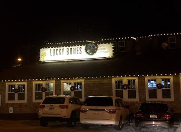
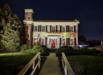
Lucky Bones Back Water Grille
Experience delicious American cuisine at Lucky Bones Back Water Grille in scenic Cape May – perfect for families and food lovers alike.
-
Grill
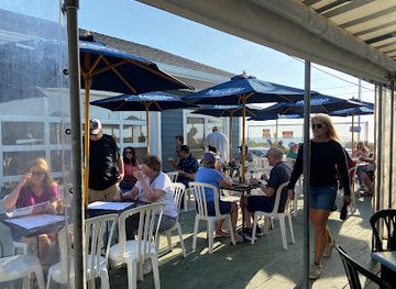
Harpoon Willy's
Discover Harpoon Willy's in Manasquan – where fresh seafood meets family-friendly dining along the scenic riverfront.
-
Restaurant
Harpoons on the Bay
Discover delectable seafood and refreshing drinks at Harpoons on the Bay - your perfect dining destination in North Cape May.
-
Cafe
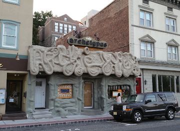
Cafe Archetypus
Discover the charm of Cafe Archetypus in Edgewater – where exceptional cuisine meets stunning river views.
Best bars in Delaware Bayshore
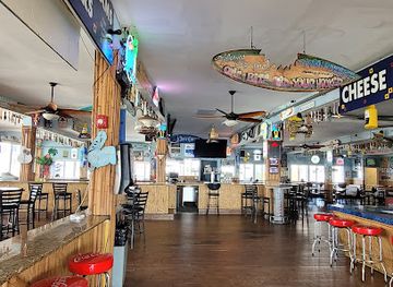
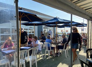
Evening life on the Delaware Bayshore is generally low-key and dispersed. Traditional pubs, taverns, restaurant bars and casual waterfront venues provide the main options in Salem, Cumberland County and the communities around Cape May, while breweries and wineries in the wider South Jersey countryside offer daytime and early-evening tastings where available. Cape May and nearby resort districts have the region’s broadest choice of cocktail bars, live music and seasonal entertainment, although these are concentrated away from the quieter marsh settlements. In rural bayshore communities, evenings are more likely to centre on dinner, conversation or a local event than on nightclubs. Visitors should plan transport in advance, particularly where roads are dark and taxis are limited, and should not assume that small waterfront businesses remain open late outside the main summer period.
-
Seafood
The Shrimp Box & Outside The Box Patio Bar
Discover the vibrant flavors of the sea at The Shrimp Box, a premier seafood dining destination in Point Pleasant Beach, NJ.
-
Restaurant
Asbury Ale House
Discover the festive spirit of Asbury Ale House, a lively spot for food, drinks, and entertainment in Asbury Park, NJ.
-
Bar
Beachcomber Bar & Grill
Experience the vibrant atmosphere of Beachcomber Bar & Grill, your go-to spot for delicious food and refreshing drinks by the ocean in Seaside Heights.
-
Restaurant
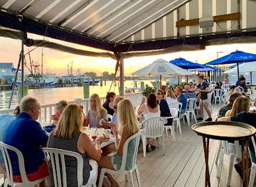
Harpoons on the Bay
Discover the vibrant flavors of Harpoons on the Bay, where delicious seafood meets unique craft beers in a stunning waterfront setting.

Best nightclubs in Delaware Bayshore
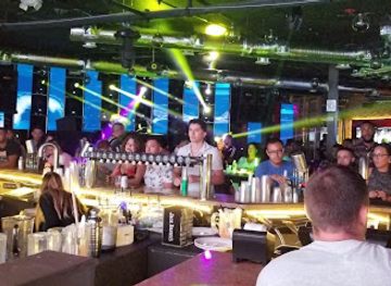
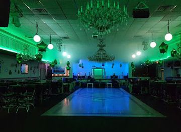
Evening life on the Delaware Bayshore is generally low-key and dispersed. Traditional pubs, taverns, restaurant bars and casual waterfront venues provide the main options in Salem, Cumberland County and the communities around Cape May, while breweries and wineries in the wider South Jersey countryside offer daytime and early-evening tastings where available. Cape May and nearby resort districts have the region’s broadest choice of cocktail bars, live music and seasonal entertainment, although these are concentrated away from the quieter marsh settlements. In rural bayshore communities, evenings are more likely to centre on dinner, conversation or a local event than on nightclubs. Visitors should plan transport in advance, particularly where roads are dark and taxis are limited, and should not assume that small waterfront businesses remain open late outside the main summer period.
-
Night club
BarCode Entertainment Complex
Experience the vibrant nightlife of Elizabeth, NJ at BarCode Entertainment Complex, where dining meets dancing in a lively atmosphere.
-
Lounge
Infinity Lounge
Infinity Lounge in Trenton: A perfect blend of dining and nightlife that captures the essence of modern elegance.
-
Night club
QXT's Night Club
Discover the vibrant nightlife at QXT's Night Club in Newark, where music, art, and fun collide for an unforgettable experience.
-
Night club
Headliner Oasis
Discover the nightlife of Neptune City at Headliner Oasis, a vibrant club offering great music, delicious food, and an unforgettable experience.


Best shops in Delaware Bayshore
Shopping on the Delaware Bayshore is modest in scale and closely tied to local food, crafts and historic towns. Salem provides the northern area’s most useful combination of independent businesses, antiques and everyday services, while Cape May and nearby Cape May Point offer galleries, bookshops, craft stores, maritime souvenirs and specialist food retailers, particularly in the visitor season. Around Cumberland County, look for locally produced seafood where legally and sustainably sold, regional farm produce, preserves, baked goods and products associated with South Jersey agriculture. Farmers’ markets and seasonal roadside stands vary by community and date, so confirm local operating arrangements before making a special journey. Museums and heritage attractions can be good places to find books about the Delaware Bay, maritime history and bird migration. Shopping is best approached as a search for regional produce, craft and historical material rather than as a conventional retail excursion.
-
Shopping mall
Bayshore Plaza
Discover the ultimate shopping experience at Bayshore Plaza, featuring diverse retail shops and dining options in Hazlet, NJ.
-
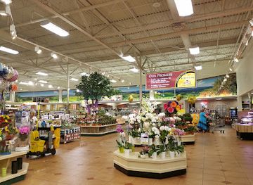
Grocery store
ACME Markets
Discover fresh produce, quality meats, and artisanal baked goods at ACME Markets in North Cape May, your convenient grocery destination.
-
Shopping mall
Bayshore Mall
Explore Bayshore Mall in North Cape May for an exceptional shopping experience with diverse stores, dining options, and plenty of free parking.
-
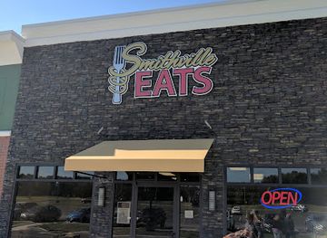
Shopping mall
Smithville Square
Explore the vibrant shopping scene at Smithville Square, where great stores and delightful dining come together in Galloway, NJ.

Get your free copy of our complete guide to Delaware Bayshore, delivered straight to you.
Everything on this page, from attractions and restaurants to essentials and local phrases, in one PDF you can read offline, print or share.
Already have an account? Sign in
Your Delaware Bayshore guide is ready.
We'll send it to · Not you? Sign out

Getting your guide ready…
We are putting together a fresh copy of the Delaware Bayshore guide. This can take up to a minute.
This can take a few moments. If your browser asks, choose Allow so the download can start. You'll find the guide in your Downloads folder.
Nothing happened? Download it again
Sorry, the guide is taking longer than usual. Please try again in a minute, or get it by email instead.
Delaware Bayshore essentials
Currency and Payment
Safety
Emergency Situations
Do's and Don'ts
Local Tips
From Eve
Local phrases worth knowing
You don't need to get them perfect. A few words go a long way, and locals appreciate the effort.
Basics
| English | Local | Say it |
|---|---|---|
| Hello | Howdy | [Ha-dee] |
| Goodbye | See ya | [See yah] |
| Yes | Yep | [Yep] |
| No | Nah | [Nah] |
| Please/You're welcome | No problem | [No prob-lum] |
| Thank you | Thanks | [Thanks] |
| Excuse me/Sorry | Pardon me | [Pardon me] |
| How are you? | How ya doin'? | [How ya doin'?] |
| Fine. And you? | Good. You? | [Good. You?] |
| Do you speak English? | You speak English? | [You speak English?] |
| I don't understand | I don't get it | [I don't get it] |
Eating & Drinking
| English | Local | Say it |
|---|---|---|
| I'd like to see the menu, please | Can I see the menu? | [Can I see the menu?] |
| I don't eat meat | I'm a vegetarian | [I'm a vege-tair-ee-an] |
| Cheers! | Cheers! | [Cheers!] |
| I would like to pay, please | Can I get the check? | [Can I get the check?] |
Emergencies
| English | Local | Say it |
|---|---|---|
| Help! | Help! | [Help!] |
| Go away! | Leave me alone! | [Leave me alone!] |
| Call the Police! | Call the cops! | [Call the cops!] |
| Call a doctor! | Get a doctor! | [Get a doctor!] |
| I'm lost | I'm turned around | [I'm turned around] |
| I'm ill | I'm not feeling well | [I'm not feeling well] |
Shopping
| English | Local | Say it |
|---|---|---|
| I'd like to buy... | I wanna buy... | [I wanna buy...] |
| I'm just looking | Just browsing | [Just browsing] |
| How much is it? | What’s the price? | [What’s the price?] |
| That's too expensive | That costs too much | [That costs too much] |
| Can you lower the price? | Can you give me a discount? | [Can you give me a discount?] |
Time & Numbers
| English | Local | Say it |
|---|---|---|
| What time is it? | What time ya got? | [What time ya got?] |
| It's one o'clock | It's one | [It's one] |
| Half past (10) | Half past ten | [Half past ten] |
| Morning | Morning | [Morning] |
| Afternoon | Afternoon | [Afternoon] |
| Evening | Evening | [Evening] |
| Yesterday | Yesterday | [Yesterday] |
| Today | Today | [Today] |
| Tomorrow | Tomorrow | [Tomorrow] |
| 1 | One | [One] |
| 2 | Two | [Two] |
| 3 | Three | [Three] |
| 4 | Four | [Four] |
| 5 | Five | [Five] |
| 6 | Six | [Six] |
| 7 | Seven | [Seven] |
| 8 | Eight | [Eight] |
| 9 | Nine | [Nine] |
| 10 | Ten | [Ten] |
Transport & Directions
| English | Local | Say it |
|---|---|---|
| Where's a/the...? | Where’s the nearest...? | [Where’s the nearest...?] |
| What's the address? | What’s the address? | [What’s the address?] |
| Can you show me (on the map)? | Can you point it out? | [Can you point it out?] |
| When's the next (bus)? | When’s the next bus? | [When’s the next bus?] |
| A ticket (to ....) | One ticket to ... | [One ticket to ...] |
History of Delaware Bayshore
Lenape Homeland and Estuarine Lifeways
Before European settlement, the Delaware Bay region formed part of the homeland of Lenape communities, whose lives were closely connected with tidal creeks, forests, shellfish beds and seasonal resources. The bay was not an empty wilderness but a travelled and managed landscape, with established knowledge of waterways, plants, fish and wildlife. European colonisation, land purchase and changing political control profoundly disrupted Lenape communities and access to their traditional territories. Today, the bayshore’s marshes and rivers still reveal the environmental setting that shaped Indigenous lifeways, even though comparatively little of the visible built heritage directly represents that earlier history.
Quaker Settlement and Colonial Salem
European settlement expanded in the late seventeenth century, particularly under Quaker influence. Salem developed as an agricultural and river-connected community, and its historic district contains surviving buildings associated with colonial and early national New Jersey. The surrounding lowlands supported farms, mills and small ports linked to the Delaware River and Bay. Salem’s location made it part of a wider network of settlements rather than an isolated frontier, while religious pluralism, maritime trade and agricultural production helped shape the social character of the northern bayshore.
Revolutionary-Era Resistance and the Greenwich Tea Burning
The bayshore and lower Delaware region were drawn into the political tensions that preceded the American Revolution. In 1774, local residents at Greenwich in Cumberland County burned a shipment of tea to protest British taxation, an act remembered as the Greenwich Tea Party or Tea Burning. The event occurred before the Declaration of Independence and reflected the region’s connections to coastal trade, smuggling concerns and colonial resistance. The Greenwich Tea Burning site, marked near the historic village, provides a local perspective on revolutionary politics beyond the better-known military campaigns.
Civil War Defences at Finns Point
During the American Civil War, Finns Point on the Delaware River was developed as a defensive position opposite Fort Delaware, which stood on Pea Patch Island across the river in Delaware. The unfinished earthwork known as Fort Mott formed part of the wider defence of the river approaches to Philadelphia. Nearby Finns Point National Cemetery contains the graves of Confederate prisoners who died while held at Fort Delaware, alongside later military burials. The site’s significance lies in the way landscape, imprisonment and river defence intersect in one of the northern bayshore’s quietest settings.
Oyster Grounds and the Maurice River Waterfront
From the nineteenth century into the twentieth, the Maurice River and adjacent Delaware Bay supported a major oyster economy. Port Norris, Bivalve and neighbouring communities became associated with dredging, shucking, packing and shipping oysters, while boatyards built and repaired the vessels used on the bay. The industry employed generations of workers and connected Cumberland County to markets beyond New Jersey. Mechanisation, disease, pollution and changing environmental conditions altered the trade, but the Bayshore Center at Bivalve and the reconstructed oyster schooner demonstrates how strongly shellfish shaped local work, settlement and identity.
Conservation, Migration and the Modern Bayshore
During the twentieth and early twenty-first centuries, the Delaware Bayshore increasingly became recognised for its ecological importance as well as its working landscapes. Salt marshes, tidal flats and adjoining forests provide habitat for migratory shorebirds, waterfowl, raptors and fish. Conservation agencies, wildlife refuges and state management areas now protect substantial portions of the shoreline while supporting carefully managed hunting, fishing and nature study. The modern bayshore therefore reflects a continuing negotiation between habitat conservation, shellfishing, recreation, flood resilience and the needs of small coastal communities.
Delaware Bayshore in Photos
Browse through our photo collection highlighting the charm and character of the destination.
Neighbouring regions of Delaware Bayshore
The closest regions to Delaware Bayshore, if you have time for more than one.
-

-

-

-

-


Swipe for more regions
Explore more
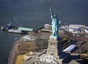
Explore more of New Jersey
Discover New Jersey: From vibrant cities and historic towns to scenic beaches and lush parks, the Garden State offers a rich blend of culture, nature, and adventure.
Explore New Jersey