

Mambilla Plateau Travel Guide - Free Web & App
Your ultimate guide to Mambilla Plateau. Discover top landmarks, proposed trips, and local tips. Free on the web or via the Evendo companion app.


Mambilla Plateau, Nigeria combines cool mountain scenery, tea estates, highland culture, forest habitats and scenic rural roads near the Cameroon border.
Highlands above Taraba
Mambilla Plateau occupies a high, rolling tract of south-eastern Taraba State, close to Nigeria’s international boundary with Cameroon. Reached principally through the town of Gembu and the settlements of Sardauna Local Government Area, it rises far above the surrounding lowlands and has a markedly cooler, wetter climate than much of northern Nigeria. Open grass-covered ridges, deep valleys, cultivated slopes and scattered forest create a landscape that feels distinct from the country’s better-known savannah destinations.Read more about Mambilla Plateau
People, Farms and Tea Country
Forests and Highland Exploration
Getting to and around Mambilla Plateau
How to get there
Transportation
Best attractions in Mambilla Plateau
The Mambilla Plateau’s principal attraction is its broad highland scenery: grass-covered ridges, cultivated slopes, winding valleys and distant escarpments that can be explored by road or on locally arranged walks. Gembu is the main starting point for understanding the region, while the rural surroundings of Nguroje and Maisamari reveal the plateau’s farming and pastoral character. Tea-growing landscapes provide one of the area’s most recognisable cultural vistas, although access to estates depends on local permission. Ngel Nyaki Forest Reserve offers a contrasting environment of montane forest and scientific importance, with opportunities for carefully managed nature observation rather than casual independent exploration. The wider Taraba highlands can also lead travellers towards Gashaka-Gumti National Park and the Chappal Waddi area, but these are neighbouring or broader regional attractions and should not be described as universally inside the Mambilla Plateau. The journey itself, including changing vegetation and views across high valleys, forms a substantial part of the experience.
-
Tourist attraction
Gashaka-Gumti National Park
Explore the breathtaking landscapes and diverse wildlife of Gashaka-Gumti National Park, Nigeria's largest national park, an adventure for every nature lover.
-
 Mountain peak
Chappal Hendu
Explore the breathtaking heights of Chappal Hendu, Nigeria's highest peak, where adventure meets nature's splendor in Taraba State.

Explore Mambilla Plateau on the map
Plan your trip on one map. See where the top attractions, landmarks, restaurants and hotels are, and book hotels and experiences in a few clicks.
Best hotels in Mambilla Plateau
Best restaurants in Mambilla Plateau
Dining on the Mambilla Plateau is concentrated in Gembu and other larger settlements rather than in a developed network of destination restaurants. Small local eateries and roadside food sellers provide familiar Nigerian meals, commonly drawing on maize, rice, potatoes, beans, vegetables and locally produced dairy, while tea-growing areas reflect the plateau’s agricultural identity. Fulani pastoral traditions also contribute milk and cattle-based products to the regional food economy, although availability varies. Visitors staying outside Gembu should not assume that restaurants or shops will be nearby and may need to arrange meals through accommodation providers or carry provisions for long excursions. In larger Taraba towns on the approach route, travellers will find a broader choice of Nigerian cooking and supplies, but the plateau itself is best understood as a rural food landscape shaped by farms, markets and household production rather than a formal culinary destination.
-
Restaurant
MALADISU RESTAURANT
Discover the culinary delights at Maladisu Restaurant in Gembu – where every meal tells a story of flavor and tradition.
-
Restaurant
GECHAAN RESTAURANT
Savor authentic flavors at Gechaan Restaurant in Gembu, where local cuisine meets international flair in a cozy atmosphere.


Best bars in Mambilla Plateau
The Mambilla Plateau does not have a substantial nightlife industry, and Gembu’s evening scene is principally local and informal rather than built around nightclubs or entertainment districts. Visitors may find modest bars, beer parlours or social venues in the main settlements, alongside small restaurants and accommodation-based spaces, but opening patterns and availability can change. In villages and rural areas, evenings are generally quiet, with conversation, community gatherings and the sounds of working settlements replacing commercial entertainment. Travellers should arrange transport before dark, particularly when staying outside Gembu, and should not expect late-night services on remote roads. Cultural events and celebrations may provide more meaningful evening experiences when they are taking place, but participation and photography should always be guided by local invitation and custom.
-
Bar
Madiba's Jazzy-K Club
Discover the vibrant nightlife at Madiba's Jazzy-K Club in Gembu, Taraba - a lively bar where local culture meets music and fun.
-
Bar
The World Bar
Experience the vibrant nightlife of Gembu at The World Bar, where local flavors and warm hospitality come together for an unforgettable evening.
-
Restaurant
Mamilla Camp Restaurant
Discover the authentic flavors of Nigerian cuisine at Mamilla Camp Restaurant in Banda, Taraba, where every meal is a culinary adventure.

Best nightclubs in Mambilla Plateau
The Mambilla Plateau does not have a substantial nightlife industry, and Gembu’s evening scene is principally local and informal rather than built around nightclubs or entertainment districts. Visitors may find modest bars, beer parlours or social venues in the main settlements, alongside small restaurants and accommodation-based spaces, but opening patterns and availability can change. In villages and rural areas, evenings are generally quiet, with conversation, community gatherings and the sounds of working settlements replacing commercial entertainment. Travellers should arrange transport before dark, particularly when staying outside Gembu, and should not expect late-night services on remote roads. Cultural events and celebrations may provide more meaningful evening experiences when they are taking place, but participation and photography should always be guided by local invitation and custom.
-
Mountain peak
Mambilla Plateau
Experience the breathtaking beauty and rich culture of the Mambilla Plateau, a mountain peak in Taraba, Nigeria, perfect for nature lovers and adventure seekers.

Best shops in Mambilla Plateau
Shopping on the Mambilla Plateau is modest and practical, with the greatest concentration of supplies in Gembu and smaller quantities available in village shops and local markets. Visitors may find fresh produce, dairy products, grains, potatoes and other farm goods reflecting the plateau’s agricultural economy, while tea and locally produced food items can be associated with the region where available. Everyday Nigerian clothing, household goods and provisions are more realistic purchases than a dedicated souvenir industry. Traditional textiles, craft objects or locally made products may be encountered through community contacts, but availability should not be assumed and respectful bargaining is preferable to aggressive negotiation. Travellers heading into remote areas should buy fuel, food, medicines and other essentials before leaving the main service centres, as retail choice becomes increasingly limited across the rural plateau.
-
Mountain peak
Mambilla Plateau
Experience the breathtaking beauty of Mambilla Plateau, a hidden gem in Taraba State, Nigeria, known for its stunning landscapes and rich cultural heritage.
-
Supermarket
Bashmall Cement Depot
Discover the heart of Taraba at Bashmall Cement Depot, a vibrant supermarket offering local goods and an authentic shopping experience.
-
Supermarket
C-Mee Super Market
Explore local flavors and everyday essentials at C-Mee Super Market in Gembu, your go-to supermarket for a taste of Taraba's vibrant culture.
-
Home goods store
Zainab Shopping Complex
Discover unique home goods and local craftsmanship at Zainab Shopping Complex in Guroji, Taraba – a vibrant shopping destination.


Get your free copy of our complete guide to Mambilla Plateau, delivered straight to you.
Everything on this page, from attractions and restaurants to essentials and local phrases, in one PDF you can read offline, print or share.
Already have an account? Sign in
Your Mambilla Plateau guide is ready.
We'll send it to · Not you? Sign out

Getting your guide ready…
We are putting together a fresh copy of the Mambilla Plateau guide. This can take up to a minute.
This can take a few moments. If your browser asks, choose Allow so the download can start. You'll find the guide in your Downloads folder.
Nothing happened? Download it again
Sorry, the guide is taking longer than usual. Please try again in a minute, or get it by email instead.
Mambilla Plateau essentials
Currency and Payment
Safety
Emergency Situations
Do's and Don'ts
Local Tips
From Eve
Local phrases worth knowing
You don't need to get them perfect. A few words go a long way, and locals appreciate the effort.
Basics
| English | Local | Say it |
|---|---|---|
| Hello | Nda | [Nda] |
| Goodbye | Ndua | [Ndua] |
| Yes | Awo | [Awo] |
| No | Nji | [Nji] |
| Please/You're welcome | Inama | [Inama] |
| Thank you | Ndala | [Ndala] |
| Excuse me/Sorry | Mafi | [Mafi] |
| How are you? | Ori? | [Ori?] |
| Fine. And you? | Ori. Iwo? | [Ori. Iwo?] |
| Do you speak English? | O kpe ta English? | [O kpe ta English?] |
| I don't understand | A m si | [A m si] |
Eating & Drinking
| English | Local | Say it |
|---|---|---|
| I'd like to see the menu, please | A kpe kpo menu, inama | [A kpe kpo menu, inama] |
| I don't eat meat | A nji nso | [A nji nso] |
| Cheers! | Ndo! | [Ndo!] |
| I would like to pay, please | A kpe kpo ewu, inama | [A kpe kpo ewu, inama] |
Emergencies
| English | Local | Say it |
|---|---|---|
| Help! | Ndua! | [Ndua!] |
| Go away! | Nyala! | [Nyala!] |
| Call the Police! | Kpe kpo Police! | [Kpe kpo Police!] |
| Call a doctor! | Kpe kpo doctor! | [Kpe kpo doctor!] |
| I'm lost | A nji cho | [A nji cho] |
| I'm ill | A nji nso | [A nji nso] |
Shopping
| English | Local | Say it |
|---|---|---|
| I'd like to buy... | A kpe nso... | [A kpe nso...] |
| I'm just looking | A nji ta | [A nji ta] |
| How much is it? | O kpe kpo? | [O kpe kpo?] |
| That's too expensive | O kpala | [O kpala] |
| Can you lower the price? | O kpe kpo ewu? | [O kpe kpo ewu?] |
Time & Numbers
| English | Local | Say it |
|---|---|---|
| What time is it? | O kpe nda? | [O kpe nda?] |
| It's one o'clock | A kpe nda yi | [A kpe nda yi] |
| Half past (10) | Nda kpe aha (10) | [Nda kpe aha (10)] |
| Morning | Ndou | [Ndou] |
| Afternoon | Nda yara | [Nda yara] |
| Evening | Nda kpe | [Nda kpe] |
| Yesterday | Nda kpala | [Nda kpala] |
| Today | Nda kpe | [Nda kpe] |
| Tomorrow | Nda yi | [Nda yi] |
| 1 | Ahala | [Ahala] |
| 2 | Ahaa | [Ahaa] |
| 3 | Ahaata | [Ahaata] |
| 4 | Ahana | [Ahana] |
| 5 | Aha da | [Aha da] |
| 6 | Aha dda | [Aha dda] |
| 7 | Aha nta | [Aha nta] |
| 8 | Aha naa | [Aha naa] |
| 9 | Aha kpe | [Aha kpe] |
| 10 | Aha kpe aha | [Aha kpe aha] |
Transport & Directions
| English | Local | Say it |
|---|---|---|
| Where's a/the...? | O kpe kpo...? | [O kpe kpo...?] |
| What's the address? | O kpe ina? | [O kpe ina?] |
| Can you show me (on the map)? | O kpe kpo o (na map)? | [O kpe kpo o (na map)?] |
| When's the next (bus)? | O kpe kpo aha (bus)? | [O kpe kpo aha (bus)?] |
| A ticket (to ....) | A kpe nso (si ....) | [A kpe nso (si ....)] |
History of Mambilla Plateau
A Volcanic Highland Landscape
The plateau’s character begins with its highland geology and long-term erosion rather than with human settlement. Upland surfaces, rounded ridges and deeply cut valleys reflect the interaction of elevated terrain, volcanic rocks in the wider region and a wet tropical climate. Over time, soils and drainage patterns created conditions suitable for grassland, cultivation and pastoralism. This physical setting also explains the plateau’s cooler climate and its ecological contrast with the lower country surrounding the Taraba highlands.
Mambilla Communities and Pastoral Life
The Mambilla people have long cultivated and occupied the plateau, developing a distinctive cultural identity tied to its highland environment. Farming communities produced crops suited to the uplands, while Fulani pastoralists brought and maintained important traditions of cattle husbandry. Seasonal movement, grazing, household production and local exchange shaped relationships between settlements and open countryside. The resulting landscape is neither untouched wilderness nor an urbanised region, but a working highland environment in which agriculture and pastoralism remain central to local life.
Colonial Boundaries and New Connections
The plateau’s position beside Cameroon gave it strategic importance as colonial administrations established and managed boundaries across the central African highlands. Roads, administrative centres and trading connections linked the uplands more closely with the rest of what became Nigeria, while the international border also helped shape local movement and commerce. Many journeys remain influenced by this geography: Gembu functions as the principal Nigerian service centre, while the surrounding settlements retain a strongly rural character.
Tea and Agricultural Change
During the twentieth century, the plateau’s climate and elevation encouraged experiments with commercial agriculture, most visibly tea cultivation. Tea estates became an important visual and economic feature in parts of the Mambilla region, standing alongside smallholder farms, cattle production and dairy activity. Agricultural development altered sections of the grassland and introduced new employment and market relationships, although the wider plateau continued to depend heavily on dispersed rural production rather than large towns or industrial infrastructure.
Forest Conservation and Highland Research
As natural forest became increasingly limited across cultivated and grazed landscapes, remaining montane habitats gained conservation importance. Ngel Nyaki Forest Reserve is one of the best-known examples, supporting scientific research and attention to the biological value of the highlands. Conservation work in and around such forests reflects a continuing tension between protecting habitat, maintaining local livelihoods and improving rural access. The plateau’s contemporary identity therefore includes not only farming and pastoral traditions but also ecological research and responsible nature-based travel.
Mambilla Plateau in Photos
Browse through our photo collection highlighting the charm and character of the destination.
Neighbouring destination travel guides
The closest destinations to Mambilla Plateau, if you have time for more than one.
-

-
-
-

-


Swipe for more destinations
Explore more

Explore more of North Central
Explore North Central Nigeria for Abuja's hills, Jos's plateau landscapes, Lokoja's river confluence, craft traditions and diverse inland foodways.
Explore North Central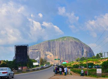
Explore more of Nigeria
Discover Nigeria: A Land of Vibrant Cultures, Stunning Landscapes, and Rich History in the Heart of Africa.
Explore Nigeria