

Free Albemarle-Pamlico Peninsula Travel Guide & Mobile App
Explore Albemarle-Pamlico Peninsula with free travel guides. Discover regional history, expert tips, proposed trips, and audio guides on web or mobile app.


Explore North Carolina's Albemarle-Pamlico Peninsula for wildlife refuges, historic villages, quiet waterways, wetlands and authentic coastal food.
Read more about Albemarle-Pamlico Peninsula
Getting to and around Albemarle-Pamlico Peninsula
How to get there
Transportation
Destinations in Albemarle-Pamlico Peninsula
Resorts, valleys and scenic spots worth a trip of their own.

Swipe for more destinations
Best attractions in Albemarle-Pamlico Peninsula
The Albemarle-Pamlico Peninsula is best explored through a combination of wildlife refuges, state-park landscapes, historic settlements and water-based activities. Pocosin Lakes National Wildlife Refuge offers broad views of pocosin wetlands, forest and shallow lakes, with opportunities for birdwatching and seasonal wildlife observation. Alligator River National Wildlife Refuge occupies an extensive, remote wetland landscape on the eastern mainland, while Mattamuskeet National Wildlife Refuge surrounds the shallow lake and marshes of Hyde County. Pettigrew State Park provides access to Lake Phelps, cypress woods, walking routes, boating and archaeological interpretation near the former Somerset Place plantation landscape. Historic Bath brings colonial architecture and riverfront history into the itinerary, and Columbia's waterfront and local cultural institutions provide a useful western base. Kayaking, fishing, wildlife photography and scenic driving are central experiences, but conditions vary considerably with storms, insects, water levels and seasonal refuge access.
-
Memorial park
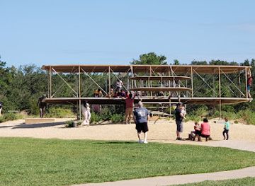
Wright Brothers National Memorial
Explore the birthplace of aviation at the Wright Brothers National Memorial, a tribute to the pioneers of flight in Kill Devil Hills, North Carolina.
-
Historical place
Fort Raleigh National Historic Site
Explore Fort Raleigh National Historic Site, where history meets nature on Roanoke Island, uncovering the stories of America's first settlers and the Lost Colony.
-
Tourist attraction
Ocracoke Lighthouse
Discover the historic Ocracoke Lighthouse, a treasured landmark in North Carolina's Outer Banks, offering stunning views and rich maritime heritage.
-
History museum
Roanoke Island Festival Park
Explore the captivating history and vibrant culture of Roanoke Island at Festival Park, where the past comes alive amidst beautiful landscapes.


Best landmarks in Albemarle-Pamlico Peninsula
The peninsula's most distinctive landmarks are often expansive natural features rather than monumental buildings. Lake Mattamuskeet is a defining geographical presence, a vast shallow lake enclosed by marsh and refuge habitat. Lake Phelps, within Pettigrew State Park, is notable for its dark, cypress-fringed waters and its association with long Indigenous and later plantation histories. The historic village of Bath preserves an unusually early colonial townscape, including St Thomas Church and surviving eighteenth-century houses, while Somerset Place offers a sobering view of plantation slavery and the lives of the people who were forced to work there. The Albemarle and Pamlico sounds themselves are cultural landmarks: broad estuarine waters that shaped settlement, trade, fishing and transport. In the eastern marshes, the open horizons, pocosin vegetation and refuge landscapes of Alligator River and Mattamuskeet express the peninsula's environmental identity more powerfully than a single architectural monument.
-
Historical place
Fort Raleigh National Historic Site
Unearth the mysteries of America's first colony at Fort Raleigh National Historic Site, a blend of rich history and breathtaking nature.
-
Historical place museum
Somerset Place State Historic Site
Explore the rich history of Somerset Place State Historic Site in Creswell, North Carolina, where the stories of a bygone era come to life.
-
Museum
Historic Edenton State Historic Site
Discover North Carolina's colonial past at the Historic Edenton State Historic Site, where history comes alive through engaging exhibits and beautiful architecture.
-
Historical landmark
Wright Brother's Garage Monument
Explore the Wright Brother's Garage Monument in Kitty Hawk, NC, where aviation history took flight and discover the legacy of the pioneers of powered flight.


Explore Albemarle-Pamlico Peninsula on the map
Plan your trip on one map. See where the top cities, national parks and sights are, and book hotels and experiences in a few clicks.
Best hotels in Albemarle-Pamlico Peninsula
Best restaurants in Albemarle-Pamlico Peninsula
Dining is closely tied to the peninsula's coastal plain and working waterways. Seafood may include local or regionally sourced oysters, crab, shrimp, fish and clams, often served fried, grilled or in stews, while country cooking draws on pork, chicken, corn, beans, greens and seasonal vegetables. Peanuts, sweet potatoes and other crops associated with eastern North Carolina appear in markets, roadside stalls and home-style menus. Small-town cafés, independent diners, family restaurants, seafood counters and traditional barbecue establishments provide much of the everyday choice, while waterfront restaurants are found in selected communities rather than continuously along the sounds. Farmers' markets and seasonal produce stands are useful for discovering local ingredients. Menus and opening patterns can be limited in remote districts, so plan meals around the towns on your route and carry provisions for refuge excursions.
-
Seafood
Tale of the Whale
Experience culinary excellence at Tale of the Whale in Nags Head—where fresh seafood meets breathtaking ocean views.
-
Grill
Blue Water Grill & Raw Bar
Experience fresh seafood and coastal charm at Blue Water Grill & Raw Bar in Manteo - your go-to destination for delightful dining.
-
Fine Dining
Cafe Pamlico
Experience exquisite fine dining at Cafe Pamlico in Buxton – where fresh seafood meets upscale ambiance.
-
Restaurant
Charlie's Restaurant
Discover delicious Southern cuisine at Charlie's Restaurant in Bayboro - where comfort meets flavor in every bite!

Best bars in Albemarle-Pamlico Peninsula
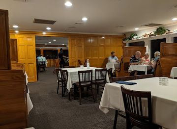
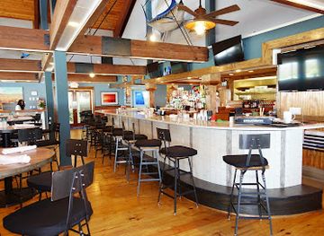
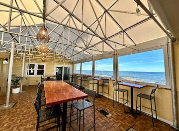
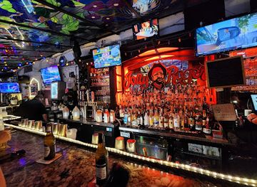
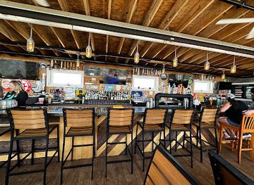
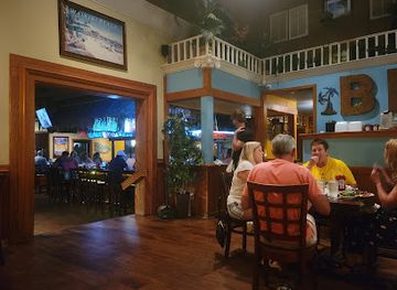
Nightlife is restrained and community-focused rather than built around clubs. In towns such as Columbia, Belhaven, Plymouth and nearby Bath, evenings are more likely to involve a pub-style restaurant, casual bar, live local music, a community event or a quiet meal than a late-night entertainment district. Waterfront venues may offer drinks and views, but operating patterns can change with the season and weather. Larger nightlife choices are found outside the peninsula in regional centres such as Greenville or New Bern, which are useful only if included deliberately in a wider itinerary. Breweries and cocktail-led venues are less widespread than in North Carolina's larger cities. Visitors should arrange a sober driver on rural roads, where distances are long, lighting is limited and wildlife or farm traffic may be encountered after dark.
-
Italian
The Jolly Roger Restaurant
Discover The Jolly Roger Restaurant, where delicious Italian cuisine meets live music and family-friendly fun on the Outer Banks.
-
Seafood
Miller's Waterfront Restaurant
Discover Miller's Waterfront Restaurant in Nags Head, NC – a seafood lover's paradise with stunning views and a lively atmosphere.
-
Grill
Barefoot Bernie's Tropical Grill & Bar
Experience the vibrant taste of the Outer Banks at Barefoot Bernie's Tropical Grill & Bar, where seafood and tropical flavors meet delightful ambiance.
-
Grill
Mulligan's Grille in Historic Cottage Row
Experience the vibrant flavors of Southern cuisine and fresh seafood at Mulligan's Grille, a must-visit spot in the heart of Nags Head, NC.

Best nightclubs in Albemarle-Pamlico Peninsula
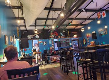
Nightlife is restrained and community-focused rather than built around clubs. In towns such as Columbia, Belhaven, Plymouth and nearby Bath, evenings are more likely to involve a pub-style restaurant, casual bar, live local music, a community event or a quiet meal than a late-night entertainment district. Waterfront venues may offer drinks and views, but operating patterns can change with the season and weather. Larger nightlife choices are found outside the peninsula in regional centres such as Greenville or New Bern, which are useful only if included deliberately in a wider itinerary. Breweries and cocktail-led venues are less widespread than in North Carolina's larger cities. Visitors should arrange a sober driver on rural roads, where distances are long, lighting is limited and wildlife or farm traffic may be encountered after dark.
-
Live music bar
The Brown Pelican
Discover the lively ambiance of The Brown Pelican, where live music, a vibrant bar, and Southern hospitality meet in New Bern, NC.
Best shops in Albemarle-Pamlico Peninsula
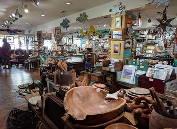
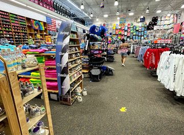
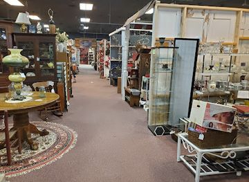
Shopping is concentrated in small town centres, local markets, farm stands and independent businesses rather than large retail districts. Columbia, Belhaven, Plymouth and nearby Bath provide opportunities to browse locally made gifts, books, art, antiques and practical supplies, while seasonal farmers' markets and roadside stands are good places to look for peanuts, sweet potatoes, preserves, baked goods and other eastern North Carolina produce. Seafood purchases should be made through established sellers and kept properly chilled for the journey. Galleries and craft shops may feature woodwork, paintings, pottery, textiles and objects inspired by the coastal landscape, although availability varies by town and season. Visitors seeking extensive chain retail or specialist shopping will find more choice outside the peninsula in larger regional centres, so treat shopping here as a way to support local producers and understand the area's agricultural and maritime character.
-
Gift shop
The Christmas Shop
Discover the magic of the season at The Christmas Shop in Manteo, NC, a charming gift store filled with unique holiday treasures and festive decor.
-
Gift shop
SeaGreen Gallery
Explore SeaGreen Gallery in Nags Head for unique gifts, local art, and handcrafted jewelry that capture the essence of coastal North Carolina.
-
Gift shop
Super Wings South Nags Head
Explore a vibrant gift shop in Nags Head, offering beach clothing and unique souvenirs that capture the charm of the Outer Banks.
-
Gift shop
The Marketplace
Explore The Marketplace in Albemarle, NC, for unique gifts, antiques, and local art that capture the essence of the region.

Get your free copy of our complete guide to Albemarle-Pamlico Peninsula, delivered straight to you.
Everything on this page, from attractions and restaurants to essentials and local phrases, in one PDF you can read offline, print or share.
Already have an account? Sign in
Your Albemarle-Pamlico Peninsula guide is ready.
We'll send it to · Not you? Sign out

Getting your guide ready…
We are putting together a fresh copy of the Albemarle-Pamlico Peninsula guide. This can take up to a minute.
This can take a few moments. If your browser asks, choose Allow so the download can start. You'll find the guide in your Downloads folder.
Nothing happened? Download it again
Sorry, the guide is taking longer than usual. Please try again in a minute, or get it by email instead.
Albemarle-Pamlico Peninsula essentials
Currency and Payment
Safety
Emergency Situations
Do's and Don'ts
Local Tips
From Eve
Local phrases worth knowing
You don't need to get them perfect. A few words go a long way, and locals appreciate the effort.
Basics
| English | Local | Say it |
|---|---|---|
| Hello | Howdy | [Ha-dee] |
| Goodbye | See ya later | [See ya lay-ta] |
| Yes | Yup | [Yup] |
| No | Nah | [Nah] |
| Please/You’re welcome | No problem | [No prob-lum] |
| Thank you | Thank ya | [Thank ya] |
| Excuse me/Sorry | Pardon me | [Par-don me] |
| How are you? | How ya doin'? | [How ya do-in?] |
| Fine. And you? | I’m good, and you? | [I'm good, an' you?] |
| Do you speak English? | You speakin' English? | [You speak-in English?] |
| I don't understand | I don't get it | [I don't get it] |
Eating & Drinking
| English | Local | Say it |
|---|---|---|
| I’d like to see the menu, please | Can I see the menu? | [Can I see the men-u?] |
| I don't eat meat | I ain't eatin' no meat | [I ain't eat-in' no meat] |
| Cheers! | Cheers! | [Cheers!] |
| I would like to pay, please | I’d like to settle up | [I'd like to set-tle up] |
Emergencies
| English | Local | Say it |
|---|---|---|
| Help! | Help! | [Help!] |
| Go away! | Get away! | [Get away!] |
| Call the Police! | Call the cops! | [Call the cops!] |
| Call a doctor! | Get a doctor! | [Get a doc-tor!] |
| I’m lost | I’m turned around | [I'm turned a-round] |
| I’m ill | I ain't feelin' well | [I ain't feel-in' well] |
Shopping
| English | Local | Say it |
|---|---|---|
| I’d like to buy... | I wanna buy... | [I wanna buy...] |
| I’m just looking | Just browsin' | [Just brows-in'] |
| How much is it? | How much fer that? | [How much fer that?] |
| That’s too expensive | That's too high | [That's too high] |
| Can you lower the price? | Can ya bring it down? | [Can ya bring it down?] |
Time & Numbers
| English | Local | Say it |
|---|---|---|
| What time is it? | What time's it? | [What time's it?] |
| It's one o'clock | It's one o'clock | [It's one o'clock] |
| Half past (10) | Half past ten | [Half past ten] |
| Morning | Mornin' | [Morn-in'] |
| Afternoon | Afternoon | [Afternoon] |
| Evening | Evenin' | [Even-in'] |
| Yesterday | Yestiddy | [Yes-tid-dee] |
| Today | Today | [Today] |
| Tomorrow | Tomorra | [To-mor-ra] |
| 1 | One | [One] |
| 2 | Two | [Two] |
| 3 | Three | [Three] |
| 4 | Four | [Four] |
| 5 | Five | [Five] |
| 6 | Six | [Six] |
| 7 | Seven | [Seven] |
| 8 | Eight | [Eight] |
| 9 | Nine | [Nine] |
| 10 | Ten | [Ten] |
Transport & Directions
| English | Local | Say it |
|---|---|---|
| Where's a/the...? | Where's a...? | [Where's a...?] |
| What's the address? | What's the address? | [What's the address?] |
| Can you show me (on the map)? | Can ya show me on the map? | [Can ya show me on the map?] |
| When's the next (bus)? | When's the next bus? | [When's the next bus?] |
| A ticket (to ....) | A ticket to... | [A ticket to...] |
History of Albemarle-Pamlico Peninsula
Indigenous Landscapes Before European Settlement
The peninsula's rivers, sounds and wetlands were inhabited and used by Indigenous peoples long before European colonisation. Algonquian-speaking communities, including the Secotan and related peoples of the coastal plain, relied on fishing, hunting, gathering and agriculture adapted to estuarine conditions. Archaeological evidence around Lake Phelps and other waterways records long occupation, while place names preserve traces of Indigenous geography. European settlement, disease and political pressure transformed these societies, but the region's waterways and ecological knowledge remain central to understanding its earliest history.
Colonial Settlement and the Founding of Bath
English colonists established settlements along the Albemarle and Pamlico waterways during the late seventeenth and early eighteenth centuries. Bath, incorporated in 1705 on the Pamlico River, became North Carolina's oldest incorporated town and an early centre of trade and government. Its surviving houses, church and compact street pattern reflect a period when river transport was more practical than overland travel. The colonial economy depended on farms, timber, naval stores and commerce conducted through creeks and sounds rather than through a major inland road network.
The Tuscarora War and Colonial Conflict
The Tuscarora War of 1711–1715 affected eastern North Carolina, including the wider Albemarle-Pamlico region. Conflict grew from land pressure, colonisation, trade disputes and violence between settlers and the Tuscarora people. The war brought military campaigns and political upheaval to the coastal plain, followed by the migration of many Tuscarora northwards and the further expansion of colonial settlement. Its legacy is part of the region's story of contested land and changing Indigenous-settler relationships, rather than simply a remote episode of colonial history.
Waterborne Trade, Timber and Agriculture
For much of the eighteenth and nineteenth centuries, the peninsula's economic life was organised around water. Rivers and sounds carried lumber, shingles, tar, grain and farm produce to larger markets, while shallow-draft boats connected isolated settlements. Vast forests supplied timber and naval stores, and later agriculture expanded through drainage, canals and improved roads. Towns such as Columbia, Plymouth and Belhaven developed as local trading points. The same geography that supported commerce also made communities vulnerable to storms, changing channels and difficult overland travel.
Civil War on the Sounds and Rivers
The Albemarle and Pamlico waterways were strategically important during the American Civil War. Union forces sought control of North Carolina's sounds and river approaches, while Confederate defenders relied on forts, gunboats and local knowledge of shallow channels. Engagements in the broader coastal region, including the capture of Roanoke Island and fighting along nearby waterways, disrupted trade and altered control of the coast. Although many sites are modest or changed, the war's geography remains visible in historic communities, military earthworks and maritime interpretations.
Drainage, Conservation and the Modern Wetland Economy
During the twentieth century, drainage schemes, forestry, farming and road building reshaped the peninsula's pocosins and marshes. Some projects opened land for cultivation, while others demonstrated the environmental cost of altering peat-rich wetlands, which store water and carbon and provide important wildlife habitat. The establishment and expansion of wildlife refuges, including Pocosin Lakes, Mattamuskeet and Alligator River, marked a major shift towards conservation. Today agriculture, fishing, forestry, ecotourism and habitat protection coexist, sometimes uneasily, across the same low-lying landscape.
Albemarle-Pamlico Peninsula in Photos
Browse through our photo collection highlighting the charm and character of the destination.
Neighbouring regions of Albemarle-Pamlico Peninsula
The closest regions to Albemarle-Pamlico Peninsula, if you have time for more than one.
-
-
-
-

-


Swipe for more regions
Explore more

Explore more of North Carolina
Discover North Carolina's blend of natural beauty, vibrant cities, and rich history. From the Outer Banks to the Blue Ridge Mountains, experience diverse landscapes and cultures.
Explore North Carolina