

Free Crystal Coast Travel Guide & Mobile App
Explore Crystal Coast with free travel guides. Discover regional history, expert tips, proposed trips, and audio guides on web or mobile app.


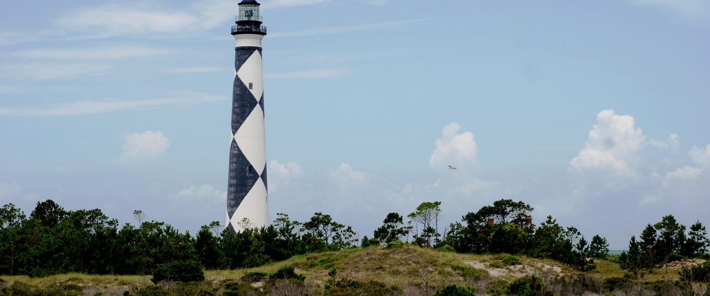


Explore North Carolina’s Crystal Coast for barrier-island beaches, Beaufort’s maritime heritage, seafood towns and Cape Lookout’s wild seascapes.
Read more about Crystal Coast
When is the best time to visit Crystal Coast?
Best: April–May, October · 22–27°C| Month | High (°C) | Rainfall (mm) |
|---|---|---|
| January | 13 | 87 |
| February | 15 | 84 |
| March | 17 | 92 |
| April (best) | 22 | 84 |
| May (best) | 27 | 100 |
| June | 30 | 110 |
| July | 32 | 130 |
| August | 32 | 135 |
| September | 29 | 120 |
| October (best) | 23 | 105 |
| November | 17 | 90 |
| December | 13 | 95 |
Getting to and around Crystal Coast
How to get there
Transportation
Top city travel guides in Crystal Coast
The cities of Crystal Coast, and the easiest places to base yourself.

Swipe for more cities
Best attractions in Crystal Coast
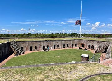
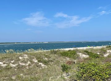
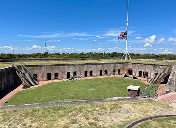
The Crystal Coast’s attractions range from historic coastal defences to protected islands and marine discovery. Fort Macon State Park combines a well-preserved nineteenth-century fort with beaches, dunes, trails and views across Beaufort Inlet, while the Cape Lookout Lighthouse and the long beaches of Cape Lookout National Seashore require a boat journey and reward visitors with a more remote coastal setting. Shackleford Banks adds wildlife interest through its feral-horse herd, tidal flats and undeveloped shoreline. In Beaufort, the North Carolina Maritime Museum explains boatbuilding, fishing, shipwrecks and the maritime history associated with Blackbeard, while the town’s historic district provides a walkable architectural experience. The North Carolina Aquarium at Pine Knoll Shores focuses on local rivers, sounds, ocean habitats and conservation. Morehead City supports charter fishing, diving, paddle sports and waterfront excursions, and the beaches from Atlantic Beach to Emerald Isle provide space for swimming, surfing, fishing and family recreation. Kayaking through sound-side creeks and estuaries offers a quieter perspective on marshes and birdlife, while seasonal events and working waterfronts add cultural context to the outdoor attractions.
-
State park
Fort Macon State Park
Experience the breathtaking landscapes and historical significance of Fort Macon State Park, a coastal gem in North Carolina perfect for outdoor adventures.
-
Fishing pier
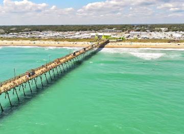
Bogue Inlet Fishing Pier
Experience the charm of Bogue Inlet Fishing Pier in Emerald Isle, NC, where fishing, stunning views, and family fun await you along the Atlantic coast.
-
Aquarium
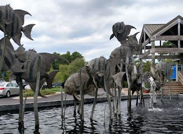
North Carolina Aquarium at Pine Knoll Shores
Discover marine life and conservation at the North Carolina Aquarium at Pine Knoll Shores, an engaging destination for families and ocean enthusiasts alike.
-
Historical landmark
Ft. Macon
Discover the rich history and natural beauty of Fort Macon State Park, a coastal treasure in Atlantic Beach, NC, perfect for history buffs and nature lovers alike.
Best landmarks in Crystal Coast
The most recognisable landmark is the Cape Lookout Lighthouse, whose black-and-white diamond pattern has guided mariners and become an emblem of the southern Outer Banks. It stands within Cape Lookout National Seashore, a federally protected chain of barrier islands reached by boat, where the lighthouse, shifting dunes and open ocean express the region’s exposed geography. Fort Macon is another defining structure: its masonry walls and casemates occupy the eastern end of Bogue Banks and recall the coastal defence systems and Civil War history of the United States. Beaufort’s historic district is marked by eighteenth- and nineteenth-century houses, waterfront streets and buildings associated with a long port tradition rather than by one monumental structure. In Morehead City, the port, docks and working waterfront are landmarks of a continuing maritime economy. The North Carolina Aquarium at Pine Knoll Shores is a contemporary civic landmark, recognised for interpreting the coast’s estuaries, rivers and offshore waters. Together these places show the Crystal Coast as a meeting point of navigation, defence, settlement, science and a constantly shifting barrier-island environment.
-
State park
Fort Macon State Park
Explore Fort Macon State Park, a coastal paradise in North Carolina, blending breathtaking nature with rich Civil War history.
-
Historical landmark
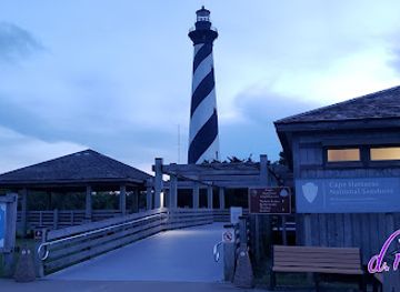
Cape Hatteras Lighthouse
Explore the iconic Cape Hatteras Lighthouse, a historical landmark that offers breathtaking views and a glimpse into America's maritime history.
-
Historical landmark
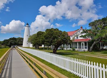
Ocracoke Lighthouse
Explore the historic Ocracoke Lighthouse, a captivating symbol of maritime heritage and breathtaking coastal views in North Carolina's Outer Banks.
-
Historical place
Fort Raleigh National Historic Site
Explore the captivating history and scenic beauty of Fort Raleigh National Historic Site, where the story of America's first colonists comes to life.
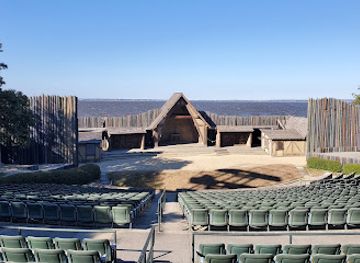
Explore Crystal Coast on the map
Plan your trip on one map. See where the top cities, national parks and sights are, and book hotels and experiences in a few clicks.
Best hotels in Crystal Coast
Best restaurants in Crystal Coast
Dining on the Crystal Coast is grounded in the waters surrounding it. Shrimp, blue crab, oysters and locally caught fish appear in casual seafood restaurants, harbour-side settings, fish markets and more contemporary kitchens, with preparations ranging from fried platters and sandwiches to grilled, steamed or seasonally composed dishes. Morehead City has a particularly strong connection with commercial fishing and seafood distribution, while Beaufort combines waterfront dining with cafés, bakeries and restaurants in and around its historic centre. The barrier-island communities offer a broad resort mix, including family-friendly seafood houses, pizzerias, breakfast cafés, ice-cream shops and restaurants serving broader American and international menus. Local produce, barbecue and North Carolina’s wider culinary traditions are also part of the region’s table. Farmers’ markets and independent seafood sellers can be useful for visitors staying in self-catering accommodation, although availability follows weather, fishing conditions and season. In summer, reservations are sensible for popular evening dining, particularly at weekends.
-
Seafood
Amos Mosquito's Restaurant
Discover exceptional seafood dining at Amos Mosquito's Restaurant in Atlantic Beach – where fresh flavors meet family-friendly fun.
-
American
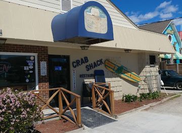
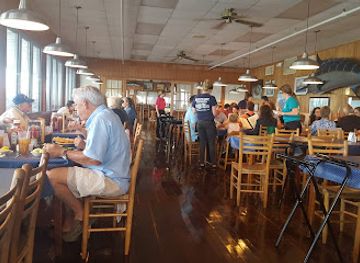
The Crab Shack
Discover fresh seafood delights at The Crab Shack - a must-visit culinary gem on North Carolina's coast.
-
Seafood
Sanitary Fish Market and Restaurant
Discover fresh seafood delights at Sanitary Fish Market & Restaurant in Morehead City - where local flavors meet coastal charm.
-
American
Rucker Johns Restaurant
Experience delicious American comfort food at Rucker Johns Restaurant in Emerald Isle - perfect for families and gluten-free diners alike.

Best bars in Crystal Coast
Evening life is generally relaxed and coastal rather than centred on a large nightclub scene. Beaufort’s historic waterfront and adjacent streets have pubs, restaurants, wine-focused venues and places for a drink after visiting the museums or walking along the harbour. Morehead City provides a broader working-town and social scene, with waterfront bars, breweries, live music and restaurants that stay active later during the summer. Along Atlantic Beach, Pine Knoll Shores and Emerald Isle, nightlife is concentrated in resort restaurants, beach bars, casual pubs and seasonal entertainment rather than in a single continuous strip. Some venues offer live music or outdoor seating, but schedules and opening patterns vary considerably by season and weather. Visitors should not assume that remote parts of the barrier islands have late-night transport; arranging a designated driver or staying within walking distance is particularly sensible when accommodation is outside a town centre.
-
Seafood
Amos Mosquito's Restaurant
Savor the coastal flavors at Amos Mosquito's Restaurant, where seafood meets American classics in a family-friendly atmosphere.
-
Restaurant
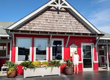
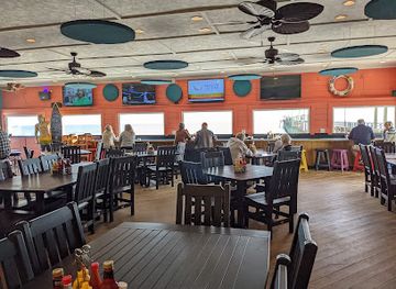
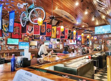
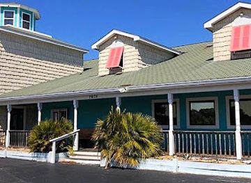
Surf's Up Grill & Bar
Surf's Up Grill & Bar in Emerald Isle offers a vibrant dining experience with great food, refreshing drinks, and stunning ocean views.
-
Grill
Ioanni's Grill
Discover Ioanni's Grill, where Italian flavors meet sports bar vibes in Morehead City for an unforgettable dining experience.
-
Restaurant
On The Rocks
Experience delicious American cuisine and live music at On The Rocks, the vibrant heart of Atlantic Beach's dining scene.
Best nightclubs in Crystal Coast
Evening life is generally relaxed and coastal rather than centred on a large nightclub scene. Beaufort’s historic waterfront and adjacent streets have pubs, restaurants, wine-focused venues and places for a drink after visiting the museums or walking along the harbour. Morehead City provides a broader working-town and social scene, with waterfront bars, breweries, live music and restaurants that stay active later during the summer. Along Atlantic Beach, Pine Knoll Shores and Emerald Isle, nightlife is concentrated in resort restaurants, beach bars, casual pubs and seasonal entertainment rather than in a single continuous strip. Some venues offer live music or outdoor seating, but schedules and opening patterns vary considerably by season and weather. Visitors should not assume that remote parts of the barrier islands have late-night transport; arranging a designated driver or staying within walking distance is particularly sensible when accommodation is outside a town centre.
-
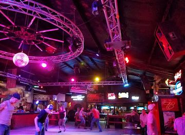
Dance hall
Gus' Country Rock Club
Discover the heart of country music and dance at Gus' Country Rock Club in Midway Park, NC, where great music and good times await.
-
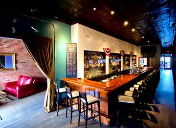
Bar
Arendell Room Bar
Uncover the charm of Arendell Room Bar in Morehead City, NC; a perfect spot for unique drinks and unforgettable nightlife experiences.
-
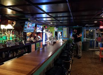
Bar
Emerald Club
Experience vibrant nightlife at the Emerald Club in Emerald Isle, NC—where live music, great drinks, and fun come together for an unforgettable evening.
-
Club
Memories Beach & Shag Club
Experience the vibrant nightlife of Atlantic Beach at Memories Beach & Shag Club, where music and dance meet coastal charm.

Best shops in Crystal Coast
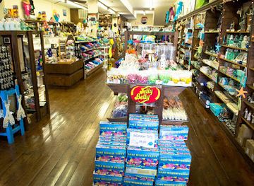
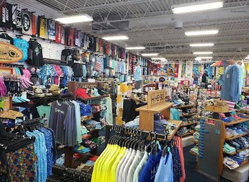
Shopping is concentrated in Beaufort, Morehead City and the developed barrier-island communities, with the greatest emphasis on independent businesses, practical beach goods and locally themed products rather than major luxury retail. Beaufort’s historic streets contain galleries, bookshops, craft retailers, jewellery stores, nautical gifts and shops selling work by regional artists. Morehead City combines a traditional town-centre and waterfront character with marine-supply businesses, seafood sellers and everyday retail. Along Bogue Banks, visitors will find surf and beachwear, equipment hire, souvenirs, small galleries and seasonal shops aimed at holidaymakers. Farmers’ markets and direct seafood outlets can provide local produce when operating, while regional food products make useful gifts for travellers with self-catering or checked-baggage space. Look for coastal artwork, pottery, photography, maritime books and products connected with North Carolina’s fishing heritage, but check current market days and seasonal opening patterns before making a special journey.
-
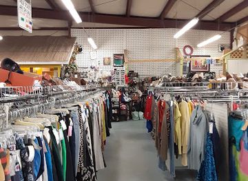
Consignment shop
Second Go-Round Consignment
Explore Second Go-Round Consignment in Newport, NC, for a unique shopping experience filled with vintage treasures and sustainable finds.
-
Gift shop
General Store
Discover unique gifts and local treasures at Beaufort's General Store, a charming gift shop with a coastal flair.
-
Surf shop
Paradise Beach Shop
Discover the ultimate beach shopping experience at Paradise Beach Shop, your destination for surf gear, swimwear, and coastal fashion in Atlantic Beach, NC.
-
Store
Gigi & Company
Discover unique treasures and local artisan products at Gigi & Company, the charming store in Morehead City, NC.

Get your free copy of our complete guide to Crystal Coast, delivered straight to you.
Everything on this page, from attractions and restaurants to essentials and local phrases, in one PDF you can read offline, print or share.
Already have an account? Sign in
Your Crystal Coast guide is ready.
We'll send it to · Not you? Sign out

Getting your guide ready…
We are putting together a fresh copy of the Crystal Coast guide. This can take up to a minute.
This can take a few moments. If your browser asks, choose Allow so the download can start. You'll find the guide in your Downloads folder.
Nothing happened? Download it again
Sorry, the guide is taking longer than usual. Please try again in a minute, or get it by email instead.
Crystal Coast essentials
Currency and Payment
Safety
Emergency Situations
Do's and Don'ts
Local Tips
From Eve
Local phrases worth knowing
You don't need to get them perfect. A few words go a long way, and locals appreciate the effort.
Basics
| English | Local | Say it |
|---|---|---|
| Hello | Hey there | [Hay thair] |
| Goodbye | See ya | [See yah] |
| Yes | Yep | [Yep] |
| No | Nah | [Nah] |
| Please/You're welcome | No problem | [No prob-lum] |
| Thank you | Thanks a lot | [Thangs a lot] |
| Excuse me/Sorry | Sorry 'bout that | [Sorry 'bout that] |
| How are you? | How ya doin'? | [How ya doin'?] |
| Fine. And you? | I’m good. And you? | [I’m gud. And you?] |
| Do you speak English? | Y'all speak English? | [Y'all speek Inglish?] |
| I don't understand | I ain't followin' | [I ain't foll-win'] |
Eating & Drinking
| English | Local | Say it |
|---|---|---|
| I'd like to see the menu, please | Can I see the menu? | [Can I see the men-you?] |
| I don't eat meat | I don’t eat meat | [I don’t eet meet] |
| Cheers! | Cheers! | [Cheers!] |
| I would like to pay, please | Can I get the check, please? | [Can I get the chek, pleez?] |
Emergencies
| English | Local | Say it |
|---|---|---|
| Help! | Help! | [Help!] |
| Go away! | Leave me be! | [Leev me bee!] |
| Call the Police! | Call 911! | [Call nine-one-one!] |
| Call a doctor! | Get me a doctor! | [Get me a dok-tor!] |
| I'm lost | I ain't got a clue | [I ain't got a clew] |
| I'm ill | I ain't feelin' good | [I ain't feelin' gud] |
Shopping
| English | Local | Say it |
|---|---|---|
| I'd like to buy... | I wanna buy... | [I wanna bye...] |
| I'm just looking | Just lookin' around | [Just lookin' a-round] |
| How much is it? | What's the price? | [What's the prais?] |
| That's too expensive | That's way too pricey | [That's way too pricy] |
| Can you lower the price? | Can ya bring it down? | [Can ya bring it down?] |
Time & Numbers
| English | Local | Say it |
|---|---|---|
| What time is it? | What time is it? | [What time is it?] |
| It's one o'clock | It's one o'clock | [It's one o'clock] |
| Half past (10) | Half past ten | [Half past ten] |
| Morning | Mornin' | [Mornin'] |
| Afternoon | Afternoon | [Afternoon] |
| Evening | Evenin' | [Evenin'] |
| Yesterday | Yestiddy | [Yes-tiddy] |
| Today | Today | [Today] |
| Tomorrow | Tomorra | [Tuh-mor-rah] |
| 1 | One | [Wun] |
| 2 | Two | [Too] |
| 3 | Three | [Three] |
| 4 | Four | [For] |
| 5 | Five | [Fyv] |
| 6 | Six | [Six] |
| 7 | Seven | [Sev-en] |
| 8 | Eight | [Ayt] |
| 9 | Nine | [Nyn] |
| 10 | Ten | [Ten] |
Transport & Directions
| English | Local | Say it |
|---|---|---|
| Where's a/the...? | Where's a...? | [Where's a...?] |
| What's the address? | What’s the address? | [What’s the ad-dress?] |
| Can you show me (on the map)? | Can ya show me on the map? | [Can ya show me on the map?] |
| When's the next (bus)? | When's the next bus? | [When's the next bus?] |
| A ticket (to ....) | A ticket to... | [A tik-it to...] |
History of Crystal Coast
Indigenous Coastal Societies and Estuarine Traditions
Long before European colonisation, the sounds, islands and river mouths of present-day Carteret County supported Indigenous communities, including peoples associated with the Coree and Neusiok. Shell middens, fishing grounds and other archaeological evidence record sustained use of the coastal environment, where seasonal movement, shellfish gathering, fishing and hunting were closely adapted to tides and wetlands. European settlement, disease, displacement and changing colonial landholding systems profoundly altered these societies. The region’s modern maritime identity still rests on an older understanding of the sounds and barrier islands as interconnected working landscapes rather than simply as beaches.
Colonial Settlement and the Port of Beaufort
European settlement expanded along the North Carolina coast during the late seventeenth and early eighteenth centuries. Beaufort was established as a port and incorporated in 1785, although settlement in the area began earlier. Its protected position on Taylor’s Creek and the waters of North River made it useful for coastal trade, fishing and small-scale shipping. The surviving street pattern and wooden houses in the historic district reflect the town’s maritime development, while the surrounding sounds connected farms, fisheries and settlements to the wider Atlantic economy.
Piracy, Privateering and Blackbeard’s Waters
The inlets and shoals of the North Carolina coast were associated with piracy and privateering during the early eighteenth century. Edward Teach, better known as Blackbeard, operated in the region, and his flagship Queen Anne’s Revenge ran aground near Beaufort Inlet in 1718. The wreck site, discovered offshore in the twentieth century, became an important focus of maritime archaeology. Artefacts recovered from the vessel are interpreted at the North Carolina Maritime Museum in Beaufort, linking a famous episode of Atlantic history with the continuing scientific study of the coastal seabed.
Fort Macon and the Civil War Coast
Fort Macon, at the eastern end of Bogue Banks near Beaufort Inlet, was completed in the 1830s as part of the United States coastal defence system. During the Civil War, Confederate forces occupied the fort before Union troops captured it in April 1862 after a bombardment. The fort later served various military and administrative purposes before becoming the centrepiece of Fort Macon State Park. Its brick casemates, earthworks and position beside the inlet show how geography made the coast strategically important as well as commercially valuable.
Commercial Fishing, Boatbuilding and the Working Waterfront
Through the nineteenth and twentieth centuries, fishing, boatbuilding, seafood processing and coastal shipping shaped communities such as Morehead City and Beaufort. The arrival of rail connections at Morehead City in the nineteenth century strengthened its role as a port and linked the coast more closely with inland markets. Local boatyards produced and repaired vessels suited to the sounds and offshore waters, while commercial fishermen developed detailed knowledge of changing channels, shoals and seasons. Working waterfronts remain visible in docks, charter operations, seafood businesses and the continued presence of commercial fleets.
Military, Marine Science and the Modern Coast
The wider Carteret County coast became increasingly connected to military and scientific institutions during the twentieth century. Marine research, fisheries studies and coastal conservation grew around the region’s estuaries and ocean waters, while military facilities and training areas influenced parts of the mainland and barrier islands. The North Carolina Aquarium at Pine Knoll Shores and the maritime museum in Beaufort reflect the region’s later emphasis on public education, marine science and heritage interpretation. At the same time, improved roads and post-war holiday travel transformed the barrier islands into a major beach destination.
Barrier-Island Tourism and Coastal Conservation
Beach tourism expanded rapidly after the Second World War as improved highways, bridges and holiday accommodation made Bogue Banks and nearby communities accessible to visitors from across North Carolina and beyond. Resorts, second homes and seasonal businesses grew alongside older fishing settlements. Conservation has remained equally important: Fort Macon State Park protects a historic coastal landscape, the aquarium interprets marine habitats, and Cape Lookout National Seashore preserves extensive barrier-island environments. The modern Crystal Coast is consequently shaped by a continuing balance between recreation, working waterfronts, private development and protection of vulnerable coastal ecosystems.
Crystal Coast in Photos
Browse through our photo collection highlighting the charm and character of the destination.
Neighbouring regions of Crystal Coast
The closest regions to Crystal Coast, if you have time for more than one.
-

-

-

-

-


Swipe for more regions
Explore more

Explore more of North Carolina
Discover North Carolina's blend of natural beauty, vibrant cities, and rich history. From the Outer Banks to the Blue Ridge Mountains, experience diverse landscapes and cultures.
Explore North Carolina