

Nanga Parbat Base Camp Travel Guide - Free Web & App
Your ultimate guide to Nanga Parbat Base Camp. Discover top landmarks, proposed trips, and local tips. Free on the web or via the Evendo companion app.


Nanga Parbat Base Camp in Pakistan offers Himalayan trekking from Fairy Meadows, alpine views, village culture and a close approach to the Rupal and Raikot faces.
The Mountain and Its Approaches
Nanga Parbat Base Camp is not a single built facility but a group of high-mountain approaches beneath Nanga Parbat, Pakistan’s 8,126-metre Himalayan giant. The most accessible route for visitors runs from the Karakoram Highway near Raikot Bridge through the forested settlement of Tato and Fairy Meadows, continuing on foot towards Beyal Camp and the celebrated Nanga Parbat viewpoint. On the mountain’s western side, the Rupal Valley provides a more remote approach from Tarashing towards camps beneath the enormous Rupal Face. These routes lead into demanding alpine terrain rather than to a conventional tourist attraction with permanent services.Read more about Nanga Parbat Base Camp
Landscape and Mountain Culture
Trekking and Practical Character
When is the best time to visit Nanga Parbat Base Camp?
Best: June–August · 10–13°C| Month | High (°C) | Rainfall (mm) |
|---|---|---|
| January | -10 | 4 |
| February | -10 | 4 |
| March | -5 | 4 |
| April | 0 | 5 |
| May | 6 | 5 |
| June (best) | 10 | 6 |
| July (best) | 13 | 6 |
| August (best) | 12 | 6 |
| September | 9 | 6 |
| October | 4 | 5 |
| November | -3 | 5 |
| December | -7 | 4 |
Getting to and around Nanga Parbat Base Camp
How to get there
Transportation
Best attractions in Nanga Parbat Base Camp
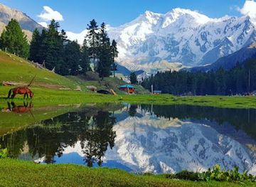
The classic attraction on the Raikot side is the approach from Tato through Fairy Meadows towards Beyal Camp, where open alpine meadows and forest clearings provide expansive views of Nanga Parbat’s glaciated Rakhiot flank. The trail’s appeal lies in the changing landscape: cultivated lower valleys give way to conifer woodland, pasture and increasingly stark mountain terrain. On the opposite side, the Rupal Valley offers a more remote setting beneath the immense Rupal Face, approached from Tarashing through a landscape of steep slopes, streams and high pastures. The settlements themselves are part of the experience, revealing how local communities occupy narrow, elevated valleys. Chilas, outside the base-camp area, is a practical road gateway and is known for prehistoric rock carvings along the Indus and nearby routes. These approaches are best understood as trekking landscapes rather than a collection of formal visitor attractions, with weather and local access determining how far visitors can safely proceed.
-
Mountain peak
Nanga Parbat
Discover the breathtaking beauty and adventure of Nanga Parbat, the majestic 'Killer Mountain' in the heart of the Himalayas.
-
Plateau
Fairy Meadows
Experience Fairy Meadows: A breathtaking plateau at the foot of Nanga Parbat, perfect for trekking and capturing stunning landscapes.
-
Hotel
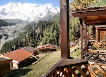
Fairy Meadows Cottages
Discover the serene beauty of Fairy Meadows Cottages, where breathtaking views of Nanga Parbat meet cozy accommodations for the perfect getaway.
-
Lake
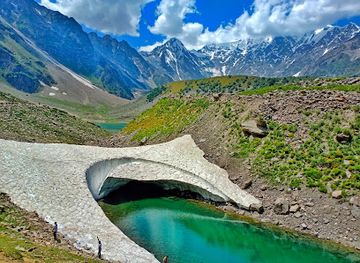
Rama Lake
Discover the tranquil beauty of Rama Lake, a serene lake surrounded by majestic mountains in northern Pakistan, perfect for nature lovers and adventurers.


Best landmarks in Nanga Parbat Base Camp
Nanga Parbat itself is the defining landmark: at 8,126 metres, its enormous mass rises above the surrounding valleys and presents dramatically different faces from the Raikot and Rupal approaches. Beyal Camp and the viewpoints beyond Fairy Meadows are valued for their close visual relationship with the mountain’s ridges, glaciers and high cirques, while the Rupal Face is one of the most imposing walls in the Himalaya. The Indus valley and the Karakoram Highway form important lower-level geographical landmarks on the journey to Raikot Bridge and Chilas. Chilas is also associated with extensive prehistoric rock art along the Indus corridor, a reminder that these mountain routes have a human history reaching far beyond modern trekking. In the valleys, traditional settlements, irrigation channels and cultivated terraces are modest but significant landmarks of adaptation to steep terrain and a demanding climate.
-
Mountain peak
Nanga Parbat
Explore Nanga Parbat, the majestic 'Killer Mountain' in Pakistan – a breathtaking adventure awaits amidst stunning landscapes and rich culture.
-
Hotel
Fairy Meadows Cottages
Experience the tranquility of nature at Fairy Meadows Cottages, where breathtaking views and rustic charm meet adventure in the heart of Pakistan.
-
Mountain cabin
Beyal Camp
Explore the breathtaking Beyal Camp, the perfect base for adventurers seeking to conquer the majestic Nanga Parbat in Pakistan's stunning landscapes.


Explore Nanga Parbat Base Camp on the map
Plan your trip on one map. See where the top attractions, landmarks, restaurants and hotels are, and book hotels and experiences in a few clicks.
Best hotels in Nanga Parbat Base Camp
Best restaurants in Nanga Parbat Base Camp
Dining at Nanga Parbat Base Camp is simple and closely linked to local accommodation, camps and village hospitality rather than a developed restaurant scene. Around Fairy Meadows, visitors commonly rely on basic meals prepared by lodge or campsite operators, with supplies brought up from lower settlements; menus and availability vary with season and transport. Chilas, Gilgit and Astore provide the widest choice before or after a trek, including chapati, rice, lentils, vegetable dishes, meat curries, tea and regional mountain cooking shaped by local agricultural traditions. In the Rupal Valley, options are more limited and arrangements should be made with accommodation providers or trekking organisers in advance. Carrying compact snacks and a personal reserve of drinking water is sensible, while visitors should avoid assuming that remote camps can provide specialised diets or continuous supplies.
-
Hotel
Fairy Meadows Cottages
Discover tranquility at Fairy Meadows Cottages—your gateway to breathtaking views and adventures near Nanga Parbat.
-
Mountain cabin
Beyal Camp
Experience the serene beauty of Beyal Camp, your gateway to adventure at Nanga Parbat's stunning base.
-
Guest house
Fairy Meadows Guest House
Discover unparalleled tranquility and breathtaking views at Fairy Meadows Guest House near Nanga Parbat Base Camp.
-
Hotel
Nanga Parbat Tourist Cottage
Experience breathtaking views and warm hospitality at Nanga Parbat Tourist Cottage in Astore—your perfect mountain getaway.


Best bars in Nanga Parbat Base Camp
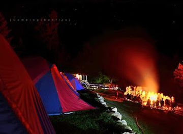
Nanga Parbat Base Camp has no nightclub district or conventional bars, and evening life is centred on quiet mountain accommodation, shared meals and conversation after walking. Fairy Meadows may have a sociable atmosphere in the main trekking season, with visitors and local staff gathering around simple dining areas, but facilities remain basic and can change with weather and seasonal demand. Tarashing and settlements in the Rupal Valley are similarly quiet, with evenings shaped by village life, early starts and mountain conditions rather than organised entertainment. Chilas and Gilgit offer more restaurants and informal cafés, although they should be regarded as gateway-town facilities rather than nightlife located at the base camp. Alcohol is not part of ordinary visitor infrastructure and Pakistan’s laws and local customs should be respected.
-
Restaurant
Nanga Parbat View Hotel
Discover a culinary gem in the heart of Gilgit-Baltistan with breathtaking views of Nanga Parbat at Nanga Parbat View Hotel.

Best nightclubs in Nanga Parbat Base Camp
Nanga Parbat Base Camp has no nightclub district or conventional bars, and evening life is centred on quiet mountain accommodation, shared meals and conversation after walking. Fairy Meadows may have a sociable atmosphere in the main trekking season, with visitors and local staff gathering around simple dining areas, but facilities remain basic and can change with weather and seasonal demand. Tarashing and settlements in the Rupal Valley are similarly quiet, with evenings shaped by village life, early starts and mountain conditions rather than organised entertainment. Chilas and Gilgit offer more restaurants and informal cafés, although they should be regarded as gateway-town facilities rather than nightlife located at the base camp. Alcohol is not part of ordinary visitor infrastructure and Pakistan’s laws and local customs should be respected.
-
Mountain cabin
Beyal Camp
Experience the breathtaking beauty of Nanga Parbat from Beyal Camp, a serene mountain cabin nestled in the heart of the Himalayas.

Best shops in Nanga Parbat Base Camp
Shopping at Nanga Parbat Base Camp is limited to practical trekking supplies and small locally made items available through accommodation providers or village shops, rather than a permanent retail centre. Fairy Meadows and Tato may offer basic refreshments and essentials during the trekking season, while Chilas, Astore and Gilgit are more reliable places to obtain food, fuel, clothing, phone credit and outdoor necessities before entering the mountains. In larger towns, visitors may find regional handicrafts, woollen goods, embroidered textiles, dried foods and locally produced items associated with the cultures of Gilgit-Baltistan, although stock varies between businesses. Buying directly from local makers or family-run shops can support valley communities; visitors should avoid purchasing archaeological objects, old carvings or anything presented as removed from a historic site.
-
Mountain cabin
Beyal Camp
Discover the serenity of Beyal Camp, the gateway to Nanga Parbat, offering breathtaking views and a unique mountain experience.
-
Children's camp
Nanga Parbat Base Camp
Explore Nanga Parbat Base Camp, a breathtaking gateway to the majestic mountains of Pakistan, where adventure meets stunning natural beauty.


Get your free copy of our complete guide to Nanga Parbat Base Camp, delivered straight to you.
Everything on this page, from attractions and restaurants to essentials and local phrases, in one PDF you can read offline, print or share.
Already have an account? Sign in
Your Nanga Parbat Base Camp guide is ready.
We'll send it to · Not you? Sign out

Getting your guide ready…
We are putting together a fresh copy of the Nanga Parbat Base Camp guide. This can take up to a minute.
This can take a few moments. If your browser asks, choose Allow so the download can start. You'll find the guide in your Downloads folder.
Nothing happened? Download it again
Sorry, the guide is taking longer than usual. Please try again in a minute, or get it by email instead.
Nanga Parbat Base Camp essentials
Currency and Payment
Safety
Emergency Situations
Do's and Don'ts
Local Tips
From Eve
Local phrases worth knowing
You don't need to get them perfect. A few words go a long way, and locals appreciate the effort.
Basics
| English | Local | Say it |
|---|---|---|
| Hello | سلام | [Salaam] |
| Goodbye | خدا حافظ | [Khuda Hafiz] |
| Yes | ہاں | [Haan] |
| No | نہیں | [Nahi] |
| Please/You're welcome | براہ کرم | [Barah-e-karam] |
| Thank you | شکریہ | [Shukriya] |
| Excuse me/Sorry | معذرت چاہتا ہوں | [Mazrat chahta hoon] |
| How are you? | آپ کیسے ہیں؟ | [Aap kaise hain?] |
| Fine. And you? | ٹھیک ہوں۔ آپ؟ | [Theek hoon. Aap?] |
| Do you speak English? | کیا آپ انگریزی بولتے ہیں؟ | [Kya aap Angrezi bolte hain?] |
| I don't understand | میں سمجھ نہیں پایا | [Mein samajh nahi paya] |
Eating & Drinking
| English | Local | Say it |
|---|---|---|
| I'd like to see the menu, please | براہ کرم مینو دیکھنا چاہوں | [Barah-e-karam menu dekhna chahoon] |
| I don't eat meat | میں گوشت نہیں کھاتا | [Mein gosht nahi khata] |
| Cheers! | خوش رہیں! | [Khush rahain] |
| I would like to pay, please | براہ کرم میں ادا کرنا چاہتا ہوں | [Barah-e-karam mein ada karna chahta hoon] |
Emergencies
| English | Local | Say it |
|---|---|---|
| Help! | مدد! | [Madad!] |
| Go away! | چلے جاؤ! | [Chale jao!] |
| Call the Police! | پولیس کو بلاؤ! | [Police ko bulao!] |
| Call a doctor! | ڈاکٹر کو بلاؤ! | [Doctor ko bulao!] |
| I'm lost | میں گم ہو گیا ہوں | [Mein gum ho gaya hoon] |
| I'm ill | مجھے بیماری ہے | [Mujhe bimari hai] |
Shopping
| English | Local | Say it |
|---|---|---|
| I'd like to buy... | میں خریدنا چاہتا ہوں... | [Mein kharidna chahta hoon...] |
| I'm just looking | میں صرف دیکھ رہا ہوں | [Mein sirf dekh raha hoon] |
| How much is it? | یہ کتنا ہے؟ | [Yeh kitna hai?] |
| That's too expensive | یہ بہت مہنگا ہے | [Yeh bohat mehnga hai] |
| Can you lower the price? | کیا آپ قیمت کم کر سکتے ہیں؟ | [Kya aap qeemat kam kar sakte hain?] |
Time & Numbers
| English | Local | Say it |
|---|---|---|
| What time is it? | وقت کیا ہوا ہے؟ | [Waqt kya hua hai?] |
| It's one o'clock | ایک بجے ہیں | [Ek baje hain] |
| Half past (10) | دس بج کر پندرہ منٹ ہو رہے ہیں | [Das baje kar pandrah minute ho rahe hain] |
| Morning | صبح | [Subah] |
| Afternoon | دوپہر | [Dopahar] |
| Evening | شام | [Shaam] |
| Yesterday | کل | [Kal] |
| Today | آج | [Aaj] |
| Tomorrow | کل | [Kal] |
| 1 | ایک | [Ek] |
| 2 | دو | [Do] |
| 3 | تین | [Teen] |
| 4 | چار | [Chaar] |
| 5 | پانچ | [Paanch] |
| 6 | چھے | [Chhe] |
| 7 | سات | [Saat] |
| 8 | آٹھ | [Aath] |
| 9 | نو | [Nau] |
| 10 | دس | [Das] |
Transport & Directions
| English | Local | Say it |
|---|---|---|
| Where's a/the...? | کہاں ہے... | [Kahan hai...] |
| What's the address? | پتہ کیا ہے؟ | [Pata kya hai?] |
| Can you show me (on the map)? | کیا آپ مجھے دکھا سکتے ہیں؟ | [Kya aap mujhe dikhwa sakte hain?] |
| When's the next (bus)? | اگلی (بس) کب ہے؟ | [Agli (bus) kab hai?] |
| A ticket (to ....) | ایک ٹکٹ (کے لئے....) | [Ek ticket (ke liye...)] |
History of Nanga Parbat Base Camp
A Himalayan Mountain of Collision
Nanga Parbat belongs to the western Himalaya, a mountain system created by the continuing collision of the Indian and Eurasian tectonic plates. The massif rises dramatically from the surrounding valleys, giving it an unusually great vertical prominence and producing immense faces, ridges and glaciated approaches. Its geological setting helps explain the contrast between cultivated lower valleys, deeply cut gorges and the high, unstable alpine terrain encountered on the way towards base camp.
Valley Communities and Older Routes
The valleys around Nanga Parbat have long been inhabited by communities whose languages, agriculture and transhumant traditions reflect the cultural complexity of the western Himalaya. Shina-speaking settlements in Diamer and the Astore region developed around narrow areas of cultivable land, water from mountain streams and routes linking the Indus valley with higher pastures. The approaches to the mountain therefore belong to a lived landscape, not an empty wilderness, with villages such as Tato and Tarashing providing practical links between lowland roads and the high valleys.
Early Mountaineering Attempts
Nanga Parbat entered the history of Himalayan mountaineering through repeated attempts to climb its steep faces and ridges. The British mountaineer Albert Mummery made the first recorded expedition attempt in 1895, approaching from the Diamer side before disappearing with two Gurkha companions while exploring the mountain. Later expeditions tested routes on the Rakhiot and Rupal sides, establishing the massif’s reputation for difficult terrain, severe weather and complex altitude-related risks.
The First Ascent and a New Era
Hermann Buhl made the first successful ascent of Nanga Parbat in 1953 as part of an Austrian expedition, climbing from the Rakhiot side in a celebrated high-altitude solo effort. The achievement made the mountain a major reference point in Himalayan climbing history. In 1970, Reinhold and Günther Messner completed the first ascent of the Rupal Face and descended towards the Diamer side; Günther died during the descent. Their expedition further established Nanga Parbat’s reputation for demanding, technically serious mountaineering.
Access, Tourism and Conservation
Modern access has gradually connected the mountain’s lower approaches with the Karakoram Highway, the Raikot road and local jeep tracks, allowing trekking tourism to develop around Fairy Meadows and the nearby valleys. Tourism has brought income to guides, drivers, porters, campsite operators and family-run accommodation, while also increasing pressure on fragile meadows, water supplies and waste management. Visitors now encounter a landscape where local livelihoods, mountaineering history and the need for responsible high-altitude travel are closely connected.
Nanga Parbat Base Camp in Photos
Browse through our photo collection highlighting the charm and character of the destination.
Neighbouring destination travel guides
The closest destinations to Nanga Parbat Base Camp, if you have time for more than one.
-

-
-

-

-


Swipe for more destinations
Explore more
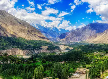
Explore more of Gilgit-Baltistan
Explore Gilgit-Baltistan’s glacier-carved valleys, historic forts, high plateaux and mountaineering routes across northern Pakistan.
Explore Gilgit-Baltistan
Explore more of Pakistan
Discover Pakistan: A land of majestic mountains, rich history, and delicious cuisine, where every journey is an adventure and every moment is filled with wonder.
Explore Pakistan