

University City (Philadelphia) Travel Guide - Free
Explore University City in Philadelphia with Evendo's free guide. Find the best shops, historic streets, restaurants, and gems on web or mobile.


University City, Philadelphia blends Penn and Drexel campuses, museums, research, global dining and West Philadelphia street life beside the Schuylkill River.
Campuses and City Life
University City occupies a broad stretch of West Philadelphia shaped above all by the University of Pennsylvania and Drexel University. Its centre is a meeting place of academic quads, research buildings, teaching hospitals, Victorian row houses, student apartments and busy commercial blocks, with the Schuylkill River and 30th Street Station forming important eastern landmarks. The district is not a single ornamental campus: it is a working part of Philadelphia where students, researchers, hospital staff, long-established residents and visitors share streets such as Walnut, Chestnut, Market and 40th Street.Read more about University City
Architecture, Museums and Public Spaces
Food, Music and Everyday Movement
Best attractions in University City
University City’s principal attractions are concentrated around its two major campuses and the cultural institutions that accompany them. The University of Pennsylvania Museum of Archaeology and Anthropology presents collections and exhibitions spanning ancient civilisations, while the Institute of Contemporary Art, on the Penn campus, focuses on contemporary artists and changing exhibitions. Penn’s central grounds reward an unhurried architectural walk, with tree-lined paths, sculptures and historic university buildings around Locust Walk and College Green. Drexel University adds a contrasting urban campus, including the Great Court and Main Building, while World Cafe Live offers a music-led evening venue near the eastern edge. The district’s streets also reveal the scale of Philadelphia’s academic and medical economy, from laboratories to teaching hospitals. Nearby 30th Street Station lies on the neighbourhood’s eastern boundary and is worth seeing for its monumental interior, though it functions primarily as a transport hub rather than a museum.
-
Zoo
Philadelphia Zoo
Discover the beauty of wildlife at Philadelphia Zoo, home to over 1,300 animals and dedicated to conservation and education.
6 min drive · 2.1 km from neighbourhood centre
-
Science museum
The Franklin Institute
Discover interactive science exhibits, IMAX films, and a planetarium at The Franklin Institute in Philadelphia, a top-rated destination for families and science lovers.
6 min drive · 2.0 km from neighbourhood centre
-
Museum
Penn Museum
Discover ancient civilizations and diverse cultures at the Penn Museum in Philadelphia, a must-visit destination for history lovers.
7 min walk · 0.5 km from neighbourhood centre
-
Park
Drexel Park
Explore Drexel Park, a scenic green escape in Philadelphia, offering stunning skyline views, vibrant flora, and a peaceful retreat from the urban hustle.
14 min walk · 1.1 km from neighbourhood centre


Best landmarks in University City
University City’s landmarks express Philadelphia’s transformation into an educational, medical and transport centre. The University of Pennsylvania’s College Green and surrounding historic buildings form the district’s most coherent architectural ensemble, with Locust Walk providing a memorable pedestrian spine through the campus. The Penn Museum is both a cultural institution and a substantial landmark, while Drexel University’s Main Building and Great Court represent the older part of the institution’s urban presence. At the eastern edge, 30th Street Station is a monumental Pennsylvania Railroad-era structure whose classical design and vast waiting room still convey the importance of intercity rail. The Cira Centre, rising beside the station, provides a sharply contemporary counterpoint. The University City Science Center’s research buildings and the major Penn Medicine complexes are less ornamental but equally significant to the neighbourhood’s modern identity.
-
Park
Clark Park
Explore the lush landscapes and vibrant community events at Clark Park, a delightful urban oasis in the heart of West Philadelphia.
17 min walk · 1.4 km from neighbourhood centre
-
Park
Drexel Park
Discover tranquility at Drexel Park, a stunning urban park in Philadelphia featuring lush greenery and breathtaking skyline views.
14 min walk · 1.1 km from neighbourhood centre
-
Park
Penn Park
Experience tranquility and urban beauty at Penn Park, a scenic retreat in the heart of Philadelphia, perfect for relaxation, picnics, and outdoor fun.
11 min walk · 0.8 km from neighbourhood centre
-
Cemetery
The Woodlands
Discover the peaceful beauty and historical significance of The Woodlands, a unique arboretum and cemetery in the heart of Philadelphia.
14 min walk · 1.1 km from neighbourhood centre


Explore University City on the map
A handpicked selection of must-see spots in University City, mapped for you.
Best hotels in University City
Best restaurants in University City
University City’s dining scene reflects the habits of a large student population, an international academic community and the staff and visitors of major hospitals. Food trucks cluster around university campuses, offering a quick and varied alternative to sit-down restaurants, while Walnut, Chestnut and Sansom streets provide cafés, casual dining and more polished restaurants. White Dog Cafe is a long-established local name associated with university-area dining, and the neighbourhood also has reliable options for pizza, noodles, Middle Eastern food, vegetarian meals and coffee without presenting one single culinary tradition as dominant. Penn’s campus cafés and university food outlets add practical daytime choices, though access may depend on the building or institution. For a more residential West Philadelphia dining atmosphere, nearby Baltimore Avenue and Spruce Hill offer additional options, but they should not be confused with University City’s central restaurant cluster.
-
American
Sabrina's Cafe
Discover Sabrina's Cafe: A top American restaurant in University City offering delicious brunches with vegan options in Philadelphia.
11 min walk · 0.9 km from neighbourhood centre
-
American
White Dog Cafe University City
Experience the charm of White Dog Cafe University City - where American cuisine meets vegetarian delights in a cozy setting.
2 min walk · 0.2 km from neighbourhood centre
-
Mexican
Copabanana University City
Experience the delightful fusion of Mexican flavors and American favorites at Copabanana University City in Philadelphia.
9 min walk · 0.7 km from neighbourhood centre
-
Pakistani
Kabobeesh
Experience authentic Pakistani flavors at Kabobeesh in West Philadelphia – where every dish tells a story.
13 min walk · 1.1 km from neighbourhood centre


Best bars in University City
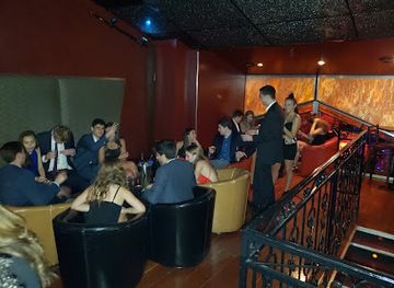
Nightlife in University City is shaped more by campus culture, live music and casual bars than by a concentrated nightclub district. World Cafe Live, near 30th Street, is the neighbourhood’s best-known dedicated music venue, hosting performances across a range of genres in an intimate setting. Bars and restaurant lounges around Walnut, Chestnut and Sansom streets attract students, university staff and visitors, while hotel and campus venues provide quieter evening options. The area can feel active around performance times and term-time social gatherings, but much of the district becomes subdued after institutional offices close. Nearby Spruce Hill and the wider Baltimore Avenue corridor have additional pubs and bars, although they are outside the core University City area. Check individual venue programmes and entry arrangements before setting out, as the evening scene is event-led rather than continuously club-focused.
-
Irish pub
New Deck Tavern
Discover the vibrant atmosphere of New Deck Tavern, a delightful Irish pub in West Philadelphia, offering an authentic taste of local culture.
3 min walk · 0.2 km from neighbourhood centre
-
Restaurant
Louie Louie
Louie Louie: A vibrant dining experience in West Philadelphia with a diverse menu and a lively lounge atmosphere.
1 min walk · 0.1 km from neighbourhood centre
-
Bar
Local 44 Restaurant & Bar
Discover Local 44, a vibrant bar and brunch restaurant in West Philadelphia, offering craft beers, delightful dishes, and a welcoming atmosphere.
16 min walk · 1.3 km from neighbourhood centre
-
Sports bar
The Post
Experience the thrill of sports and great food at The Post, Philadelphia's premier sports bar and pool hall.
12 min walk · 1.0 km from neighbourhood centre


Best nightclubs in University City
Nightlife in University City is shaped more by campus culture, live music and casual bars than by a concentrated nightclub district. World Cafe Live, near 30th Street, is the neighbourhood’s best-known dedicated music venue, hosting performances across a range of genres in an intimate setting. Bars and restaurant lounges around Walnut, Chestnut and Sansom streets attract students, university staff and visitors, while hotel and campus venues provide quieter evening options. The area can feel active around performance times and term-time social gatherings, but much of the district becomes subdued after institutional offices close. Nearby Spruce Hill and the wider Baltimore Avenue corridor have additional pubs and bars, although they are outside the core University City area. Check individual venue programmes and entry arrangements before setting out, as the evening scene is event-led rather than continuously club-focused.
-
Night club
Concourse
Discover Concourse, Philadelphia's trendy night club where music, dancing, and vibrant nightlife come together for an unforgettable experience.
7 min drive · 2.3 km from neighbourhood centre
-
Caribbean
Festivals Restaurant & Lounge
Discover the flavors of the Caribbean at Festivals Restaurant & Lounge, where vibrant cuisine meets lively entertainment in West Philadelphia.
8 min drive · 2.7 km from neighbourhood centre
-
Social club
Pulse Nightclub & Bar
Discover the heartbeat of Philadelphia's nightlife at Pulse Nightclub & Bar, where music, dancing, and fun collide in an unforgettable experience.
7 min drive · 2.4 km from neighbourhood centre
-
Lounge
Spades Restaurant & Lounge | SpadesPHL
Experience the vibrant culinary scene at Spades Restaurant & Lounge in West Philadelphia, where delicious food and lively atmosphere await.
17 min walk · 1.4 km from neighbourhood centre



Best shops in University City
Shopping in University City is practical, student-oriented and closely tied to daily campus life rather than organised around a traditional retail street. Walnut, Chestnut and Sansom streets contain cafés, convenience shops, pharmacies, book retailers and services used by residents and university communities, while independent food trucks and small eateries contribute to the commercial rhythm. University bookstores and campus shops are useful for branded clothing, academic titles and Philadelphia-themed gifts, although access and stock vary by institution. The district has fewer specialist boutiques, antiques dealers or large markets than central Philadelphia, and visitors should not expect a standalone bazaar. For a broader independent retail experience, nearby Baltimore Avenue and the surrounding West Philadelphia neighbourhoods offer more small businesses and community-oriented shopping, but those areas lie beyond University City’s commonly understood core.
-
Metaphysical supply store
Ritual Space by Angela Monaco
Discover the essence of spirituality at Ritual Space, Philadelphia's premier metaphysical supply store featuring unique jewelry and holistic products.
5 min drive · 1.8 km from neighbourhood centre
-
Variety store
Jinxed West Philly
Explore Jinxed West Philly, a variety store featuring unique antiques and eclectic finds, celebrating the charm of Philadelphia's rich history.
5 min drive · 1.6 km from neighbourhood centre
-
Gift shop
VIX Emporium
Explore VIX Emporium in Cedar Park, Philadelphia - your destination for unique gifts, local crafts, and unforgettable souvenirs.
8 min drive · 2.5 km from neighbourhood centre
-
Gift shop
Hello World Modern Mercantile
Explore Hello World Modern Mercantile, a unique gift shop in Philadelphia offering handcrafted treasures and local artisan goods.
2 min walk · 0.1 km from neighbourhood centre


University City essentials
Getting There
Getting Around
Safety
Emergency Situations
Do's and Don'ts
Local Tips

From Eve
Local phrases worth knowing
You don't need to get them perfect. A few words go a long way, and locals appreciate the effort.
Basics
| English | Local | Say it |
|---|---|---|
| Hello | Hey | [hey] |
| Goodbye | See ya | [see ya] |
| Yes | Yeah | [yeah] |
| No | Nah | [nah] |
| Please/You're welcome | Please/No problem | [please/no problem] |
| Thank you | Thanks | [thanks] |
| Excuse me/Sorry | Excuse me/Sorry | [excuse me/sorry] |
| How are you? | How you doin'? | [how you doin'] |
| Fine. And you? | I'm good. You? | [i'm good. you?] |
| Do you speak English? | Ya speak English? | [ya speak english?] |
| I don't understand | I don't get it | [i don't get it] |
Eating & Drinking
| English | Local | Say it |
|---|---|---|
| I'd like to see the menu, please | Can I check the menu? | [can i check the menu?] |
| I don't eat meat | I'm vegetarian | [i'm vegetarian] |
| Cheers! | Cheers! | [cheers!] |
| I would like to pay, please | Check, please | [check, please] |
Emergencies
| English | Local | Say it |
|---|---|---|
| Help! | Help! | [help!] |
| Go away! | Get lost! | [get lost!] |
| Call the Police! | Call the cops! | [call the cops!] |
| Call a doctor! | Call a doc! | [call a doc!] |
| I'm lost | I'm lost | [i'm lost] |
| I'm ill | I'm sick | [i'm sick] |
Shopping
| English | Local | Say it |
|---|---|---|
| I'd like to buy... | I wanna buy... | [i wanna buy...] |
| I'm just looking | Just browsing | [just browsing] |
| How much is it? | How much? | [how much?] |
| That's too expensive | Too pricey | [too pricey] |
| Can you lower the price? | Can you do better? | [can you do better?] |
Time & Numbers
| English | Local | Say it |
|---|---|---|
| What time is it? | What time is it? | [what time is it?] |
| It's one o'clock | It's one | [it's one] |
| Half past (10) | Ten-thirty | [ten-thirty] |
| Morning | Morning | [morning] |
| Afternoon | Afternoon | [afternoon] |
| Evening | Evening | [evening] |
| Yesterday | Yesterday | [yesterday] |
| Today | Today | [today] |
| Tomorrow | Tomorrow | [tomorrow] |
| 1 | One | [one] |
| 2 | Two | [two] |
| 3 | Three | [three] |
| 4 | Four | [four] |
| 5 | Five | [five] |
| 6 | Six | [six] |
| 7 | Seven | [seven] |
| 8 | Eight | [eight] |
| 9 | Nine | [nine] |
| 10 | Ten | [ten] |
Transport & Directions
| English | Local | Say it |
|---|---|---|
| Where's a/the...? | Where's the...? | [where's the...?] |
| What's the address? | What's the address? | [what's the address?] |
| Can you show me (on the map)? | Can you show me (on the map)? | [can you show me (on the map)?] |
| When's the next (bus)? | When's the next (bus)? | [when's the next (bus)?] |
| A ticket (to ....) | A ticket (to ....) | [a ticket (to ....)] |
History of University City
From Rural District to Westward Expansion
Before Philadelphia expanded west of the Schuylkill, the area now associated with University City consisted largely of farms, estates and country roads in the former Blockley Township. The opening of the permanent Market Street Bridge in 1805 strengthened the connection with the established city east of the river, encouraging development along westward routes. Urbanisation accelerated during the nineteenth century as Philadelphia’s population grew and improved roads, horse-drawn transport and later streetcars made the district more accessible. The area’s modern identity began to take shape when educational and medical institutions moved or expanded into this formerly semi-rural landscape.
The University of Pennsylvania Moves West
The University of Pennsylvania relocated from the old Ninth Street campus to West Philadelphia in the 1870s, establishing a substantial academic presence beside what became Woodland Cemetery and the developing street grid. The new campus helped turn the surrounding district into an institutional and residential quarter, attracting faculty housing, shops, churches and transport links. Its buildings also introduced a distinctive collegiate architectural language, later associated particularly with the work of Frank Furness and the revival styles used across the campus. The move was part of a wider nineteenth-century transformation that connected higher education with Philadelphia’s expanding western districts.
Railways, Drexel and the Modern District
Railway construction gave the eastern edge of University City a powerful new role. Broad Street Station opened in 1881 nearby, while the Pennsylvania Railroad’s 30th Street Station, completed in 1934, created a monumental gateway beside the Schuylkill. Drexel Institute, founded in 1891 by financier Anthony J. Drexel, developed into Drexel University and became another defining institution in the district. During the twentieth century, universities, hospitals and research organisations expanded their landholdings and facilities, sometimes replacing older housing and industrial buildings. The result was an increasingly specialised urban landscape linked to education, medicine, transport and scientific research.
University City Takes Shape
The name University City gained wider currency during the post-war period as local institutions, planners and businesses sought a common identity for the area around Penn and Drexel. Redevelopment brought major laboratories, healthcare facilities, office towers and new housing, while community organisations and long-established residents continued to shape the surrounding streets. The opening of the University City Science Center in 1963 reinforced the district’s research character and helped attract technology and biomedical enterprises. Contemporary University City therefore combines historic campuses and row-house streets with large institutional projects, reflecting both Philadelphia’s academic economy and the continuing debates over development, access and neighbourhood identity.
University City in Photos
Browse through our photo collection highlighting the charm and character of the destination.
Neighbourhoods near University City
The closest neighbourhoods to University City, if you have time for more than one stop.
-
-

-

-

-


Swipe for more neighbourhoods
Explore more

Explore more of Philadelphia
Philadelphia combines Revolutionary history, world-class museums, cheesesteaks and lively neighbourhoods with riverfront trails and celebrated American landmarks.
Explore Philadelphia