

Mt. Mayon Travel Guide - Free Web & App
Your ultimate guide to Mt. Mayon. Discover top landmarks, proposed trips, and local tips. Free on the web or via the Evendo companion app.


Mt. Mayon in the Philippines pairs a near-perfect volcanic cone with Albay’s heritage, viewpoints, paddy fields, lava trails and active outdoor adventures.
Volcanic Landscape
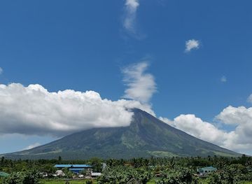
Mt. Mayon rises above Albay in the eastern Philippines as one of the country’s most recognisable natural landmarks. Its near-symmetrical cone dominates the landscape around Legazpi City and the municipalities of Daraga, Camalig, Guinobatan, Malilipot, Santo Domingo and Bacacay, although the volcano itself is an active and carefully monitored geological environment rather than an ordinary mountain recreation area. Forested lower slopes, cultivated fields, lava-formed terrain and broad views across Albay Gulf create a changing backdrop as the weather moves across the peak.Read more about Mt. Mayon
Heritage and Human Stories
Exploring the Foothills
When is the best time to visit Mt. Mayon?
Best: December–February · 27–28°C| Month | High (°C) | Rainfall (mm) |
|---|---|---|
| January (best) | 28 | 40 |
| February (best) | 27 | 40 |
| March | 28 | 40 |
| April | 29 | 40 |
| May | 30 | 40 |
| June | 30 | 40 |
| July | 29 | 40 |
| August | 29 | 40 |
| September | 29 | 40 |
| October | 29 | 40 |
| November | 28 | 40 |
| December (best) | 28 | 40 |
Getting to and around Mt. Mayon
How to get there
Transportation
Best attractions in Mt. Mayon
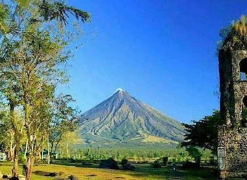
The Cagsawa Ruins in Daraga offer Mayon’s most recognisable historical view, with the surviving church bell tower set against the volcanic cone when skies are clear. Around the lower slopes, the Mayon Volcano Natural Park landscape includes forest, lava formations, agricultural land and drainage channels shaped by past eruptions, although access depends on official restrictions. Ligñon Hill Nature Park in Legazpi provides a relatively accessible elevated perspective over the city, Albay Gulf and Mayon, while the Legazpi Boulevard waterfront gives a broad lowland view. Camalig and Guinobatan are useful starting points for exploring rural scenery and authorised ATV or hiking routes, and the Quitinday Green Hills near Camalig add rolling grass-covered terrain to the regional landscape. In the wider Albay area, Daraga Church contributes an important architectural and cultural stop, while farms, coconut groves and village roads reveal how closely everyday life remains connected to the volcano.
-
 Park
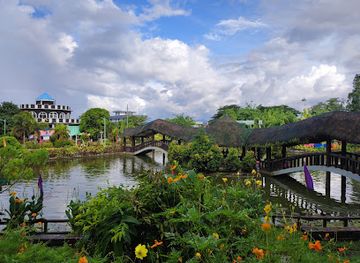
Ligñon Hill Nature Park
Explore Ligñon Hill Nature Park, a breathtaking natural preserve in Albay, Philippines, perfect for hiking, birdwatching, and enjoying stunning views of Mayon Volcano.
-
Zoo
Albay Park & Wildlife
Explore Albay Park & Wildlife, a family-friendly zoo and park in Legazpi City, featuring diverse animal species and beautiful landscapes.
-
Historical landmark
Quituinan Hill
Experience the breathtaking views and historical significance of Quituinan Hill, a serene landmark in Albay, Philippines, perfect for nature lovers and explorers.
-
Tourist attraction
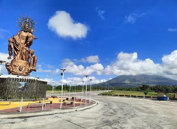
Giant Statue of Nuestra Señora de Salvacion
Explore the Giant Statue of Nuestra Señora de Salvacion in Legazpi City, a stunning symbol of faith with breathtaking views of Mayon Volcano.
Best landmarks in Mt. Mayon
Mt. Mayon itself is Albay’s defining natural landmark, its steep cone rising from fertile lowlands and marked by the lava flows and channels of successive eruptions. The Cagsawa Bell Tower is the most important historic emblem associated with the volcano: the surviving remnant of a church overwhelmed during the 1814 eruption and preserved within the Cagsawa Ruins in Daraga. Daraga Church, formally the Church of Nuestra Señora de la Porteria, is another significant regional landmark, known for its elevated position and volcanic-stone construction. Ligñon Hill forms a prominent urban viewpoint in Legazpi, looking towards Mayon and Albay Gulf, while the black and forested foothill terrain records the mountain’s continuing geological activity. Together these natural and built features express the region’s central story: fertile settlement and cultural life developed beneath a volcano that remains active and capable of reshaping its surroundings.
-
National park
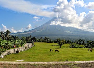
Mayon Volcano Natural Park
Experience the breathtaking beauty of Mayon Volcano Natural Park, a natural wonder in Albay, Philippines, known for its perfect cone shape and rich biodiversity.
-
Nature preserve
Mayon Volcano Center Point
Experience the breathtaking beauty of Mayon Volcano at the Center Point, a nature preserve that offers stunning views and unforgettable adventures in Albay.
-
Volcano
Mayon Volcano
Experience the breathtaking beauty of Mayon Volcano, an iconic natural wonder in Albay, Philippines, renowned for its perfect cone shape and rich biodiversity.
-
Tourist attraction
Mayon best view
Experience the stunning beauty of Mayon Volcano with its iconic cone shape and rich cultural heritage in Albay, Philippines.
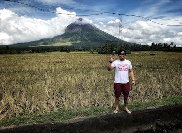
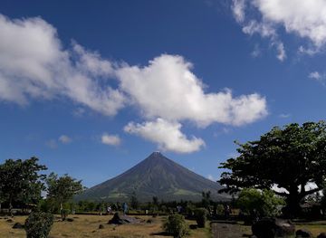
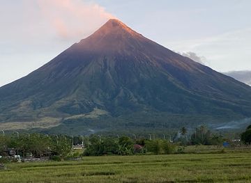
Explore Mt. Mayon on the map
Plan your trip on one map. See where the top attractions, landmarks, restaurants and hotels are, and book hotels and experiences in a few clicks.
Best hotels in Mt. Mayon
Best restaurants in Mt. Mayon
Dining around Mt. Mayon is concentrated in Legazpi City, Daraga and the larger Albay municipalities rather than on the mountain itself. Bicolano cooking is known for the use of coconut milk and chilli, with laing and Bicol Express among the region’s best-known dishes; menus also draw on rice, vegetables, pork, chicken and seafood from the surrounding coast and countryside. Legazpi and Daraga offer the broadest choice of restaurants, cafés and casual eateries, while Camalig and other foothill communities have smaller local establishments and food businesses. Pili nuts, a crop strongly associated with Bicol, appear in sweets, pastries and savoury products. Visitors joining early excursions should not assume that food is available at rural launch points, so local dining arrangements and packed refreshments may be useful for longer days outside the main settlements.
-
Filipino
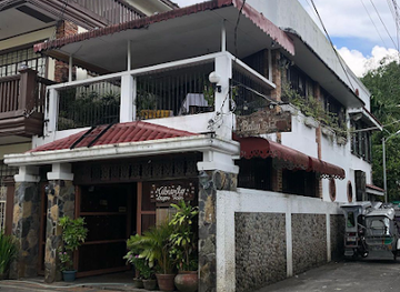
Casa Lorenzo Food and Culture
Experience authentic Filipino cuisine at Casa Lorenzo in Legazpi City – where flavor meets culture in every dish.
-
Restaurant
Catyel's Kinalas & Restaurant
Experience authentic Filipino cuisine at Catyel's Kinalas & Restaurant in Santo Domingo - where every dish tells a story.
-
Restaurant
Balay sa Bikol
Experience authentic Filipino flavors at Balay sa Bikol—a cozy restaurant and café in Daraga offering a taste of Bicol's culinary heritage.
-
Restaurant
Socorro's Lakeside Restaurant and Grill
Experience authentic Filipino flavors amidst stunning lakeside views at Socorro's Lakeside Restaurant and Grill in Camalig.
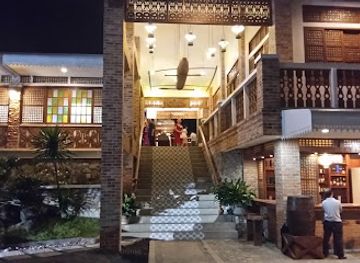

Best bars in Mt. Mayon
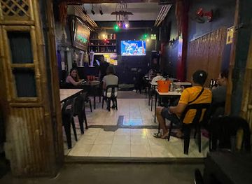
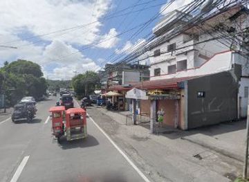
Evening entertainment around Mt. Mayon is centred on Legazpi City rather than the volcano’s rural slopes. The city has the region’s broadest selection of hotel bars, casual drinking places, cafés and restaurants where visitors can spend the evening, while Daraga provides a more local, settlement-based atmosphere. Around viewpoints and foothill communities, nights are generally quiet, with small eateries and neighbourhood establishments rather than a concentrated club scene. Some hotels and venues may present live music or seasonal events, but availability changes and should be checked locally. The waterfront and central urban areas can be pleasant for an evening walk, although visitors should treat the boulevard and roads as public spaces rather than assume every section offers late-night facilities. Rural bases around Mayon are better suited to early starts, landscape views and conversation than to nightlife.
-
Bar
Highway 21
Discover the vibrant nightlife at Highway 21, a lively bar in Daraga, Albay, offering an eclectic drink menu and a welcoming atmosphere.
-
Grill
Marcianos Bar and Restaurant
Experience unforgettable dining with grilled specialties and stunning coastal views at Marcianos Bar and Restaurant in Albay.
-
Grill
URBAN Escape Grill and Resto Bar
Experience the best grilled dishes and vibrant atmosphere at URBAN Escape Grill and Resto Bar in Daraga, Albay, a must-visit culinary destination.
-
Bar
Bamba Resto Bar
Experience the vibrant atmosphere and exquisite flavors of Bamba Resto Bar in Daraga, a must-visit destination for food and drink lovers.
Best nightclubs in Mt. Mayon
Evening entertainment around Mt. Mayon is centred on Legazpi City rather than the volcano’s rural slopes. The city has the region’s broadest selection of hotel bars, casual drinking places, cafés and restaurants where visitors can spend the evening, while Daraga provides a more local, settlement-based atmosphere. Around viewpoints and foothill communities, nights are generally quiet, with small eateries and neighbourhood establishments rather than a concentrated club scene. Some hotels and venues may present live music or seasonal events, but availability changes and should be checked locally. The waterfront and central urban areas can be pleasant for an evening walk, although visitors should treat the boulevard and roads as public spaces rather than assume every section offers late-night facilities. Rural bases around Mayon are better suited to early starts, landscape views and conversation than to nightlife.
-
Disco club
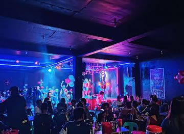
GMUSIC DISCO HOUSE
Discover the vibrant nightlife of Tabaco City at GMUSIC DISCO HOUSE, where music and culture collide for an unforgettable experience.
Best shops in Mt. Mayon
Shopping for Mayon-related products is concentrated in Legazpi City, Daraga and other established Albay settlements rather than at remote viewpoints. Pili-nut sweets, roasted nuts, pastries and other Bicol food products are among the most characteristic purchases, while local markets and small food shops provide regional ingredients and snacks. Visitors may also encounter abaca-based goods, woven items, handicrafts and souvenir products associated with Bicol, although selection varies between businesses and communities. Public markets offer a more everyday view of local commerce than formal tourism retail, with produce, seafood and household goods reflecting Albay’s agricultural and coastal economy. Cagsawa and other popular stops have souvenir stalls, but visitors exploring the foothills should not expect extensive retail facilities. For practical purchases, transport supplies and a wider choice of shops, Legazpi is the most dependable base.
-
Gift shop
N. Bolaños Handicraft
Explore N. Bolaños Handicraft for authentic Filipino souvenirs and unique gifts, reflecting the artistry and culture of the beautiful Albay region.
-
Convenience store
Napay Store
Discover the essence of local life at Napay Store, your go-to convenience store in Camalig for snacks, essentials, and a taste of Filipino culture.
-
General store
Matocinos Store
Explore Matocinos Store in Daraga for an authentic shopping experience filled with local crafts, delicious snacks, and warm hospitality.
-
General store
Miravalles Store
Discover the charm of local shopping at Miravalles Store in Daraga, Albay, a treasure trove of goods and cultural experiences.
Get your free copy of our complete guide to Mt. Mayon, delivered straight to you.
Everything on this page, from attractions and restaurants to essentials and local phrases, in one PDF you can read offline, print or share.
Already have an account? Sign in
Your Mt. Mayon guide is ready.
We'll send it to · Not you? Sign out

Getting your guide ready…
We are putting together a fresh copy of the Mt. Mayon guide. This can take up to a minute.
This can take a few moments. If your browser asks, choose Allow so the download can start. You'll find the guide in your Downloads folder.
Nothing happened? Download it again
Sorry, the guide is taking longer than usual. Please try again in a minute, or get it by email instead.
Mt. Mayon essentials
Currency and Payment
Safety
Emergency Situations
Do's and Don'ts
Local Tips
From Eve
Local phrases worth knowing
You don't need to get them perfect. A few words go a long way, and locals appreciate the effort.
Basics
| English | Local | Say it |
|---|---|---|
| Hello | Kamusta | [ka-mu-sta] |
| Goodbye | Paalam | [pa-a-lam] |
| Yes | Oo | [o-o] |
| No | Hindi | [hin-di] |
| Please/You're welcome | Mangyari/Lubos na kasiyahan | [man-gya-ri/lu-bos na ka-si-ya-han] |
| Thank you | Salamat | [sa-la-mat] |
| Excuse me/Sorry | Patawad/Pasensya | [pa-ta-wad/pa-sen-sya] |
| How are you? | Kamusta ka? | [ka-mu-sta ka?] |
| Fine. And you? | Mabuti. Ikaw? | [ma-bu-ti. i-kaw?] |
| Do you speak English? | Nagsasalita ka ba ng Ingles? | [nag-sa-sa-li-ta ka ba ng in-gles?] |
| I don't understand | Hindi ko maintindihan | [hin-di ko main-tin-di-han] |
Eating & Drinking
| English | Local | Say it |
|---|---|---|
| I'd like to see the menu, please | Gusto ko sanang makita ang menu, pakiusap | [gus-to ko sa-nang ma-ki-ta ang me-nu, pa-ki-u-sap] |
| I don't eat meat | Hindi ako kumakain ng karne | [hin-di a-ko ku-ma-ka-in ng kar-ne] |
| Cheers! | Mabuhay! | [ma-bu-hay] |
| I would like to pay, please | Gusto ko sanang magbayad, pakiusap | [gus-to ko sa-nang mag-ba-ya-d, pa-ki-u-sap] |
Emergencies
| English | Local | Say it |
|---|---|---|
| Help! | Tulong! | [tu-long] |
| Go away! | Umalis ka! | [u-ma-lis ka!] |
| Call the Police! | Tumawag ng Pulis! | [tu-ma-wag ng pu-lis!] |
| Call a doctor! | Tumawag ng doktor! | [tu-ma-wag ng dok-tor!] |
| I'm lost | Nawawala ako | [na-wa-wa-la a-ko] |
| I'm ill | May sakit ako | [may sa-kit a-ko] |
Shopping
| English | Local | Say it |
|---|---|---|
| I'd like to buy... | Gusto ko bumili ng... | [gus-to ko bu-mi-li ng] |
| I'm just looking | Nagmamasid lang ako | [nag-ma-ma-sid lang a-ko] |
| How much is it? | Magkano ito? | [mag-ka-no i-to?] |
| That's too expensive | Masyadong mahal iyan | [ma-sya-dong ma-hal i-yan] |
| Can you lower the price? | Pwede bang babaan ang presyo? | [pwe-de bang ba-ba-an ang pres-yo?] |
Time & Numbers
| English | Local | Say it |
|---|---|---|
| What time is it? | Anong oras na? | [a-nong o-ras na?] |
| It's one o'clock | Alas-uno na | [a-las-u-no na] |
| Half past (10) | Alas-diyes y medya | [a-las-di-yes y med-ya] |
| Morning | Umaga | [u-ma-ga] |
| Afternoon | Hapon | [ha-pon] |
| Evening | Gabi | [ga-bi] |
| Yesterday | Kahapon | [ka-ha-pon] |
| Today | Ngayon | [nga-yon] |
| Tomorrow | Bukas | [bu-kas] |
| 1 | Isa | [i-sa] |
| 2 | Dalawa | [da-la-wa] |
| 3 | Tatlo | [tat-lo] |
| 4 | Apat | [a-pat] |
| 5 | Lima | [li-ma] |
| 6 | Anim | [a-nim] |
| 7 | Pito | [pi-to] |
| 8 | Walo | [wa-lo] |
| 9 | Siyam | [si-yam] |
| 10 | Sampu | [sam-pu] |
Transport & Directions
| English | Local | Say it |
|---|---|---|
| Where's a/the...? | Nasaan ang...? | [na-sa-an ang...?] |
| What's the address? | Ano ang address? | [a-no ang ad-dres?] |
| Can you show me (on the map)? | Pwede mo akong ipakita (sa mapa)? | [pwe-de mo a-kong i-pa-ki-ta (sa ma-pa)?] |
| When's the next (bus)? | Kailan ang susunod na (bus)? | [ka-i-lan ang su-su-nod na (bus)?] |
| A ticket (to ....) | Isang tiket (papuntang ...) | [i-sang ti-ket (pa-pun-tang ...)] |
History of Mt. Mayon
A Young Active Volcano
Mayon is a stratovolcano formed by repeated eruptions of lava, ash and other volcanic material along the Bicol volcanic arc. Its steep cone is the product of successive eruptions over geological time, while lava flows, ash deposits and lahar channels continue to reshape the lower landscape. The volcano remains active and is monitored by the Philippine Institute of Volcanology and Seismology, known as PHIVOLCS. Its geological history is therefore not simply a distant story of formation: eruptions and associated hazards continue to influence settlement, agriculture, road building and land management around Albay.
Early Communities and Albay Tradition
Long before modern tourism, communities around Mayon cultivated the fertile volcanic lowlands and developed traditions tied to the mountain, agriculture and the wider Bicol region. The volcano features in local folklore, including stories associated with Daragang Magayon, a tragic heroine whose name is commonly linked with the mountain and the province of Albay. These traditions remain part of the region’s cultural identity, although the landscape’s history is also grounded in everyday farming, fishing, trade and settlement around the fertile plains and coastal waters.
Spanish-Era Settlements and Cagsawa
Spanish colonial influence shaped the towns and religious settlements around Mayon, including Cagsawa, which developed around a Franciscan church in what is now Daraga. The eruption of 1 February 1814 devastated communities around the volcano and buried much of Cagsawa Church, leaving its bell tower as the best-known surviving element. The tower and surrounding ruins became a powerful historical symbol of Mayon’s destructive force and of the repeated relationship between Albay’s communities and the volcano.
Eruptions, Evacuation and Resilience
Mayon has erupted many times since the Spanish period, with significant episodes recorded in the nineteenth, twentieth and twenty-first centuries. Major eruptions and rainfall-triggered lahars have repeatedly damaged homes, farmland and infrastructure, while evacuation systems have become an essential part of life in the surrounding municipalities. The 2006 eruption was followed by destructive lahars during Typhoon Durian, demonstrating how volcanic risk can combine with extreme weather. More recent eruptive activity, including episodes in 2018 and 2023, has reinforced the importance of scientific monitoring and locally managed exclusion zones.
Conservation and Responsible Tourism
As pressure from settlement, farming and tourism increased, the volcano and its surrounding habitats became the focus of formal environmental management. Mayon Volcano Natural Park was established to protect the mountain’s forested and volcanic landscapes, while the wider Albay Biosphere Reserve, recognised by UNESCO in 2016, reflects the region’s connected ecological and cultural values. Contemporary tourism increasingly centres on controlled viewpoints, heritage interpretation and authorised outdoor activities, with access adjusted according to volcanic conditions and conservation requirements.
Mt. Mayon in Photos
Browse through our photo collection highlighting the charm and character of the destination.
Neighbouring destination travel guides
The closest destinations to Mt. Mayon, if you have time for more than one.
-

-

-

-

-


Swipe for more destinations
Explore more

Explore more of Bicol Region
Explore the Bicol Region for Mayon Volcano, Pacific beaches, island landscapes, whale sharks and a celebrated chilli-and-coconut cuisine.
Explore Bicol Region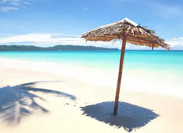
Explore more of Philippines
Discover the Philippines: A tropical paradise of islands, rich history, and warm hospitality, perfect for adventurers and relaxation seekers alike.
Explore Philippines