

Free Matam Travel Guide & Mobile App
Explore Matam with free travel guides. Discover regional history, expert tips, proposed trips, and audio guides on web or mobile app.


Explore Matam in northern Senegal for Senegal River landscapes, Pulaar culture, Sahelian pastoral life and the historic traditions of Fouta-Toro.
Read more about Matam
When is the best time to visit Matam?
Best: November–January · 28–31°C| Month | High (°C) | Rainfall (mm) |
|---|---|---|
| January (best) | 28 | 0 |
| February | 31 | 0 |
| March | 35 | 0 |
| April | 38 | 0 |
| May | 42 | 2 |
| June | 44 | 10 |
| July | 42 | 40 |
| August | 40 | 100 |
| September | 37 | 50 |
| October | 33 | 10 |
| November (best) | 31 | 1 |
| December (best) | 28 | 0 |
Getting to and around Matam
How to get there
Transportation
Destinations in Matam
Resorts, valleys and scenic spots worth a trip of their own.

Swipe for more destinations
Best attractions in Matam
Matam’s attractions are primarily landscapes, living communities and cultural experiences rather than a dense collection of ticketed monuments. The Senegal River corridor offers opportunities to observe irrigated agriculture, fishing activity, riverside settlement and the changing vegetation of the northern Sahel, while towns such as Matam and Kanel provide markets and an introduction to everyday regional commerce. The wider Fouta-Toro cultural area is important for Pulaar history, Islamic scholarship and oral traditions, best explored through respectful local interpretation rather than hurried sightseeing. Southwards, the Ferlo presents a markedly different environment of open scrub, wells, seasonal grazing and long horizons. Wildlife viewing is not organised on the scale of Senegal’s major parks, and visitors should avoid making unsupervised approaches to livestock camps or remote wells. Cultural tourism, village visits arranged in advance, agricultural observation and overland journeys are more realistic than a conventional attraction circuit. The experience depends heavily on season, road conditions and local relationships, so a guide, driver or host is valuable for arranging access and explaining the region’s environmental contrasts.
-
Mountain peak
Deux Mamelles
Discover the breathtaking views and exhilarating hikes at Deux Mamelles, an iconic mountain peak near Dakar, Senegal.
-
Island
Carabane
Experience the serene beauty and rich history of Carabane Island, a hidden gem in Senegal perfect for relaxation and cultural exploration.


Best landmarks in Matam
The Senegal River is Matam’s defining natural landmark, forming a broad, fertile corridor against the drier Sahel and marking the northern edge of the region. Its banks are more than a scenic setting: they express the region’s agricultural economy, cross-border history and dense network of settlements. The town of Matam, as the regional capital, is a civic and commercial reference point rather than a preserved historic city, with modern administrative buildings, markets and urban activity reflecting contemporary regional life. Kanel and other river-valley settlements contribute to the historic geography of Fouta-Toro through mosques, local religious communities and traditional patterns of cultivation, although many significant places are community landmarks rather than formal monuments. South of the river, the Ferlo’s open pastoral terrain is itself a geographical landmark, distinguished by scrub, seasonal grazing areas and widely spaced wells. The contrast between irrigated river land and dry inland expanses is the region’s most important visual and environmental marker. Visitors should approach religious buildings, village compounds and pastoral camps as living places, seeking permission rather than treating them as photographic objects.
-
Monument
African Renaissance Monument
Experience the grandeur of the African Renaissance Monument in Dakar, a towering symbol of pride and unity, offering breathtaking views and rich cultural insights.
-
Wildlife refuge
Bandia Reserve
Discover Bandia Reserve, a stunning wildlife refuge in Senegal, home to diverse animal species and breathtaking natural landscapes that invite exploration.
-
Tourist attraction
Place du Souvenir Africain
Discover the heart of African heritage at Place du Souvenir Africain in Dakar, where history, art, and culture converge in a tranquil setting.
-
Museum
House of Slaves
Discover the House of Slaves in Gorée Island, a poignant museum that reflects on the history of the Atlantic slave trade and its enduring impact on society.


Explore Matam on the map
Plan your trip on one map. See where the top cities, national parks and sights are, and book hotels and experiences in a few clicks.
Best hotels in Matam
Best restaurants in Matam
Dining in Matam is closely connected to household cooking, market supplies and Senegalese food traditions rather than a formal restaurant scene. Rice, millet, sorghum, vegetables and locally available fish or meat are important foods, with dishes such as thieboudienne, rice served with fish and vegetables, and thiebou yapp, rice with meat, found in the wider national culinary repertoire. In Pulaar communities, visitors may encounter hearty grain-based meals, sauces, milk products and preparations suited to farming and herding life. Small eateries and cafés in the main towns provide simple plates, tea and breakfast foods, while accommodation is the most reliable place to arrange meals in advance. River fish can be part of the local diet, but availability varies by season and location. Food is often shared, and accepting a host’s hospitality with thanks is more significant than seeking elaborate presentation. Bottled or treated water is advisable, especially outside established accommodation.
-
Restaurant
Restaurant Le Lagon 1
Experience exquisite seafood and stunning ocean views at Restaurant Le Lagon 1 in Dakar – a culinary gem that delights every visitor.
-
Restaurant
Restaurant La Pointe des Almadies
Experience authentic Senegalese cuisine with breathtaking ocean views at Restaurant La Pointe des Almadies in Dakar.
-
Restaurant
Restaurant Le N'Gor Pieds dans l'Eau
Savor fresh seafood and stunning ocean views at Restaurant Le N'Gor Pieds dans l'Eau in Dakar.
-
Restaurant
Alkimia
Experience exquisite dining at Alkimia in Dakar – where local flavors meet innovative culinary artistry amidst stunning ocean views.



Best bars in Matam
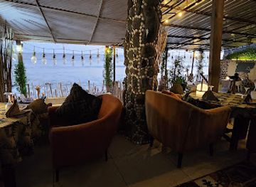
Matam does not have a major nightclub culture, and evening life is generally centred on family visits, tea, conversation, cafés and modest local eateries. In the regional capital and larger market towns, a small number of restaurants or hotel premises may offer a later social setting, but opening arrangements and entertainment change frequently. Alcohol is not central to public life in this predominantly Muslim region, and visitors should behave discreetly and respect local religious and social norms. The most distinctive evening experience may be sitting outdoors as temperatures fall, listening to conversation or music and watching activity around a market or town street. In rural areas, darkness, distance and limited electricity mean that nightlife is minimal; arrange transport before going out and do not expect a bar or club in every settlement.
-
Restaurant
Iroko beach
Discover the perfect blend of local cuisine and breathtaking ocean views at Iroko Beach in Saly.
-
Restaurant
Bayékou
Experience the best of Senegalese cuisine at Bayékou, a must-visit restaurant in the heart of Dakar known for its vibrant atmosphere and delicious dishes.
-
Restaurant
Exotik Beach
Experience the vibrant flavors of Senegal at Exotik Beach, a seaside restaurant offering fresh, delicious cuisine and stunning ocean views.
-
Bar
Kraken Pub
Experience the vibrant nightlife of Dakar at Kraken Pub, where every drink tells a story and every evening is a celebration.


Best nightclubs in Matam
Matam does not have a major nightclub culture, and evening life is generally centred on family visits, tea, conversation, cafés and modest local eateries. In the regional capital and larger market towns, a small number of restaurants or hotel premises may offer a later social setting, but opening arrangements and entertainment change frequently. Alcohol is not central to public life in this predominantly Muslim region, and visitors should behave discreetly and respect local religious and social norms. The most distinctive evening experience may be sitting outdoors as temperatures fall, listening to conversation or music and watching activity around a market or town street. In rural areas, darkness, distance and limited electricity mean that nightlife is minimal; arrange transport before going out and do not expect a bar or club in every settlement.
-
Disco club
CASTEL NIGHT CLUB
Discover the electrifying nightlife of Dakar at Castel Night Club, where music, dance, and a vibrant atmosphere create unforgettable experiences.
-
Disco club
King Night Club
Unleash your energy at King Night Club, Saly's premier disco destination for unforgettable nights filled with music, dance, and vibrant culture.
-
Disco club
Club Gaindé
Immerse yourself in the lively nightlife of Dakar at Club Gaindé, where traditional beats meet modern rhythms for an unforgettable experience.
-
Night club
Le Nabini Club
Dive into the heart of Dakar's nightlife at Le Nabini Club, where electrifying music and vibrant crowds create unforgettable nights.

Best shops in Matam
Shopping in Matam is concentrated in town markets and everyday trading areas rather than large retail centres. Visitors can look for locally traded rice, millet, onions and other agricultural produce from the Senegal River zone, as well as dates, tea, fabrics, household goods and practical supplies brought through regional commerce. Clothing and textiles reflect wider Senegalese and Sahelian tastes, while craft availability varies considerably between market days and towns. Matam and Kanel are more reliable places for basic shopping than remote Ferlo settlements, where choices are limited and shops may be widely spaced. Small purchases from local traders are more appropriate than expecting a specialised souvenir industry, and bargaining should remain courteous. If buying food, confirm how it was produced and transported before travelling long distances. Handmade items may be available through personal introductions, but they should not be assumed to be permanently stocked in formal shops or visitor centres.
-
 Computer store
7upZone
Explore cutting-edge technology and exceptional service at 7upZone, your destination for all things tech in a welcoming atmosphere.
-
Market
Nouveau marché de Matam
Experience the vibrant culture and local flavors at Nouveau Marché de Matam, a must-visit market in Senegal.
-
Supermarket
Haayoo supérette
Explore local flavors and everyday life at Haayoo Supérette, a vibrant supermarket in Ouro Sogui, Senegal, perfect for tourists seeking genuine experiences.
-
Sewing shop
Atelier Couture Sangue Thiam
Discover the exquisite craftsmanship of Senegal at Atelier Couture Sangue Thiam, where each stitch tells a story of culture and artistry.


Get your free copy of our complete guide to Matam, delivered straight to you.
Everything on this page, from attractions and restaurants to essentials and local phrases, in one PDF you can read offline, print or share.
Already have an account? Sign in
Your Matam guide is ready.
We'll send it to · Not you? Sign out

Getting your guide ready…
We are putting together a fresh copy of the Matam guide. This can take up to a minute.
This can take a few moments. If your browser asks, choose Allow so the download can start. You'll find the guide in your Downloads folder.
Nothing happened? Download it again
Sorry, the guide is taking longer than usual. Please try again in a minute, or get it by email instead.
Matam essentials
Currency and Payment
Safety
Emergency Situations
Do's and Don'ts
Local Tips
From Eve
Local phrases worth knowing
You don't need to get them perfect. A few words go a long way, and locals appreciate the effort.
Basics
| English | Local | Say it |
|---|---|---|
| Hello | Naka nga def? | [Nah-kah nah-gah def?] |
| Goodbye | Ba beneen | [Bah beh-neen] |
| Yes | Waaw | [Wah-w] |
| No | Déedéet | [Deh-deht] |
| Please/You're welcome | S'il vous plaît | [Seel voo pleh] |
| Thank you | Jërëjëf | [Jair-jayf] |
| Excuse me/Sorry | Nangadef | [Nahn-gah-def] |
| How are you? | Naka nga def? | [Nah-kah nah-gah def?] |
| Fine. And you? | Maangi fi. Yow? | [Mahng-ee fee. Yoh?] |
| Do you speak English? | Ndax jàngle na anglé? | [N-dahk jahng-lay nah ahng-lay?] |
| I don't understand | Damañu xam | [Dah-mah-nyoo kham] |
Eating & Drinking
| English | Local | Say it |
|---|---|---|
| I'd like to see the menu, please | Nungi mañ aji menu, s'il vous plaît | [Noon-gee mah-ny ah-jee meh-noo, seel voo pleh] |
| I don't eat meat | Damañu jëf | [Dah-mah-nyoo jef] |
| Cheers! | Nuy jëm! | [Nwee jemm!] |
| I would like to pay, please | Nungi mañ aji pay, s'il vous plaît | [Noon-gee mah-ny ah-jee pay, seel voo pleh] |
Emergencies
| English | Local | Say it |
|---|---|---|
| Help! | Jëfandikoo! | [Jef-ahn-dee-koh!] |
| Go away! | Dëgg! | [Degg!] |
| Call the Police! | Jot ci police! | [Jot chee poh-lees!] |
| Call a doctor! | Jot ci docteur! | [Jot chee dohk-teur!] |
| I'm lost | Dama bëgg bët | [Dah-mah behg beh-t] |
| I'm ill | Dama fey | [Dah-mah feh] |
Shopping
| English | Local | Say it |
|---|---|---|
| I'd like to buy... | Nungi mañ aji jënd... | [Noon-gee mah-ny ah-jee jend...] |
| I'm just looking | Damañu jàng | [Dah-mah-nyoo jahng] |
| How much is it? | Naka lu mel? | [Nah-kah loo mel?] |
| That's too expensive | Dama tërëm | [Dah-mah tehr-ehm] |
| Can you lower the price? | Ndax nga joxal jàmm? | [N-dahk nah jahk-sahl jahmm?] |
Time & Numbers
| English | Local | Say it |
|---|---|---|
| What time is it? | Naka at? | [Nah-kah aht?] |
| It's one o'clock | Moomi benn at | [Moo-mee behn aht] |
| Half past (10) | Fukki at (10) | [Foo-kee aht (dix)] |
| Morning | Suba | [Soo-bah] |
| Afternoon | Nuit | [Nwee] |
| Evening | Ginaar | [Gee-nahr] |
| Yesterday | Daan | [Dahn] |
| Today | Benn | [Behn] |
| Tomorrow | Benn jàmm | [Behn jahm] |
| 1 | Benn | [Behn] |
| 2 | Naar | [Nahr] |
| 3 | Taal | [Tahl] |
| 4 | Ñaar | [N-yahr] |
| 5 | Juroom | [Joo-room] |
| 6 | Juroom-ñaar | [Joo-room-n-yahr] |
| 7 | Juroom-tala | [Joo-room-tahl] |
| 8 | Juroom-ñaar | [Joo-room-n-yahr] |
| 9 | Juroom-ñaar | [Joo-room-n-yahr] |
| 10 | Juroom-fukki | [Joo-room-foo-kee] |
Transport & Directions
| English | Local | Say it |
|---|---|---|
| Where's a/the...? | Fané la...? | [Fah-nay lah...?] |
| What's the address? | Naka adrès? | [Nah-kah ah-dress?] |
| Can you show me (on the map)? | Ndax nga mën aji (ci plan)? | [N-dahk nah men ah-jee (chee plahn)?] |
| When's the next (bus)? | Kan la bus bi? | [Kahn lah boos bee?] |
| A ticket (to ....) | Bokku (ci....) | [Boh-kkoo (chee....)] |
History of Matam
Ancient Fouta-Toro and Takrur
The Senegal River valley around present-day Matam belongs to the historic cultural area of Fouta-Toro. Medieval Arab and West African sources refer to Takrur, an early state or political centre associated with the middle Senegal valley and its trans-Saharan connections. The river supported farming, fishing, transport and settlement, while links with the Sahel brought Islam, commerce and new political influences. Archaeological evidence and historical traditions point to a long-established human presence, although the precise extent and location of early political centres should not be reduced to a single modern town.
Islam and River-Valley Scholarship
From the medieval period onwards, Islam became deeply rooted in communities along the Senegal River. Religious teachers, Quranic schools and scholarly lineages helped connect Fouta-Toro with centres of learning elsewhere in the western Sahel. In the Matam area, religious authority became an important element of social organisation and local identity. Islam did not erase older farming and pastoral practices; instead, religious life developed alongside river agriculture, livestock management, kinship networks and commerce. This history remains visible in the prominence of mosques, teachers and religious communities throughout the region.
The Imamate of Fouta-Toro
During the eighteenth century, the Islamic revolution led by Sulayman Baal and Abd al-Qadir Kan shaped the political history of Fouta-Toro. The resulting imamate, commonly known as the Almamyate, was governed through a system in which religious legitimacy and political authority were closely connected. The movement and its institutions affected the wider Senegal River valley, including the territory of modern Matam. Its legacy is remembered through oral history, religious traditions and debates about the relationship between scholarship, leadership and community life.
French Colonial Rule and the Senegal River
French colonial expansion gradually brought the middle Senegal valley into a new administrative and commercial system during the nineteenth century. Colonial officials sought to control river settlements, taxation, movement and trade, while existing local authorities and religious leaders continued to shape everyday life. The river became both a route of communication and a political boundary, linking communities on its banks while separating French Senegal from territories administered on the opposite side. Colonial policies also influenced migration, agriculture and the later development of towns such as Matam.
Agriculture, Pastoralism and Modern Water Management
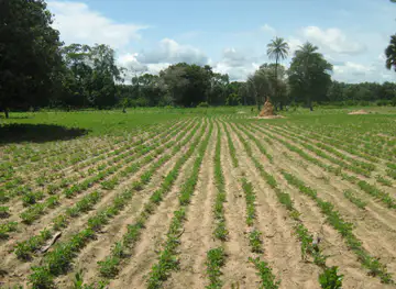
After independence, development in Matam continued to revolve around the contrast between irrigable land beside the Senegal River and pastoral territory inland. Irrigation schemes and water-control projects encouraged rice, vegetable and other crop production, while the Ferlo remained important for livestock herding. These systems are economically connected but environmentally different: river farming depends on managed water and land, whereas pastoral life depends on wells, seasonal vegetation and mobility. Modern pressures include climate variability, land access, youth migration and the need to balance agricultural expansion with pastoral routes.
Creation of the Matam Region
Matam became a separate administrative region of Senegal in 2002, reflecting the scale and distinctive needs of the north-eastern river valley and Ferlo. The region is organised around the departments of Matam, Kanel and Ranérou-Ferlo, each representing different combinations of river settlement, market activity and pastoral territory. Regional administration has brought public services and infrastructure planning into sharper focus, although distances and environmental challenges remain substantial. Contemporary Matam is consequently shaped by both historic Fouta-Toro identities and the practical demands of decentralised development.
Matam in Photos
Browse through our photo collection highlighting the charm and character of the destination.
Neighbouring regions of Matam
The closest regions to Matam, if you have time for more than one.
-

-
-

-

-


Swipe for more regions
Explore more

Explore more of Senegal
Discover Senegal: A West African gem offering rich cultural experiences, vibrant music, stunning natural landscapes, and a warm, welcoming atmosphere.
Explore Senegal