

Free Pasir Ris Travel Guide & Mobile App
Explore Pasir Ris with free travel guides. Discover regional history, expert tips, proposed trips, and audio guides on web or mobile app.


Pasir Ris combines Singapore’s coastal parkland, mangroves, family attractions and relaxed eastern neighbourhood life beside the Johor Strait.
Read more about Pasir Ris
When is the best time to visit Pasir Ris?
Best: February, June–July · 30–31°C| Month | High (°C) | Rainfall (mm) |
|---|---|---|
| January | 30 | 238 |
| February (best) | 30 | 174 |
| March | 31 | 178 |
| April | 31 | 179 |
| May | 31 | 171 |
| June (best) | 31 | 162 |
| July (best) | 31 | 157 |
| August | 31 | 174 |
| September | 31 | 177 |
| October | 31 | 191 |
| November | 30 | 256 |
| December | 30 | 288 |
Getting to and around Pasir Ris
How to get there
Transportation
Top city travel guides in Pasir Ris
The cities of Pasir Ris, and the easiest places to base yourself.

Swipe for more cities
Destinations in Pasir Ris
Resorts, valleys and scenic spots worth a trip of their own.

Swipe for more destinations
Best attractions in Pasir Ris
Pasir Ris’s attractions are built around coastal recreation, family leisure and urban nature. Pasir Ris Park is the central draw, with a long shoreline, cycling and walking routes, playgrounds, picnic areas, barbecue facilities and access to mangrove habitat around Sungei Api Api. Its boardwalks provide an accessible introduction to Singapore’s tidal ecology, while the beach and open lawns suit visitors seeking space away from the central districts. Around the town centre, Downtown East offers entertainment, dining and accommodation, and Wild Wild Wet is a major water-based attraction for families. Pasir Ris Town Park adds a more local, everyday green space centred on a large pond and recreational paths. The district’s waterways and eastern park connections also reward visitors who prefer cycling or informal exploration to scheduled sightseeing. Nearby Lorong Halus, associated with wetland landscapes and routes towards the eastern shore, may be considered as a neighbouring extension only after checking precise access and boundaries. Together, these places show Pasir Ris less as a museum-led destination than as a living residential district where parks, leisure facilities and managed natural habitats are closely integrated.
-
Garden
Butterfly Garden
Discover the enchanting Butterfly Garden at Changi Airport, a unique oasis featuring hundreds of butterflies in a lush, tropical setting.
-
Park
Pasir Ris Town Park
Discover the serene beauty of Pasir Ris Town Park, a perfect retreat in Singapore for nature lovers and families seeking outdoor enjoyment.
-
Water park
Wild Wild Wet
Discover the excitement of Wild Wild Wet, Singapore's ultimate water park, featuring thrilling rides, relaxing pools, and fun for the entire family.
-
Taoist temple
Loyang Tua Pek Kong
Discover the spiritual essence of Loyang Tua Pek Kong, a vibrant Taoist temple in Pasir Ris, Singapore, rich in culture, rituals, and serene beauty.


Best landmarks in Pasir Ris
Pasir Ris Park is the district’s most recognisable physical landmark, extending along the north-eastern coast and defining the relationship between the town and the Johor Strait. Its mangrove boardwalk and waterways are particularly significant because they preserve a visible tidal ecosystem within a densely planned urban environment. Sungei Api Api, a tidal stream running through the park landscape, gives the area a further sense of ecological and geographical identity. At the urban centre, Pasir Ris MRT station and the adjoining White Sands and bus interchange complex represent the infrastructure of the modern new town, where transport, retail and housing are closely connected. Downtown East is another prominent contemporary landmark, associated with leisure facilities and Wild Wild Wet rather than historic architecture. Pasir Ris Town Park, with its broad pond and landscaped paths, is an important local civic landscape. These places are not monumental in the manner of Singapore’s central colonial buildings, but together they express Pasir Ris’s defining story: a former rural and coastal fringe reshaped into a connected residential town that retains open water, parkland and mangrove habitats.
-
Tourist attraction
Cloud Forest
Experience the breathtaking beauty of Cloud Forest, an indoor garden featuring diverse tropical flora and a stunning waterfall in Singapore's iconic Gardens by the Bay.
-
National museum
National Museum of Singapore
Explore the National Museum of Singapore: A Journey Through History, Art, and Culture in the Heart of the City.
-
Shopping mall
Downtown East
Experience the ultimate destination for shopping, dining, and recreation at Downtown East, Singapore’s vibrant hub for entertainment and leisure.
-
Park
Pasir Ris Town Park
Explore the serene landscapes and recreational wonders of Pasir Ris Town Park in Singapore, a perfect escape for families and nature lovers.


Explore Pasir Ris on the map
Plan your trip on one map. See where the top cities, national parks and sights are, and book hotels and experiences in a few clicks.
Best hotels in Pasir Ris
Best restaurants in Pasir Ris
Dining in Pasir Ris is primarily neighbourhood-based, with the greatest concentration around Pasir Ris MRT station, White Sands, Downtown East and local housing-estate centres. Visitors will find Singaporean staples such as chicken rice, laksa, roti prata, nasi lemak, noodle dishes, seafood preparations and a wide range of drinks and desserts, alongside fast food, cafés and casual international restaurants. Hawker-style eating and food-court meals offer an affordable way to sample the country’s multi-ethnic culinary traditions, while restaurants at Downtown East provide a more leisure-oriented setting. Pasir Ris’s coastal location does not mean that every shoreline venue specialises in freshly landed seafood, but seafood restaurants and outlets can be found within the wider eastern dining scene. For groceries and edible souvenirs, look for Singaporean snacks, sauces, spice mixes, tea and confectionery in supermarkets and shopping-centre stores. Seating can be busy at peak meal times, and diners should follow local table-clearing and return-tray arrangements where displayed.
-
French
Poulet - White Sands
Discover exquisite French cuisine at Poulet - White Sands in Pasir Ris, Singapore – where every dish tells a delicious story.
-
Korean BBQ
I'm Kim Korean BBQ & Shabu Shabu @ Pasir Ris Mall
Experience authentic Korean BBQ and Shabu Shabu in Singapore's Pasir Ris Mall – fresh ingredients served in a cozy atmosphere.
-
Grill
georges @ The Cove
Discover delicious grilled cuisine at Georges @ The Cove in Pasir Ris, Singapore - where flavor meets relaxation.
-
Italian
Saizeriya
Experience authentic Italian cuisine at Saizeriya - affordable dining with delicious flavors in the heart of Singapore's Pasir Ris.


Best bars in Pasir Ris
Pasir Ris has a modest, local evening scene rather than a concentrated nightclub district. After dark, activity centres on casual restaurants, cafés, family entertainment and pubs or bars around Downtown East and the town centre. Some venues may offer televised sport, live entertainment or relaxed drinks, but opening arrangements and individual businesses can change, so visitors should check current listings directly. The nearby coastal park is more suited to an evening walk than to nightlife, with low lighting and quieter stretches that require attention after dark. Travellers seeking a larger choice of clubs, cocktail bars and late-night music venues will generally need to travel outside Pasir Ris towards central Singapore, while those staying locally can expect a practical neighbourhood atmosphere rather than an all-night entertainment strip.
-
Lounge
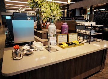
SilverKris Lounge
Relax in the luxurious SilverKris Lounge at Changi Airport, where comfort meets sophistication for the discerning traveler.
-
Lounge
Stella Seaside Lounge
Experience the ultimate seaside relaxation at Stella Seaside Lounge with exquisite dining and breathtaking views of Singapore's coastline.
-
Gastropub
Tipsy Penguin
Discover Tipsy Penguin, a vibrant gastropub in Tampines, Singapore, where culinary delights meet a lively atmosphere for an unforgettable dining experience.
-
Bar
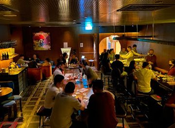
Jigger & Pony
Experience innovative cocktails and vibrant nightlife at Jigger & Pony, a top bar destination in Singapore's Tanjong Pagar.


Best nightclubs in Pasir Ris
Pasir Ris has a modest, local evening scene rather than a concentrated nightclub district. After dark, activity centres on casual restaurants, cafés, family entertainment and pubs or bars around Downtown East and the town centre. Some venues may offer televised sport, live entertainment or relaxed drinks, but opening arrangements and individual businesses can change, so visitors should check current listings directly. The nearby coastal park is more suited to an evening walk than to nightlife, with low lighting and quieter stretches that require attention after dark. Travellers seeking a larger choice of clubs, cocktail bars and late-night music venues will generally need to travel outside Pasir Ris towards central Singapore, while those staying locally can expect a practical neighbourhood atmosphere rather than an all-night entertainment strip.
-
Grill
georges @ The Cove
Experience the vibrant flavors and relaxed ambiance of Georges @ The Cove, a premier grill destination in Pasir Ris, Singapore.
-
Night club
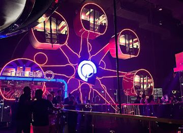
MARQUEE Singapore
Dive into the electrifying nightlife of MARQUEE Singapore, where world-class DJs and stunning visuals create an unforgettable clubbing experience.
-
Night club
XclusiV
Experience the vibrant nightlife at XclusiV, Singapore's premier night club with electrifying music and a lively atmosphere.
-
Karaoke bar
JEWEL MUSIC BOX PASIR RIS
Experience unforgettable karaoke nights at Jewel Music Box Pasir Ris, Singapore's premier karaoke bar, perfect for all music lovers.



Best shops in Pasir Ris
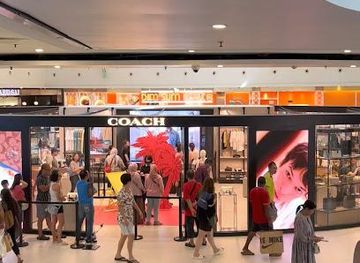
Shopping in Pasir Ris is centred on practical neighbourhood retail rather than luxury malls or specialist heritage streets. White Sands beside Pasir Ris MRT station is the main shopping centre, with everyday services, fashion, groceries, cafés and restaurants, while smaller estate shops and food centres serve local residents. Downtown East adds leisure-oriented retail and dining connected with its entertainment facilities. Visitors looking for Singaporean food products can browse supermarkets and speciality counters for snacks, sauces, spice mixes, tea, biscuits and packaged gifts, although product ranges vary. Pasir Ris is not principally a craft-shopping destination, but independent services and small retail outlets around the housing estates offer a more ordinary view of daily Singaporean commerce than the major shopping districts in the centre. For extensive designer shopping, electronics or international brands, visitors will need to travel beyond the district. Markets and temporary community bazaars may appear at different times, so current local notices are more reliable than assuming a permanent market schedule.
-
Shopping mall
Changi City Point
Discover Changi City Point, Singapore's premier shopping mall featuring over 200 stores and diverse dining options for an unparalleled shopping experience.
-
Shopping mall
Downtown East
Experience the ultimate shopping and recreation destination at Downtown East, where fun and excitement await for every traveler in Singapore.
-
Shopping mall
White Sands
Explore the ultimate shopping experience at White Sands, where retail therapy meets delightful dining and family-friendly fun in Singapore.
-
Shopping mall
Elias Mall
Explore Elias Mall: Your ultimate shopping and dining destination in Singapore, offering unique stores and delightful cuisines for an unforgettable experience.


Get your free copy of our complete guide to Pasir Ris, delivered straight to you.
Everything on this page, from attractions and restaurants to essentials and local phrases, in one PDF you can read offline, print or share.
Already have an account? Sign in
Your Pasir Ris guide is ready.
We'll send it to · Not you? Sign out

Getting your guide ready…
We are putting together a fresh copy of the Pasir Ris guide. This can take up to a minute.
This can take a few moments. If your browser asks, choose Allow so the download can start. You'll find the guide in your Downloads folder.
Nothing happened? Download it again
Sorry, the guide is taking longer than usual. Please try again in a minute, or get it by email instead.
Pasir Ris essentials
Currency and Payment
Safety
Emergency Situations
Do's and Don'ts
Local Tips
From Eve
Local phrases worth knowing
You don't need to get them perfect. A few words go a long way, and locals appreciate the effort.
Basics
| English | Local | Say it |
|---|---|---|
| Hello | Hello | [həˈloʊ] |
| Goodbye | Goodbye | [ɡʊdˈbaɪ] |
| Yes | Yes | [jɛs] |
| No | No | [noʊ] |
| Please/You're welcome | Please/You're welcome | [pliːz/jʊr ˈwɛlkəm] |
| Thank you | Thank you | [θæŋk ju] |
| Excuse me/Sorry | Excuse me/Sorry | [ɪkˈskjuːz mi/ˈsɑːri] |
| How are you? | How are you? | [haʊ ɑːr ju] |
| Fine. And you? | Fine. And you? | [faɪn. ənd ju] |
| Do you speak English? | Do you speak English? | [du ju spiːk ˈɪŋɡlɪʃ] |
| I don't understand | I don't understand | [aɪ doʊnt ˌʌndərˈstænd] |
Eating & Drinking
| English | Local | Say it |
|---|---|---|
| I'd like to see the menu, please | I'd like to see the menu, please | [aɪd laɪk tə si ðə ˈmɛnjuː, pliz] |
| I don't eat meat | I don't eat meat | [aɪ doʊnt iːt miːt] |
| Cheers! | Cheers! | [ʧɪrz] |
| I would like to pay, please | I would like to pay, please | [aɪ wəd laɪk tə peɪ, pliz] |
Emergencies
| English | Local | Say it |
|---|---|---|
| Help! | Help! | [hɛlp] |
| Go away! | Go away! | [ɡoʊ əˈweɪ] |
| Call the Police! | Call the Police! | [kɔl ðə pəˈliːs] |
| Call a doctor! | Call a doctor! | [kɔl ə ˈdɑːktər] |
| I'm lost | I'm lost | [aɪm lɔst] |
| I'm ill | I'm ill | [aɪm ɪl] |
Shopping
| English | Local | Say it |
|---|---|---|
| I'd like to buy... | I'd like to buy... | [aɪd laɪk tə baɪ...] |
| I'm just looking | I'm just looking | [aɪm dʒʌst ˈlʊkɪŋ] |
| How much is it? | How much is it? | [haʊ mʌʧ ɪz ɪt] |
| That's too expensive | That's too expensive | [ðæts tuː ɪkˈspɛnsɪv] |
| Can you lower the price? | Can you lower the price? | [kæn ju ˈloʊər ðə praɪs] |
Time & Numbers
| English | Local | Say it |
|---|---|---|
| What time is it? | What time is it? | [wɑt taɪm ɪz ɪt] |
| It's one o'clock | It's one o'clock | [ɪts wʌn əˈklɑk] |
| Half past (10) | Half past (10) | [hæf pæst (10)] |
| Morning | Morning | [ˈmɔrnɪŋ] |
| Afternoon | Afternoon | [ˌæftərˈnun] |
| Evening | Evening | [ˈivnɪŋ] |
| Yesterday | Yesterday | [ˈjɛstərdeɪ] |
| Today | Today | [təˈdeɪ] |
| Tomorrow | Tomorrow | [təˈmɔroʊ] |
| 1 | 1 | [wʌn] |
| 2 | 2 | [tu] |
| 3 | 3 | [θri] |
| 4 | 4 | [fɔr] |
| 5 | 5 | [faɪv] |
| 6 | 6 | [sɪks] |
| 7 | 7 | [sɛvən] |
| 8 | 8 | [eɪt] |
| 9 | 9 | [naɪn] |
| 10 | 10 | [tɛn] |
Transport & Directions
| English | Local | Say it |
|---|---|---|
| Where's a/the...? | Where's a/the...? | [wɛrz ə/ðə...?] |
| What's the address? | What's the address? | [wɑts ði əˈdrɛs] |
| Can you show me (on the map)? | Can you show me (on the map)? | [kæn ju ʃoʊ mi (ɑn ðə mæp)?] |
| When's the next (bus)? | When's the next (bus)? | [wɛn'z ðə nɛkst (bʌs)?] |
| A ticket (to ....) | A ticket (to ....) | [ə ˈtɪkɪt (tə ....)] |
History of Pasir Ris
Coastal Settlement and Early Malay Connections
Before Pasir Ris became a planned town, Singapore’s north-eastern coast was characterised by villages, smallholdings, plantations and waterways. Coastal communities used the shore and nearby islands for fishing, boat travel and local trade, while mangroves and tidal creeks formed part of the working landscape. The name Pasir Ris is commonly linked to Malay words associated with sand, though historical explanations of the name vary. Its coastal setting connected the area to the wider maritime world of the Johor Strait rather than isolating it from neighbouring communities.
Plantations, Farms and Rural Roads
During the colonial period and into the twentieth century, much of what is now Pasir Ris remained relatively rural compared with Singapore’s central districts. Coconut plantations, vegetable farms, fruit orchards and other small agricultural holdings occupied parts of the eastern landscape. Roads and tracks followed the needs of farms and coastal settlements, while streams and tidal channels remained important physical features. Little of this rural economy survives in its original form, but the district’s open edges, waterways and surviving green corridors reflect that earlier landscape.
Wartime Singapore and the Eastern Coast
The eastern coastline formed part of Singapore’s wider wartime environment during the Japanese invasion and occupation from 1942 to 1945. Military movements, coastal surveillance and the disruption of civilian life affected the island as a whole, including rural settlements and agricultural districts in the east. Pasir Ris is not principally known for a single major battlefield, but its position beside the Johor Strait placed it within the strategic geography of Singapore’s northern and eastern approaches. The period remains important context for understanding the transformation of the island after the war.
From Rural Fringe to Planned New Town
Pasir Ris was substantially transformed from the late twentieth century as Singapore expanded public housing and town infrastructure beyond the older central settlements. Housing estates, schools, shops, transport links and community facilities were planned together, replacing much of the former farm and village landscape. This development created the recognisable Pasir Ris town of today while retaining substantial coastal and recreational land. The district illustrates Singapore’s broader approach to new-town planning: dense housing is balanced by parks, waterways, sports facilities and neighbourhood services.
The MRT Era and Eastern Connectivity
The opening of the East West MRT Line to Pasir Ris in 1989 strengthened the district’s connection with central Singapore and other major employment areas. Rail access helped turn Pasir Ris from a peripheral settlement into a fully integrated residential town, while bus services connected the station and interchange with surrounding estates and the coast. Improved accessibility also supported the growth of leisure facilities around Downtown East and the continuing use of Pasir Ris Park as a destination for residents from across Singapore.
Parks, Mangrove Conservation and Urban Nature
As Pasir Ris grew, parts of its coastal and wetland environment were incorporated into the public park system rather than being entirely developed. Pasir Ris Park preserves mangrove habitat, beach frontage and freshwater and tidal landscapes within the urban fabric. Boardwalks and managed access allow visitors to observe these environments while limiting pressure on sensitive areas. This blend of housing, recreation and ecological management reflects a modern phase in Pasir Ris’s history, in which the district’s natural setting has become part of its civic identity.
Pasir Ris in Photos
Browse through our photo collection highlighting the charm and character of the destination.
Neighbouring regions of Pasir Ris
The closest regions to Pasir Ris, if you have time for more than one.
-

-

-

-

-


Swipe for more regions
Explore more

Explore more of Singapore
Explore Singapore: A vibrant city-state where modernity meets tradition, offering world-class cuisine, stunning gardens, and unique cultural experiences.
Explore Singapore