

Free Drakensberg Travel Guide & Mobile App
Explore Drakensberg with free travel guides. Discover regional history, expert tips, proposed trips, and audio guides on web or mobile app.


Explore the Drakensberg’s basalt peaks, San rock art, highland trails and protected valleys across South Africa’s premier mountain wilderness.
Read more about Drakensberg
When is the best time to visit Drakensberg?
Best: January–March · 21–23°C| Month | High (°C) | Rainfall (mm) |
|---|---|---|
| January (best) | 23 | 120 |
| February (best) | 22 | 110 |
| March (best) | 21 | 100 |
| April | 18 | 80 |
| May | 14 | 60 |
| June | 12 | 50 |
| July | 11 | 50 |
| August | 14 | 50 |
| September | 17 | 70 |
| October | 19 | 90 |
| November | 21 | 110 |
| December | 22 | 130 |
Getting to and around Drakensberg
How to get there
Transportation
Destinations in Drakensberg
Resorts, valleys and scenic spots worth a trip of their own.
-

-


Swipe for more destinations
Best attractions in Drakensberg
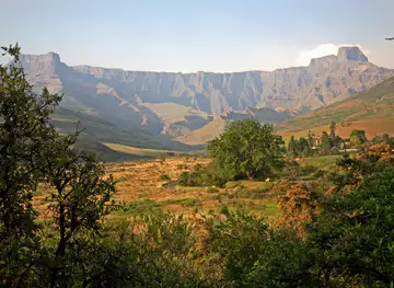
The Drakensberg’s attractions are dominated by protected mountain landscapes rather than a single urban centre. Royal Natal National Park provides access to the Amphitheatre, Tugela Falls viewpoints and valley walks beneath some of the range’s most imposing cliffs. Further south, Cathedral Peak, Monk’s Cowl, Injisuthi and Giant’s Castle offer contrasting combinations of steep valleys, high passes, grassland and guided rock-art sites. Kamberg is particularly associated with cultural heritage and accessible walks, while the southern Drakensberg around Underberg and Himeville offers routes towards Sani Pass, horse riding, fishing and broad highland scenery. The uKhahlamba-Drakensberg Park protects important habitats for birds and mountain wildlife, although this is primarily a hiking destination rather than a conventional game-viewing reserve. Activities include day walks, multi-day trekking, climbing, fly-fishing, mountain biking in appropriate areas and visits to San rock-art shelters. Facilities and access vary greatly, so visitors should distinguish between formal park attractions, private lodges and remote routes requiring a guide or permit.
-
Tourist attraction
Golden Gate Highlands National Park
Discover the stunning landscapes and diverse wildlife of Golden Gate Highlands National Park, a true gem in South Africa's natural heritage.
-
Tourist attraction
Paradise Valley
Experience the natural beauty of Paradise Valley, a serene nature preserve in Durban, perfect for adventure and relaxation amidst stunning landscapes.
-
Tourist attraction
Howick Falls
Experience the breathtaking beauty of Howick Falls, a must-visit natural wonder in South Africa's KwaZulu-Natal region, perfect for nature lovers and adventure seekers.
-
Resort hotel
Gooderson Drakensberg Gardens Golf & Spa Resort
Discover the perfect blend of relaxation and adventure at Gooderson Drakensberg Gardens Golf & Spa Resort in South Africa's stunning Drakensberg Mountains.


Best landmarks in Drakensberg
The Amphitheatre is the Drakensberg’s most recognisable natural landmark: a broad basalt escarpment in Royal Natal National Park whose cliffs form a powerful northern gateway to the range. The Tugela Falls system descends from the high plateau nearby, although the visible waterfalls and routes depend on weather and viewpoint. Cathedral Peak is a distinctive mountain spire in the central Drakensberg, while the surrounding valley is known for its dramatic cliffs and walking routes. In the southern section, Sani Pass is a historic and visually striking route climbing from KwaZulu-Natal towards the Lesotho border; the pass’s upper destination is outside South Africa and should not be confused with a landmark wholly within the Drakensberg park. The sandstone formations, basalt buttresses and high ridgelines are themselves defining features of the landscape. Cultural landmarks include the protected rock shelters and paintings found throughout uKhahlamba-Drakensberg Park, whose importance rests on both their artistic quality and their evidence of long-standing San presence.
-
Resort hotel
Drakensberg Sun Resort
Discover unparalleled luxury and breathtaking nature at Drakensberg Sun Resort, the ultimate getaway in South Africa's stunning Drakensberg Mountains.
-
Resort hotel
aha Alpine Heath Resort
Discover tranquility and adventure at aha Alpine Heath Resort in the breathtaking Northern Drakensberg mountains, perfect for relaxation and outdoor exploration.
-
Self-catering accommodation
ATKV Drakensville
Explore the beauty of the Drakensberg at ATKV Drakensville, your ultimate self-catering accommodation destination amidst nature's splendor.
-
National park
Royal Natal National Park
Discover the breathtaking beauty and adventure of Royal Natal National Park, a must-visit destination in the Drakensberg mountains of South Africa.


Explore Drakensberg on the map
Plan your trip on one map. See where the top cities, national parks and sights are, and book hotels and experiences in a few clicks.
Best hotels in Drakensberg
Best restaurants in Drakensberg
Dining in the Drakensberg is shaped by rural accommodation, farming country and the practical needs of hikers rather than by a concentrated restaurant scene. Lodges, mountain resorts, guesthouses and country inns commonly provide hearty breakfasts, packed lunches and evening meals, with menus influenced by South African home cooking, grilled meat, seasonal vegetables, soups, baked goods and locally sourced produce. Around Bergville, Winterton, Underberg and Himeville, visitors can find cafés, pubs and independent restaurants suited to stocking up or eating before and after a mountain excursion. Farm stalls and local shops may offer fresh fruit, preserves, baked items and other provisions, although selection varies by location and season. The region is not associated with one exclusive dish, but its culinary character lies in substantial country food, hospitality at rural lodges and access to produce from the surrounding highlands. Advance arrangements are sensible for dinner at remote accommodation, where meal service may be limited and distances make spontaneous alternatives impractical.
-
Restaurant
The Valley Bakery
Discover The Valley Bakery: A delightful café in Champagne Valley offering fresh homemade pastries amidst stunning mountain views.
-
Restaurant
Waffle Hut
Discover the delightful flavors of Waffle Hut in Winterton—where every waffle is crafted with love amidst stunning Champagne Valley views.
-
 Resort hotel
Castleburn Resort
Experience unparalleled relaxation at Castleburn Resort in South Africa's breathtaking Drakensberg Mountains.
-
Restaurant
Thokozisa Restaurant
Experience authentic South African cuisine at Thokozisa Restaurant in Cathkin Park amidst breathtaking Drakensberg landscapes.


Best bars in Drakensberg
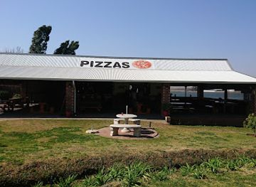
Evenings in the Drakensberg are generally quiet and centred on country pubs, lodge dining rooms, hotel bars and informal social spaces rather than nightclubs. Underberg, Himeville, Winterton and other gateway settlements provide the most accessible places for a drink or casual meal, while some mountain lodges offer licensed bars, fireplaces and views of the escarpment. Live music and community events may occur locally, but they are not a permanent feature that can be assumed in every valley. Visitors staying in remote accommodation often spend the evening stargazing, reading or discussing the next day’s route, and many establishments encourage an early start for hiking. Drink-driving is a serious risk on rural roads, and visitors should arrange transport rather than drive after drinking. Check current arrangements locally, as seasonal demand and remote operating conditions influence the availability of evening services.
-
Resort hotel
Drakensberg Sun Resort
Discover the serene beauty and adventure of Drakensberg Sun Resort, a luxurious getaway in the heart of the stunning Drakensberg Mountains.
-
Restaurant
The Valley Bakery
Discover The Valley Bakery in Champagne Valley, where artisanal baked goods meet breathtaking scenery for the ultimate culinary experience.
-
Hotel
Cathedral Peak Hotel
Experience luxury and adventure at Cathedral Peak Hotel, your gateway to the breathtaking beauty of the Drakensberg mountains and heritage.
-
Golf course
Gooderson Drakensberg Gardens Golf & Spa Resort
Discover the perfect getaway at Gooderson Drakensberg Gardens Golf & Spa Resort, where adventure meets relaxation in a stunning natural setting.


Best nightclubs in Drakensberg
Evenings in the Drakensberg are generally quiet and centred on country pubs, lodge dining rooms, hotel bars and informal social spaces rather than nightclubs. Underberg, Himeville, Winterton and other gateway settlements provide the most accessible places for a drink or casual meal, while some mountain lodges offer licensed bars, fireplaces and views of the escarpment. Live music and community events may occur locally, but they are not a permanent feature that can be assumed in every valley. Visitors staying in remote accommodation often spend the evening stargazing, reading or discussing the next day’s route, and many establishments encourage an early start for hiking. Drink-driving is a serious risk on rural roads, and visitors should arrange transport rather than drive after drinking. Check current arrangements locally, as seasonal demand and remote operating conditions influence the availability of evening services.
-
Resort hotel
Drakensberg Sun Resort
Experience luxury and adventure at Drakensberg Sun Resort, your gateway to the breathtaking Drakensberg Mountains.
-
Resort hotel
The Cavern Drakensberg Resort & Spa
Discover the serene beauty of The Cavern Drakensberg Resort & Spa, where luxurious comfort meets breathtaking nature in South Africa's stunning mountains.
-
Hotel
Premier Resort Sani Pass
Experience breathtaking mountain views and adventure at Premier Resort Sani Pass, a perfect escape in KwaZulu-Natal, South Africa.
-
Hotel
Sani Lodge Backpackers
Experience the beauty of the Southern Drakensberg at Sani Lodge Backpackers, where adventure meets tranquility in a sustainable paradise.


Best shops in Drakensberg
Shopping in the Drakensberg is concentrated in gateway towns and rural farm outlets rather than large retail districts. Bergville, Winterton, Underberg and Himeville are useful places for food, fuel, outdoor necessities and basic supplies before travelling to remote accommodation or trailheads. Independent shops, craft outlets, farm stalls and local markets may sell preserves, baked goods, honey, leatherwork, woven items, artwork and regional produce, although opening patterns and product ranges vary. Visitors should distinguish locally made crafts from generic souvenirs and buy respectfully, particularly where cultural imagery or heritage themes are involved. Galleries and small craft businesses around mountain settlements can provide work by regional artists, while lodge shops may stock books, maps and outdoor equipment. There is little reason to expect extensive designer shopping in the mountain valleys; the appeal lies in practical provisions, farm products and small-scale crafts connected with the rural setting.
-
Resort hotel
Drakensberg Sun Resort
Discover the serene beauty and adventure of Drakensberg Sun Resort, a perfect getaway in the heart of the stunning Drakensberg mountains.
-
Resort hotel
Gooderson Drakensberg Gardens Golf & Spa Resort
Discover the enchanting beauty and adventure at Gooderson Drakensberg Gardens Golf & Spa Resort, where relaxation meets excitement in the heart of nature.
-
Resort hotel
Little Switzerland Resort By Dream Resorts
Experience breathtaking views and ultimate relaxation at Little Switzerland Resort, a hidden gem in the Northern Drakensberg mountains of South Africa.
-
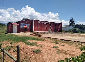
Chocolate cafe
Drakensberg Chocolate Memories
Experience the delicious world of handcrafted chocolates and desserts in the breathtaking Drakensberg Mountains.


Get your free copy of our complete guide to Drakensberg, delivered straight to you.
Everything on this page, from attractions and restaurants to essentials and local phrases, in one PDF you can read offline, print or share.
Already have an account? Sign in
Your Drakensberg guide is ready.
We'll send it to · Not you? Sign out

Getting your guide ready…
We are putting together a fresh copy of the Drakensberg guide. This can take up to a minute.
This can take a few moments. If your browser asks, choose Allow so the download can start. You'll find the guide in your Downloads folder.
Nothing happened? Download it again
Sorry, the guide is taking longer than usual. Please try again in a minute, or get it by email instead.
Drakensberg essentials
Currency and Payment
Safety
Emergency Situations
Do's and Don'ts
Local Tips
From Eve
Local phrases worth knowing
You don't need to get them perfect. A few words go a long way, and locals appreciate the effort.
Basics
| English | Local | Say it |
|---|---|---|
| Hello | Hallo | [Hah-loh] |
| Goodbye | Totsiens | [Tot-see-ens] |
| Yes | Ja | [Yah] |
| No | Nee | [Nay] |
| Please/You're welcome | Asseblief | [As-seh-bleef] |
| Thank you | Dankie | [Dahn-kee] |
| Excuse me/Sorry | Verskoon my | [Ver-skoon my] |
| How are you? | Hoe gaan dit? | [Hoo gahn dit?] |
| Fine. And you? | Goed. En jy? | [Hoot. En yay?] |
| Do you speak English? | Praat jy Engels? | [Praht yay Eng-els?] |
| I don't understand | Ek verstaan nie | [Ek fer-stahn nee] |
Eating & Drinking
| English | Local | Say it |
|---|---|---|
| I'd like to see the menu, please | Ek wil graag die spyskaart sien, asseblief | [Ek vil graahg dee spies-kaart seen, as-seh-bleef] |
| I don't eat meat | Ek eet nie vleis nie | [Ek eet nee flays nee] |
| Cheers! | Gesondheid! | [Ge-sond-hayt!] |
| I would like to pay, please | Ek wil graag betaal, asseblief | [Ek vil graahg be-taal, as-seh-bleef] |
Emergencies
| English | Local | Say it |
|---|---|---|
| Help! | Help! | [Help!] |
| Go away! | Gaan weg! | [Gahn vek!] |
| Call the Police! | Bel die polisiemag! | [Bel dee po-lee-see-mahg!] |
| Call a doctor! | Bel 'n dokter! | [Bel 'n dok-ter!] |
| I'm lost | Ek is verloore | [Ek is fer-loo-reh] |
| I'm ill | Ek is siek | [Ek is seek] |
Shopping
| English | Local | Say it |
|---|---|---|
| I'd like to buy... | Ek wil graag koop... | [Ek vil graahg koop...] |
| I'm just looking | Ek kyk net | [Ek kayk net] |
| How much is it? | Hoeveel kos dit? | [Hoo-veel kos dit?] |
| That's too expensive | Dit is te duur | [Dit is te dyur] |
| Can you lower the price? | Kan jy die prys verlaag? | [Kan yay dee prays fer-lahg?] |
Time & Numbers
| English | Local | Say it |
|---|---|---|
| What time is it? | Hoe laat is dit? | [Hoo laat is dit?] |
| It's one o'clock | Dit is eenuur | [Dit is een-oor] |
| Half past (10) | Half elf | [Half elf] |
| Morning | Oggend | [Ogg-end] |
| Afternoon | Namiddag | [Nah-mid-dahg] |
| Evening | Aand | [Aand] |
| Yesterday | Gister | [Gis-ter] |
| Today | Vandag | [Vahn-dahg] |
| Tomorrow | Môre | [Maw-reh] |
| 1 | Een | [Een] |
| 2 | Twee | [Twee] |
| 3 | Drie | [Dree] |
| 4 | Vier | [Veer] |
| 5 | Vyf | [Fife] |
| 6 | Ses | [Ses] |
| 7 | Sewe | [Seh-weh] |
| 8 | Agt | [Agt] |
| 9 | Nege | [Neh-heh] |
| 10 | Tien | [Teen] |
Transport & Directions
| English | Local | Say it |
|---|---|---|
| Where's a/the...? | Waar is 'n/ die...? | [Vahr is 'n/ dee...?] |
| What's the address? | Wat is die adres? | [Vaht is dee a-dress?] |
| Can you show me (on the map)? | Kan jy vir my wys (op die kaart)? | [Kan yay fer my vays (op dee kaart)?] |
| When's the next (bus)? | Wanneer is die volgende (bus)? | [Van-deer is dee vol-gen-deh (bus)?] |
| A ticket (to ....) | ‘n Kaartjie (na ....) | [‘n Kart-kee (nah ....)] |
History of Drakensberg
San Presence and Rock-Art Heritage
San communities used the Drakensberg over a long period, leaving thousands of paintings in caves and rock shelters across the mountain valleys. The images include eland and other animals, human figures, hunting scenes and motifs associated with ritual life. Their meaning cannot always be reduced to literal scenes of everyday activity; many are connected with spiritual beliefs and social practices. The paintings are especially concentrated in protected sections of the range and are central to the uKhahlamba-Drakensberg Park’s World Heritage status. They remain vulnerable to touching, moisture, vandalism and careless visitation, so access is managed in many locations.
Early Iron Age and Later Settlement
The wider foothills and valleys were occupied and used by farming communities whose material remains include stone structures, artefacts and evidence of livestock keeping. Later settlement patterns were shaped by the movement and political organisation of Nguni-speaking communities in the region. The mountains themselves were not an isolated wilderness: they served as seasonal grazing areas, sources of water and natural routes between the interior and the eastern lowlands. Archaeological evidence, oral history and the continuing presence of local communities together show that the Drakensberg has long been a lived-in cultural landscape.
The Zulu Kingdom and Mountain Frontier
During the nineteenth century, the growth of the Zulu kingdom transformed political relationships across present-day KwaZulu-Natal. The Drakensberg’s valleys and passes formed part of a broader frontier between the eastern lowlands, the highland interior and territories influenced by the Basotho kingdom. Livestock, land, trade and political authority shaped movement through the region. The mountains later became associated with the conflicts that accompanied colonial expansion and the Anglo-Zulu War, although many of the best-known battlefields lie east of the main Drakensberg escarpment rather than within the mountain park itself.
Colonial Expansion and Missionary Influence
From the nineteenth century, colonial settlement, mission activity and expanding administrative control altered landholding and movement around the mountains. European farmers established homesteads in the foothills, while roads and mountain passes connected Natal with the interior. These changes affected African communities through land dispossession, labour demands and new political boundaries. In the southern Drakensberg, the routes towards the Maloti mountains became increasingly important for trade, administration and later tourism. The landscape’s present division between protected areas, commercial farms and communal settlements reflects this layered history rather than a simple transition from wilderness to park.
The Anglo-Boer War and the Mountain Passes
The Drakensberg and adjacent highlands were affected by the South African War of 1899–1902, when the difficult terrain influenced military movement, communication and supply. Passes such as those leading towards the Free State and Lesotho had strategic importance, while farms and settlements in the foothills experienced disruption. The war did not turn every part of the range into a battlefield, but it intensified the significance of routes across the escarpment. Reminders of this period are found in the broader highland landscape and in regional histories of the communities living on either side of the mountains.
Protected Areas and Conservation
Formal conservation developed during the twentieth century as governments and landowners increasingly recognised the value of the Drakensberg’s grasslands, wetlands, wildlife and scenery. Reserves and wilderness areas were established in sections including Royal Natal, Cathedral Peak, Monk’s Cowl, Giant’s Castle, Kamberg and the southern Drakensberg. In 2000, the uKhahlamba-Drakensberg Park was inscribed as a UNESCO World Heritage Site for its natural importance and exceptional concentration of rock art. Conservation has also required continuing attention to fire, invasive plants, erosion, tourism pressure and the rights and livelihoods of neighbouring communities.
Modern Mountain Tourism
Tourism became a major part of the Drakensberg economy through mountain resorts, walking trails, guided rock-art excursions, camping and adventure activities. The region’s identity today combines protected wilderness with working farms, rural settlements, guesthouses and gateway towns. Visitors increasingly seek both recreation and cultural understanding, while park authorities manage access to fragile high-altitude environments and archaeological sites. The modern Drakensberg is therefore not merely a scenic destination: it is a conservation landscape, a cultural heritage area and an important source of income for communities and businesses around the escarpment.
Drakensberg in Photos
Browse through our photo collection highlighting the charm and character of the destination.
Neighbouring regions of Drakensberg
The closest regions to Drakensberg, if you have time for more than one.
-

-
-

-

-


Swipe for more regions
Explore more

Explore more of South Africa
Discover South Africa: A land of breathtaking landscapes, rich history, and diverse cultures, from bustling cities to world-renowned wildlife reserves.
Explore South Africa