

Free Lake Oahe Travel Guide & Mobile App
Explore Lake Oahe with free travel guides. Discover regional history, expert tips, proposed trips, and audio guides on web or mobile app.


Lake Oahe in South Dakota combines Missouri River history, wide-open prairie, excellent fishing, boating, camping and quiet shoreline escapes.
Read more about Lake Oahe
Getting to and around Lake Oahe
How to get there
Transportation
Best attractions in Lake Oahe
Lake Oahe’s attractions centre on water, open space and the relationship between the Missouri River and the surrounding prairie. Oahe Dam, north of Pierre, is the essential starting point for understanding the reservoir’s scale and its role in flood control, electricity generation and water management. Public recreation areas around the lake provide boat ramps, fishing access, picnic areas, campgrounds and shoreline viewpoints, with facilities differing considerably from one site to another. Anglers come for walleye, northern pike, smallmouth bass and other freshwater species, while boaters and paddlers use the coves and wider channels when conditions permit. The surrounding grasslands support birdwatching, deer spotting and quiet drives through a sparsely settled landscape. Camping is available in selected developed areas, while more remote shorelines appeal to visitors prepared for limited services and changing weather. Pierre and Fort Pierre add museums, local history and practical visitor facilities near the southern end, and Mobridge provides a northern South Dakota base with access to additional lake recreation. The reservoir is also a place for reflective historical travel: its creation transformed the river valley and affected Native communities, settlements and archaeological sites, a story that should be considered alongside the recreational landscape.
-
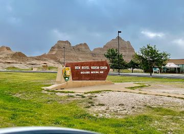
Ben Reifel Visitor Center
Explore the Ben Reifel Visitor Center, your essential starting point for discovering the breathtaking landscapes and rich history of Badlands National Park.
-
Akta Lakota Museum & Cultural Center
Explore the Akta Lakota Museum & Cultural Center for an enriching experience of Lakota culture, history, and artistry in the heart of South Dakota.
-
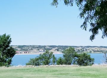
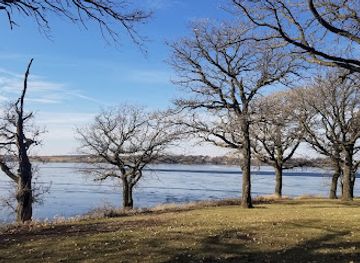
Lake Herman State Park
Experience the natural beauty and recreational opportunities at Lake Herman State Park, South Dakota's serene outdoor escape for nature lovers and adventure seekers.
-
Actual Geographical Center of the United States
Explore the Actual Geographical Center of the United States in Belle Fourche, SD—a unique landmark steeped in history and breathtaking landscapes.

Best landmarks in Lake Oahe
Oahe Dam is Lake Oahe’s defining landmark: a massive earth-fill structure that spans the Missouri River north of Pierre and marks the point where the natural river becomes the reservoir. Its scale is best appreciated from nearby viewpoints and roads, although visitors must obey all security and access restrictions around the operating facility. The broad expanse of Lake Oahe itself is another landmark, with long bays and rolling prairie horizons illustrating how profoundly the dam altered central South Dakota’s geography. The southern lake is visually linked to Pierre and Fort Pierre, two communities on opposite sides of the Missouri River whose histories reflect the river’s role in Indigenous life, trade, military movement and settlement. The surrounding dam and recreation landscape also includes the Oahe Chapel, a small interdenominational chapel associated with the Oahe area and the reservoir’s scenic setting. Farther north, the open shoreline near Mobridge presents a different landmark character: less urban, more expansive and closely associated with boating, fishing and prairie weather. Together these places represent engineering, geography and layered human history rather than a collection of isolated monuments.
-
National reserve
Jewel Cave National Monument
Explore the mesmerizing underground world of Jewel Cave National Monument, a stunning natural reserve in South Dakota's Black Hills, perfect for adventure seekers and nature lovers.
-
Historical landmark
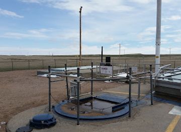
Delta-01 Launch Control Facility
Discover the Delta-01 Launch Control Facility in Wall, SD – a pivotal historical landmark showcasing Cold War nuclear history and technology.
-
History museum
South Dakota State Historical Society
Explore the captivating history of South Dakota at the State Historical Society, where artifacts and stories come alive in an engaging museum experience.
-
Historical landmark
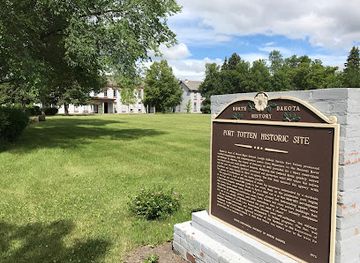
Fort Totten State Historic Site
Discover the rich history of Fort Totten State Historic Site, a fascinating military fort turned museum in North Dakota, perfect for history enthusiasts and tourists alike.

Explore Lake Oahe on the map
Plan your trip on one map. See where the top cities, national parks and sights are, and book hotels and experiences in a few clicks.
Best hotels in Lake Oahe
Best restaurants in Lake Oahe
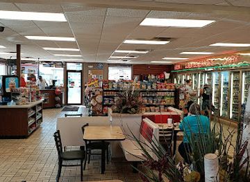
Dining around Lake Oahe is concentrated in Pierre, Fort Pierre, Mobridge and smaller communities serving anglers, ranchers, campers and passing motorists rather than in a continuous lakeside restaurant district. Menus commonly reflect the wider food culture of the northern Great Plains, with burgers, steaks, sandwiches, breakfast cooking and hearty café meals prominent in local eateries and traditional pubs. Freshly caught fish may feature in private cooking and seasonal local menus, but visitors should not assume that every restaurant serves locally landed catch. Grocery shops, bait-store communities and convenience outlets are useful for stocking boats and campsites, especially away from the main towns. Ranching contributes to the importance of beef, while regional South Dakota products can appear at farmers’ markets and independent food shops when in season. In Pierre and Mobridge, visitors will find the broadest choice of casual restaurants, cafés and takeaways; rural areas have fewer options and earlier closing patterns. Planning meals and carrying provisions is sensible for full days on the water or distant shorelines.
-
Restaurant
Johnny Carino's
Experience authentic Italian cuisine at Johnny Carino's in Sioux Falls – where delicious flavors meet warm hospitality.
-
American
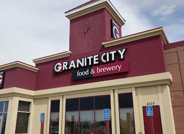
Granite City Food & Brewery
Discover Granite City Food & Brewery: A unique blend of traditional American cuisine and craft brews in the heart of Sioux Falls.
-
Fast Food
Arby's
Discover the delicious fast food experience at Arby's in Oacoma, where mouthwatering roast beef meets convenience and affordability.
-
Buffet
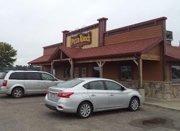
Pizza Ranch
Experience the ultimate buffet at Pizza Ranch in Fort Pierre - where delicious pizza meets crispy chicken and endless variety.
Best bars in Lake Oahe
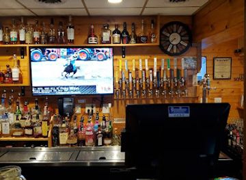
Evening life around Lake Oahe is low-key and community-based rather than centred on large clubs. Pierre, Fort Pierre and Mobridge have the widest choice of traditional bars, restaurants and occasional live-music settings, while smaller settlements generally revolve around local pubs, grills and social venues. After a day of fishing or boating, the common pattern is an early meal, a drink in a relaxed bar or time around a campsite rather than a late-night entertainment circuit. Seasonal events and summer visitors can make waterfront communities busier, but nightlife remains modest and dispersed. Alcohol laws, closing arrangements and transport options follow South Dakota regulations, and visitors should plan a sober driver or other safe route when staying outside town. Breweries, cocktails and live entertainment may be available in the larger communities, but current offerings change, so local visitor information is more reliable than expecting a permanent programme of events.
-
Bar
Full Throttle Saloon
Experience the thrill of Full Throttle Saloon, where bikers unite for great food, live music, and unforgettable moments in South Dakota.
-
Steak
Cattleman's Club Steakhouse
Experience the finest steaks in Pierre, South Dakota at Cattleman's Club Steakhouse, where flavor and quality meet in a warm and inviting atmosphere.
-
Bar
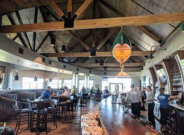
Drifters Bar & Grille
Experience the best of Fort Pierre dining at Drifters Bar & Grille, where local flavors and family-friendly vibes create unforgettable moments.
-
Steak
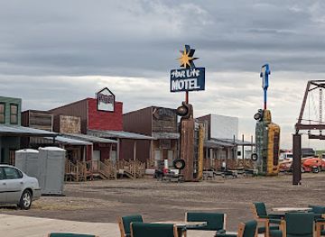
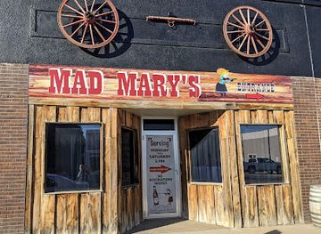
Mad Mary's Steakhouse & Saloon
Experience the savory flavors and vibrant atmosphere of Mad Mary's Steakhouse & Saloon, where delicious steak meets Wild West charm in Pierre, South Dakota.
Best nightclubs in Lake Oahe
Evening life around Lake Oahe is low-key and community-based rather than centred on large clubs. Pierre, Fort Pierre and Mobridge have the widest choice of traditional bars, restaurants and occasional live-music settings, while smaller settlements generally revolve around local pubs, grills and social venues. After a day of fishing or boating, the common pattern is an early meal, a drink in a relaxed bar or time around a campsite rather than a late-night entertainment circuit. Seasonal events and summer visitors can make waterfront communities busier, but nightlife remains modest and dispersed. Alcohol laws, closing arrangements and transport options follow South Dakota regulations, and visitors should plan a sober driver or other safe route when staying outside town. Breweries, cocktails and live entertainment may be available in the larger communities, but current offerings change, so local visitor information is more reliable than expecting a permanent programme of events.
-
Bar
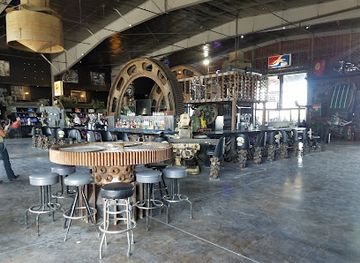
Full Throttle Saloon
Discover the vibrant spirit of motorcycle culture at Full Throttle Saloon in Vale, South Dakota, where music, food, and fun unite.
Best shops in Lake Oahe
Shopping around Lake Oahe is practical and locally focused, with the widest range in Pierre, Fort Pierre and Mobridge. These communities provide supermarkets, outdoor suppliers, bait and tackle shops, fuel stations, independent gift shops and services for camping, boating and fishing. Rather than a single regional shopping quarter, the area’s retail pattern follows dispersed market towns and highway communities. Visitors may find South Dakota-made food products, western clothing, books, Native-inspired or locally produced artwork, outdoor equipment and small souvenirs connected with the Missouri River and prairie. Farmers’ markets and seasonal community events can offer produce, baked goods and crafts, but dates and availability vary throughout the year. Along the lake itself, shop choices are limited, so buy specialist equipment, medication and substantial provisions before heading to remote recreation areas. Local galleries, museums and visitor centres in the gateway communities can be better sources of meaningful regional gifts than generic roadside merchandise, while fishing licences and boating supplies should be obtained from authorised local retailers or official services.
-
General store
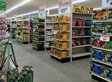
Runnings
Discover Runnings in Pierre, SD - your one-stop shop for clothing, outdoor gear, and pet supplies in a welcoming community atmosphere.
-
State park
Oahe Downstream Recreation Area
Discover the stunning landscapes and recreational activities at Oahe Downstream Recreation Area, a perfect getaway for nature lovers and adventure seekers.
-
Craft store
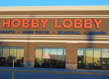
Hobby Lobby
Discover a world of creativity at Hobby Lobby, your ultimate destination for arts, crafts, and home decor in Pierre, South Dakota.
-
Gift shop
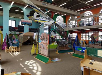
South Dakota Discovery Center
Discover Science and Fun at the South Dakota Discovery Center - an engaging museum perfect for curious minds and families alike.

Get your free copy of our complete guide to Lake Oahe, delivered straight to you.
Everything on this page, from attractions and restaurants to essentials and local phrases, in one PDF you can read offline, print or share.
Already have an account? Sign in
Your Lake Oahe guide is ready.
We'll send it to · Not you? Sign out

Getting your guide ready…
We are putting together a fresh copy of the Lake Oahe guide. This can take up to a minute.
This can take a few moments. If your browser asks, choose Allow so the download can start. You'll find the guide in your Downloads folder.
Nothing happened? Download it again
Sorry, the guide is taking longer than usual. Please try again in a minute, or get it by email instead.
Lake Oahe essentials
Currency and Payment
Safety
Emergency Situations
Do's and Don'ts
Local Tips
From Eve
Local phrases worth knowing
You don't need to get them perfect. A few words go a long way, and locals appreciate the effort.
Basics
| English | Local | Say it |
|---|---|---|
| Hello | Hau | [How] |
| Goodbye | Toksa | [Toke-sah] |
| Yes | Ee | [Ee] |
| No | Na | [Nah] |
| Please/You're welcome | Pilamaya | [Pee-lah-mah-yah] |
| Thank you | Wopila | [Woh-pee-lah] |
| Excuse me/Sorry | Mato he | [Mah-toh heh] |
| How are you? | T'kae he? | [T'kah-eh he?] |
| Fine. And you? | Kah'iyA. T'kae he? | [Kah-ee-yah. T'kah-eh he?] |
| Do you speak English? | T'kae wíiyA English? | [T'kah-eh wee-yah English?] |
| I don't understand | Núŋŋe yuhá | [Noon-gay yuh-hah] |
Eating & Drinking
| English | Local | Say it |
|---|---|---|
| I'd like to see the menu, please | Pilamaya, kta wíiyA munu. | [Pee-lah-mah-yah, k-tah wee-yah moo-noo.] |
| I don't eat meat | Núŋŋe wííŋyA. | [Noon-gay wee-ee-nyah.] |
| Cheers! | WíiyA! | [Wee-yah!] |
| I would like to pay, please | Pilamaya, kta wíiyA peya. | [Pee-lah-mah-yah, k-tah wee-yah pay-ah.] |
Emergencies
| English | Local | Say it |
|---|---|---|
| Help! | T'kae wíiyA! | [T'kah-eh wee-yah!] |
| Go away! | WíiyA kta! | [Wee-yah k-tah!] |
| Call the Police! | WíiyA kta Pólice! | [Wee-yah k-tah Poh-lee-chay!] |
| Call a doctor! | WíiyA kta wííčhA! | [Wee-yah k-tah wee-ee-chah!] |
| I'm lost | Núŋŋe wíiyA t'kae. | [Noon-gay wee-yah t'kah-eh.] |
| I'm ill | Núŋŋe wíiyA wíiyA. | [Noon-gay wee-yah wee-yah.] |
Shopping
| English | Local | Say it |
|---|---|---|
| I'd like to buy... | Pilamaya, kta wíiyA ... | [Pee-lah-mah-yah, k-tah wee-yah ...] |
| I'm just looking | Núŋŋe wíiyA kta. | [Noon-gay wee-yah k-tah.] |
| How much is it? | T'kae hwo? | [T'kah-eh hwo?] |
| That's too expensive | Ná hwo wíiyA. | [Nah hwo wee-yah.] |
| Can you lower the price? | T'kae wíiyA hwo kta wíiyA? | [T'kah-eh wee-yah hwo k-tah wee-yah?] |
Time & Numbers
| English | Local | Say it |
|---|---|---|
| What time is it? | T'kae wíiyA hwo? | [T'kah-eh wee-yah hwo?] |
| It's one o'clock | WíiyA yé. | [Wee-yah yay.] |
| Half past (10) | WíiyA na wíiyA (10). | [Wee-yah nah wee-yah (10).] |
| Morning | Aŋpétu | [Ahng-peh-tu] |
| Afternoon | T'éčhí | [T'eh-chee] |
| Evening | WíiyA k'íŋ | [Wee-yah keen] |
| Yesterday | WíiyA yé t'kae. | [Wee-yah yay t'kah-eh.] |
| Today | WíiyA t'kae. | [Wee-yah t'kah-eh.] |
| Tomorrow | WíiyA t'kae yé. | [Wee-yah t'kah-eh yay.] |
| 1 | 1 | [1] |
| 2 | 2 | [2] |
| 3 | 3 | [3] |
| 4 | 4 | [4] |
| 5 | 5 | [5] |
| 6 | 6 | [6] |
| 7 | 7 | [7] |
| 8 | 8 | [8] |
| 9 | 9 | [9] |
| 10 | 10 | [10] |
Transport & Directions
| English | Local | Say it |
|---|---|---|
| Where's a/the...? | T'kae wíiyA ...? | [T'kah-eh wee-yah ...?] |
| What's the address? | T'kae wíiyA hwo kta wíiyA? | [T'kah-eh wee-yah hwo k-tah wee-yah?] |
| Can you show me (on the map)? | T'kae wíiyA kta wíiyA ...? | [T'kah-eh wee-yah k-tah wee-yah ...?] |
| When's the next (bus)? | T'kae wíiyA kta wíiyA ...? | [T'kah-eh wee-yah k-tah wee-yah ...?] |
| A ticket (to ....) | WíiyA wíiyA (to ...) | [Wee-yah wee-yah (to ...)] |
History of Lake Oahe
Indigenous Missouri River Homelands
The Missouri River valley around present-day Lake Oahe has long been part of the homelands and travel networks of Indigenous peoples, including the Lakota and Dakota. River-bottom settlements, hunting areas and cultivated lands depended on the river’s seasonal cycles. The reservoir later covered many of these places, making the modern lake inseparable from the history of Native land loss, treaty relations and the continuing presence of tribal communities in central South Dakota.
Exploration and the Missouri River Frontier
The Missouri River was a major route for Indigenous trade and diplomacy before becoming a corridor for American exploration, fur trading and military expansion. The Lewis and Clark Expedition travelled the wider river system in 1804 and 1806, while later steamboat traffic and military movements linked settlements across the northern Plains. The river’s importance declined when railways and roads grew, but its role as a geographic and cultural corridor remains visible around Lake Oahe.
Ranching, Forts and Prairie Settlement
During the nineteenth century, military posts, cattle operations, homesteads and growing river communities reshaped the region surrounding the future reservoir. Fort Pierre, opposite modern Pierre, became an important trading and transport centre, while ranching adapted to the open grasslands west and east of the Missouri. Settlement brought new farms and communities but also intensified conflict and dispossession affecting Indigenous nations whose lands and political rights were already under pressure.
Missouri River Basin Planning
The devastating floods of the 1930s and the need for electricity, irrigation, navigation and flood control led to major federal planning for the Missouri River Basin. The Pick-Sloan Plan envisaged a chain of large dams and reservoirs, including the Oahe project. Its aims reflected the engineering priorities of the era, but its consequences were uneven, particularly for Native communities and river settlements situated in areas designated for inundation.
Construction of Oahe Dam, 1948–1962
Construction of Oahe Dam began in 1948 and the dam was completed in 1962. Built by the United States Army Corps of Engineers, it impounded a vast reach of the Missouri River and created Lake Oahe, one of the largest reservoirs in the country. The project supported flood control, hydroelectric generation and water management, while permanently altering the river valley, flooding bottomlands and requiring the relocation or loss of communities and cultural landscapes.
The Reservoir Era
After the lake filled, the Missouri River became a managed reservoir system rather than a free-flowing river through central South Dakota. New marinas, campgrounds, boat ramps and recreation areas developed around Lake Oahe, and fishing became a major part of the regional economy. Pierre, Fort Pierre, Mobridge and smaller settlements adapted their services to visitors, anglers and seasonal residents while ranching and prairie life continued beyond the shoreline.
Contemporary Cultural and Environmental Awareness
Today, Lake Oahe is valued both as a recreational landscape and as part of a contested modern history. Water management, shoreline erosion, habitat protection, fisheries and drought affect the reservoir’s future. Interpretation of the lake increasingly needs to acknowledge the Indigenous communities and descendants whose river-bottom lands were flooded, alongside the engineering achievement and recreational opportunities that visitors can see.
Lake Oahe in Photos
Browse through our photo collection highlighting the charm and character of the destination.
Neighbouring regions of Lake Oahe
The closest regions to Lake Oahe, if you have time for more than one.
-

-

-

-
-


Swipe for more regions
Explore more

Explore more of South Dakota
Discover South Dakota: From the iconic Mount Rushmore and Crazy Horse Memorial to the stunning Badlands and charming small towns, it's a land of history and natural beauty.
Explore South Dakota