

Free Phetchabun Mountains Travel Guide & Mobile App
Explore Phetchabun Mountains with free travel guides. Discover regional history, expert tips, proposed trips, and audio guides on web or mobile app.


Explore the Phetchabun Mountains for misty viewpoints, forest parks, highland farms, striking temples and cooler rural landscapes in central Thailand.
Read more about Phetchabun Mountains
When is the best time to visit Phetchabun Mountains?
Best: December–February · 26–28°C| Month | High (°C) | Rainfall (mm) |
|---|---|---|
| January (best) | 26 | 3 |
| February (best) | 28 | 5 |
| March | 31 | 10 |
| April | 34 | 18 |
| May | 35 | 25 |
| June | 34 | 30 |
| July | 33 | 36 |
| August | 33 | 36 |
| September | 33 | 31 |
| October | 31 | 25 |
| November | 29 | 15 |
| December (best) | 26 | 6 |
Getting to and around Phetchabun Mountains
How to get there
Transportation
Best attractions in Phetchabun Mountains
The Phetchabun Mountains offer a varied combination of highland scenery, religious architecture, historical sites and protected forest. Khao Kho is the most developed visitor area, with viewpoints across the lower valleys, pine-covered slopes, agricultural scenery and the striking Wat Pha Sorn Kaew. The Khao Kho Memorial and nearby military heritage sites provide historical context for a landscape once affected by Cold War conflict. Phu Thap Boek has a different character, combining high-elevation views and cool-season mist with vegetable farming and Hmong community life. Nam Nao National Park is the principal choice for forest scenery, with conifer stands, evergreen woodland, caves, waterfalls and opportunities for nature walks, subject to local access conditions. Elsewhere, small temples, flower plots, roadside farms and rural settlements reward slower travel. The region is better suited to scenic drives, short walks, photography, birdwatching and cultural stops than to a dense programme of urban attractions, and weather should influence plans throughout the year.
-
Buddhist temple
Wat Phra That Pha Sorn Kaew
Experience the breathtaking beauty and serenity of Wat Phra That Pha Sorn Kaew, a stunning Buddhist temple nestled in the mountains of Thailand.
-
Homestay
Phu Tubberk
Discover the breathtaking beauty of Phu Tubberk, a serene mountain retreat in Thailand known for stunning views and rich culture.
-
Scenic spot
Khao Kho Viewpoint
Discover the serene beauty of Khao Kho Viewpoint, a stunning scenic spot in Thailand's Phetchabun province, perfect for stunning views and relaxation.
-
National park
Khao Kho Royal Palace
Explore the stunning Khao Kho Royal Palace, a national park in Phetchabun, known for its breathtaking views, rich history, and serene surroundings.


Best landmarks in Phetchabun Mountains
Wat Pha Sorn Kaew is the most recognisable architectural landmark of the Phetchabun highlands. Set near Khao Kho, its temple buildings are covered with intricate decorative mosaics, while a large seated Buddha forms a powerful focal point against the surrounding ridges. The Khao Kho Memorial landscape is significant for a different reason: monuments and military remains commemorate the conflict that affected the mountains during Thailand’s Cold War insurgency. Phu Thap Boek is a prominent natural and cultural landmark, recognised for its elevated position, broad cloud-filled views and distinctive agricultural slopes. Nam Nao National Park represents the region’s forested identity, with mountain watersheds, pine woodland and protected habitats rather than a single monumental structure. Across the range, winding ridgelines, misty summits and carefully cultivated highland fields are themselves important visual markers, showing how natural terrain, conservation and rural livelihoods have shaped the Phetchabun landscape.
-
Homestay
Phu Tubberk
Experience the breathtaking beauty and tranquility of Phu Tubberk, a hidden gem in Thailand's mountains, perfect for nature lovers and adventure seekers.
-
Scenic spot
Khao Kho Viewpoint
Discover the serene beauty of Khao Kho Viewpoint, a must-visit scenic spot in Phetchabun, Thailand, perfect for unforgettable landscapes and tranquil moments.
-
 Resort hotel
The Blue Sky Resort Khao Kho
Experience tranquility and breathtaking views at The Blue Sky Resort Khao Kho, a serene retreat in the heart of Thailand's stunning landscapes.
-
Coffee shop
Pino Latte Restaurant & Cafe
Discover the perfect blend of delicious cuisine and breathtaking views at Pino Latte Restaurant & Cafe in Khao Kho, Thailand.


Explore Phetchabun Mountains on the map
Plan your trip on one map. See where the top cities, national parks and sights are, and book hotels and experiences in a few clicks.
Best hotels in Phetchabun Mountains
Best restaurants in Phetchabun Mountains
Dining in the Phetchabun Mountains is closely connected to roadside travel, farming and the cooler upland climate. Around Khao Kho, restaurants and resorts commonly serve Thai dishes suited to shared meals, while cafés and simple eateries make use of locally grown vegetables, fruit and herbs. Phu Thap Boek is associated with fresh highland produce, especially cabbage and other cool-climate vegetables, which appear in local meals and roadside stalls. Phetchabun province is also known more broadly for sweet tamarind, a useful regional food souvenir when in season. Expect a mixture of family-run restaurants, Thai cafés, food stalls and resort dining rather than a concentrated fine-dining scene. Menus and opening arrangements can be seasonal in rural areas, so carrying snacks is sensible on longer drives. Food markets in larger towns provide a broader choice of prepared dishes and fresh produce than isolated mountain viewpoints.
-
Restaurant
Pino Latte Restaurant & Cafe
Discover culinary delights with breathtaking views at Pino Latte Restaurant & Cafe in Khao Kho – an unforgettable mountain retreat.
-
Thai
New Bua Tong Restaurant
Experience the rich flavors of Thailand at New Bua Tong Restaurant in Phetchabun – where authentic cuisine meets warm hospitality.
-
Restaurant
Rai Song Rao Kitchen
Experience authentic Thai flavors at Rai Song Rao Kitchen in Khao Kho—where traditional meets modern in a stunning hillside setting.
-
Thai
Krua Khao Kho
Discover authentic Thai flavors at Krua Khao Kho amidst breathtaking mountain views in beautiful Thailand.


Best bars in Phetchabun Mountains
Evening life in the Phetchabun Mountains is generally quiet and centred on resort restaurants, cafés, small local eateries and informal gatherings rather than nightclubs. Khao Kho has the greatest concentration of visitor-oriented accommodation, where guests may sit outdoors with a meal and enjoy cooler air and dark mountain skies. In smaller upland settlements, traditional Thai restaurants and local shops close earlier, while larger nightlife choices are found in provincial towns rather than on remote ridges. Some accommodation offers simple evening dining, but facilities and licensing vary, particularly outside the main tourist areas. The region’s appeal after sunset lies more in misty viewpoints, cooler temperatures and rural quiet than in organised entertainment. Visitors should keep noise low near temples, homestays and farming communities, and should never drive after drinking on the mountain roads.
-
Cafe
La Borne Point - ลา บล็อง พ้อยท์
Discover La Borne Point, a charming café in Phetchabun, where delicious treats meet stunning mountain views and tranquil orchards.
-
Swiss
Fondue house and much more
Experience authentic Swiss fondue and delightful cuisine in the heart of Khao Kho, where generous portions and a cozy atmosphere await.
-
Cafe
Norr Mountain Cafe' เขาตานอ
Discover the charming Norr Mountain Cafe' in Phetchabun, where delicious Thai cuisine meets breathtaking mountain views for an unforgettable experience.
-
Resort hotel
Bar Lan View
Experience the serene beauty of Khao Kho at Bar Lan View, your perfect mountain retreat with stunning views and cozy accommodations.


Best nightclubs in Phetchabun Mountains
Evening life in the Phetchabun Mountains is generally quiet and centred on resort restaurants, cafés, small local eateries and informal gatherings rather than nightclubs. Khao Kho has the greatest concentration of visitor-oriented accommodation, where guests may sit outdoors with a meal and enjoy cooler air and dark mountain skies. In smaller upland settlements, traditional Thai restaurants and local shops close earlier, while larger nightlife choices are found in provincial towns rather than on remote ridges. Some accommodation offers simple evening dining, but facilities and licensing vary, particularly outside the main tourist areas. The region’s appeal after sunset lies more in misty viewpoints, cooler temperatures and rural quiet than in organised entertainment. Visitors should keep noise low near temples, homestays and farming communities, and should never drive after drinking on the mountain roads.
-
Disco club
Z-Club
Experience the electric nightlife at Z-Club in Phetchabun, where great music, dancing, and a lively crowd await you.
-
Bar
8°C Camp Bar
Experience the vibrant nightlife of Phetchabun at 8°C Camp Bar, where relaxation meets a diverse selection of drinks in a cozy atmosphere.


Best shops in Phetchabun Mountains
Shopping in the Phetchabun Mountains is primarily connected with local produce, farm stalls and practical regional souvenirs rather than large retail centres. Around Khao Kho and Phu Thap Boek, roadside sellers offer seasonal vegetables, fruit, flowers and preserved foods, although quality, availability and prices vary with the harvest. Sweet tamarind from Phetchabun province is one of the most recognised food products to look for, alongside dried fruit and other packaged snacks sold in towns and travel stops. Small shops near temples and viewpoints may carry religious items, clothing and locally made gifts, while larger markets in Phetchabun town provide a wider selection of fresh food and household goods. Ask before photographing stalls or farms, use reusable bags where possible and remember that mountain settlements are working communities rather than dedicated shopping districts. Visitors seeking handicrafts should favour clearly identified local products over generic souvenirs.
-
Buddhist temple
Wat Phra That Pha Sorn Kaew
Experience the tranquil beauty and spiritual essence of Wat Phra That Pha Sorn Kaew, a must-visit Buddhist temple in Thailand's scenic Khao Kho District.
-
Homestay
Phu Tubberk
Discover the breathtaking landscapes and vibrant culture of Phu Tubberk, a serene highland retreat in Thailand perfect for nature lovers and adventurers.
-
Coffee shop
Pino Latte Restaurant & Cafe
Discover the charm of Pino Latte Restaurant & Cafe, where exquisite coffee and delicious cuisine meet stunning mountain views in Khao Kho, Thailand.
-
National park
Thung Salaeng Luang National Park
Explore the breathtaking beauty of Thung Salaeng Luang National Park, a natural wonder in Thailand known for its diverse wildlife and stunning landscapes.


Get your free copy of our complete guide to Phetchabun Mountains, delivered straight to you.
Everything on this page, from attractions and restaurants to essentials and local phrases, in one PDF you can read offline, print or share.
Already have an account? Sign in
Your Phetchabun Mountains guide is ready.
We'll send it to · Not you? Sign out

Getting your guide ready…
We are putting together a fresh copy of the Phetchabun Mountains guide. This can take up to a minute.
This can take a few moments. If your browser asks, choose Allow so the download can start. You'll find the guide in your Downloads folder.
Nothing happened? Download it again
Sorry, the guide is taking longer than usual. Please try again in a minute, or get it by email instead.
Phetchabun Mountains essentials
Currency and Payment
Safety
Emergency Situations
Do's and Don'ts
Local Tips
From Eve
Local phrases worth knowing
You don't need to get them perfect. A few words go a long way, and locals appreciate the effort.
Basics
| English | Local | Say it |
|---|---|---|
| Hello | สวัสดี | [sawasdee] |
| Goodbye | ลาก่อน | [laa-gon] |
| Yes | ใช่ | [chai] |
| No | ไม่ | [mai] |
| Please/You're welcome | โปรด | [bproht] |
| Thank you | ขอบคุณ | [khob khun] |
| Excuse me/Sorry | ขอโทษ | [kho thot] |
| How are you? | สบายดีไหม | [sabai dee mai] |
| Fine. And you? | ดี แล้วคุณล่ะ | [dee laew khun la] |
| Do you speak English? | คุณพูดภาษาอังกฤษได้ไหม | [khun phut phasa angkrit dai mai] |
| I don't understand | ฉันไม่เข้าใจ | [chan mai khao jai] |
Eating & Drinking
| English | Local | Say it |
|---|---|---|
| I'd like to see the menu, please | ขอดูเมนูหน่อย | [kho du menu noi] |
| I don't eat meat | ฉันไม่กินเนื้อ | [chan mai gin neua] |
| Cheers! | ชนแก้ว! | [chon kaew] |
| I would like to pay, please | ฉันอยากจ่ายเงิน | [chan yak jai ngoen] |
Emergencies
| English | Local | Say it |
|---|---|---|
| Help! | ช่วยด้วย! | [chuay duai] |
| Go away! | ไปให้พ้น! | [bpai hai pon] |
| Call the Police! | โทรเรียกตำรวจ! | [tho riek tamruat] |
| Call a doctor! | โทรเรียกหมอ! | [tho riek mor] |
| I'm lost | ฉันหลงทาง | [chan long thang] |
| I'm ill | ฉันป่วย | [chan puai] |
Shopping
| English | Local | Say it |
|---|---|---|
| I'd like to buy... | ฉันอยากซื้อ... | [chan yak seu] |
| I'm just looking | ฉันแค่ดู | [chan khae du] |
| How much is it? | ราคาเท่าไหร่? | [rakha thao rai] |
| That's too expensive | แพงเกินไป | [phaeng koen bpai] |
| Can you lower the price? | ลดราคาได้ไหม? | [lot rakha dai mai] |
Time & Numbers
| English | Local | Say it |
|---|---|---|
| What time is it? | ตอนนี้กี่โมง? | [ton ni ki mong] |
| It's one o'clock | บ่ายโมงหนึ่ง | [bai mong neung] |
| Half past (10) | สิบโมงครึ่ง | [sip mong khrueng] |
| Morning | เช้า | [chao] |
| Afternoon | บ่าย | [bai] |
| Evening | เย็น | [yen] |
| Yesterday | เมื่อวาน | [meu wan] |
| Today | วันนี้ | [wan ni] |
| Tomorrow | วันพรุ่งนี้ | [wan phrung ni] |
| 1 | หนึ่ง | [neung] |
| 2 | สอง | [song] |
| 3 | สาม | [sarm] |
| 4 | สี่ | [si] |
| 5 | ห้า | [ha] |
| 6 | หก | [hok] |
| 7 | เจ็ด | [jet] |
| 8 | แปด | [bpaet] |
| 9 | เก้า | [kao] |
| 10 | สิบ | [sip] |
Transport & Directions
| English | Local | Say it |
|---|---|---|
| Where's a/the...? | ที่ไหนมี...? | [thee nai mee] |
| What's the address? | ที่อยู่คืออะไร? | [thee yuu kheu arai] |
| Can you show me (on the map)? | ช่วยบอกฉันหน่อยได้ไหม? | [chuay bok chan noi dai mai] |
| When's the next (bus)? | รถบัสคันถัดไปเมื่อไหร่? | [rot bas khan that bpai meu rai] |
| A ticket (to ....) | ตั๋วไป... | [tua bpai] |
History of Phetchabun Mountains
Early Settlement and Highland Landscapes
The valleys and lower slopes around the Phetchabun Mountains have long supported settlement, farming and movement between central Thailand and the north-east. Archaeological evidence from the wider Phetchabun region points to ancient communities practising agriculture and participating in regional exchange before the modern Thai state took shape. Mountain forests, river corridors and passes influenced where people lived and travelled. The uplands were never an empty wilderness: they have been used by farming communities, forest gatherers and travellers, with settlement patterns changing as roads, state administration and conservation policies expanded.
Regional Kingdoms and Religious Networks
The mountains occupied a meeting zone between the central Thai plain, the north and the Khorat Plateau. Political authority varied over time, while religious ideas, trade and artistic styles moved along routes through the valleys. Buddhist temples became important markers of settled communities, and later religious foundations continued to link remote upland districts with the wider Thai cultural sphere. Much of the visible temple architecture in the mountains is modern, but it reflects a longer history in which sacred sites helped organise settlement, pilgrimage and local identity.
Roads, Administration and Agricultural Change
During the twentieth century, improved roads and expanding state administration connected the highlands more closely with Phetchabun’s lowland towns and with neighbouring provinces. Forest clearance, resettlement and commercial agriculture altered parts of the landscape, while upland communities increasingly grew crops for regional markets. The development of roads also made mountain temples, scenic ridges and farming districts accessible to domestic visitors. Today’s vegetable fields and roadside produce stalls are therefore part of a broader transformation from relatively difficult-to-reach uplands into a connected agricultural and tourism region.
The Cold War Insurgency in the Mountains
From the 1960s into the early 1980s, parts of the Phetchabun highlands were affected by armed conflict between the Thai state and communist insurgents. Forested terrain and remote settlements gave the mountains strategic importance, and military roads, bases and defensive positions were established in response. Khao Kho contains memorials and military heritage associated with this period, including sites commemorating soldiers and civilians. The conflict shaped infrastructure and local memory, and its legacy remains visible in memorial landscapes that sit alongside today’s viewpoints and resorts.
Hmong Highland Agriculture
Hmong communities have contributed significantly to the cultural and agricultural character of the higher Phetchabun districts, including the Phu Thap Boek area. Farming on steep terrain requires specialised knowledge of soils, water and seasonal conditions, and commercial vegetable cultivation has become an important part of the local economy. The modern visitor landscape of cabbage fields, farm stalls and mountain settlements should not be separated from this living community history. Visitors should approach local villages and agricultural land respectfully, recognising that the mountains are working landscapes as well as scenic destinations.
National Parks and Conservation
The creation and management of protected areas brought a different historical phase to the mountains, particularly through places such as Nam Nao National Park. Conservation has helped retain extensive forest, watersheds and habitats in a region also affected by farming, roads and tourism. National-park landscapes now provide opportunities for walking, wildlife observation and environmental education, although access and facilities vary. The continuing challenge is to balance forest protection, local livelihoods, road safety and visitor demand without reducing the mountains to a purely commercial scenic backdrop.
Phetchabun Mountains in Photos
Browse through our photo collection highlighting the charm and character of the destination.
Neighbouring regions of Phetchabun Mountains
The closest regions to Phetchabun Mountains, if you have time for more than one.
-

-

-

-

-
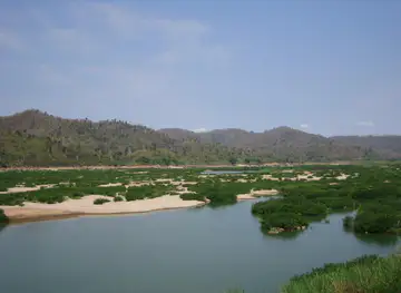


Swipe for more regions
Explore more
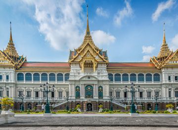
Explore more of Thailand
Discover Thailand: A land of diverse landscapes, rich culture, and warm hospitality, where ancient traditions blend seamlessly with modern attractions.
Explore Thailand