

Free Köýtendag Mountains Travel Guide & Mobile App
Explore Köýtendag Mountains with free travel guides. Discover regional history, expert tips, proposed trips, and audio guides on web or mobile app.


Explore the Köýtendag Mountains for dinosaur footprints, limestone caves, high valleys and remote protected landscapes in eastern Turkmenistan.
Read more about Köýtendag Mountains
When is the best time to visit Köýtendag Mountains?
Best: April–May, October · 23–28°C| Month | High (°C) | Rainfall (mm) |
|---|---|---|
| January | 8 | 15 |
| February | 12 | 13 |
| March | 17 | 20 |
| April (best) | 23 | 25 |
| May (best) | 28 | 30 |
| June | 33 | 10 |
| July | 36 | 5 |
| August | 35 | 7 |
| September | 30 | 12 |
| October (best) | 23 | 16 |
| November | 16 | 20 |
| December | 10 | 15 |
Getting to and around Köýtendag Mountains
How to get there
Transportation
Best attractions in Köýtendag Mountains
The Köýtendag Mountains offer a concentrated group of geological, palaeontological and outdoor attractions rather than a conventional circuit of museums and urban sights. The Hojapil dinosaur trackways are the region’s signature site, allowing visitors to examine preserved footprints set into a limestone surface and to understand the range’s deep geological history. Karst formations and caves, including the Kyrk Gyz cave associated with local traditions, provide a different perspective on the mountain’s subterranean landscape, although access should be organised with a guide. The Umbar-depe waterfall is among the mountain valleys’ notable natural features, with its appeal dependent on season and recent weather. Protected habitats within the Köýtendag area support mountain wildlife and birds, while high trails offer views across ridges, ravines and the dry lowlands. Visits are best suited to travellers interested in geology, photography, wildlife observation and walking; facilities are sparse, distances are substantial and many sites are reached by rough tracks rather than marked tourist roads.
-
Tourist attraction
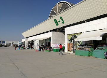
Altyn Asyr Bazar
Explore the vibrant Altyn Asyr Bazar in Ashgabat, a dazzling market of local crafts, fresh produce, and rich Turkmen culture waiting for you.
-
Natural history museum
Плато динозавров
Explore the captivating world of dinosaurs at Plato Dinozavrov, a premier natural history museum in Khodzhapil, Turkmenistan, perfect for curious minds.
-
Mountain peak
Köýtendag Range
Explore the breathtaking landscapes of the Köktendag Range in Uzbekistan, where adventure meets natural beauty in the heart of Surxondaryo Region.
-
 Mountain peak
Garkent
Discover the breathtaking beauty of Garkent Mountain Peak in Turkmenistan, a hidden gem for adventurers and nature enthusiasts.


Best landmarks in Köýtendag Mountains
The most recognisable landmark of the Köýtendag Mountains is the Hojapil dinosaur footprint plateau, whose exposed limestone preserves tracks from the Jurassic past and gives the region an importance far beyond its remote setting. Ayrybaba, rising to about 3,139 metres, forms the range’s dominant high point and symbolises the mountain frontier, although reaching its summit is a serious undertaking rather than an ordinary sightseeing excursion. The limestone ridges, deeply cut ravines and cave entrances are themselves defining natural landmarks, displaying the effects of uplift, erosion and underground water. The Umbar-depe waterfall provides a contrasting focal point in a mountain valley, while the Kyrk Gyz cave is notable for both its karst setting and its place in local cultural traditions. These landmarks are dispersed and access is controlled or weather-dependent, so they should be regarded as parts of a guided geographical itinerary rather than as independently signposted monuments.
-
Tourist attraction
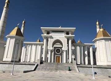
Ertugrul Gazi Mosque
Discover the spiritual beauty of Ertugrul Gazi Mosque in Ashgabat, a stunning blend of Islamic architecture and cultural heritage.
-
Tourist attraction
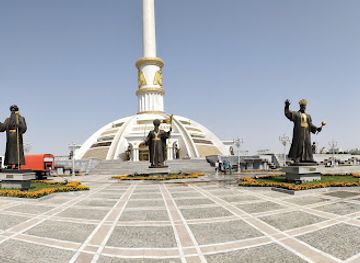
Independence Monument
Discover the breathtaking Independence Monument in Ashgabat, a stunning tribute to Turkmenistan's rich history and culture.
-
Tourist attraction
Turkmenbashy Ruhy Mosque
Discover the grandeur of the Turkmenbashy Ruhy Mosque in Ashgabat—an architectural masterpiece and a serene cultural sanctuary.
-
Tourist attraction
Independence Park
Explore Independence Park in Ashgabat, a tranquil urban oasis filled with stunning monuments, lush greenery, and cultural significance for every traveler.


Explore Köýtendag Mountains on the map
Plan your trip on one map. See where the top cities, national parks and sights are, and book hotels and experiences in a few clicks.
Best hotels in Köýtendag Mountains
Best restaurants in Köýtendag Mountains
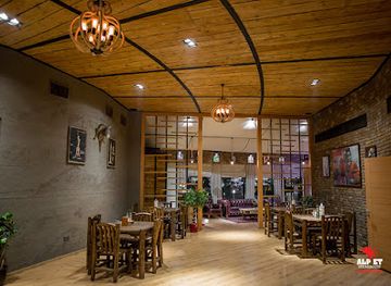
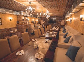
Dining in the Köýtendag region is primarily practical and local, with meals arranged through guesthouses, tour organisers or family-run establishments in mountain-edge settlements rather than through a developed restaurant scene. Visitors may encounter Turkmen and wider Central Asian staples such as flatbread, rice-based dishes, soups, grilled meat, dumplings and fresh or preserved produce, alongside tea served throughout the day. The exact menu depends on the settlement, season and availability of supplies. Markets and shops in larger eastern towns are more useful for assembling provisions than the remote valleys, where visitors should carry snacks and drinking water. Hospitality is important in rural settings, but dietary requirements should be explained in advance because specialised alternatives may be difficult to obtain. Meals are often part of the logistics of an organised excursion, so confirm what is included before setting out rather than expecting cafés or restaurants at natural attractions.
-
Turkmen restaurant
Hezzet Restaurant
Experience authentic Turkmen cuisine at Hezzet Restaurant in Ashgabat - perfect for families and food lovers alike.
-
Steak
AlpEt Steakhouse
Experience exquisite steaks at AlpEt Steakhouse in Ashgabat – where quality meets flavor in every bite.
-
Restaurant
Altın Çağ Restoranı
Experience authentic Turkmen cuisine at Altın Çağ Restoranı in Avaza – where every meal tells a story.
-
Restaurant
KOPETDAG PROJECT
Discover the rich flavors of Turkmen cuisine at KOPETDAG PROJECT in Ashgabat - a culinary gem offering delightful dishes in a welcoming atmosphere.

Best bars in Köýtendag Mountains
Köýtendag is not a nightlife destination, and remote mountain settlements have few venues designed for late-evening entertainment. Evening life generally centres on tea, family hospitality, simple meals and conversation at guesthouses or accommodation arranged by an organiser. In larger towns serving the eastern districts, visitors may find modest cafés and hotel-based dining, but opening arrangements and alcohol availability can vary. The region’s protected landscapes and long road journeys make early starts more relevant than nightclubs or bar-hopping. Travellers should avoid assuming that a remote village has a licensed bar, and should respect local preferences around alcohol, dress and public behaviour. For organised groups, the most rewarding evenings are usually spent discussing the day’s geological and mountain routes or observing the clear night sky away from settlement lights.
-
Steak
AlpEt Steakhouse
Discover the ultimate steak experience at AlpEt Steakhouse in Ashgabat, where every meal is a celebration of flavor and hospitality.
-
Cafe
Üzüm Café
Discover the flavors of Turkmenistan at Üzüm Café in Ashgabat, where cozy ambiance meets delightful culinary experiences.
-
Restaurant
KOPETDAG PROJECT
Experience the culinary delights of KOPETDAG PROJECT, where local flavors meet international cuisine in the heart of Ashgabat.
-
Banquet hall
Gul zaman Restaurant
Experience the rich flavors of Turkmen cuisine at Gul zaman Restaurant, the perfect venue for gatherings and celebrations in Ashgabat.


Best nightclubs in Köýtendag Mountains
Köýtendag is not a nightlife destination, and remote mountain settlements have few venues designed for late-evening entertainment. Evening life generally centres on tea, family hospitality, simple meals and conversation at guesthouses or accommodation arranged by an organiser. In larger towns serving the eastern districts, visitors may find modest cafés and hotel-based dining, but opening arrangements and alcohol availability can vary. The region’s protected landscapes and long road journeys make early starts more relevant than nightclubs or bar-hopping. Travellers should avoid assuming that a remote village has a licensed bar, and should respect local preferences around alcohol, dress and public behaviour. For organised groups, the most rewarding evenings are usually spent discussing the day’s geological and mountain routes or observing the clear night sky away from settlement lights.
-
Tourist attraction
Koytendag Nature Reserve
Explore the breathtaking landscapes and diverse wildlife of Koytendag Nature Reserve, a national park in Turkmenistan's stunning wilderness.
-
Night club
Yunus Club
Explore the vibrant nightlife of Ashgabat at Yunus Club, where music, dance, and style converge for an unforgettable experience.
-
Night club
Florida
Discover Florida's vibrant nightlife, featuring diverse cuisines and energetic clubs perfect for an unforgettable night out.


Best shops in Köýtendag Mountains
Shopping in Köýtendag is limited and functional, with small local stores and market provision in the larger settlements rather than dedicated visitor retail districts. Travellers may find bread, dried fruit, nuts, tea, seasonal produce and basic supplies useful for mountain excursions. In eastern towns, informal market trading can offer a broader selection of food and household goods, while locally made textiles, embroidered items or small craft objects may occasionally be available through personal contacts or organised visits. Availability is inconsistent, and visitors should not expect a permanent craft market or specialist outdoor shop near the natural attractions. Regional purchases are best made lawfully and respectfully, with particular care not to buy fossils, archaeological material, protected plants or stones removed from the mountains. Carrying cash in Turkmenistani manat is essential, as card payment facilities are limited.
-
Butcher shop
Kuwandykowlar maşgalasy
Experience the vibrant flavors of Turkmenistan at Kuwandykowlar maşgalasy, a butcher shop that brings local culinary traditions to life.

Get your free copy of our complete guide to Köýtendag Mountains, delivered straight to you.
Everything on this page, from attractions and restaurants to essentials and local phrases, in one PDF you can read offline, print or share.
Already have an account? Sign in
Your Köýtendag Mountains guide is ready.
We'll send it to · Not you? Sign out

Getting your guide ready…
We are putting together a fresh copy of the Köýtendag Mountains guide. This can take up to a minute.
This can take a few moments. If your browser asks, choose Allow so the download can start. You'll find the guide in your Downloads folder.
Nothing happened? Download it again
Sorry, the guide is taking longer than usual. Please try again in a minute, or get it by email instead.
Köýtendag Mountains essentials
Currency and Payment
Safety
Emergency Situations
Do's and Don'ts
Local Tips
From Eve
Local phrases worth knowing
You don't need to get them perfect. A few words go a long way, and locals appreciate the effort.
Basics
| English | Local | Say it |
|---|---|---|
| Hello | Salam | [sah-lahm] |
| Goodbye | Hoşlaşmak | [hosh-lash-mak] |
| Yes | Hawa | [hah-wah] |
| No | Ýok | [yok] |
| Please/You're welcome | Haýyr | [high-er] |
| Thank you | Sag boluň | [sahg bo-loon] |
| Excuse me/Sorry | Bagyşlaň | [bah-gih-lahn] |
| How are you? | Nädip? | [neh-dip] |
| Fine. And you? | Gowy. Siz näme? | [goh-wee. siz ne-meh] |
| Do you speak English? | İnglisçe aýdyp bilýärsiňizmi? | [een-glis-cheh ahy-dip bil-yer-sin-iz-mi] |
| I don't understand | Men düşünemok | [men du-shu-nem-ok] |
Eating & Drinking
| English | Local | Say it |
|---|---|---|
| I'd like to see the menu, please | Men menyu görmeli, haýyr | [men men-yu goor-me-li, high-er] |
| I don't eat meat | Men et iýmeýärin | [men et ee-meh-yar-in] |
| Cheers! | Şerefe! | [sheh-reh-feh] |
| I would like to pay, please | Men tölemeli, haýyr | [men to-le-ma-li, high-er] |
Emergencies
| English | Local | Say it |
|---|---|---|
| Help! | Kömek! | [ko-mehk] |
| Go away! | Gaýdyň! | [gai-dyn] |
| Call the Police! | Polisiýa jaň ediň! | [po-li-si-ya jan eh-din] |
| Call a doctor! | Doktory jaň ediň! | [dok-tor-y jan eh-din] |
| I'm lost | Men ýitdim | [men yeet-dim] |
| I'm ill | Men keselim | [men keh-se-lim] |
Shopping
| English | Local | Say it |
|---|---|---|
| I'd like to buy... | Men satyn almak isleýärin... | [men sa-tin al-mak ee-sle-ye-rin] |
| I'm just looking | Men diňe gözleýärin | [men din-ye gohz-le-ye-rin] |
| How much is it? | Bu näçe? | [boo neh-cheh] |
| That's too expensive | Bu gaty gymmat | [boo gah-tee gum-mat] |
| Can you lower the price? | Bahany peseldip bilersiňizmi? | [bah-ha-nee pes-el-dip bil-er-sin-iz-mi] |
Time & Numbers
| English | Local | Say it |
|---|---|---|
| What time is it? | Bu sagat näçe? | [boo sah-gat neh-cheh] |
| It's one o'clock | Bu bir sagat | [boo beer sah-gat] |
| Half past (10) | On bir geçdi | [on beer gech-di] |
| Morning | Ertesi | [er-te-si] |
| Afternoon | Gündiz | [gun-diz] |
| Evening | Gije | [gi-je] |
| Yesterday | Düýn | [dun] |
| Today | Şu gün | [shoo gun] |
| Tomorrow | Ertesi gün | [er-te-si gun] |
| 1 | 1 | [bir] |
| 2 | 2 | [iki] |
| 3 | 3 | [üç] |
| 4 | 4 | [dört] |
| 5 | 5 | [bäş] |
| 6 | 6 | [alty] |
| 7 | 7 | [ýedi] |
| 8 | 8 | [sekiz] |
| 9 | 9 | [dokuz] |
| 10 | 10 | [on] |
Transport & Directions
| English | Local | Say it |
|---|---|---|
| Where's a/the...? | Nerede ...? | [ne-reh-deh] |
| What's the address? | Address näme? | [ad-dress ne-meh] |
| Can you show me (on the map)? | Meni görkezip bilersiňizmi (kartada)? | [meh-nee goh-reh-zipe bil-er-sin-iz-mi (kar-ta-da)] |
| When's the next (bus)? | Indiki (awtobus) näme wagty? | [in-di-ki (aw-to-bus) ne-meh vahg-ty] |
| A ticket (to ....) | Bir bilet (....) | [beer bee-let (....)] |
History of Köýtendag Mountains
Jurassic Seas and Dinosaur Trackways
The geological story of Köýtendag reaches back to the Jurassic period, when parts of the region lay beneath or beside a shallow sea. Later uplift, folding and erosion created the limestone ridges and plateaux visible today. Near Hojapil, preserved dinosaur footprints provide evidence of large reptiles moving across ancient sedimentary surfaces. The trackways are important not simply as curiosities but as a record of the environment and animal life that existed before the formation of the modern Central Asian mountain landscape. Their survival in exposed limestone has made Köýtendag a significant palaeontological locality.
Ancient Central Asian Borderlands
Köýtendag lies within a wider region historically connected to Bactria, Sogdiana and the settled oases of Central Asia. Mountain passes linked upland communities with the Amu Darya plain and the towns of what are now eastern Turkmenistan and southern Uzbekistan. The range was not a single political unit throughout antiquity; authority shifted between regional states and larger empires. Nevertheless, its valleys, springs and mineral resources gave the mountains continuing importance within the broader history of eastern Central Asia.
Islamic Settlement and Mountain Communities
From the medieval period onwards, the mountain margins were shaped by Islamic culture, village agriculture, pastoralism and local networks of travel. Springs and cultivable pockets supported settlements in an otherwise dry environment, while caves, shrines and dramatic natural features acquired religious and folkloric associations. Communities in the Köýtendag area developed within the cultural world of Transoxiana, with connections across today’s Turkmenistan and Uzbekistan borderlands. Much of this heritage survives through settlement patterns, local place names, rural land use and traditions rather than through large monumental buildings.
Trade, Mining and Imperial Frontier Administration
The eastern Turkmenistan mountains occupied a frontier position during the period of Russian imperial expansion and subsequent administrative reorganisation in Central Asia. Their remoteness limited large-scale urban development, but geological resources encouraged surveying and extraction. Gypsum, sulphur and other minerals became increasingly significant as modern authorities mapped the region’s geology. Roads and administrative links were improved unevenly, connecting mountain districts with the Amu Darya corridor while leaving many valleys difficult to reach.
Soviet Geological Research and Protected Landscapes
During the Soviet period, systematic geological, palaeontological and biological research brought wider scientific attention to Köýtendag. Researchers documented its karst, caves, fossils, dinosaur tracks and mountain ecosystems, while state institutions also developed mineral resources and rural infrastructure. Protection of important habitats and geological features became part of the region’s modern administrative history. The Köýtendag State Nature Reserve reflects this emphasis on conserving the range’s unusual wildlife and landscapes, although access remains regulated.
Independent Turkmenistan and Controlled Mountain Tourism
Since Turkmenistan became independent in 1991, Köýtendag has remained a remote eastern region with tightly managed travel conditions. Its natural assets are presented through a limited form of organised tourism focused on dinosaur footprints, caves, waterfalls, wildlife and mountain scenery. The area’s proximity to an international border and the presence of protected and strategically sensitive zones mean that permits, official guidance and restrictions may apply. Contemporary visits therefore combine scientific and landscape interest with the practical realities of travelling in a highly regulated country.
Köýtendag Mountains in Photos
Browse through our photo collection highlighting the charm and character of the destination.
Neighbouring regions of Köýtendag Mountains
The closest regions to Köýtendag Mountains, if you have time for more than one.
-

-

-

-

-


Swipe for more regions
Explore more
Explore more of Turkmenistan
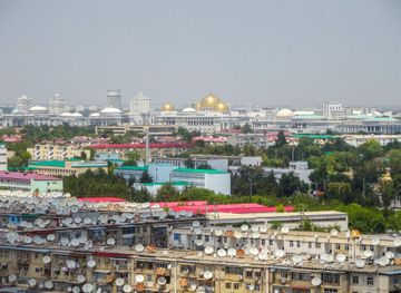
Discover Turkmenistan: A Unique Blend of Ancient Silk Road Heritage, Modern Architectural Marvels, and Stunning Natural Landscapes.
Explore Turkmenistan