

Free Medicine Bow Mountains Travel Guide & Mobile App
Explore Medicine Bow Mountains with free travel guides. Discover regional history, expert tips, proposed trips, and audio guides on web or mobile app.


Explore the Medicine Bow Mountains for alpine lakes, granite summits, forest trails and scenic drives across south-eastern Wyoming.
Read more about Medicine Bow Mountains
Getting to and around Medicine Bow Mountains
How to get there
Transportation
Destinations in Medicine Bow Mountains
Resorts, valleys and scenic spots worth a trip of their own.
-

-


Swipe for more destinations
Best attractions in Medicine Bow Mountains
The principal attraction of the Medicine Bow Mountains is the combination of accessible alpine scenery and extensive public land. The Snowy Range Scenic Byway crosses Wyoming’s high country between Laramie and the Saratoga–Encampment area, with viewpoints, pull-offs and access to trails around Mirror Lake, Brooklyn Lake and Libby Creek. Medicine Bow Peak provides the range’s most prominent summit objective, while numerous shorter walks explore glacial basins, granite outcrops, forest and open tundra. Medicine Bow National Forest offers camping, fishing, wildlife watching, climbing and scenic drives, with facilities varying by season and location. Lower forest roads and valleys provide quieter hiking and cycling opportunities, while winter brings snowshoeing, Nordic skiing and other snow-based activities. The nearby communities add useful complementary experiences: Laramie has museums, historic architecture and a university cultural scene; Saratoga is known for its mineral hot springs; and Encampment preserves aspects of the area’s mining and timber heritage. These towns are gateways outside or at the edge of the mountain landscape rather than attractions contained within every high-elevation district. Visitors should regard the range as a dispersed recreation area, where weather, road access and trail conditions are part of the experience.
-
Museum
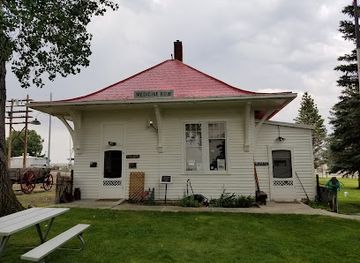
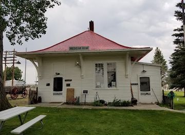
Medicine Bow Museum
Explore the historical treasures of Medicine Bow Museum, where the past meets the present in Wyoming's charming community.
-
Tourist attraction
Deerwood Ranch Wild Horse EcoSanctuary
Experience the beauty of wild horses in their natural habitat at Deerwood Ranch Wild Horse EcoSanctuary, a serene wildlife refuge in Laramie, Wyoming.
-
Nature preserve
Savage Run Wilderness
Explore the untouched beauty of Savage Run Wilderness in Wyoming, a natural preserve perfect for hiking, wildlife watching, and reconnecting with nature.
-
Hiking area
Chimney Park Trailhead
Experience the breathtaking beauty of Chimney Park Trailhead in Wyoming, where stunning landscapes and diverse wildlife await outdoor enthusiasts.
Best landmarks in Medicine Bow Mountains
Medicine Bow Peak is the defining natural landmark of the range, rising above the Snowy Range’s granite ridges and glacial basins and forming a recognisable summit from surrounding Wyoming country. The high crossing of the Snowy Range Scenic Byway is itself a landmark route, revealing a succession of forest, exposed rock, lakes and tundra as it climbs above the tree line. Mirror Lake and Brooklyn Lake are notable glacial-water landscapes whose shores and surrounding peaks illustrate the range’s Ice Age geology. Libby Creek marks another characteristic corridor of forest and mountain water. Beyond the summits, the broad public-land setting of Medicine Bow National Forest is an important regional landmark in its own right, reflecting the long American history of forestry, watershed management and outdoor recreation. The mountains lack a single monumental castle or cathedral; their identity rests instead on the relationship between high peaks, weather, forest and open access. Nearby Saratoga’s hot springs and historic townscape, and Encampment’s mining-era heritage, are relevant gateway landmarks but lie in surrounding communities rather than representing the high alpine core.
-
Museum
Medicine Bow Museum
Explore the Medicine Bow Museum and step back in time to discover the rich history and culture of Wyoming's Medicine Bow region.
Explore Medicine Bow Mountains on the map
Plan your trip on one map. See where the top cities, national parks and sights are, and book hotels and experiences in a few clicks.
Best hotels in Medicine Bow Mountains
Best restaurants in Medicine Bow Mountains
There is no single dining centre in the Medicine Bow Mountains, so most meals are taken before or after excursions in Laramie, Centennial, Saratoga, Encampment or Rawlins. Laramie offers the broadest choice, including cafés, bakeries, breweries, casual restaurants and cuisines reflecting its university population. Saratoga and Encampment provide smaller-town dining, diners, cafés and informal restaurants suited to travellers using the southern approaches, while rural lodges and seasonal services may have limited availability. Wyoming’s wider food culture is visible in hearty breakfasts, burgers, steaks, game where legally and responsibly sourced, trout, chilli and practical trail provisions, alongside American baking and coffee-shop fare. Farmers’ markets and local shops can be useful for picnic supplies, though dates and availability vary by season. Plan carefully before entering the high country: restaurants, groceries and reliable drinking-water supplies are not distributed among remote lakes and trailheads, and camp cooking is often the realistic option for overnight visitors.
-
Hotel
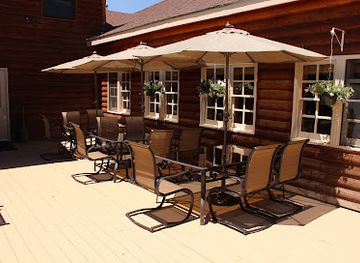
Old Corral Hotel & Steakhouse
Discover rustic elegance at Old Corral Hotel & Steakhouse in Centennial, Wyoming - your gateway to adventure and fine dining.
-
American
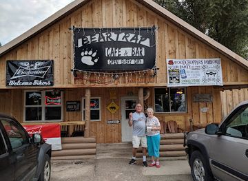
Bear Trap Cafe & Bar
Discover the warmth of American cuisine at Bear Trap Cafe & Bar in Riverside – where every meal feels like home.
-
Restaurant
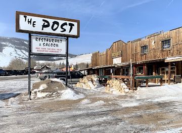
Trading Post, Centennial
Discover authentic Wyoming flavors at Trading Post in Centennial – a cozy restaurant celebrating local cuisine amidst stunning landscapes.
-
Restaurant
C-Spear
Experience the flavors of Wyoming at C-Spear, where every meal is a celebration of local ingredients and culinary excellence.
Best bars in Medicine Bow Mountains
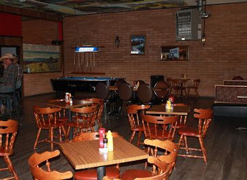
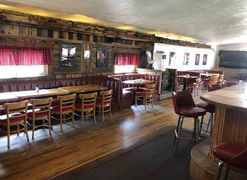
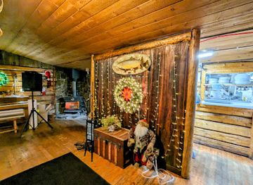
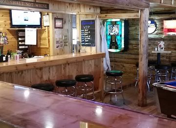
Evening life around the Medicine Bow Mountains is low-key and concentrated in nearby communities rather than in the high country. Laramie has the largest selection of traditional bars, breweries, live-music settings and late-evening restaurants, influenced in part by its university population. Saratoga and Encampment offer smaller-town bars, historic-style drinking establishments and restaurants where travellers may meet local residents, while Rawlins provides additional services outside the range on the western approach. Centennial has a limited seasonal visitor scene linked to the Snowy Range road and outdoor recreation. In the mountains themselves, evenings generally mean campfires where permitted, stargazing and quiet lodge or campsite time rather than clubs. Alcohol should never be combined with driving, boating or strenuous backcountry activity, and fire restrictions can change during dry periods.
-
Grill
Bear Bottom Bar and Grill
Discover the flavors of Wyoming at Bear Bottom Bar and Grill, where delicious food meets warm hospitality in a stunning natural setting.
-
Restaurant
Trading Post, Centennial
Experience the authentic taste of Wyoming at Trading Post, Centennial – a cozy restaurant nestled in the heart of nature's beauty.
-
Grill
307 Pub & Grub LLC
Experience the heart of Wyoming's culinary scene at 307 Pub & Grub LLC, where delicious grilled dishes and warm hospitality await.
-
Restaurant
C-Spear
Experience the charm and flavors of Medicine Bow at C-Spear, your go-to restaurant for comfort food and local specialties.
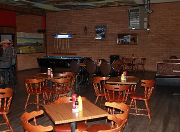
Best nightclubs in Medicine Bow Mountains
-
Bar
Outlaw Saloon
Experience the vibrant atmosphere and live music at Outlaw Saloon in Cheyenne, a perfect blend of local culture and hearty fare.
-
Bar
Beacon Club
Experience the lively atmosphere at The Beacon Club, Mills' premier bar and club, perfect for nightlife enthusiasts and social gatherings.
-
Bar
Cadillac Ranch Bar
Discover the lively nightlife at Cadillac Ranch Bar in Cheyenne, Wyoming, where locals and tourists unite for great drinks and a fun atmosphere.
-
Bar
Buckhorn Bar & Parlor
Experience the spirited atmosphere of Buckhorn Bar & Parlor, Laramie's favorite bar, where local culture meets vibrant nightlife in a welcoming setting.
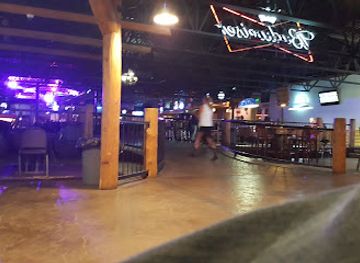
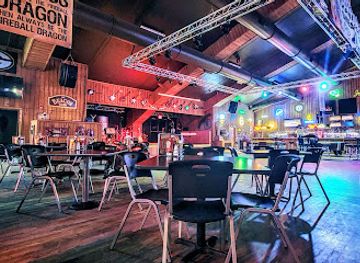
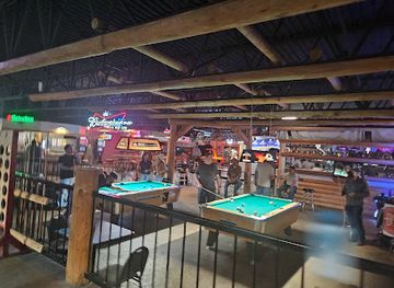
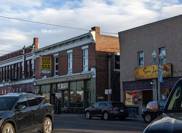
Best shops in Medicine Bow Mountains
Shopping in the Medicine Bow Mountains is practical and dispersed, with the most useful choices in Laramie, Saratoga, Encampment, Centennial and Rawlins rather than at remote trailheads. Laramie has independent shops, galleries, bookstores, outdoor retailers and seasonal markets, making it the strongest place to buy clothing, maps, provisions and locally made gifts. Saratoga and Encampment offer small-town shops, art, antiques, western-style goods and locally oriented souvenirs, while Centennial has limited seasonal services near the eastern mountain approach. Useful regional purchases include Wyoming-made foods, coffee, preserves, leather goods, artwork, books about local history and outdoor equipment. Farmers’ markets can provide produce and baked goods when operating, but market days are seasonal and should be checked locally. Visitors should stock up before driving into the mountains, where shopping is essentially limited to supplies obtained in gateway communities rather than a network of mountain retail outlets.
-
Gas station
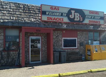
J B's Stop-N-Shop
Discover the welcoming charm of J B's Stop-N-Shop in Medicine Bow, Wyoming, where every visit feels like home on your journey.
-
Gift shop
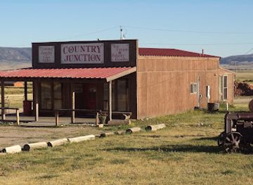
Country Junction
Explore Country Junction in Laramie, Wyoming, for a unique gift shopping experience filled with local crafts and homemade delights.
-
Convenience store
Friendly Store & Motel
Experience the warmth of Wyoming hospitality at Friendly Store & Motel, your go-to convenience store, bar, café, and motel in Centennial.
-
Gift shop
Creations at the mercantile
Discover unique gifts and handcrafted treasures at Creations at the Mercantile in Centennial, Wyoming – a must-visit for every traveler.
Get your free copy of our complete guide to Medicine Bow Mountains, delivered straight to you.
Everything on this page, from attractions and restaurants to essentials and local phrases, in one PDF you can read offline, print or share.
Already have an account? Sign in
Your Medicine Bow Mountains guide is ready.
We'll send it to · Not you? Sign out

Getting your guide ready…
We are putting together a fresh copy of the Medicine Bow Mountains guide. This can take up to a minute.
This can take a few moments. If your browser asks, choose Allow so the download can start. You'll find the guide in your Downloads folder.
Nothing happened? Download it again
Sorry, the guide is taking longer than usual. Please try again in a minute, or get it by email instead.
Medicine Bow Mountains essentials
Currency and Payment
Safety
Emergency Situations
Do's and Don'ts
Local Tips
From Eve
Local phrases worth knowing
You don't need to get them perfect. A few words go a long way, and locals appreciate the effort.
Basics
| English | Local | Say it |
|---|---|---|
| Hello | Howdy | [haʊdi] |
| Goodbye | See ya later | [si jə ˈleɪtər] |
| Yes | Yup | [jʌp] |
| No | Nah | [nɑ] |
| Please/You're welcome | Sure thing | [ʃʊr θɪŋ] |
| Thank you | Thanks | [θæŋks] |
| Excuse me/Sorry | Pardon me | [ˈpɑrdən mi] |
| How are you? | How's it going? | [haʊz ɪt ˈɡoʊɪŋ] |
| Fine. And you? | Good, and you? | [ɡʊd, ən ju] |
| Do you speak English? | Do ya speak English? | [du jə spiːk ˈɪŋɡlɪʃ] |
| I don't understand | I ain't following | [aɪ eɪnt ˈfɑloʊɪŋ] |
Eating & Drinking
| English | Local | Say it |
|---|---|---|
| I'd like to see the menu, please | Can I see the menu? | [kæn aɪ si ðə ˈmɛnju] |
| I don't eat meat | I don't eat meat | [aɪ doʊnt it miːt] |
| Cheers! | Cheers! | [ʧɪrz] |
| I would like to pay, please | Can I get the check, please? | [kæn aɪ ɡɛt ðə ʧɛk pliz] |
Emergencies
| English | Local | Say it |
|---|---|---|
| Help! | Help! | [hɛlp] |
| Go away! | Get lost! | [ɡɛt lɔst] |
| Call the Police! | Call the cops! | [kɔl ðə kɑps] |
| Call a doctor! | Get a doctor! | [ɡɛt ə ˈdɑktər] |
| I'm lost | I'm lost | [aɪm lɔst] |
| I'm ill | I'm sick | [aɪm sɪk] |
Shopping
| English | Local | Say it |
|---|---|---|
| I'd like to buy... | I wanna buy... | [aɪ ˈwɑnə baɪ] |
| I'm just looking | Just browsing | [dʒʌst ˈbraʊzɪŋ] |
| How much is it? | What's the price? | [wɑts ðə praɪs] |
| That's too expensive | That's a bit pricey | [ðæts ə bɪt ˈpraɪsi] |
| Can you lower the price? | Can ya knock down the price? | [kæn jə nɑk daʊn ðə praɪs] |
Time & Numbers
| English | Local | Say it |
|---|---|---|
| What time is it? | What's the time? | [wɑts ðə taɪm] |
| It's one o'clock | It's one o'clock | [ɪts wʌn əˈklɑk] |
| Half past (10) | Half past ten | [hæf pæst tɛn] |
| Morning | Morning | [ˈmɔrnɪŋ] |
| Afternoon | Afternoon | [ˌæftərˈnun] |
| Evening | Evening | [ˈivnɪŋ] |
| Yesterday | Yesterday | [ˈjɛstərdeɪ] |
| Today | Today | [təˈdeɪ] |
| Tomorrow | Tomorrow | [təˈmɔroʊ] |
| 1 | One | [wʌn] |
| 2 | Two | [tu] |
| 3 | Three | [θri] |
| 4 | Four | [fɔr] |
| 5 | Five | [faɪv] |
| 6 | Six | [sɪks] |
| 7 | Seven | [ˈsɛvən] |
| 8 | Eight | [eɪt] |
| 9 | Nine | [naɪn] |
| 10 | Ten | [tɛn] |
Transport & Directions
| English | Local | Say it |
|---|---|---|
| Where's a/the...? | Where's the...? | [wɛrz ðə] |
| What's the address? | What's the address? | [wɑts ði ˈædrɛs] |
| Can you show me (on the map)? | Can you point it out? | [kæn jə pɔɪnt ɪt aʊt] |
| When's the next (bus)? | When's the next bus? | [wɛn zðə nɛkst bʌs] |
| A ticket (to....) | One ticket to... | [wʌn ˈtɪkɪt tə] |
History of Medicine Bow Mountains
Indigenous Homelands and Mountain Travel
The Medicine Bow Mountains occupy ancestral lands associated with Indigenous peoples of the central Rocky Mountains, including the Cheyenne, Arapaho and Ute, among other communities. Mountain passes, river corridors and nearby plains formed part of wider seasonal geographies rather than isolated wildernesses. The name Medicine Bow reflects the region’s long association with Indigenous material culture and bow-making traditions, although historical explanations of the name vary. Indigenous presence remains an essential part of understanding the landscape before and beyond American settlement.
Exploration and the Expansion of the United States
During the nineteenth century, American explorers, surveyors, trappers and emigrants moved through the wider Wyoming landscape as the United States extended control across the region. The mountains were difficult country for overland travel, but nearby routes linked the Southern Rocky Mountains with the plains and river valleys. Forts, wagon corridors and later military and administrative infrastructure changed patterns of movement. These developments also brought profound disruption to Indigenous communities through conflict, treaty-making, displacement and the loss of access to established territories.
Railways, Ranching and Resource Use
The arrival of the Union Pacific Railroad across southern Wyoming in the nineteenth century strengthened nearby towns and connected the region to national markets, although the main line runs outside the high mountain core. Ranching developed in surrounding valleys and basins, while timber, minerals and water became increasingly important to settlement and industry. Towns such as Laramie, Saratoga, Rawlins and Encampment grew in different ways from this wider network of transportation and natural-resource use. Their histories provide context for the mountain landscapes visited today.
National Forest Conservation
Federal forest administration brought much of the Medicine Bow country into a national-forest framework in the early twentieth century. Management sought to regulate timber cutting, grazing, watershed protection and later recreation across a large public landscape. The forests are now administered within Medicine Bow National Forest, part of the wider Medicine Bow–Routt National Forest system. This history explains why visitors encounter a mixture of working forest, managed campgrounds, roads, wilderness-like backcountry and protected alpine environments rather than a privately developed mountain resort.
Road Building and the Snowy Range Scenic Byway
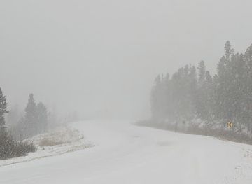
Improved roads transformed the mountains from a difficult destination into a reachable summer touring and recreation area. Wyoming Highway 130 crosses the Snowy Range through high country and is now known as the Snowy Range Scenic Byway. Its construction and later improvement made alpine lakes, trailheads and viewpoints accessible to motorists travelling between the Laramie Basin and the communities south-west of the range. Seasonal snow remains a practical reminder that the road passes through a genuinely high mountain environment.
Modern Outdoor Recreation
In the twentieth and twenty-first centuries, hiking, camping, fishing, climbing, cross-country skiing and scenic driving became central to the region’s visitor economy. The growth of recreation has brought facilities and access but also pressure on trails, lakeshores, wildlife and fragile alpine vegetation. Contemporary management therefore balances public enjoyment with road closures, fire regulations, campsite controls and conservation. The Medicine Bow Mountains remain a working public landscape, not simply a backdrop for tourism.
Medicine Bow Mountains in Photos
Browse through our photo collection highlighting the charm and character of the destination.
Neighbouring regions of Medicine Bow Mountains
The closest regions to Medicine Bow Mountains, if you have time for more than one.
-

-

-

-

-


Swipe for more regions
Explore more

Explore more of Wyoming
Discover Wyoming: A Land of Unspoiled Beauty, Rich History, and Boundless Outdoor Adventures in the Heart of the American West.
Explore Wyoming