

Medicine Bow National Forest Travel Guide - Free Web & App
Your ultimate guide to Medicine Bow National Forest. Discover top landmarks, proposed trips, and local tips. Free on the web or via the Evendo companion app.


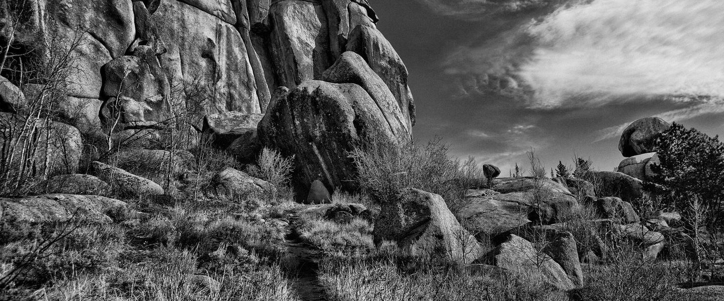


Medicine Bow National Forest in Wyoming offers alpine lakes, granite formations, wildlife, scenic drives and mountain trails near Laramie and Saratoga.
Mountain Landscapes
\n\nMedicine Bow National Forest occupies a broad sweep of south-eastern Wyoming, extending across the Laramie, Snowy and Sierra Madre ranges. Its forests, alpine lakes, granite outcrops, open meadows and high plateaux create a destination with considerable geographical variety. The Snowy Range rises west of Laramie, where Wyoming Highway 130 crosses the mountains through the Medicine Bow-Routt National Forests and reaches elevations above 3,000 metres. Farther south, the Sierra Madre offers quieter valleys, coniferous woodland and access to the communities of Saratoga, Encampment and Riverside.\n\nOutdoor Character
\n\nWalking, camping, fishing, mountain biking, climbing, wildlife observation and scenic driving are central to the forest experience, although conditions and permissions vary by site and season. Popular landscapes include the alpine surroundings of Mirror Lake and the Libby Creek area, the granite formations of Vedauwoo, and the high-country trails around the Snowy Range. Elk, mule deer, moose, pronghorn and black bears inhabit parts of the forest, while lakes and streams support cold-water fisheries. Wildlife sightings are never guaranteed, and visitors should keep their distance and store food responsibly.\n\nGateway Communities
\n\nLaramie is the principal eastern gateway for the Snowy Range and Vedauwoo, while Saratoga and Encampment provide access to the southern forest. Centennial is a useful small base near the Snowy Range, and Rawlins and southern Wyoming communities serve some western and southern approaches. Facilities become sparse away from these settlements, so a visit depends on preparation, weather awareness and an understanding that large sections of the forest are remote rather than developed recreation parks.When is the best time to visit Medicine Bow National Forest?
Best: June–August · 16–18°C| Month | High (°C) | Rainfall (mm) |
|---|---|---|
| January | -5 | 20 |
| February | -3 | 18 |
| March | 3 | 30 |
| April | 7 | 35 |
| May | 11 | 40 |
| June (best) | 16 | 45 |
| July (best) | 18 | 50 |
| August (best) | 18 | 45 |
| September | 14 | 40 |
| October | 8 | 35 |
| November | 1 | 30 |
| December | -3 | 25 |
Getting to and around Medicine Bow National Forest
How to get there
Transportation
Best attractions in Medicine Bow National Forest
Medicine Bow National Forest’s attractions are distributed across several mountain landscapes rather than concentrated at one visitor centre. The Snowy Range Scenic Byway along Wyoming Highway 130 offers access to high-elevation scenery, lakes, trailheads and viewpoints when the route is open. Mirror Lake and the surrounding Snowy Range provide opportunities for walking, fishing and landscape photography, while Libby Creek offers a more wooded recreation setting near Centennial. Vedauwoo, east of Laramie, is known for its weathered granite formations, climbing areas, trails and distinctive open woodland. In the southern forest, the Sierra Madre around Saratoga, Encampment and Riverside combines conifer forest, mountain streams and broad recreational country. Visitors may also explore the forest’s dispersed trail systems, campgrounds and fishing waters, subject to local regulations and seasonal conditions. The scale of the area makes it important to choose one mountain district or corridor at a time rather than treating the forest as a compact attraction.
-
Monument
Abraham Lincoln Memorial Monument
Visit the iconic Abraham Lincoln Memorial Monument in Laramie, Wyoming, a picturesque tribute to the legacy of a great American president.
-
Historical place museum
Wyoming Territorial Prison State Historic Site
Explore the rich history of the Old West at the Wyoming Territorial Prison State Historic Site, where tales of infamous outlaws come to life.
-
Ski resort
Snowy Range Ski Area
Experience the adventure of winter sports at Snowy Range Ski Area, Wyoming's premier destination for skiing, snowboarding, and breathtaking mountain views.
-
Natural history museum
Geological Museum
Explore the Geological Museum in Laramie, Wyoming: A fascinating journey through the earth's history with interactive exhibits and stunning collections.


Explore Medicine Bow National Forest on the map
Plan your trip on one map. See where the top attractions, landmarks, restaurants and hotels are, and book hotels and experiences in a few clicks.
Best hotels in Medicine Bow National Forest
Best restaurants in Medicine Bow National Forest
Dining within Medicine Bow National Forest is limited because the area is predominantly public forest and recreation land rather than a continuous settled region. Most substantial meals, groceries and fuel-based food stops are found in gateway communities such as Laramie, Saratoga, Encampment, Riverside and Rawlins. These towns provide the practical setting for American regional cooking, café meals, bakeries, provisions for camping and the informal food culture associated with ranching and mountain travel. Visitors staying in cabins, campgrounds or remote accommodation should plan supplies in advance, particularly for journeys into the Snowy Range or Sierra Madre. Local restaurants and pubs may feature beef, burgers, sandwiches, trout or other broadly Western and Rocky Mountain fare, but specific menus vary. Picnic food and self-catering are often the most reliable options inside the forest, where there are no guarantees of nearby shops or restaurants.
-
Truck stop
Akal Travel Center
Discover Akal Travel Center: A unique truck stop offering delicious Armenian and Indian cuisine along with convenient fueling services.
-
Grill
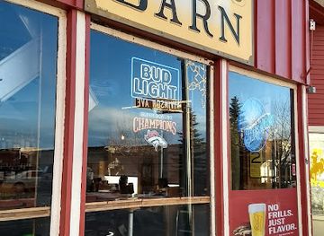
Born In A Barn
Discover Laramie's hidden gem at Born In A Barn, where American grill favorites meet warm hospitality in a charming setting.
-
Mexican
Corona Village
Experience authentic Mexican cuisine at Corona Village in Laramie - where vibrant flavors meet warm hospitality.
-
Breakfast
J's Prairie Rose
Experience homestyle breakfasts at J's Prairie Rose - where every bite brings comfort and joy in Laramie, Wyoming.


Best bars in Medicine Bow National Forest
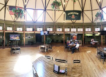
Evening entertainment in Medicine Bow National Forest is generally quiet and outdoors-oriented, with no concentrated nightlife district inside the forest. Traditional pubs, bars and casual restaurants in Laramie, Saratoga, Encampment, Riverside and Rawlins provide the main opportunities for a drink or evening meal after a day on the trails. Laramie has the broadest urban selection because of its university population, while Saratoga and the smaller southern communities offer a more restrained small-town atmosphere. In the forest itself, evenings are more likely to involve campfire settings where permitted, stargazing or relaxation at a cabin or lodge than organised entertainment. Check local fire regulations and seasonal restrictions before planning a campfire, and do not rely on remote recreation areas for late-night supplies, transport or mobile connectivity.
-
Grill
Crowbar & Grill
Experience the heart of Laramie at Crowbar & Grill, where local flavors meet a welcoming atmosphere in Wyoming's vibrant dining scene.
-
Restaurant
O'Dwyers Public House
Discover the flavors of Wyoming at O'Dwyers Public House, a lively restaurant and bar & grill in Laramie offering delicious meals and local brews.
-
Bar
Altitude Chophouse & Brewery
Experience the best of Laramie's culinary scene at Altitude Chophouse & Brewery, where local flavors meet expertly crafted brews.
-
Hotel
Old Corral Hotel & Steakhouse
Experience rustic charm and delectable flavors at the Old Corral Hotel & Steakhouse, your ultimate Wyoming getaway.



Best nightclubs in Medicine Bow National Forest
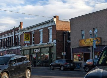
Evening entertainment in Medicine Bow National Forest is generally quiet and outdoors-oriented, with no concentrated nightlife district inside the forest. Traditional pubs, bars and casual restaurants in Laramie, Saratoga, Encampment, Riverside and Rawlins provide the main opportunities for a drink or evening meal after a day on the trails. Laramie has the broadest urban selection because of its university population, while Saratoga and the smaller southern communities offer a more restrained small-town atmosphere. In the forest itself, evenings are more likely to involve campfire settings where permitted, stargazing or relaxation at a cabin or lodge than organised entertainment. Check local fire regulations and seasonal restrictions before planning a campfire, and do not rely on remote recreation areas for late-night supplies, transport or mobile connectivity.
-
Bar
Buckhorn Bar & Parlor
Experience the spirited atmosphere of Buckhorn Bar & Parlor, Laramie's favorite bar, where local culture meets vibrant nightlife in a welcoming setting.
-
Bar
Mingle's Lounge
Discover the lively charm of Mingle's Lounge in Laramie, Wyoming - a welcoming bar with great drinks and a vibrant atmosphere.
-
Bar
The Cowboy Saloon & Dance Hall
Discover the authentic Western nightlife at The Cowboy Saloon & Dance Hall, where lively music and dance come together in a fun, friendly atmosphere.
-
Bar
Keystone Hall
Discover the heart of Laramie's nightlife at Keystone Hall, where lively music and a vibrant atmosphere create unforgettable memories.



Best shops in Medicine Bow National Forest
Shopping opportunities are concentrated outside the forest in its gateway communities. Laramie offers the widest range of outdoor equipment, groceries, books, gifts and independent retail, while Saratoga, Encampment, Riverside and Rawlins provide smaller selections of provisions, practical supplies, art, souvenirs and locally oriented businesses. Visitors may find Western clothing, regional art, handmade goods, locally produced food and items associated with ranching and outdoor recreation, although stock varies by town and season. Shops near the forest are useful places to obtain fuel, food, maps and last-minute equipment before heading into remote areas, but they should not be treated as guaranteed trailhead services. The forest itself has no continuous shopping district, and visitors planning a multi-day trip should buy specialist supplies and camping provisions before leaving the larger settlements.
-
Department store
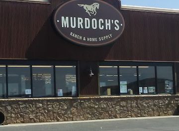
Murdoch's Ranch & Home Supply
Explore Murdoch's Ranch & Home Supply in Laramie for an eclectic mix of clothing, hardware, and sporting goods that captures the spirit of Wyoming.
-
Tobacco shop
BlackMarket Vape & Smoke
Explore BlackMarket Vape & Smoke in Laramie, Wyoming for a diverse selection of tobacco, vape products, and a welcoming community atmosphere.
-
Grocery store
Big Hollow Food Co-Op
Explore local flavors and sustainable products at Big Hollow Food Co-Op in Laramie, Wyoming, a must-visit grocery store for discerning travelers.
-
Coffee shop
Night Heron Books & Coffeehouse
Discover Laramie's hidden gem where literature meets luscious pastries and aromatic coffee in a cozy setting.


Get your free copy of our complete guide to Medicine Bow National Forest, delivered straight to you.
Everything on this page, from attractions and restaurants to essentials and local phrases, in one PDF you can read offline, print or share.
Already have an account? Sign in
Your Medicine Bow National Forest guide is ready.
We'll send it to · Not you? Sign out

Getting your guide ready…
We are putting together a fresh copy of the Medicine Bow National Forest guide. This can take up to a minute.
This can take a few moments. If your browser asks, choose Allow so the download can start. You'll find the guide in your Downloads folder.
Nothing happened? Download it again
Sorry, the guide is taking longer than usual. Please try again in a minute, or get it by email instead.
Medicine Bow National Forest essentials
Currency and Payment
Safety
Emergency Situations
Do's and Don'ts
Local Tips
From Eve
Local phrases worth knowing
You don't need to get them perfect. A few words go a long way, and locals appreciate the effort.
Basics
| English | Local | Say it |
|---|---|---|
| Hello | Howdy | [haw-dee] |
| Goodbye | See ya | [see yuh] |
| Yes | Yep | [yep] |
| No | Nah | [nah] |
| Please/You're welcome | Please/No worries | [pleez / no wur-eez] |
| Thank you | Thanks | [thanks] |
| Excuse me/Sorry | Pardon me/My bad | [par-dun me / my bad] |
| How are you? | Howdy | [haw-dee] |
| Fine. And you? | Good. How 'bout you? | [good. how 'bout yuh] |
| Do you speak English? | Ya speak English? | [ya speak ing-glish] |
| I don't understand | I ain't catchin' on | [I aint ketch-in on] |
Eating & Drinking
| English | Local | Say it |
|---|---|---|
| I'd like to see the menu, please | Can I check out the menu? | [kan eye chek out the men-yoo] |
| I don't eat meat | I don't do meat | [I don't do meat] |
| Cheers! | Cheers! | [cheers] |
| I would like to pay, please | Can I settle up, please | [kan eye set-tul up, please] |
Emergencies
| English | Local | Say it |
|---|---|---|
| Help! | Help! | [help] |
| Go away! | Git! | [git] |
| Call the Police! | Ring the Sheriff! | [ring the sher-uff] |
| Call a doctor! | Get a doc! | [get a doc] |
| I'm lost | I'm turned around | [i'm turned around] |
| I'm ill | I'm feelin' poorly | [i'm feelin' poor-ly] |
Shopping
| English | Local | Say it |
|---|---|---|
| I'd like to buy... | I'm interested in... | [I'm in-tur-es-ted in] |
| I'm just looking | Just browsing | [just brows-ing] |
| How much is it? | What's the damage? | [whats the dam-ij] |
| That's too expensive | That's steep | [thats steep] |
| Can you lower the price? | Can ya knock it down? | [can ya nok it down] |
Time & Numbers
| English | Local | Say it |
|---|---|---|
| What time is it? | What's the time? | [whats the time] |
| It's one o'clock | It's one | [its one] |
| Half past (10) | Half ten | [half ten] |
| Morning | Mornin' | [mornin'] |
| Afternoon | Afternoon | [afternoon] |
| Evening | Evenin' | [evenin'] |
| Yesterday | Yest'day | [yest'day] |
| Today | Today | [today] |
| Tomorrow | Tomorrer | [tom-er-er] |
| 1 | One | [wun] |
| 2 | Two | [too] |
| 3 | Three | [three] |
| 4 | Four | [four] |
| 5 | Five | [five] |
| 6 | Six | [six] |
| 7 | Seven | [sev-en] |
| 8 | Eight | [ate] |
| 9 | Nine | [nine] |
| 10 | Ten | [ten] |
Transport & Directions
| English | Local | Say it |
|---|---|---|
| Where's a/the...? | Where's the...? | [wheres the] |
| What's the address? | What's the addy? | [whats the add-ee] |
| Can you show me (on the map)? | Can ya point it out (on the map)? | [can ya point it out (on the map)] |
| When's the next (bus)? | When's the next bus? | [whens the next bus] |
| A ticket (to ....) | A pass (to ....) | [a pass (to ....)] |
History of Medicine Bow National Forest
Mountains, Ice and Geological Foundations
The forest’s character begins with the ancient mountain systems and geological processes that shaped south-eastern Wyoming. The Laramie, Snowy and Sierra Madre ranges contain uplifted rock, weathered ridges, glacially influenced high-country terrain and broad valleys. In the Snowy Range, past glacial activity helped form basins and lakes among the higher peaks, while granite outcrops such as those at Vedauwoo reflect the region’s resistant bedrock. These landscapes developed over geological timescales rather than through a single historical event, but they have strongly influenced later travel, settlement, grazing, recreation and conservation.
Indigenous Homelands and Early Travel
The mountains and plains of what is now Medicine Bow National Forest formed part of the wider homelands and travel landscapes of Indigenous peoples, including the Cheyenne, Arapaho, Crow, Shoshone and Ute. Hunting, seasonal movement and knowledge of mountain passes connected the high country with surrounding plains and valleys. Later emigrants, surveyors and commercial travellers crossed southern Wyoming along routes shaped by water, terrain and passes. The forest should therefore be understood not as an empty wilderness created by modern designation, but as a landscape with a much longer human history than its present recreational infrastructure suggests.
Railways, Timber and Settlement
During the nineteenth and early twentieth centuries, railways, mining, ranching, logging and expanding settlement changed the relationship between communities and the surrounding ranges. Towns including Laramie, Saratoga and Encampment developed as regional centres for ranching, transport, timber and other resource-based activity. Forest products supplied nearby settlements and industries, while mountain routes became increasingly important for communication and commerce. The surviving communities around the forest retain elements of this working-landscape history, even as recreation and tourism have become more prominent reasons for visiting the ranges.
Forest Stewardship and Recreation
Medicine Bow National Forest was established in the early twentieth century as part of the expanding United States national forest system, which sought to manage public lands for sustained resource use, watershed protection and later recreation. Roads, campgrounds, trails and scenic routes gradually made the mountains more accessible, particularly around the Snowy Range and Vedauwoo. Contemporary management balances recreation with wildlife habitat, water resources, grazing, timber interests and protection of sensitive alpine environments. Seasonal closures, changing road conditions and local regulations reflect this continuing effort to manage a large and varied public landscape.
Medicine Bow National Forest in Photos
Browse through our photo collection highlighting the charm and character of the destination.
Cities in Medicine Bow National Forest
The towns and cities of Medicine Bow National Forest, and the easiest places to base yourself.

Swipe for more cities
Neighbouring destination travel guides
The closest destinations to Medicine Bow National Forest, if you have time for more than one.
-

-

-

-

-


Swipe for more destinations
Explore more

Explore more of Medicine Bow Mountains
Explore the Medicine Bow Mountains for alpine lakes, granite summits, forest trails and scenic drives across south-eastern Wyoming.
Explore Medicine Bow Mountains
Explore more of Wyoming
Discover Wyoming: A Land of Unspoiled Beauty, Rich History, and Boundless Outdoor Adventures in the Heart of the American West.
Explore Wyoming