

Free Snowy Range Travel Guide & Mobile App
Explore Snowy Range with free travel guides. Discover regional history, expert tips, proposed trips, and audio guides on web or mobile app.


Explore Wyoming's Snowy Range for alpine lakes, granite peaks, scenic drives, hiking, skiing and small mountain communities between Laramie and Saratoga.
Read more about Snowy Range
Getting to and around Snowy Range
How to get there
Transportation
Destinations in Snowy Range
Resorts, valleys and scenic spots worth a trip of their own.
-
-


Swipe for more destinations
Best attractions in Snowy Range
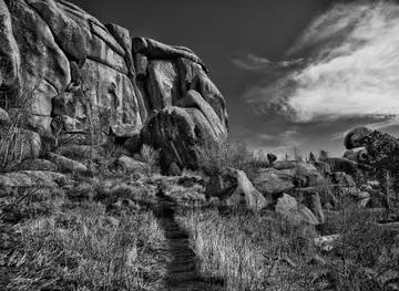
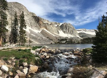
The region's attractions are primarily landscape-based, with the Snowy Range Scenic Byway providing an introduction to forests, glacial terrain, alpine lakes and broad views across south-central Wyoming. Around the high section, Lake Marie, Mirror Lake and nearby trail systems offer short walks, fishing and access to more demanding routes, while the area around Medicine Bow Peak rewards experienced hikers with exposed high-country scenery. Developed campgrounds and picnic areas make the mountains accessible, but facilities are seasonal and limited. Medicine Bow National Forest also provides opportunities for wildlife watching, photography, horseback riding, cross-country skiing and snowmobiling, subject to local rules and conditions. Centennial adds mining-era history and a small-town base on the eastern approach, while Saratoga, outside the immediate high range but serving as its western gateway, contributes hot-spring bathing, local history and services. In winter, the Snowy Range Ski Area near Centennial focuses on downhill skiing and snowboarding, while surrounding forest terrain supports other snow activities where permitted. The attraction landscape is therefore less about a dense collection of visitor sites than about moving carefully between mountain environments, historic communities and changing seasons.
-
Tourist attraction
Medicine Bow-Routt National Forest
Explore the vast beauty of Medicine Bow-Routt National Forest, a natural wonderland in Wyoming perfect for outdoor enthusiasts and nature lovers.
-
Libby Flats Observation Area
Explore the breathtaking landscapes and panoramic views at Libby Flats Observation Area in Wyoming's Snowy Range for an unforgettable outdoor adventure.
-
Lewis Lake Picnic Site
Experience the tranquil beauty of Lewis Lake Picnic Site in Wyoming, where stunning landscapes and outdoor adventures await every visitor.
-
Snowy Range Pass
Discover the breathtaking beauty of Snowy Range Pass, a scenic mountain pass in Wyoming, perfect for outdoor adventures and stunning views year-round.


Best landmarks in Snowy Range
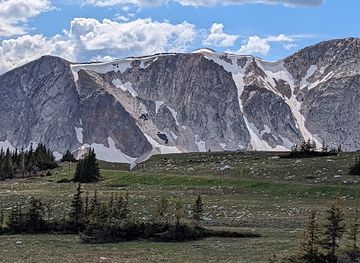
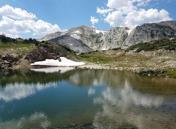
Medicine Bow Peak is the defining natural landmark of the region, rising above the high lakes and forming a dramatic focus for views from the byway and surrounding trails. Libby Flats, near the summit section of Wyoming Highway 130, marks the transition into exposed alpine terrain and offers an immediate sense of the range's elevation and weather. Lake Marie and Mirror Lake are recognisable waters set beneath the granite and glacial landforms of the Snowy Range, while the wider chain of lakes and cirques shows how ice shaped the mountains. Centennial's surviving historic buildings and mining-era townscape represent the human history of the eastern gateway, contrasting with Saratoga's valley setting and long-established hot springs to the west. The Snowy Range Scenic Byway itself is an important landscape landmark: its high road reveals an unusual sequence from sagebrush foothills and conifer forest to open alpine country. These places matter not simply as viewpoints, but as evidence of the region's geology, climate, settlement history and continuing relationship with public land.
-
National park
Grand Teton National Park
Explore the breathtaking landscapes, diverse wildlife, and endless adventure opportunities at Grand Teton National Park in Wyoming.
-
National reserve
Devils Tower National Monument
Discover the breathtaking beauty and rich history of Devils Tower National Monument, a must-visit natural wonder in Wyoming.
-
National forest
Medicine Bow-Routt National Forest
Explore the breathtaking landscapes and diverse wildlife of Medicine Bow-Routt National Forest – a true outdoor paradise in Wyoming.
-
Monument
Abraham Lincoln Memorial Monument
Explore the Abraham Lincoln Memorial Monument in Laramie, Wyoming, where history and stunning views come together in a serene setting.

Explore Snowy Range on the map
Plan your trip on one map. See where the top cities, national parks and sights are, and book hotels and experiences in a few clicks.
Best hotels in Snowy Range
Best restaurants in Snowy Range
Dining in the Snowy Range is concentrated in Laramie, Centennial and Saratoga rather than along the high byway. Expect practical cafés, diners, bars, bakeries and casual restaurants serving the hearty food associated with rural Wyoming, including burgers, steaks, sandwiches, soups and breakfasts suited to an early start. Saratoga has a strong connection with ranching and hot-spring tourism, while Centennial caters to travellers heading towards the mountains; menus and opening arrangements can be seasonal. Local food shopping may include Wyoming beef, game where legally sourced and regional produce, although the range itself is not defined by one exclusive dish. Farmers' markets and independent food producers are more likely to be found in the gateway communities and larger nearby towns than at remote trailheads. Carry picnic supplies for the byway, as there are no continuous food services in the high country, and treat a stocked cooler as part of responsible mountain planning rather than assuming a café will appear beside a lake.
-
Truck stop
Akal Travel Center
Discover culinary treasures at Akal Travel Center - an Armenian and Indian restaurant truck stop offering comfort food and convenience in Laramie.
-
Grill
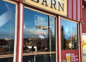
Born In A Barn
Discover the rustic charm of Born In A Barn in Laramie, WY – where classic American dishes meet innovative flavors in a cozy setting.
-
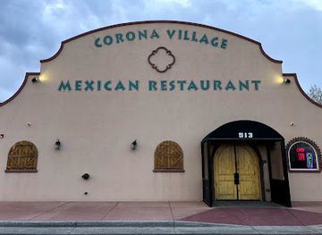
Mexican
Corona Village
Discover authentic Mexican cuisine at Corona Village in Laramie - where every dish tells a flavorful story!
-
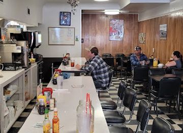
Breakfast
J's Prairie Rose
Discover the heartwarming flavors of Wyoming at J's Prairie Rose - your go-to breakfast destination in Laramie.
Best bars in Snowy Range
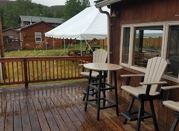
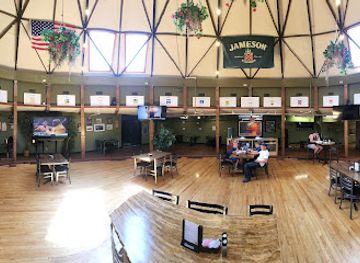
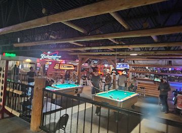
Evening life in the Snowy Range is low-key and community-oriented. Centennial and Saratoga provide traditional bars, restaurants and historic-town gathering places, while Laramie, outside the mountain region, has the broadest choice of pubs, breweries, live music and late-evening venues because of its larger population and university community. Saratoga's hot-spring tradition gives the town a relaxed after-outdoors atmosphere, and both gateway communities may have busier periods during summer travel and winter sports seasons. There is no major nightclub district in the high mountains, and remote accommodation is generally better suited to quiet evenings, stargazing and early starts than late entertainment. Visitors should check seasonal opening arrangements, arrange a safe return journey and avoid driving after drinking on rural roads, where distances, darkness and wildlife create additional risks.
-
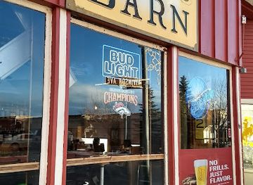
Grill
Born In A Barn
Discover the rustic charm of Born In A Barn, where delightful American cuisine meets a cozy, inviting atmosphere in the heart of Laramie, Wyoming.
-
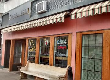
Grill
Crowbar & Grill
Discover the vibrant culinary scene at Crowbar & Grill, Laramie's go-to spot for mouthwatering grill dishes and a lively atmosphere.
-
Bar
Albany Lodge
Discover Albany Lodge: A cozy bar and lodge in Laramie, Wyoming, blending rustic charm with modern amenities for the perfect retreat.
-
Restaurant
O'Dwyers Public House
Experience the heart of Laramie's dining scene at O'Dwyers Public House, where great food and local charm meet.
Best nightclubs in Snowy Range
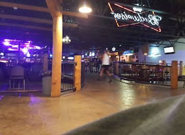
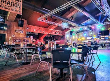
Evening life in the Snowy Range is low-key and community-oriented. Centennial and Saratoga provide traditional bars, restaurants and historic-town gathering places, while Laramie, outside the mountain region, has the broadest choice of pubs, breweries, live music and late-evening venues because of its larger population and university community. Saratoga's hot-spring tradition gives the town a relaxed after-outdoors atmosphere, and both gateway communities may have busier periods during summer travel and winter sports seasons. There is no major nightclub district in the high mountains, and remote accommodation is generally better suited to quiet evenings, stargazing and early starts than late entertainment. Visitors should check seasonal opening arrangements, arrange a safe return journey and avoid driving after drinking on rural roads, where distances, darkness and wildlife create additional risks.
-
Bar
Outlaw Saloon
Experience the vibrant atmosphere and live music at Outlaw Saloon in Cheyenne, a perfect blend of local culture and hearty fare.
-
Bar
Beacon Club
Experience the lively atmosphere at The Beacon Club, Mills' premier bar and club, perfect for nightlife enthusiasts and social gatherings.
-
Bar
Cadillac Ranch Bar
Discover the lively nightlife at Cadillac Ranch Bar in Cheyenne, Wyoming, where locals and tourists unite for great drinks and a fun atmosphere.
-
Cocktail bar
Sundance Lounge
Discover Sundance Lounge in Gillette, a lively cocktail bar and karaoke hotspot with delicious food and a fun atmosphere for everyone.
Best shops in Snowy Range
Shopping is modest and locally focused, with the greatest choice in Laramie and useful small-town services in Centennial and Saratoga. Independent shops and galleries may offer Western clothing, books, artwork, jewellery, handmade goods and souvenirs connected with the mountains, ranching and Wyoming's wider visual culture. Saratoga is a practical place to look for provisions and locally oriented gifts, while Centennial's shops and services are closely tied to visitors using the Snowy Range approach. Farmers' markets and direct sales can provide regional food products when operating seasonally, including beef, baked goods and preserves, but availability should not be assumed outside market periods. In the mountains themselves, retail opportunities are limited, so purchase fuel, groceries, outdoor essentials and gifts before driving the byway. A useful souvenir is often a locally made craft or a product from a gateway community rather than a mass-produced item labelled only with a generic Rocky Mountain theme.
-
Ski resort
Snowy Range Ski Area
Discover the beauty of winter at Snowy Range Ski Area, Wyoming's premier destination for skiing and snowboarding adventures amidst breathtaking mountain views.
-
Department store
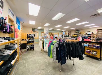
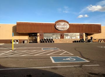
Murdoch's Ranch & Home Supply
Explore Murdoch's Ranch & Home Supply in Laramie, Wyoming - your ultimate destination for outdoor gear, home supplies, and unique local finds.
-
Scenic spot
Libby Flats Observation Area
Experience the stunning vistas and serene beauty of Libby Flats Observation Area, a premier scenic destination in Wyoming's breathtaking landscapes.
-
Grocery store
Big Hollow Food Co-Op
Explore Laramie's vibrant food scene at Big Hollow Food Co-Op, your destination for organic and local products in Wyoming.
Get your free copy of our complete guide to Snowy Range, delivered straight to you.
Everything on this page, from attractions and restaurants to essentials and local phrases, in one PDF you can read offline, print or share.
Already have an account? Sign in
Your Snowy Range guide is ready.
We'll send it to · Not you? Sign out

Getting your guide ready…
We are putting together a fresh copy of the Snowy Range guide. This can take up to a minute.
This can take a few moments. If your browser asks, choose Allow so the download can start. You'll find the guide in your Downloads folder.
Nothing happened? Download it again
Sorry, the guide is taking longer than usual. Please try again in a minute, or get it by email instead.
Snowy Range essentials
Currency and Payment
Safety
Emergency Situations
Do's and Don'ts
Local Tips
From Eve
Local phrases worth knowing
You don't need to get them perfect. A few words go a long way, and locals appreciate the effort.
Basics
| English | Local | Say it |
|---|---|---|
| Hello | Howdy | [haʊdi] |
| Goodbye | See ya | [si jə] |
| Yes | Yep | [jɛp] |
| No | Nah | [nɑ] |
| Please/You’re welcome | Sure thing | [ʃʊr θɪŋ] |
| Thank you | Thanks a bunch | [θæŋks ə bʌnʧ] |
| Excuse me/Sorry | Pardon me | [ˈpɑrdən mi] |
| How are you? | How's it going? | [haʊz ɪt ˈɡoʊɪŋ] |
| Fine. And you? | Good, you? | [ɡʊd, ju?] |
| Do you speak English? | You speakin' English? | [ju ˈspiːkɪn ˈɪŋɡlɪʃ?] |
| I don’t understand | I ain't got it | [aɪ eɪnt ɡɑt ɪt] |
Eating & Drinking
| English | Local | Say it |
|---|---|---|
| I’d like to see the menu, please | Can I see the menu? | [kæn aɪ si ðə ˈmɛnju?] |
| I don’t eat meat | I don't eat meat | [aɪ doʊnt it mit] |
| Cheers! | Cheers! | [ʧɪrz] |
| I would like to pay, please | Can I get the check? | [kæn aɪ ɡɛt ðə ʧɛk?] |
Emergencies
| English | Local | Say it |
|---|---|---|
| Help! | Help! | [hɛlp] |
| Go away! | Get lost! | [ɡɛt lɔst] |
| Call the Police! | Call the cops! | [kɔl ðə kɑps] |
| Call a doctor! | Call a doc! | [kɔl ə dɑk] |
| I’m lost | I'm turned around | [aɪm tɜrnd əˈraʊnd] |
| I’m ill | I'm not feelin' well | [aɪm nɑt ˈfiːlɪn wɛl] |
Shopping
| English | Local | Say it |
|---|---|---|
| I’d like to buy... | I wanna buy... | [aɪ ˈwɑnə baɪ...] |
| I’m just looking | Just browsing | [dʒʌst ˈbraʊzɪŋ] |
| How much is it? | What’s the price? | [wʌts ðə praɪs?] |
| That’s too expensive | That’s pricey | [ðæts ˈpraɪsi] |
| Can you lower the price? | Can ya make it cheaper? | [kæn jə meɪk ɪt ˈʧipər?] |
Time & Numbers
| English | Local | Say it |
|---|---|---|
| What time is it? | What time we got? | [wʌt taɪm wi ɡɑt?] |
| It’s one o’clock | It’s one | [ɪts wʌn] |
| Half past (10) | Half past ten | [hæf pæst tɛn] |
| Morning | Mornin' | [ˈmɔrnɪn] |
| Afternoon | Afternoon | [ˌæftərˈnun] |
| Evening | Evenin' | [ˈivnɪn] |
| Yesterday | Yesterday | [ˈjɛstərdeɪ] |
| Today | Today | [təˈdeɪ] |
| Tomorrow | Tomorrow | [təˈmɔroʊ] |
| 1 | One | [wʌn] |
| 2 | Two | [tu] |
| 3 | Three | [θri] |
| 4 | Four | [fɔr] |
| 5 | Five | [faɪv] |
| 6 | Six | [sɪks] |
| 7 | Seven | [sɛvən] |
| 8 | Eight | [eɪt] |
| 9 | Nine | [naɪn] |
| 10 | Ten | [tɛn] |
Transport & Directions
| English | Local | Say it |
|---|---|---|
| Where's a/the...? | Where’s the...? | [wɛrz ðə...?] |
| What’s the address? | What’s the address? | [wʌts ði ˈædrɛs?] |
| Can you show me (on the map)? | Can ya point it out? | [kæn jə pɔɪnt ɪt aʊt?] |
| When’s the next (bus)? | When’s the next bus? | [wɛnʤ ðə nɛkst bʌs?] |
| A ticket (to ....) | A ticket to ... | [ə ˈtɪkɪt tu ...] |
History of Snowy Range
Indigenous Homelands and Mountain Travel
The Snowy Range lies within a wider landscape used, travelled and valued by Indigenous peoples, including the Arapaho, Cheyenne and Eastern Shoshone. Mountain passes, valleys and water sources formed part of seasonal movement through the central Rocky Mountains, although written accounts often underrepresent earlier Indigenous relationships with the land. Visitors should understand the range not as an empty wilderness discovered by later settlers, but as part of a much older cultural geography. Indigenous knowledge, place names and continuing tribal presence remain important to the history of Wyoming.
The Fur Trade and Overland Era
During the nineteenth century, trappers, traders, military expeditions and emigrants moved through the broader region surrounding the Medicine Bow Mountains. The principal overland routes across southern Wyoming generally followed lower corridors rather than the most difficult high country, but they connected the plains, river valleys and mountain passes that shaped later settlement. The arrival of the United States Army and expanding territorial administration increased outside control over the area, while disease, conflict and federal policy severely disrupted Indigenous communities.
Centennial's Mining Origins
Centennial began as a mining settlement after gold was discovered in the Centennial Valley in 1867. The rush brought prospectors, merchants and short-lived hopes of a major mineral boom to the eastern side of the Snowy Range. Mining never transformed the district on the scale seen in some western mountain regions, but it left a durable imprint on Centennial's layout, surviving buildings and local identity. Later livelihoods combined ranching, forestry, tourism and services, demonstrating the economic adaptability required in a remote high-altitude community.
Railways, Ranching and Saratoga
Saratoga developed in the North Platte Valley, where its hot springs and access to surrounding ranch country helped distinguish it from the mining settlement of Centennial. The Union Pacific's arrival in the area around the turn of the twentieth century improved connections with wider markets and encouraged the movement of livestock, supplies and visitors. Rail transport supported ranching and timber-related activity while the springs contributed to Saratoga's reputation as a place for rest and bathing. The town remains a western gateway to the Snowy Range rather than a mountain settlement in the high alpine zone.
Forest Conservation and Public Lands
The forests and watersheds of the Medicine Bow Mountains became part of the United States national-forest system during the early twentieth century, reflecting a national shift towards managing timber, water, wildlife and recreation as public resources. The area is now administered within Medicine Bow National Forest, where conservation and public access must coexist. Roads, campgrounds and trails have made the mountains more accessible, but seasonal closures and restrictions also reflect the fragility of alpine environments and the severe conditions of winter.
The Snowy Range Scenic Byway
Wyoming Highway 130 across the mountains developed into the Snowy Range Scenic Byway, linking the eastern plains near Centennial with the North Platte country near Saratoga. Its high route made the range accessible to visitors who might not undertake a long wilderness journey, while its elevation also required substantial seasonal management. The byway's significance lies in the way it reveals changing mountain environments over a relatively short drive, from sagebrush and forest to exposed alpine terrain. Winter snow commonly interrupts through travel over the summit section.
Modern Recreation and Mountain Research
In the twentieth and twenty-first centuries, recreation became a central part of the Snowy Range economy and public identity. Hiking, camping, fishing, skiing, snowmobiling and scenic driving now attract visitors alongside ranching, forestry and local services. The nearby University of Wyoming and other institutions have also contributed to scientific understanding of high-altitude ecology, hydrology and climate. Contemporary management increasingly focuses on balancing access with erosion control, wildlife protection, limited infrastructure and the effects of changing snow and weather patterns.
Snowy Range in Photos
Browse through our photo collection highlighting the charm and character of the destination.
Neighbouring regions of Snowy Range
The closest regions to Snowy Range, if you have time for more than one.
-

-
-

-
-


Swipe for more regions
Explore more

Explore more of Wyoming
Discover Wyoming: A Land of Unspoiled Beauty, Rich History, and Boundless Outdoor Adventures in the Heart of the American West.
Explore Wyoming