

Free Grand Canyon Travel Guide & Mobile App
Explore Grand Canyon with free travel guides. Discover regional history, expert tips, proposed trips, and audio guides on web or mobile app.


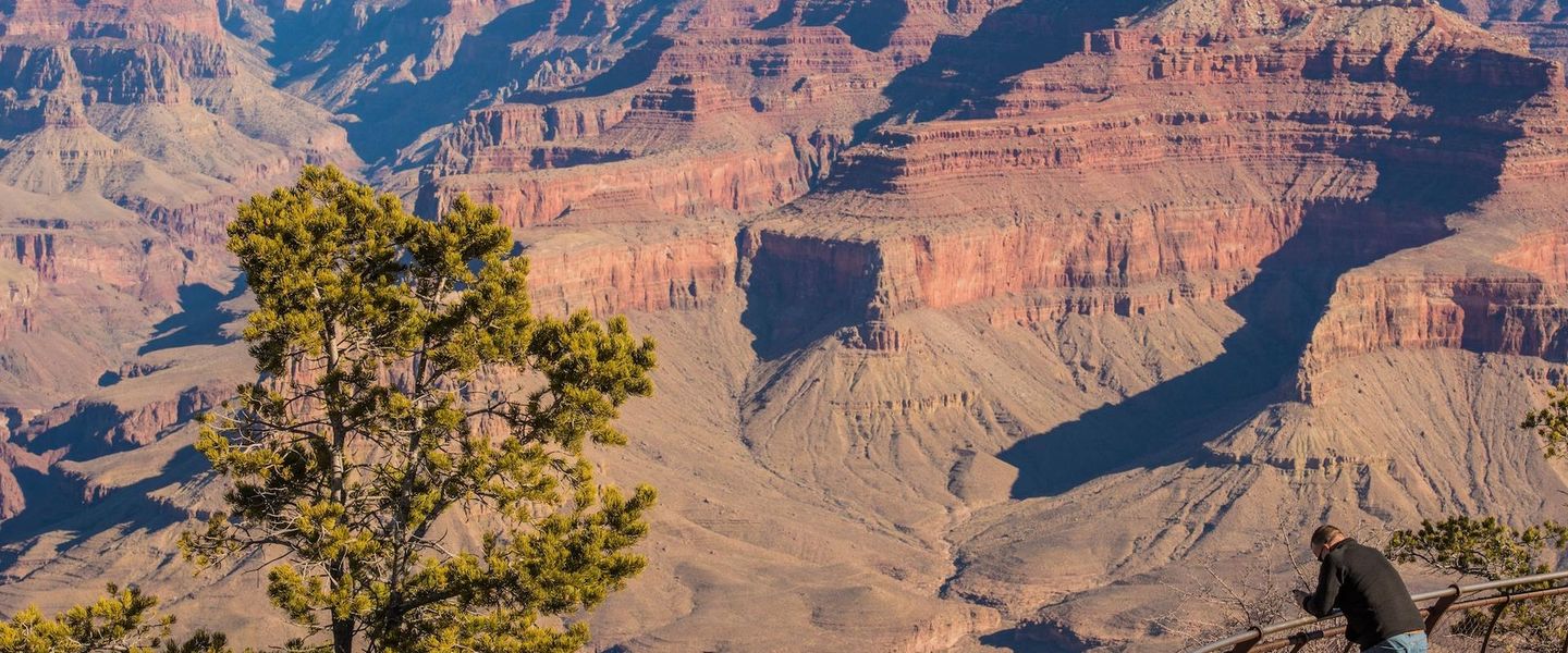


Explore the Grand Canyon’s layered geology, forested rims, Indigenous heritage, demanding trails and wide-open Arizona landscapes from the South and North Rims.
Read more about Grand Canyon
Getting to and around Grand Canyon
How to get there
Transportation
Top city travel guides in Grand Canyon
The cities of Grand Canyon, and the easiest places to base yourself.

Swipe for more cities
Destinations in Grand Canyon
Resorts, valleys and scenic spots worth a trip of their own.
-

-
-


Swipe for more destinations
Best attractions in Grand Canyon
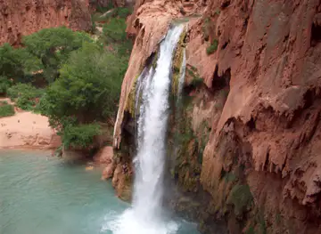
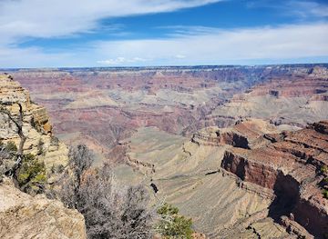
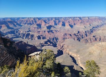
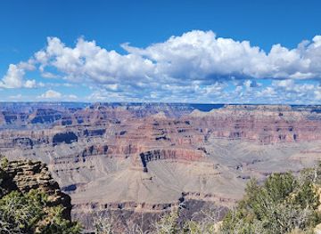
Grand Canyon National Park is the region’s central attraction, with South Rim viewpoints, rim trails, visitor facilities and the historic Grand Canyon Village forming the most accessible introduction. The South Rim’s Hermit Road and Desert View areas reveal different aspects of the gorge, from broad river panoramas to views shaped by side canyons and eastern desert landscapes. The North Rim offers forest walks, high-elevation overlooks and a quieter atmosphere when its seasonal road and facilities are open. More demanding trails, including routes towards the river, expose visitors to changing geology and climate rather than simply providing another viewpoint. Organised river journeys offer an entirely different experience of the canyon from below. Beyond the national park, the wider region includes the Havasupai Reservation’s waterfall country and Grand Canyon West on the Hualapai Reservation; both are distinct, independently managed destinations requiring advance planning. Scenic drives across the Kaibab Plateau, wildlife watching, stargazing, photography and guided geology or cultural programmes broaden the experience, although distances and limited services mean that the region rewards careful itineraries rather than spontaneous touring.
-
National park
Grand Canyon National Park
Explore the breathtaking beauty and rich history of Grand Canyon National Park, a must-visit destination for nature lovers and adventure seekers.
-
Visitor center
Grand Canyon Visitor Center
Discover the Grand Canyon Visitor Center - your essential starting point for exploring breathtaking landscapes, hiking adventures, and rich history.
-
Tourist attraction
Grand Canyon West
Experience the Grand Canyon's West Rim: Adventure, culture, and breathtaking views await with the Hualapai Tribe's unique perspective.
-
Historical landmark
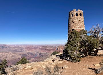
Desert View Watchtower
Experience breathtaking panoramic views and Native American art at the historic Desert View Watchtower, a cultural gem on the Grand Canyon's South Rim.

Best landmarks in Grand Canyon
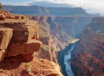
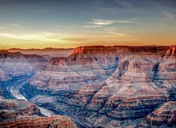
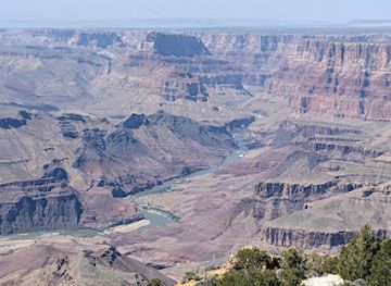
The South Rim itself is the Grand Canyon’s defining landmark, but its character changes along the developed rim. Grand Canyon Village contains historic buildings associated with the railway and early twentieth-century park tourism, including the stone El Tovar hotel and the nearby Hopi House, designed by Mary Colter in an architectural style influenced by Indigenous Southwestern forms. Desert View Watchtower, also designed by Colter, rises above the eastern South Rim and is one of the region’s most recognisable structures, combining a dramatic lookout with murals and decorative details. On the North Rim, Bright Angel Point projects towards the canyon from a forested high plateau, while Cape Royal and Point Imperial provide distinctive outlooks over different sections of the gorge when accessible. The Colorado River is the canyon’s natural landmark and its geological cause, although it is often visible only as a narrow line from the rim. The layered walls, temples, mesas and side canyons are themselves the most significant physical monuments, recording immense spans of geological time rather than a single historical event.
-
Visitor center
Grand Canyon Visitor Center
Discover the Grand Canyon Visitor Center, your essential guide to exploring Arizona's iconic natural wonder and its breathtaking landscapes.
-
Historical landmark
Desert View Watchtower
Iconic stone tower on the South Rim offering panoramic Grand Canyon views and a glimpse into Native American history and culture.
-
Vista point
Mather Point
Experience the Grand Canyon's grandeur at Mather Point, offering panoramic views and easy access for an unforgettable first impression.
-
National forest
Kaibab National Forest
Explore the vast landscapes and outdoor adventures surrounding the Grand Canyon in Kaibab National Forest.
Explore Grand Canyon on the map
Plan your trip on one map. See where the top cities, national parks and sights are, and book hotels and experiences in a few clicks.
Best hotels in Grand Canyon
Best restaurants in Grand Canyon
Dining around the Grand Canyon is shaped by remoteness, park logistics and the needs of travellers spending time outdoors. South Rim and Grand Canyon Village facilities provide cafés, casual restaurants, dining rooms and provisions for packed lunches, while Tusayan, outside the national park, adds further places to eat. Meals tend to be practical and broadly American, with burgers, sandwiches, salads, breakfast dishes and grilled foods common alongside vegetarian options. The North Rim has a smaller, more seasonal food scene, with dining linked closely to its lodge and visitor facilities when open. In nearby Arizona communities, visitors may encounter foods associated with the wider Southwest, including tortillas, beans, chillies and regional barbecue, but these should not automatically be presented as inventions of the canyon itself. Markets and shops are useful for water, fruit, snacks and picnic supplies, particularly before entering remote areas. Dining reservations and supplies deserve attention during busy seasons because distances between established food outlets can be considerable.
-
Mexican
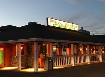
Plaza Bonita Restaurant
Experience authentic Mexican cuisine at Plaza Bonita Restaurant in Grand Canyon Village - where every meal is a celebration of flavor.
-
Hotel
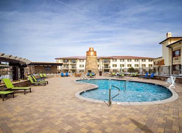
Squire Resort at the Grand Canyon, BW Signature Collection
Discover comfort and convenience at Squire Resort in Grand Canyon Village - your gateway to breathtaking landscapes and unforgettable adventures.
-
Lodge
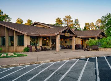
Yavapai Lodge
Experience comfort and adventure at Yavapai Lodge in Grand Canyon Village – your ideal base for exploring stunning landscapes.
-
Pizza
We Cook Pizza and Pasta
Experience authentic Italian cuisine at We Cook Pizza and Pasta in Grand Canyon Village - where delicious pizza meets breathtaking views.
Best bars in Grand Canyon
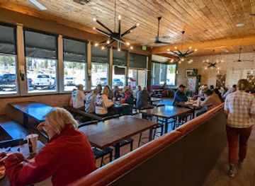
Nightlife at the Grand Canyon is quiet and oriented towards rest, conversation and the outdoors rather than clubs. South Rim hotels, lodges and nearby Tusayan provide the region’s main evening options, including hotel bars, casual lounges and restaurants where visitors can eat after a day on the trails. The North Rim is even more limited and seasonal, with evening activity concentrated around lodge facilities and organised talks or informal gatherings. There is little conventional nightclub culture within the canyon region, and many visitors choose sunset, astronomy or an early night instead. Alcohol is available in approved restaurants and licensed premises, but drinking is subject to United States laws and should never be combined with driving, rim walking or demanding hikes. Evening conditions can become cold quickly, roads are dark and wildlife may be active, so practical caution matters more than seeking late-night entertainment.
-
Pizza
We Cook Pizza and Pasta
Experience authentic Italian cuisine at We Cook Pizza and Pasta, where every dish is a delightful journey through Italy's culinary traditions.
-
Steak
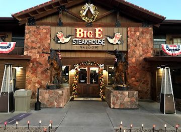
Big E Steakhouse & Saloon
Experience the best of American steakhouse dining at Big E Steakhouse & Saloon, nestled in the scenic beauty of Grand Canyon Village.
-
Fine Dining
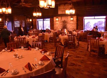
El Tovar Dining Room
Experience fine dining at El Tovar Dining Room with stunning views of the Grand Canyon, showcasing American and South American culinary delights.
-
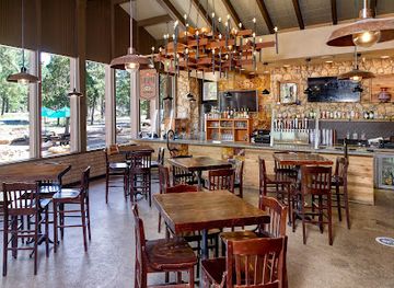
Sports bar
Yavapai Tavern
Experience the best of American dining and sports at Yavapai Tavern, just steps from the breathtaking Grand Canyon.
Best nightclubs in Grand Canyon
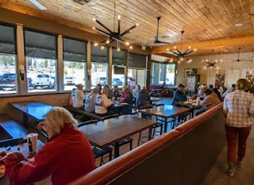
Nightlife at the Grand Canyon is quiet and oriented towards rest, conversation and the outdoors rather than clubs. South Rim hotels, lodges and nearby Tusayan provide the region’s main evening options, including hotel bars, casual lounges and restaurants where visitors can eat after a day on the trails. The North Rim is even more limited and seasonal, with evening activity concentrated around lodge facilities and organised talks or informal gatherings. There is little conventional nightclub culture within the canyon region, and many visitors choose sunset, astronomy or an early night instead. Alcohol is available in approved restaurants and licensed premises, but drinking is subject to United States laws and should never be combined with driving, rim walking or demanding hikes. Evening conditions can become cold quickly, roads are dark and wildlife may be active, so practical caution matters more than seeking late-night entertainment.
-
Sports bar
Yavapai Tavern
Experience the vibrant atmosphere of Yavapai Tavern, a premier sports bar in Grand Canyon Village, where great food meets stunning views.
-
Restaurant
Foodie Club
Experience local flavors and breathtaking views at Foodie Club in the heart of Grand Canyon Village, a culinary gem for all food lovers.
-
Cocktail bar
Canyon Club
Experience the vibrant nightlife at Canyon Club, where delicious cocktails meet exciting karaoke in the heart of Williams, Arizona.
-
Southwestern American
Desert Lounge + Grill
Experience the vibrant flavors of Southwestern American cuisine at Desert Lounge + Grill in the heart of Grand Canyon Village.

Best shops in Grand Canyon
Shopping at the Grand Canyon is concentrated in practical visitor services, books, art and regionally themed goods rather than extensive retail districts. South Rim facilities and Grand Canyon Village offer outdoor supplies, maps, geological publications, clothing, photography material and souvenirs, while Tusayan, outside the national park, provides additional everyday shopping and dining services. Official park shops and museums are useful places to learn about geology, wildlife and Indigenous history, but visitors should distinguish mass-produced souvenirs from responsibly sourced Native American art. Handmade jewellery, pottery, textiles and other works may be available through authorised galleries or tribal enterprises; ask about the artist and provenance, and never buy archaeological objects. Shops on the North Rim are smaller and seasonal. Across the wider region, practical purchases such as water, snacks, sun protection and warm layers are often more valuable than decorative items, particularly because supply options become limited away from the main settlements.
-
Visitor center
Grand Canyon Visitor Center
Explore the Grand Canyon Visitor Center for breathtaking views, engaging exhibits, and essential resources for an unforgettable adventure.
-
Vista point
Mather Point
Experience the breathtaking vistas of Mather Point at the Grand Canyon, a must-visit spot for awe-inspiring views and unforgettable memories.
-
Vista point
Hopi Point
Experience the breathtaking views of Hopi Point, a must-see vista on the South Rim of the Grand Canyon, perfect for unforgettable sunrise and sunset moments.
-
Train depot
Grand Canyon Railway
Discover the beauty of the Grand Canyon with a scenic train ride through Arizona’s breathtaking landscapes.

Get your free copy of our complete guide to Grand Canyon, delivered straight to you.
Everything on this page, from attractions and restaurants to essentials and local phrases, in one PDF you can read offline, print or share.
Already have an account? Sign in
Your Grand Canyon guide is ready.
We'll send it to · Not you? Sign out

Getting your guide ready…
We are putting together a fresh copy of the Grand Canyon guide. This can take up to a minute.
This can take a few moments. If your browser asks, choose Allow so the download can start. You'll find the guide in your Downloads folder.
Nothing happened? Download it again
Sorry, the guide is taking longer than usual. Please try again in a minute, or get it by email instead.
Grand Canyon essentials
Currency and Payment
Safety
Emergency Situations
Do's and Don'ts
Local Tips
From Eve
Local phrases worth knowing
You don't need to get them perfect. A few words go a long way, and locals appreciate the effort.
Basics
| English | Local | Say it |
|---|---|---|
| Hello | Howdy | [haʊdi] |
| Goodbye | See ya | [siː jə] |
| Yes | Yep | [jɛp] |
| No | Nah | [nɑː] |
| Please/You're welcome | Sure thing | [ʃʊr θɪŋ] |
| Thank you | Thanks a lot | [θæŋks ə lɑt] |
| Excuse me/Sorry | Pardon me | [ˈpɑrdən mi] |
| How are you? | How's it going? | [haʊz ɪt ˈɡoʊɪŋ] |
| Fine. And you? | Good. And you? | [ɡʊd. ənd ju] |
| Do you speak English? | Do ya speak English? | [du jə spiːk ˈɪŋɡlɪʃ] |
| I don't understand | I don't get it | [aɪ doʊnt ɡɛt ɪt] |
Eating & Drinking
| English | Local | Say it |
|---|---|---|
| I'd like to see the menu, please | Can I see the menu? | [kæn aɪ siː ðə ˈmɛnju] |
| I don't eat meat | I’m a vegetarian | [aɪm ə ˌvɛdʒəˈtɛriən] |
| Cheers! | Cheers! | [ʧɪrz] |
| I would like to pay, please | Can I get the check? | [kæn aɪ ɡɛt ðə ʧɛk] |
Emergencies
| English | Local | Say it |
|---|---|---|
| Help! | Help! | [hɛlp] |
| Go away! | Leave me alone! | [liːv mi əˈloʊn] |
| Call the Police! | Call 911! | [kɔl nɪnəʊ wʌn] |
| Call a doctor! | Get a doctor! | [ɡɛt ə ˈdɑktər] |
| I'm lost | I'm turned around | [aɪm tɜrnd əˈraʊnd] |
| I'm ill | I'm not feeling well | [aɪm nɑt ˈfiːlɪŋ wɛl] |
Shopping
| English | Local | Say it |
|---|---|---|
| I'd like to buy... | I want to buy... | [aɪ wɑnt tə baɪ] |
| I'm just looking | Just browsing | [dʒʌst ˈbraʊzɪŋ] |
| How much is it? | What's the price? | [wʌts ðə praɪs] |
| That's too expensive | That's way too high | [ðæts weɪ tu haɪ] |
| Can you lower the price? | Can you give me a better deal? | [kæn jə ɡɪv mi ə ˈbɛtər dil] |
Time & Numbers
| English | Local | Say it |
|---|---|---|
| What time is it? | What time ya got? | [wʌt taɪm jə ɡɑt] |
| It's one o'clock | It's 1 o'clock | [ɪts wʌn əˈklɑk] |
| Half past (10) | Half past 10 | [hæf pæst tɛn] |
| Morning | Morning | [ˈmɔrnɪŋ] |
| Afternoon | Afternoon | [ˌæftərˈnun] |
| Evening | Evening | [ˈivnɪŋ] |
| Yesterday | Yesterday | [ˈjɛstərdeɪ] |
| Today | Today | [təˈdeɪ] |
| Tomorrow | Tomorrow | [təˈmɔroʊ] |
| 1 | One | [wʌn] |
| 2 | Two | [tuː] |
| 3 | Three | [θriː] |
| 4 | Four | [fɔr] |
| 5 | Five | [faɪv] |
| 6 | Six | [sɪks] |
| 7 | Seven | [sɛvən] |
| 8 | Eight | [eɪt] |
| 9 | Nine | [naɪn] |
| 10 | Ten | [tɛn] |
Transport & Directions
| English | Local | Say it |
|---|---|---|
| Where's a/the...? | Where's the nearest...? | [wɛrz ðə ˈnɪrəst] |
| What's the address? | What's the address? | [wʌts ði ˈædrɛs] |
| Can you show me (on the map)? | Can you point it out? | [kæn jə pɔɪnt ɪt aʊt] |
| When's the next (bus)? | When's the next bus? | [wɛn z ðə nɛkst bʌs] |
| A ticket (to ....) | One ticket to... | [wʌn ˈtɪkɪt tə] |
History of Grand Canyon
Ancient Indigenous Connections
The Grand Canyon has been inhabited, travelled through and regarded as a significant place by Indigenous peoples for thousands of years. Archaeological remains include former dwellings, storage structures, tools and rock art associated with Ancestral Puebloan communities and other groups. The canyon also remains part of the homelands and cultural landscapes of peoples including the Havasupai, Hualapai, Hopi, Navajo, Southern Paiute and Zuni. Their relationships with springs, plants, river corridors and ceremonial places continue today, making the canyon a living cultural landscape rather than an archaeological site belonging only to the distant past.
River Exploration and Mapping
Spanish expeditionaries reached the canyon in the sixteenth century, but its interior remained difficult for outsiders to access. In the nineteenth century, American surveys and exploratory journeys gradually mapped the river and its tributaries. John Wesley Powell’s 1869 expedition down the Colorado River, followed by a larger journey in 1871–72, produced influential descriptions and maps of the canyon. These expeditions encouraged scientific interest while also contributing to an era of exploration in which Indigenous presence and knowledge were often inadequately acknowledged.
Mining, Prospecting and Early Tourism
During the late nineteenth century, prospectors searched parts of the canyon for minerals, including copper, and several short-lived mining ventures left traces in the wider landscape. Tourism grew as railways, roads, hotels and guide services made the South Rim more accessible. The arrival of the railway at the South Rim in 1901 was particularly important, bringing visitors from Williams and helping establish Grand Canyon Village as the principal tourism centre. Early tourism was concentrated at the rim, since reaching the river and inner canyon remained a demanding undertaking.
National Park Protection
Grand Canyon Forest Reserve was created in 1893, followed by further federal protection as concern grew about mining, logging and uncontrolled development. President Theodore Roosevelt strongly supported preserving the canyon, which became a national monument in 1908. Grand Canyon National Park was established in 1919. These measures shaped the landscape visitors know today, although conservation has continued to involve difficult questions about roads, wildlife, water, development, Indigenous rights and the balance between public access and protection.
The Colorado River and River Running
The Colorado River has always been the canyon’s geological force and a practical route through its depths. Commercial and private river expeditions expanded during the twentieth century, developing techniques for navigating rapids and camping in the inner canyon. River journeys provide a perspective fundamentally different from rim viewpoints, revealing narrow side canyons, river terraces and rock walls from below. Access remains limited and carefully managed, with permits and commercial arrangements required for many trips because the river corridor is remote and environmentally sensitive.
Indigenous Sovereignty and Contemporary Stewardship
Modern relationships with the Grand Canyon increasingly recognise that national park boundaries do not contain its full cultural or ecological meaning. The Havasupai Reservation, Hualapai Reservation and neighbouring tribal lands have their own governments, access rules and tourism arrangements. Issues including water use, uranium mining, sacred places, trail access and the protection of cultural resources remain important. Contemporary stewardship therefore involves federal agencies, tribal nations, local communities, scientists and visitors, with a growing emphasis on Indigenous knowledge and respectful engagement.
Grand Canyon in Photos
Browse through our photo collection highlighting the charm and character of the destination.
Neighbouring regions of Grand Canyon
The closest regions to Grand Canyon, if you have time for more than one.
-

-

-

-

-


Swipe for more regions
Explore more

Explore more of Arizona
Discover Arizona: From the majestic Grand Canyon and red rocks of Sedona to the vibrant cities of Phoenix and Scottsdale, explore the diverse beauty and culture of the Grand Canyon State.
Explore Arizona