

Free San Francisco Peaks Travel Guide & Mobile App
Explore San Francisco Peaks with free travel guides. Discover regional history, expert tips, proposed trips, and audio guides on web or mobile app.


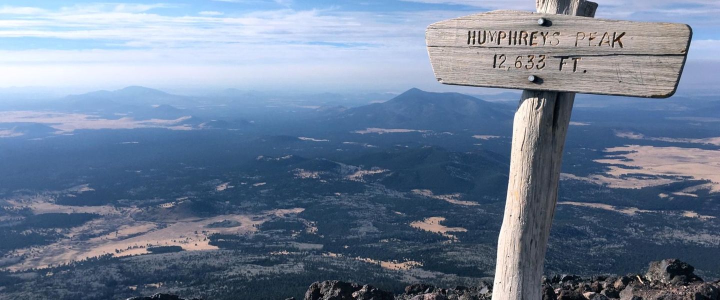


San Francisco Peaks combine Arizona’s highest summit, volcanic landscapes, alpine trails, sacred Indigenous heritage and four-season outdoor recreation.
Read more about San Francisco Peaks
Getting to and around San Francisco Peaks
How to get there
Transportation
Top city travel guides in San Francisco Peaks
The cities of San Francisco Peaks, and the easiest places to base yourself.

Swipe for more cities
Best attractions in San Francisco Peaks
The San Francisco Peaks offer a concentrated high-elevation outdoor experience rather than a collection of urban attractions. The principal challenge is Humphreys Peak, reached by a demanding trail through conifer forest and exposed alpine terrain; the summit route is best suited to prepared hikers who have checked weather and conditions. The Kachina Peaks Wilderness protects much of the upper mountain and provides opportunities for hiking, wildlife observation, snowshoeing and backcountry travel subject to wilderness regulations. Arizona Snowbowl, on the western slopes, is the region’s main developed winter-sports centre and also supports seasonal mountain recreation. Lower forest roads and clearings provide quieter opportunities for photography and birdwatching, while the changing vegetation illustrates the dramatic ecological shift between the high mountain and the surrounding plateau. The broader volcanic landscape adds geological interest, though the most famous cones and lava features are outside the immediate peaks area. With no substantial settlement on the massif itself, visits focus on trails, forests, viewpoints, snow and the mountain’s cultural setting rather than museums or conventional family attractions.
-
National park
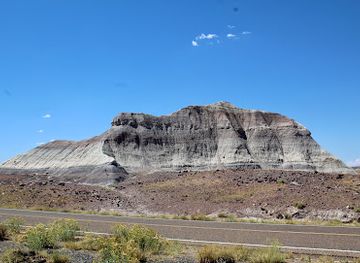
Petrified Forest National Park
Explore the breathtaking Petrified Forest National Park, where ancient trees turned to stone create a mesmerizing landscape filled with vibrant colors and rich history.
-
National reserve
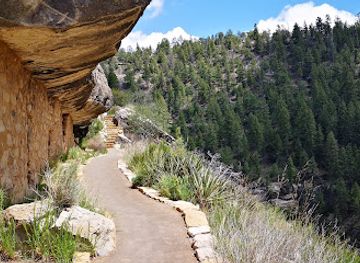
Walnut Canyon National Monument
Discover the breathtaking landscapes and rich history of Walnut Canyon National Monument in Arizona, where ancient cliff dwellings await you.
-
Observatory
Lowell Observatory
Discover the wonders of the universe at Lowell Observatory, a historic landmark in Flagstaff, Arizona, renowned for its astronomical research and stargazing experiences.
-
Park
Fort Tuthill County Park
Explore the natural beauty and recreational wonders of Fort Tuthill County Park in Flagstaff, Arizona, a perfect outdoor escape for tourists.
Best landmarks in San Francisco Peaks
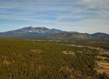
Humphreys Peak is the defining landmark of the San Francisco Peaks and the highest point in Arizona, its exposed summit ridge rising above the surrounding conifer forests. Nearby Agassiz Peak, Fremont Peak, Doyle Peak and Rees Peak form the recognisable crown of the massif, although some summits and upper routes have access restrictions or demanding conditions. The steep volcanic profile is itself a geological landmark: the present peaks are remnants of a much larger volcano shaped by collapse, erosion, snow and ice. The Kachina Peaks Wilderness provides an important protected setting for the upper mountain, preserving the visual character of the high country and its subalpine environment. Arizona Snowbowl’s developed slopes are a more recent human landmark, marking the meeting point of commercial recreation and a landscape regarded as sacred by several Indigenous nations. From Flagstaff and roads on the surrounding plateau, the peaks form a prominent northern Arizona skyline, but their cultural importance extends far beyond their visual presence.
-
Monument
Sunset Crater Volcano National Monument
Discover Arizona's volcanic past at Sunset Crater Volcano National Monument, with unique landscapes and hiking trails near Flagstaff.
-
National reserve
Wupatki National Monument
Discover ancient pueblos and stunning desert landscapes at Wupatki National Monument, a testament to the ingenuity of early inhabitants.
-
Hiking area
Lava River Cave
Explore a 700,000-year-old lava tube near Flagstaff, Arizona, with year-round cool temperatures and unique geological features.
-
Historical landmark
Wukoki Pueblo
Discover the ancient mysteries and stunning architecture of Wukoki Pueblo, a remarkable window into Arizona's rich Native American heritage.
Explore San Francisco Peaks on the map
Plan your trip on one map. See where the top cities, national parks and sights are, and book hotels and experiences in a few clicks.
Best hotels in San Francisco Peaks
Best restaurants in San Francisco Peaks
There is no substantial dining district on the San Francisco Peaks, so most visitors eat before or after their outing in nearby Flagstaff, which lies outside the massif and functions as its practical service town. Flagstaff’s food scene includes cafés, bakeries, breweries, restaurants and casual places suited to hikers and winter-sports visitors, with menus reflecting both contemporary American cooking and the wider culinary traditions of northern Arizona. Visitors can find regional ingredients such as local-grown produce when in season, Southwestern flavours, beans, maize-based dishes and a range of craft beverages, although not every local restaurant serves food that is specifically from the mountain. Near the ski area, seasonal concessions and mountain-oriented dining may be available, but arrangements can change and should not be assumed outside operating periods. For a day in the wilderness, carry sufficient food and water rather than expecting trail-side services, and purchase supplies in Flagstaff before leaving town.
-
American
Pine Country Restaurant
Experience the heartwarming flavors of America at Pine Country Restaurant in Williams - your perfect stop near the Grand Canyon.
-
American
Cracker Barrel Old Country Store
Savor delicious Southern comfort food at Cracker Barrel Old Country Store in Flagstaff – a perfect family dining experience with delightful shopping.
-
Italian
Fat Olives
Discover authentic Italian cuisine at Fat Olives in Flagstaff - where every meal is a celebration of flavor and hospitality.
-
Mexican
MartAnnes Burrito Palace
Experience authentic Mexican cuisine at MartAnnes Burrito Palace in Flagstaff – where every bite tells a story!
Best bars in San Francisco Peaks
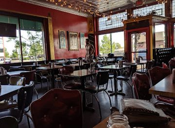
Nightlife connected with the San Francisco Peaks is concentrated in Flagstaff rather than on the mountain itself. The city has traditional pubs, breweries, cafés, restaurants, live-music venues and bars serving students, residents and visitors, with the greatest choice around the central districts outside the regional boundary. After a day on the trails or ski slopes, evening activity is generally more subdued and practical than a resort nightclub scene, although Flagstaff can offer late-opening entertainment at selected venues. In the mountain area, darkness, cold, wildlife and limited services make the emphasis one of rest, stargazing and preparation for the following day rather than spontaneous nightlife. Visitors should arrange transport before drinking, particularly when staying outside central Flagstaff, and should not drive forest roads after consuming alcohol.
-
Brewpub
Beaver Street Brewery
Experience the best of Flagstaff with handcrafted beers and delicious American cuisine at Beaver Street Brewery - a local favorite.
-
Restaurant
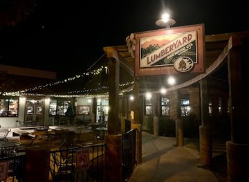
Lumberyard Brewing Co
Experience the best of American cuisine and craft beer at Lumberyard Brewing Co in Flagstaff, AZ, a must-visit brewpub for all food and beer lovers.
-
Grill
Collins Irish Pub
Discover Collins Irish Pub in Flagstaff, a vibrant blend of Irish tradition and American cuisine, perfect for family dining and nightlife.
-
Gastropub
Cornish Pasty Co
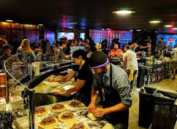
Discover the flavors of British cuisine at Cornish Pasty Co, a vibrant gastropub in Flagstaff offering a unique culinary experience for all.
Best nightclubs in San Francisco Peaks
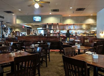
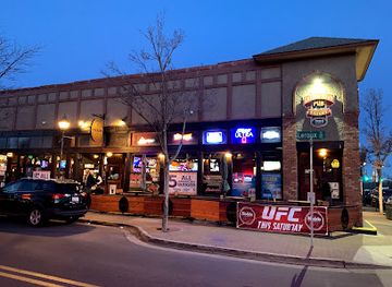
Nightlife connected with the San Francisco Peaks is concentrated in Flagstaff rather than on the mountain itself. The city has traditional pubs, breweries, cafés, restaurants, live-music venues and bars serving students, residents and visitors, with the greatest choice around the central districts outside the regional boundary. After a day on the trails or ski slopes, evening activity is generally more subdued and practical than a resort nightclub scene, although Flagstaff can offer late-opening entertainment at selected venues. In the mountain area, darkness, cold, wildlife and limited services make the emphasis one of rest, stargazing and preparation for the following day rather than spontaneous nightlife. Visitors should arrange transport before drinking, particularly when staying outside central Flagstaff, and should not drive forest roads after consuming alcohol.
-
Night club
The Valencia Room
Discover The Valencia Room, a vibrant night club in San Francisco's Mission District, where live music, dancing, and cocktails create unforgettable nightlife experiences.
-
Bar
The Museum Club
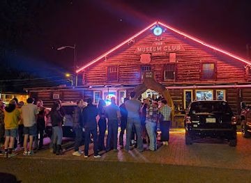
Experience the lively atmosphere of The Museum Club in Flagstaff, a bar filled with local music, affordable drinks, and a unique log cabin charm.
-
Bar
Hops On Birch
Discover the vibrant atmosphere and craft beer selection at Hops On Birch, Flagstaff's top bar destination for locals and tourists alike.
-
Dance club
Raven Bar
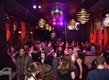
Discover the pulse of San Francisco's nightlife at Raven Bar, where dance, cocktails, and unforgettable memories await in the heart of SoMa.

Best shops in San Francisco Peaks
Shopping on the San Francisco Peaks is limited because the massif is a protected, largely undeveloped mountain environment. Visitors should buy hiking equipment, groceries, fuel, maps and weather-appropriate clothing in nearby Flagstaff, outside the regional boundary, where independent outdoor retailers, bookshops, galleries, markets and general stores serve the mountain trade. Regional foods and practical trail provisions are more useful souvenirs than items purchased at the trailhead. Flagstaff also provides opportunities to buy art and craftwork connected with northern Arizona, but visitors should use reputable, authorised sellers and ask about provenance when purchasing Indigenous art; avoid objects made from protected materials or presented as ceremonial items. Do not remove rocks, plants, wood or other natural materials from the peaks. Souvenir choices are therefore best focused on responsibly sourced artwork, books about the region, maps and locally produced food purchased through legitimate businesses.
-
Shopping mall
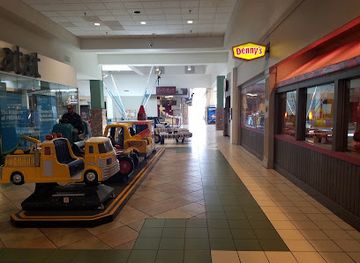
Flagstaff Mall
Explore Flagstaff Mall, your go-to shopping destination in Flagstaff, Arizona, featuring diverse stores, delicious dining, and a cozy ambiance.
-
Used book store
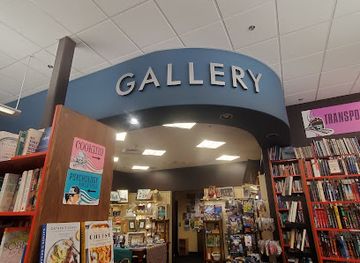
Bookmans Flagstaff Entertainment Exchange
Explore the enchanting world of used books, video games, and a cozy café at Bookmans Flagstaff, your ultimate entertainment exchange.
-
Shopping mall
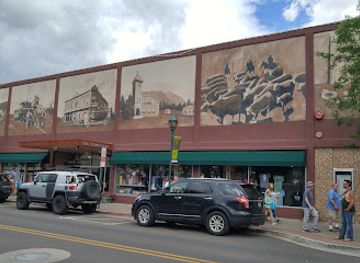
Old Town Shops
Explore unique boutiques and local artisan shops at Old Town Shops in Flagstaff, Arizona, where shopping meets charm.
-
Gift shop
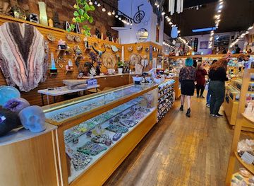
Crystal Magic
Explore Crystal Magic: A unique gift shop in Flagstaff, Arizona, offering exquisite jewelry and enchanting crystals for every traveler.
Get your free copy of our complete guide to San Francisco Peaks, delivered straight to you.
Everything on this page, from attractions and restaurants to essentials and local phrases, in one PDF you can read offline, print or share.
Already have an account? Sign in
Your San Francisco Peaks guide is ready.
We'll send it to · Not you? Sign out

Getting your guide ready…
We are putting together a fresh copy of the San Francisco Peaks guide. This can take up to a minute.
This can take a few moments. If your browser asks, choose Allow so the download can start. You'll find the guide in your Downloads folder.
Nothing happened? Download it again
Sorry, the guide is taking longer than usual. Please try again in a minute, or get it by email instead.
San Francisco Peaks essentials
Currency and Payment
Safety
Emergency Situations
Do's and Don'ts
Local Tips
From Eve
Local phrases worth knowing
You don't need to get them perfect. A few words go a long way, and locals appreciate the effort.
Basics
| English | Local | Say it |
|---|---|---|
| Hello | Yá'át'ééh | [yah-teh-eh] |
| Goodbye | Hágoónee' | [hah-go-nee] |
| Yes | Aoo' | [ah-oo] |
| No | Doo' | [doo] |
| Please/You're welcome | Ahéhee' | [ah-heh-eh] |
| Thank you | Ahéhee' | [ah-heh-eh] |
| Excuse me/Sorry | T'áá shoodí | [tah shoh-dee] |
| How are you? | Haash yinilyé? | [hahsh yee-nee-lyeh] |
| Fine. And you? | T'áá shoodi. Haash yinilyé? | [tah shoh-dee. hahsh yee-nee-lyeh] |
| Do you speak English? | T'áá shí éí naashá? | [tah shee ay nah-shah] |
| I don't understand | T'áá shí éí doo akót'éeh | [tah shee ay doo ah-koh-tay] |
Eating & Drinking
| English | Local | Say it |
|---|---|---|
| I'd like to see the menu, please | Ayóó anííníshní menu, ahéhee' | [ah-yoh ah-nee-nee-shnee men-oo, ah-heh-eh] |
| I don't eat meat | T'áá shí éí doo naashá áshį́į́h | [tah shee ay doo nah-shah ah-shee] |
| Cheers! | Naashá | [nah-shah] |
| I would like to pay, please | Ayóó anííníshní biniiyé, ahéhee' | [ah-yoh ah-nee-nee-shnee bin-ee-yeh, ah-heh-eh] |
Emergencies
| English | Local | Say it |
|---|---|---|
| Help! | T'áá shoodí! | [tah shoh-dee] |
| Go away! | Doo shił hágo! | [doo shih-l hah-go] |
| Call the Police! | Dííjį' hólǫ́! | [dee-jee hahl-oh] |
| Call a doctor! | Dííjį' ahxéé'! | [dee-jee ah-hay] |
| I'm lost | Nihíji'ígíí | [nee-hee-ji-ih-gee] |
| I'm ill | Nihíji'ígíí | [nee-hee-ji-ih-gee] |
Shopping
| English | Local | Say it |
|---|---|---|
| I'd like to buy... | Ayóó anííníshní ... | [ah-yoh ah-nee-nee-shnee ...] |
| I'm just looking | Nihíji'ígíí | [nee-hee-ji-ih-gee] |
| How much is it? | Hááláhá? | [hah-lah-hah] |
| That's too expensive | Doo shił hááláh | [doo shih-l hah-lah] |
| Can you lower the price? | Doo shił biniiyé éí nahasdzááh? | [doo shih-l bin-ee-yeh ay nah-has-dzah] |
Time & Numbers
| English | Local | Say it |
|---|---|---|
| What time is it? | Dííjį́' éí hólǫ́? | [dee-jee eh-hol] |
| It's one o'clock | T'áá shí éí naaki | [tah shee ay nah-kee] |
| Half past (10) | Naaki neesh'į́ | [nah-kee nay-sh-ih] |
| Morning | Ch'ííh | [chee] |
| Afternoon | T'ááłá'í | [tah-lah-ee] |
| Evening | T'ááłá'í | [tah-lah-ee] |
| Yesterday | Tsíiyisí | [tsih-yee-sih] |
| Today | T'áá shí éí | [tah shee ay] |
| Tomorrow | T'áá shí éí hólǫ́ | [tah shee ay ho-lo] |
| 1 | Naaki | [nah-kee] |
| 2 | Nį́lch'i | [neel-chee] |
| 3 | T'áá'í | [tah-ee] |
| 4 | Naaki dį́į́ | [nah-kee deh] |
| 5 | Naaki ashdla' | [nah-kee ahsh-dlah] |
| 6 | Naaki naaki | [nah-kee nah-kee] |
| 7 | Naaki náhást'éí | [nah-kee nah-hah-stay] |
| 8 | Naaki ts'ídáh | [nah-kee tsih-dah] |
| 9 | Naaki naadiin | [nah-kee nah-deen] |
| 10 | Naaki dį́į́ | [nah-kee deh] |
Transport & Directions
| English | Local | Say it |
|---|---|---|
| Where's a/the...? | Dííjį' íiyisí? | [dee-jee ee-yee-see] |
| What's the address? | Dííjį' éí hólǫ́? | [dee-jee ay-hol] |
| Can you show me (on the map)? | Doo shił naashá (map)? | [doo shih-l nah-shah (map)] |
| When's the next (bus)? | Dííjį' éí hólǫ́ (bus)? | [dee-jee ay-hol (bus)] |
| A ticket (to ....) | T'áá'í ticket (to ...) | [tah-ee ti-ket (to ...)] |
History of San Francisco Peaks
Volcanic origins and the San Francisco volcanic field
The San Francisco Peaks are the eroded remains of a major stratovolcano that formed within the San Francisco volcanic field. Volcanic activity in the wider field has continued intermittently over millions of years, producing cinder cones, lava flows and other landforms across northern Arizona. Much of the original cone was removed by a large volcanic collapse, leaving the present group of summits, including Humphreys Peak, Agassiz Peak and Fremont Peak. The mountain’s geology explains its steep upper slopes, unusual high-elevation environment and close relationship with the surrounding volcanic plateau.
Indigenous cultural landscapes before European contact
Long before modern recreation and tourism, the peaks formed part of the cultural and spiritual landscapes of several Indigenous nations. The Diné, Hopi, Havasupai and Yavapai-Apache hold distinct traditions connected with the mountain, its plants, weather and surrounding country. Indigenous use included travel, hunting, gathering and ceremonial activity, although these histories should not be reduced to a single regional narrative. The continuing importance of the peaks is central to understanding later disputes about development, access and environmental management.
Spanish naming and the colonial frontier
The name San Francisco Peaks reflects the presence and naming practices of Spanish expeditions and missionaries in the wider Southwest. European mapping placed the mountain within changing imperial claims, although its Indigenous names and meanings long predate those descriptions. The peaks remained remote from the principal colonial settlements of the region, and their high, snowy slopes were understood largely through travel routes, seasonal use and Indigenous knowledge rather than permanent European occupation.
Flagstaff, railways and the nineteenth-century timber economy
The establishment of Flagstaff in the late nineteenth century, followed by the arrival of the Atlantic and Pacific Railroad in 1882, connected the mountain country to national markets and settlement. Timber from the surrounding forests became an important local resource, while ranching, transport and later tourism shaped the economy at the base of the peaks. The railway and the growing town made the massif more accessible to visitors, scientists, hunters and recreational users, even as commercial activity transformed long-established relationships with the landscape.
The rise of organised mountain recreation
Improved roads, forest management and the development of winter sports turned the San Francisco Peaks into a recognised recreation destination during the twentieth century. Arizona Snowbowl, on the western slopes, became the principal ski area, while hiking routes and the designation of protected wilderness preserved large sections of the upper mountain. Recreation brought employment and investment to nearby Flagstaff but also raised difficult questions about water use, landscape alteration, access and the treatment of a sacred Indigenous site as a commercial resort.
Development debates and contemporary stewardship
Proposals to expand skiing and produce artificial snow led to prolonged legal and political disputes, particularly because several Indigenous communities regard the peaks as sacred. The controversies brought national attention to the conflict between recreational development, federal land management, water resources, religious freedom and Indigenous rights. Today the mountain is managed through overlapping public-land, wilderness, environmental and cultural considerations. Visitors encounter a recreation landscape, but its modern history also demonstrates why decisions about trails, facilities and water remain socially consequential.
San Francisco Peaks in Photos
Browse through our photo collection highlighting the charm and character of the destination.
Neighbouring regions of San Francisco Peaks
The closest regions to San Francisco Peaks, if you have time for more than one.
-

-

-

-

-


Swipe for more regions
Explore more

Explore more of Arizona
Discover Arizona: From the majestic Grand Canyon and red rocks of Sedona to the vibrant cities of Phoenix and Scottsdale, explore the diverse beauty and culture of the Grand Canyon State.
Explore Arizona