

Itatiaia National Park Travel Guide - Free Web & App
Your ultimate guide to Itatiaia National Park. Discover top landmarks, proposed trips, and local tips. Free on the web or via the Evendo companion app.


Itatiaia National Park in Brazil explores Mantiqueira peaks, waterfalls, Atlantic Forest trails, wildlife and highland escapes near Rio de Janeiro and Minas Gerais.
Highlands and Atlantic Forest
Itatiaia National Park occupies part of the Serra da Mantiqueira on the border between the Brazilian states of Rio de Janeiro and Minas Gerais. Created in 1937 as Brazil’s first national park, it rises from foothill forest to a rugged high-altitude landscape of granite peaks, rocky fields, mountain streams and cloud-prone ridges. The park is divided broadly into a lower area, around the headquarters and valleys near Itatiaia, and an upper area reached from the plateau near the Itamonte and Engenheiro Passos region.Read more about Itatiaia National Park
Two Distinct Park Experiences
Wildlife, Water and Mountain Culture
When is the best time to visit Itatiaia National Park?
Best: January–February, October · 25–26°C| Month | High (°C) | Rainfall (mm) |
|---|---|---|
| January (best) | 25 | 150 |
| February (best) | 26 | 150 |
| March | 26 | 150 |
| April | 26 | 150 |
| May | 24 | 150 |
| June | 24 | 150 |
| July | 24 | 150 |
| August | 24 | 150 |
| September | 24 | 150 |
| October (best) | 25 | 150 |
| November | 26 | 150 |
| December | 26 | 150 |
Getting to and around Itatiaia National Park
How to get there
Transportation
Best attractions in Itatiaia National Park
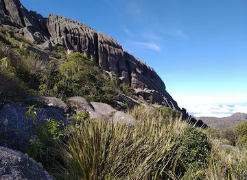
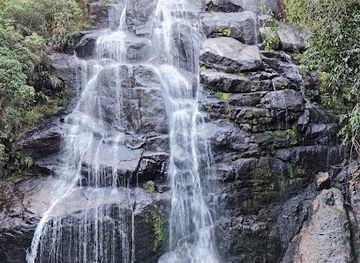
Itatiaia’s attractions are divided between a forested lower sector and a high, rocky upper sector. Near the park headquarters, the Maromba Valley offers access to the Lago Azul area and the Véu de Noiva waterfall, while woodland paths reveal streams, bromeliads and the dense vegetation of the Atlantic Forest. In the upper sector, the route towards Pico das Agulhas Negras leads into campos de altitude and a landscape of granite towers, ridges and weather-shaped outcrops; Pedra do Altar and the Prateleiras formations are among the best-known features. The contrast between humid valley scenery and exposed mountain terrain is central to the park’s appeal. Birdwatching, photography and nature observation are possible in both areas, although sightings depend on season, weather and patience. Nearby approaches through Itatiaia, Penedo, Itamonte and Visconde de Mauá add rural landscapes and mountain-village character without being part of the protected area itself.
-
Tourist attraction
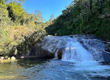
Waterfall Slide
Experience the thrill of nature at Itatiaia's Waterfall Slide, a unique and exhilarating natural waterslide nestled in Brazil's oldest national park.
-
Tourist attraction
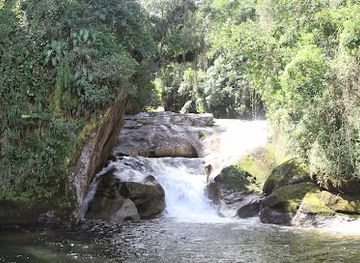
Cachoeira Veu da Noiva
Discover the enchanting Bridal Veil Waterfall in Itatiaia National Park, a serene escape into nature's embrace with easy access and stunning views.
-
Tourist attraction
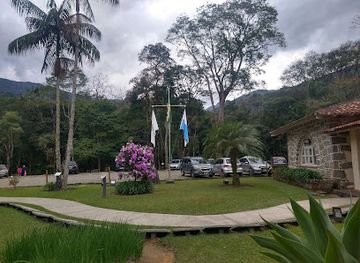
Visitor Center (Museum of Flora and Fauna)
Discover Itatiaia National Park's biodiversity at the Visitor Center: Exhibits, trails, and stunning views await!
-
Tourist attraction
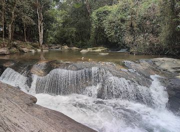
Três Cachoeiras
Discover the beauty of Três Cachoeiras in Penedo, where refreshing waterfalls and natural pools await in a lush, accessible setting.
Explore Itatiaia National Park on the map
Plan your trip on one map. See where the top attractions, landmarks, restaurants and hotels are, and book hotels and experiences in a few clicks.
Best hotels in Itatiaia National Park
Best restaurants in Itatiaia National Park
Dining associated with Itatiaia National Park is concentrated in gateway settlements rather than inside the protected area. Itatiaia and Penedo provide the broadest choice around the lower approach, with restaurants, cafés, bakeries and informal eateries serving Brazilian staples alongside dishes shaped by the area’s mountain tourism. Penedo has a strong Finnish cultural association, reflected in local sweets, chocolates and European-influenced food traditions, while the wider Mantiqueira region is known for rural produce, cheeses, preserves, coffee and trout in suitable establishments. Around Visconde de Mauá and the villages of the Mauá valley, visitors find small restaurants and inns with menus based on regional ingredients and contemporary Brazilian cooking. Near upper-sector approaches, options are more dispersed, so a meal or packed provisions are best arranged in Itamonte, Engenheiro Passos or another chosen base before entering the mountain area.
-
Buffet
Graal Itatiaia
Discover Graal Itatiaia: The ultimate buffet experience with bakery delights and convenient services amidst Brazil's breathtaking landscapes.
-
Barbecue
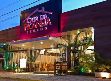
Casa da Picanha Penedo
Experience authentic Brazilian barbecue at Casa da Picanha Penedo – where every bite tells a story.
-
Restaurant
Restaurante Jardim Secreto - Penedo RJ
Discover exquisite Brazilian cuisine in a serene garden setting at Restaurante Jardim Secreto in Penedo.
-
Restaurant
Zucchine Ristorante
Discover authentic Italian cuisine at Zucchine Ristorante in Itatiaia - where every meal is a celebration of flavor amidst breathtaking scenery.
Best bars in Itatiaia National Park
Itatiaia National Park is not a nightlife destination, and evenings inside or immediately around the park are generally quiet, shaped by darkness, mountain weather and the early starts required for longer walks. Gateway towns such as Itatiaia and Penedo have casual bars, cafés and restaurants where visitors can socialise, while Visconde de Mauá and its surrounding villages offer a relaxed inn-and-pub atmosphere rather than a concentrated club scene. Some accommodation venues may host seasonal music or cultural gatherings, but these should not be assumed to operate on every visit. In the upper-sector region around Itamonte and Engenheiro Passos, evening entertainment is limited and services are spread out, making it sensible to eat, refuel and arrange transport before returning from remote approaches.
-
Bar
Casa do Fritz
Experience authentic German cuisine and a vibrant bar atmosphere at Casa do Fritz in Penedo, Brazil - a culinary gem in the heart of nature.
-
Seafood
Rei das Trutas
Discover the ultimate seafood experience at Rei das Trutas in Penedo, where fresh flavors and stunning scenery create unforgettable dining moments.
-
Restaurant
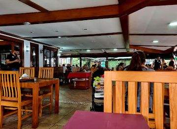
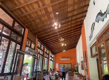
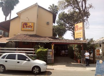
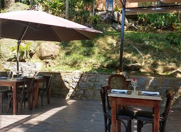
Petit Gourmet Restaurante
Experience the flavors of Brazil at Petit Gourmet Restaurante in Penedo, where diverse culinary options meet a warm and inviting atmosphere.
-
Restaurant
Restaurante Jardim Secreto - Penedo RJ
Experience the enchanting flavors of Brazil at Restaurante Jardim Secreto in Penedo, where culinary excellence meets nature's beauty.
Best nightclubs in Itatiaia National Park
Itatiaia National Park is not a nightlife destination, and evenings inside or immediately around the park are generally quiet, shaped by darkness, mountain weather and the early starts required for longer walks. Gateway towns such as Itatiaia and Penedo have casual bars, cafés and restaurants where visitors can socialise, while Visconde de Mauá and its surrounding villages offer a relaxed inn-and-pub atmosphere rather than a concentrated club scene. Some accommodation venues may host seasonal music or cultural gatherings, but these should not be assumed to operate on every visit. In the upper-sector region around Itamonte and Engenheiro Passos, evening entertainment is limited and services are spread out, making it sensible to eat, refuel and arrange transport before returning from remote approaches.
-
Tourist attraction
Pico das Agulhas Negras
Explore the breathtaking heights of Pico das Agulhas Negras in Itatiaia National Park – a paradise for adventure and nature lovers.
Best shops in Itatiaia National Park
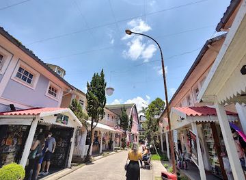
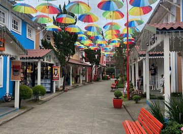
Shopping within Itatiaia National Park is limited, with the protected area offering nature experiences rather than a commercial centre. Visitors usually buy food, water and practical walking supplies in Itatiaia, Penedo, Itamonte, Visconde de Mauá or other gateway settlements before heading into the park. Penedo is particularly associated with Finnish-influenced crafts, chocolates, sweets and small independent shops, while mountain communities around the Mantiqueira sell regional cheeses, preserves, coffee, honey and other farm products where local businesses are operating. Artisans and galleries in the wider valleys may offer woodwork, textiles, ceramics or locally inspired artwork, although the range varies by settlement and season. Shops catering to outdoor visitors can be useful in larger gateways, but remote upper-sector approaches have few retail facilities, so specialist equipment should be obtained before arrival.
-
Shopping mall
Casa do Papai Noel - Pequena Finlândia
Discover the enchanting Casa do Papai Noel - Pequena Finlândia in Penedo, a unique shopping destination filled with local crafts and festive charm.
-
National park
Itatiaia National Park
Explore the breathtaking beauty and diverse wildlife of Itatiaia National Park, a top destination for nature lovers and outdoor adventurers in Brazil.
-
Shopping mall
Shopping Vale dos Duendes
Discover the vibrant Shopping Vale dos Duendes in Penedo, a unique blend of shopping, dining, and Brazilian culture in the heart of Rio de Janeiro.
-
Chocolate shop
Fabrica de Chocolates
Discover the sweet side of Penedo at Fabrica de Chocolates, a charming destination for handcrafted delights and cocoa wonders.
Get your free copy of our complete guide to Itatiaia National Park, delivered straight to you.
Everything on this page, from attractions and restaurants to essentials and local phrases, in one PDF you can read offline, print or share.
Already have an account? Sign in
Your Itatiaia National Park guide is ready.
We'll send it to · Not you? Sign out

Getting your guide ready…
We are putting together a fresh copy of the Itatiaia National Park guide. This can take up to a minute.
This can take a few moments. If your browser asks, choose Allow so the download can start. You'll find the guide in your Downloads folder.
Nothing happened? Download it again
Sorry, the guide is taking longer than usual. Please try again in a minute, or get it by email instead.
Itatiaia National Park essentials
Currency and Payment
Safety
Emergency Situations
Do's and Don'ts
Local Tips
From Eve
Local phrases worth knowing
You don't need to get them perfect. A few words go a long way, and locals appreciate the effort.
Basics
| English | Local | Say it |
|---|---|---|
| Hello | Oi | [Oy] |
| Goodbye | Tchau | [Chow] |
| Yes | Sim | [Seem] |
| No | Não | [Nao] |
| Please/You're welcome | Por favor | [Por fah-vor] |
| Thank you | Obrigado | [Oh-bree-gah-doh] |
| Excuse me/Sorry | Com licença/Desculpe | [Cohm lee-sen-sah/Des-kool-peh] |
| How are you? | Como vai? | [Koh-moh vah-ee?] |
| Fine. And you? | Bem. E você? | [Behm. Eh voh-seh?] |
| Do you speak English? | Você fala inglês? | [Voh-seh fah-lah een-gless?] |
| I don't understand | Eu não entendo | [Ayoo now en-ten-doh] |
Eating & Drinking
| English | Local | Say it |
|---|---|---|
| I'd like to see the menu, please | Eu gostaria de ver o cardápio, por favor | [Ayoo goh-stah-ree-ah jee ver oo kar-dah-pyo, poor fah-vor] |
| I don't eat meat | Eu não como carne | [Ayoo now koh-moh kar-nee] |
| Cheers! | Saúde! | [Sah-oo-deh] |
| I would like to pay, please | Eu gostaria de pagar, por favor | [Ayoo goh-stah-ree-ah jee pah-gar, poor fah-vor] |
Emergencies
| English | Local | Say it |
|---|---|---|
| Help! | Ajuda! | [Ah-zoo-dah!] |
| Go away! | Vá embora! | [Vah ehm-boh-rah!] |
| Call the Police! | Chame a polícia! | [Sha-meh ah poh-lee-see-ah!] |
| Call a doctor! | Chame um médico! | [Sha-meh oom meh-dee-koo!] |
| I'm lost | Estou perdido | [Es-toh pehr-dee-doh] |
| I'm ill | Estou doente | [Es-toh doh-en-chee] |
Shopping
| English | Local | Say it |
|---|---|---|
| I'd like to buy... | Eu gostaria de comprar... | [Ayoo goh-stah-ree-ah jee kohm-prar...] |
| I'm just looking | Estou só olhando | [Es-toh soo oh-yahn-doh] |
| How much is it? | Quanto custa? | [Kwan-toh koos-tah?] |
| That's too expensive | Isso é muito caro | [Ee-so eh moo-ee-too kah-ro] |
| Can you lower the price? | Você pode baixar o preço? | [Voh-seh poh-deh bahy-shar oo preh-so?] |
Time & Numbers
| English | Local | Say it |
|---|---|---|
| What time is it? | Que horas são? | [Keh oh-rahss sah-oh?] |
| It's one o'clock | É uma hora | [Eh oo-mah oh-rah] |
| Half past (10) | Meio-dia | [May-oh-dee-ah] |
| Morning | Manhã | [Mahn-yah] |
| Afternoon | Tarde | [Tahr-dee] |
| Evening | Noite | [Noy-chee] |
| Yesterday | Ontem | [Ohn-taym] |
| Today | Hoje | [Oh-zhee] |
| Tomorrow | Amanhã | [Ah-mahn-yah] |
| 1 | Um | [Oom] |
| 2 | Dois | [Doyss] |
| 3 | Três | [Trehss] |
| 4 | Quatro | [Kwah-troh] |
| 5 | Cinco | [Seen-koh] |
| 6 | Seis | [Sayss] |
| 7 | Sete | [Set-ee] |
| 8 | Oito | [Oy-toh] |
| 9 | Nove | [Noh-veh] |
| 10 | Dez | [Deyss] |
Transport & Directions
| English | Local | Say it |
|---|---|---|
| Where's a/the...? | Onde fica o/a...? | [Ohn-dee fee-kah oh/ah...?] |
| What's the address? | Qual é o endereço? | [Kwah-lee eh oh en-deh-reh-so?] |
| Can you show me (on the map)? | Você pode me mostrar (no mapa)? | [Voh-seh poh-deh meh moh-strahr (noh mah-pah)?] |
| When's the next (bus)? | Quando é o próximo (ônibus)? | [Kwan-doh eh oh proh-kssee-moh (ohn-ee-boos)?] |
| A ticket (to ....) | Um bilhete (para ...) | [Oom beel-yeh-teh (pah-rah ...)] |
History of Itatiaia National Park
Mountain Origins and Mantiqueira Landscapes
Itatiaia’s dramatic relief is part of the ancient Serra da Mantiqueira, a mountain system shaped by long geological processes, uplift, weathering and erosion. The park’s upper sector is known for resistant granite and gneiss formations, which weather into ridges, towers and isolated blocks such as Agulhas Negras and Prateleiras. Lower slopes hold streams and forested valleys, while the highlands support campos de altitude, a mosaic of grassland, shrubs and exposed rock adapted to cooler, windier conditions. This geological and climatic contrast explains why a relatively compact protected area contains markedly different environments.
Indigenous Landscapes and Colonial Routes
Before the creation of the park, the Mantiqueira slopes were used and traversed by Indigenous peoples, followed by expanding colonial settlement and agricultural activity in the wider region. Routes across the mountains linked communities and inland districts, while the valleys supported farming and the movement of goods between Rio de Janeiro, the Paraíba Valley and Minas Gerais. The historical record of the park is therefore not limited to its peaks: paths, clearings and settled approaches reflect a longer relationship between people and the forested uplands, even where modern visitors encounter apparently wild scenery.
The Creation of Brazil’s First National Park
Itatiaia National Park was established in 1937 during the government of Getúlio Vargas, becoming Brazil’s first national park. Its creation reflected an emerging national interest in protecting mountain scenery, forests, water sources and scientific resources, while also placing a distinctive landscape within the country’s developing protected-area system. The park’s name derives from the Tupi expression commonly interpreted as ‘pointed rock’, an apt reference to its sharp highland formations. The designation created a legal framework for conserving landscapes that had previously been influenced by travel routes, rural use and scientific exploration.
Scientific Study and Early Tourism
The park’s altitude, climatic variation and concentration of distinctive habitats attracted naturalists, botanists, geologists and mountaineers. Scientific interest helped document the transition from Atlantic Forest to high-altitude vegetation, while adventurous visitors were drawn towards the summits and rock formations of the upper plateau. Early tourism developed gradually around mountain excursions, waterfalls and scenic approaches rather than around a large resort settlement inside the protected area. Nearby communities became important gateways, supplying accommodation, food and transport for visitors exploring the park’s separated sectors.
Conservation Across Two Sectors
Modern Itatiaia National Park is managed as a protected landscape whose lower forests, waterways and upper mountain habitats require different forms of care. Visitor use is concentrated along designated access points and routes, while conservation concerns include fire, erosion, litter, disturbance to wildlife and pressure on fragile high-elevation vegetation. The park’s continuing importance lies in protecting a major headwater and forest environment in the Mantiqueira while making carefully managed recreation possible. Its history is consequently still developing through the balance between public access, scientific knowledge and long-term ecological protection.
Itatiaia National Park in Photos
Browse through our photo collection highlighting the charm and character of the destination.
Neighbouring destination travel guides
The closest destinations to Itatiaia National Park, if you have time for more than one.
-

-

-

-

-


Swipe for more destinations
Explore more

Explore more of Serra da Mantiqueira
Discover Serra da Mantiqueira, Brazil's enchanting mountain range, where lush forests, charming towns, and breathtaking views create the perfect getaway.
Explore Serra da Mantiqueira
Explore more of Brazil
Discover Brazil: a land of samba, stunning landscapes, and rich history. From the Amazon to Rio, explore diverse cultures, world-class cuisine, and vibrant festivals.
Explore Brazil