Mount Tamalpais: Marin's Majestic Peak
Discover breathtaking panoramic views, explore redwood forests, and immerse yourself in the rich history and natural beauty of Mount Tamalpais, Marin County's iconic peak.
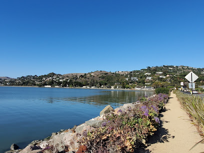
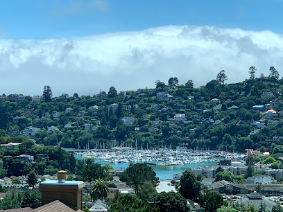
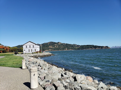
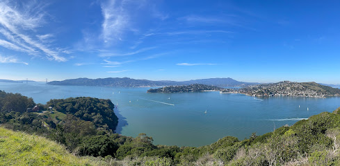
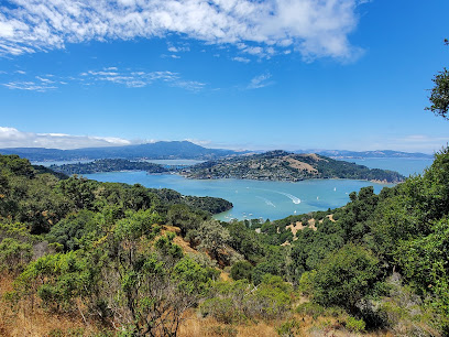
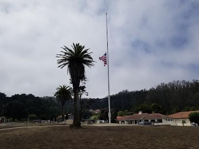
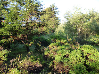
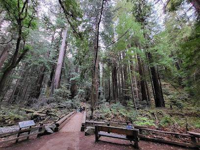
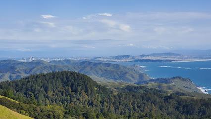
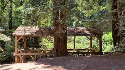
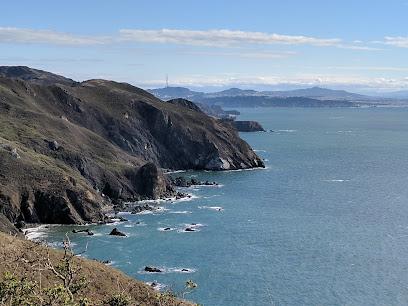
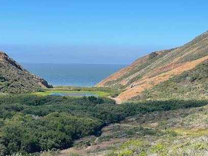
Mount Tamalpais, affectionately known as Mt. Tam by locals, is a majestic peak rising from the heart of Marin County, just north of San Francisco's Golden Gate Bridge. This iconic landmark offers breathtaking panoramic views encompassing the San Francisco Bay Area, the Pacific Ocean, and rolling hills. A haven for outdoor enthusiasts, Mt. Tam boasts over 200 miles of trails winding through redwood forests, open grasslands, and chaparral-covered ridges. Whether you're seeking a challenging hike, a leisurely picnic, or simply a stunning vista, Mt. Tam promises an unforgettable experience. Explore the mountain's rich history, from its significance to the Coast Miwok people to its role in early recreation and conservation efforts. Discover hidden waterfalls, climb to the historic Gardner Fire Lookout, or simply soak in the natural beauty that has made Mt. Tamalpais a beloved destination for generations.
A brief summary to Mt Tamalpais
- California, US
Local tips
- Arrive early, especially on weekends and holidays, as parking lots tend to fill up quickly. Consider carpooling or using public transportation to avoid parking hassles.
- Check the weather forecast before you go, as conditions on Mt. Tamalpais can change rapidly. Dress in layers and be prepared for wind and fog, even on sunny days.
- Bring plenty of water and snacks, especially if you plan on hiking. There are limited options for purchasing food and drinks within the park.
- Purchase a trail map at the Pantoll Ranger Station or East Peak Visitor Center to navigate the park's extensive trail system. Cell phone service can be unreliable in some areas.
- Be aware of wildlife, including poison oak, rattlesnakes, and mountain lions. Stay on marked trails and follow park guidelines for a safe and enjoyable visit.
Getting There
-
Driving
From Highway 101, take the Stinson Beach exit and follow Highway 1 towards the mountain. Then, follow the signs along Highway 1 up the mountain. Continue along Panoramic Highway to access various trailheads, the Pantoll Ranger Station, and East Peak. Parking fees of $8 are required at East Peak, Pantoll, and Bootjack parking lots. Exact change is often needed. Be aware that these lots can fill up quickly, especially on weekends.
-
Public Transport
Take Golden Gate Transit to Marin City, then transfer to Marin Transit Route 61. Route 61 runs on weekends and holidays and stops at various points along Panoramic Highway, including the Pantoll Ranger Station and near the Mountain Home Inn. From these stops, you can access various trailheads. A single ride on Golden Gate Transit from San Francisco to Marin City costs approximately $4-$7, depending on the exact route and payment method. A single ride on Marin Transit Route 61 costs approximately $2-$3.
Discover more about Mt Tamalpais
Iconic landmarks you can’t miss
Landmarks China Cabin
13.0 km
Discover the historic elegance of the China Cabin, a unique event venue in Belvedere Tiburon, rich with captivating history and stunning architecture.
Old St. Hilary's Historic Preserve
13.2 km
Discover the rich history and breathtaking views at Old St. Hilary's Historic Preserve, a hidden gem in Belvedere Tiburon, California.
Tiburon Railroad & Ferry Depot Museum
13.9 km
Discover the rich history of Tiburon at the Railroad & Ferry Depot Museum, a charming destination for history lovers and curious travelers.
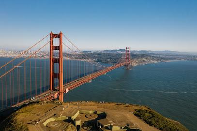
Golden Gate Bridge
15.5 km
Experience the breathtaking beauty and historical significance of the Golden Gate Bridge, an iconic symbol of San Francisco and a must-see for every traveler.

Angel Island State Park
15.9 km
Explore the stunning landscapes and rich history of Angel Island State Park, a captivating getaway in the San Francisco Bay for nature and history lovers.
Summit of Mt. Livermore
16.1 km
Explore the Summit of Mt. Livermore for breathtaking views and a serene hiking experience in Tiburon, California.
Angel Island Immigration Station
16.1 km
Explore the Angel Island Immigration Station: A historic journey through America's immigration narrative with stunning views across the San Francisco Bay.
Angel Island Immigration Museum
16.1 km
Explore the Angel Island Immigration Museum, where history and breathtaking views converge to tell the poignant stories of America's immigrants.
Antioch Aired
16.2 km
Explore Antioch Aired, your gateway to local services and classified ads that connect you with the heart of the community.

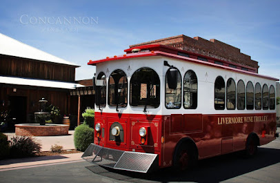
Livermore Wine Trolley
16.2 km
Discover the scenic beauty and exquisite wines of Livermore Valley with the unique Livermore Wine Trolley experience.
Strauss Statue
16.7 km
Explore the Strauss Statue in San Francisco's Presidio—a tribute to the visionary behind the Golden Gate Bridge, blending history, art, and stunning views.
Golden Gate Bridge Vista Point
16.7 km
Experience stunning panoramic views of the Golden Gate Bridge at the Vista Point in San Francisco, a must-visit for any traveler.
Sea Cliff
17.9 km
Experience the tranquil beauty of Sea Cliff in San Francisco, where breathtaking ocean views and serene parks provide a perfect escape from city life.

Pershing Square
18.4 km
Explore the historical marvels of Pershing Square in San Francisco's Presidio, a serene destination rich in culture, stunning views, and engaging stories.
Wayburn Redwood Grove
18.5 km
Explore the breathtaking tranquility of Wayburn Redwood Grove, a serene park in San Francisco's Presidio, surrounded by majestic redwoods and natural beauty.
Unmissable attractions to see
Muir Woods National Monument
3.2 km
Explore the breathtaking beauty of Muir Woods National Monument, home to ancient coastal redwoods and serene hiking trails in Mill Valley, California.
Mount Tamalpais State Park
4.0 km
Explore the breathtaking landscapes and diverse wildlife of Mount Tamalpais State Park, a must-visit destination for nature lovers and outdoor enthusiasts.
Old Mill Park
4.4 km
Explore Old Mill Park in Mill Valley, CA, a serene escape featuring lush greenery and scenic paths perfect for relaxation and outdoor adventures.
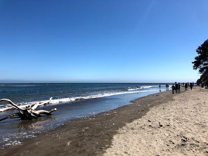
Stinson Beach
4.9 km
Experience the serene beauty of Stinson Beach, California, where golden sands meet stunning coastal cliffs and vibrant local culture awaits.
Imagination Park
6.4 km
Explore Imagination Park in San Anselmo, California – a tranquil park offering lush scenery, playful spaces, and community spirit in every corner.
Muir Beach Overlook
6.7 km
Explore the breathtaking views and serene environment of Muir Beach Overlook, an idyllic escape on California's stunning coastline.
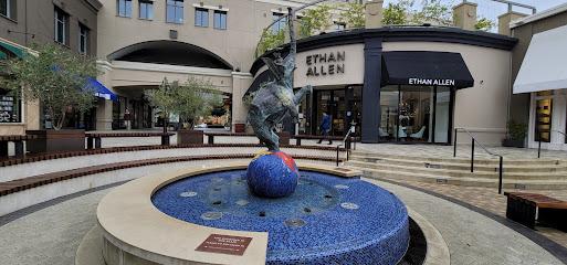
Town Center Corte Madera
7.0 km
Explore the Town Center Corte Madera, a shopping haven filled with boutiques, dining, and vibrant community spirit in the heart of California.
Muir Beach
7.0 km
Discover the tranquil beauty of Muir Beach, a coastal gem in California offering stunning views, serene nature trails, and a peaceful escape from the everyday hustle.
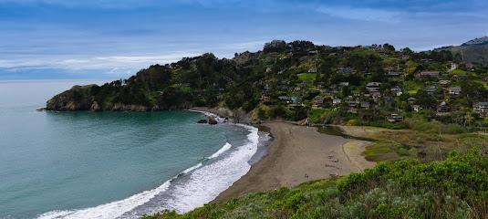
Bolinas Beach
7.8 km
Discover the tranquility of Bolinas Beach in California, where golden sands meet stunning ocean views in a serene coastal escape.
Miwok Trail
8.5 km
Explore the serene beauty of Miwok Trail in California, a perfect destination for hiking and discovering nature's wonders in a peaceful setting.
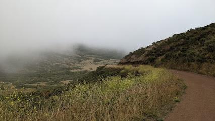
Tennessee Valley Trailhead
8.8 km
Discover the breathtaking trails and coastal views at Tennessee Valley Trailhead in Mill Valley, a must-visit for outdoor lovers exploring California's natural beauty.
Essential places to dine
Chapeau
19.6 km
Experience exquisite French cuisine at Chapeau in San Francisco's Richmond District, where elegance meets exceptional flavors.
Spruce
19.7 km
Discover Spruce: A premier New American restaurant in San Francisco's Presidio Heights serving exquisite seasonal cuisine and elegant ambiance.
Atelier Crenn
19.8 km
Experience the artistry of French cuisine at Atelier Crenn, where each dish tells a unique story crafted by Chef Dominique Crenn.
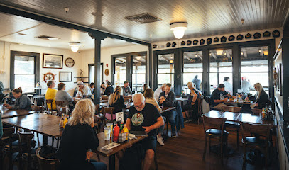
Capurro's Restaurant
20.1 km
Discover Capurro's Restaurant at Fisherman's Wharf - where fresh seafood meets Italian flair in an unforgettable dining experience.
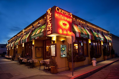
Cioppino's
20.2 km
Experience fresh seafood delights at Cioppino's - A family-friendly Italian restaurant located at Fisherman's Wharf in San Francisco.
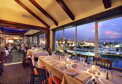
Gary Danko
20.2 km
Discover the culinary masterpiece of Gary Danko in San Francisco - where exquisite flavors meet unparalleled service.
Surisan
20.4 km
Discover Surisan: Where Korean flavors meet brunch classics in San Francisco's scenic Fisherman's Wharf.
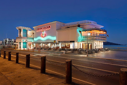
Franciscan Crab Restaurant
20.4 km
Discover exquisite seafood dining with breathtaking bay views at Franciscan Crab Restaurant in Fisherman's Wharf.
The Stinking Rose A Garlic Fish House
20.4 km
Experience exquisite garlic-infused seafood at The Stinking Rose A Garlic Fish House in San Francisco's Fisherman's Wharf.
Pier Market Seafood Restaurant
20.6 km
Experience fresh seafood delights with stunning bay views at Pier Market Seafood Restaurant in San Francisco's iconic Fisherman's Wharf.
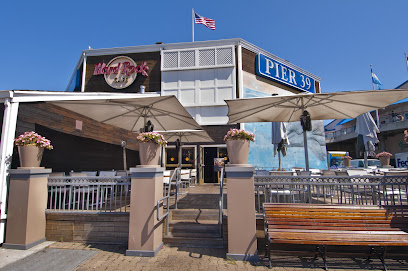
Crab House at Pier 39
20.7 km
Discover fresh seafood delights at Crab House at Pier 39 in San Francisco's iconic Fisherman's Wharf with stunning bay views.
Fog Harbor Fish House
20.7 km
Experience the freshest seafood with stunning views at Fog Harbor Fish House in Fisherman's Wharf.
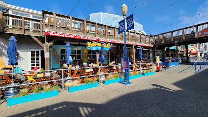
Wipeout Bar & Grill
20.7 km
Experience Californian flavors at Wipeout Bar & Grill on Pier 39—delicious food, stunning views, and unforgettable moments await you.
Eagle Cafe
20.7 km
Experience delightful seafood and breakfast dishes at Eagle Cafe in San Francisco's iconic Pier 39 with stunning bay views.
Street Restaurant and Bar
20.8 km
Discover the vibrant flavors of New American cuisine at Street Restaurant and Bar in San Francisco's Polk Gulch—where every dish tells a story.
Markets, malls and hidden boutiques
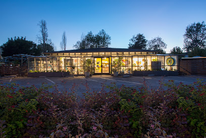
Ground
13.0 km
Explore Ground, your ultimate garden center in Belvedere Tiburon, offering a stunning selection of plants and home goods for every nature enthusiast.
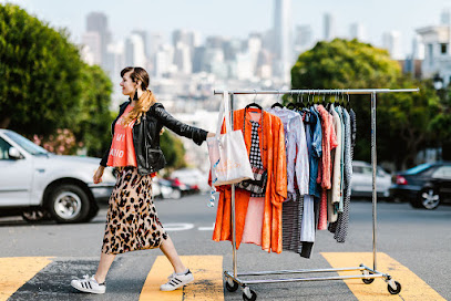
Shop the City
16.2 km
Elevate your wardrobe with personalized styling at Shop the City - a hub for fashion lovers seeking unique local trends.
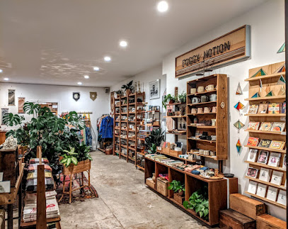
Foggy Notion
19.6 km
Explore Foggy Notion, a charming boutique in San Francisco, offering a captivating selection of unique gifts and artisanal treasures.
The Golden Hour
19.7 km
Discover vintage treasures and unique finds at The Golden Hour, San Francisco's charming vintage clothing store in the heart of Richmond District.
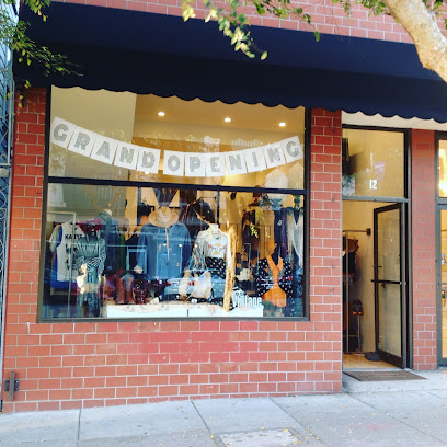
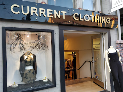
Current
19.8 km
Explore San Francisco's Current Boutique for unique women's fashion, from chic dresses to stylish accessories in a vibrant shopping atmosphere.
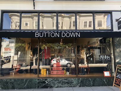
Button Down
19.9 km
Explore Button Down, a charming clothing store in San Francisco’s Presidio Heights, offering unique apparel and accessories for the fashion-savvy traveler.
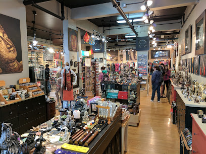
Nikoniko Gifts
20.0 km
Explore Nikoniko Gifts, a charming San Francisco gift shop offering unique souvenirs and local artisan creations that capture the city's vibrant spirit.
Lola of North Beach
20.1 km
Explore Lola of North Beach, a charming gift shop in San Francisco, offering unique souvenirs and treasures that embody the spirit of the city.
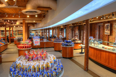
Ghirardelli Chocolate Experience
20.1 km
Discover the sweet legacy of Ghirardelli at the Chocolate Experience, where every bite takes you on a delicious journey through San Francisco's rich chocolate heritage.
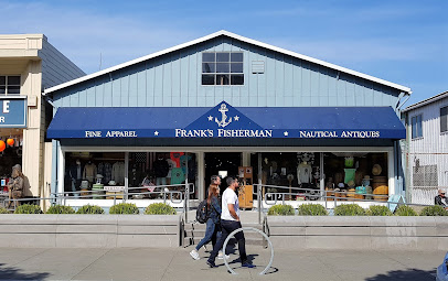
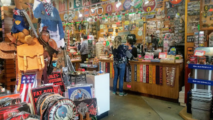
Frank's Fisherman
20.2 km
Discover unique gifts and antiques at Frank's Fisherman, a charming shop in San Francisco's Fisherman's Wharf, perfect for souvenirs and stylish finds.
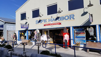
Safe Harbor
20.2 km
Explore Safe Harbor, a charming souvenir store in San Francisco's Fisherman's Wharf, offering unique treasures and local art to celebrate your visit.
Ess Eff Gift Shop (Inside)
20.4 km
Discover unique souvenirs and local crafts at Ess Eff Gift Shop, a charming destination in San Francisco's Fisherman's Wharf.
Route 66
20.5 km
Discover Route 66: A charming general store in San Francisco's Fisherman's Wharf, offering unique souvenirs and local treasures that capture the spirit of the city.
Enlightenment
20.6 km
Explore Enlightenment Gift Shop at Pier 39 for unique South Asian treasures and memorable souvenirs in San Francisco.
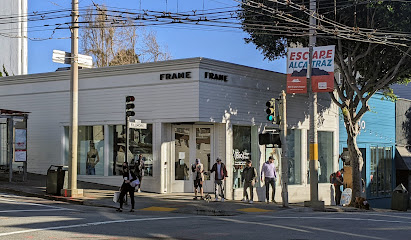
FRAME
20.6 km
Explore FRAME in Pacific Heights, a chic clothing store offering a curated collection of contemporary fashion for every style.
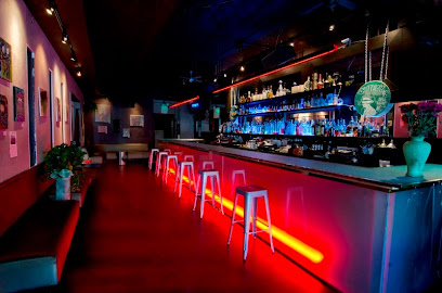
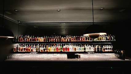
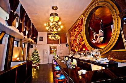
Essential bars & hidden hideouts
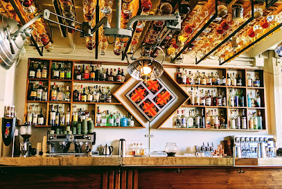
The Interval at Long Now
19.4 km
Discover The Interval at Long Now: a San Francisco cocktail bar that fuses mixology with thought-provoking exhibits, perfect for curious travelers.
The Socialite Crafthouse & Kitchen
20.5 km
Discover the vibrant flavors of San Francisco at The Socialite Crafthouse & Kitchen, a brewpub where craft beer meets delicious cuisine.
Luau Lounge
20.5 km
Savor tropical flavors and stunning views at Luau Lounge, a vibrant restaurant at Pier 39, San Francisco.
Players Sports Grill & Arcade
20.6 km
Experience the ultimate blend of food, drinks, and arcade fun at Players Sports Grill & Arcade in Fisherman's Wharf, San Francisco.
Northpoint Craft Cocktails - Local Brews
20.7 km
Experience the best of San Francisco's cocktail culture at Northpoint Craft Cocktails, featuring local brews and inventive mixology in a cozy setting.
Bar Iris
20.7 km
Discover the vibrant fusion of cocktails and Japanese cuisine at Bar Iris, a must-visit culinary gem in San Francisco's Polk Gulch.
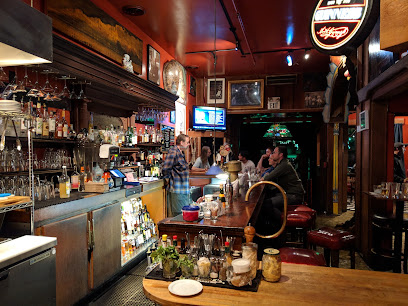
Hard Rock Cafe
20.8 km
Savor classic American cuisine amidst iconic rock music memorabilia at Hard Rock Cafe San Francisco, a vibrant dining experience at Fisherman’s Wharf.
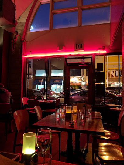
Sweetie's Art Bar
20.8 km
Experience the artistic vibe and creative cocktails at Sweetie's Art Bar, a beloved local bar in the heart of San Francisco's North Beach.
Red Jack Saloon
21.0 km
Discover the lively bar scene at Red Jack Saloon, a Fisherman's Wharf gem offering great drinks and a vibrant atmosphere in San Francisco.
Bodega North Beach
21.2 km
Discover Bodega North Beach, your go-to wine bar in San Francisco's North Beach, offering a curated selection of wines and a warm, inviting atmosphere.
Kozy Kar
21.3 km
Experience the unique charm of Kozy Kar, a vibrant bar in San Francisco's Polk Gulch, known for its water mattresses and friendly atmosphere.
The Majestic Butterfly Lounge
21.3 km
Experience the art of mixology at The Majestic Butterfly Lounge, a stylish cocktail bar in San Francisco's Cathedral Hill, perfect for a vibrant night out.
Brioche Bakery & Cafe
21.4 km
Indulge in artisanal pastries and exceptional brunch at Brioche Bakery & Cafe, a must-visit gem in San Francisco's Haight-Ashbury.
Tony Nik's CAFE
21.4 km
Discover the vibrant nightlife at Tony Nik's CAFE, a beloved bar in San Francisco's North Beach, perfect for unwinding after a day of sightseeing.
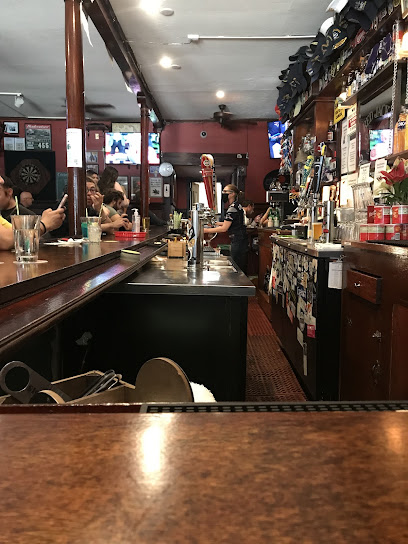
Gino & Carlo
21.5 km
Experience the lively spirit of San Francisco at Gino & Carlo, a sports bar in North Beach known for its friendly atmosphere and diverse drink selection.
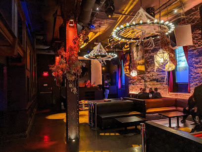
Nightclubs & after hour spots
Carbon
20.8 km
Discover the vibrant nightlife at Carbon Lounge in San Francisco’s North Beach, offering stylish ambiance and a diverse drink selection.
Rouge Night Club
20.9 km
Discover the pulsating nightlife at Rouge Night Club in San Francisco's Polk Gulch, where music, dance, and fun collide in a vibrant atmosphere.
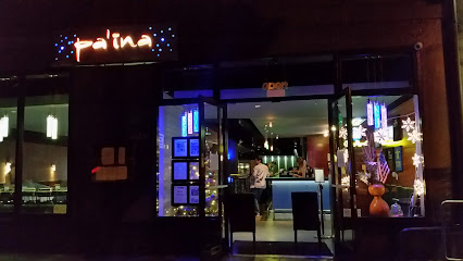
Pa'ina Restaurant & Lounge
21.1 km
Experience the vibrant flavors of Hawaiian cuisine at Pa'ina Restaurant & Lounge in San Francisco's Japantown, a perfect blend of food and festive atmosphere.
Club Fugazi Experiences
21.4 km
Discover the vibrant fusion of circus, live music, and dining at Club Fugazi in San Francisco's North Beach, where unforgettable experiences await.
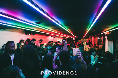
Providence Night Club
21.5 km
Dive into San Francisco's nightlife at Providence Night Club, where live music meets vibrant energy for an unforgettable evening.
Monroe SF
21.9 km
Discover the electrifying nightlife of Monroe SF, where handcrafted cocktails and vibrant music create unforgettable evenings in San Francisco's North Beach.
Vanity San Francisco
21.9 km
Discover the allure of Vanity San Francisco - a premier night club featuring live performances, cabaret shows, and an electric nightlife atmosphere.

La Movida Night Club
22.5 km
Discover the lively atmosphere and vibrant music scene at La Movida Night Club, San Pablo's hotspot for nightlife adventures.
Sam's Cable Car Lounge
22.5 km
Experience the vibrant atmosphere of Sam's Cable Car Lounge - your perfect getaway in San Francisco's Union Square for drinks, food, and fun.
Hawthorn SF Nightclub and Lounge
22.6 km
Discover Hawthorn SF Nightclub and Lounge - the premier nightlife destination in Union Square, San Francisco, where unforgettable nights await.
Club Six
22.8 km
Discover the pulse of San Francisco at Club Six, where art meets nightlife in a dynamic celebration of music and cocktails.
Monarch
22.9 km
Experience the vibrant nightlife at Monarch, San Francisco's premier night club and live music venue with electrifying performances and creative cocktails.
Harlot
23.0 km
Experience the chic ambiance of Harlot in SoMa, San Francisco's premier lounge and cocktail bar, perfect for any occasion.
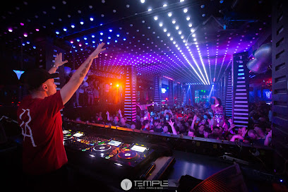
Temple Nightclub San Francisco
23.1 km
Discover the electrifying atmosphere of Temple Nightclub in San Francisco - a premier destination for nightlife, dancing, and unforgettable memories.
F8 Nightclub & Bar
23.2 km
Discover the pulse of San Francisco nightlife at F8 Nightclub & Bar, where music, art, and community come together for an unforgettable experience.